GITNUXSOFTWARE ADVICE
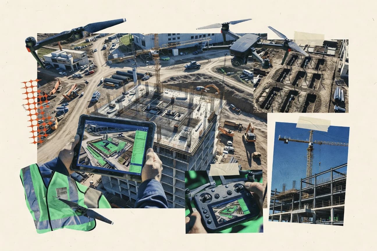
Construction InfrastructureTop 10 Best Construction Drone Software of 2026
Discover top construction drone software to streamline surveys, monitoring & project management. Find your perfect pick and boost efficiency today.

How we ranked these tools
Core product claims cross-referenced against official documentation, changelogs, and independent technical reviews.
Analyzed video reviews and hundreds of written evaluations to capture real-world user experiences with each tool.
AI persona simulations modeled how different user types would experience each tool across common use cases and workflows.
Final rankings reviewed and approved by our editorial team with authority to override AI-generated scores based on domain expertise.
Score: Features 40% · Ease 30% · Value 30%
Gitnux may earn a commission through links on this page — this does not influence rankings. Editorial policy
Editor’s top 3 picks
Three quick recommendations before you dive into the full comparison below — each one leads on a different dimension.
Propeller Aero
Automated construction progress reports from scheduled drone capture
Built for construction teams needing automated drone progress reporting with low operational overhead.
Skycatch
Editor pickRepeatable progress and QA reporting built on automated photogrammetry-derived measurement outputs
Built for construction teams needing repeatable drone progress tracking and measurement reporting.
DroneDeploy
Editor pickAutomated photogrammetry processing with time-stamped site deliverables and progress comparisons
Built for construction teams standardizing drone-based surveying, progress tracking, and stakeholder reporting.
Related reading
- Construction InfrastructureTop 10 Best Construction Management Software of 2026
- Construction InfrastructureTop 10 Best General Contractor Project Management Software of 2026
- Construction InfrastructureTop 10 Best Construction Data Analytics Software of 2026
- Construction InfrastructureTop 10 Best Construction Health And Safety Software of 2026
Comparison Table
This comparison table breaks down construction drone software used for site surveys, progress monitoring, and engineering data capture across platforms such as Propeller Aero, Skycatch, DroneDeploy, Pix4D, and OpenDroneMap. It highlights how each tool handles core workflows like flight-to-map processing, photogrammetry or LiDAR processing, and export formats so teams can match software capability to project needs.
Propeller Aero
progress analyticsPlans, captures, and delivers aerial construction progress data from drone missions and provides construction analytics for reporting and tracking.
Automated construction progress reports from scheduled drone capture
Propeller Aero stands out for turning drone and photo capture into construction deliverables through an automation-first workflow. It supports flight planning, scheduled data capture, and generation of progress outputs that teams can review against job milestones.
The product focuses on operational consistency, including team access and repeatable reporting rather than ad-hoc analysis only. Core value centers on reducing time from collection to field-ready insights for project stakeholders.
- +Automates drone-to-progress deliverables for construction teams
- +Repeatable workflows support consistent reporting across job sites
- +Reduces manual data handling between capture and stakeholder updates
- –Workflow setup and permissions require deliberate configuration
- –Best results depend on disciplined capture and collection standards
- –Advanced customization needs stronger GIS and process alignment
Best for: Construction teams needing automated drone progress reporting with low operational overhead
More related reading
Skycatch
photogrammetryProvides cloud processing of drone photogrammetry into 2D and 3D construction models used for progress monitoring and site reporting.
Repeatable progress and QA reporting built on automated photogrammetry-derived measurement outputs
Skycatch stands out for turning drone photogrammetry into construction-ready progress, QA, and reporting workflows with a field-to-office pipeline. It supports survey planning for captured imagery, automated point-cloud and mesh generation, and measurement outputs tied to project deliverables.
The platform emphasizes repeatable comparisons over time using consistent survey assets and reviewable outputs for stakeholders. Construction teams get a practical focus on documentation and change detection rather than advanced research-grade analytics.
- +Field capture workflow supports consistent inputs for repeatable construction measurements
- +Automated photogrammetry outputs enable point clouds, meshes, and derived measurements
- +Progress and QA reporting tools support stakeholder-friendly review cycles
- –Fidelity depends heavily on capture planning and image quality consistency
- –Advanced customization options for specialized analysis are limited versus broader platforms
- –Data setup and project configuration take noticeable effort for first-time teams
Best for: Construction teams needing repeatable drone progress tracking and measurement reporting
DroneDeploy
mission planningSupports drone mission planning and automated capture-to-insights workflows for construction progress and volumetric measurement.
Automated photogrammetry processing with time-stamped site deliverables and progress comparisons
DroneDeploy stands out for turning drone imagery into shareable construction deliverables through an end-to-end capture-to-insights workflow. It supports mission planning, automated photogrammetry processing, and project documentation outputs such as maps and 3D models.
Field teams get collaboration around measurements and annotations tied to specific sites and time periods. Built-in reporting helps maintain audit-ready progress views across stakeholders and project phases.
- +End-to-end workflow from mission planning to processed deliverables and sharing
- +Strong construction progress documentation with time-based comparisons and reporting
- +Collaboration features support annotations and stakeholder review of site outputs
- –Setup and configuration can be heavy for teams with minimal drone data experience
- –Advanced customization for bespoke reporting workflows is limited compared with specialist tools
- –Large, frequent survey processing can create operational friction during tight schedules
Best for: Construction teams standardizing drone-based surveying, progress tracking, and stakeholder reporting
Pix4D
mapping pipelineProcesses drone imagery into photogrammetric maps, 3D models, and measurement outputs for construction surveying tasks.
Automated photogrammetry processing that generates orthomosaics, dense point clouds, and 3D models
Pix4D stands out with an end-to-end photogrammetry workflow for drone imagery that turns captures into survey-grade outputs. It supports rapid processing for orthomosaics, dense point clouds, and 3D models, plus tools for project review and measurement.
Construction teams benefit from automated alignment, camera calibration handling, and repeatable exports for documentation and progress tracking. The strongest value comes when projects already follow a consistent imaging workflow and require accurate geospatial products.
- +Produces orthomosaics, dense point clouds, and 3D models from drone images
- +Supports project QA checks like alignment and reconstruction quality reporting
- +Exports geospatial deliverables suitable for construction documentation workflows
- +Handles large datasets with processing automation across typical survey steps
- –Deep survey settings can slow down early users during setup
- –Achieving consistent accuracy depends heavily on capture quality and control points
- –Review and measurement capabilities can feel less construction-centric than CAD workflows
- –Managing complex projects requires more workflow discipline than lighter tools
Best for: Construction teams needing photogrammetry outputs for mapping, modeling, and site reporting
OpenDroneMap
open-sourceConverts drone imagery into maps and 3D reconstructions using open-source photogrammetry and geospatial processing tools.
Scriptable photogrammetry pipeline for generating georeferenced orthomosaics and 3D reconstructions
OpenDroneMap stands out by turning raw drone imagery into georeferenced outputs through an open, scriptable photogrammetry pipeline. It can generate orthomosaics, dense point clouds, and textured meshes that construction teams can use for progress mapping and spatial QA. The tool also supports integration with spatial data workflows because outputs align to coordinate reference systems and can be inspected in common GIS or 3D viewing tools.
- +Produces orthomosaics, dense point clouds, and textured meshes from drone imagery
- +Configurable photogrammetry pipeline supports repeatable processing across project sites
- +Open and scriptable workflow fits automation and integration into construction data pipelines
- –Setup and tuning require technical familiarity with processing parameters
- –Processing can be compute intensive for large construction captures
- –Direct construction deliverables like field marking are not included in the core tool
Best for: Construction teams needing automated photogrammetry outputs for GIS and 3D site reviews
Agisoft Metashape
desktop photogrammetryCreates high-accuracy 3D models and orthomosaics from drone imagery for construction survey and monitoring workflows.
Ground Control Point georeferencing with camera calibration refinement for metric outputs
Agisoft Metashape stands out for high-accuracy photogrammetry pipelines that turn drone imagery into dense point clouds, textured meshes, and survey-grade outputs. It supports Ground Control Point workflows, camera calibration handling, and repeatable processing via batch and Python scripting.
Core construction deliverables include orthomosaics, digital surface models, and measurement-ready 3D reconstructions that integrate into common survey and BIM-grade deliverable expectations. The software’s power is paired with demanding compute needs and a workflow that often requires careful dataset preparation to avoid reconstruction gaps and scale drift.
- +Strong photogrammetry engine for dense clouds, meshes, and textured models
- +Ground control integration supports georeferenced orthomosaics and DSMs
- +Batch processing and Python scripting enable repeatable construction workflows
- –Dense cloud processing can be slow and memory intensive
- –Dataset capture quality strongly affects reconstruction success and accuracy
- –Workflow complexity increases setup time for consistent project deliverables
Best for: Surveying and civil teams needing accurate photogrammetry deliverables
RealityCapture
reconstruction engineGenerates dense 3D reconstructions and photogrammetric outputs from drone imagery for construction measurement and inspection.
RealityCapture’s automated photogrammetry pipeline for rapid alignment and dense reconstruction from drone imagery
RealityCapture stands out for its speed and robust photogrammetry pipeline for producing survey-grade outputs from drone imagery. It supports automated alignment, dense reconstruction, meshing, and texturing with accuracy workflows aimed at geospatial deliverables.
It also integrates well with georeferencing and ground control usage, which matters for construction progress documentation and measurement. The software is strong for generating models and point clouds, but it can demand careful project setup to achieve consistent accuracy.
- +Fast photogrammetry pipeline optimized for large drone datasets
- +High-quality dense reconstruction for detailed meshes and surfaces
- +Georeferencing and control-point workflows support measurement-grade outputs
- +Automation reduces repetitive processing steps across projects
- –Accuracy depends heavily on capture quality and GCP setup
- –User workflows feel technical compared with guided construction tools
- –Advanced outputs require more configuration time and monitoring
- –Less oriented toward direct construction-report exports
Best for: Survey-focused teams generating accurate 3D models and point clouds
Autodesk Construction Cloud
project documentationCentralizes construction documentation and model-linked workflows that can incorporate drone-derived deliverables for coordination.
Common Data Environment review with markups and issues linked to uploaded drone-generated assets
Autodesk Construction Cloud stands out by connecting field drone capture workflows to project controls and construction document coordination in one cloud system. It supports photogrammetry outputs such as point clouds and orthomosaic maps and ties those results to model-based design and schedule driven review.
Coordination stays centralized through permissions, issue tracking, and markup tools that link visual evidence to project activities. It is strongest for teams already using Autodesk design and construction management data models.
- +Integrates drone visuals into model and project review workflows for traceable decisions
- +Strong markup and issue tracking tied to uploaded drone deliverables
- +Centralized permissions and audit trails for cross-discipline review
- +Good alignment with Autodesk design and construction management data
- –Drone capture ingestion and asset management can require setup for consistent results
- –Advanced analysis and QA depth depends on external drone processing tooling
- –Workflows can feel complex for teams not using Autodesk ecosystems
- –Mobile field usage for capturing and QA review is limited versus dedicated drone apps
Best for: Teams aligning drone survey deliverables with BIM, review workflows, and construction coordination
Autodesk ReCap
point cloud processingProcesses reality-capture data into usable point clouds and meshes that integrate with construction documentation workflows.
Point cloud registration and cleanup for creating aligned, measurable reality models
Autodesk ReCap stands out for turning drone and terrestrial laser data into usable 3D point clouds and measurable meshes. It supports Reality Capture workflows through point cloud registration, cleanup, and export for downstream Autodesk and third-party visualization.
ReCap excels at preparing capture outputs for project review and coordination, but it does not replace dedicated photogrammetry authoring tools for full asset creation. Output quality depends heavily on capture settings and data density, since large scans and noisy inputs can require extra cleanup.
- +Converts drone photogrammetry and scan data into organized point clouds
- +Supports alignment, registration, and point cloud cleanup for clearer results
- +Exports common formats for coordination across CAD and visualization tools
- –Mesh and texture authoring is limited versus dedicated reality capture software
- –Cleaning dense or noisy point clouds takes manual effort
- –Performance and usability can degrade with very large datasets
Best for: Construction teams preparing point-cloud deliverables for coordination and review
Trimble SiteVision
field monitoringUses mobile and reality-capture inputs to support construction guidance and monitoring workflows on job sites.
In-field measurement and annotation on drone-derived point clouds and models
Trimble SiteVision distinguishes itself with a guided, field-first visual layout for drone-derived surveying workflows on construction sites. The solution supports point cloud and mesh viewing, plus measurement and annotation directly in the field for review cycles and issue tracking.
It connects site observations with Trimble ecosystem outputs to streamline how teams move from capture to QA-focused markup and collaboration. Core value centers on making drone deliverables easier to inspect and communicate rather than replacing photogrammetry capture itself.
- +Field viewing of drone outputs with measurement and markup tools
- +Good support for construction QA workflows using visual inspection
- +Smooth collaboration through shared project artifacts and annotations
- –Best results rely on a Trimble-centric drone and data workflow
- –Limited standalone capabilities compared with full end-to-end surveying suites
- –Advanced analysis requires complementary tools outside the viewer
Best for: Construction teams validating drone deliverables with field markup and review
Conclusion
After evaluating 10 construction infrastructure, Propeller Aero stands out as our overall top pick — it scored highest across our combined criteria of features, ease of use, and value, which is why it sits at #1 in the rankings above.
Use the comparison table and detailed reviews above to validate the fit against your own requirements before committing to a tool.
How to Choose the Right Construction Drone Software
This buyer’s guide explains how to evaluate construction drone software for drone mission planning, photogrammetry processing, and construction-ready delivery workflows. It covers Propeller Aero, Skycatch, DroneDeploy, Pix4D, OpenDroneMap, Agisoft Metashape, RealityCapture, Autodesk Construction Cloud, Autodesk ReCap, and Trimble SiteVision. The focus is on matching tool capabilities to construction progress reporting, measurement outputs, coordination, and field validation needs.
What Is Construction Drone Software?
Construction drone software turns drone captures into usable outputs like orthomosaics, dense point clouds, textured meshes, and construction-ready progress views. It solves the collection-to-deliverables problem by combining capture workflows, automated photogrammetry, QA reporting, and collaboration or export pipelines. Tools like DroneDeploy provide an end-to-end mission planning and capture-to-insights workflow that produces shareable, time-stamped deliverables. Tools like Autodesk Construction Cloud focus on centralized review using uploaded drone-derived assets with markups and issue tracking tied to project coordination.
Key Features to Look For
The right feature set determines whether teams get repeatable progress measurement and stakeholder-ready deliverables or extra manual work after processing.
Automated construction progress reports from scheduled capture
Propeller Aero converts scheduled drone capture into automated construction progress reports aligned to job milestones. This reduces manual handling between collection and stakeholder updates and standardizes outputs across sites.
Repeatable progress and QA reporting from photogrammetry-derived measurements
Skycatch emphasizes repeatable comparisons by generating photogrammetry-derived measurement outputs that feed progress and QA reporting. DroneDeploy also supports time-based comparisons and reporting tied to processed site deliverables.
End-to-end capture-to-insights workflow with mission planning and processed deliverables
DroneDeploy connects mission planning to automated photogrammetry and project documentation outputs like maps and 3D models. This helps construction teams standardize progress tracking and stakeholder reporting without stitching multiple tools together.
Survey-grade photogrammetry outputs including orthomosaics, dense point clouds, and 3D models
Pix4D generates orthomosaics, dense point clouds, and 3D models and includes project review and measurement oriented QA checks. RealityCapture focuses on speed for dense reconstruction and dense meshes so large drone datasets can be turned into high-detail surfaces for measurement.
Georeferenced, scriptable processing pipelines for GIS and 3D site reviews
OpenDroneMap provides an open and scriptable photogrammetry pipeline that generates georeferenced orthomosaics and 3D reconstructions. This fits teams that want repeatable processing and integration into spatial data workflows outside of a guided construction UI.
Field-first measurement and markup on drone-derived point clouds and models
Trimble SiteVision supports in-field viewing with measurement and annotation directly on drone-derived point clouds and models. Autodesk Construction Cloud adds centralized review using a common data environment with markups and issues linked to uploaded drone-generated assets for cross-discipline coordination.
How to Choose the Right Construction Drone Software
Selection should start with the exact workflow that the team needs after the drone lands, then match tools to deliverable types, review style, and operational complexity.
Define the deliverables that must leave the tool
If the core requirement is construction progress reports that repeat every job cycle, Propeller Aero is built around automated construction progress reports from scheduled drone capture. If the requirement is progress and QA reporting based on measurement outputs from photogrammetry, Skycatch is designed for repeatable progress and QA reporting from automated photogrammetry-derived measurements.
Match photogrammetry depth to dataset size and processing readiness
For teams that want orthomosaics, dense point clouds, and 3D models with an end-to-end capture-to-output workflow, Pix4D and DroneDeploy are positioned to generate those deliverables for mapping and stakeholder sharing. For large datasets needing rapid alignment and dense reconstruction, RealityCapture is optimized around a fast photogrammetry pipeline.
Choose control, accuracy, and georeferencing requirements explicitly
If Ground Control Point workflows and camera calibration refinement for metric outputs are required, Agisoft Metashape directly supports GCP georeferencing plus batch and Python scripting for repeatable processing. If the requirement is open, scriptable georeferenced outputs that can be inspected in GIS or 3D tools, OpenDroneMap is configured around a scriptable photogrammetry pipeline.
Plan where QA and decisions happen during coordination
For centralized project coordination with review markups and issues linked to uploaded drone evidence, Autodesk Construction Cloud connects drone visuals to common data environment review with traceable markups and issue tracking. For field validation and direct issue marking on drone-derived point clouds and models, Trimble SiteVision provides measurement and annotation tools inside the field review workflow.
Decide whether the tool should author reality assets or only prepare point clouds
If the workflow needs dense reconstructions with meshes and textures authored as primary outputs, Pix4D, RealityCapture, and Agisoft Metashape are full photogrammetry authoring tools. If the workflow primarily needs point cloud registration, cleanup, and export for downstream coordination, Autodesk ReCap focuses on organizing measurable reality models through point cloud registration and cleanup.
Who Needs Construction Drone Software?
Construction drone software benefits teams that must convert drone imagery into measurable outputs and coordinate those outputs across project stakeholders.
Construction teams that need automated progress reporting with low operational overhead
Propeller Aero fits because it automates drone-to-progress deliverables through scheduled capture and repeatable reporting aligned to job milestones. This reduces manual data handling and standardizes stakeholder updates across job sites.
Construction teams that need repeatable progress monitoring and QA measurement reporting
Skycatch fits teams that want repeatable comparisons using photogrammetry-derived measurement outputs that feed progress and QA reporting. DroneDeploy also supports time-based comparisons with time-stamped processed deliverables and collaboration around site measurements.
Survey and civil teams that prioritize accurate, survey-grade photogrammetry deliverables
Agisoft Metashape fits surveying and civil workflows that require Ground Control Point georeferencing and camera calibration refinement for metric outputs. RealityCapture and Pix4D fit teams generating dense point clouds, meshes, and models where accuracy depends on capture quality and control point setup.
Teams that coordinate drone evidence with markups, issues, and model-linked project workflows
Autodesk Construction Cloud fits teams aligning drone survey deliverables with BIM-linked reviews using a common data environment with markups and issues tied to uploaded drone assets. Trimble SiteVision fits teams that validate deliverables in the field with measurement and annotation on drone-derived point clouds and models.
Common Mistakes to Avoid
Common failures come from choosing tools that do not match deliverable type, review workflow, or the technical setup needed for consistent accuracy.
Buying a photogrammetry authoring tool when the team actually needs construction progress reporting outputs
Pix4D, RealityCapture, and Agisoft Metashape focus on photogrammetry outputs like orthomosaics, dense point clouds, and 3D models rather than automated construction progress report delivery. Propeller Aero and Skycatch better match construction progress and QA reporting needs that depend on scheduled capture and measurement-ready outputs.
Underestimating capture discipline needed for repeatable measurement and progress comparisons
Skycatch and DroneDeploy tie repeatable measurement fidelity to capture planning and image quality consistency. RealityCapture, Pix4D, and Agisoft Metashape also depend heavily on capture quality and control point setup for accuracy.
Skipping the georeferencing and ground control workflow when metric outputs are required
Agisoft Metashape is built around Ground Control Point georeferencing and camera calibration refinement for metric outputs. RealityCapture and other photogrammetry tools still require careful georeferencing and GCP setup to achieve consistent accuracy rather than relying on defaults.
Treating a point cloud preparation tool as a full end-to-end reality asset authoring workflow
Autodesk ReCap excels at point cloud registration, cleanup, and export but it does not replace dedicated photogrammetry authoring tools for full asset creation like dense textured meshes. For primary authoring of meshes and dense reconstructions, Pix4D, RealityCapture, and Agisoft Metashape are designed as authoring tools rather than cleanup utilities.
How We Selected and Ranked These Tools
we evaluated every tool on three sub-dimensions. features carried a 0.4 weight because mission planning, automated photogrammetry outputs, progress reporting, georeferencing, and coordination workflows directly determine what teams can deliver. ease of use carried a 0.3 weight because setup complexity, workflow discipline requirements, and field review usability affect adoption speed. value carried a 0.3 weight because each tool’s operational overhead must translate into measurable progress output and review efficiency. overall was calculated as 0.40 × features + 0.30 × ease of use + 0.30 × value. Propeller Aero separated itself from lower-ranked tools by pairing a strong automation-focused feature set with a construction-specific workflow that turns scheduled drone capture into automated construction progress reports.
Frequently Asked Questions About Construction Drone Software
Which construction drone software best automates progress reporting from scheduled captures?
Which tools are best for repeatable drone progress tracking with QA and measurement outputs?
What option produces survey-grade mapping outputs like orthomosaics and dense point clouds in a single pipeline?
Which software fits teams that need georeferenced outputs for GIS and 3D review workflows?
Which tool is strongest for high-accuracy, metric photogrammetry when Ground Control Points are part of the workflow?
Which platform is best when drone evidence must connect to construction coordination, markups, and issue tracking?
Which software helps convert drone or laser capture into aligned reality models for review and downstream visualization?
What tool supports in-field measurement and annotation directly on drone-derived point clouds and models?
Which option is most useful when the core goal is robust photogrammetry processing speed rather than heavy manual pipeline control?
What common technical issue affects output quality, and which tool’s workflow highlights capture preparation needs?
Tools reviewed
Primary sources checked during evaluation.
Referenced in the comparison table and product reviews above.
Keep exploring
Comparing two specific tools?
Software Alternatives
See head-to-head software comparisons with feature breakdowns, pricing, and our recommendation for each use case.
Explore software alternatives→In this category
Construction Infrastructure alternatives
See side-by-side comparisons of construction infrastructure tools and pick the right one for your stack.
Compare construction infrastructure tools→FOR SOFTWARE VENDORS
Not on this list? Let’s fix that.
Our best-of pages are how many teams discover and compare tools in this space. If you think your product belongs in this lineup, we’d like to hear from you—we’ll walk you through fit and what an editorial entry looks like.
Apply for a ListingWHAT THIS INCLUDES
Where buyers compare
Readers come to these pages to shortlist software—your product shows up in that moment, not in a random sidebar.
Editorial write-up
We describe your product in our own words and check the facts before anything goes live.
On-page brand presence
You appear in the roundup the same way as other tools we cover: name, positioning, and a clear next step for readers who want to learn more.
Kept up to date
We refresh lists on a regular rhythm so the category page stays useful as products and pricing change.