GITNUXSOFTWARE ADVICE
General KnowledgeTop 10 Best Draw Maps Software of 2026
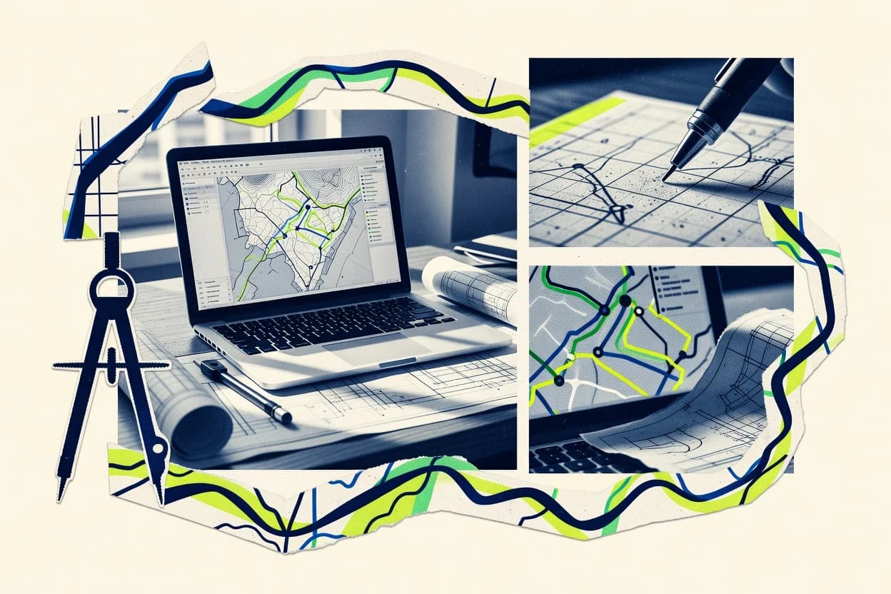
Compare the top 10 Draw Maps Software tools with ranking picks for mapping, styling, and exports. Explore the best options today.

How we ranked these tools
Core product claims cross-referenced against official documentation, changelogs, and independent technical reviews.
Analyzed video reviews and hundreds of written evaluations to capture real-world user experiences with each tool.
AI persona simulations modeled how different user types would experience each tool across common use cases and workflows.
Final rankings reviewed and approved by our editorial team with authority to override AI-generated scores based on domain expertise.
Score: Features 40% · Ease 30% · Value 30%
Gitnux may earn a commission through links on this page — this does not influence rankings. Editorial policy
Editor’s top 3 picks
Three quick recommendations before you dive into the full comparison below — each one leads on a different dimension.
Scribble Maps
Drag-and-drop hand drawing of routes, markers, and areas onto interactive maps
Built for teams drawing interactive location diagrams and routes without GIS complexity.
Mapme
Editor pickPublish and embed styled, annotation-based maps for stakeholder collaboration
Built for teams creating styled map markups and sharing them for review.
Azavea MapShaper
Editor pickTopology Preserving Simplify keeps shared boundaries consistent during polygon generalization
Built for teams cleaning and simplifying vector layers for map drawing and publication.
Related reading
Comparison Table
This comparison table maps out Draw Maps Software options across core capabilities like browser-based drawing, map styling, data import workflows, and export formats. Readers can compare tools such as Scribble Maps, Mapme, Azavea MapShaper, QGIS, and ArcGIS Online to find the best fit for web publishing, geospatial editing, and collaboration. Each row highlights the practical differences that affect setup time, supported data sources, and how finished maps are shared.
Scribble Maps
web mappingCreate interactive map pages by drawing shapes, placing markers, and sharing published links for viewing on the web.
Drag-and-drop hand drawing of routes, markers, and areas onto interactive maps
Scribble Maps turns quick hand-drawn ideas into shareable, interactive maps with minimal setup. It supports drawing custom routes, markers, and regions, then organizing them into layers and maps for presentations or planning.
The editor is web-based and map data can be reused across projects, which reduces repetition during collaboration. Sharing options focus on link-based viewing and embedding for team workflows and client reviews.
- +Web-based drawing tools for markers, routes, and filled regions
- +Layered maps make it easy to separate views for different audiences
- +Link sharing and embedding support practical reviews and stakeholder signoff
- +Fast hand-drawn workflow without complex GIS setup
- –Advanced GIS workflows like network analysis and geoprocessing are not built in
- –Data import and schema control are limited for structured datasets
- –Styling and export options can feel less flexible than dedicated GIS tools
- –Real-time multi-user editing is not a primary focus
Best for: Teams drawing interactive location diagrams and routes without GIS complexity
More related reading
Mapme
map editorDraw and publish custom maps with markers, routes, and styling, and share them as embeddable interactive pages.
Publish and embed styled, annotation-based maps for stakeholder collaboration
Mapme stands out for map-centric drawing workflows that turn uploaded data into shareable, styled maps. It supports visual map editing with point, line, and area drawing tools, plus configurable layers for consistent map design.
Collaborative sharing centers on publishing finished maps for viewing and embedding, which keeps review cycles practical. The tool is geared toward producing clean, presentation-ready cartography rather than building fully custom GIS software.
- +Drawing tools with points, lines, and polygons for practical map markup
- +Layered styling helps keep multi-map projects visually consistent
- +Publishing and sharing workflows support quick review and stakeholder viewing
- –Advanced GIS analysis and geoprocessing are limited versus full GIS suites
- –Complex data transformations require more external preparation
- –Fine-grained control over projections and cartographic rules is constrained
Best for: Teams creating styled map markups and sharing them for review
Azavea MapShaper
vector editingVisualize and edit map data by drawing and transforming vector geometry with an export workflow for map-ready files.
Topology Preserving Simplify keeps shared boundaries consistent during polygon generalization
MapShaper stands out with a browser-based, code-free workflow for editing and preparing geospatial data for map drawing and styling. It focuses on practical vector operations like simplify, dissolve, clip, merge, and topology-preserving repairs that translate directly into cleaner map outputs. MapShaper also supports importing and exporting common vector formats and provides interactive inspection tools for verifying geometry changes.
- +Topology-aware vector simplification reduces artifacts for redraw-ready shapes
- +Interactive editing tools speed up cleanup without needing GIS software
- +Powerful dissolve, clip, and merge workflows handle multi-layer boundaries
- +Supports common vector import and export for map delivery pipelines
- –Advanced styling controls remain limited compared with full GIS editors
- –Workflow strength depends on understanding GIS concepts like topology
- –Large datasets can feel constrained by the browser execution model
- –Less ideal for fine-grained symbol design and map composition
Best for: Teams cleaning and simplifying vector layers for map drawing and publication
QGIS
desktop GISDraw and style spatial layers using a desktop GIS with robust editing tools and exports for production maps.
Layout Manager for print-quality map composition with legends, scale bars, and exports
QGIS stands out as a desktop GIS editor that combines data import, cartographic styling, and map layout design in one workflow. It supports vector and raster layers, symbol styles, labeling, and repeatable geoprocessing tools for map-driven analysis. The Layout Manager enables detailed print-ready map composition with grids, legends, scale bars, and export to common publishing formats.
- +Powerful symbology, labeling, and map layout tools for publication-ready outputs
- +Strong data support for common GIS vector and raster formats
- +Extensive geoprocessing and automation through model builder
- –Layer styling and layout tuning can feel complex for new users
- –Large projects may slow down without careful performance management
- –Advanced cartography requires configuration across multiple settings panels
Best for: Teams needing detailed cartographic design and GIS analysis in one desktop tool
ArcGIS Online
GIS platformCreate and publish interactive web maps with drawing tools, feature layers, and sharing controls across organizations.
Web map sharing with built-in web app embedding and hosted layer publishing
ArcGIS Online stands out for turning map making into a connected workflow across layers, hosted data, and shareable web apps. It supports interactive map design with basemaps, feature layers, and symbology tools, plus publishing of web maps for browser-based viewing. Advanced capabilities include geocoding, analysis-driven layers, and seamless integration with ArcGIS apps for editing and dashboards.
- +Robust web map building with feature layers, styling, and pop-ups
- +Strong ecosystem for hosting, updating, and sharing geospatial datasets
- +Geocoding and analysis layers speed up map creation workflows
- +Faceted editing support through web maps and ArcGIS apps
- –Map customization can feel complex for non-technical layout needs
- –Some advanced cartography controls require more learning time
- –Workflow depends on ArcGIS-specific data formats and services
- –Performance tuning for very large datasets can require expertise
Best for: Teams publishing data-driven web maps and location-based dashboards
Carto
data mappingBuild and render maps from geospatial data while providing styling options for drawn and aggregated features.
SQL-based datasets that power interactive maps with joins and aggregations
Carto distinguishes itself with a map-centric workflow that combines styling, geospatial querying, and publishing from a single workspace. It supports building interactive web maps with vector and raster layers, plus joins and aggregations to turn tabular data into choropleths and point visualizations. The platform also emphasizes location analytics through map embeds, dashboards, and API-friendly access to map assets for integration into other systems.
- +Strong data-to-map workflow with SQL-powered views
- +High-quality basemaps and flexible Carto-style theming
- +Publish interactive web maps and embed them in other apps
- +Supports spatial joins for turning datasets into choropleths
- –Geospatial modeling setup can be heavy for simple static maps
- –UI learning curve for joins, styling logic, and layer workflows
- –Advanced customization may require familiarity with Carto tooling
Best for: Teams building interactive web maps from geospatial data pipelines
Mapbox Studio
style platformDesign custom map styles and render web maps from drawn and uploaded vector data.
Map style editor with layer-based paint and layout properties
Mapbox Studio stands out for turning map design work into an editable style workflow using Mapbox style specifications. It provides a visual style editor for basemap rendering, including layers, paint and layout properties, and sprite and glyph configuration.
The tool also supports exporting styles and managing resources so the resulting map appearance can be reused across Mapbox projects and applications. It is strongest when the goal is custom cartographic styling rather than hand-drawing routes or freeform sketching.
- +Visual layer styling with paint and layout controls
- +Direct alignment with Mapbox style specifications and resources
- +Reusable exports that support consistent map branding
- –Less suited for freeform sketching and manual map annotation
- –Layer logic can be complex for non-technical cartography work
- –Limited built-in collaboration and review workflows
Best for: Teams styling interactive web maps with strong cartographic control
Figma FigJam
collaborative sketchCreate hand-drawn diagram boards and use map-related components for collaborative visual planning and sketch mapping.
Real-time FigJam collaboration with live cursors, reactions, and threaded comments
Figma FigJam stands out for collaborative whiteboarding with the same design primitives used across Figma workflows. It supports draw-style map layouts using frames, sticky notes, shapes, connectors, and image assets on an infinite canvas.
Diagram structure can be organized with layers, components, and grouping, which helps teams maintain consistent map elements. Real-time cursors, comments, and integrations make workshops and map reviews faster than single-user diagram tools.
- +Real-time co-editing with cursors and comments for fast map workshops
- +Infinite canvas with shapes, connectors, frames, and layers for structured map layouts
- +Integration with Figma assets to reuse icons, components, and design elements
- +Templates and organization tools support consistent diagrams across projects
- –Advanced GIS features like geocoding, projections, and routing are not supported
- –Large map canvases can feel slower due to heavy freeform placement
- –Measurement and scale controls are limited compared with mapping-focused software
- –Versioning and audit trails are less specialized than diagram lifecycle tools
Best for: Collaborative teams creating visual map diagrams, journeys, and workshop artifacts
LibreCAD
2D CADDraw precise 2D vector drawings with CAD-style tools that can be used for map-like layouts and exports.
Layer-based 2D drafting with snapping and orthogonal geometry editing
LibreCAD stands out as a desktop CAD tool focused on 2D drawing workflows for map-style technical diagrams. It supports core drafting tools like lines, polylines, layers, snapping, and dimensioning to build clean vector maps.
The software centers on editing and exporting common CAD formats such as DXF and supports printing and PDF output for map delivery. Usability favors precise drafting over GIS-centric map authoring and data integration.
- +Strong 2D CAD toolset with layers, snapping, and precise editing
- +DXF-first workflow with reliable vector exchange for map drawings
- +Dimensioning and annotation tools support technical mapping deliverables
- +Export to PDF and printing workflows fit document-ready map outputs
- –Limited GIS functionality like geocoding and spatial data tooling
- –No built-in topology rules for networks or parcels beyond manual drafting
- –User interface feels CAD-oriented and can slow map-first users
- –Automation and templating are less extensive than mapping-focused tools
Best for: Teams needing 2D vector map drawings with CAD-grade precision
Inkscape
vector illustrationCreate and edit vector map graphics by drawing paths, shapes, and symbols with exports for print and web use.
Advanced SVG and PDF vector export for high-resolution cartographic artwork
Inkscape stands out for producing map-ready vector artwork using precise paths, nodes, and scalable styling. It supports layers, grouping, and reusable symbols, which helps keep cartographic elements organized during edits.
Core tools include shape building, text and typography controls, clipping and masking, and export to multiple vector formats for further GIS or design workflows. It does not provide map-specific automation like routing, geocoding, or GIS topology checks.
- +Vector-first editing with nodes and bezier handles for precise map geometry
- +Layer and group management supports reusable map elements and clean revisions
- +Symbol and style workflows speed up consistent roads, labels, and boundaries
- –No built-in GIS tools like projections, geocoding, or topology validation
- –Route planning and spatial analysis must be handled outside Inkscape
- –Data-driven mapping from GIS files requires manual import and styling
Best for: Designers creating vector maps and infographics from existing GIS or sketches
How to Choose the Right Draw Maps Software
This buyer's guide helps teams pick the right draw maps software tool for interactive sketching, structured publishing, vector cleanup, and desktop GIS cartography. It covers Scribble Maps, Mapme, Azavea MapShaper, QGIS, ArcGIS Online, Carto, Mapbox Studio, Figma FigJam, LibreCAD, and Inkscape with feature-level buying criteria derived from real tool capabilities. It also highlights where each tool breaks down, based on concrete limitations like missing GIS topology checks or limited advanced cartographic controls.
What Is Draw Maps Software?
Draw maps software creates map-like visuals by drawing markers, routes, polygons, and layers, then exporting or publishing them for viewing. These tools solve stakeholder review problems by turning sketches or vector edits into shareable map pages, print-ready layouts, or reusable vector artwork. In practice, Scribble Maps turns hand-drawn routes, markers, and filled regions into interactive web map pages. For vector cleanup and redraw-ready outputs, Azavea MapShaper supports topology-preserving simplification and vector operations like dissolve and clip.
Key Features to Look For
The right tool matches the exact workflow needed: freeform sketching, vector repair, CAD-precision drawing, or GIS-ready editing and publication.
Interactive sketch-to-map publishing with link sharing and embedding
Scribble Maps excels at turning drawn routes, markers, and filled regions into interactive map pages with link-based viewing and embed support. Mapme also supports publishing and embedding styled, annotation-based maps for stakeholder collaboration.
Layered drawing for structured reviews and consistent styling
Scribble Maps uses layered maps to separate views for different audiences. Mapme and Figma FigJam also rely on layering and organization tools so map elements remain grouped and consistent during iterative review.
Topology-aware vector editing and cleanup for redraw-ready shapes
Azavea MapShaper focuses on topology-preserving simplification to keep shared boundaries consistent during polygon generalization. MapShaper also provides geometry repair and validation tools to reduce broken features before export.
Print-quality cartographic layout with legends and scale bars
QGIS includes a Layout Manager that produces print-quality map composition with legends, scale bars, and export outputs. This is the strongest fit for teams that need detailed cartographic design instead of quick sketching.
Hosted web map workflows with feature layers and web app embedding
ArcGIS Online supports interactive web map building with feature layers, pop-ups, and web app embedding for shareable experiences. Carto similarly emphasizes publishing interactive web maps and embedding map assets in other systems.
Map-ready vector artwork export with precise vector controls
Inkscape provides advanced SVG and PDF vector export for high-resolution cartographic artwork built from paths, nodes, shapes, clipping, and masking. LibreCAD supports CAD-style 2D drawing with snapping and exports to DXF, then printing and PDF output for document-ready map drawings.
How to Choose the Right Draw Maps Software
A correct choice starts by identifying the primary output and collaboration mode, then matching the tool whose drawing and publishing workflow fits that path.
Pick the output type: interactive web map, print layout, or vector artwork
Choose Scribble Maps when the main goal is interactive map pages built from hand-drawn routes, markers, and regions that stakeholders can open via links or embeds. Choose QGIS when the main goal is print-quality map composition using the Layout Manager with legends and scale bars.
Decide whether the workflow is sketch-first or geometry-repair-first
Choose Azavea MapShaper when the starting point is vector data that needs simplifying, dissolving, clipping, merging, and topology repairs before map drawing and publication. Choose Inkscape when the starting point is map graphics that must be redrawn as vector artwork using precise nodes, layers, and symbol workflows.
Match collaboration needs to the tool’s sharing model
Choose Mapme or Scribble Maps when review cycles depend on publishing maps for viewing and embedding, not on building full GIS services. Choose Figma FigJam when collaboration depends on real-time co-editing with live cursors, threaded comments, and workshop-friendly canvases for sketch mapping.
Select the cartographic control level required for the job
Choose QGIS or ArcGIS Online when advanced cartographic control needs to include GIS-grade styling, labeling, and analysis-driven layers. Choose Mapbox Studio when the primary need is custom map styling using Mapbox style editor concepts like paint and layout properties with reusable style exports.
Confirm the tool can support the data complexity expected
Choose ArcGIS Online when workflows depend on hosted feature layers, geocoding, and seamless integration with ArcGIS apps for editing and dashboards. Choose Carto when the workflow centers on SQL-powered views, spatial joins, and turning datasets into choropleths with interactive embeds.
Who Needs Draw Maps Software?
Draw maps software fits teams that convert spatial ideas into reviewable visuals or map-ready deliverables using drawing, styling, or vector editing capabilities.
Teams drawing interactive location diagrams and routes without GIS complexity
Scribble Maps is the closest match because it supports drag-and-drop hand drawing of routes, markers, and areas onto interactive maps with layered organization. Figma FigJam also fits teams that need real-time workshop collaboration for sketch mapping without built-in GIS analysis like geocoding.
Teams creating styled map markups and embedding maps for stakeholder review
Mapme fits this audience because it emphasizes publishing and embedding styled, annotation-based maps for quick reviews. Scribble Maps also supports link sharing and embedding for client viewing and signoff.
Teams cleaning vector layers for redraw-ready map publication
Azavea MapShaper matches this need through topology-aware vector operations like topology-preserving simplify, dissolve, clip, merge, and geometry repair. This approach reduces redraw artifacts before the shapes are used in drawing or publishing workflows.
Teams that need full GIS cartography, analysis-driven layers, and detailed print outputs
QGIS supports robust editing plus print-ready map composition via Layout Manager with legends and scale bars. ArcGIS Online supports hosted web map building with feature layers, pop-ups, and geocoding with web app embedding for data-driven dashboards.
Common Mistakes to Avoid
Several recurring pitfalls come from mismatching GIS expectations to sketch-first tools or expecting diagram tools to provide map automation.
Expecting freeform sketch tools to deliver GIS analysis and topology logic
Scribble Maps lacks built-in network analysis and geoprocessing, so it is not a replacement for GIS analytical workflows. Figma FigJam also does not support geocoding, projections, or routing, so it cannot produce map-accurate spatial computations.
Using CAD-style precision tools for map data editing workflows
LibreCAD is strong at 2D drafting with snapping and DXF exchange, but it offers limited GIS functionality like geocoding and spatial data tooling. Inkscape provides vector artwork export like SVG and PDF, but it does not provide map-specific automation like routing, geocoding, or topology validation.
Assuming web map style customization replaces map layout design requirements
Mapbox Studio excels at custom map styles using Mapbox style specifications, but it is less suited for freeform sketching and manual map annotation. QGIS is the better choice when the requirement is print-ready layout composition with legends and scale bars via Layout Manager.
Skipping vector cleanup steps before publishing polygon-based visuals
If polygons have topology issues, Azavea MapShaper provides geometry repair and topology-preserving simplify to reduce redraw artifacts. Without that cleanup, tools focused on drawing and styling can produce broken boundaries and inconsistent joins during review.
How We Selected and Ranked These Tools
We evaluated every tool using three sub-dimensions with weights of 0.40 for features, 0.30 for ease of use, and 0.30 for value. The overall rating is the weighted average computed as overall = 0.40 × features + 0.30 × ease of use + 0.30 × value. Scribble Maps separated from lower-ranked options because its feature set combined fast hand-drawn sketch workflows with interactive map publishing and layered organization, which directly boosts features while keeping ease of use high for route, marker, and area drawing.
Frequently Asked Questions About Draw Maps Software
Which tool is best for turning quick sketches into interactive maps with minimal setup?
What option fits teams that need styled map markups ready for stakeholder review?
Which software helps clean up vector layers for better map drawing outputs?
Which tool is better for producing print-ready cartography with precise layouts and exports?
How do teams share interactive web maps that stay connected to hosted layers and app workflows?
Which platform turns tabular datasets into map visuals using SQL-style logic?
Which option is best for deep control over interactive web map cartographic styling?
Which tool works well for collaborative workshop map diagrams and journey-style artifacts?
When should teams use CAD-style vector drafting instead of GIS map authoring?
Which software is best for producing high-fidelity vector map artwork from paths and typography controls?
Conclusion
After evaluating 10 general knowledge, Scribble Maps stands out as our overall top pick — it scored highest across our combined criteria of features, ease of use, and value, which is why it sits at #1 in the rankings above.
Use the comparison table and detailed reviews above to validate the fit against your own requirements before committing to a tool.
Tools reviewed
Primary sources checked during evaluation.
Referenced in the comparison table and product reviews above.
Keep exploring
Comparing two specific tools?
Software Alternatives
See head-to-head software comparisons with feature breakdowns, pricing, and our recommendation for each use case.
Explore software alternatives→In this category
General Knowledge alternatives
See side-by-side comparisons of general knowledge tools and pick the right one for your stack.
Compare general knowledge tools→FOR SOFTWARE VENDORS
Not on this list? Let’s fix that.
Our best-of pages are how many teams discover and compare tools in this space. If you think your product belongs in this lineup, we’d like to hear from you—we’ll walk you through fit and what an editorial entry looks like.
Apply for a ListingWHAT THIS INCLUDES
Where buyers compare
Readers come to these pages to shortlist software—your product shows up in that moment, not in a random sidebar.
Editorial write-up
We describe your product in our own words and check the facts before anything goes live.
On-page brand presence
You appear in the roundup the same way as other tools we cover: name, positioning, and a clear next step for readers who want to learn more.
Kept up to date
We refresh lists on a regular rhythm so the category page stays useful as products and pricing change.