GITNUXSOFTWARE ADVICE
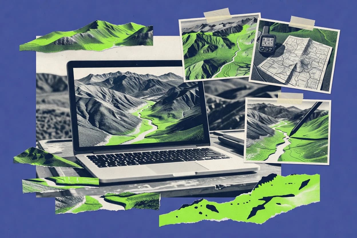
Science ResearchTop 10 Best Digital Elevation Model Software of 2026
Compare top Digital Elevation Model Software picks with a ranked list. Evaluate QGIS, ArcGIS Pro, GRASS GIS and more. Explore options.

How we ranked these tools
Core product claims cross-referenced against official documentation, changelogs, and independent technical reviews.
Analyzed video reviews and hundreds of written evaluations to capture real-world user experiences with each tool.
AI persona simulations modeled how different user types would experience each tool across common use cases and workflows.
Final rankings reviewed and approved by our editorial team with authority to override AI-generated scores based on domain expertise.
Score: Features 40% · Ease 30% · Value 30%
Gitnux may earn a commission through links on this page — this does not influence rankings. Editorial policy
Editor’s top 3 picks
Three quick recommendations before you dive into the full comparison below — each one leads on a different dimension.
QGIS
Processing Toolbox with raster terrain analysis tools for slope, aspect, and hillshade
Built for teams producing DEM derivatives, cartography, and repeatable GIS processing.
ArcGIS Pro
Editor pick3D Analyst terrain analysis and surface derivatives within the ArcGIS Pro geoprocessing framework
Built for gIS teams producing DEM derivatives and 3D scene products from heterogeneous rasters.
GRASS GIS
Editor pickGRASS GIS raster hydrology suite with flow direction and basin delineation tools
Built for teams needing rigorous DEM processing and hydrologic analysis with reproducible workflows.
Related reading
Comparison Table
This comparison table reviews Digital Elevation Model software options used to generate, process, and analyze elevation surfaces, including QGIS, ArcGIS Pro, GRASS GIS, SAGA GIS, and Global Mapper. It summarizes the key capabilities that affect DEM workflows, such as import and reprojection support, terrain analysis tools, raster processing features, and typical data handling for point clouds and raster elevation products.
QGIS
desktop GISQGIS provides desktop geospatial analysis and raster processing workflows for DEM creation, reprojection, mosaicking, hillshades, slope, and custom scripts using GRASS and GDAL.
Processing Toolbox with raster terrain analysis tools for slope, aspect, and hillshade
QGIS stands out for turning elevation datasets into analysis-ready layers through a highly extensible desktop GIS workflow. It supports DEM ingestion from common raster formats and includes core tools for resampling, reprojection, mosaicking, and terrain derivatives like slope, aspect, and hillshade.
Its visualization stack offers interactive styling, transparency controls, and map layouts that are useful for elevation reporting. Plugin-based processing expands DEM workflows to include hydrology and other terrain analysis steps without requiring a separate GIS application.
- +Native DEM raster handling with consistent layer styling and inspection tools
- +Processing Toolbox enables reproducible terrain derivatives like slope, aspect, and hillshade
- +Rich plugin ecosystem supports hydrology and advanced raster workflows
- +Layout and map exports support clear elevation cartography deliverables
- –Large DEM processing can be slow without careful raster settings
- –Some advanced DEM workflows require GIS-specific parameter knowledge
- –Managing huge mosaics may need external preprocessing for stability
Best for: Teams producing DEM derivatives, cartography, and repeatable GIS processing
More related reading
ArcGIS Pro
GIS platformArcGIS Pro supports DEM ingest, geoprocessing, terrain analysis, and visualization with tools for building elevation derivatives like slope, aspect, and contours.
3D Analyst terrain analysis and surface derivatives within the ArcGIS Pro geoprocessing framework
ArcGIS Pro stands out with a tightly integrated geoprocessing and 3D visualization workflow for elevation workflows. It supports DEM creation and maintenance using raster analysis tools, including mosaicking, resampling, reprojection, and hydrology-driven derivatives like hillshade and slope.
The software also enables classification and editing of elevation surfaces in a GIS-centric environment, then renders results with advanced symbology and scene layers. It fits teams that need reproducible raster processing and map-ready 3D outputs from the same project workspace.
- +End-to-end DEM processing inside one project with raster geoprocessing tools
- +Strong 3D scene visualization for QA of elevation surfaces and derivatives
- +Hydrology and terrain analysis tools support terrain-aware DEM outputs
- –Tool complexity can slow DEM pipelines for small teams
- –Large rasters demand careful hardware and tuning for smooth performance
- –Geoprocessing task setup can be verbose compared with simpler DEM tools
Best for: GIS teams producing DEM derivatives and 3D scene products from heterogeneous rasters
GRASS GIS
open-source GISGRASS GIS offers raster DEM processing modules for terrain modeling, hydrology workflows, and advanced map algebra for elevation analysis.
GRASS GIS raster hydrology suite with flow direction and basin delineation tools
GRASS GIS is distinct for its long-running, research-grade geospatial engine and command-line geoprocessing model. It provides a full raster workflow for building, editing, and analyzing digital elevation models from raw elevation sources.
Core capabilities include hydrologic modeling tools, slope and aspect derivation, interpolation support, and robust raster map algebra for repeatable DEM pipelines. Spatial processing scales via modular workflows, GRASS scripting, and tight integration with common geospatial formats.
- +Deep raster and terrain analysis toolset for DEMs including slope and aspect
- +Powerful hydrology modules for flow direction, accumulation, and watershed delineation
- +Reproducible geoprocessing through scripts, models, and command chaining
- +Strong raster algebra enables custom DEM derivations and conditioning steps
- –Learning curve is steep due to dense CLI and parameter-heavy tools
- –Interactive GUI workflows are slower than scripting for complex DEM pipelines
- –Preprocessing steps like reprojection and resampling require careful manual setup
- –Large datasets can demand significant CPU and memory tuning
Best for: Teams needing rigorous DEM processing and hydrologic analysis with reproducible workflows
SAGA GIS
terrain analysisSAGA GIS provides specialized terrain analysis algorithms for DEM derivatives such as slope, curvature, and geomorphometric indices.
Integrated terrain analysis toolbox with configurable hydrology and derivative tools
SAGA GIS stands out for providing a deep geoprocessing toolbox with many terrain-oriented tools built for raster workflows. It supports common Digital Elevation Model tasks such as sink filling, terrain conditioning, hillshade, slope, aspect, and profile generation.
The software emphasizes scripted, repeatable analysis through batch processing and parameterized tool chains. It also integrates well with other GIS stacks via standard raster and vector data exchange.
- +Large terrain toolset for DEM preprocessing and derivatives
- +Batch processing supports repeatable geoprocessing workflows
- +Strong raster conditioning options like sink filling and filtering
- +Accessible in one desktop app without separate DEM utilities
- –Workflow setup can feel technical compared with simpler DEM apps
- –Dense menus make tool discovery slower for first-time users
- –Advanced analysis requires careful parameter tuning to avoid artifacts
- –Visualization tools are less polished than specialized GIS editors
Best for: Geospatial analysts generating many DEM derivatives in repeatable workflows
Global Mapper
desktop terrainGlobal Mapper enables DEM import, terrain modeling, and batch raster operations for elevation layers, including contour generation and profiling.
Terrain ingestion and surface generation for DEM exports from both raster and point sources
Global Mapper stands out for fast, integrated handling of raster, point cloud, and vector geospatial data around elevation workflows. It supports DEM creation from surfaces and samples, plus visualization and measurement tools for quality checks before exporting. The software also includes terrain processing like reprojecting, filtering, and grid resampling, which helps normalize elevation datasets for downstream analysis.
- +Strong DEM generation from multiple inputs including terrain grids and point data
- +Reliable reprojection and resampling tools for preparing consistent elevation rasters
- +Fast terrain visualization and analysis aids for validating elevation surfaces
- –Advanced elevation workflows can feel complex without GIS background
- –Less focused DEM editing than specialized terrain modelers
Best for: GIS teams producing and validating DEMs from varied survey data formats
WhiteboxTools
hydrology DEMWhiteboxTools delivers open-source geospatial processing for DEM preprocessing and hydrologic terrain analysis including sinks, flow accumulation, and stream burning.
Hydrology and watershed delineation tools built for raster DEM flow processing
WhiteboxTools is a open-source geospatial analysis toolkit that runs from the command line and desktop style workflows. It offers raster-based terrain analysis tools used for DEM conditioning, hydrology preprocessing, and derivative surface products like slope and aspect.
The project also supports extensive algorithm chaining for watershed boundaries, flow accumulation, and stream network extraction. This makes it distinct for reproducible DEM processing using many specialized algorithms packaged into one toolset.
- +Large collection of DEM conditioning and terrain analysis operators in one toolkit
- +Command-line workflow supports repeatable batch processing for raster pipelines
- +Hydrology tools include flow accumulation, stream extraction, and watershed delineation
- +Raster outputs for slope, aspect, curvature, and common derivative surfaces are readily generated
- +Well-suited for automating DEM pre-processing steps across many tiles
- –Many workflows require GIS preprocessing knowledge and parameter tuning
- –User experience can be slower than point-and-click DEM tools for quick tasks
- –No single integrated GUI-centric DEM editing and quality assurance suite
- –Large rasters can demand careful memory and environment management during runs
Best for: Teams automating DEM conditioning and hydrology workflows with scriptable raster tools
GDAL
raster engineGDAL supplies command-line and library tools to translate, warp, mosaic, and resample DEM rasters with consistent georeferencing and NoData handling.
Warp and reprojection engine with configurable resampling for DEM alignment
GDAL stands out for being a mature geospatial data translation and processing library with strong support for raster workflows used in DEM preparation. It provides high-performance command-line tools and a programming API for warping, reprojection, resampling, mosaicking, and raster format conversion across common DEM encodings.
The toolset includes elevation-specific workflows such as generating derived products, managing nodata and georeferencing metadata, and building analysis-ready rasters through consistent geospatial transforms. GDAL’s depth comes from broad format support and configurable processing chains rather than a dedicated DEM editor UI.
- +Extensive raster input and output support for DEM pipelines
- +High-quality reprojection and resampling using established geospatial algorithms
- +Scripting with CLI and APIs enables repeatable batch processing
- –Command syntax can be steep without workflow automation templates
- –DEM-specific editing and hydrology tools require external utilities
- –Large pipeline builds need careful nodata and metadata handling
Best for: Teams automating DEM preprocessing and format conversion through scripts
PDAL
point-to-DEMPDAL processes point clouds into gridded elevation products using repeatable pipelines for generating DEMs from LiDAR and other 3D point data.
Point cloud processing pipeline that builds DEM rasters with explicit gridding stages
PDAL stands out for turning heterogeneous geospatial point cloud data into consistent raster outputs through a pipeline-driven workflow. It supports Digital Elevation Model production from point clouds using filtering, classification, and interpolation stages.
The tool integrates tightly with GDAL-style formats and can run locally via command line or embedded in applications through libraries. Output control is strong through explicit pipeline steps that define gridding, neighborhood behavior, and nodata handling.
- +Pipeline control enables reproducible DEM generation from point clouds
- +Rich processing chain supports filtering, classification, and gridding steps
- +Strong format interoperability via shared geospatial raster and vector conventions
- +Batch and automation friendly command-line execution for large datasets
- –Pipeline JSON increases setup complexity compared with wizard tools
- –DEM results depend heavily on correct parameter choices and data conditioning
- –Interactive visualization and GUI editing are not the primary workflow
Best for: Teams generating DEMs from point clouds using automated, reproducible pipelines
CloudCompare
point cloudCloudCompare supports LiDAR and point-cloud cleaning and filtering workflows that precede DEM generation from processed elevation points.
Iterative Closest Point alignment for registering LiDAR or scan datasets
CloudCompare stands out as a desktop point-cloud workbench for cleaning, registering, and analyzing 3D data used to derive elevation models. It supports common LiDAR and photogrammetry workflows, including point cloud alignment, filtering, and interpolation-driven surface generation.
For DEM creation, it excels at preparing terrain-ready point sets with robust noise removal and quality checks before exporting raster or gridded products. Its strength is interactive geometry processing rather than end-to-end GIS automation for terrain products.
- +Powerful point cloud filtering and classification helpers for terrain preparation
- +Strong alignment tools for merging scans before DEM surface generation
- +Rich measurement, inspection, and quality checks for elevation accuracy control
- +Flexible exports for downstream GIS and raster workflows
- –DEM-focused automation is limited versus dedicated GIS or surveying suites
- –Raster gridding workflows require careful parameter tuning and validation
- –GUI-based operation can feel complex for repeatable production pipelines
Best for: Terrain analysts preparing point clouds for DEMs with interactive QA and manual control
CesiumJS
3D visualizationCesiumJS renders global terrain and elevation layers for interactive 3D visualization of DEM-derived surfaces in web applications.
Cesium terrain provider integration for streaming and rendering tiled global terrain
CesiumJS stands out for rendering global geospatial data in a browser using an interactive 3D globe and map engine. It supports high-performance terrain visualization through Cesium terrain providers, which are suitable for digital elevation model workflows.
It also integrates with external imagery, 3D tiles, and camera-driven interactions for analyzing and inspecting terrain surfaces. DEM-heavy projects typically rely on preprocessing and data hosting for the elevation layer, while CesiumJS focuses on fast visualization and client-side interaction.
- +Interactive WebGL globe for real-time terrain inspection
- +Terrain providers enable elevation rendering without custom mesh generation
- +Flexible camera controls for exploring DEMs at multiple scales
- –DEM processing and format preparation are not handled inside the library
- –Advanced terrain analysis requires extra tooling outside CesiumJS
- –Large datasets can demand careful streaming and tiling strategy
Best for: Teams visualizing hosted DEM terrain in a browser for review and exploration
How to Choose the Right Digital Elevation Model Software
This buyer's guide covers Digital Elevation Model software workflows across QGIS, ArcGIS Pro, GRASS GIS, SAGA GIS, Global Mapper, WhiteboxTools, GDAL, PDAL, CloudCompare, and CesiumJS. It maps tool strengths like terrain derivatives, hydrology, raster preprocessing, point-cloud-to-DEM pipelines, and interactive 3D visualization to concrete selection criteria.
What Is Digital Elevation Model Software?
Digital Elevation Model software converts elevation data into analysis-ready terrain products by handling raster operations like reprojection, resampling, mosaicking, and terrain derivatives. It also supports hydrology steps such as sink filling, flow direction, and watershed delineation, plus point-cloud processing pipelines that grid LiDAR into DEM rasters. Teams use these tools to produce slope, aspect, and hillshade layers for mapping, QA, and terrain analysis. QGIS and ArcGIS Pro represent full GIS-style DEM workflows that generate derivatives and deliver map outputs.
Key Features to Look For
The right feature set determines whether a DEM workflow is reproducible, terrain-aware, and fast enough for the dataset sizes involved.
Reproducible raster processing for terrain derivatives
QGIS includes a Processing Toolbox that generates slope, aspect, and hillshade in repeatable workflows. ArcGIS Pro provides an integrated geoprocessing framework that supports surface derivatives and 3D-ready outputs from the same project workspace.
Hydrology-capable terrain conditioning and analysis
GRASS GIS supplies a raster hydrology suite with flow direction, flow accumulation, and basin delineation tools for watershed workflows. WhiteboxTools adds hydrology operators for sinks, flow accumulation, stream extraction, and watershed delineation to condition DEMs for flow-based analysis.
Integrated terrain conditioning tools such as sink filling and filtering
SAGA GIS emphasizes terrain conditioning options like sink filling and filtering alongside derivative generation for many DEM preprocessing pipelines. WhiteboxTools also focuses on DEM conditioning operators that feed hydrology and derivative surfaces.
High-performance alignment via warp, reprojection, and resampling
GDAL provides warp and reprojection engines with configurable resampling for DEM alignment across rasters and tiles. QGIS also supports reprojection and mosaicking workflows, but GDAL is the core choice when pipeline-driven raster alignment is the primary requirement.
Point cloud to DEM gridding pipelines with explicit control
PDAL turns LiDAR and other point clouds into gridded DEM products using pipeline JSON steps that define filtering, classification, and gridding. CloudCompare supports interactive cleaning and alignment such as Iterative Closest Point, then prepares terrain-ready point sets for gridding outside the point-cloud workbench.
3D visualization and interactive inspection of elevation surfaces
ArcGIS Pro delivers strong 3D scene visualization for QA of elevation surfaces and derivatives through the same geoprocessing project. CesiumJS focuses on browser-based interactive terrain inspection using Cesium terrain providers that render hosted tiled elevation data.
How to Choose the Right Digital Elevation Model Software
Selection should start with data type and end product requirements, then match tooling to terrain derivatives, hydrology, automation needs, and visualization targets.
Match the tool to the input data type
Use PDAL when the workflow starts from LiDAR or other point clouds and ends with gridded DEM rasters produced through explicit pipeline stages. Use CloudCompare when point-cloud cleaning and registration need iterative interactive control such as Iterative Closest Point before exporting data for DEM surface generation.
Select a primary DEM processing backbone based on automation goals
Choose GDAL when the core requirement is format conversion and scripted reprojection, warping, mosaicking, and resampling for DEM preprocessing pipelines. Choose QGIS when the requirement is a desktop GIS workflow that turns elevation datasets into analysis-ready layers using the Processing Toolbox for repeatable derivative outputs.
Plan for terrain derivatives and hydrology needs early
If slope, aspect, and hillshade must be produced repeatedly with terrain-aware steps, use QGIS or ArcGIS Pro where derivative workflows are first-class geoprocessing operations. If flow modeling, stream extraction, and watershed delineation are mandatory, use GRASS GIS for flow direction and basin delineation or WhiteboxTools for flow accumulation and stream network workflows.
Account for conditioning and artifact risk from parameter-heavy tools
SAGA GIS and GRASS GIS provide dense terrain toolsets for conditioning and hydrology, but parameter tuning directly affects artifacts in derivatives. WhiteboxTools and PDAL also depend on correct operator parameters and conditioning stages, so pipelines should include validation steps such as visual inspection and output checks.
Choose the delivery format and visualization path
Use ArcGIS Pro when DEM processing and 3D scene QA need to happen inside one project, including terrain-aware derivatives for scenes. Use CesiumJS when the goal is fast browser visualization of hosted DEM terrain and interactive inspection through tiled terrain providers.
Who Needs Digital Elevation Model Software?
Different DEM software choices align to different production roles based on automation level, data sources, terrain analysis depth, and output targets.
GIS teams producing DEM derivatives, cartography deliverables, and repeatable raster workflows
QGIS is a strong fit for producing slope, aspect, and hillshade with a Processing Toolbox and map layout exports. ArcGIS Pro is a strong fit for teams that also need 3D Analyst terrain analysis and 3D scene outputs for QA of elevation surfaces.
Teams needing rigorous hydrology with reproducible terrain pipelines
GRASS GIS targets rigorous raster hydrology with flow direction, accumulation, and basin delineation tools, plus scriptable reproducibility. WhiteboxTools targets automated hydrology and watershed workflows with operators for flow accumulation, stream extraction, and watershed delineation suited for batch tile processing.
Analysts generating many DEM derivatives through batch-oriented terrain toolchains
SAGA GIS provides an integrated terrain analysis toolbox that supports sink filling, filtering, and derivative generation through batch processing. SAGA GIS fits repeated derivative production where consistent tool chains matter more than polished visualization.
Survey and LiDAR production teams converting point clouds into consistent gridded elevation products
PDAL is the fit when DEM generation must be driven by explicit pipeline steps for filtering, classification, and gridding. CloudCompare fits teams that require interactive point-cloud cleaning, alignment, and inspection like Iterative Closest Point before exporting for gridding.
Teams preparing and validating DEMs from varied survey data formats and point or raster sources
Global Mapper is built for terrain ingestion and surface generation so DEM exports can come from raster and point sources. Global Mapper also supports reprojecting and resampling for consistent elevation rasters plus fast visualization and measurement tools for validation.
Organizations building DEM preprocessing and raster alignment pipelines at scale
GDAL fits scripted preprocessing requirements for warp and reprojection alignment with configurable resampling and strong nodata and metadata handling. QGIS can complement GDAL for workflow orchestration, but GDAL is the automation backbone when format conversion and alignment are the central tasks.
Web teams visualizing hosted DEM terrain and reviewing elevation interactively
CesiumJS fits interactive web visualization where tiled global terrain and elevation layers are rendered through Cesium terrain provider integration. CesiumJS avoids DEM processing itself, so preprocessing should be done with raster and pipeline tools like GDAL or PDAL.
Common Mistakes to Avoid
Repeated pitfalls across these tools come from mismatching automation expectations, underestimating parameter sensitivity, and assuming visualization tools replace DEM processing.
Picking a visualization-first tool for DEM processing
CesiumJS provides interactive terrain visualization via Cesium terrain providers but does not handle DEM processing, so preprocessing and hosting must be handled with tools like GDAL or PDAL. CloudCompare supports point-cloud preparation and alignment, but its DEM-focused automation is limited compared with dedicated DEM processing suites.
Treating hydrology as a simple derivative step
GRASS GIS includes flow direction, accumulation, and basin delineation tools that require careful workflow setup to produce correct watershed results. WhiteboxTools also provides hydrology and watershed delineation operators, so sink handling and flow accumulation parameters must be validated before relying on extracted streams.
Running large raster workflows without tuning raster settings
QGIS can slow on large DEM processing if raster settings are not chosen carefully for performance. ArcGIS Pro can also demand careful hardware and tuning for smooth performance when large rasters are processed for derivatives and 3D scenes.
Using a point-cloud pipeline without explicit gridding and conditioning control
PDAL builds DEM rasters through explicit pipeline stages for gridding, filtering, and classification, so incorrect pipeline parameters can propagate into DEM outputs. PDAL pipeline JSON setup increases complexity compared with wizard tools, so teams must include validation steps after gridding to confirm artifacts are not introduced.
How We Selected and Ranked These Tools
We evaluated every tool on three sub-dimensions with features weighted at 0.40, ease of use weighted at 0.30, and value weighted at 0.30. The overall rating is computed as overall = 0.40 × features + 0.30 × ease of use + 0.30 × value. QGIS separated from lower-ranked tools by pairing a high-utility features set with strong workflow breadth, including a Processing Toolbox dedicated to slope, aspect, and hillshade generation and consistent DEM raster handling that supports repeatable cartography deliverables. That combination supported higher practical throughput for teams producing multiple terrain derivatives rather than only single-step conversions.
Frequently Asked Questions About Digital Elevation Model Software
Which tool best turns a raw DEM into analysis-ready derivatives like slope and hillshade?
What software is strongest for hydrology workflows like flow direction and basin delineation?
Which options work best when DEMs must be produced from point clouds instead of raster elevation sources?
How do users typically automate repeatable DEM pipelines and batch processing?
Which tool is best for aligning and converting DEM formats at scale before analysis?
What software helps validate DEM quality before exporting results to other systems?
Which option is best for creating and editing elevation surfaces with map-ready 3D outputs in one environment?
When should a team use CesiumJS instead of a desktop DEM processing tool?
Why might an analyst choose GRASS GIS or SAGA GIS over a general GIS interface for terrain conditioning?
Conclusion
After evaluating 10 science research, QGIS stands out as our overall top pick — it scored highest across our combined criteria of features, ease of use, and value, which is why it sits at #1 in the rankings above.
Use the comparison table and detailed reviews above to validate the fit against your own requirements before committing to a tool.
Tools reviewed
Primary sources checked during evaluation.
Referenced in the comparison table and product reviews above.
Keep exploring
Comparing two specific tools?
Software Alternatives
See head-to-head software comparisons with feature breakdowns, pricing, and our recommendation for each use case.
Explore software alternatives→In this category
Science Research alternatives
See side-by-side comparisons of science research tools and pick the right one for your stack.
Compare science research tools→FOR SOFTWARE VENDORS
Not on this list? Let’s fix that.
Our best-of pages are how many teams discover and compare tools in this space. If you think your product belongs in this lineup, we’d like to hear from you—we’ll walk you through fit and what an editorial entry looks like.
Apply for a ListingWHAT THIS INCLUDES
Where buyers compare
Readers come to these pages to shortlist software—your product shows up in that moment, not in a random sidebar.
Editorial write-up
We describe your product in our own words and check the facts before anything goes live.
On-page brand presence
You appear in the roundup the same way as other tools we cover: name, positioning, and a clear next step for readers who want to learn more.
Kept up to date
We refresh lists on a regular rhythm so the category page stays useful as products and pricing change.