GITNUXSOFTWARE ADVICE
Market ResearchTop 8 Best Demographic Mapping Software of 2026
Compare the Top 10 Best Demographic Mapping Software picks. Maptive, Azavea Story Maps, BatchGeo included. Explore the ranked options.

How we ranked these tools
Core product claims cross-referenced against official documentation, changelogs, and independent technical reviews.
Analyzed video reviews and hundreds of written evaluations to capture real-world user experiences with each tool.
AI persona simulations modeled how different user types would experience each tool across common use cases and workflows.
Final rankings reviewed and approved by our editorial team with authority to override AI-generated scores based on domain expertise.
Score: Features 40% · Ease 30% · Value 30%
Gitnux may earn a commission through links on this page — this does not influence rankings. Editorial policy
Editor’s top 3 picks
Three quick recommendations before you dive into the full comparison below — each one leads on a different dimension.
Maptive
Demographic layers with radius and boundary targeting for localized population insights
Built for teams needing fast demographic mapping for markets, sites, and coverage planning.
Azavea Story Maps
Editor pickScene-based Story Maps that combine narration, thematic layers, and interactive map popups
Built for teams publishing demographic insights through guided interactive map narratives.
BatchGeo
Editor pickAuto-mapping of spreadsheet rows into an interactive geocoded map
Built for teams creating demographic point maps from spreadsheets without GIS expertise.
Related reading
Comparison Table
This comparison table evaluates demographic mapping software tools, including Maptive, Azavea Story Maps, BatchGeo, Mapline, and Nearest Neighbor, across core capabilities like data sources, geocoding support, and visualization features. Readers can use the table to compare which platforms best fit use cases such as market analysis, site selection, and location-based reporting, based on how each tool handles mapping workflows and outputs.
Maptive
demographic mappingA demographic and market insights mapping platform that supports audience segmentation on interactive maps for market research workflows.
Demographic layers with radius and boundary targeting for localized population insights
Maptive stands out with built-in demographic mapping workflows that combine geocoding, analytics, and shareable map outputs in one place. Core capabilities include demographic and consumer insights layered on maps, radius and polygon-based targeting, and exporting results for reporting workflows.
Teams can create location-based visuals and filter populations by common demographic indicators to support market planning and service coverage decisions. The tool is geared toward practical mapping tasks rather than custom GIS building.
- +Built-in demographic layers support fast analysis without GIS setup
- +Radius and boundary selection speeds up market area comparisons
- +Shareable map outputs align with presentation and stakeholder needs
- +Geocoding and location targeting reduce manual data prep
- –Custom data modeling options are limited versus full GIS platforms
- –Advanced spatial analysis tools are not as deep as enterprise GIS
- –Large territory management can feel heavy for complex projects
Best for: Teams needing fast demographic mapping for markets, sites, and coverage planning
More related reading
Azavea Story Maps
geospatial publishingA geospatial storytelling and analysis platform that supports mapping demographic and community data for research and communication use cases.
Scene-based Story Maps that combine narration, thematic layers, and interactive map popups
Azavea Story Maps stands out for combining narrative storyboarding with interactive maps designed for demographic exploration and communication. It supports scene-based map storytelling where each chapter can pair filters, popups, and thematic layers to explain spatial patterns. Core capabilities include configurable web map viewing, dataset-driven thematic presentation, and shareable story links for stakeholder-facing analysis.
- +Scene-based story structure helps communicate demographic change across places
- +Interactive map layers support thematic exploration without leaving the narrative
- +Shareable story pages make stakeholder review and updates straightforward
- +Configurable popups improve interpretability of demographic attributes
- +Works well for mapping workflows that require narrative plus geography
- –Advanced demographic transformations require GIS preparation outside the tool
- –Complex filter logic can become cumbersome across multiple story scenes
- –Template-heavy storytelling can limit highly bespoke analytic layouts
- –Map customization depth is lower than full GIS authoring environments
Best for: Teams publishing demographic insights through guided interactive map narratives
BatchGeo
lightweight mappingA web-based mapping tool that geocodes address lists and visualizes results on maps for localized demographic analysis.
Auto-mapping of spreadsheet rows into an interactive geocoded map
BatchGeo stands out for turning pasted or uploaded spreadsheet data into an interactive map with point markers and heat-style views. It supports location-based mapping workflows that fit demographic use cases like region-level spotting and site selection based on attributes.
The workflow emphasizes quick geocoding of address-like fields and fast sharing of map results with collaborators. Mapping depth is geared toward operational visualization rather than advanced demographic modeling.
- +Rapid spreadsheet-to-map workflow with automatic geocoding
- +Point, marker, and thematic styling support for attribute visualization
- +Easy sharing so stakeholders can review maps without GIS tools
- –Limited advanced demographic analytics beyond visual exploration
- –Geocoding quality depends heavily on clean address fields
- –Less suitable for large datasets needing complex spatial workflows
Best for: Teams creating demographic point maps from spreadsheets without GIS expertise
Mapline
site selection mappingA map-based demographic and market planning tool that combines mapping with local area attributes for site selection and research.
Audience and demographic overlay configuration for choropleth comparisons across selectable regions
Mapline stands out for focusing demographic mapping on fast map-driven workflows built around selectable geographies and audience attributes. It supports choropleths and heatmaps to visualize population, households, and market indicators across regions while keeping the workflow centered on spatial analysis. The tool is designed for repeating mapping tasks such as comparing segments, generating shareable outputs, and exporting results for downstream reporting.
- +Demographic layers enable quick audience profiling by region
- +Interactive map styling supports choropleths and heat-style views
- +Export and sharing workflows fit recurring reporting cycles
- –Limited deep modeling workflows beyond map-based segmentation
- –Advanced data preparation options can feel constrained for complex datasets
- –Geography management is less flexible than dedicated GIS tools
Best for: Marketing teams producing repeatable demographic maps for campaigns and planning
Nearest Neighbor
location intelligenceA consumer location and demographic mapping service that supports audience targeting based on geographic proximity and profiles.
Trade area buffers and ring-based demographic aggregation directly on the map
Nearest Neighbor focuses on demographic mapping by connecting user locations to population and household insights on an interactive map. The core workflow centers on drawing buffers or rings around points, then visualizing trade area demographics like age distribution, income, and household characteristics. Mapping outputs support shareable map views and report-style exports for planning conversations.
- +Interactive trade area mapping from point locations with buffers and ring rings
- +Clear demographic layers including age and income categories
- +Map views are easy to share with stakeholders
- +Works well for site selection and territory planning use cases
- –Limited support for complex multipolygon boundaries versus GIS-grade tools
- –Some workflows require careful data setup for consistent results
- –Export and formatting options can feel basic for polished reports
Best for: Regional planners needing fast demographic trade area maps and stakeholder sharing
Sicily
demographic analyticsA demographic mapping and workforce insight platform that supports regional analysis with geographic context.
Interactive demographic layer mapping for comparing population indicators across chosen areas
Sicily stands out by focusing on demographic mapping workflows tied to real-world locations and market analysis needs. The platform supports visual mapping to explore population characteristics and spatial patterns across selected geographies.
It provides tools to filter and compare demographic indicators so teams can translate geographic data into targeting insights. Sicily is geared toward practical use cases like planning, site selection, and segmentation where map-based analysis drives decisions.
- +Map-first workflow for exploring demographic indicators by location
- +Geography filtering supports segmentation and comparative analysis
- +Spatial context helps translate demographic data into actionable targeting
- –Advanced demographic modeling options appear limited compared with top platforms
- –Geography setup and layer configuration can feel technical for new users
- –Export and downstream integration capabilities are not a standout strength
Best for: Teams needing location-based demographic segmentation for market planning decisions
Foursquare Audience Insights
location intelligenceA location intelligence product that provides audience and venue analytics for demographic and behavioral targeting on a map context.
Audience concentration mapping around points of interest with demographic breakdowns
Foursquare Audience Insights stands out for mapping demographic and consumer insights from location signals tied to points of interest. It delivers audience concentration views around specific venues and geographies using age, gender, and other population-style breakdowns.
The tool supports comparing audiences across locations and understanding how foot-traffic cohorts differ within defined study areas. It is best treated as a venue and area intelligence layer that complements marketing and site planning rather than a full customer profile system.
- +Venue and area demographic mapping using location-based audience signals
- +Side-by-side audience comparisons across defined geographies
- +Clear outputs for planning retail sites and marketing territories
- +Works well with points of interest rather than only custom polygons
- +Consistent demographic breakdowns like age and gender by geography
- –Limited depth for household and psychographic dimensions compared to broader CDP tools
- –Fewer advanced modeling options than GIS-first demographic platforms
- –Insight outputs are less actionable without downstream campaign measurement integration
- –Study-area accuracy depends heavily on well-defined boundaries and venues
- –Export and workflow customization can feel constrained for analysts
Best for: Location marketers mapping nearby audiences for store planning and targeting
Locu
local intelligenceA data platform that supports mapping and discovery workflows for local business research and area-level analysis.
Venue data enrichment that links demographic attributes to specific locations
Locu stands out by combining venue-focused data enrichment with demographic context around real-world locations. It supports geographic mapping workflows that tie population and consumer attributes to specific points, radii, or service areas. The core capability centers on extracting place intelligence and visualizing it for outreach, site selection, and market analysis use cases.
- +Venue-centric demographic mapping for location planning and customer targeting.
- +Geographic queries using points or areas to generate localized demographic views.
- +Practical outputs for market analysis and site selection workflows.
- –Limited depth for advanced demographic modeling beyond standard locality attributes.
- –Mapping setup and iteration can feel heavier than pure GIS point-and-click tools.
- –Less suited for complex spatial analysis compared with dedicated GIS platforms.
Best for: Teams mapping demographics around venues for market entry and site selection
How to Choose the Right Demographic Mapping Software
This buyer's guide helps teams pick demographic mapping software that turns location data into usable market insights and stakeholder-ready maps. It covers Maptive, Azavea Story Maps, BatchGeo, Mapline, Nearest Neighbor, Sicily, Foursquare Audience Insights, and Locu, with comparisons grounded in how each tool performs in real mapping workflows. The guide focuses on decision-ready capabilities like radius and boundary targeting, choropleth and heat-style visualization, trade area aggregation, and narrative map publishing.
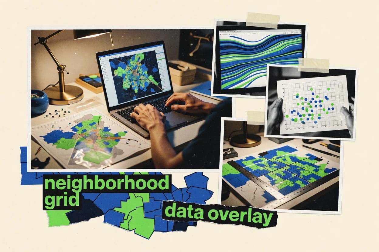
What Is Demographic Mapping Software?
Demographic mapping software visualizes population, households, and related demographic indicators on maps tied to locations like addresses, venues, points, buffers, and selectable regions. It solves common problems in market planning and site selection by supporting segmentation on interactive maps, then producing shareable map outputs for decision workflows. Tools like Maptive combine demographic layers with radius and boundary targeting to speed localized population insights. Story-driven platforms like Azavea Story Maps add scene-based map narratives with interactive popups for communicating demographic change across places.
Key Features to Look For
The right tool depends on matching the mapping workflow, the geography type, and the output format to real planning and reporting needs.
Radius and boundary targeting with demographic layers
Demographic layers must support radius and boundary selection so teams can compare localized populations for markets, sites, and coverage planning. Maptive is built around demographic layers with radius and boundary targeting to produce localized population insights quickly.
Trade area buffers and ring-based demographic aggregation
Trade area workflows need buffer and ring tools that aggregate demographics around point locations for territory planning. Nearest Neighbor centers its mapping workflow on drawing buffers or ring rings and then visualizing trade area demographics on the map.
Choropleths and heat-style visualization for selectable regions
Regional planning needs choropleths and heat-style views that make demographic differences visible across geography. Mapline provides choropleths and heatmaps for population, households, and market indicators across selectable regions.
Spreadsheet-to-map geocoding for rapid point visualization
Address and spreadsheet ingestion should turn rows into geocoded points fast so teams can visualize demographics without heavy GIS setup. BatchGeo auto-maps spreadsheet rows into an interactive geocoded map with point markers and thematic styling for attribute visualization.
Scene-based interactive storytelling with popups for stakeholder communication
Stakeholder-facing work benefits from guided map narratives where each scene can pair filters, popups, and thematic layers. Azavea Story Maps supports scene-based story structure with interactive map layers and configurable popups to explain spatial patterns.
Venue and audience concentration mapping around points of interest
Retail and location marketing needs venue and area intelligence that anchors audiences to points of interest. Foursquare Audience Insights maps audience concentration around specific venues with demographic breakdowns like age and gender.
How to Choose the Right Demographic Mapping Software
Selecting the right tool is a workflow match decision that depends on which geography type will be analyzed and how results must be shared.
Start with the geography and targeting shape
Choose a tool based on whether analysis uses radii, trade-area rings, choropleth regions, or venue-based points. For radius and boundary segmentation, Maptive supports demographic layers with radius and boundary targeting for localized population insights. For trade areas built from point locations, Nearest Neighbor supports buffer and ring-based demographic aggregation directly on the map.
Match visualization style to decision needs
Pick choropleths and heat-style views for regional comparisons and map-ready campaign planning. Mapline provides choropleths and heatmaps with audience and demographic overlay configuration for choropleth comparisons across selectable regions. Pick point maps and thematic styling when the work starts as address-like rows in spreadsheets using BatchGeo.
Plan for how insights will be communicated
Select narrative publishing tools when demographic change must be explained across multiple stakeholder scenes. Azavea Story Maps supports scene-based story structure with interactive map layers and configurable popups to make demographic attributes interpretable. For faster stakeholder walkthroughs using simpler interactive maps, tools like Maptive emphasize shareable map outputs aligned to presentation needs.
Evaluate venue-centric requirements for retail and nearby audiences
Use venue-focused audience intelligence when targeting is anchored to specific places. Foursquare Audience Insights provides audience concentration mapping around points of interest with demographic breakdowns such as age and gender for store planning and territory comparison. Locu also focuses on venue data enrichment linked to demographic attributes for market entry and site selection using points, radii, or service areas.
Confirm how much modeling depth and spatial complexity is required
If custom demographic transformations and deep spatial analysis are required, expect GIS-grade limitations in map-first platforms and plan for external preparation. Maptive limits custom data modeling options versus full GIS platforms and advanced spatial analysis depth. Azavea Story Maps also relies on external GIS preparation for advanced demographic transformations, while BatchGeo emphasizes rapid operational visualization over complex demographic modeling.
Who Needs Demographic Mapping Software?
Demographic mapping tools serve teams that need location-based segmentation and map outputs for planning, targeting, and stakeholder sharing.
Teams needing fast demographic mapping for markets, sites, and coverage planning
Maptive is best for fast demographic mapping because it combines built-in demographic layers with radius and boundary targeting and produces shareable map outputs for presentation and reporting workflows. This matches the need for practical market planning where localized population insights drive coverage decisions.
Teams publishing demographic insights through guided interactive map narratives
Azavea Story Maps fits teams that must communicate demographic change with narrative structure because it uses scene-based story maps with interactive map layers, filters, and configurable popups. This supports stakeholder review when maps need context instead of just raw geographic layers.
Teams creating demographic point maps from spreadsheets without GIS expertise
BatchGeo is built for turning pasted or uploaded spreadsheet data into interactive geocoded maps with point markers and thematic styling. This supports localized demographic analysis without requiring complex GIS setup and is ideal for quick site screening workflows.
Marketing teams producing repeatable demographic maps for campaigns and planning
Mapline supports repeatable demographic mapping through choropleths and heat-style views with export and sharing workflows designed for recurring reporting cycles. It also enables audience and demographic overlay configuration for comparing segments across selectable regions.
Common Mistakes to Avoid
Several recurring pitfalls come from choosing the wrong geography workflow, underestimating data preparation requirements, or expecting GIS-level modeling from map-first authoring tools.
Choosing a point-map workflow when trade-area rings are required
Teams that need trade area buffers and ring-based aggregation should not rely only on spreadsheet point mapping. Nearest Neighbor supports buffer and ring rings with trade area demographic aggregation directly on the map, while BatchGeo focuses on auto-mapping spreadsheet rows into geocoded point markers.
Expecting deep demographic transformations inside story or map-first tools
Narrative map tools and map-first platforms often depend on data preparation for advanced transformations. Azavea Story Maps supports interactive popups and scene filters, but advanced demographic transformations require GIS preparation outside the tool, while Maptive limits custom data modeling options compared with enterprise GIS.
Entering messy address data without validating geocoding quality
Geocoding quality depends on clean address fields when the workflow is spreadsheet to map. BatchGeo auto-geocodes spreadsheet rows, so inconsistent address formatting can reduce mapping accuracy, while Maptive and Mapline focus more on demographic layers after geography selection.
Building complex multipolygon boundaries in tools that emphasize simple shapes
Tools that prioritize radius and boundary selection for map-based targeting may handle multipolygon boundaries less robustly than GIS platforms. Nearest Neighbor emphasizes buffers and ring rings, and Sicily focuses on geography filtering for segmentation, so complex multipolygon boundary work can become constrained compared with GIS-grade systems.
How We Selected and Ranked These Tools
we evaluated every tool on three sub-dimensions. Features received a weight of 0.4. Ease of use received a weight of 0.3. Value received a weight of 0.3. The overall rating is computed as overall = 0.40 × features + 0.30 × ease of use + 0.30 × value. Maptive separated itself by combining built-in demographic layers with radius and boundary targeting inside a single workflow, which boosted both features coverage and ease of use for practical market mapping compared with tools focused on storytelling like Azavea Story Maps or spreadsheet point mapping like BatchGeo.
Frequently Asked Questions About Demographic Mapping Software
Which tool is best for quick demographic mapping directly from spreadsheet data?
What’s the best fit for trade area demographic mapping using buffers or rings?
Which option supports stakeholder-ready interactive storytelling, not just map visuals?
How do teams create repeatable choropleth and segment comparison maps?
Which tools are strongest for demographic layer mapping driven by population indicators across selected areas?
Which solution is best when demographic mapping must connect to venues and nearby audience concentration?
What tool fits market planning workflows that require layered demographic analytics plus exportable map outputs?
How do interactive map sharing workflows differ across the top options?
Which tool requires the least GIS workflow setup for non-technical demographic map creation?
Conclusion
After evaluating 8 market research, Maptive stands out as our overall top pick — it scored highest across our combined criteria of features, ease of use, and value, which is why it sits at #1 in the rankings above.
Use the comparison table and detailed reviews above to validate the fit against your own requirements before committing to a tool.
Tools reviewed
Primary sources checked during evaluation.
Referenced in the comparison table and product reviews above.
Keep exploring
Comparing two specific tools?
Software Alternatives
See head-to-head software comparisons with feature breakdowns, pricing, and our recommendation for each use case.
Explore software alternatives→In this category
Market Research alternatives
See side-by-side comparisons of market research tools and pick the right one for your stack.
Compare market research tools→FOR SOFTWARE VENDORS
Not on this list? Let’s fix that.
Our best-of pages are how many teams discover and compare tools in this space. If you think your product belongs in this lineup, we’d like to hear from you—we’ll walk you through fit and what an editorial entry looks like.
Apply for a ListingWHAT THIS INCLUDES
Where buyers compare
Readers come to these pages to shortlist software—your product shows up in that moment, not in a random sidebar.
Editorial write-up
We describe your product in our own words and check the facts before anything goes live.
On-page brand presence
You appear in the roundup the same way as other tools we cover: name, positioning, and a clear next step for readers who want to learn more.
Kept up to date
We refresh lists on a regular rhythm so the category page stays useful as products and pricing change.