GITNUXSOFTWARE ADVICE
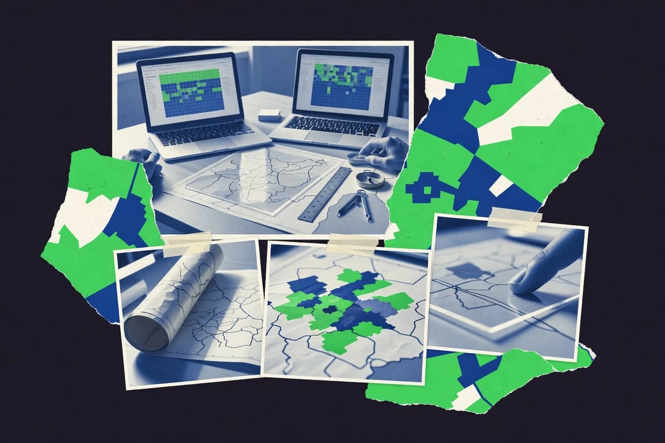
Market ResearchTop 10 Best Business Territory Mapping Software of 2026
Compare the top Business Territory Mapping Software with a ranked list for teams using mapping APIs and tools like Mapbox. Explore picks.

How we ranked these tools
Core product claims cross-referenced against official documentation, changelogs, and independent technical reviews.
Analyzed video reviews and hundreds of written evaluations to capture real-world user experiences with each tool.
AI persona simulations modeled how different user types would experience each tool across common use cases and workflows.
Final rankings reviewed and approved by our editorial team with authority to override AI-generated scores based on domain expertise.
Score: Features 40% · Ease 30% · Value 30%
Gitnux may earn a commission through links on this page — this does not influence rankings. Editorial policy
Editor’s top 3 picks
Three quick recommendations before you dive into the full comparison below — each one leads on a different dimension.
Mapbox
Vector-based map rendering with fine-grained layer styling control
Built for teams building custom territory maps and geospatial workflows into applications.
Geoapify
Editor pickGeocoding and search API for generating territory inputs from addresses and places
Built for teams building territory maps via APIs and GIS-grade location data integration.
Carto
Editor pickCarto hosted maps and SQL-based geospatial processing for territory-ready layers
Built for teams building web-delivered territory maps with spatial analysis and data governance.
Related reading
Comparison Table
This comparison table evaluates business territory mapping software across tools including Mapbox, Geoapify, Carto, QGIS, and ArcGIS Online. It highlights how each platform supports core workflows such as geocoding, boundary and territory creation, data styling, and map publishing so teams can match the right tool to their mapping requirements.
Mapbox
mapping APIsAPIs for building interactive maps used to visualize sales territories and market boundaries with custom geospatial layers.
Vector-based map rendering with fine-grained layer styling control
Mapbox stands out with a mapping toolchain built for custom business maps, including styled basemaps, vector rendering, and developer-grade geospatial components. It supports business territory mapping through route planning, geocoding, and spatial workflows that can be embedded into internal tools or customer-facing applications.
Mapbox also enables data visualization over maps using custom markers, layers, and performant client-side rendering for dense geographic views. For territory analysis, it fits teams that need tailored map behavior rather than a fixed territorial segmentation wizard.
- +Highly customizable map styling using vector tiles and layer controls
- +Strong geocoding and route inputs for building territory intelligence
- +Flexible integration with web and internal apps for map-driven workflows
- +High performance rendering for dense territory views and overlays
- –Territory segmentation logic needs custom implementation for most workflows
- –Configuration and layer tuning require technical mapping knowledge
- –Complex analyses like catchment modeling need external data and tooling
- –Operational setup for production map services can add engineering overhead
Best for: Teams building custom territory maps and geospatial workflows into applications
More related reading
Geoapify
geodata servicesGeocoding, maps, and spatial data services used to generate territory maps and boundary visualizations for market research workflows.
Geocoding and search API for generating territory inputs from addresses and places
Geoapify stands out with geocoding, routing, and map-ready data capabilities that support territory boundaries tied to real-world locations. Business territory mapping can be built by combining place searches with polygon and grid workflows, then visualizing results directly on interactive maps. It also supports export-friendly outputs through its API-driven approach for integrating territory logic into internal tools.
- +API-first geocoding supports building territories from addresses and places
- +Polygon and boundary workflows fit realistic service-area and region definitions
- +Interactive map rendering helps validate territories against geography quickly
- +Routing and distance data can improve territory centering and coverage logic
- –Complex territory automation requires more integration work than drag-and-drop tools
- –Advanced mapping workflows depend on API usage and data formatting discipline
- –Territory analytics like forecasting and optimization are not the primary focus
- –Map styling and layout control can feel limited without custom build effort
Best for: Teams building territory maps via APIs and GIS-grade location data integration
Carto
location intelligenceLocation intelligence tooling that supports mapping territory polygons, aggregating spatial metrics, and publishing interactive maps.
Carto hosted maps and SQL-based geospatial processing for territory-ready layers
Carto stands out with a unified geospatial workflow that connects data ingestion, mapping, and location-aware analysis for territory-style decision making. It supports interactive web maps, spatial data management, and styling that let business teams visualize customer, route, or coverage patterns on shared cartographic surfaces. Strong server-side geoprocessing and hosted layers support repeatable workflows for boundary creation and operational planning across regions.
- +Hosted geospatial layers speed up sharing and reuse of territory maps
- +Server-side processing supports repeatable boundary generation workflows
- +Interactive web maps help align sales, ops, and planning teams on coverage
- –Advanced territory logic often requires GIS-style thinking and data preparation
- –Complex layouts can take tuning to match strict business boundary needs
- –Not focused solely on territory modeling, so some workflows need custom effort
Best for: Teams building web-delivered territory maps with spatial analysis and data governance
More related reading
QGIS
desktop GISDesktop GIS software that supports territory boundary construction, spatial analysis, and map production for market research.
Processing toolbox with graphical models for automated geoprocessing workflows
QGIS stands out with a desktop-first, open geospatial analysis workflow built around a rich map styling and data processing stack. It supports territory-style mapping through layered vector and raster data, boundary digitizing, and spatial analysis tools like buffering, joins, and clustering.
Business territory mapping becomes practical by combining administrative boundaries, customer points, and demographic or facility layers into styled thematic maps and exportable layouts. The tool is not a guided territory-mapping product, so teams implement repeatable workflows using processing models and scripts.
- +Advanced spatial analysis tools for territory boundaries, buffers, and spatial joins
- +Highly flexible map styling with layered symbols and rule-based symbology
- +Layout composer produces shareable maps for territory reviews and documentation
- +Processing models and scripting enable repeatable territory workflows
- +Strong import and export support for common GIS and geodata formats
- –No native territory planning interface for sales routes or quota zones
- –Operational complexity rises with multi-layer projects and large datasets
- –Desktop setup and data preparation often require GIS expertise
- –Versioning and team collaboration features are limited compared with cloud tools
- –Performance can degrade without careful indexing and data optimization
Best for: GIS-driven teams building custom territory maps from spatial data
ArcGIS Online
web GISWeb-based GIS mapping that enables sharing territory layers, running spatial analysis, and publishing maps for distribution planning.
Drive-time area analysis for generating coverage polygons from origin points
ArcGIS Online stands out for turning territory planning into a full GIS workflow with hosted maps, layers, and analysis accessible through a shared web interface. Business territory mapping is supported through geocoding, route and drive-time analysis, and spatial tools that help model coverage areas, service regions, and customer distributions. Tight integration with ArcGIS Living Atlas provides rich boundary layers and basemap context for refining business territories without building geography datasets from scratch.
- +Web-based mapping with hosted layers supports multi-user territory plans
- +Drive-time and route analysis helps build realistic coverage boundaries
- +Living Atlas basemaps and boundaries reduce setup time for territory data
- –Territory optimization and boundary-drafting workflows can feel complex
- –Advanced modeling often requires GIS skills and careful data preparation
- –Custom territory rules need additional configuration beyond standard tools
Best for: Teams needing GIS-backed territory creation and scenario mapping in the cloud
ArcGIS Pro
desktop GISProfessional desktop GIS used to analyze geography for territory design, boundary refinement, and market spatial modeling.
Network Analyst service areas for validating territory coverage and driving-time constraints
ArcGIS Pro stands out with a full desktop GIS environment that supports territory design using both spatial analysis and authoritative geospatial data. Core capabilities include network and service-area analysis, geoprocessing workflows for boundary creation, and integration with ArcGIS Online and ArcGIS Enterprise for shared territory layers and maps. Business territory mapping is strengthened by high-quality cartography, attribute-driven rules for assigning customers or locations, and reproducible project packages for consistent territory updates.
- +Advanced geoprocessing supports repeatable territory boundary and assignment workflows
- +Network and service-area analysis helps validate territory coverage and accessibility
- +High-end mapping tools produce publication-ready territory visuals
- +Works with authoritative GIS layers and integrates with ArcGIS Enterprise sharing
- –Territory-specific tooling is less turnkey than dedicated territory platforms
- –Spatial modeling and symbology setup require GIS training and experience
Best for: Organizations with GIS skills needing precise territory boundaries and validation analysis
More related reading
Google Maps Platform
platform mappingMapping and geocoding services used to build territory visualization and geospatial dashboards from business location data.
Distance Matrix API for travel-time based territory and coverage calculations
Google Maps Platform stands out for delivering production-grade mapping, geocoding, and routing backed by large-scale map data. Business territory mapping can leverage Geocoding, Places data, and Distance Matrix or Routes to assign customers to areas and estimate travel times.
Territory visuals and operational workflows can be built by combining JavaScript map rendering with custom overlays and store or polygon boundaries. Strong API coverage supports event-driven updates when customer locations or service availability change.
- +High-accuracy geocoding for turning addresses into usable territory coordinates
- +Rich Places and routing data supports coverage modeling beyond simple polygons
- +Flexible JavaScript mapping enables custom overlays for territories and boundaries
- –No native territory optimization workflow for automatic boundary generation
- –Data preparation for customers, stores, and rules requires custom engineering
- –Location accuracy and boundary outcomes vary by address quality and region
Best for: Teams building custom territory maps with routing-based coverage logic
Azure Maps
cloud mappingLocation and map services that support routing-aware territory mapping and spatial dashboards for go-to-market planning.
Azure Maps spatial search with geocoding and reverse geocoding for territory lookup
Azure Maps stands out for tight Microsoft cloud integration and enterprise mapping capabilities built for geospatial applications. It provides routing, geocoding, spatial search, and tile rendering to support territory and sales area visualization workflows. The service also includes Azure-hosted geospatial data storage patterns and SDK support for building interactive business maps and overlays.
- +Strong Azure integration with identity, hosting options, and deployment alignment
- +Geocoding and spatial search support fast territory boundary lookups
- +Routing and distance tools help analyze coverage areas and travel time
- –Territory mapping still requires custom work for boundary generation and workflows
- –GIS-grade styling and layer control can take more effort than lighter tools
- –Business territory dashboards require stitching multiple APIs and data sources
Best for: Enterprises building territory maps within Azure applications and APIs
More related reading
AWS Location Services
cloud mappingGeocoding, places search, and map integration services used to power territory mapping features in business applications.
Route calculations using TravelTime, Distance, and waypoint support
AWS Location Services stands out by combining geocoding, routing, and maps into AWS-native APIs that plug into existing AWS data pipelines. For business territory mapping, it supports geocoding, place searches, and routes needed to build coverage polygons, service areas, and territory assignment logic.
It also provides map rendering and tracking primitives so territory UIs can show customer locations and movement while using the same backend geography services. The solution is strongest when territory definitions are computed in the application layer and consumed by these location APIs.
- +AWS-native geocoding and place search reduce custom location infrastructure.
- +Routing outputs support territory service-area and travel-time based assignments.
- +Maps and location data visualizations integrate cleanly with AWS applications.
- –Territory polygon creation and coverage rules require custom application logic.
- –No built-in territory boundary management workflow for sales regions.
- –Cross-system GIS requirements can add engineering overhead.
Best for: AWS teams needing API-driven territory routing and geocoding workflows
Tableau
analytics mappingBusiness analytics with map visualizations that support territory-level market research through interactive geospatial dashboards.
Interactive map dashboards with geocoded territories and cross-filtering drill-down
Tableau stands out for turning territory and sales analysis into interactive dashboards with strong drill-down behavior. It supports map-based visualization with point and region geocoding, plus joins to CRM and order datasets so territory performance can be sliced by segment and time.
Business territory mapping work is best done by modeling geography fields and then building views that compare coverage, quotas, and outcomes across mapped areas. Advanced mapping logic is possible, but it depends heavily on data preparation and custom calculations rather than a dedicated territory planning workflow.
- +Interactive territory dashboards with cross-filtering and fast drill-down on mapped regions
- +Strong geospatial visualization with point and polygon maps for sales coverage analysis
- +Flexible data modeling using calculated fields, parameters, and reusable dashboard components
- +Broad connector ecosystem for pulling CRM, ERP, and location data into mapping views
- –No dedicated territory optimization workflow for automatic boundary or quota redesign
- –Geocoding and territory logic often require data cleanup and careful field modeling
- –Territory changes may demand repeated rebuilds of mappings and calculated logic
- –Geospatial performance can degrade with large polygon datasets and heavy dashboard filters
Best for: Analytics teams mapping territory performance with interactive, dashboard-driven workflows
How to Choose the Right Business Territory Mapping Software
This buyer's guide explains how to choose Business Territory Mapping Software by comparing Mapbox, Geoapify, Carto, QGIS, ArcGIS Online, ArcGIS Pro, Google Maps Platform, Azure Maps, AWS Location Services, and Tableau. It focuses on territory boundary creation, route and drive-time coverage logic, and how each platform fits different delivery modes like custom apps, hosted maps, GIS desktops, and analytics dashboards. The guide also highlights repeatable workflow patterns and the most common implementation pitfalls that slow down territory projects.
What Is Business Territory Mapping Software?
Business Territory Mapping Software builds, validates, and publishes geographic territories such as quota zones, service areas, route-based coverage regions, and market boundaries. It connects address and location data to map visualizations and then applies spatial operations like drive-time polygons, service-area buffers, and polygon overlays. Teams use it to align sales and operations coverage planning with real-world geography and travel constraints. Mapbox and Google Maps Platform show what this category looks like when territory visuals and coverage logic are embedded into custom applications using APIs and routing data.
Key Features to Look For
These features determine whether a territory project becomes a repeatable workflow or a one-off map exercise.
API-driven geocoding and place search inputs
A strong geocoding and place search layer turns addresses, stores, and service locations into usable territory coordinates. Geoapify excels here with an API-first geocoding and search workflow that supports building territories from addresses and places.
Routing and travel-time coverage calculations for realistic boundaries
Territory boundaries need travel-time constraints to avoid unrealistic straight-line areas. ArcGIS Online provides drive-time area analysis that generates coverage polygons from origin points. Google Maps Platform adds Distance Matrix API support for travel-time based territory and coverage calculations, and AWS Location Services supports route calculations using TravelTime, Distance, and waypoint support.
Network and service-area analysis for constraint validation
Network-aware service-area modeling helps validate whether a territory is reachable within defined time or distance limits. ArcGIS Pro stands out with Network Analyst service areas that validate territory coverage and driving-time constraints using GIS network analysis.
Polygon and boundary workflows for service regions and regions of coverage
Territory mapping depends on polygon creation, editing, and boundary definitions that match business regions. Geoapify supports polygon and boundary workflows for realistic service-area and region definitions, and ArcGIS Online supports hosted boundary and layer workflows for scenario mapping.
Hosted map layers and server-side processing for repeatable delivery
Teams need shared, reusable territory maps and repeatable boundary generation without rebuilding everything from scratch. Carto provides hosted geospatial layers and server-side processing so teams can publish interactive web maps and repeat boundary creation workflows across regions.
Advanced desktop GIS automation for custom territory workflows
Custom territories often require scripted and model-driven spatial operations rather than guided wizards. QGIS delivers a processing toolbox with graphical models for automated geoprocessing workflows, and it supports buffering, joins, and clustering for boundary construction.
How to Choose the Right Business Territory Mapping Software
A short decision path maps delivery needs to the specific spatial and mapping capabilities of each platform.
Pick the territory boundary logic tied to travel constraints
If territories must reflect driving time, prioritize tools with drive-time or routing coverage outputs. ArcGIS Online creates coverage polygons from origin points using drive-time area analysis, and Google Maps Platform supports travel-time territory calculations using the Distance Matrix API. For network accuracy, ArcGIS Pro adds Network Analyst service areas that validate coverage within driving-time constraints.
Choose the delivery mode: embedded app maps, hosted web maps, desktop GIS, or dashboards
For territory visuals inside custom customer or internal tools, Mapbox and Google Maps Platform are built for JavaScript map rendering with custom overlays and high performance layers. For shared web-delivered territory planning and governance, Carto provides hosted maps and interactive web map publishing. For GIS desktop workflows and deep spatial modeling, QGIS and ArcGIS Pro support boundary construction and automated geoprocessing in a desktop environment.
Validate how locations get into the system
If the workflow starts from addresses and store locations, confirm that geocoding and search can reliably generate territory inputs. Geoapify emphasizes API-first geocoding and search for generating territory inputs from addresses and places, and Google Maps Platform focuses on high-accuracy geocoding that turns addresses into usable coordinates. Azure Maps and AWS Location Services also provide geocoding and spatial lookups, but territory polygon creation still typically requires application-layer workflow logic.
Decide who will own territory logic and boundary generation
If boundary generation needs GIS-style data preparation, choose QGIS or ArcGIS Pro so teams can run spatial analysis and build repeatable models. If the goal is hosted layer reuse and server-side processing, Carto provides SQL-based geospatial processing and hosted layers for territory-ready outputs. If the goal is fully custom segmentation behavior inside products, Mapbox enables fine-grained layer control, but territory segmentation logic usually needs custom implementation.
Plan for performance and repeatability with dense territories
Dense territory overlays and many layers require rendering and performance considerations. Mapbox supports high performance rendering for dense geographic views using vector tiles and layer controls, and it helps keep interactive maps responsive. Tableau focuses on interactive territory dashboards with drill-down, but geospatial performance can degrade with large polygon datasets and heavy dashboard filters.
Who Needs Business Territory Mapping Software?
Different territory teams need different mapping surfaces and different boundary-generation styles.
Teams embedding territory mapping into custom applications
Mapbox is best for building custom territory maps and geospatial workflows directly into applications using vector-based map rendering and fine-grained layer styling controls. Google Maps Platform fits when routing-based coverage logic drives custom overlays and territory assignment updates.
Teams building territory maps via APIs and GIS-grade location data
Geoapify fits teams that need API-driven geocoding and search to generate territory inputs from addresses and places. The polygon and boundary workflows in Geoapify align to service-area and region definitions built from location APIs.
Teams delivering shared, web-based territory maps with governed layers
Carto is tailored for web-delivered territory maps that need hosted layers and server-side geoprocessing for repeatable boundary creation workflows. ArcGIS Online supports multi-user territory plans with hosted layers and drive-time and route analysis in a cloud GIS interface.
GIS-driven teams creating custom territories from spatial data and automation
QGIS is a fit for GIS-driven teams that want boundary construction, buffering, spatial joins, and graphical automation using processing models. ArcGIS Pro targets organizations with GIS skills that need network and service-area analysis for precise territory coverage validation.
Common Mistakes to Avoid
Territory projects typically fail when teams underestimate how much custom workflow and data preparation boundary tools require.
Assuming territory segmentation is turnkey without custom rules
Mapbox requires custom implementation for territory segmentation logic in most workflows, and QGIS has no native territory planning interface for sales routes or quota zones. Google Maps Platform also lacks a native territory optimization workflow for automatic boundary generation, so boundary definitions require custom engineering.
Building coverage boundaries without drive-time or network constraints
Straight-line polygons can misrepresent real service coverage when travel time matters, and tools like ArcGIS Online provide drive-time area analysis specifically for coverage polygon generation. ArcGIS Pro supports Network Analyst service areas for validating territory coverage within driving-time constraints.
Overloading dashboards with large polygon datasets
Tableau can experience geospatial performance degradation with large polygon datasets and heavy dashboard filters. For large territory overlays, Mapbox focuses on high performance rendering using vector tiles and layered client-side visualization.
Treating boundary generation as a separate GIS task instead of an end-to-end workflow
Carto provides hosted layers and server-side processing so boundary creation stays repeatable, while Azure Maps and AWS Location Services still require stitching multiple APIs and application-layer logic for polygon creation. Geoapify can build territory inputs from geocoding and boundary workflows, but advanced territory automation needs more integration work.
How We Selected and Ranked These Tools
we evaluated every tool on three sub-dimensions: features with weight 0.4, ease of use with weight 0.3, and value with weight 0.3. The overall rating equals 0.40 × features plus 0.30 × ease of use plus 0.30 × value. Mapbox separated itself mainly through features that directly support production territory visualization using vector-based map rendering with fine-grained layer styling control and strong geocoding and route inputs for building territory intelligence. Lower-ranked tools often provided weaker territory planning automation or shifted more territory logic work into custom implementation.
Frequently Asked Questions About Business Territory Mapping Software
What tool is best for building custom territory maps with granular map styling control?
Which option is strongest for generating territory inputs from addresses and places via APIs?
How do ArcGIS Online and ArcGIS Pro differ for territory planning workflows?
Which platform handles drive-time and service-area coverage polygons well for territory constraints?
Which tool is better when territory mapping must be operationalized with hosted spatial layers and repeatable SQL-based processing?
What software fits organizations that want desktop-first territory digitizing and analysis from multiple spatial datasets?
Which option is best for routing-based territory assignment logic using large-scale map services?
Which mapping stack works best for enterprises building territory experiences inside Azure applications?
When territory UIs must rely on AWS-native geocoding and routing services, what choice fits?
Which tool is best for presenting territory performance through interactive drill-down dashboards?
Conclusion
After evaluating 10 market research, Mapbox stands out as our overall top pick — it scored highest across our combined criteria of features, ease of use, and value, which is why it sits at #1 in the rankings above.
Use the comparison table and detailed reviews above to validate the fit against your own requirements before committing to a tool.
Tools reviewed
Primary sources checked during evaluation.
Referenced in the comparison table and product reviews above.
Keep exploring
Comparing two specific tools?
Software Alternatives
See head-to-head software comparisons with feature breakdowns, pricing, and our recommendation for each use case.
Explore software alternatives→In this category
Market Research alternatives
See side-by-side comparisons of market research tools and pick the right one for your stack.
Compare market research tools→FOR SOFTWARE VENDORS
Not on this list? Let’s fix that.
Our best-of pages are how many teams discover and compare tools in this space. If you think your product belongs in this lineup, we’d like to hear from you—we’ll walk you through fit and what an editorial entry looks like.
Apply for a ListingWHAT THIS INCLUDES
Where buyers compare
Readers come to these pages to shortlist software—your product shows up in that moment, not in a random sidebar.
Editorial write-up
We describe your product in our own words and check the facts before anything goes live.
On-page brand presence
You appear in the roundup the same way as other tools we cover: name, positioning, and a clear next step for readers who want to learn more.
Kept up to date
We refresh lists on a regular rhythm so the category page stays useful as products and pricing change.