GITNUXSOFTWARE ADVICE
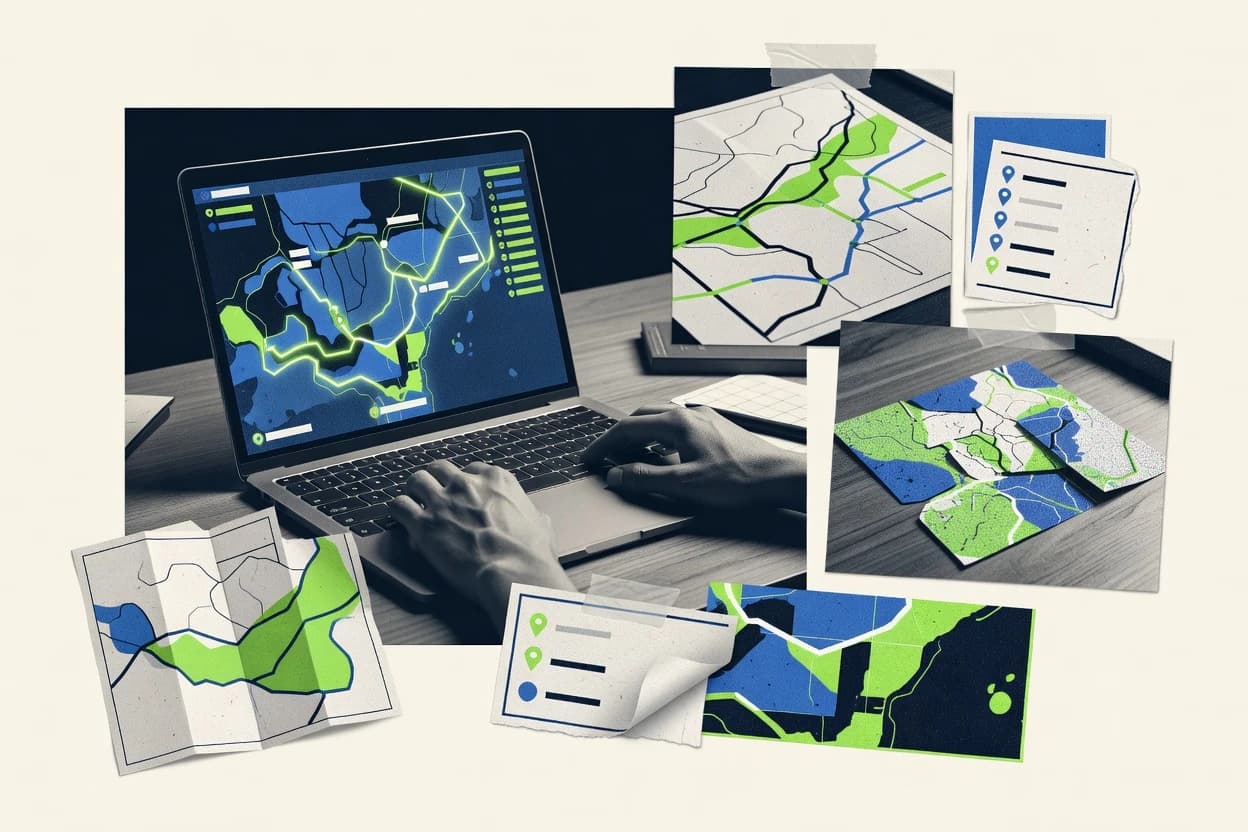
Technology Digital MediaTop 10 Best Custom Map Software of 2026
Ranked roundup of Top 10 Custom Map Software tools with Mapbox, Google Maps Platform, and HERE, comparing features for GIS and web teams.

How we ranked these tools
Core product claims cross-referenced against official documentation, changelogs, and independent technical reviews.
Analyzed video reviews and hundreds of written evaluations to capture real-world user experiences with each tool.
AI persona simulations modeled how different user types would experience each tool across common use cases and workflows.
Final rankings reviewed and approved by our editorial team with authority to override AI-generated scores based on domain expertise.
Score: Features 40% · Ease 30% · Value 30%
Gitnux may earn a commission through links on this page — this does not influence rankings. Editorial policy
Editor’s top 3 picks
Three quick recommendations before you dive into the full comparison below — each one leads on a different dimension.
Mapbox
Mapbox Studio style editor for custom basemaps using vector tile styling
Built for teams building custom map applications needing styling, search, and routing.
Google Maps Platform
Editor pickGeocoding and Places API for turning addresses and queries into map-ready data
Built for teams building location features and interactive custom maps in production apps.
HERE Technologies
Editor pickRouting and maneuver generation integrated with custom map rendering and layers
Built for enterprises building interactive, location-intelligent custom maps with strong APIs.
Related reading
Comparison Table
This comparison table maps Custom Map Software products against integration depth, data model design, automation and API surface, and admin and governance controls like RBAC and audit logs. It highlights how each platform handles schema and data provisioning, supports extensibility, and exposes configuration options that affect deployment throughput and sandbox workflows. The ranked roundup narrows attention to Mapbox, Google Maps Platform, and HERE, then positions ArcGIS Online and ArcGIS Enterprise where their governance and data models differ.
Mapbox
API-firstProvides customizable map rendering, vector tiles, and mapping APIs for building branded interactive maps and geospatial experiences.
Mapbox Studio style editor for custom basemaps using vector tile styling
Mapbox stands out for delivering customizable mapping experiences with fine control over map styling, data layers, and interactive components. Core capabilities include vector tiles, custom basemaps, geocoding, routing, and spatial search built for integration into web and mobile applications.
Mapbox Studio and the Mapbox Maps SDK support designer-friendly style authoring and developer-ready rendering, including markers, popups, and event handling. Strong tooling for custom overlays and performant map visualization makes it suited to bespoke map products rather than generic embed maps.
- +Vector-tile rendering with highly customizable map styles
- +Geocoding, routing, and search APIs support end-to-end map workflows
- +Strong SDK support for interactive maps in web and mobile
- –Advanced styling and data pipelines require developer effort
- –Performance tuning can be complex for dense, real-time overlays
- –Licensing and usage constraints can complicate large deployments
GIS teams in logistics
Real-time fleet maps with custom overlays
Faster dispatch decisions
Product teams in retail
Store locator with routing and search
Higher store visit rate
Show 2 more scenarios
Government planning departments
Thematic maps for public services
Clearer public communication
Departments author cartographic styles for census layers and interactive popups in citizen-facing portals.
Media and event platforms
Interactive maps with venues and events
Improved event discovery
Teams display venue markers, handle events clicks, and integrate data-driven layers into mobile pages.
Best for: Teams building custom map applications needing styling, search, and routing
More related reading
Google Maps Platform
enterpriseDelivers customizable maps, places, and routing services through APIs and SDKs for embedding tailored map experiences.
Geocoding and Places API for turning addresses and queries into map-ready data
Google Maps Platform stands out for combining global map rendering with production-ready location APIs under one developer ecosystem. It supports custom map styling, geocoding, routing, place search, and route optimization inputs for building map-driven apps.
It also offers event handling for user interactions and multilayer geospatial visualization through supported overlays, which helps create interactive custom maps. Tight integration with Maps Platform services supports workflows like address validation, nearest search, and delivery route planning.
- +High-quality base maps with global coverage for custom map experiences
- +Robust geocoding, place search, and routing inputs for end-to-end location workflows
- +Flexible map styling and interactive map events for tailored user interfaces
- +Mature developer tooling and documentation for production mapping integrations
- –Feature depth can increase implementation complexity for nonstandard use cases
- –Accuracy and coverage vary by region for geocoding and places data
- –Advanced customization often requires careful performance and quota management
Delivery operations teams
Plan routes with geocoded delivery addresses
Faster dispatch with fewer route edits
Fleet managers
Assign nearest service locations to vehicles
Reduced travel time for technicians
Show 2 more scenarios
GIS developers
Build custom multilayer map visualization apps
Clear, responsive geospatial experiences
Render styled maps and combine overlays with event handling for interactive user workflows.
Customer support teams
Validate addresses during onboarding flows
Fewer address-related customer issues
Apply geocoding and address validation to improve input quality and display corrected locations.
Best for: Teams building location features and interactive custom maps in production apps
HERE Technologies
location APIsOffers map data, routing, and location APIs that support custom map applications with developer tooling and geospatial services.
Routing and maneuver generation integrated with custom map rendering and layers
HERE Technologies stands out with production-grade mapping content and location intelligence built for routing, analytics, and geospatial data workflows. The HERE platform supports custom map creation using vector tile pipelines, map overlays, and location-enabled APIs for search, routing, and map rendering.
Developers can integrate dynamic datasets like POIs, polygons, and traffic context to build interactive map experiences. Governance and data refresh tooling support enterprise map operations and change management.
- +Strong routing and search APIs for location-aware custom maps
- +Enterprise mapping content quality for visual and analytical workloads
- +Vector and tile-friendly workflows for responsive map rendering
- +Robust support for real-time context like traffic layers
- –Advanced custom map pipelines require developer integration effort
- –Workflow complexity rises when managing frequent dataset updates
- –Custom UX beyond mapping layers needs substantial front-end work
- –Enterprise tooling can feel heavy for small, simple map projects
Logistics routing operations teams
Optimize delivery routes with live traffic context
Reduced drive time and exceptions
Retail merchandising GIS analysts
Overlay store polygons and nearby POIs
Better store site decisions
Show 2 more scenarios
Enterprise data governance leads
Manage change control for map content
Fewer mapping inconsistencies
Governance teams coordinate updates to geodata layers and audit location content refresh cycles.
Field service app developers
Render interactive maps for mobile dispatch
Faster dispatch and navigation
Developers integrate custom vector tile layers with geocoding, search, and map rendering APIs.
Best for: Enterprises building interactive, location-intelligent custom maps with strong APIs
More related reading
Esri ArcGIS Online
GIS platformEnables custom interactive web maps, app building, and hosted geospatial layers with administration and sharing controls.
ArcGIS Online web app builder and dashboard experiences from configurable templates
ArcGIS Online stands out with a mature, hosted mapping and location analytics ecosystem that supports web maps and dashboards without building infrastructure. Core capabilities include web app configuration, feature layers with editing workflows, role-based access, and integrations with ArcGIS Living Atlas datasets. The platform also supports custom development through ArcGIS API for JavaScript and REST services, enabling tailored map experiences and data-driven applications.
- +Hosted feature layers support map-centric editing and collaboration
- +Dashboards and web apps cover common operational visualization needs
- +ArcGIS Living Atlas accelerates content setup with ready-to-use layers
- +ArcGIS API for JavaScript enables custom UI and advanced interactions
- +Strong security controls support organizational role-based access
- –Complex custom application logic often requires custom front-end development
- –Some advanced GIS workflows depend on ArcGIS-specific data models
- –Performance tuning for very large datasets can require careful design
Best for: Teams building secure, custom web mapping apps with minimal infrastructure
ArcGIS Enterprise
self-hosted GISSupports on-premises or private-cloud GIS deployments for publishing customized maps, services, and interactive apps.
ArcGIS Enterprise integrated portal and server federation for governed web GIS
ArcGIS Enterprise stands out with a full geospatial platform that combines data management, map authoring, and deployment in one ecosystem. It supports hosted feature layers, raster services, and publishing from common ArcGIS data formats through ArcGIS Server, while web experiences run via Web AppBuilder, Experience Builder, and configurable ArcGIS APIs. Security, identity, and governance controls integrate tightly with enterprise authentication and role-based access across services and apps.
- +Rich publishing pipeline for maps, feature services, and imagery
- +Strong enterprise security with roles, groups, and integrated identity
- +Scales with clustered GIS services and supports multi-workspace architectures
- +Configurable web apps plus API support for custom map interfaces
- –Deployment and upgrades require experienced administrators
- –Custom app development still demands ArcGIS-specific configuration knowledge
- –Performance tuning can be complex across services, caches, and clients
Best for: Organizations building secure, governed web mapping with GIS-managed data
OpenLayers
open-sourceProvides a JavaScript mapping library for building highly customized web maps with controls, layers, and map interaction tools.
Vector layer styling and rendering pipeline with feature-level customization
OpenLayers is distinct for being a low-level, highly flexible web mapping library that runs entirely in the browser. It provides core map rendering, vector and raster layer composition, and interactive features like pan, zoom, and custom styling.
Developers can integrate tiled basemaps, ingest GeoJSON, and wire up selection, drawing, and overlays to build custom map experiences. The project targets full control of map behavior rather than a turn-key authoring workflow.
- +Highly flexible layer system for tiled, vector, and raster compositions
- +Strong GeoJSON support with powerful feature styling and editing hooks
- +Works well with custom projections and interactive controls through map APIs
- –Requires solid JavaScript knowledge to implement common GIS workflows
- –Advanced configuration can become verbose and harder to maintain
- –No built-in UI authoring tools for non-developers
Best for: Developer teams building custom web maps needing deep map control
More related reading
Leaflet
open-sourceDelivers a lightweight JavaScript library for creating custom interactive maps with markers, layers, and extensible plugins.
Layer system for combining tiled basemaps with vector overlays
Leaflet is distinct for using lightweight JavaScript map rendering with a simple API built around tile layers. Core capabilities include interactive markers, popups, tooltips, vector overlays, and extensive support for common map workflows like panning and zooming.
Custom map software builds are typically done by composing tile providers and optional drawing or geometry plugins rather than relying on a full built-in editor. The result is strong flexibility for web mapping integrations with predictable performance for many common datasets.
- +Lightweight core with fast rendering for typical tile-based maps
- +Rich interactivity using markers, popups, and tooltips APIs
- +Flexible layer model supports custom tile and vector overlays
- –No built-in GIS editing suite for full custom map authoring
- –Advanced workflows require additional plugins and integration work
- –Styling and data pipelines demand frontend engineering for complex datasets
Best for: Web teams embedding interactive maps into products with custom layers
MapTiler
map hostingProvides map tiling, styles, and hosting options that enable custom basemaps and vector tile workflows for web and apps.
MapTiler Server for creating and serving custom map tiles and styles
MapTiler stands out for converting and serving geospatial data into production-ready map tiles and datasets with configurable styles. It supports offline workflows and custom basemap creation using geospatial inputs, plus raster-to-tiles pipelines suitable for embedding in web or mobile map experiences.
The solution also includes geocoding and routing options when configured for application-level location features. Overall, it targets teams that need control over rendering, data ingestion, and deployment of custom maps.
- +Custom raster and vector tiling workflows with controllable rendering outputs
- +Offline-first options for packaged map resources in constrained environments
- +Style-driven basemap creation for consistent branding across map views
- –Advanced setup requires geospatial data and map styling knowledge
- –Some application integration requires more engineering than plug-and-play tools
- –Feature breadth favors map rendering over full GIS analytics suites
Best for: Teams building branded custom map experiences with offline and hosting control
More related reading
Geocortex
app frameworkDelivers custom map applications and viewer frameworks that extend ArcGIS capabilities for branded operational mapping.
Geocortex Workflow-based app templates for branded, role-aware operational mapping
Geocortex stands out for building branded web mapping experiences on top of ArcGIS and extending them with configurable workflows. Core capabilities include geocoding and routing integrations, forms and editing tools, and operational map viewers for asset and field workflows.
It also supports role-based access and custom UI widgets so organizations can tailor maps to specific business processes. Deployments typically target teams needing repeatable map apps instead of raw GIS development.
- +Workflow-driven app building for ArcGIS-backed custom map experiences
- +Configurable forms and editing tools for data capture and updates
- +Role-based access controls support operational map governance
- +Customizable widgets and branded viewers reduce repeated development work
- –Most advanced behavior depends on ArcGIS configuration and content setup
- –UI customization can require specialized knowledge of Geocortex components
- –Integrations often assume a specific ArcGIS-centered deployment pattern
Best for: Organizations building repeatable operational web maps for asset and field workflows
Cesium
3D mappingEnables 3D geospatial visualization with custom scenes, terrain, and imagery layers for web-based globe and map apps.
3D Tiles streaming with Cesium’s terrain and imagery integration
Cesium’s distinct strength is high-fidelity 3D and globe rendering using WebGL, which supports streamed 3D tiles at large scale. Core capabilities include geospatial visualization, interactive camera controls, and the CesiumJS/ion toolchain for loading terrain, imagery, and 3D models.
The platform focuses on building custom web map applications rather than providing a fixed set of prebuilt workflows. Developers can combine layers, events, and custom UI to create domain-specific mapping experiences with fine-grained performance control.
- +WebGL 3D globe rendering with smooth camera navigation and large datasets
- +3D Tiles support enables scalable streaming of detailed city and terrain models
- +Rich developer APIs for layers, entities, picking, and scene interactions
- +Integrated terrain and imagery workflows reduce heavy geospatial plumbing effort
- +Client-side controls support highly customized map UX patterns
- –Custom app development requires JavaScript engineering and GIS data preparation
- –Complex styling and layer logic take significant work for non developers
- –Performance tuning can be nontrivial for dense scenes and dynamic updates
- –Out-of-the-box workflow automation for non technical teams is limited
Best for: Engineering teams building custom interactive 3D web mapping applications
Conclusion
After evaluating 10 technology digital media, Mapbox stands out as our overall top pick — it scored highest across our combined criteria of features, ease of use, and value, which is why it sits at #1 in the rankings above.
Use the comparison table and detailed reviews above to validate the fit against your own requirements before committing to a tool.
How to Choose the Right Custom Map Software
This buyer’s guide covers Mapbox, Google Maps Platform, HERE Technologies, Esri ArcGIS Online, ArcGIS Enterprise, OpenLayers, Leaflet, MapTiler, Geocortex, and Cesium using concrete selection criteria.
It focuses on integration depth, the underlying data model, automation and API surface, and admin and governance controls so teams can match tool behavior to internal workflow requirements.
The guide also maps common implementation failures to specific products and gives example tool pairings for each decision path.
Custom map platforms and SDKs that ship your own basemaps, layers, and location workflows
Custom map software provides programmable map rendering plus location APIs that let teams build tailored web and mobile mapping experiences with custom styling, overlays, and interactions.
The category typically combines a map rendering layer with an application-facing surface for geocoding, place search, routing, and event-driven interactivity. Mapbox is a concrete example because it pairs the Mapbox Maps SDK with Mapbox Studio style authoring and production mapping APIs for geocoding, routing, and spatial search.
Google Maps Platform is another example because it bundles address-to-map workflows with Geocoding and Places API and supports interactive map events for custom UI around the embedded map experience.
Evaluation criteria that map to integration, schemas, automation, and governance
Teams get the best outcomes when custom map software exposes an explicit automation surface and a predictable data model for overlays, edits, and operational workflows.
Mapbox and Google Maps Platform emphasize developer APIs for routing, search, and interactive events. ArcGIS Online, ArcGIS Enterprise, and Geocortex emphasize governance and role-aware operational mapping.
Cesium and OpenLayers emphasize fine-grained rendering control through JavaScript layer systems, which changes how data and performance engineering are handled.
API surface for geocoding, places, and routing
Mapbox supports geocoding, routing, and spatial search APIs for turning user input into map-ready features. Google Maps Platform provides Geocoding and Places API so custom UI can request address and query results and render map-ready locations.
Map styling workflow tied to vector or tile pipelines
Mapbox uses Mapbox Studio as a style editor for custom basemaps built on vector tile styling. MapTiler targets custom raster-to-tiles and vector tile serving with style-driven basemap creation for consistent branding across map views.
Overlay and layer data model for interactive map features
OpenLayers uses a highly flexible layer composition model with GeoJSON support and feature-level styling and interaction hooks. Leaflet uses a lightweight tile and vector overlay layer model with marker, popup, and tooltip APIs for interactive map objects.
Automation and operational update workflows for datasets
HERE Technologies supports governance and change management tooling for enterprise map operations when datasets refresh frequently. ArcGIS Online supports hosted feature layers with editing workflows and integrations with ArcGIS Living Atlas for faster content setup.
Admin controls, RBAC, and identity integration
ArcGIS Online provides security controls with organizational role-based access for sharing and editing across web apps. ArcGIS Enterprise integrates identity and role-based access across services and apps and supports portal and server federation for governed web GIS.
Extensibility and frontend control over interactions and performance
Cesium provides WebGL scene APIs plus 3D Tiles streaming support with terrain and imagery integration for highly customized 3D map UX. Mapbox and Google Maps Platform support event handling and interactive components so custom applications can bind user interactions to data overlays.
A decision framework for choosing a custom map tool by integration depth and governance
Start by defining the integration targets for location workflows like address validation, place search, and routing inputs. Mapbox and Google Maps Platform prioritize end-to-end developer workflows with geocoding, routing, and search APIs and interactive map event handling.
Next, identify the data model ownership for overlays and edits. ArcGIS Online and ArcGIS Enterprise center hosted feature layers and ArcGIS-specific data models, while OpenLayers, Leaflet, and Cesium center frontend layer composition and client-side interaction wiring.
Map the required location workflows to named APIs and expected input-output shapes
If the product needs turning addresses and queries into map-ready results, prioritize Google Maps Platform for Geocoding and Places API or Mapbox for its geocoding and spatial search APIs. If routing outputs must be integrated with custom map rendering and layers, HERE Technologies offers routing and maneuver generation integrated with map layers.
Lock in the styling pipeline and decide where map rendering configuration lives
For a design-to-render workflow, Mapbox is a direct match because Mapbox Studio provides a style editor that feeds custom basemaps built on vector tile styling. For full control over tile production, MapTiler pairs tile conversion and style-driven basemap creation with a server for creating and serving tiles and styles.
Choose the data model and editing ownership based on overlay complexity and update frequency
If the team needs hosted feature layer editing and collaboration patterns, ArcGIS Online supports feature layers with editing workflows and dashboard and web app configuration. If the team prefers direct control of client-side interaction and feature styling, OpenLayers and Leaflet use layer composition and GeoJSON or vector overlay patterns.
Validate automation and dataset refresh behavior before committing to operational mapping
For frequent dataset updates with governance and enterprise change management, HERE Technologies provides tooling designed for operational map operations. For operational workflows where repeatable field and asset tasks matter, Geocortex builds branded viewers on top of ArcGIS with workflow-driven app templates and role-aware access.
Confirm governance requirements like RBAC and audit-ready admin workflows
For organizational role-based access tied to app sharing and security, ArcGIS Online supports role-based access controls. For tighter enterprise identity integration and federated deployment patterns, ArcGIS Enterprise integrates identity and role-based access across services and apps using a portal and server federation model.
Match rendering depth to the user experience target, especially for 3D
For 3D globe experiences with streamed 3D Tiles, Cesium provides WebGL rendering plus CesiumJS and ion workflows for terrain, imagery, and 3D models. For 2D custom mapping with deep control and custom projections, OpenLayers provides a low-level JavaScript map engine with a flexible vector and raster layer system.
Which organizations match each tool’s integration and governance model
Selection depends on whether the primary work is building developer-led mapping experiences, operating governed GIS content, or shipping a branded operational viewer.
The best fit depends on how the tool handles API integration versus who owns the data model for overlays and edits. Mapbox and Google Maps Platform align with production app developers focused on routing, search, and interactive events. ArcGIS Online, ArcGIS Enterprise, and Geocortex align with organizations focused on RBAC and workflow-driven operational mapping.
Product and engineering teams building custom 2D mapping apps with geocoding and routing
Mapbox fits teams that need Mapbox Studio style editing plus geocoding, routing, and spatial search APIs with interactive components. Google Maps Platform fits teams that need mature Geocoding and Places API plus flexible map styling and interactive events for tailored production interfaces.
Enterprises that require governance over datasets and frequent operational updates
HERE Technologies fits enterprises needing routing and maneuver generation with governance and tooling for map refresh change management. ArcGIS Enterprise fits organizations that need enterprise identity integration and role-based access across services and apps with portal and server federation for governed deployments.
Organizations that want repeatable branded operational map apps on top of ArcGIS
Geocortex fits organizations that need workflow-based app templates with forms, editing tools, and role-based access for asset and field operations. ArcGIS Online fits teams that want secure custom web mapping and dashboards with hosted feature layers and configurable web app builder experiences.
Developer teams optimizing for rendering control and custom frontend interaction design
OpenLayers fits teams that want deep layer composition control with GeoJSON ingestion and feature-level styling and interaction hooks. Cesium fits teams that need WebGL 3D globe rendering with 3D Tiles streaming plus terrain and imagery integration driven by client-side APIs.
Teams producing their own custom basemaps and tile hosting pipelines
MapTiler fits teams that need conversion and serving of custom raster and vector tiles with offline-first options and style-driven basemap creation. Leaflet fits teams embedding interactive maps into products that rely on a lightweight tile and vector overlay layer model with markers, popups, and tooltips.
Frequent implementation failures when choosing custom map software
Common failures happen when teams underestimate developer effort in styling pipelines, overestimate built-in authoring, or miss governance requirements until deployment time.
The reviewed tools show repeated patterns where advanced customization increases engineering work, where dataset refresh operations raise workflow complexity, and where non-developers expect UI authoring that some tools do not include.
Assuming visual styling will be straightforward without a workflow plan
Mapbox style authoring and vector tile pipelines demand developer effort for dense or real-time overlays. MapTiler also requires geospatial data and map styling knowledge to reach production-ready rendering outputs.
Choosing a low-level map library without allocating engineering for common GIS workflows
OpenLayers requires strong JavaScript knowledge and can become verbose to maintain for advanced GIS workflows. Leaflet has no built-in GIS editing suite, so complex workflows depend on plugins and integration work.
Ignoring dataset refresh governance until operational mapping is live
HERE Technologies increases workflow complexity when managing frequent dataset updates unless the integration plan includes change management. ArcGIS Enterprise can add admin overhead because upgrades and deployment federation require experienced administrators to keep services and caches aligned.
Selecting a tool for mapping layers and then trying to use it as a full operational app framework
Cesium provides rich 3D scene APIs but out-of-the-box workflow automation for non technical teams is limited. Geocortex is designed for repeatable operational web maps, but advanced behavior depends on ArcGIS configuration and content setup.
How We Selected and Ranked These Tools
We evaluated Mapbox, Google Maps Platform, HERE Technologies, Esri ArcGIS Online, ArcGIS Enterprise, OpenLayers, Leaflet, MapTiler, Geocortex, and Cesium on feature capability, ease of use, and value. Features carried the most weight at forty percent while ease of use accounted for thirty percent and value accounted for thirty percent. Scores reflect how each tool’s named capabilities align with map rendering control, location API coverage, developer interaction support, and operational governance needs described in the provided tool breakdowns.
Mapbox separated itself from lower-ranked tools through its Mapbox Studio style editor for custom basemaps using vector tile styling and through end-to-end integration support that includes geocoding, routing, and search APIs. That combination lifted it most on features coverage and developer integration depth for building branded interactive map applications.
Frequently Asked Questions About Custom Map Software
Which toolset fits building a fully custom web map UI with fine styling control?
How do Mapbox, Google Maps Platform, and HERE handle address geocoding and place search in production apps?
What differences matter when routing and turn-by-turn guidance must align with custom map layers?
Which platforms best support enterprise identity, RBAC, and audit-style governance for map access?
What are common migration steps when moving from ArcGIS Online to ArcGIS Enterprise or vice versa?
How do teams automate map workflows and custom UI integrations with APIs?
Which tools support extensibility through custom forms, editing workflows, and branded operational map apps?
What problem does Cesium solve when the map must render detailed 3D at scale?
When offline and custom tile hosting are required, which tool is typically the starting point?
Tools reviewed
Primary sources checked during evaluation.
Referenced in the comparison table and product reviews above.
Keep exploring
Comparing two specific tools?
Software Alternatives
See head-to-head software comparisons with feature breakdowns, pricing, and our recommendation for each use case.
Explore software alternatives→In this category
Technology Digital Media alternatives
See side-by-side comparisons of technology digital media tools and pick the right one for your stack.
Compare technology digital media tools→FOR SOFTWARE VENDORS
Not on this list? Let’s fix that.
Our best-of pages are how many teams discover and compare tools in this space. If you think your product belongs in this lineup, we’d like to hear from you—we’ll walk you through fit and what an editorial entry looks like.
Apply for a ListingWHAT THIS INCLUDES
Where buyers compare
Readers come to these pages to shortlist software—your product shows up in that moment, not in a random sidebar.
Editorial write-up
We describe your product in our own words and check the facts before anything goes live.
On-page brand presence
You appear in the roundup the same way as other tools we cover: name, positioning, and a clear next step for readers who want to learn more.
Kept up to date
We refresh lists on a regular rhythm so the category page stays useful as products and pricing change.