GITNUXSOFTWARE ADVICE
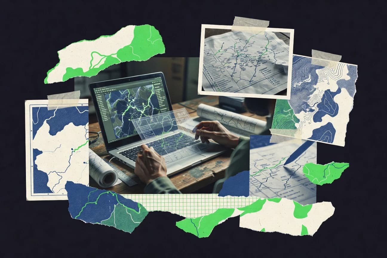
Science ResearchTop 10 Best Cartographer Software of 2026
Compare the top Cartographer Software picks in a best-of ranking, including QGIS, ArcGIS Online, and CartoDB. Explore options now.

How we ranked these tools
Core product claims cross-referenced against official documentation, changelogs, and independent technical reviews.
Analyzed video reviews and hundreds of written evaluations to capture real-world user experiences with each tool.
AI persona simulations modeled how different user types would experience each tool across common use cases and workflows.
Final rankings reviewed and approved by our editorial team with authority to override AI-generated scores based on domain expertise.
Score: Features 40% · Ease 30% · Value 30%
Gitnux may earn a commission through links on this page — this does not influence rankings. Editorial policy
Editor’s top 3 picks
Three quick recommendations before you dive into the full comparison below — each one leads on a different dimension.
CartoDB
SQL-powered hosted geospatial tables that drive live Carto map layers
Built for teams publishing data-driven web maps with SQL-backed geospatial pipelines.
QGIS
Editor pickLayout Manager with data-driven map items, labeling controls, and export settings
Built for cartographers producing print and analysis maps from GIS data.
ArcGIS Online
Editor pickSmart Mapping styles with Smart Labels for automated cartographic clarity
Built for teams producing shareable web maps with consistent labeling and styles.
Related reading
Comparison Table
This comparison table maps Cartographer Software against major mapping and GIS platforms such as CartoDB, QGIS, ArcGIS Online, ArcGIS Pro, and Google Earth Pro. It highlights which tools handle common geospatial workflows like data publishing, spatial analysis, map styling, and interactive sharing so readers can match platform capabilities to their use case.
CartoDB
geospatial analyticsProvides a SQL-friendly geospatial analytics platform for building maps, spatial visualizations, and location-based research datasets.
SQL-powered hosted geospatial tables that drive live Carto map layers
CartoDB stands out for a tight workflow between SQL-based geospatial data management and interactive map publishing. It combines hosted storage with map rendering powered by Carto’s mapping stack and styling controls for web-ready outputs. The platform supports analysis-minded pipelines using spatial SQL and reusable layers so updates can propagate to existing map views.
- +SQL-first geospatial workflow for building and updating layers quickly
- +Robust map styling with layers, legends, and responsive web rendering
- +Integrated dataset-to-map publishing reduces manual export steps
- +Spatial querying supports analysis-oriented map generation
- –Advanced customization can require SQL and Carto-specific styling knowledge
- –Complex multi-source dashboards can feel heavy to manage
- –Offline and fully self-hosted workflows are limited compared with pure GIS stacks
Best for: Teams publishing data-driven web maps with SQL-backed geospatial pipelines
More related reading
QGIS
open-source GISOffers an open-source desktop GIS for creating cartographic products, managing spatial layers, and performing spatial research workflows.
Layout Manager with data-driven map items, labeling controls, and export settings
QGIS stands out with deep support for desktop cartography using a project-based workflow and a large plugin ecosystem. It provides robust GIS data import, editing, and styling with layered map composition, labeled symbology, and export to common print and web formats.
Geoprocessing tools like buffering, spatial joins, and raster analysis support repeatable analysis inside the same environment. Cartographers also benefit from annotation tools, layout manager control, and standards-oriented formats such as GeoJSON, Shapefile, and GeoPackage.
- +Layout Manager enables precise map composition, legends, scales, and export-ready layouts
- +Powerful symbology with rules, expressions, and data-driven styling across vector layers
- +Extensive geoprocessing tools for cleaning, analysis, and spatial joins within one project
- +Rich plugin ecosystem for CAD import, publishing workflows, and specialized cartographic tools
- +Strong interoperability through common GIS formats and database connections
- –Complex projects can feel heavy with steep learning for expressions and processing chains
- –Advanced cartographic automation often requires expressions and careful layer management
- –On-the-fly web map styling workflow needs extra tooling compared with web-native editors
Best for: Cartographers producing print and analysis maps from GIS data
ArcGIS Online
web mappingEnables web mapping and geospatial sharing with configurable dashboards, data layers, and analysis tools for research cartography.
Smart Mapping styles with Smart Labels for automated cartographic clarity
ArcGIS Online stands out for cartographic publishing inside a full web GIS ecosystem with shareable web maps and web scenes. Strong core capabilities include configurable map themes, smart labels, map styling tools, and map composition workflows built around layers, pop-ups, and templates.
Cartographers get streamlined sharing through public or organization access, plus analysis-ready layers via hosted feature layers, imagery, and tiles. Limitations show up in less direct control of deep cartographic styling compared to desktop-first design tools and in a reliance on ArcGIS hosted content patterns.
- +Web maps and scenes support fast styling with layer-based controls
- +Smart labeling improves readability across varying scales
- +Map sharing and access control are built into the publishing workflow
- –Advanced cartographic design control is weaker than dedicated desktop cartography tools
- –Deep symbol and layout customization can require workaround templates
- –Heavy reliance on ArcGIS-hosted layers limits portability of workflows
Best for: Teams producing shareable web maps with consistent labeling and styles
More related reading
ArcGIS Pro
desktop GISProvides a desktop GIS for advanced cartography, geoprocessing, and repeatable spatial analysis workflows used in research.
Map layouts with dynamic data frames and map series driven by geodatabase attributes
ArcGIS Pro stands out for producing publication-ready maps inside a GIS-centric authoring environment. It supports layered cartographic design with symbol libraries, labeling controls, and map layouts backed by a single project geodatabase. Core capabilities include geoprocessing-driven map updates, 2D and 3D visualization, and automation through Python geoprocessing and cartographic workflows.
- +Strong labeling and symbology controls for cartographic production at scale
- +Layout and publishing workflow stays linked to geodatabase-backed data
- +Python automation enables repeatable map production workflows
- +Robust 2D and 3D visualization supports consistent cartographic styling
- –Interface complexity slows first-time adoption for pure cartography tasks
- –Automation requires GIS data discipline and Python proficiency for best results
- –Large projects can become heavy to manage during iterative cartographic edits
Best for: GIS-focused teams needing high-control cartography with repeatable automation
Google Earth Pro
3D geospatialSupports map-based exploration, geospatial measurement, and research-oriented visualization for layers and locations.
KML and KMZ support for importing, styling, and exporting cartographic annotations
Google Earth Pro stands out for its immediate access to high-resolution global imagery and a fast map-to-globe workflow. It supports cartographic tasks like adding points, paths, and polygons, then exporting data through KML and KMZ layers.
The tool also enables measuring distances and areas and managing geospatial content with a layered interface for projects that mix basemap context with user-authored features. Content editing is practical for visualization and field review workflows, but it lacks the advanced GIS data modeling and automation found in dedicated desktop cartography platforms.
- +Instant globe navigation with high-detail imagery for rapid cartographic context checks
- +KML and KMZ export enables straightforward sharing of points, paths, and polygons
- +Measurement tools support distance and area calculations for quick on-map analysis
- +Layer management helps organize multiple feature sets for thematic visualization
- –Limited editing for complex geospatial datasets compared to full GIS authoring tools
- –Geospatial processing automation and batch workflows are minimal for production pipelines
- –Style control is basic for advanced cartographic symbology and labeling rules
Best for: Visualizing and sharing geospatial annotations with KML-first workflows
Mapbox
developer mappingDelivers a developer-focused mapping platform for custom basemaps and interactive web maps powered by tile and style services.
Mapbox GL expressions for data-driven styling across layers
Mapbox stands out for production-grade map rendering and developer-first cartography delivered through a tile and styling stack. It provides Mapbox GL vector rendering with Mapbox Studio for style authoring, plus SDKs for WebGL, iOS, and Android. Cartographic workflows can automate data-driven styling with expressions, manage sprites and glyphs, and publish styles for interactive maps.
- +High-performance vector map rendering with expressive style controls
- +Mapbox Studio supports iterative cartography via tiles and style layers
- +SDK ecosystem enables interactive maps with consistent rendering across platforms
- +Data-driven styling using expressions supports reusable visual rules
- –Style and symbol management can be complex for non-developers
- –Achieving pixel-perfect design often requires careful tuning across renderers
- –Advanced effects increase work in layer ordering and asset preparation
Best for: Teams building interactive, style-rich web and mobile maps with vector data
More related reading
Leaflet
web mapping libraryProvides a lightweight JavaScript library for interactive maps used to build research cartography on the web.
Layered tile and vector rendering with popups and event-driven interactions
Leaflet stands out for lightweight, code-first interactive mapping built around a simple JavaScript API. It supports tile layers, vector overlays, markers, popups, and custom controls for interactive web maps.
Strong extension points include plugins for drawing, geocoding, and additional visualization layers. It is best suited to cartography delivered through the browser rather than desktop map authoring workflows.
- +Small core bundle and fast rendering for interactive web maps
- +Rich layer model for base tiles, vector overlays, and styled markers
- +Comprehensive event system for clicks, hovers, and popup interactions
- +Active plugin ecosystem for drawing and advanced layer behaviors
- –No built-in cartography editor for non-developers
- –Advanced workflows require JavaScript and careful state management
- –High-DPI symbol and typography tuning needs manual styling work
- –Performance tuning is required for very large vector datasets
Best for: Developers building interactive web cartography with custom layers
OpenLayers
web mapping frameworkSupplies a JavaScript mapping framework for building interactive map applications with support for many geospatial standards.
Vector layer styling and interaction APIs with per-feature rendering control
OpenLayers stands out by offering a flexible JavaScript map rendering library that integrates directly into custom web applications. It supports interactive layers, vector and raster sources, and standard map behaviors like pan, zoom, and projections.
The library emphasizes low-level control over map composition, feature styling, and event handling for GIS workflows. OpenLayers can power cartographic displays, but it requires building application logic around it for end-to-end cartographer software tasks.
- +Rich layer model for vector and raster sources in one map runtime
- +Strong projection and transformation support for custom GIS coordinate systems
- +Highly configurable styling and interaction hooks for cartographic behavior
- –No built-in cartographer workflow UI, so teams must build interfaces
- –API complexity increases for advanced tiling, clustering, and editing flows
- –Large customizations can require significant engineering effort and testing
Best for: Teams building bespoke web maps needing GIS-grade control without a fixed UI
More related reading
GRASS GIS
spatial modelingDelivers an open-source GIS and geospatial processing suite for advanced spatial modeling and cartographic preparation.
GRASS GIS modular command system with geoprocessing for reproducible raster and vector pipelines
GRASS GIS stands out for deep, open geospatial processing capabilities rather than cartography-only output tools. The software delivers raster and vector geoprocessing, spatial analysis, and map production through a mature command-line and module system.
Core capabilities include terrain analysis, hydrologic modeling, and scalable workflows that can be scripted for reproducible map builds. Its cartographic side benefits from standard GIS data handling and exports, while advanced layout control usually relies on GIS-native rendering and external tooling.
- +Extensive geoprocessing modules for raster and vector analysis
- +Scriptable workflows using a consistent module command interface
- +Strong support for terrain, hydrology, and spatial modeling workflows
- –Cartography workflow needs extra steps for polished map layouts
- –Steep learning curve for module syntax and GRASS-specific conventions
- –GUI-centric users may prefer dedicated layout tools for final design
Best for: GIS teams needing advanced analysis and reproducible map workflows
SAGA GIS
raster analysisProvides open-source geoscience-oriented GIS tools for raster analysis and terrain processing used in research mapping.
Terrain and hydrology toolbox for DEM processing like flow accumulation and watershed modeling
SAGA GIS stands out for its large catalog of geoprocessing tools focused on terrain, remote sensing, and spatial statistics. It supports raster and vector workflows using a command-based processing model plus a graphical interface for tool execution.
Cartographic output is supported through map composition and styling, while analysis-heavy projects benefit from batch processing and repeatable workflows. Integration with common GIS data formats makes it useful as a preprocessing and analysis engine before final cartographic layout.
- +Extensive terrain analysis tools for DEM hydrology and landform derivatives
- +Raster and vector processing support for end-to-end cartographic prep
- +Batch processing and repeatable workflows for repeatable map production
- +Strong geoprocessing depth with many specialized algorithms
- –Map composition tools feel less polished than dedicated cartography suites
- –Finding and parameterizing the right tool can be slow for new users
- –User interface layout does not prioritize streamlined cartographic layout
Best for: Analysis-first mapping workflows needing terrain processing and batch repeatability
How to Choose the Right Cartographer Software
This buyer's guide helps map teams and cartographers choose among CartoDB, QGIS, ArcGIS Online, ArcGIS Pro, Google Earth Pro, Mapbox, Leaflet, OpenLayers, GRASS GIS, and SAGA GIS. It focuses on decision points like SQL-first data pipelines, layout-quality cartography, and web-map rendering workflows using vector tiles and interaction APIs. The guide also covers common selection traps tied to styling depth, workflow UI expectations, and automation complexity.
What Is Cartographer Software?
Cartographer software builds maps from spatial data by combining layer composition, cartographic styling, and export or publishing workflows. It solves problems like turning GIS datasets into print-ready layouts in QGIS or ArcGIS Pro, and turning geospatial layers into shareable web maps in ArcGIS Online or custom applications in Mapbox, Leaflet, and OpenLayers. Teams typically use these tools to manage symbology, labeling, and map outputs such as KML and KMZ in Google Earth Pro or repeatable map series driven by geodatabase attributes in ArcGIS Pro.
Key Features to Look For
Cartographer software selection should prioritize features that match the production pipeline, whether the work is SQL-driven web cartography or desktop print layouts with repeatable automation.
SQL-powered hosted geospatial layers for live web maps
CartoDB excels because SQL-powered hosted geospatial tables drive live Carto map layers and reduce manual export steps. This fit targets teams that want analysis-oriented map generation where updates propagate to existing map views through reusable layers.
Layout Manager for precise legends, scales, and export-ready cartographic compositions
QGIS provides a Layout Manager with data-driven map items, labeling controls, and export settings that support production-grade print and analysis maps. ArcGIS Pro also provides map layouts with dynamic data frames and map series driven by geodatabase attributes for scalable cartographic output.
Smart labeling and theme-driven web cartography controls
ArcGIS Online focuses on smart labels and configurable map themes built around layer-based publishing. This helps teams keep readability consistent across varying scales using labeling automation rather than manual label placement.
Data-driven styling with expressions across layers
Mapbox supports Mapbox GL expressions for data-driven styling across layers so visual rules can be reused across an interactive map. Leaflet and OpenLayers also enable layered vector styling and event-driven interactions, but Mapbox emphasizes a tile and style service workflow geared for production web rendering.
High-control desktop cartography with symbology and geoprocessing workflows
ArcGIS Pro delivers strong labeling and symbology controls with geoprocessing-driven map updates. QGIS complements this with powerful symbology using rules, expressions, and data-driven styling across vector layers plus geoprocessing tools like buffering and spatial joins.
Deep terrain and hydrology processing for analysis-first cartographic preparation
SAGA GIS provides a terrain and hydrology toolbox for DEM processing such as flow accumulation and watershed modeling with batch processing for repeatable map production. GRASS GIS delivers extensive geoprocessing modules that can be scripted for reproducible raster and vector pipelines, which supports advanced spatial modeling before cartographic layout work.
How to Choose the Right Cartographer Software
A reliable selection picks a tool whose layer model and cartographic output workflow match the team’s target format, publishing method, and automation needs.
Start with the intended output target and publishing method
Select QGIS for print and analysis maps that need layout composition and export settings with precise legends, scales, and labeled symbology. Choose ArcGIS Online for web map sharing with smart labels and layer-based publishing, or choose Mapbox for interactive vector-tile web and mobile maps using Mapbox GL expressions.
Match the styling and labeling workflow to the production level of control required
If automated readability across varying scales matters, ArcGIS Online provides Smart Mapping styles with Smart Labels. If rules-based symbology and labeling controls must be tightly managed in a desktop workflow, QGIS layout tools plus data-driven styling across vector layers fit that need.
Choose an authoring environment that matches the team’s data pipeline approach
Use CartoDB when the core workflow is SQL-based geospatial data management where SQL-powered hosted tables drive live map layers. Use ArcGIS Pro when a geodatabase-backed project should link layouts, publishing, and Python automation for repeatable map series driven by geodatabase attributes.
Plan for extensibility and ecosystem support based on how bespoke the application needs to be
Pick Leaflet when a lightweight JavaScript library is enough for interactive maps using tile layers, vector overlays, popups, and custom controls with a plugin ecosystem. Pick OpenLayers when bespoke application logic is required because it provides vector and raster sources with GIS-grade control but no built-in cartographer workflow UI.
Ensure the analysis depth required before cartographic layout exists in one place or a connected pipeline
Choose SAGA GIS for terrain and hydrology preprocessing that includes DEM hydrology derivatives like flow accumulation and watershed modeling with batch repeatability. Choose GRASS GIS for deep raster and vector geoprocessing modules that can be scripted into reproducible pipelines, then finalize map layout with layout tooling in the GIS or connected workflow.
Who Needs Cartographer Software?
Cartographer software tools serve distinct teams based on whether the work centers on web publishing, desktop cartography production, or advanced spatial analysis and terrain preprocessing.
Teams publishing data-driven web maps from SQL-based pipelines
CartoDB fits because SQL-powered hosted geospatial tables drive live Carto map layers and updates can propagate to existing map views. Mapbox also fits teams building interactive, style-rich web and mobile maps using Mapbox GL expressions for data-driven styling across layers.
Cartographers producing print and analysis maps from desktop GIS data
QGIS fits because Layout Manager controls provide export-ready compositions with data-driven map items, labeling controls, and precise layout settings. ArcGIS Pro fits GIS-focused cartography teams that need labeling and symbology controls at scale plus map series driven by geodatabase attributes.
Organizations standardizing shareable web maps with consistent readability
ArcGIS Online fits because smart labels and configurable map themes support readable web map publishing with layer-based controls. It is especially suitable when publishing workflow access control matters along with templated map experiences.
Analysis-first teams building terrain and hydrology derivatives for later cartographic layout
SAGA GIS fits because its terrain and hydrology toolbox includes DEM processing like flow accumulation and watershed modeling with batch repeatability. GRASS GIS fits because modular geoprocessing modules and a scriptable module command interface enable reproducible raster and vector pipelines.
Common Mistakes to Avoid
Selection errors typically come from mismatching workflow UI expectations, underestimating styling complexity, or choosing a tool that lacks the automation and analysis depth required for production.
Choosing a developer-first map renderer and expecting a cartography editor UI
Leaflet and OpenLayers provide interactive mapping building blocks with layered rendering and event handling, but they do not supply a built-in cartographer workflow UI. Mapbox also requires careful style and symbol management for non-developers, so a team needing a guided cartographic authoring workflow should look at QGIS or ArcGIS Pro instead.
Underplanning for styling and layout complexity in desktop GIS projects
QGIS and ArcGIS Pro can become heavy for complex projects because expressions and processing chains must be managed carefully. Teams that only need basic annotation workflows should use Google Earth Pro for KML and KMZ export and measurement instead of expecting full cartographic automation.
Over-relying on hosted web layers when portability and symbol depth are the priority
ArcGIS Online relies on ArcGIS hosted content patterns and can limit deep symbol and layout customization compared with desktop-first design tools. CartoDB and Mapbox also depend on their rendering and styling stacks, so teams needing maximum layout control should evaluate QGIS or ArcGIS Pro first.
Skipping analysis depth planning before committing to cartographic production
SAGA GIS and GRASS GIS are built for deep terrain and hydrology or modular geoprocessing workflows, so skipping them can lead to fragmented preprocessing steps. For maps that depend on DEM hydrology derivatives, teams should route DEM processing through SAGA GIS terrain and hydrology tools or GRASS GIS modules before investing in layout work.
How We Selected and Ranked These Tools
we evaluated every tool on three sub-dimensions with features weighted at 0.4, ease of use weighted at 0.3, and value weighted at 0.3. The overall rating is the weighted average computed as overall = 0.40 × features + 0.30 × ease of use + 0.30 × value. CartoDB separated itself with SQL-powered hosted geospatial tables that drive live Carto map layers, which scored strongly on the features dimension because it tightly connects data management and interactive map publishing. Tools like Leaflet and OpenLayers contributed strong value through lightweight web rendering and configurable GIS-grade control, but their features scored lower for cartography-focused production because they lack a dedicated cartographer workflow UI.
Frequently Asked Questions About Cartographer Software
Which tool fits a SQL-backed workflow that keeps map layers synchronized with changing geospatial tables?
Which option is better for print-first cartography with precise layout control and consistent labeling?
Which tool should be chosen for shareable web maps with automated labeling and style themes?
What is the best choice for teams that need repeatable cartographic updates driven by automation and a project geodatabase?
Which tool is most suitable for globe-based visualization and exporting KML or KMZ annotations?
Which platform is best for data-driven vector styling in interactive web and mobile maps?
Which option is best for developers who want a lightweight JavaScript mapping API with custom interactions?
Which tool is the right fit when the mapping UI must be fully custom-built for GIS-grade control?
When analysis and reproducible geoprocessing matter more than cartography-only output, which tool should be used?
Conclusion
After evaluating 10 science research, CartoDB stands out as our overall top pick — it scored highest across our combined criteria of features, ease of use, and value, which is why it sits at #1 in the rankings above.
Use the comparison table and detailed reviews above to validate the fit against your own requirements before committing to a tool.
Tools reviewed
Primary sources checked during evaluation.
Referenced in the comparison table and product reviews above.
Keep exploring
Comparing two specific tools?
Software Alternatives
See head-to-head software comparisons with feature breakdowns, pricing, and our recommendation for each use case.
Explore software alternatives→In this category
Science Research alternatives
See side-by-side comparisons of science research tools and pick the right one for your stack.
Compare science research tools→FOR SOFTWARE VENDORS
Not on this list? Let’s fix that.
Our best-of pages are how many teams discover and compare tools in this space. If you think your product belongs in this lineup, we’d like to hear from you—we’ll walk you through fit and what an editorial entry looks like.
Apply for a ListingWHAT THIS INCLUDES
Where buyers compare
Readers come to these pages to shortlist software—your product shows up in that moment, not in a random sidebar.
Editorial write-up
We describe your product in our own words and check the facts before anything goes live.
On-page brand presence
You appear in the roundup the same way as other tools we cover: name, positioning, and a clear next step for readers who want to learn more.
Kept up to date
We refresh lists on a regular rhythm so the category page stays useful as products and pricing change.