GITNUXSOFTWARE ADVICE
Furniture And Home DecorTop 10 Best Cad Landscape Design Software of 2026
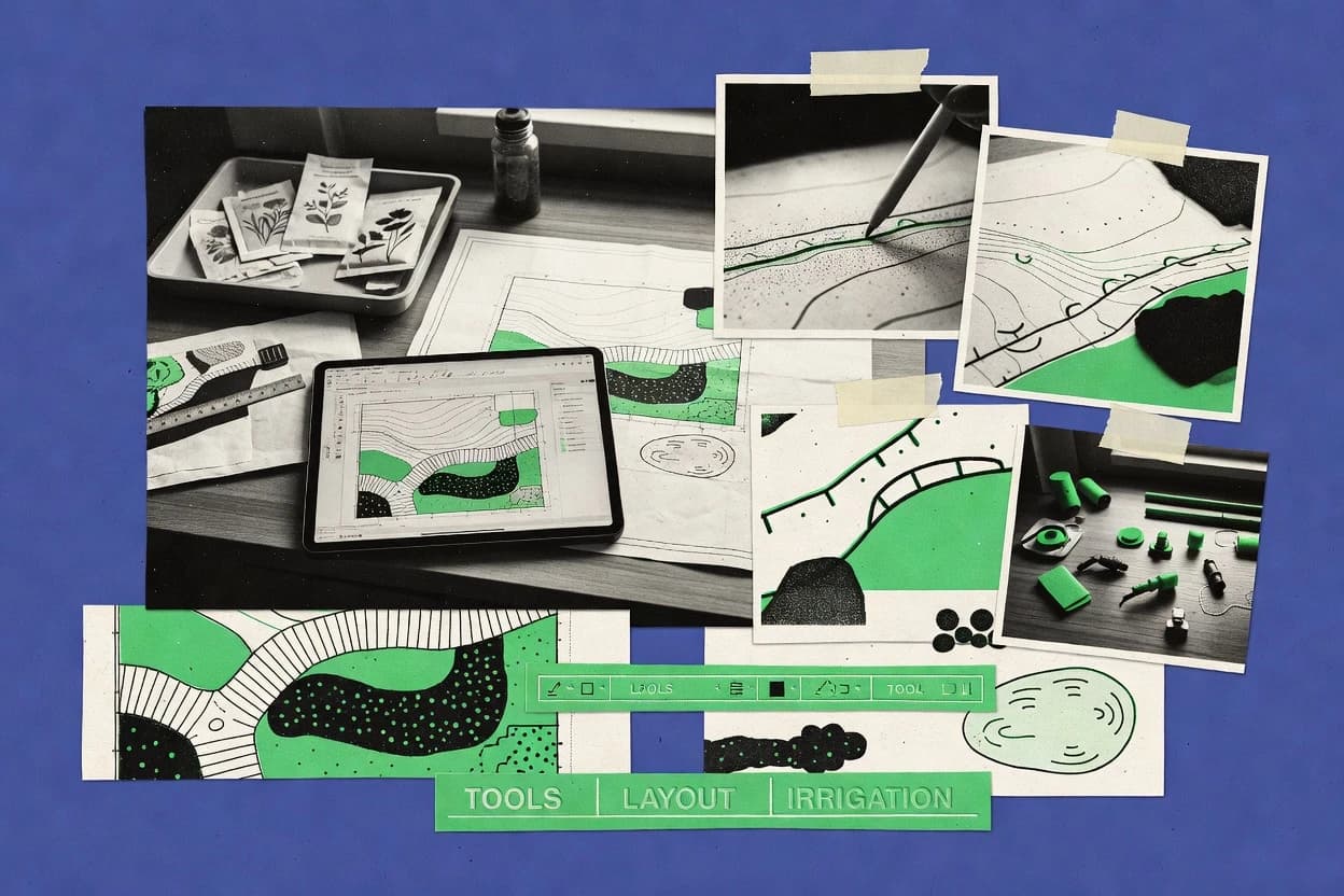
Top 10 Cad Landscape Design Software picks ranked for accuracy and ease of use. Compare PRO Landscape, SketchUp, and Revit.

How we ranked these tools
Core product claims cross-referenced against official documentation, changelogs, and independent technical reviews.
Analyzed video reviews and hundreds of written evaluations to capture real-world user experiences with each tool.
AI persona simulations modeled how different user types would experience each tool across common use cases and workflows.
Final rankings reviewed and approved by our editorial team with authority to override AI-generated scores based on domain expertise.
Score: Features 40% · Ease 30% · Value 30%
Gitnux may earn a commission through links on this page — this does not influence rankings. Editorial policy
Editor’s top 3 picks
Three quick recommendations before you dive into the full comparison below — each one leads on a different dimension.
PRO Landscape
Landscape CAD detailing workflow for maintaining consistent site plan deliverables
Built for landscape design firms needing consistent CAD plan production and drawing reuse.
SketchUp
Editor pickPush-pull solid modeling combined with section and dimension tools
Built for landscape designers needing quick 3D concepting and client-ready visualization.
Revit
Editor pickSite and Topography surfaces with grading that updates dependent elements automatically
Built for bIM-oriented landscape teams producing coordinated drawings and quantities.
Related reading
Comparison Table
This comparison table evaluates Cad Landscape Design Software tools used to design site plans, model terrain, and produce construction-ready drawings across workflows. It contrasts PRO Landscape, SketchUp, Revit, AutoCAD, AutoCAD Civil 3D, and other common options by key capabilities such as modeling approach, drafting toolsets, terrain and grading features, and output needs for landscape projects. Readers can use the table to identify which software best matches project requirements for visualization, documentation, and civil design tasks.
PRO Landscape
desktopDesktop landscape design software for drawing property layouts, grading concepts, planting plans, and generating hardscape and material outputs.
Landscape CAD detailing workflow for maintaining consistent site plan deliverables
PRO Landscape stands out for combining plan-view landscape CAD drafting with a project workflow tailored to site layout and planting deliverables. It supports common landscape CAD tasks like drawing geometry, managing layers, and producing plan outputs used in design packages. The tool emphasizes repeatable detailing so teams can update a concept and propagate changes across the drawing set.
- +Landscape-focused CAD workflow reduces rework across common site plan tasks
- +Layer and drawing management supports organized deliverable creation
- +Repeatable detailing helps keep updated concepts consistent across outputs
- –Advanced landscape libraries and templates can take time to configure
- –File handoff may require cleanup when collaborating with non-ideal CAD setups
- –Tool breadth for niche planting schedules may lag specialized landscape suites
Best for: Landscape design firms needing consistent CAD plan production and drawing reuse
More related reading
SketchUp
3D modeling3D modeling software used to create landscape and outdoor scene designs with importable terrain, vegetation modeling, and render workflows.
Push-pull solid modeling combined with section and dimension tools
SketchUp stands out for its fast 3D conceptual modeling workflow and massive ecosystem of shared models. It supports landscape design by enabling accurate terrain and massing through imported contours, push-pull modeling, and layered scene organization.
Design teams can document work with section cuts, dimensions, and layout-ready 2D views derived from the 3D model. Real-world drafting handoffs depend heavily on export quality for CAD and BIM interoperability.
- +Rapid push-pull modeling for quick landscape concepts and iterations
- +Layer and scene tools help organize design options and presentation views
- +Strong ecosystem of plugins and prebuilt landscape components
- –CAD-grade detailing and constraints are weaker than dedicated CAD systems
- –Terrain editing can become cumbersome for complex grading scenarios
- –CAD export workflows require careful setup to avoid model loss
Best for: Landscape designers needing quick 3D concepting and client-ready visualization
Revit
bimBIM design platform for producing coordinated architectural and landscape elements with parametric components and construction-ready documentation.
Site and Topography surfaces with grading that updates dependent elements automatically
Revit stands out with building-information modeling for landscape elements, where terrain, site components, and civil-adjacent details stay connected in one parametric model. Core landscape workflows include creating site plans with terrain surfaces, placing plant and hardscape components, and producing coordinated sheets with schedules and views.
For CAD landscape design, it supports BIM-style documentation rather than flat 2D drafting, which improves consistency across plans, sections, and quantities. Rendering and export options help communicate design intent to stakeholders without rebuilding geometry in separate tools.
- +Parametric terrain modeling ties grading, surfaces, and site components together
- +Schedules and legends produce consistent planting and quantity documentation
- +Linked-model workflows support coordinated design reviews and revisions
- –Landscape-specific CAD drafting is slower than 2D-focused applications
- –Learning the Revit family system takes significant modeling discipline
- –Heavy projects can degrade responsiveness during large site documentation
Best for: BIM-oriented landscape teams producing coordinated drawings and quantities
More related reading
AutoCAD
2D CAD2D CAD drafting and annotation tool used to generate precise site plans, grading drawings, and detail sheets for landscape and outdoor projects.
AutoCAD 2D drafting with dynamic blocks for reusable landscape symbols
AutoCAD stands out for its industry-standard 2D drafting core combined with solid 3D modeling capability. It supports site planning workflows with precision drawing tools, layer standards, and scalable blocks for landscape elements.
For landscape design, it enables detailed grading, retaining walls, and annotation through customizable templates and drafting standards. The software’s flexibility comes with a learning curve and requires discipline to keep CAD files clean for consistent landscape deliverables.
- +Strong 2D drafting tools for planting plans, hardscape layouts, and dimensioning
- +3D modeling supports grading concepts, walls, and volumetric site visualization
- +Blocks and reusable symbols accelerate repeating landscape details
- +Layer control enables consistent landscape drawing organization
- –Landscape-specific workflows require setup rather than guided wizards
- –Complex CAD files become harder to manage without strict standards
- –Rendering and presentation are limited without additional tools or plugins
- –Object modeling can be time-consuming for detailed planting plans
Best for: Landscape CAD production needing precise 2D plans and controlled drafting standards
AutoCAD Civil 3D
civil gradingCivil engineering CAD used for grading, terrain surfaces, alignments, and earthwork workflows that support landscape design deliverables.
Corridor modeling with assembly-driven targets for automated cut and fill surfaces
AutoCAD Civil 3D stands out for modeling and drafting infrastructure using a data-driven civil engineering workflow built on top of AutoCAD. It supports surface creation, grading, alignments, profiles, and corridor modeling that can support landscape-adjacent grading, earthworks, and grading plans tied to survey-like data.
Civil 3D also produces linked plan and profile outputs and quantity-style deliverables that stay consistent when design geometry updates. For landscape design tasks that need survey-grade terrain modeling and grading automation, it delivers strong civil design logic with CAD control.
- +Corridor modeling automates earthworks between alignments and surfaces.
- +Linked surfaces, alignments, and profiles update consistently across drawings.
- +Survey-style alignment and profile tools fit grading-focused landscape deliverables.
- +Civil data structures improve traceability from design geometry to outputs.
- +Workflow integrates with familiar AutoCAD drafting tools and standards.
- –Landscape-specific modeling still requires extra configuration beyond civil-centric objects.
- –Steep learning curve for corridor parameters and rules-based components.
- –Performance can degrade on large surface and corridor projects.
Best for: Civil-minded landscape firms needing grading automation tied to survey data
Rhino
NURBS CADNURBS-based 3D CAD tool for creating curved landscape forms, custom furniture and hardscape geometry, and production-ready geometry.
Rhino’s NURBS surface modeling for highly controllable terrain and hardscape forms
Rhino stands out for using a NURBS modeling core that supports precise, editable surfaces for landscape forms like grading, terraces, and custom paving geometries. It delivers CAD workflows with strong export interoperability through common file formats and extensible modeling via scripts and plugins. Rhino also connects to visualization and analysis tools through its ecosystem and data exchange patterns used by landscape designers.
- +NURBS surface modeling enables accurate landscape grading and complex formwork
- +Extensive plugin ecosystem expands capabilities for terrain, detailing, and export
- +Parametric and scripted workflows support repeatable site modeling tasks
- –Landscape-specific drafting tools are less turnkey than dedicated landscape CAD
- –Learning curve is steep for surface modeling and precision constraints
- –Document management and annotation workflows require more manual setup
Best for: Landscape design teams needing precise NURBS geometry and flexible CAD workflows
More related reading
Lumion
renderingReal-time rendering software for visualizing landscape scenes and outdoor environments created in CAD and 3D modeling tools.
Real-time rendering and instant scene updates in the Live workflow
Lumion stands out for fast, photorealistic landscape visualization with real-time rendering, letting design iterations show up quickly. The tool supports importing landscape geometry and using environment, sky, vegetation, and materials to build compelling exterior scenes.
Lumion also includes animation and camera tools for walkthroughs and presentations, which fit landscape design review workflows. Landscape output is strongest when teams iterate visually rather than when they need deep CAD-grade drafting inside the software.
- +Real-time rendering accelerates landscape iteration and design review
- +Strong library tools for vegetation, materials, and lighting setups
- +Camera paths and animation features support walkthrough presentations
- –CAD modeling remains limited compared with dedicated CAD tools
- –Large landscape scenes can strain performance during editing
- –Advanced procedural control for plants and terrain is not as granular as specialized tools
Best for: Landscape teams needing quick photoreal exterior visualization from CAD geometry
Twinmotion
visualizationReal-time visualization tool for creating photoreal landscape and outdoor design presentations from imported 3D models.
Real-time path-traced rendering mode for high-fidelity stills and walkthroughs
Twinmotion stands out for turning landscape and site models into fast, photo-real visualizations with real-time rendering. It supports importing CAD and 3D geometry and then refining scene lighting, materials, vegetation, and weather-driven atmosphere for presentation.
The workflow centers on interactive viewpoints, instant iteration, and export-ready outputs for client deliverables. It is strongest when landscape design work already exists in other tools and the visualization stage needs speed and realism.
- +Real-time rendering speeds landscape iteration with immediate visual feedback
- +Rich lighting, sky, and weather effects support compelling landscape presentations
- +Vegetation assets and scattering tools help populate sites quickly
- +Direct model import enables faster visualization from existing CAD workflows
- –Terrain and grading tools are limited compared with dedicated landscape CAD
- –Scene organization can become difficult with large, multi-phase site models
- –Advanced landscaping detailing often requires external modeling workflows
Best for: Landscape design teams needing quick visualization from imported CAD models
More related reading
Twinmotion Cloud
cloud sharingCloud publishing for interactive Twinmotion presentations that share outdoor design scenes with stakeholders.
Twinmotion Cloud web publishing for interactive real-time landscape scene sharing
Twinmotion Cloud stands out by combining real-time Twinmotion visualization with browser-based sharing, which reduces friction for client review. It supports landscape-focused rendering workflows through live asset placement, vegetation and material libraries, and dynamic lighting for daylight and time-of-day scenes.
Cloud publishing lets teams stream interactive scenes to stakeholders without requiring local software installs. It still depends on external CAD and BIM inputs for geometry, so landscape detail quality largely follows the quality of the imported model.
- +Browser-based scene viewing cuts setup time for stakeholder walkthroughs
- +High-quality real-time lighting for landscape day and seasonal mood studies
- +Large asset libraries for vegetation, materials, and scene dressing
- +Interactive navigation supports early feedback on layout, massing, and finishes
- –Relies on imported CAD or BIM geometry for accurate landscape grading
- –Advanced landscape modeling tools are limited compared with dedicated CAD
- –Fine control over vegetation placement can be slower for complex sites
Best for: Landscape design teams needing fast, interactive client visualizations from CAD
Blender
open-source 3DOpen-source 3D creation suite for modeling outdoor environments, furniture, and landscape props with rendering for presentation.
Geometry Nodes procedural modeling for terrains, scatter, and plant placement workflows
Blender stands out for landscape design work because it combines modeling, UV unwrapping, and physically based rendering in one application. It supports mesh modeling workflows for terrains, roads, and planted beds using modifiers, booleans, and procedural tools.
Core capabilities include animation and camera-based walkthroughs, plus exportable assets for visualization pipelines. For CAD-like precision tasks, Blender can handle geometry but it lacks dedicated 2D drafting and dimensioning tools used in traditional landscape CAD.
- +Procedural modifiers and booleans help build terrains and hardscape forms quickly
- +Physically based rendering produces presentation-grade landscape visuals and lighting
- +Animation and camera tools enable walkthroughs and client-facing motion views
- –No dedicated CAD-style 2D drafting with dimensions and constraints
- –Landscape-specific libraries and labeling workflows are not built-in
- –Modeling accuracy requires careful snapping and manual measurements
Best for: Visualization-focused landscape designers modeling scenes for client walkthroughs
How to Choose the Right Cad Landscape Design Software
This buyer's guide explains how to choose CAD landscape design software for plan production, grading workflows, and visualization deliverables. It covers PRO Landscape, SketchUp, Revit, AutoCAD, AutoCAD Civil 3D, Rhino, Lumion, Twinmotion, Twinmotion Cloud, and Blender. The guide translates tool strengths into buyer requirements so teams can match software to deliverables and collaboration needs.
What Is Cad Landscape Design Software?
CAD landscape design software helps teams create site plans, grading concepts, planting layouts, and hardscape geometry with geometry tools, layers, and deliverable outputs. It solves the problem of turning a design intent into consistent plan and documentation that can be updated without redrawing everything. PRO Landscape shows a landscape CAD drafting approach with project workflow built around site layout and planting deliverables. AutoCAD shows a general 2D drafting and annotation core with dynamic blocks used for reusable landscape symbols.
Key Features to Look For
The right feature set determines whether a team can produce consistent landscape deliverables, automate grading work, or generate presentations without rework.
Landscape CAD plan detailing workflow for repeatable deliverables
PRO Landscape emphasizes a landscape CAD detailing workflow that maintains consistent site plan deliverables when concepts update. This reduces rework by supporting drawing and layer management that keeps deliverables aligned across a drawing set.
2D drafting precision with reusable symbols via dynamic blocks
AutoCAD provides strong 2D drafting tools for planting plans, hardscape layouts, and dimensioning. Dynamic blocks and layer control accelerate repeating landscape details and keep CAD files organized for controlled plan production.
Parametric terrain and site components with coordinated schedules
Revit ties site and Topography surfaces to dependent elements so grading updates propagate through the model. Revit also generates schedules and legends that keep planting and quantity documentation consistent across views and sheets.
Survey-style grading automation using corridors and assemblies
AutoCAD Civil 3D delivers grading and earthwork logic with corridor modeling that automates cut and fill between alignments and surfaces. It uses assembly-driven targets that keep outputs aligned when design geometry changes.
NURBS precision for curved forms, paving geometry, and terrain surfaces
Rhino uses NURBS surface modeling for highly controllable terrain, terraces, and custom paving geometries. It supports flexible CAD workflows with an ecosystem of plugins that expand terrain and detailing capabilities beyond basic drafting.
Real-time photoreal visualization for fast client iteration and walkthroughs
Lumion focuses on real-time rendering with instant scene updates in a Live workflow so landscape teams can iterate visually. Twinmotion and Twinmotion Cloud add fast photoreal rendering and path-traced stills or cloud-based interactive sharing for stakeholder review.
How to Choose the Right Cad Landscape Design Software
A practical selection process matches the software to the deliverables that matter most such as 2D plan accuracy, automated grading, or photoreal presentation speed.
Start with the deliverable type: 2D plans, BIM documentation, grading automation, or visualization
Choose PRO Landscape for landscape CAD plan production that prioritizes repeatable detailing and consistent deliverables across updates. Choose AutoCAD for precise 2D planting plans and controlled drafting standards built on dynamic blocks and layer management.
Pick the grading workflow that matches the design logic in the project
Choose Revit when terrain and site components must stay connected in one parametric model so Topography surface edits update dependent elements. Choose AutoCAD Civil 3D when grading requires corridor modeling with assembly-driven targets tied to survey-style alignments and profiles.
Decide how much curved or custom geometry control is required
Choose Rhino when curved landscape forms and complex hardscape geometry need NURBS precision that stays editable. Choose SketchUp when the priority is fast 3D conceptual modeling with push-pull workflows and layered scene organization for derived 2D views.
Match visualization needs to the tool’s real-time pipeline
Choose Lumion when fast photoreal landscape visualization depends on real-time rendering and quick iteration rather than deep CAD-grade drafting inside the renderer. Choose Twinmotion or Twinmotion Cloud when importing existing CAD or BIM geometry and producing interactive walkthroughs or browser-based stakeholder views matters most.
Validate interoperability and collaboration needs before committing
Use SketchUp and Twinmotion when workflows depend on exporting from CAD-like tools into render or visualization stages, because export quality and imported geometry fidelity determine presentation outcomes. Use AutoCAD Civil 3D or Revit when coordinated drawing sets and model-driven documentation reduce downstream inconsistencies between grading, views, and quantities.
Who Needs Cad Landscape Design Software?
Cad landscape design software supports different landscape roles based on whether the job is plan drafting, grading automation, BIM documentation, or visualization-heavy client communication.
Landscape design firms that need consistent CAD plan production and drawing reuse
PRO Landscape fits firms that rely on repeatable detailing and layer-managed deliverables so updates propagate across a drawing set. Teams that produce site plans, grading concepts, and planting deliverables benefit from the landscape-focused CAD drafting workflow in PRO Landscape.
Landscape designers who need rapid 3D concepts and client-ready visualization views
SketchUp suits designers who iterate quickly using push-pull solid modeling and derive section cuts and dimensioned views from layered 3D scenes. Lumion and Twinmotion also suit this audience when the deliverable is photoreal visualization based on imported geometry rather than CAD-grade detailing.
BIM-oriented landscape teams producing coordinated drawings and quantity documentation
Revit fits teams that need parametric Topography surfaces and site components that update together for consistent documentation. Revit schedules and legends support planting and quantity workflows in coordinated sheet sets.
Civil-minded landscape firms that require survey-grade grading automation
AutoCAD Civil 3D fits firms using alignments, profiles, and corridor modeling to automate earthworks between surfaces. Corridor modeling with assembly-driven targets supports cut and fill outputs that stay consistent when design geometry updates.
Landscape teams that must model precise curved forms and custom hardscape geometry
Rhino fits teams needing NURBS surface modeling for controllable terrain and complex formwork geometry. Rhino’s plugin ecosystem supports expanded terrain, detailing, and export workflows for production-grade geometry.
Teams focused on interactive real-time visualization for client review
Twinmotion and Twinmotion Cloud fit workflows where landscape geometry already exists and the goal is real-time presentations with instant iteration. Lumion suits teams that want real-time rendering and animation workflows to deliver walkthrough-ready visuals quickly.
Common Mistakes to Avoid
Selection errors often come from mismatching drafting, modeling, and visualization expectations to what each tool actually supports in production.
Choosing a visualization renderer as the primary CAD drafting environment
Lumion, Twinmotion, and Twinmotion Cloud optimize real-time rendering and scene updates rather than CAD-grade 2D drafting and constraint-based detailing. Teams that need precise 2D plan production should prioritize AutoCAD, PRO Landscape, or Revit for drafting and documentation.
Underestimating landscape-specific setup required for general CAD tools
AutoCAD and Rhino require careful configuration for landscape libraries and templates because landscape-specific workflows are less turnkey than dedicated landscape CAD systems. PRO Landscape reduces this risk with a landscape CAD workflow designed around site layout and planting deliverables.
Assuming push-pull conceptual modeling will replace CAD-grade detailing
SketchUp is strong for fast 3D conceptual modeling but CAD-grade detailing and constraints are weaker than dedicated CAD systems. Projects that demand precise drafting standards should use AutoCAD with dynamic blocks or PRO Landscape for consistent landscape deliverables.
Buying a BIM tool without committing to parametric family discipline
Revit relies on parametric family systems and terrain relationships so landscape-specific CAD drafting can be slower than 2D-focused applications. Teams that cannot invest in Revit modeling discipline should start with AutoCAD or PRO Landscape for faster drafting outputs.
How We Selected and Ranked These Tools
we evaluated every tool on three sub-dimensions with features weighted at 0.40, ease of use weighted at 0.30, and value weighted at 0.30. The overall rating is the weighted average calculated as overall = 0.40 × features + 0.30 × ease of use + 0.30 × value. PRO Landscape separated itself primarily on the features sub-dimension because it delivers a landscape CAD detailing workflow that maintains consistent site plan deliverables across updates. That same deliverable-focused workflow also supports stronger drawing and layer management for repeatable outputs, which improved the practical features score.
Frequently Asked Questions About Cad Landscape Design Software
Which tool is best for producing clean 2D landscape CAD deliverables with reusable detail?
What software supports survey-grade grading and automated cut-and-fill logic?
Which option is strongest for coordinated site documentation and quantity-style schedules?
Which tool is better for fast concepting with accurate terrain and massing in 3D?
What software handles highly controllable curved terrain and custom paving geometry?
Which tools are best for photoreal visualization without rebuilding CAD geometry inside the renderer?
When does Blender fit landscape design workflows better than traditional CAD-style drafting?
How do teams typically bridge from a CAD model to client-ready visuals?
What common workflow problem should teams plan for when using visualization tools with CAD imports?
Conclusion
After evaluating 10 furniture and home decor, PRO Landscape stands out as our overall top pick — it scored highest across our combined criteria of features, ease of use, and value, which is why it sits at #1 in the rankings above.
Use the comparison table and detailed reviews above to validate the fit against your own requirements before committing to a tool.
Tools reviewed
Primary sources checked during evaluation.
Referenced in the comparison table and product reviews above.
Keep exploring
Comparing two specific tools?
Software Alternatives
See head-to-head software comparisons with feature breakdowns, pricing, and our recommendation for each use case.
Explore software alternatives→In this category
Furniture And Home Decor alternatives
See side-by-side comparisons of furniture and home decor tools and pick the right one for your stack.
Compare furniture and home decor tools→FOR SOFTWARE VENDORS
Not on this list? Let’s fix that.
Our best-of pages are how many teams discover and compare tools in this space. If you think your product belongs in this lineup, we’d like to hear from you—we’ll walk you through fit and what an editorial entry looks like.
Apply for a ListingWHAT THIS INCLUDES
Where buyers compare
Readers come to these pages to shortlist software—your product shows up in that moment, not in a random sidebar.
Editorial write-up
We describe your product in our own words and check the facts before anything goes live.
On-page brand presence
You appear in the roundup the same way as other tools we cover: name, positioning, and a clear next step for readers who want to learn more.
Kept up to date
We refresh lists on a regular rhythm so the category page stays useful as products and pricing change.