GITNUXSOFTWARE ADVICE
Agriculture FarmingTop 10 Best Agricultural Mapping Software of 2026
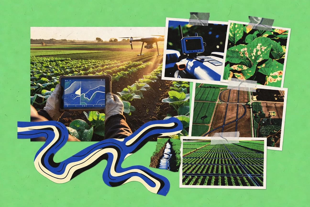
Compare Agricultural Mapping Software picks with ranking criteria, including Esri ArcGIS, Google Earth Engine, and QGIS, for technical buyers.

How we ranked these tools
Core product claims cross-referenced against official documentation, changelogs, and independent technical reviews.
Analyzed video reviews and hundreds of written evaluations to capture real-world user experiences with each tool.
AI persona simulations modeled how different user types would experience each tool across common use cases and workflows.
Final rankings reviewed and approved by our editorial team with authority to override AI-generated scores based on domain expertise.
Score: Features 40% · Ease 30% · Value 30%
Gitnux may earn a commission through links on this page — this does not influence rankings. Editorial policy
Editor’s top 3 picks
Three quick recommendations before you dive into the full comparison below — each one leads on a different dimension.
Esri ArcGIS
ArcGIS Image for raster analysis and change detection across imagery layers
Built for agronomy, precision agriculture teams needing scalable GIS mapping and analysis.
Google Earth Engine
Editor pickCode Editor-driven, server-side geospatial processing on Earth-scale image collections
Built for remote-sensing teams mapping crop conditions with cloud-scale analysis and exports.
QGIS
Editor pickProcessing Toolbox with Model Builder and geoprocessing algorithms for repeatable spatial workflows
Built for agronomy teams needing advanced GIS analysis and custom mapping workflows.
Related reading
Comparison Table
The comparison table evaluates agricultural mapping tools across integration depth, data model, and the automation and API surface for ingesting imagery, field boundaries, and agronomy outputs. It also highlights admin and governance controls such as RBAC, provisioning workflows, and audit log coverage, plus extensibility paths for custom schema and processing throughput. Entries include ArcGIS, Google Earth Engine, QGIS, Sentera Opti, Climate FieldView, and other leading platforms.
Esri ArcGIS
GIS platformArcGIS provides map authoring, geocoding, GIS data layers, and field mapping workflows for farm and crop mapping at local and enterprise scale.
ArcGIS Image for raster analysis and change detection across imagery layers
ArcGIS supports agricultural mapping through a full GIS stack that includes data creation, editing, and publication for both feature layers and raster layers. It enables location-aware operational workflows by letting teams package web maps and services into apps that guide field data capture, inspection, and decision support tied to the same authoritative spatial data.
For enrichment, the platform fits agriculture because it supports analytical workflows such as suitability modeling, site selection, and change detection using imagery and derived layers. These workflows can be chained into automated processes through geoprocessing tools and scheduled tasks that update dashboards and map experiences as new observations arrive.
A practical tradeoff is that ArcGIS’s breadth requires stronger GIS governance to keep coordinate systems, layer schemas, and data quality consistent across field collection, analysis, and reporting. Field teams often benefit from using preconfigured templates for map-centric tasks, while analysts and GIS administrators typically handle the configuration of services and the validation rules that prevent misaligned edits.
- +Robust web maps, dashboards, and apps built on reusable GIS services
- +Powerful spatial analysis tools for raster, vector, and terrain data
- +Strong data governance with feature services, geodatabases, and editing
- +Workflow support through automation patterns using GIS geoprocessing
- +High interoperability with common satellite and remote-sensing data formats
- –Advanced analysis requires GIS expertise and careful dataset preparation
- –App customization can become complex across maps, layers, and permissions
- –Performance tuning is needed for large farms with dense imagery
Farm operators and agronomy field teams using mobile map-based data capture
Record crop condition observations and scouting notes against parcel boundaries in the field
Field observations appear on parcel-level maps quickly, reducing time spent reconciling spreadsheets with locations.
GIS analysts building environmental and agronomic decision layers
Run suitability modeling that combines soils, slope, climate normals, and irrigation constraints to support planting decisions
Decision maps are standardized and reusable, so future seasons use consistent inputs and model logic.
Show 2 more scenarios
Operations managers coordinating multi-source monitoring over time
Detect changes in vegetation or land cover using imagery and update alerts for priority areas
Monitoring outputs translate into actionable work queues aligned to the affected locations.
ArcGIS change detection workflows can compare temporal raster imagery and produce new layers that flag differences for review. These outputs can feed map-based operations views and drive follow-up tasks through configured dashboards and web maps.
Enterprise mapping teams standardizing spatial data across regions
Maintain a governed set of parcel, boundary, and sensor layers shared across departments and regions
Teams across regions use the same authoritative boundaries and layer schemas for reporting and planning.
ArcGIS supports centralized management of geospatial content through shared services and consistent data models used by multiple teams. Governance reduces drift between regional datasets by keeping layer definitions and publication patterns aligned across the organization.
Best for: Agronomy, precision agriculture teams needing scalable GIS mapping and analysis
More related reading
Google Earth Engine
remote sensingEarth Engine processes satellite imagery and geospatial datasets to generate agricultural layers like vegetation indices and land cover maps for farms.
Code Editor-driven, server-side geospatial processing on Earth-scale image collections
Google Earth Engine stands out for its planet-scale satellite and geospatial archive paired with scalable cloud computation. It supports agricultural mapping workflows using scripts, imagery collections, and geospatial analysis for land cover, vegetation, and change detection.
A large catalog of ready-to-use datasets and example scripts helps teams move from data access to analysis quickly. Outputs can be exported for further modeling or reporting, including rasters and derived vector layers.
- +Massive satellite catalog enables rapid crop and vegetation monitoring
- +Built-in geospatial operations for indices, classifications, and change detection
- +Scalable cloud processing handles large regions without local GIS bottlenecks
- +Export tools support rasters and vectors for downstream agronomy workflows
- –JavaScript or Python scripting is required for most production workflows
- –Debugging and validation can be difficult for non-programmers
- –Training data preparation and ground truth integration require careful planning
- –Operational dashboarding and field workflow tools are limited versus dedicated apps
Crop monitoring teams at agribusinesses and service providers
Vegetation index monitoring across multiple farms using time-series satellite imagery for field-level status checks
Near-real-time maps and tabular summaries that highlight emerging stress patterns for crop management and agronomic review.
Remote sensing analysts in agriculture research groups
Land cover and crop classification using training samples and supervised or unsupervised classification over multiple regions
Repeatable classification outputs with derived accuracy metrics that support study reporting and multi-season comparisons.
Show 2 more scenarios
Environmental compliance and spatial planning teams
Change detection for cultivation expansion, deforestation signals, and land disturbance monitoring
Documented change layers aligned to reporting boundaries that can feed audit workflows and regulatory submissions.
Earth Engine supports change detection workflows that combine multi-temporal imagery, thresholding or classification logic, and spatial masking. Teams can produce change rasters and convert detected areas into vector geometries for review.
Geospatial developers building internal agricultural analytics pipelines
Automated export of derived rasters and vector features for downstream modeling in GIS and machine learning tools
Curated analysis products stored for downstream dashboards, crop yield modeling, and post-processing in external systems.
Earth Engine provides export mechanisms for rasters and derived vector products, which can be integrated into external processing systems. Developers can orchestrate analysis at scale using scripts and geospatial reducers before exporting results.
Best for: Remote-sensing teams mapping crop conditions with cloud-scale analysis and exports
QGIS
open-source GISQGIS is an open-source desktop GIS used to create, edit, and analyze agricultural maps using shapefiles, raster layers, and spatial tools.
Processing Toolbox with Model Builder and geoprocessing algorithms for repeatable spatial workflows
QGIS stands out for its GIS depth and open data workflows that map fields, soils, and infrastructure with layered geospatial analysis. It supports raster and vector layers, georeferencing, digitizing, and spatial processing tools suited for agriculture map production and inspection.
Styling, labeling, and map layout exports help turn analysis outputs into shareable farm or district maps. Python scripting and a large plugin ecosystem extend capabilities for custom agricultural workflows.
- +Robust raster and vector toolset for field mapping and analysis
- +Flexible cartography with styles, labels, and publication-grade print layouts
- +Extensive plugin support for agricultural mapping add-ons
- +Python and processing models enable repeatable workflows
- –Steeper learning curve for advanced geoprocessing and data models
- –Desktop-first workflow can add overhead for mobile field edits
- –Data cleaning and projection management require careful setup
- –Some agriculture-specific tasks depend on plugins or manual configuration
Agricultural extension officers and agronomists
Creating field-level disease risk maps by joining climate rasters to farm parcel boundaries and symbolizing severity classes
Extension teams produce farm-specific, print-ready maps that highlight which parcels need targeted scouting.
Farm managers and landowners
Monitoring irrigation and drainage issues using digitized canal networks and elevation-derived slope and flow proxies
Managers get location-specific map layers that guide where to inspect valves, clean channels, or adjust drainage.
Show 2 more scenarios
Soil survey teams and environmental consultants
Preparing soil property map packages by georeferencing legacy soil survey sheets and modeling spatial interpolation outputs
Consultants deliver standardized soil maps that align soil sampling data with GIS-ready coordinate frameworks.
QGIS georeferences scanned survey maps, manages coordinate systems for soil sampling points, and supports interpolation and raster handling for soil attribute surfaces.
GIS analysts working with public agriculture agencies
Building recurring geoprocessing workflows for agricultural zoning and infrastructure planning
Agencies maintain consistent zoning and infrastructure map outputs that reduce manual remapping between project cycles.
QGIS supports reproducible geospatial processing with Python scripting and processing models so agency staff can run the same layered workflow across districts.
Best for: Agronomy teams needing advanced GIS analysis and custom mapping workflows
More related reading
Sentera Opti
crop scoutingSentera Opti provides crop scanning workflows and spatial crop insights by linking field data capture to map-based agronomic recommendations.
Crop health map creation using Sentinel-based vegetation indices for field scouting
Sentera Opti stands out by centering mapping around field-level crop health insights from Sentinel imagery and related agronomic data. The workflow supports creating agronomic maps and interpreting vegetation signals for scouting and decision-making. Users can package results into shareable outputs for agronomists and farm teams.
- +Field mapping focused on crop health signals for actionable scouting
- +Agronomic map outputs are easy to share with farm teams
- +Designed for recurring monitoring as imagery and indices update
- +Supports workflows aligned to spot issues across zones
- –Limited control compared with GIS-first tools for custom layers
- –Map interpretation can require agronomy context to avoid false flags
- –Integration options for nonstandard data sources can be restrictive
- –Advanced analysis depth lags specialized remote-sensing platforms
Best for: Agronomy teams generating recurring crop health maps without GIS heavy customization
Climate FieldView
farm operationsClimate FieldView centralizes farm and field mapping data to support variable-rate operations and seasonal agronomy visibility.
Prescription map creation tied to FieldView field-layer workflows
Climate FieldView distinguishes itself with end-to-end field operations workflows tied to mapping, recommendations, and prescription-style job planning. The platform supports collecting and syncing agronomic layers such as yield and soil-related datasets with field boundaries for decision-ready maps. Core capabilities include variable-rate map creation, layered visualization, and export of application-ready guidance for compatible hardware and workflows.
- +Field maps connect directly to prescription-style job planning workflows.
- +Layered visualization supports combining agronomic datasets with clear field boundaries.
- +Export-ready mapping outputs fit operator and machine guidance use cases.
- –Setup and data onboarding can be slow for new farms and new workflows.
- –Some advanced mapping tasks require specialist attention to data quality.
- –Integration depth depends on compatible hardware and supported operational processes.
Best for: Agronomy teams needing prescription mapping and layered field decisions
Taranis
aerial intelligenceTaranis uses aerial imagery and machine learning to detect crop issues and deliver field-level maps for targeted interventions.
AI-driven crop stress scoring with zone-level issue maps
Taranis stands out for turning drone and satellite imagery into automated farm insights using an AI workflow. The platform supports vegetation and crop stress analysis, field boundary mapping, and issue detection for actionable scouting.
Teams can visualize results at field and zone levels to prioritize where agronomy interventions are needed. Taranis also emphasizes repeatable analysis over time to track changes across growing seasons.
- +Automated crop stress detection from imagery reduces manual scouting effort
- +Field and zone visualizations support clear agronomic prioritization
- +Time-based comparisons help track changes across growth stages
- +Guided workflows turn imagery uploads into decision-ready outputs
- –Best results depend on image quality, timing, and consistent capture setups
- –Not all agronomic layers integrate cleanly into existing GIS or farm software
- –Higher-level analytics can be less transparent for troubleshooting model outputs
Best for: Agronomy teams needing automated crop problem detection from drone or satellite imagery
More related reading
Farmers Edge
agronomy analyticsFarmers Edge provides digital agronomy mapping using satellite, field scouting data, and decision support built around crop management zones.
Farm-scale agronomic mapping that converts spatial layers into actionable recommendations
Farmers Edge stands out by tying mapping outputs to agronomic decision support built for field operations. The system supports soil and crop management mapping workflows with spatial layers used to guide recommendations.
It focuses on farm-scale analytics rather than general-purpose GIS tooling, which streamlines adoption for agricultural teams. Farmers Edge is best evaluated for how well its mapping integrates with its recommendations and data management around fields.
- +Agronomy-focused mapping layers align directly with field decision workflows
- +Field-scale analytics support practical operational planning instead of raw GIS exports
- +Spatial data organization reduces the effort to manage maps across seasons
- –Less suitable for teams that need full custom GIS analysis and scripting
- –Workflow strength depends on the ecosystem and expected data inputs
- –Interoperability with nonstandard external mapping stacks can be restrictive
Best for: Agronomy teams needing decision-ready farm mapping for field operations
CropIn
farm analyticsCropIn delivers farm mapping and agronomic analytics that fuse satellite data and farm operations into actionable field insights.
Parcel-based crop monitoring dashboard that links mapped fields to agronomic recommendations
CropIn stands out for combining agronomy intelligence with farm-level geospatial mapping workflows. The platform supports field boundary capture, crop planning, and monitoring views that help teams track crop status across regions.
It also emphasizes actionable recommendations tied to field activity, soil, and operational data rather than offering mapping alone. CropIn is strongest for agriculture teams that need map-driven decision support across many parcels, not just static GIS visuals.
- +Field-level mapping integrated with crop monitoring and agronomy workflows
- +Actionable recommendations connected to mapped parcels and operational context
- +Designed for multi-location deployments with consistent farm views
- –Setup and data onboarding take time to reach reliable mapping outputs
- –Geospatial tooling is less developer-flexible than full GIS platforms
- –Advanced custom analysis needs stronger internal process discipline
Best for: Agronomy teams needing parcel mapping with decision support across many farms
More related reading
EOSDA Crop Monitoring
crop monitoringEOSDA Crop Monitoring produces map-based crop monitoring outputs using satellite imagery and field analytics for farm management.
Time-series crop stress monitoring with automated alerts per field and date
EOSDA Crop Monitoring focuses on satellite-driven crop analytics with field-scale maps and time series that support monitoring rather than only one-off mapping. It provides vegetation and stress indicators derived from optical and radar sources, with workflows for comparing conditions across dates and locations. The platform also supports alerts and reporting outputs tied to agronomic tasks such as crop health tracking and field-level evaluation.
- +Field-level vegetation and stress mapping with clear temporal comparisons
- +Multi-sensor inputs help coverage when cloud conditions limit optical imagery
- +Alerting and reporting outputs reduce manual map review time
- –Setup of monitoring parameters and thresholds can feel complex
- –Less suited to custom GIS workflows needing full manual geoprocessing control
- –Field boundaries and crop calendars must be curated for accurate interpretation
Best for: Agronomists and mapping teams needing repeatable crop monitoring across many fields
Agremo
farm monitoringAgremo offers spatial crop intelligence that maps field variability and supports agronomic decision-making from satellite and field data.
Field parcel mapping with editable boundaries and annotation layers in one workspace
Agremo focuses on field mapping workflows that connect imagery, boundaries, and operational data into a single place for farms and agronomy teams. The product supports map-driven tasks like viewing field parcels, annotating areas, and organizing agronomic context alongside spatial layers. Agremo’s distinct value is turning farm locations into a usable workflow for planning and follow-up rather than only producing static maps.
- +Map-first workflow links parcels to agronomy context
- +Supports creating and managing field boundaries for operational use
- +Enables annotations on top of spatial views for field communication
- +Centralizes field information so teams can reference the same map
- –Best results depend on consistent geodata and boundary setup
- –Advanced automation and integrations are less comprehensive than top-tier platforms
- –Layer-heavy views can feel dense for users new to mapping tools
Best for: Agronomy teams needing map-based field organization and collaboration
Conclusion
After evaluating 10 agriculture farming, Esri ArcGIS stands out as our overall top pick — it scored highest across our combined criteria of features, ease of use, and value, which is why it sits at #1 in the rankings above.
Use the comparison table and detailed reviews above to validate the fit against your own requirements before committing to a tool.
How to Choose the Right Agricultural Mapping Software
This buyer’s guide covers Esri ArcGIS, Google Earth Engine, and QGIS alongside agriculture-focused platforms like Climate FieldView, Taranis, EOSDA Crop Monitoring, and Sentera Opti.
The guide also compares operational and collaboration tools like Farmers Edge, CropIn, and Agremo to help teams match integration depth, data model fit, and automation or API surface to their workflow.
Coverage focuses on selection controls like RBAC style governance, auditability expectations, configuration discipline, and extensibility paths that affect field operations and analytics throughput.
Agricultural mapping software that ties spatial data to field operations and agronomy outputs
Agricultural mapping software turns field boundaries, imagery, and agronomic layers into map outputs that can drive scouting, variable-rate decisions, prescription planning, or monitoring alerts.
Esri ArcGIS represents the general-purpose end of this spectrum by combining feature layers, raster analysis, and field data capture workflows tied to authoritative services.
Google Earth Engine represents the remote-sensing end by running script-driven processing over planet-scale imagery collections to produce vegetation indices, land cover, and change detection exports.
Teams typically use these tools to maintain consistent layer schemas across seasons, automate repeatable spatial workflows, and publish maps or field-ready outputs that match operational hardware and roles.
Integration depth, governed data models, and automation or API surfaces that match farm workflows
Agricultural mapping selection depends on how tool internals represent spatial data as a data model and how that model stays consistent across ingest, processing, and publication.
Automation depth matters most when mapping results must update on a schedule after new imagery or field observations arrive, because manual relabeling and schema edits quickly break repeatability.
Administrative and governance controls decide whether map layers, coordinate systems, and edit rules stay aligned across field crews, analysts, and GIS administrators.
Extensibility decides whether custom sensors, derived layers, or internal analytics can be integrated without rebuilding the entire workflow.
Geospatial data model consistency across feature and raster layers
ArcGIS supports both feature layers and raster or terrain workflows inside a single GIS stack, which keeps layer schemas consistent from editing to dashboards and apps. QGIS can deliver the same breadth through desktop processing models, but teams must manage projection handling and data cleaning to avoid schema drift.
Automation surface for repeatable imagery and change detection workflows
ArcGIS uses geoprocessing tools and scheduled tasks to update dashboards and map experiences as new observations arrive. Google Earth Engine provides a code editor-driven processing pipeline for server-side operations across Earth-scale imagery collections, which supports repeatable indices, classifications, and change detection for exporting.
API and automation extensibility for integrating internal pipelines
ArcGIS service-based workflows and app packaging patterns make it easier to connect mapping outputs to custom decision apps and field capture experiences built on the same spatial services. Google Earth Engine’s script-first workflow requires production scripting in JavaScript or Python, which offers a high automation surface but raises debugging and validation complexity.
Governance controls for edits, permissions, and data quality rules
ArcGIS emphasizes strong data governance through feature services, geodatabases, and editing validation patterns that GIS administrators configure to prevent misaligned edits. QGIS can be extended with Python and processing models, but governance and edit controls depend more on how the team sets up desktop-first workflows and shared datasets.
Agronomy workflow outputs tied to prescriptions, zones, or parcel recommendations
Climate FieldView ties mapping to prescription-style job planning and exports application-ready guidance for compatible operator workflows. Farmers Edge and CropIn tie spatial layers to field decision support by organizing data around management zones or parcels and linking mapped boundaries to recommendations.
Remote sensing pipeline fit for vegetation, stress, and time-series monitoring
Sentera Opti focuses on crop health map creation using Sentinel-based vegetation indices to support recurring scouting. EOSDA Crop Monitoring adds time-series crop stress monitoring with automated alerts per field and date and uses multi-sensor inputs to reduce cloud gaps.
A decision framework for matching mapping outputs to integration, schema, and automation requirements
Start by mapping the required output type to the tool’s data model and workflow shape. ArcGIS fits teams needing authoritative feature and raster services with field capture apps and analytical chains, while Google Earth Engine fits teams needing automated satellite processing that exports derived rasters and vectors.
Next, validate how results update over time and how governance keeps edits and schemas consistent. Climate FieldView and EOSDA Crop Monitoring focus on field or temporal monitoring loops that can be operationalized with layered visualization and alerting, while QGIS and ArcGIS fit teams that will run custom geoprocessing repeatably.
Define the authoritative spatial layer type and who edits it
If field crews and GIS admins must edit authoritative boundaries and layers, ArcGIS provides strong editing governance through feature services and validation rules configured by GIS administrators. If mapping is primarily desktop-centric with local shapefiles and raster layers, QGIS can support georeferencing, digitizing, and spatial processing, but projection and data cleaning must be handled carefully.
Match remote-sensing automation to the expected production workflow
For planet-scale satellite processing that runs server-side with a code editor workflow, Google Earth Engine is designed around scripts that generate vegetation indices, land cover, and change detection exports. For Sentinel-index crop health maps intended for scouting, Sentera Opti centers workflows on vegetation signal interpretation aligned to recurring monitoring.
Check whether the tool provides operational outputs or only analytics
If mapping must produce prescription-style job plans and guidance for compatible hardware, Climate FieldView connects field-layer workflows to prescription map creation and export-ready guidance. If mapping must prioritize interventions from drone or satellite imagery with automated issue scoring, Taranis converts imagery uploads into guided, zone-level issue maps.
Evaluate governance and permissions depth before scaling to multi-farm operations
ArcGIS supports a governance pattern based on service packaging and editing validation, which reduces misaligned edits when multiple roles touch the same spatial assets. Farmers Edge and CropIn reduce governance overhead by focusing on decision-ready layers aligned to their ecosystems, which can limit full custom GIS analysis and scripting for teams that need it.
Design for integration breadth or constrain to an ecosystem on purpose
If the goal is integration breadth across imagery formats, derived layers, and app experiences, ArcGIS delivers strong interoperability for raster analysis and change detection with packaged web maps and services. If the goal is consistent farm views and parcel-linked recommendations across locations, CropIn and Farmers Edge emphasize multi-location deployments and farm-scale analytics over developer flexibility.
Verify extensibility for custom layers and troubleshooting requirements
If custom geoprocessing must be repeatable, QGIS provides a Processing Toolbox with Model Builder and processing algorithms plus Python and a plugin ecosystem. If model transparency and troubleshooting are essential, QGIS and ArcGIS allow more controllable step-by-step workflows, while Taranis can keep higher-level analytics less transparent for troubleshooting model outputs.
Tool selection by operational role and workflow intent
Agricultural mapping tools split by workflow intent: general GIS stacks for governed layer editing and publication versus monitoring and decision platforms that bind mapping outputs to agronomy actions.
The right fit depends on whether the team owns the data model, needs automation for time-series updates, or requires prescription-style job guidance built into field operations.
Precision agriculture GIS teams that need governed feature and raster workflows
Esri ArcGIS fits teams that need reusable GIS services for web maps, dashboards, and apps plus analytical chains like suitability modeling and change detection. QGIS also fits when desktop-first repeatability and custom cartography are required, but governance and projection management add setup overhead.
Remote-sensing teams producing vegetation and land cover outputs at scale
Google Earth Engine fits teams that can run JavaScript or Python scripts for server-side geospatial processing and exports derived rasters and vectors. EOSDA Crop Monitoring fits teams that want monitoring-oriented time series with multi-sensor coverage and automated alerts per field and date without manual review loops.
Agronomy teams that need scouting and intervention maps with minimal GIS customization
Sentera Opti fits recurring scouting workflows that convert Sentinel signals into crop health maps for field interpretation. Taranis fits drone or satellite issue detection with AI-driven crop stress scoring and zone-level issue maps designed for targeted interventions.
Operators and agronomists who need prescription mapping tied to field execution
Climate FieldView fits teams that need prescription map creation connected to FieldView field-layer workflows and export-ready guidance for compatible operational hardware. Farmers Edge and CropIn fit teams that want decision-ready farm mapping that ties spatial layers to recommendations through field operations ecosystems.
Multi-location teams that need parcel organization and collaboration with consistent views
CropIn fits teams that map parcels across many farms and connect mapped fields to actionable recommendations tied to operational context. Agremo fits collaboration workflows that center field parcel mapping with editable boundaries and annotation layers inside one workspace.
Common failure modes when adopting agricultural mapping tools
Most adoption problems come from mismatched expectations about how the tool represents spatial data and how automation and governance behave at scale.
Several cons across ArcGIS, Google Earth Engine, QGIS, and the agriculture-focused platforms show that layer schema discipline, scripting requirements, and integration breadth are frequent bottlenecks.
Assuming raster and feature edits will stay consistent without governance
ArcGIS reduces schema and coordinate misalignment through editing validation configured with feature services and geodatabases, which should be treated as a deployment requirement. QGIS can support both raster and vector work, but desktop workflows demand careful projection management and data cleaning to prevent inconsistent datasets.
Choosing a remote-sensing platform without planning for script-based production
Google Earth Engine requires JavaScript or Python scripting for most production workflows, so non-programmers often struggle with debugging and validation. Taranis can automate issue scoring from imagery uploads, but higher-level analytics can be less transparent for troubleshooting model outputs.
Building decision workflows on mapping outputs that do not connect to prescription or recommendations
Climate FieldView connects mapping to prescription-style job planning and export-ready guidance, so plain map exports alone will miss the operational loop it is designed to complete. Farmers Edge and CropIn are strong where recommendations and zone or parcel structures are required, so exporting generic GIS maps instead can undermine their intended decision support.
Underestimating onboarding effort for monitoring parameters and thresholds
EOSDA Crop Monitoring requires setup of monitoring parameters and thresholds, and field boundaries and crop calendars must be curated for accurate interpretation. Sentera Opti delivers scouting-oriented crop health maps, but interpretation still needs agronomy context to avoid false flags.
Overrelying on ecosystem integrations while needing full custom GIS analysis
Farmers Edge and Sentera Opti are optimized for agronomy workflows and can limit control compared with GIS-first tools for custom layers. QGIS and ArcGIS are better aligned to repeatable custom geoprocessing, but they demand GIS expertise and careful dataset preparation.
How We Selected and Ranked These Tools
We evaluated Esri ArcGIS, Google Earth Engine, QGIS, and the agriculture-focused platforms by scoring features, ease of use, and value from the provided review evidence, with features carrying the most weight at 40% while ease of use and value each account for the remaining share. The ranking reflects how each tool’s spatial workflow shape supports agricultural mapping needs like raster change detection, parcel-linked recommendations, zone-level issue scoring, and time-series monitoring outputs.
Esri ArcGIS set the pace because it combines raster analysis and change detection through ArcGIS Image with strong data governance for editing using feature services and geodatabases. That combination lifted ArcGIS most on features and also improved ease of scaling compared with tools that either require script-heavy production like Google Earth Engine or limit control for custom GIS layers like Sentera Opti and Farmers Edge.
Frequently Asked Questions About Agricultural Mapping Software
How do ArcGIS, Google Earth Engine, and QGIS differ for producing agricultural change-detection outputs?
Which tools fit best for parcel-level field mapping versus farm-scale agronomy dashboards?
What integration and API options support automated workflows with mapping layers and exports?
How do these platforms handle data model consistency across field editing and analytic layers?
What are the main security controls and access-management features to evaluate when multiple teams edit and view maps?
How should teams plan migration when moving existing boundaries, shapefiles, or layer schemas into a new mapping workflow?
Which tools support recurring operational mapping without heavy GIS administration?
How do workflow outputs differ across remote sensing analysis tools and agronomy-focused mapping tools?
What technical requirements commonly affect performance when mapping large imagery areas or high-frequency updates?
Tools reviewed
Primary sources checked during evaluation.
Referenced in the comparison table and product reviews above.
Keep exploring
Comparing two specific tools?
Software Alternatives
See head-to-head software comparisons with feature breakdowns, pricing, and our recommendation for each use case.
Explore software alternatives→In this category
Agriculture Farming alternatives
See side-by-side comparisons of agriculture farming tools and pick the right one for your stack.
Compare agriculture farming tools→FOR SOFTWARE VENDORS
Not on this list? Let’s fix that.
Our best-of pages are how many teams discover and compare tools in this space. If you think your product belongs in this lineup, we’d like to hear from you—we’ll walk you through fit and what an editorial entry looks like.
Apply for a ListingWHAT THIS INCLUDES
Where buyers compare
Readers come to these pages to shortlist software—your product shows up in that moment, not in a random sidebar.
Editorial write-up
We describe your product in our own words and check the facts before anything goes live.
On-page brand presence
You appear in the roundup the same way as other tools we cover: name, positioning, and a clear next step for readers who want to learn more.
Kept up to date
We refresh lists on a regular rhythm so the category page stays useful as products and pricing change.