GITNUXSOFTWARE ADVICE
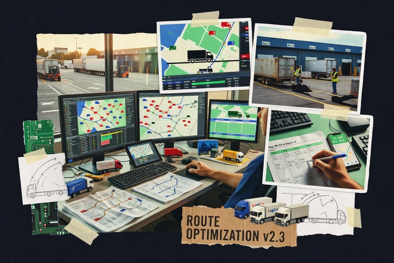
Transportation LogisticsTop 10 Best Transport Planning Software of 2026
Discover the top 10 transport planning software solutions. Compare features and find the best fit—read our expert guide now.

How we ranked these tools
Core product claims cross-referenced against official documentation, changelogs, and independent technical reviews.
Analyzed video reviews and hundreds of written evaluations to capture real-world user experiences with each tool.
AI persona simulations modeled how different user types would experience each tool across common use cases and workflows.
Final rankings reviewed and approved by our editorial team with authority to override AI-generated scores based on domain expertise.
Score: Features 40% · Ease 30% · Value 30%
Gitnux may earn a commission through links on this page — this does not influence rankings. Editorial policy
Editor picks
Three quick recommendations before you dive into the full comparison below — each one leads on a different dimension.
TransCAD
GIS-driven network modeling with integrated trip assignment and skims generation
Built for transport planning teams building repeatable GIS-based forecasting studies.
PTV VISUM
Runner UpIntegrated OD-based four-step demand modeling with advanced assignment and calibration
Built for regional and national transport agencies building calibrated multi-modal demand models.
Aimsun
Also GreatAimsun micro-simulation for evaluating road network operations under scenario changes
Built for transport planning teams needing microscopic simulation and scenario evaluation.
Related reading
Comparison Table
This comparison table evaluates transport planning software used for traditional travel demand modeling and multimodal network analysis, including TransCAD, PTV VISUM, PTV Vissim, Aimsun, and SYSTRA Planex. You can compare modeling scope, network representation, demand and assignment capabilities, and typical workflows across each platform to match tool selection to project needs.
TransCAD
GIS transport modelingTransCAD provides GIS-enabled transport modeling, routing, demand forecasting, and network analysis for planning projects.
GIS-driven network modeling with integrated trip assignment and skims generation
TransCAD from Caliper stands out with deep transport modeling workflows built around GIS-driven data handling and network analysis. It supports classic planning tasks like multimodal network modeling, demand modeling, trip assignment, and route analysis with configurable assignment methods.
The software also emphasizes visualization and map-based QA so planners can inspect matrices, skims, and network performance in spatial context. Strong support for scripting and model configuration makes it fit repeatable studies with large datasets and structured scenario management.
- +GIS-first workflow for networks, zones, and spatial QA
- +Comprehensive transport modeling from demand to assignment
- +Scenario management supports repeated study runs
- +Strong reporting and map-based outputs for stakeholders
- –Steeper learning curve than lightweight planning tools
- –Requires data preparation discipline for best results
- –Interface can feel dated for modern UX expectations
Best for: Transport planning teams building repeatable GIS-based forecasting studies
More related reading
PTV VISUM
strategic planningPTV VISUM supports multi-modal transport planning with network assignment, demand modeling, and scenario analysis.
Integrated OD-based four-step demand modeling with advanced assignment and calibration
PTV VISUM stands out for its graph- and network-based transport demand modeling workflow that supports full multi-modal planning in a single environment. It combines trip distribution, mode choice, and assignment methods on large transport networks to produce OD-based results and route performance metrics.
Strong import and export support lets teams connect VISUM with external data pipelines for network coding, scenarios, and reporting. Model calibration and validation tools help planners tune parameters using observed counts and OD data to improve scenario credibility.
- +Advanced OD demand modeling with distribution, mode split, and assignment in one workflow
- +Scales to large multi-modal networks with detailed link and node coding
- +Calibration and validation tooling supports counts and OD-based parameter tuning
- +Scenario management and result reporting fit structured transport planning studies
- –Learning curve is steep for new modelers and analysts
- –Model setup and data preparation time is high for realistic networks
- –Licensing and deployment costs can be heavy for small teams
- –Visual outputs depend on careful network coding and consistent scenario inputs
Best for: Regional and national transport agencies building calibrated multi-modal demand models
PTV Vissim
microsimulationPTV Vissim delivers microscopic traffic simulation for signal control, lane-based behavior, and operational scenario testing.
Microscopic traffic simulation with customizable driver behavior and traffic signal control.
PTV Vissim stands out for microscopic traffic simulation that models individual vehicle behavior with detailed control and routing logic. It supports traffic signal control, lane-changing, driving behavior parameters, and integration with external tools for scenario and demand modeling.
The software is also used for multimodal studies by coupling traffic simulation with public transport modeling workflows. Strong visualization and analysis help planners compare performance metrics like delays, queue lengths, and throughput across alternatives.
- +Microscopic simulation captures lane choice and car-following behavior in detail
- +Built-in traffic signal control supports realistic actuator and phase logic
- +Scenario comparison tools streamline evaluating delays, queues, and throughput
- +Extensible interfaces support workflows with demand and network data tools
- –Model setup requires specialized knowledge of driver and signal parameters
- –Large networks can demand high computing resources and careful performance tuning
- –Licensing and implementation costs can be heavy for small teams
Best for: Transportation agencies and consultancies running detailed, signal-focused traffic studies
Aimsun
traffic simulationAimsun provides traffic simulation and analysis for urban systems, including advanced vehicle behavior and network performance evaluation.
Aimsun micro-simulation for evaluating road network operations under scenario changes
Aimsun stands out for traffic simulation and policy analysis aimed at public agencies and consultants working on complex, multi-modal networks. It supports microscopic traffic simulation tied to demand, control, and signal or network operational studies.
Users typically build scenarios, calibrate performance, and compare variants to quantify network impacts. The workflow favors technical teams comfortable with model setup, calibration, and results validation.
- +Microscopic traffic simulation supports detailed operational impact studies
- +Scenario comparison supports policy and network change performance evaluation
- +Calibration and assignment workflows fit agency-grade transport modeling needs
- –Model setup and calibration require specialized transport modeling expertise
- –User experience can feel heavy for one-off studies and small teams
- –Integration and data preparation time can dominate project schedules
Best for: Transport planning teams needing microscopic simulation and scenario evaluation
SYSTRA Planex
planning platformSYSTRA Planex enables transport planning through strategic modeling workflows, scenario planning, and analysis for policy decisions.
Scenario comparison workspace that ties assumptions to outputs for transport planning reviews
SYSTRA Planex focuses on transport planning workflows with integrated model setup, demand analysis, and scenario evaluation in one environment. It supports multi-modal planning use cases like ridership forecasting, network impacts, and schedule or service assumptions tied to planning decisions.
Collaboration and controlled scenario management help teams compare options with consistent inputs and outputs. Reporting and export tools support downstream review by transport planners and decision stakeholders.
- +Integrated scenario management keeps planning inputs consistent across comparisons
- +Multi-modal transport planning supports network and demand evaluation in one workflow
- +Reporting outputs fit review cycles for planners and decision-makers
- –Setup and modeling workflows can require strong planning domain knowledge
- –Customization flexibility can demand professional services or configuration effort
- –User experience feels geared to specialists rather than casual analysis
Best for: Transport planning teams needing scenario comparison for multimodal network decisions
Downtown Planner
planning workflowsDowntown Planner supports transport and traffic planning for streets and intersections with interactive tools for workflow and reporting.
Downtown map-based scenario workflow that links assumptions to evaluation outputs
Downtown Planner focuses on downtown-specific transport planning workflows with a map-first workflow and street segment level analysis. It supports scenario planning inputs like traffic, parking, and transit assumptions tied to an evaluation workflow. The tool emphasizes collaboration around plan alternatives and helps structure outputs for stakeholder review.
- +Map-first workflow ties planning assumptions to street segments
- +Scenario planning structure supports comparing downtown alternatives
- +Collaboration features help teams review plan iterations
- –Downtown-only focus limits fit for citywide or corridor modeling
- –Advanced transport modeling depth is weaker than specialized simulation tools
- –Setup and data preparation feel heavier than simple planning dashboards
Best for: Downtown teams comparing traffic and parking scenarios with map-based collaboration
OpenTripPlanner
open-source routingOpenTripPlanner generates multi-modal trip planning using an open-source routing and itinerary engine.
Time-dependent transit routing with itinerary generation using a prebuilt routing graph
OpenTripPlanner stands out as a highly configurable open-source route planning and timetable routing engine driven by General Transit Feed Specification data. It supports multimodal trip planning with real-world constraints like transfers, departure and arrival windows, and accessibility options.
You get detailed outputs for public transport trip choices, including itinerary generation and route alternatives, with customization through configuration files and extensions. Use it to power transport planning workflows, from scenario-based accessibility analysis to custom mobility apps built on its graph and routing core.
- +Open-source routing engine supports deep customization via configuration
- +Multimodal transit itineraries with time-dependent routing and transfers
- +Strong support for GTFS-to-routing graph generation workflows
- +Extensible architecture enables custom costing, constraints, and analysis
- –Setup and operational tuning require technical skills and planning
- –User-facing UI and reporting are not provided as a complete product
- –Performance tuning for large regions needs engineering effort
- –Data quality issues in GTFS propagate into itinerary results
Best for: Teams building custom transit trip planners, accessibility analyses, or routing services
OSRM
routing engineOSRM runs high-performance routing on OpenStreetMap data to compute fast travel paths for transport modeling pipelines.
Built-in routing and matrix services exposed as an OSRM HTTP API
OSRM stands out for using open geospatial data and exposing fast, standards-based routing via an API rather than a spreadsheet workflow. It delivers turn-by-turn road routing with support for routing profiles and travel-time calculations, which fits transport planning when you need repeatable network computations.
It also supports batch and matrix-style requests for large OD analyses, making it practical for modeling scenarios like freight corridors and service areas. Setup requires running an OSRM server and tuning data and profiles to match your network and time assumptions.
- +API-first routing with fast response times for repeated transport analyses
- +Support for routing profiles to model different vehicle behaviors on the same network
- +Efficient matrix routing for OD studies and scenario comparisons
- –Self-hosting and tuning add operational burden for planning teams
- –Limited built-in planning UI for GIS preprocessing and results visualization
- –Time-dependent modeling depends on your inputs and custom configuration
Best for: Transport teams running OD and network-routing workflows with an API
GraphHopper
routing APIGraphHopper provides an API for routing and accessibility calculations built for fast travel-time computation.
Matrix API for fast travel-time and distance computations across many stops
GraphHopper stands out with high-performance route optimization powered by an advanced routing engine for road networks. It supports transport planning workflows with APIs for routing, turn-by-turn directions, and routing for trucks and other vehicle profiles.
You can model time-dependent travel costs with factors like speed profiles and restrictions while generating repeatable routes at scale. The core strength is developer-driven routing computation rather than a built-in, drag-and-drop planning dashboard.
- +Fast routing responses from a dedicated routing engine
- +Vehicle and profile support for truck-oriented transport planning
- +API-first design fits automated planning pipelines at scale
- –Planning workflows require engineering to integrate the APIs
- –Limited native visualization tools compared with planning suites
- –Complex constraint modeling can increase setup and tuning time
Best for: Teams integrating routing calculations into transport planning systems
OpenRouteService
routing APIOpenRouteService offers an API for route finding and routing-related analysis based on OpenStreetMap data.
Multimodal routing with OpenRouteService’s APIs for geometry and time estimates
OpenRouteService stands out with its global routing engine and map-based journey planning built on OpenStreetMap data and graph routing. It supports multimodal travel including driving, cycling, and walking with turn-by-turn route geometries and travel-time estimates.
Transport planners also get geocoding, matrix-style distance and time calculations through routing services, and APIs for embedding routing into planning workflows. The platform is best used when teams want route computation and analysis rather than full network planning, scenario simulation, or dedicated transit schedule optimization.
- +Global routing across driving, cycling, and walking
- +API-first design for embedding routes into transport workflows
- +Geocoding and route outputs suitable for mapping and analysis
- –Limited built-in transit planning beyond route geometry
- –Advanced analytics require custom integration and tooling
- –Setup and optimization work for production API usage
Best for: Teams embedding route planning into transport planning tools
Conclusion
After evaluating 10 transportation logistics, TransCAD stands out as our overall top pick — it scored highest across our combined criteria of features, ease of use, and value, which is why it sits at #1 in the rankings above.
Use the comparison table and detailed reviews above to validate the fit against your own requirements before committing to a tool.
How to Choose the Right Transport Planning Software
This buyer's guide shows how to match transport planning software capabilities to real planning deliverables across TransCAD, PTV VISUM, PTV Vissim, Aimsun, SYSTRA Planex, Downtown Planner, OpenTripPlanner, OSRM, GraphHopper, and OpenRouteService. It explains the key features to demand, the modeling depth to choose, and the operational constraints that decide whether a tool fits your workflow. You will also find common mistakes that break projects when teams mix the wrong tool with the wrong data and study type.
What Is Transport Planning Software?
Transport planning software builds, calibrates, and compares transportation scenarios that connect networks, demand, and assignment outputs into decision-ready results. It supports workflows that range from GIS-enabled transport modeling in TransCAD to OD-based four-step demand modeling and assignment in PTV VISUM. It also spans microscopic simulation for signal and lane behavior in PTV Vissim and Aimsun, plus API-first routing engines like OSRM, GraphHopper, and OpenRouteService for fast route and matrix computations. Teams use these tools to quantify travel patterns, delays, queueing behavior, ridership impacts, and route performance across alternatives.
Key Features to Look For
The right feature set determines whether your study can go from inputs to credible, repeatable outputs without rebuilding workflows across tools.
GIS-driven network modeling with integrated assignment and skims
TransCAD excels at GIS-first network modeling for networks and zones with integrated trip assignment and skims generation. This matters because skims and assignment outputs often drive downstream demand and cost calculations with spatial QA support in TransCAD.
Integrated OD-based demand modeling with calibration and validation
PTV VISUM combines trip distribution, mode choice, and assignment in a single OD-based workflow and includes model calibration and validation tooling. This matters because realistic scenario credibility depends on tuning parameters against observed counts and OD data.
Microscopic traffic simulation with signal control and driver behavior
PTV Vissim and Aimsun provide microscopic simulation that models lane-based behavior, traffic signal control, and operational impacts like delays, queue lengths, and throughput. This matters because intersection signal logic and lane behavior drive the operational performance that classic network skims often cannot represent.
Scenario management that keeps assumptions consistent across alternatives
SYSTRA Planex focuses on a scenario comparison workspace that ties assumptions to outputs for transport planning reviews. This matters because consistent inputs across runs reduce mismatched assumptions when comparing ridership, network impacts, and service assumptions.
Map-first, street-segment scenario planning and stakeholder collaboration
Downtown Planner uses a map-first workflow at the street segment level to connect traffic, parking, and transit assumptions to evaluation outputs. This matters because downtown teams often need collaboration-ready plan alternatives rather than full-scale regional modeling depth.
API-first multimodal routing and time-dependent itinerary computation
OpenTripPlanner provides time-dependent transit routing with itinerary generation using a routing graph built from GTFS workflows. OSRM, GraphHopper, and OpenRouteService provide API-first routing and matrix-style computations for repeated network analysis, with OSRM exposing routing and matrix services and GraphHopper offering a matrix API for many stops.
How to Choose the Right Transport Planning Software
Pick the tool that matches your study type and required output granularity from GIS assignment and OD modeling to microscopic signal operations and API-based routing computations.
Start by matching your study type to the modeling engine you actually need
If you need GIS-driven network modeling with assignment and skims generation, choose TransCAD because it is built around GIS-first workflows for networks and zones. If your deliverable is an OD-based multi-modal four-step model with distribution, mode split, assignment, and calibration, choose PTV VISUM because it integrates those steps in one environment.
Select microscopic simulation only when you need lane and signal operational truth
Choose PTV Vissim when you need microscopic lane-changing and car-following behavior plus traffic signal control with detailed actuator and phase logic. Choose Aimsun when you need microscopic scenario evaluation that ties demand and signal or network operational changes to calibrated performance and scenario comparisons.
Use scenario comparison workspaces to control assumption drift
Choose SYSTRA Planex when your team must compare multimodal alternatives with a scenario comparison workspace that ties assumptions to outputs. Choose Downtown Planner when your focus is downtown street segment planning with map-based scenario workflow that links assumptions to evaluation outputs and supports collaboration around plan alternatives.
Plan for engineering effort when you adopt routing APIs instead of a full planning suite
Choose OSRM when your workflow needs fast, repeatable route computations exposed as an OSRM HTTP API with matrix-style requests for OD studies. Choose GraphHopper when you want a matrix API for fast travel-time and distance computations and you plan to integrate APIs into automated transport planning pipelines.
Pick transit-first routing engines when you need real itineraries and constraints
Choose OpenTripPlanner when you need time-dependent multimodal transit routing with transfers, departure and arrival windows, and accessibility options plus itinerary generation. Choose OpenRouteService when you need multimodal driving, cycling, and walking route geometries and travel-time estimates through APIs, while recognizing it does not provide full transit schedule optimization beyond route geometry.
Who Needs Transport Planning Software?
Transport planning software fits organizations that must translate transport data into scenario comparisons, operational performance measures, or repeatable routing computations.
Transport planning teams building repeatable GIS-based forecasting studies
TransCAD fits this audience because it provides GIS-driven network modeling with integrated trip assignment and skims generation plus strong map-based QA for matrices, skims, and network performance. It is also built for scenario management that supports repeatable study runs with structured configuration.
Regional and national agencies running calibrated multi-modal demand models
PTV VISUM fits this audience because it delivers integrated OD-based four-step demand modeling with distribution, mode choice, assignment, and advanced calibration and validation tooling. It also supports large-scale multi-modal networks with detailed link and node coding.
Agencies and consultancies running signal-focused operational impact studies
PTV Vissim fits this audience because it models microscopic driver behavior with customizable parameters and includes built-in traffic signal control for realistic phase logic. Aimsun fits this audience when you need microscopic scenario evaluation for road network operations with calibration and variant comparisons.
Teams that need custom transit routing, accessibility analyses, or routing services
OpenTripPlanner fits this audience because it is an open-source route planning and itinerary engine driven by GTFS with time-dependent routing, transfers, and accessibility options. OSRM, GraphHopper, and OpenRouteService fit teams that want API-first routing services for embedded planning computations rather than full scenario simulation.
Common Mistakes to Avoid
These pitfalls repeatedly derail transport planning efforts by mismatching tool depth to data readiness and study goals.
Using a lightweight planning workflow for a problem that requires calibrated OD demand modeling
Downtown Planner is focused on downtown street segment planning and scenario comparison, so it will not replace PTV VISUM when you need OD-based distribution, mode choice, assignment, and calibration. Use PTV VISUM for OD and calibration needs and use scenario comparison tooling like SYSTRA Planex for policy alternatives once inputs are consistent.
Skipping microscopic simulation when stakeholders are asking about delays, queues, and signal operations
If you need lane behavior and traffic signal control with queue and delay performance, choose PTV Vissim or Aimsun instead of relying on classic assignment skims alone. PTV Vissim and Aimsun are designed for scenario comparisons of operational impacts like throughput, delays, and queue lengths.
Treating routing APIs as plug-and-play planning suites
OSRM, GraphHopper, and OpenRouteService are API-first engines that require self-hosting, tuning, and integration work for production use. If you need a full scenario modeling environment with assignment and calibration, choose TransCAD, PTV VISUM, or SYSTRA Planex rather than building everything around an API.
Feeding inconsistent network coding or GTFS data into the routing and expecting reliable outputs
PTV VISUM outcomes depend on careful network coding and consistent scenario inputs, so inconsistent coding undermines multi-modal assignment results. OpenTripPlanner itinerary outputs also depend on GTFS data quality, so inaccurate or incomplete GTFS inputs propagate into itinerary results.
How We Selected and Ranked These Tools
We evaluated each transport planning software tool across overall capability, feature depth, ease of use, and value for the workflows each tool targets. We separated TransCAD from lower-ranked tools by its combination of GIS-first network modeling with integrated trip assignment and skims generation plus scenario management designed for repeatable forecasting studies. We also weighted tools that cover the full chain of planning work for their intended use case, like PTV VISUM for OD-based demand modeling with calibration and PTV Vissim and Aimsun for microscopic signal and driver behavior simulation. For API-driven routing and accessibility computation, we favored tools with explicit matrix or time-dependent routing services like OSRM, GraphHopper, and OpenTripPlanner because those features directly support repeatable transport analysis pipelines.
Frequently Asked Questions About Transport Planning Software
Which tool is best for GIS-driven transport forecasting workflows with skims and trip assignment?
How do PTV VISUM and TransCAD differ for OD-based multi-modal demand modeling?
When should planners choose microscopic traffic simulation instead of network-level modeling?
Which platform is designed for scenario comparison with assumptions tied to outputs?
Can OpenTripPlanner produce realistic public transport itineraries with transfer and timing constraints?
What’s the practical difference between routing APIs like OSRM, GraphHopper, and OpenRouteService?
Which tool should be used to compute travel-time matrices for many origins and destinations?
How do teams typically integrate transit scheduling or routing engines into planning workflows?
What common setup or technical work is required when using API-based routing engines?
Tools reviewed
Primary sources checked during evaluation.
Referenced in the comparison table and product reviews above.
Keep exploring
Comparing two specific tools?
Software Alternatives
See head-to-head software comparisons with feature breakdowns, pricing, and our recommendation for each use case.
Explore software alternatives→In this category
Transportation Logistics alternatives
See side-by-side comparisons of transportation logistics tools and pick the right one for your stack.
Compare transportation logistics tools→FOR SOFTWARE VENDORS
Not on this list? Let’s fix that.
Our best-of pages are how many teams discover and compare tools in this space. If you think your product belongs in this lineup, we’d like to hear from you—we’ll walk you through fit and what an editorial entry looks like.
Apply for a ListingWHAT THIS INCLUDES
Where buyers compare
Readers come to these pages to shortlist software—your product shows up in that moment, not in a random sidebar.
Editorial write-up
We describe your product in our own words and check the facts before anything goes live.
On-page brand presence
You appear in the roundup the same way as other tools we cover: name, positioning, and a clear next step for readers who want to learn more.
Kept up to date
We refresh lists on a regular rhythm so the category page stays useful as products and pricing change.