
GITNUXSOFTWARE ADVICE
Art DesignTop 10 Best Terrain Creation Software of 2026
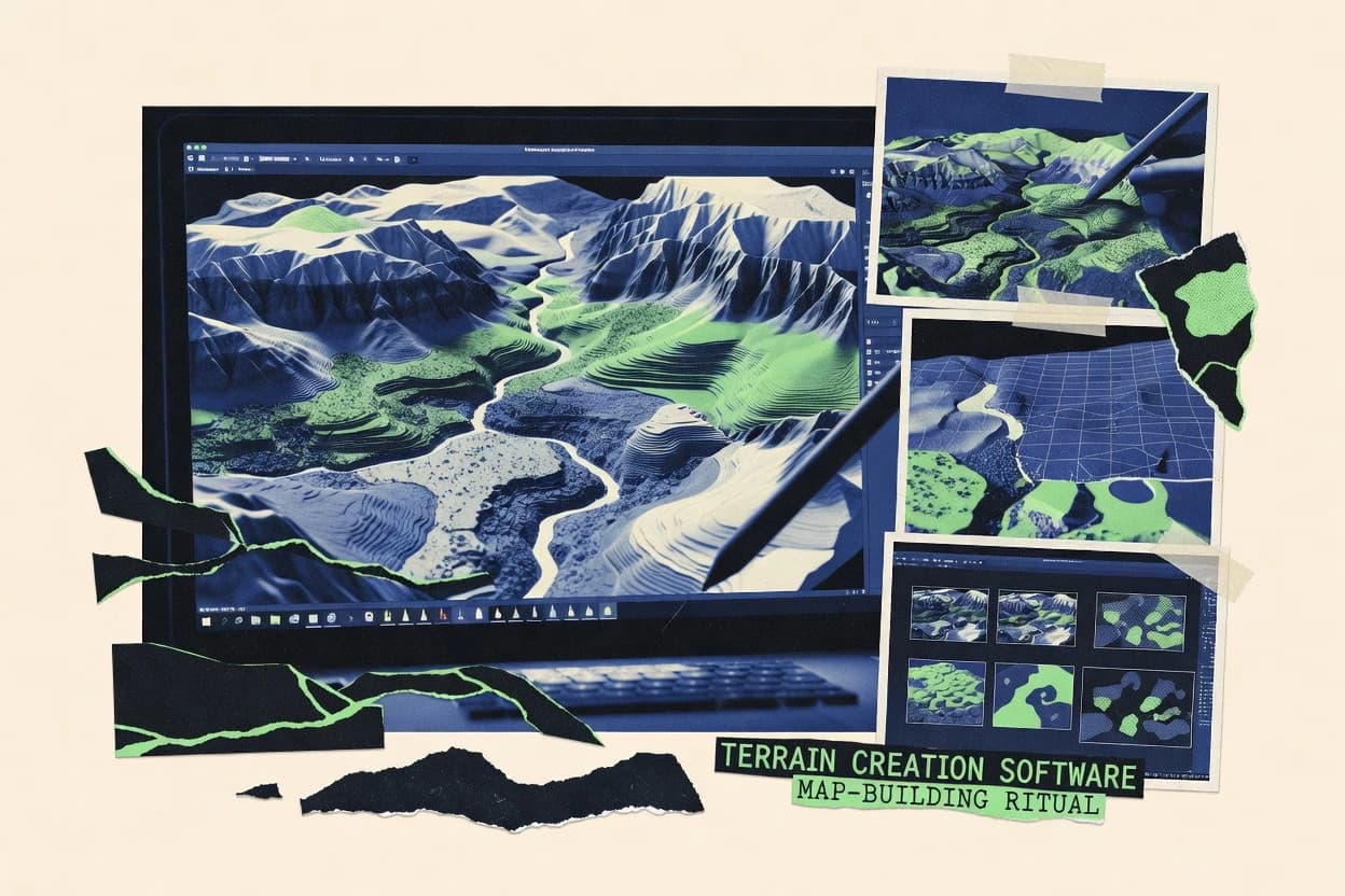
Top 10 terrain creation software ranked for heightmaps and world building, with technical comparisons of Gaea, Houdini, and Blender.

How we ranked these tools
Core product claims cross-referenced against official documentation, changelogs, and independent technical reviews.
Analyzed video reviews and hundreds of written evaluations to capture real-world user experiences with each tool.
AI persona simulations modeled how different user types would experience each tool across common use cases and workflows.
Final rankings reviewed and approved by our editorial team with authority to override AI-generated scores based on domain expertise.
Score: Features 40% · Ease 30% · Value 30%
Gitnux may earn a commission through links on this page — this does not influence rankings. Editorial policy
If your Unity team iterates terrain tiles and materials inside the engine, Unity Terrain Tools is the safest pick, whereas Gaea fits when you want repeatable procedural terrain recipes with erosion-like variation, and Unreal Engine Landscape is better if you need in-engine editing tied to large-scale rendering.
Editor’s top 3 picks
Three quick recommendations before you dive into the full comparison below — each one leads on a different dimension.
Unity Terrain Tools
Unity Terrain-aware conversion that maps heightmap inputs directly into Unity Terrain layers and painting workflows.
Built for fits when Unity level teams iterate terrain tiles and textures inside the engine..
Gaea
Editor pickErosion-centric node graph design keeps weathering outputs tied to masks for controlled downstream blending.
Built for fits when teams need repeatable terrain recipes with erosion-like variation across many levels..
World Machine
Editor pickHydraulic erosion and related geological operators provide terrain forms that stay stable under parameter changes.
Built for fits when teams iterate erosion parameters and export heightmaps for level design pipelines..
Comparison Table
Unity Terrain Tools
SMBTerrain authoring toolkit for sculpting, painting, stamping, and vegetation workflows inside Unity.
Unity Terrain-aware conversion that maps heightmap inputs directly into Unity Terrain layers and painting workflows.
Unity Terrain Tools focuses on generating and converting terrain inputs into Unity Terrain data, including heightmap ingestion and terrain layer configuration for immediate scene editing. The toolset fits teams that want a single terrain editing surface in Unity instead of a separate DCC-to-game roundtrip for every iteration. It also supports terrain export formats that match Unity level design pipeline expectations for geometry and asset handoff.
A tradeoff is that Unity Terrain Tools is constrained to Unity’s terrain data model, which limits usage for pipelines built around non-Unity terrain representations like external mesh-only worlds. It is a strong fit when iterative level design needs fast terrain repainting and texture blending directly on Unity Terrain while keeping LOD behavior consistent during gameplay testing.
- +Tight Unity Terrain integration keeps layers and painting aligned
- +Terrain tiling workflows reduce rework for large map iteration
- +Editor-driven conversion supports fast heightmap-to-scene loops
- +Export handoff matches Unity level design pipeline expectations
- –Limited outside-Unity terrain data portability for non-Terrain workflows
- –Automation surface is editor-centric instead of headless batch tooling
- –Fine control over generation algorithms depends on external tools
- –World streaming requires Unity project setup coordination
Unity environment artists
Import heightmaps and set terrain layers
Faster texture iteration in-editor
Level design teams
Assemble tiled terrains for a world
Reduced tiling rework
Show 2 more scenarios
Technical artists
Prepare terrain for downstream asset export
Cleaner pipeline handoffs
Use Unity-compatible exports to hand off terrain-derived geometry and materials to production steps.
Small Unity studios
Keep terrain work in one tool
Fewer iteration bottlenecks
Avoid frequent DCC roundtrips by editing and validating terrain directly in Unity Terrain.
Best for: Fits when Unity level teams iterate terrain tiles and textures inside the engine.
Gaea
vertical specialistModern procedural terrain design tool with node-based workflows and erosion simulation developed by QuadSpinner.
Erosion-centric node graph design keeps weathering outputs tied to masks for controlled downstream blending.
Gaea focuses on procedural generation driven by a node graph, which makes complex terrain recipes easier to reproduce across maps and seasons. The workflow supports iterative parameter tuning and keeps intermediate masks and maps available for later stages like terrain painting and material assignment. Output is typically aligned to standard heightmap-to-mesh usage, which fits level design pipeline needs where displacement or mesh generation happens downstream. Integration depth tends to be strongest at the export boundaries where engines and terrain toolchains consume baked results.
A tradeoff is that highly custom modeling and hand-crafted landform editing are not the core strength compared with DCC sculpting tools. Gaea fits usage situations where many terrains must share the same erosion and masking logic, such as generating a set of biome-consistent maps for a level pack. It also fits teams that want to iterate quickly on world rules, then regenerate outputs when art direction changes.
- +Node graph keeps erosion, masks, and outputs reproducible
- +High iteration speed for parameter-driven terrain variations
- +Good control over intermediate masks for downstream texturing
- +Export workflow supports typical terrain and displacement pipelines
- –Less suited for freeform modeling compared with DCC sculpt tools
- –Complex graphs take time to learn and maintain
Level design teams
Batch-generate terrain variants per mission
Faster terrain iteration
Environment art studios
Deliver consistent mask-ready terrain materials
More consistent materials
Show 1 more scenario
World-building artists
Prototype erosion-driven landforms for worlds
More coherent geography
Erosion nodes produce structured forms that stay parameter-controlled during iteration.
Best for: Fits when teams need repeatable terrain recipes with erosion-like variation across many levels.
World Machine
vertical specialistProcedural terrain generation software using a node-based graph editor for creating heightmaps and terrain meshes.
Hydraulic erosion and related geological operators provide terrain forms that stay stable under parameter changes.
World Machine uses a graph-based editor for assembling terrain steps such as noise generation, shaping, and erosion passes, which makes builds reproducible across heightmap revisions. It provides erosion-focused tools that create terrain more consistent with erosion-driven forms than pure noise stacks, and it can output terrain-aligned masks and shading inputs for later texturing stages. Export options cover both heightmap-driven pipelines and mesh outputs, so production teams can target multiple renderer workflows.
A tradeoff is that more advanced automation depends on project discipline since there is no native scripting-first workflow for batch regeneration inside the core editor. World Machine fits best when a team needs repeatable erosion tuning for a small to medium set of maps and then relies on external tools for runtime terrain streaming, LOD, or material graph wiring.
- +Graph editor makes erosion tuning traceable by build steps
- +Terrain tiling support speeds up production for large worlds
- +Heightmap and texture map exports fit common terrain pipelines
- +Erosion controls produce more geologic structure than noise stacks
- –Batch automation is limited compared with code-driven node tools
- –High-res builds can take long to recompute after changes
Level design artists
Iterate erosion-heavy heightmaps
Faster terrain iteration cycles
Terrain pipeline engineers
Export maps for engine import
Cleaner handoff to engines
Show 1 more scenario
World-building teams
Produce tiled regions
More consistent adjacent tiles
Generate consistent map tiles for large scenes without rebuilding every region from scratch.
Best for: Fits when teams iterate erosion parameters and export heightmaps for level design pipelines.
TerreSculptor
vertical specialistTerrain and heightmap editor for generating, sculpting, converting, and exporting digital landscapes.
Interactive heightmap sculpting paired with erosion and procedural shaping in a single authoring environment.
TerreSculptor is a terrain creation tool that focuses on fast, interactive heightmap sculpting and terrain data authoring for world-building workflows. It supports procedural generation with noise-based tools and provides erosion-focused shaping to move from rough forms to believable landforms.
The software centers on producing terrain-ready outputs such as heightmaps and derived maps for downstream terrain material workflows. TerreSculptor is most compelling when the workflow needs tight authoring feedback loops before export and integration.
- +Real-time sculpting workflow for rapid heightmap iteration
- +Procedural noise tools speed up first-pass landform creation
- +Export-focused pipeline for getting terrain data into other tools
- +Erosion-oriented tools help produce more natural slopes and valleys
- –Terrain tiling workflows need more manual staging than node-based graph tools
- –Fewer automation hooks than tools that expose deeper API-driven pipelines
Best for: Fits when artists need quick terrain shaping and map export for a later level design pipeline.
Unreal Engine Landscape
enterpriseIntegrated terrain authoring tools for sculpting, painting, streaming, and optimizing large landscapes in Unreal Engine.
Landscape Material integration lets terrain height and per-layer masks control shading and blending during editing.
Unreal Engine Landscape generates and edits heightfields directly inside Unreal Engine, then drives rendering through Landscape Actors and Landscape Materials. It supports terrain painting workflows, LOD for runtime scaling, and export or interchange via standard 3D asset formats for downstream pipelines.
Landscape integrates with the engine’s real-time rendering pipeline, including collision and runtime updates needed for level design iteration. For heightmap-driven world-building workflow, it handles tiling and material-driven surface detail without leaving the editor.
- +Terrain painting and Landscape Material layers stay editable in-editor
- +Runtime LOD reduces mesh resolution cost across large outdoor scenes
- +Built-in collision and navigation-ready terrain support level design iteration
- +Landscape tiling fits multi-map world-building workflow in Unreal
- –Heightmap authoring outside Unreal often requires manual import settings
- –Material layer complexity can raise shader compile and runtime cost
Best for: Fits when Unreal teams need in-engine terrain editing tied to level design and rendering.
Blender
SMBOpen source 3D software that supports terrain creation through displacement, geometry nodes, sculpting, and add-ons.
Python scripting that ties heightmap processing, mesh operations, and batch exports into repeatable terrain build scripts.
Blender fits teams that need terrain work inside a full 3D content pipeline rather than a dedicated heightmap-only tool. Heightmaps can be converted to meshes and refined with Sculpt Mode, modifier stacks, and node-based shading for terrain materials.
Export paths cover common interchange formats used in level design workflows, including OBJ, FBX, and Alembic. Automation and extensibility come from Python scripting across modeling, rendering, and asset processing tasks.
- +Node-based materials support repeatable terrain texture blending workflows
- +Python scripting automates heightmap import, mesh cleanup, and export steps
- +Modifier stacks enable parametric terrain edits across iterations
- +Sculpting tools refine mesh terrain detail after conversion from height data
- –Hydraulic and thermal erosion simulators require add-ons or custom node workflows
- –Terrain tiling and runtime streaming are not first-class features
Best for: Fits when world-building pipelines need mesh terrain editing plus Python automation inside Blender.
Voxel Farm
vertical specialistVoxel Farm provides voxel terrain creation, sculpting, procedural generation, and world streaming tools.
Terrain graph generation that keeps height, painting, and texture blending inputs connected for export-ready terrain assets.
Voxel Farm focuses on a node-based terrain authoring workflow that bakes from procedural inputs into engine-ready assets. It provides tools for erosion-style terrain shaping, terrain painting, and texture set management aimed at production level design pipelines.
The workflow is designed around generating height and material data that can be exported for downstream rendering and world building. Compared with general-purpose DCC tools, it centers on terrain graph iteration and terrain export outputs.
- +Node-based graph workflow for iterative height and material authoring
- +Erosion-oriented shaping tools that reduce manual cleanup work
- +Terrain painting support for controlled texture blending regions
- +Export-oriented pipeline for feeding terrain into external rendering stages
- –Terrain tiling and LOD workflows require careful planning before authoring
- –Automation and API surface are limited for fully headless terrain generation
- –Complex multi-material setups can become difficult to manage in large graphs
- –Voxel sculpting-style workflows are not the primary authoring model
Best for: Fits when teams need terrain graphs that output height and material assets for a repeatable level design pipeline.
Cesium ion
API-firstCesium ion converts geospatial terrain and 3D data into tiled assets for web, simulation, and 3D applications.
Cloud terrain and 3D asset processing that publishes Cesium-ready tiles for runtime globe or map streaming.
Cesium ion focuses on geospatial terrain and 3D asset delivery for Cesium-based runtimes rather than authoring heightmaps from scratch. It ingests common terrain sources and serves tiled terrain and 3D content with configuration geared for streaming and runtime rendering pipeline needs.
Cesium ion also supplies asset hosting workflows and automated processing hooks that reduce manual publishing steps for world-building pipelines. The result is tighter integration between terrain creation inputs and deployment into a map or globe viewer.
- +Automates terrain and 3D asset hosting for Cesium runtime streaming workflows
- +Supports standard geospatial terrain inputs for quicker world-building pipeline handoffs
- +Asset processing reduces manual conversion and tiling steps before publication
- +Clear separation between terrain data creation inputs and runtime delivery
- –Terrain creation authoring tools are limited compared with node-based heightmap editors
- –Custom terrain material assignment and texture blending workflows can be constrained
- –Geospatial-oriented pipeline may add friction for non-GIS heightmap-only projects
- –Advanced tuning of mesh resolution and tiling parameters needs extra discipline
Best for: Fits when Cesium-based teams need fast terrain publishing from geospatial sources into a streamed runtime.
QGIS
open-sourceQGIS creates and analyzes terrain surfaces from DEM, raster, vector, and GIS datasets through native tools and plugins.
DEM-to-heightmap preprocessing using GIS raster processing chains, including reprojection and tile generation with Python automation.
QGIS converts geospatial elevation sources into terrain-ready outputs through map algebra, raster processing, and strong coordinate handling. It supports DEM workflows with GeoTIFF and reprojecting layers, which is useful for heightmap generation before any mesh or engine step.
QGIS also automates bulk processing using batch tools and Python scripting, which fits repeating world-building tasks like tiling and preprocessing. Terrain export is strongest for GIS-aligned raster products, with geometry export depending on plugin availability and downstream conversion steps.
- +DEM preprocessing with raster math, reprojection, and cleanup workflows
- +Python automation enables repeatable batch heightmap production
- +Rich geospatial import support for elevation rasters and masks
- +Terrain tiling via raster processing chains for large areas
- –Not a dedicated node-based terrain authoring tool for real-time materials
- –Direct mesh and terrain export to production formats needs external conversion steps
- –Hydraulic erosion and weathering tools require extra plugins or custom workflows
- –Geometry-level painting and sculpting pipelines are not its core focus
Best for: Fits when geospatial elevation data must be cleaned, tiled, and prepared for a separate terrain or rendering pipeline.
MapMagic
vertical specialistMapMagic creates procedural Unity terrains from node graphs, masks, biomes, and heightmap inputs.
Heightmap generation guided by map inputs with repeatable tiling and export suited for level design pipelines.
MapMagic by denispot.com generates heightmaps and terrain-related outputs from rules built around real-world map data and procedural synthesis. The workflow centers on producing usable terrain maps quickly for pipelines that need consistent tile sizes and repeatable results.
Core capabilities focus on terrain generation and exporting terrain assets for downstream terrain painting, normal map baking, and engine import work. MapMagic is geared toward world-building workflows where map-derived inputs need to drive terrain shape rather than starting from scratch noise alone.
- +Map data driven heightmap generation for world-building workflows
- +Deterministic tiling support for consistent terrain tiles
- +Export formats targeted for typical DCC and engine pipelines
- +Rule based controls that keep outputs reproducible across runs
- –Limited authoring depth compared to node-based terrain graph editors
- –Terrain material authoring like splat maps needs extra downstream steps
- –Advanced erosion workflows are narrower than specialist procedural tools
- –Requires careful parameter setup to avoid tiling seams
Best for: Fits when map-derived inputs must drive heightmaps and the pipeline needs repeatable tiling exports.
Conclusion
After evaluating 10 art design, Unity Terrain Tools stands out as our overall top pick — it scored highest across our combined criteria of features, ease of use, and value, which is why it sits at #1 in the rankings above.
Use the comparison table and detailed reviews above to validate the fit against your own requirements before committing to a tool.
How to Choose the Right terrain creation software
Terrain creation software covers heightmap authoring and terrain tiling workflows that feed real-time level design pipelines. This guide covers Unity Terrain Tools, Gaea, Houdini, and Blender, alongside World Machine, TerreSculptor, Unreal Engine Landscape, Voxel Farm, Cesium ion, QGIS, and MapMagic.
The comparison sections focus on integration depth with engine terrain systems, reproducibility via node graphs and scripting, and automation surfaces for batch terrain builds. The tools included span erosion-first node graphs in Gaea, hydraulic operator tuning in World Machine, and Python automation for repeatable mesh and export steps in Blender.
Terrain creation software for heightmaps, terrain tiling, and export-ready worlds
Terrain creation software generates and refines terrain geometry from heightmaps or map-derived inputs, then exports assets for downstream rendering and level design pipelines. Many tools center on node graphs or procedural operators that produce height data and masks that guide blending and shading workflows.
Unity Terrain Tools focuses on mapping heightmap inputs directly into Unity Terrain layers and painting workflows, reducing drift between imported data and in-engine terrain layers. Gaea emphasizes erosion-centric node graphs that keep weathering outputs tied to masks, which supports controlled parameter-driven variation across multiple levels.
Terrain build fit checklist for heightmaps, tiling, and export pipelines
Terrain creation software earns selection when it connects authoring outputs to downstream terrain material assignment, terrain painting, and tiling exports without rework. The highest-friction failures show up when a tool’s graph or scripting workflow cannot reproduce the same height and mask results after parameter changes.
Engine-native terrain layer alignment
Unity Terrain Tools maps heightmap inputs directly into Unity Terrain layers and painting workflows so imported height and layer masks stay aligned during iteration. Unreal Engine Landscape keeps height and per-layer masks tied to Landscape Material editing inside Unreal.
Erosion and weathering outputs that stay controllable
Gaea uses erosion-centric node graphs that tie weathering outputs to masks for controlled blending downstream. World Machine provides hydraulic erosion and geological operators designed to keep terrain forms stable as parameters change.
Tiling and large-world iteration mechanics
World Machine includes terrain tiling support that speeds up production for large worlds and export-driven level design pipelines. Unity Terrain Tools adds Terrain tiling workflows that reduce rework when iterating many map tiles.
Repeatable batch builds via scripting or graph reproducibility
Blender’s Python scripting automates heightmap import, mesh cleanup, and export steps for repeatable terrain build scripts. Gaea’s node graph design keeps erosion, masks, and outputs reproducible so terrain recipes can be reused across levels.
Authoring depth across sculpting, graph generation, and material prep
TerreSculptor combines real-time interactive heightmap sculpting with erosion and procedural shaping in a single authoring environment. Voxel Farm focuses on terrain graph generation that keeps height, painting inputs, and texture blending inputs connected for export-ready terrain assets.
Geospatial ingestion and preprocessing to elevation-ready inputs
QGIS provides DEM preprocessing using raster math, reprojection, and tile generation with Python automation for repeatable elevation production. Cesium ion automates terrain and 3D asset hosting for Cesium runtime streaming workflows using geospatial terrain inputs.
Pipeline fit for map-derived inputs and deterministic height generation
MapMagic generates heightmaps guided by map inputs with repeatable tiling and export suited for level design pipelines. Cesium ion publishes Cesium-ready tiles that support streamed runtime globe or map workflows where terrain data is delivered as tiles.
Choose by pipeline stage: in-engine editing, recipe generation, or batch preprocessing
Start by identifying the stage that owns the terrain truth in the pipeline. Unity Terrain Tools fits when terrain truth lives inside Unity Terrain editing, and Unreal Engine Landscape fits when terrain truth lives inside Unreal Landscape Material layers.
Pick the system that owns in-editor terrain painting
If terrain layers are painted and validated in Unity, Unity Terrain Tools maps heightmap inputs directly into Unity Terrain layers and painting workflows to avoid layer drift. If terrain height editing and shading blending are validated in Unreal, Unreal Engine Landscape keeps Terrain painting and Landscape Material layers editable in-editor.
Choose recipe-style erosion graphs or interactive sculpting for primary shaping
If terrain shaping must be driven by repeatable weathering parameters, Gaea keeps erosion outputs tied to masks so downstream blending stays consistent across parameter changes. If interactive shaping and quick landform tweaks matter more than maintaining complex graph recipes, TerreSculptor provides real-time sculpting paired with procedural shaping and erosion.
Decide how tiling and recomputation affect iteration throughput
For large map iteration with parameter tuning, World Machine’s terrain tiling support speeds up production for large worlds but recomputation of high-resolution builds can take long after changes. For Unity tile iteration, Unity Terrain Tools uses Terrain tiling workflows to reduce rework when regenerating many tiles and keeping layers aligned.
Select automation depth based on headless or batch requirements
For pipeline automation that needs repeatable batch processing, Blender’s Python scripting can tie heightmap processing, mesh operations, and export steps into build scripts. For graph-driven reproducibility without writing code, Gaea’s node graph keeps erosion, masks, and outputs reproducible as terrain recipes.
Match geospatial preprocessing to who owns data cleaning and tiling
If raw elevation comes from DEM and must be cleaned, reprojected, and tiled before terrain authoring, QGIS produces raster processing chains with Python automation that output elevation-ready heightmaps. If the pipeline is already Cesium-based for runtime streaming, Cesium ion focuses on automating terrain and 3D asset hosting for Cesium-ready tiles.
Evaluate export intent for meshes, tiles, and material inputs
If the output must include connected height plus painting and texture blending inputs for export-ready terrain assets, Voxel Farm’s terrain graph generation keeps these inputs linked. If the pipeline expects deterministic heightmap generation from map inputs and tiling exports, MapMagic produces map data guided heightmaps with repeatable tiling suited for level design workflows.
Who benefits from terrain creation software by workflow style
Different terrain creation software aligns to different workflow ownership models. Teams that iterate inside an engine need tight mapping into engine terrain systems, while teams that build terrain recipes need node graphs and reproducible outputs.
Unity level design teams iterating many terrain tiles
Unity Terrain Tools keeps heightmap inputs aligned with Unity Terrain layers and painting workflows so tile regeneration reduces rework when many maps are updated.
Environment teams building erosion-driven terrain variation across levels
Gaea fits teams that need erosion-like variation as a reusable recipe because its node graph binds weathering outputs to masks for controlled downstream blending.
Level design pipelines exporting heightmaps after erosion tuning
World Machine fits teams that tune hydraulic erosion and export heightmaps for level design pipelines because its graph editor makes operator tuning traceable.
Artist-led terrain sculpting workflows that still require export automation
TerreSculptor fits artists who want interactive heightmap sculpting plus erosion and procedural shaping in a single environment, while Blender fits teams who need Python-driven batch exports.
Geospatial teams that must preprocess DEM and publish streamed tiles
QGIS fits when DEM preprocessing with reprojection and tile generation is required before terrain creation, and Cesium ion fits when Cesium runtime streaming needs automated Cesium-ready tile publishing.
Common terrain creation software pitfalls during production
Terrain pipelines fail when the chosen tool cannot preserve the relationship between height outputs and the masks or materials used later. Another frequent failure is selecting interactive sculpting or map-driven height generation when the production reality requires recipe reproducibility and automation.
Choosing an in-editor workflow tool without verifying how inputs map into terrain layers
Unity Terrain Tools prevents layer drift by mapping heightmap inputs directly into Unity Terrain layers and painting workflows, while Unreal Engine Landscape depends on correct import and Landscape Material layer setup in Unreal.
Building a terrain recipe in a complex node graph without planning for maintainability
Gaea’s node graphs keep erosion, masks, and outputs reproducible, but complex graphs can take time to learn and maintain when requirements change frequently.
Assuming tiling is automatic even when recomputation costs are high
World Machine accelerates large-world production with terrain tiling support, but high-resolution builds can take long to recompute after changes.
Treating Blender as a full erosion authoring environment without addressing erosion dependency
Blender can batch terrain exports through Python scripting, but hydraulic and thermal erosion simulators are not first-class without add-ons or custom node workflows.
Using geospatial preprocessing tools as if they were real-time terrain authoring systems
QGIS can produce DEM-to-heightmap preprocessing with Python automation, but it is not a dedicated node-based terrain authoring tool for real-time materials, so mesh export and conversion often require external steps.
How We Selected and Ranked These Tools
We evaluated terrain creation software on feature fit for heightmap and terrain tiling workflows, ease of iterating terrain outputs, and value for producing export-ready assets. Features carried 40% of the score because the tools need to support terrain authoring, erosion or shaping operators, and downstream export workflows used in production.
Ease/value carried 30% each because teams must regenerate terrains consistently without excessive rebuild time or manual staging. Unity Terrain Tools received the highest ranking because its Unity Terrain-aware conversion maps heightmap inputs directly into Unity Terrain layers and painting workflows while Terrain tiling workflows reduce rework during large map iteration.
Frequently Asked Questions About terrain creation software
How does a node-based graph workflow affect repeatability in Gaea compared with TerreSculptor?
When does Unity Terrain Tools become the wrong choice compared with Unreal Engine Landscape for terrain painting?
What breaks if terrain tiling requirements differ between World Machine and Cesium ion exports?
Which tool maps height and per-layer masks into the same editing loop for shading changes?
How do Blender and QGIS differ when converting heightmaps for a production mesh pipeline?
What integration path handles DEM preprocessing with GIS reprojection better in QGIS than in Gaea?
How do admin controls and audit logging expectations differ when using Blender versus a terrain tool embedded in an engine editor?
Where does data migration fall short when moving projects from Voxel Farm to Unity Terrain Tools?
What tradeoff appears when choosing MapMagic over World Machine for erosion-like form control?
Tools reviewed
Primary sources checked during evaluation.
Referenced in the comparison table and product reviews above.
Keep exploring
Comparing two specific tools?
Software Alternatives
See head-to-head software comparisons with feature breakdowns, pricing, and our recommendation for each use case.
Explore software alternatives→In this category
Art Design alternatives
See side-by-side comparisons of art design tools and pick the right one for your stack.
Compare art design tools→