GITNUXSOFTWARE ADVICE
Construction InfrastructureTop 10 Best Stormwater Inspection Software of 2026
Discover the top stormwater inspection software options to streamline your tasks.

How we ranked these tools
Core product claims cross-referenced against official documentation, changelogs, and independent technical reviews.
Analyzed video reviews and hundreds of written evaluations to capture real-world user experiences with each tool.
AI persona simulations modeled how different user types would experience each tool across common use cases and workflows.
Final rankings reviewed and approved by our editorial team with authority to override AI-generated scores based on domain expertise.
Score: Features 40% · Ease 30% · Value 30%
Gitnux may earn a commission through links on this page — this does not influence rankings. Editorial policy
Editor’s top 3 picks
Three quick recommendations before you dive into the full comparison below — each one leads on a different dimension.
ClearGov
Inspection checklists with evidence attachments that create audit-ready documentation for each site visit
Built for stormwater compliance teams needing structured inspections, evidence capture, and traceable workflows.
GoCanvas
Editor pickOffline-capable mobile form capture with photo attachments for evidence-first inspections
Built for stormwater programs needing mobile offline inspection forms and standardized documentation.
GoSpotCheck
Editor pickChecklist item photos with GPS context for audit-ready stormwater inspection documentation
Built for stormwater inspection teams needing mobile evidence capture and checklist-driven compliance.
Related reading
- Construction InfrastructureTop 10 Best Chimney Inspection Software of 2026
- Construction InfrastructureTop 10 Best Landscape Construction Software of 2026
- Construction InfrastructureTop 10 Best Construction Companies Software of 2026
- Construction InfrastructureTop 10 Best Construction Equipment Software of 2026
Comparison Table
This comparison table evaluates stormwater inspection software options used for field data collection, photo and document capture, and inspection workflows, including ClearGov, GoCanvas, GoSpotCheck, Fulcrum, and Airtable. Each row summarizes how the tools handle form building, offline capture, reporting, integrations, and administrative controls so buyers can map capabilities to inspection requirements.
ClearGov
workflow & reportingCentralized asset and inspection workflow software with configurable checklists and reporting for infrastructure compliance programs.
Inspection checklists with evidence attachments that create audit-ready documentation for each site visit
ClearGov centers stormwater and compliance work around inspector-ready workflows, including inspection checklists and structured documentation capture. The system supports field and office teams with task management and evidence collection tied to inspections. Reports and audit trails are organized to support regulatory follow-up and internal accountability across sites and projects.
- +Stormwater inspection checklists structure field data capture consistently
- +Evidence and documentation attach to inspection records for audit-ready traceability
- +Workflow and task management reduce missed steps across inspections
- –Advanced customization requires platform configuration effort
- –Some reporting depth can feel limited without additional workflow setup
- –Integrations and data sync options may not cover every legacy GIS approach
Best for: Stormwater compliance teams needing structured inspections, evidence capture, and traceable workflows
More related reading
GoCanvas
mobile inspectionsMobile forms and inspections with offline capture, automated data collection, and dashboards for stormwater field inspections.
Offline-capable mobile form capture with photo attachments for evidence-first inspections
GoCanvas stands out for turning stormwater field workflows into offline-ready, mobile-first inspection forms with structured data capture. It supports visual form building, conditional logic, and attachments so inspectors can document conditions, photos, and notes in a consistent way. The platform also includes task management and reporting views that help teams track findings across sites and crews.
- +Mobile form capture with offline support for field inspections and checklists
- +Form builder supports conditional logic and required fields for consistent documentation
- +Photo and attachment handling supports evidence-based stormwater compliance records
- +Task assignment and workflow controls help standardize repeat inspections
- –Reporting and dashboards can feel limited for highly customized stormwater KPIs
- –Advanced workflow setup requires more configuration effort than simple form tools
- –Data export and integration depth may lag specialized stormwater ecosystems
Best for: Stormwater programs needing mobile offline inspection forms and standardized documentation
GoSpotCheck
audit automationField inspection software built for mobile audit workflows, standardized forms, and exception reporting for compliance tasks.
Checklist item photos with GPS context for audit-ready stormwater inspection documentation
GoSpotCheck differentiates itself with mobile-first stormwater inspection workflows that capture evidence in the field and turn it into consistent inspection records. The tool supports configurable inspection forms, photo attachments, GPS tagging, and structured scoring tied to checklist items.
Teams can route inspections through defined statuses and use reports and dashboards to summarize compliance activity across locations and assets. It also supports exportable audit-ready outputs for internal review and document retention.
- +Mobile inspection checklists with photo evidence per checklist item
- +GPS capture and structured scoring for repeatable stormwater inspections
- +Workflow statuses and reporting to track completion and compliance trends
- –Setup for complex stormwater regimes can require careful configuration
- –Reporting flexibility is strong but can feel rigid for custom analytics
Best for: Stormwater inspection teams needing mobile evidence capture and checklist-driven compliance
Fulcrum
GIS field captureGIS-friendly field data collection that supports inspections with photos, geotagging, and structured attributes for stormwater assets.
Offline mobile data collection with geotagged observations and evidence attachments
Fulcrum stands out for field-first stormwater inspections that turn captured observations into structured records with map-ready locations. The system supports configurable form building, photo and attachment capture, and offline collection for on-site workflows. Inspection outputs can be shared through dashboards and exports for compliance reporting and follow-up work orders.
- +Offline-capable mobile capture supports inspections in low-connectivity sites
- +Configurable inspection forms map observations to consistent fields
- +Photo and attachment handling ties evidence directly to each finding
- +GIS-friendly location data improves prioritization and routing
- –Advanced configuration depth can slow setup for complex compliance rules
- –Reporting and dashboard design may require more admin effort than teams expect
- –Larger multi-department workflows can feel less turnkey than dedicated inspection suites
Best for: Stormwater teams needing offline inspections, evidence capture, and map-based reporting
Airtable
low-code dataConfigurable inspection databases with form-based data capture, relational tracking, and automations for stormwater inspection management.
Linked Records across tables for assets, inspections, and corrective actions
Airtable stands out by combining spreadsheet-like flexibility with relational database building for stormwater inspection workflows. Teams can model inspection sites, assets, findings, photos, and follow-ups in linked tables and custom forms.
Automated views, filters, and conditional fields help route work without heavy system integration. It works well when inspections need configurable data structures more than rigid, prebuilt stormwater templates.
- +Linked tables connect assets, inspections, defects, and actions in one data model
- +Form views capture inspection fields consistently and feed standardized records
- +Flexible automations update statuses and create follow-ups from inspection events
- +Attach photos and files directly to records for audit-ready evidence
- +Granular permissions support role-based access across teams and locations
- –Complex relational setups take time to design and maintain for inspection programs
- –Reporting depends on configured views and can require work for executive dashboards
- –Map-style field operations and routing are limited without external tooling
Best for: Teams customizing stormwater inspection data models with lightweight workflow automation
ServiceTitan
field serviceField service inspection and work order management with dispatch, technician execution, and job reporting workflows.
Mobile job execution with configurable digital inspection forms and photo capture
ServiceTitan stands out with field service workflows built for inspection-heavy operations, including dispatch, scheduling, and job management tied to on-site execution. It supports stormwater inspection processes through configurable service tasks, digital forms for collecting observations, and photo capture for evidence.
Route planning and technician assignment connect inspections to operational capacity so work stays organized from lead to completion. Strong reporting and mobile-first execution help teams standardize documentation across crews and sites.
- +Configurable inspection workflows connect scheduling, dispatch, and field documentation
- +Mobile job execution supports digital forms and photo evidence for compliance records
- +Automated reporting packages inspection outputs for operational visibility
- +Role-based controls help standardize field data capture across teams
- +Integration-ready architecture supports connecting inspection data to broader operations
- –Stormwater-specific setup requires careful configuration of forms and task templates
- –Dashboard and reporting usefulness depends on how workflows are modeled
- –Multi-location inspection operations can add complexity to permissions and data structure
Best for: Stormwater inspection teams needing workflow control, mobile evidence capture, and reporting
Cityworks
enterprise asset managementAsset and work management platform that supports service requests, inspections, and compliance tracking tied to asset records.
Location and asset-based inspection capture within GIS-driven Cityworks workflows
Cityworks is distinct for combining asset-centric GIS mapping with inspection workflows for municipal infrastructure. It supports stormwater inspection planning, field assignment, and geospatially anchored issue capture tied to asset and location records.
The platform’s strength shows in configurable workflows, forms, and dashboards that help teams turn inspections into trackable work items. Integrated GIS context and standardized field-to-backoffice processes reduce rework when inspections generate repairs or follow-up actions.
- +GIS-first workflows tie stormwater findings to exact asset locations
- +Configurable inspection forms support consistent field capture across crews
- +Dashboards and work management links inspections to follow-up tasks
- +Role-based views help teams focus on assignments and completed inspections
- +Integration-friendly architecture supports linking with broader city systems
- –Workflow and data model setup can be complex for new jurisdictions
- –Usability depends on configuration quality and GIS data readiness
- –Advanced reporting often requires admin involvement and template tuning
- –Field user experience can vary with form complexity and device setup
Best for: Stormwater programs needing GIS-based inspection workflows with asset tracking
OpenGov
public works reportingInfrastructure and public works reporting platform with workflows that can structure inspection and maintenance activities.
Audit-ready inspection evidence trails tied to tasks, statuses, and compliance reporting
OpenGov distinguishes itself by pairing stormwater program inspection workflows with broader government performance and compliance workflows. The product supports structured inspections, task assignment, and audit-ready records for field work and follow-ups.
It also emphasizes configurable reporting so agencies can track compliance status and evidence tied to inspections. Integration with existing government data systems is a key capability for keeping inspection results consistent across teams.
- +Inspection workflows connect tasks, assignments, and evidence for audit-ready documentation
- +Configurable reporting helps track inspection completion and compliance status
- +Designed to align stormwater inspection data with broader government operations
- –Setup and configuration for stormwater-specific processes can take significant effort
- –UI complexity increases when managing many workflows, forms, and status rules
- –Field workflows depend on disciplined data capture to keep reporting reliable
Best for: Government stormwater teams needing audit-ready inspections and reporting workflows
MaintainX
maintenance inspectionsMaintenance and inspection management with mobile checklists, job plans, and asset-linked work tracking.
Mobile-first inspection execution with photo evidence and configurable checklists
MaintainX stands out by combining mobile-first work management with maintenance and inspection workflows driven by real assets and scheduled checklists. It supports field inspection capture with photo attachments, structured findings, and task generation tied to assets.
The platform also enables reporting and audit-ready histories for executed inspections across distributed teams. For stormwater programs, it works best when inspections map cleanly to assets, locations, and repeatable maintenance tasks.
- +Mobile inspection capture with photos, notes, and structured checklists
- +Asset-based task tracking links findings to repeatable work orders
- +Audit-ready history shows who inspected, what they recorded, and when
- –Stormwater-specific inspection templates require configuration and governance
- –Reporting flexibility can be limited for highly custom compliance outputs
- –Field data quality depends on consistent form design across locations
Best for: Utilities and contractors needing mobile stormwater inspections tied to asset work orders
AssetTiger
asset inspectionsAsset inspection and maintenance tracking with mobile workflows, configurable inspection checklists, and management reporting.
Asset-linked inspection history that maintains photo and observation traceability per stormwater asset
AssetTiger centers stormwater inspections on asset-centric workflows tied to field surveys and documentation. The solution supports creating inspections, capturing observations, managing photos and notes, and driving repeatable checklists for compliance-oriented documentation.
It also emphasizes traceability by linking inspection outcomes to specific assets so records stay organized across time. Automation is focused on inspection execution and record management rather than heavy analytics.
- +Asset-first structure keeps inspections tied to specific stormwater assets
- +Checklist-driven inspections standardize recurring field assessments
- +Photo and note capture supports clear evidence for findings
- +Clear record trail links inspection results back to asset history
- –Stormwater-specific reporting templates are limited compared with specialist platforms
- –Advanced analytics and benchmarking are not the primary focus
- –Workflows can feel rigid for highly customized inspection processes
Best for: Teams needing asset-linked stormwater inspection checklists with strong field documentation
Conclusion
After evaluating 10 construction infrastructure, ClearGov stands out as our overall top pick — it scored highest across our combined criteria of features, ease of use, and value, which is why it sits at #1 in the rankings above.
Use the comparison table and detailed reviews above to validate the fit against your own requirements before committing to a tool.
How to Choose the Right Stormwater Inspection Software
This buyer's guide maps the capabilities of ClearGov, GoCanvas, GoSpotCheck, Fulcrum, Airtable, ServiceTitan, Cityworks, OpenGov, MaintainX, and AssetTiger to real stormwater inspection workflows. It focuses on evidence capture, checklist design, mobile offline execution, and audit-ready reporting that supports regulatory compliance and follow-up work. Readers will also find a decision framework for choosing between mobile-first tools like GoCanvas and Fulcrum and GIS-centric options like Cityworks.
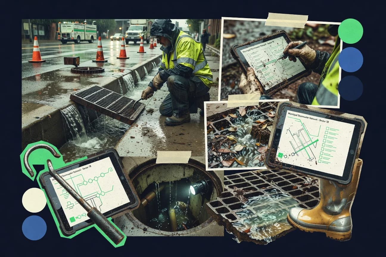
What Is Stormwater Inspection Software?
Stormwater inspection software digitizes field checks so inspectors can capture conditions, photos, and notes in structured checklists tied to locations and assets. It also routes inspections through statuses and turns recorded evidence into audit-ready documentation for compliance follow-up. Teams typically use these systems to standardize documentation, reduce missed steps, and generate consistent inspection histories across sites. Tools like GoSpotCheck deliver checklist-driven evidence capture with GPS context, while Cityworks ties inspection capture to asset and location records inside GIS-first workflows.
Key Features to Look For
Stormwater programs rely on specific field-to-record workflows, so evaluation should focus on evidence capture, asset or location anchoring, and operational follow-through.
Inspection checklists with evidence attachments
ClearGov excels at inspection checklists that attach evidence directly to each inspection record for audit-ready traceability. GoSpotCheck strengthens this with checklist item photos tied to GPS context so documentation stays consistent per condition.
Offline-capable mobile inspection capture
GoCanvas supports offline mobile form capture so inspectors can complete stormwater checks in low-connectivity areas. Fulcrum also provides offline mobile data collection with geotagged observations and evidence attachments for on-site execution.
GPS and geotagging for location-anchored evidence
GoSpotCheck captures GPS context alongside checklist item photos so repeat inspections can be compared across locations. Fulcrum provides map-ready location data and geotagged observations that support prioritization and routing.
Structured workflow statuses and task routing
GoSpotCheck supports workflow statuses that track completion and compliance trends across locations and assets. OpenGov connects inspections to tasks, statuses, and audit-ready evidence trails so compliance status updates stay consistent.
Asset-linked inspection history with photo and observation traceability
MaintainX links mobile inspection execution to assets and repeatable scheduled checklists, then preserves audit-ready inspection histories. AssetTiger also emphasizes asset-linked inspection history that maintains photo and observation traceability per stormwater asset.
GIS-first inspection workflows tied to asset records
Cityworks combines GIS mapping with inspection workflows so stormwater findings are captured against exact asset locations. OpenGov supports inspection workflows that align stormwater evidence with broader government operations, but Cityworks is the option when geospatial anchoring drives the process.
How to Choose the Right Stormwater Inspection Software
The right choice matches the inspection execution model first, then validates that evidence capture and reporting workflows fit compliance needs.
Start with the evidence and checklist execution model
If each inspection must produce inspector-ready documentation with attachments, shortlist ClearGov and GoSpotCheck because both tie evidence to checklist structure. If inspections must work without reliable connectivity, shortlist GoCanvas and Fulcrum because both support offline mobile capture with photo attachments.
Confirm how locations and assets are represented
If stormwater inspections must attach findings to exact GIS-backed locations, choose Cityworks because it anchors issue capture to asset records inside GIS-driven workflows. If inspections must be organized around asset history without heavy GIS dependency, choose MaintainX or AssetTiger because both emphasize asset-linked inspection history with traceability.
Validate workflow statuses and follow-up task creation
If inspections need routing through statuses and evidence trails that support compliance reporting, choose GoSpotCheck or OpenGov because both connect checklist evidence to structured workflow progress. If inspections must flow into operational execution like dispatch and work orders, shortlist ServiceTitan because it ties digital inspection forms and photo evidence to job execution and reporting.
Check how much configuration the team can govern
If the program can invest in checklist configuration and governance, ClearGov can centralize structured workflows with configurable checklists and audit trails. If the team needs flexible data modeling with lightweight workflow automation, Airtable can connect assets, inspections, defects, and actions through linked tables, but complex relational setups require design time.
Stress-test reporting depth with real inspection questions
If executive or compliance reporting must be highly custom, verify whether the tool supports the exact KPI structure without heavy template tuning by testing dashboards and export outputs with sample stormwater datasets. If reporting must be operationalized into job execution packages, validate that ServiceTitan produces inspection output packages that align with dispatch and technician workflows.
Who Needs Stormwater Inspection Software?
Stormwater inspection software serves teams that must standardize field evidence capture and convert it into compliant, trackable records.
Stormwater compliance teams needing structured inspections, evidence capture, and traceable workflows
ClearGov fits these teams because it centralizes stormwater work around inspection checklists and evidence attachments that create audit-ready documentation. OpenGov also fits these teams because it pairs inspection workflows with configurable reporting and audit-ready evidence trails tied to tasks and statuses.
Stormwater programs needing mobile offline inspection forms and standardized documentation
GoCanvas matches these needs because it delivers offline-capable mobile form capture with conditional logic and photo attachments. Fulcrum is another fit because it supports offline mobile data collection with geotagged observations and evidence attachments for on-site inspection execution.
Stormwater inspection teams needing mobile evidence capture and checklist-driven compliance
GoSpotCheck fits these teams because it captures checklist item photos with GPS context and uses workflow statuses to track completion and compliance trends. MaintainX fits teams that also need asset-linked inspection history so executed inspections remain tied to scheduled checklists and assets.
Municipal and government programs that run inspections from GIS-linked asset context
Cityworks fits programs that must capture findings within GIS-driven workflows and then link inspections to follow-up work management. OpenGov fits government stormwater teams that need audit-ready inspections and reporting workflows aligned with broader government operations.
Common Mistakes to Avoid
Common failures come from choosing a tool that cannot sustain field documentation quality, evidence traceability, and workflow governance across locations.
Choosing a tool that does not bind evidence to the checklist structure
Programs need evidence attached to the inspection or checklist unit, which ClearGov delivers through evidence attachments on inspection checklists. GoSpotCheck also avoids loose documentation by attaching photos to checklist items with GPS context.
Underestimating offline field execution requirements
Teams that inspect low-connectivity sites often need offline capture, which GoCanvas and Fulcrum both provide. Tools without offline-first execution can delay evidence capture and reduce inspection completion rates.
Assuming GIS mapping is optional for GIS-driven asset workflows
Cityworks is built to anchor inspections to exact asset locations using GIS-first workflows, which reduces rework when follow-ups must land on the right asset records. Tools that focus on mobile capture like MaintainX and AssetTiger can still tie inspections to assets, but they do not provide Cityworks-style GIS workflow depth.
Overbuilding custom analytics before standard workflows are stable
Several tools can require careful configuration for custom compliance rules, including Fulcrum and OpenGov. GoCanvas and GoSpotCheck can deliver consistent checklist outputs, but highly customized stormwater KPIs often demand extra workflow setup and dashboard design effort.
How We Selected and Ranked These Tools
We evaluated every tool on three sub-dimensions. Features have weight 0.4, ease of use has weight 0.3, and value has weight 0.3. The overall rating is the weighted average of those three terms, computed as overall = 0.40 × features + 0.30 × ease of use + 0.30 × value. ClearGov separated itself from lower-ranked tools by combining inspection checklists with evidence attachments that create audit-ready documentation for each site visit, which boosted the features score while keeping workflow execution practical for field and office teams.
Frequently Asked Questions About Stormwater Inspection Software
Which stormwater inspection software options work best for offline field inspections?
How do the top tools handle audit-ready documentation and traceability for each inspection?
Which platforms are strongest for checklist-driven scoring and structured evidence capture?
Which software supports GIS-based stormwater inspection workflows and asset-centric location capture?
What tool options are better suited for building highly customized inspection data models?
How do these platforms route inspections and findings from field teams to follow-up work?
Which stormwater inspection software handles mobile photo evidence and location context with minimal manual formatting?
What integration or operational workflow capabilities matter most for stormwater programs that behave like field service operations?
What common problem happens when inspection data lacks consistent structure, and how do these tools reduce it?
How should a team get started when migrating to stormwater inspection software for the first time?
Tools reviewed
Primary sources checked during evaluation.
Referenced in the comparison table and product reviews above.
Keep exploring
Comparing two specific tools?
Software Alternatives
See head-to-head software comparisons with feature breakdowns, pricing, and our recommendation for each use case.
Explore software alternatives→In this category
Construction Infrastructure alternatives
See side-by-side comparisons of construction infrastructure tools and pick the right one for your stack.
Compare construction infrastructure tools→FOR SOFTWARE VENDORS
Not on this list? Let’s fix that.
Our best-of pages are how many teams discover and compare tools in this space. If you think your product belongs in this lineup, we’d like to hear from you—we’ll walk you through fit and what an editorial entry looks like.
Apply for a ListingWHAT THIS INCLUDES
Where buyers compare
Readers come to these pages to shortlist software—your product shows up in that moment, not in a random sidebar.
Editorial write-up
We describe your product in our own words and check the facts before anything goes live.
On-page brand presence
You appear in the roundup the same way as other tools we cover: name, positioning, and a clear next step for readers who want to learn more.
Kept up to date
We refresh lists on a regular rhythm so the category page stays useful as products and pricing change.