GITNUXSOFTWARE ADVICE
Utilities PowerTop 10 Best Solar Inspection Software of 2026
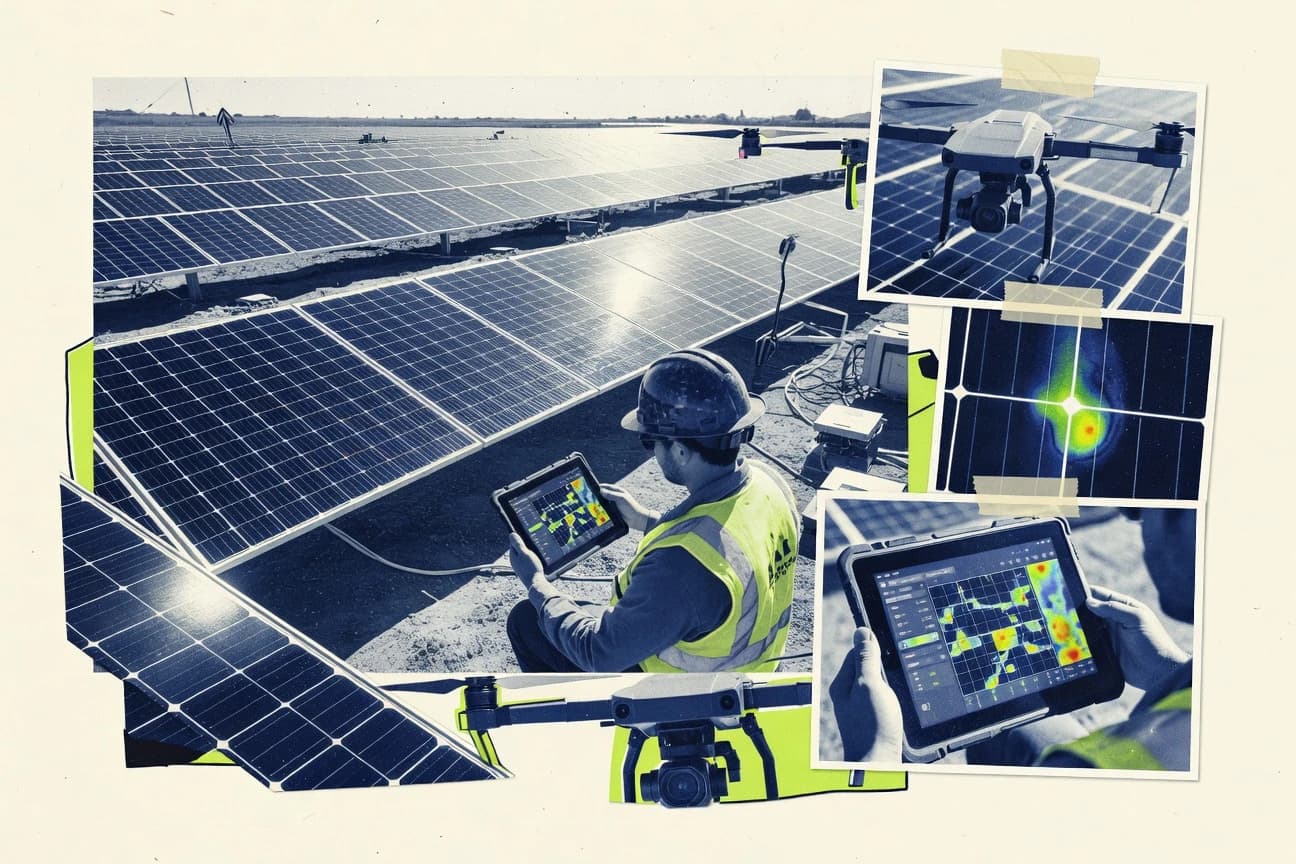
Check out the top 10 solar inspection software tools.

How we ranked these tools
Core product claims cross-referenced against official documentation, changelogs, and independent technical reviews.
Analyzed video reviews and hundreds of written evaluations to capture real-world user experiences with each tool.
AI persona simulations modeled how different user types would experience each tool across common use cases and workflows.
Final rankings reviewed and approved by our editorial team with authority to override AI-generated scores based on domain expertise.
Score: Features 40% · Ease 30% · Value 30%
Gitnux may earn a commission through links on this page — this does not influence rankings. Editorial policy
Editor’s top 3 picks
Three quick recommendations before you dive into the full comparison below — each one leads on a different dimension.
Aurora Solar
Design and inspection review workflow that keeps layouts consistent from modeling to verification
Built for solar installers and sales teams needing design-to-inspection validation at scale.
OpenSolar
Editor pickPhoto evidence with checklist-based defect logging for inspection-to-report traceability
Built for solar inspection teams needing consistent photo evidence and reviewable reports.
SolarEdge Portal
Editor pickPlant and inverter performance monitoring that guides which systems require inspection
Built for solar installers and service teams maintaining SolarEdge-only fleets needing monitoring-led inspections.
Related reading
Comparison Table
This comparison table benchmarks leading solar inspection and site assessment tools, including Aurora Solar, OpenSolar, SolarEdge Portal, Enphase Installer App, Sonnen, and other widely used options. Each row summarizes what the software supports for inspection workflows, project visibility, device or inverter integration, and operational usability so teams can match tool capabilities to their installer and compliance needs.
Aurora Solar
design-and-opsSolar design, proposal, and inspection workflows that support site measurements and system validation for PV projects.
Design and inspection review workflow that keeps layouts consistent from modeling to verification
Aurora Solar stands out by combining solar design with inspection and production workflows around real project data. It supports plan-and-model review using system layouts tied to measurement inputs, then helps teams validate designs against site constraints. Teams can generate consistent documentation for field verification and drive repeatable review cycles across multiple projects.
- +Tight link between design models and inspection documentation
- +Clear visual workflows for reviewing roof suitability and layout choices
- +Repeatable review process across many projects and variations
- +Strong support for communicating field-ready design decisions
- –Inspection workflows depend on accurate upstream project inputs
- –Advanced checks can require training to interpret correctly
- –Some inspection tasks feel less flexible than dedicated QA tools
Best for: Solar installers and sales teams needing design-to-inspection validation at scale
More related reading
OpenSolar
design-and-inspectionPV design, sales, and inspection tools that generate project documentation and support quality checks for solar installations.
Photo evidence with checklist-based defect logging for inspection-to-report traceability
OpenSolar stands out with a dedicated workflow for solar inspections that turns field findings into structured deliverables. The platform supports standardized checklists, photo capture, and defect notes so teams can document issues consistently across sites.
Inspection outputs can be compiled into client-ready reports tied to specific assets and locations, reducing manual rework after visits. Collaboration tools help reviewers add comments and confirm remediation priorities before final sign-off.
- +Structured inspection checklists standardize documentation across installers
- +Photo-driven defect logging links visual evidence to specific findings
- +Report generation streamlines review and sign-off workflows
- +Collaboration tools support reviewer comments during the inspection cycle
- –Setup of checklists and inspection templates can take time
- –Advanced customization requires careful process design to avoid rework
- –Workflow mapping is less flexible for highly custom inspection methods
Best for: Solar inspection teams needing consistent photo evidence and reviewable reports
SolarEdge Portal
monitoring-validationMonitoring and site-level analytics for solar systems that support ongoing performance verification after installation inspections.
Plant and inverter performance monitoring that guides which systems require inspection
SolarEdge Portal stands out because it centralizes performance monitoring and site access for SolarEdge PV systems, then connects that information to inspection and maintenance workflows. The platform supports inverter and plant-level views that inspection teams can use to validate system behavior, track issues, and prioritize follow-up. Site and asset context helps teams correlate operational anomalies with the inspection activities needed to resolve them.
- +Strong asset context with inverter and site views for inspection prioritization
- +Issue-oriented monitoring signals help focus inspections on likely problem systems
- +Workflow use is streamlined for teams managing SolarEdge portfolios
- –Inspection execution relies on system monitoring context rather than dedicated forms
- –Limited support for mixed-vendor solar inspection scenarios
- –Advanced inspection documentation and audit trails are not the primary focus
Best for: Solar installers and service teams maintaining SolarEdge-only fleets needing monitoring-led inspections
Enphase Installer App
commissioning-checksInstaller workflows for commissioning and validating microinverter systems with documentation tied to job inspection steps.
Commissioning and verification prompts tied to Enphase microinverter and system status
Enphase Installer App centers on structured solar inspection workflows tightly aligned to Enphase microinverter and monitoring systems. It supports onsite commissioning and verification tasks that help confirm system health and capture relevant evidence during installation.
The app’s inspection usefulness is strongest when projects rely on Enphase hardware ecosystems and the inspection goals match Enphase-style checks. It provides less flexibility for non-Enphase portfolios that need generic inspection templates or custom verification logic.
- +Enphase-specific inspection checks align with microinverter commissioning signals
- +Fast onsite verification reduces time spent cross-checking monitoring data
- +Guided workflows help standardize evidence collection during installs
- –Limited utility for sites that do not use Enphase hardware
- –Inspection customization is constrained versus generic solar inspection platforms
- –Richer reporting workflows depend on Enphase monitoring context
Best for: Installer teams deploying Enphase systems needing guided onsite verification
Sonnen
storage-commissioningEnergy storage installer and commissioning tooling that supports inspection-grade configuration checks for storage projects.
Operational telemetry-backed inspection reporting for solar assets
Sonnen stands out with solar plant and asset oversight tied to power generation telemetry and operational control, not just document storage. The system supports inspection workflows through centralized data capture, reporting, and site performance visibility across assets. It helps teams connect field observations to operational outcomes by grounding inspections in live monitoring context.
- +Inspection reporting is grounded in operational and performance telemetry.
- +Centralized asset visibility reduces time spent correlating site issues.
- +Workflow outputs align with how solar plants are monitored day to day.
- –Inspection setup can require more configuration than document-only tools.
- –Visual field capture and offline inspection capability feel limited for field-first work.
- –Collaboration features can be less flexible than standalone inspection platforms.
Best for: Solar operators needing inspection reporting linked to live asset performance
Sense
post-install-monitoringElectrical monitoring that helps confirm solar generation behavior during post-install inspection and verification.
Smart inspection capture that links photos and measurements to structured findings for reports
Sense distinguishes itself with an inspection workflow built around smart image capture, measurements, and field-ready documentation. It supports organizing inspection findings into structured reports with traceable photos and documented solar assets. Core capabilities focus on turning on-site observations into consistent outputs for review, handoff, and remediation planning.
- +Structured inspection capture turns photos and measurements into consistent findings
- +Report outputs help standardize documentation across inspectors and sites
- +Field-to-review workflow supports faster handoff of evidence for remediation
- –Advanced customization can require more effort than simpler inspection checklists
- –Not designed for highly bespoke workflows without configuration work
- –Best results depend on consistent capture behavior during inspections
Best for: Solar inspection teams needing photo-evidence reports and standardized findings
Aurora Inspection Checklist Templates
checklistsInspection checklist tooling embedded in solar project workflows to capture evidence and documentation during site acceptance.
Reusable checklist templates for consistent solar inspection data capture
Aurora Inspection Checklist Templates focuses on standardizing solar inspection workflows through reusable checklist templates. It helps teams capture inspection results with structured form fields instead of free-form notes.
The tool supports visual, step-based documentation that improves consistency across technicians and sites. It is best suited for organizations that want repeatable inspection checklists for common solar asset types.
- +Reusable inspection checklists reduce variation across technicians
- +Structured fields make findings easier to compare across sites
- +Template-driven workflows speed up repeat inspections
- –Template-centric approach limits advanced reporting automation
- –Collaboration and review workflows feel less comprehensive than inspection suite leaders
- –Customization depth may be constrained for highly unique inspection processes
Best for: Solar teams needing consistent checklist-based inspections without heavy process customization
Inspectify
field-inspectionMobile inspection management software that supports creating field checklists and collecting photo evidence for solar site inspections.
Checklist-based inspections that produce photo-backed reports directly from mobile field capture
Inspectify centers solar inspection workflows around mobile field capture, photo documentation, and structured reporting. The software supports checklist-based inspections and generates customer-ready reports that standardize findings across teams.
It also facilitates task and workflow organization for inspection execution, follow-ups, and internal review. The platform’s value is strongest where consistent documentation and repeatable processes matter more than deep engineering automation.
- +Mobile-first solar inspection capture with photo evidence
- +Checklist-driven workflows improve consistency across inspectors
- +Report generation turns field findings into shareable documentation
- +Task flow helps manage inspections and internal follow-up steps
- –Advanced integrations and custom automations are limited versus broader platforms
- –User onboarding can require setup to match inspection standards
- –Complex multi-site reporting needs more configuration effort
Best for: Solar teams needing standardized mobile inspections and document-ready reporting
GoCanvas
digital-formsDigital form and inspection execution platform that captures jobsite data and attachments for solar inspection reports.
Offline-capable mobile form capture with photo and signature evidence
GoCanvas stands out for replacing paper workflows with mobile forms, signatures, and photo capture that support field execution for solar inspections. It provides form builders, conditional logic, and offline-capable data collection so inspection checklists can run in low-connectivity jobsites.
Captured submissions can be sent to dashboards or exported for downstream reporting on compliance, defect capture, and work order handoff. Integration depth is practical for many teams but can be limiting when solar teams require deep asset, permitting, or GIS-specific workflows.
- +Mobile inspections use offline-ready form capture with photos and signatures
- +Conditional form logic supports checklist branching by system type or condition
- +Exports and integrations support turning inspections into actionable records
- –Solar-specific inspection analytics and compliance reporting are not built-in
- –Some complex workflows require configuration that can become difficult to maintain
- –Limited depth for asset, permitting, and GIS workflows compared with specialist tools
Best for: Teams needing mobile inspection checklists with photos and signatures for solar field work
iAuditor
QA-inspectionsConfigurable inspection templates with mobile capture and audit trails for solar construction and QA field checks.
Guided mobile inspections that attach photos directly to checklist findings
iAuditor distinguishes itself with mobile-first inspection workflows built around guided checklists and photo evidence capture. Core capabilities include customizable templates for solar site and equipment inspections, issue logging, and document exports that consolidate findings for client delivery. The workflow supports standardized observations across teams through consistent form structure and repeatable data collection.
- +Mobile guided checklists speed consistent solar inspection data capture
- +Photo and evidence attachment keeps findings tied to the exact observation
- +Configurable templates support repeatable reporting across sites and crews
- –Advanced solar-specific analytics and engineering views are limited
- –Cross-team workflow governance and role controls are not as granular
- –Large inspection libraries can feel heavy without strong search workflows
Best for: Solar inspection teams needing standardized mobile forms with evidence-backed reporting
Conclusion
After evaluating 10 utilities power, Aurora Solar stands out as our overall top pick — it scored highest across our combined criteria of features, ease of use, and value, which is why it sits at #1 in the rankings above.
Use the comparison table and detailed reviews above to validate the fit against your own requirements before committing to a tool.
How to Choose the Right Solar Inspection Software
This buyer’s guide explains what to evaluate in solar inspection workflows across Aurora Solar, OpenSolar, SolarEdge Portal, Enphase Installer App, Sonnen, Sense, Aurora Inspection Checklist Templates, Inspectify, GoCanvas, and iAuditor. It maps real inspection needs to specific capabilities like photo-backed defect logging, guided mobile checklists, offline-capable form capture, and monitoring-led inspection prioritization. It also highlights common selection mistakes tied to checklist setup overhead, workflow rigidity, and limited asset or GIS depth in form tools.
What Is Solar Inspection Software?
Solar inspection software captures on-site evidence and turns field observations into structured, reviewable outputs like checklists, defect notes, and client-ready reports. It solves problems caused by paper workflows, inconsistent evidence capture, and manual report rework after site visits. Tools such as OpenSolar use photo capture linked to checklist-based defect logging to create inspection-to-report traceability. Tools such as Inspectify focus on mobile-first inspection capture with photo evidence and report generation for standardized documentation.
Key Features to Look For
The right solar inspection software reduces rework by connecting field evidence to the exact inspection finding and the exact output people need for sign-off.
Photo-backed defect logging tied to checklist findings
OpenSolar links photo evidence to checklist-based defect logging so reviewers can trace each issue to the exact visual evidence. Inspectify and iAuditor also attach photos directly to guided mobile checklist findings to keep evidence aligned to observations.
Guided mobile checklists with structured observations
iAuditor delivers guided mobile inspections that standardize solar construction and QA field checks with configurable templates. Aurora Inspection Checklist Templates uses reusable checklist templates and structured form fields to reduce technician-to-technician variation during repeated inspections.
Design-to-inspection validation workflows using real project inputs
Aurora Solar keeps layouts consistent from modeling to verification by using a design and inspection review workflow tied to measurement inputs. This is a strong fit for teams that want plan-and-model review plus roof suitability and layout decisions communicated as field-ready design outcomes.
Offline-capable mobile form capture with signatures and attachments
GoCanvas supports offline-capable mobile inspection form capture with photos and signatures, which helps field teams complete inspections in low-connectivity locations. Inspectify covers mobile field capture and photo documentation and also emphasizes task flow for inspection execution and follow-up.
Monitoring-led inspection prioritization using site and asset context
SolarEdge Portal connects inspection and maintenance workflows to plant and inverter performance views so inspection teams focus on likely problem systems. Sonnen uses operational telemetry-backed inspection reporting to ground inspection findings in live asset performance context.
Ecosystem-specific commissioning and verification prompts
Enphase Installer App provides commissioning and verification prompts tied to Enphase microinverter system status for guided onsite verification. Sense supports smart inspection capture that links photos and measurements to structured findings for report-ready handoff, which is valuable when inspection evidence must include measurement context.
How to Choose the Right Solar Inspection Software
The selection framework starts by matching the inspection output format and evidence requirements to the workflow model of the tool.
Match the tool to the evidence type and output people need
If inspection deliverables must show photo evidence tied to each defect, OpenSolar and iAuditor support photo capture attached to structured findings for review and client delivery. If inspection deliverables must include measurement context, Sense links photos and measurements to structured findings for consistent reporting across sites.
Choose a workflow model that fits how teams operate in the field
For technicians who need a guided checklist that standardizes capture on mobile devices, iAuditor and Aurora Inspection Checklist Templates provide template-driven mobile checklists and structured fields. For low-connectivity jobsites that require offline completion, GoCanvas supports offline-capable form capture with photos and signatures.
Decide whether inspection should be driven by design, monitoring, or pure field capture
For design-to-verification alignment, Aurora Solar connects modeling to inspection documentation so review cycles remain consistent across many project variations. For ongoing operations where inspection should be guided by live signals, SolarEdge Portal and Sonnen tie inspection execution to plant, inverter, and operational telemetry context.
Evaluate how much customization and template setup the organization can support
OpenSolar and iAuditor rely on standardized inspection checklists or configurable templates, and checklist setup can take time when templates must reflect unique field methods. Inspectify and Aurora Inspection Checklist Templates keep the process template-centric, which reduces flexibility for highly unique inspection processes that need deep automation.
Confirm ecosystem fit for microinverter and telemetry-centric sites
For Enphase microinverter commissioning and verification steps, Enphase Installer App provides prompts tied to Enphase-style system status. For SolarEdge-only portfolios, SolarEdge Portal supplies inverter and site views that align inspections with operational anomalies rather than generic forms.
Who Needs Solar Inspection Software?
Solar inspection software benefits teams that must standardize field evidence capture, convert findings into structured reports, and reduce post-visit rework across multiple sites.
Solar installers and sales teams that need design-to-inspection validation at scale
Aurora Solar fits this audience because it links design models and inspection documentation through a repeatable review process tied to measurement inputs. It also supports visual workflows for reviewing roof suitability and communicating field-ready design decisions.
Solar inspection teams that must standardize photo evidence and defect documentation
OpenSolar matches this need with structured inspection checklists, photo-driven defect logging, and report generation for review and sign-off workflows. Sense also targets standardized findings by linking smart image capture and measurements to structured outputs.
Solar installers and service teams maintaining SolarEdge-only fleets
SolarEdge Portal is designed for monitoring-led inspections with plant and inverter performance views that guide inspection prioritization. This approach keeps inspections grounded in system behavior context rather than generic checklist completion.
Mobile-first inspection teams that need guided checklists or offline capture
iAuditor supports guided mobile checklists that attach photos directly to checklist findings for consistent evidence-backed reporting. GoCanvas supports offline-capable mobile form capture with photos and signatures for inspections completed in low-connectivity conditions.
Common Mistakes to Avoid
Common selection failures come from choosing a tool whose workflow rigidity, template setup burden, or limited asset context does not match the organization’s inspection reality.
Selecting a document-only tool when inspections must connect to design verification
Aurora Solar is built for design-to-inspection validation because it keeps layouts consistent from modeling to verification and ties inspection documentation to measurement inputs. OpenSolar and iAuditor focus on inspection documentation and mobile evidence capture, which can leave design validation as an extra manual step.
Underestimating checklist and template setup effort for standardized inspection methods
OpenSolar can require time to set up checklists and inspection templates, and advanced customization needs careful process design to avoid rework. iAuditor also depends on configurable templates, and large inspection libraries can feel heavy without strong search workflows.
Assuming every tool supports field capture in low-connectivity sites
GoCanvas supports offline-capable mobile inspection form capture with photos and signatures, which prevents stalled inspections when connectivity is unavailable. Tools focused on checklist templates without explicit offline execution support may require connectivity to complete consistent capture.
Choosing monitoring-heavy inspection platforms for mixed-vendor or form-centric workflows
SolarEdge Portal is optimized for SolarEdge portfolios and uses monitoring context rather than dedicated forms for inspection execution. Enphase Installer App is optimized for Enphase hardware commissioning and verification prompts, which limits usefulness for non-Enphase portfolios needing generic inspection templates.
How We Selected and Ranked These Tools
we evaluated Aurora Solar, OpenSolar, SolarEdge Portal, Enphase Installer App, Sonnen, Sense, Aurora Inspection Checklist Templates, Inspectify, GoCanvas, and iAuditor on three sub-dimensions. Features carry a weight of 0.4. Ease of use carries a weight of 0.3. Value carries a weight of 0.3. The overall rating is the weighted average calculated as overall = 0.40 × features + 0.30 × ease of use + 0.30 × value. Aurora Solar stood out with a design and inspection review workflow that keeps layouts consistent from modeling to verification, which strongly improved the features dimension compared with more document- and form-centric tools like Aurora Inspection Checklist Templates.
Frequently Asked Questions About Solar Inspection Software
Which solar inspection platform turns field findings into client-ready reports with traceable photo evidence?
What tool best supports design-to-inspection validation for projects that need consistent system layouts?
Which option is most useful for SolarEdge-only fleets that want monitoring-led inspection planning?
Which software is strongest for guided onsite commissioning and verification with Enphase microinverters?
Which tools support offline inspection work on low-connectivity jobsites while still capturing photos?
What option is best for standardizing checklist-based inspections across many technicians and sites?
How do teams link inspection activities to live asset performance instead of treating inspections as standalone paperwork?
Which platform is designed for structured defect logging and remediation review collaboration before final sign-off?
What is a common setup path to get teams using mobile solar inspections quickly?
Which tool is the best fit when solar teams need generic solar inspection forms rather than equipment-specific checks?
Tools reviewed
Primary sources checked during evaluation.
Referenced in the comparison table and product reviews above.
Keep exploring
Comparing two specific tools?
Software Alternatives
See head-to-head software comparisons with feature breakdowns, pricing, and our recommendation for each use case.
Explore software alternatives→In this category
Utilities Power alternatives
See side-by-side comparisons of utilities power tools and pick the right one for your stack.
Compare utilities power tools→FOR SOFTWARE VENDORS
Not on this list? Let’s fix that.
Our best-of pages are how many teams discover and compare tools in this space. If you think your product belongs in this lineup, we’d like to hear from you—we’ll walk you through fit and what an editorial entry looks like.
Apply for a ListingWHAT THIS INCLUDES
Where buyers compare
Readers come to these pages to shortlist software—your product shows up in that moment, not in a random sidebar.
Editorial write-up
We describe your product in our own words and check the facts before anything goes live.
On-page brand presence
You appear in the roundup the same way as other tools we cover: name, positioning, and a clear next step for readers who want to learn more.
Kept up to date
We refresh lists on a regular rhythm so the category page stays useful as products and pricing change.