GITNUXSOFTWARE ADVICE
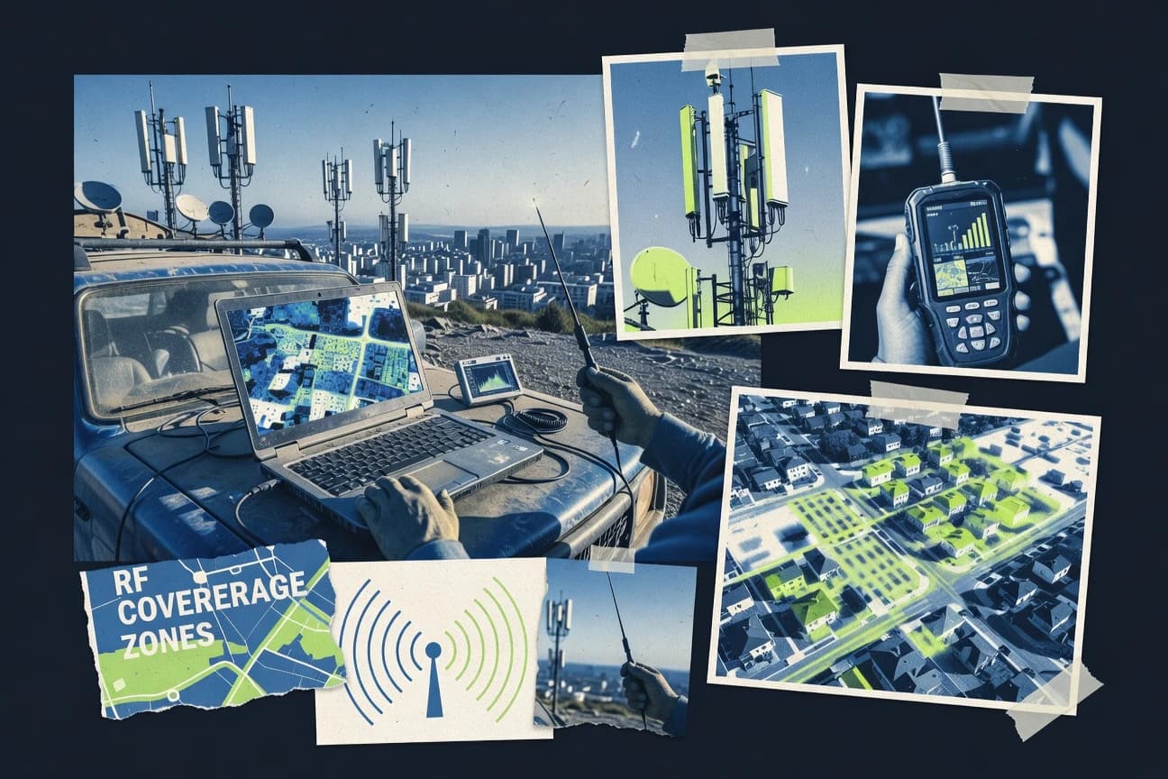
Telecommunications ConnectivityTop 10 Best Rf Coverage Mapping Software of 2026
Discover top RF coverage mapping software tools. Compare features, find the best fit for your needs, and optimize signal performance. Explore now.

How we ranked these tools
Core product claims cross-referenced against official documentation, changelogs, and independent technical reviews.
Analyzed video reviews and hundreds of written evaluations to capture real-world user experiences with each tool.
AI persona simulations modeled how different user types would experience each tool across common use cases and workflows.
Final rankings reviewed and approved by our editorial team with authority to override AI-generated scores based on domain expertise.
Score: Features 40% · Ease 30% · Value 30%
Gitnux may earn a commission through links on this page — this does not influence rankings. Editorial policy
Editor’s top 3 picks
Three quick recommendations before you dive into the full comparison below — each one leads on a different dimension.
CellMapper
Sector-level coverage visualization from parsed drive-test logs
Built for teams mapping LTE and 5G RF coverage with sector-level evidence.
OpenSignal (Drive Test and Coverage Insights via app-derived mapping)
Editor pickDrive Test coverage mapping from app-collected measurements into interactive coverage experience visuals
Built for regional teams validating coverage quality patterns using app-collected measurements.
Network Cell Info Lite (with community mapping exports)
Editor pickCommunity mapping exports that turn logged cell measurements into shareable coverage data
Built for field teams collecting crowdsourced Rf samples for external map generation.
Related reading
Comparison Table
This comparison table evaluates RF coverage mapping tools that turn drive-test results, mobile app measurements, or community cell logs into coverage views, including CellMapper, OpenSignal’s Drive Test and Coverage Insights, and Network Cell Info Lite export workflows. It also covers planning and optimization suites such as NetMonster and Nokia AirScale Planning Suite, alongside other mapping options, so readers can compare data sources, mapping outputs, and use cases. The goal is to help teams select the right tool for field validation, network planning, or ongoing crowd-sourced mapping.
CellMapper
crowdsourced mappingCrowdsourced cellular coverage mapping that visualizes RF performance metrics from user measurements on an interactive map.
Sector-level coverage visualization from parsed drive-test logs
CellMapper turns drive-test and crowdsourced cellular logs into coverage maps with interactive map views and sector-level details. It emphasizes visualizing LTE and 5G signal strength plus serving relationships across time and location.
The tool distinguishes itself by combining RF measurements with downloadable artifacts and a workflow aimed at mapping real network behavior. Results are best for geographically organized coverage work where sector accuracy and evidence trails matter.
- +Interactive maps render sector coverage using real measurement logs
- +Sector-level summaries make it easier to spot gaps and overlap
- +Exportable outputs support reports, sharing, and field verification
- +Crowdsourced aggregation helps compare coverage across areas
- –Setup and data ingestion require more RF and log familiarity
- –Map interpretation can be noisy without careful drive-test discipline
- –Workflow depends on consistent measurement logging and metadata
Best for: Teams mapping LTE and 5G RF coverage with sector-level evidence
More related reading
OpenSignal (Drive Test and Coverage Insights via app-derived mapping)
network analyticsProvides coverage and network performance insights using large-scale measurement data that supports coverage mapping and benchmarking.
Drive Test coverage mapping from app-collected measurements into interactive coverage experience visuals
OpenSignal’s Drive Test and Coverage Insights combine crowd-sourced and app-derived drive testing with mapped coverage analytics for RF performance understanding. The tool’s coverage experience views translate measurement data into usable maps and performance indicators across geographies.
Coverage insights emphasize signal experience and network behavior observed from user collection, which supports planning discussions without requiring bespoke measurement infrastructure. Coverage mapping is strongest for evaluating coverage quality patterns rather than exporting fully engineered RF planning models.
- +App-derived drive testing delivers dense coverage views without dedicated test gear.
- +Coverage maps make signal experience patterns easy to interpret for planning groups.
- +Rich location-based analytics support comparisons across regions and time windows.
- +User-friendly exploration reduces the effort needed to turn data into insights.
- –Coverage insights are better for experience mapping than engineering-grade RF modeling.
- –Output formats and export depth may not satisfy detailed optimization workflows.
- –Crowd-collection bias can skew results in low-sample or high-mobility areas.
- –Limited direct control over test routes and measurement parameters compared to lab gear.
Best for: Regional teams validating coverage quality patterns using app-collected measurements
Network Cell Info Lite (with community mapping exports)
measurement captureCaptures detailed cellular RF and neighbor measurements that can be exported for coverage mapping workflows.
Community mapping exports that turn logged cell measurements into shareable coverage data
Network Cell Info Lite focuses on turning Android device radio measurements into usable Rf coverage evidence with minimal setup effort. It captures neighbor cells and signal metrics with cell identity context, then supports community mapping style exports that help teams share crowdsourced coverage.
The app is strongest for field collection workflows and for feeding external map tools rather than for performing advanced GIS analysis inside the app. Coverage mapping output depends on consistent measurement logging and on how exported data is processed downstream.
- +Runs on Android and logs cell measurements with cell identity context
- +Captures neighbor cells and timing data that improve coverage interpretation
- +Supports community mapping exports for crowdsourced coverage sharing
- +Lightweight interface keeps measurement collection fast in the field
- –Provides limited in-app mapping and analysis compared with GIS tools
- –Export workflow relies on downstream processing for map accuracy
- –Measurement quality varies with device behavior and placement strategy
Best for: Field teams collecting crowdsourced Rf samples for external map generation
NetMonster
drive-test loggingLogs cellular signal, neighbor, and drive-test data to support RF coverage analysis and mapping exports.
Scenario-driven RF coverage map generation and comparison
NetMonster distinguishes itself with rapid Rf coverage mapping workflows built around antenna and site inputs that translate directly into coverage views. Core capabilities center on generating coverage maps, organizing RF planning data per scenario, and visualizing results across configurable regions.
It supports iterative adjustments so teams can compare planning assumptions and refine coverage outcomes without rebuilding datasets. The tool targets practical RF engineering deliverables rather than broad general-purpose GIS analytics.
- +Fast workflow for generating and updating RF coverage maps
- +Scenario-based organization supports iterative planning and comparisons
- +Clear visualization of planned RF footprints for site decisions
- +Focused feature set aligns well to RF coverage mapping tasks
- –Requires RF input discipline to avoid misleading coverage outputs
- –Limited flexibility for advanced geospatial analytics workflows
- –UI complexity can slow teams without strong RF planning habits
Best for: RF planning teams needing scenario-based coverage maps with quick iteration
Nokia AirScale Planning Suite
planning and simulationPerforms radio network planning and coverage simulation for RF rollouts using engineering-grade planning tools.
Integrated RF coverage planning workflow that links propagation models to engineered site configurations
Nokia AirScale Planning Suite focuses on radio planning workflows for cellular networks, with RF coverage and capacity planning for modern deployments. It supports engineered planning around radio parameters, antenna configuration, and propagation modeling to produce coverage outputs for design iterations. The suite emphasizes integration between planning inputs and results so teams can iterate on sites, sectors, and policies without rebuilding the workflow each time.
- +Radio planning workflow ties site, antenna, and RF assumptions to outputs
- +Coverage planning supports iterative refinement across design scenarios
- +Results reflect engineering inputs such as antenna and propagation assumptions
- –Advanced planning setup requires strong RF engineering process discipline
- –UI complexity can slow initial onboarding for non-specialist planners
- –Scenario management overhead grows with large multi-area studies
Best for: Carrier RF planning teams needing repeatable coverage studies with engineering rigor
Keysight GoldenGate
drive-test platformSupports drive-test data acquisition and engineering analysis used for RF coverage mapping and verification.
Ray-tracing based coverage mapping with terrain-aware propagation modeling
Keysight GoldenGate is distinct for coupling RF propagation modeling with ray-tracing and coverage prediction workflows designed for RF network planning. It supports outdoor coverage mapping from site and terrain inputs and can evaluate performance impacts across frequency and antenna configurations. It also integrates with Keysight ecosystem tools for geospatial data handling and measurement-driven validation so predictions can be compared to real RF behavior.
- +Ray-tracing coverage prediction improves spatial accuracy versus basic path-loss models
- +Strong geospatial and terrain-aware RF mapping for outdoor network planning
- +Workflow supports scenario comparisons across frequencies and antenna configurations
- +Integration with Keysight tools enables measurement-driven validation loops
- –Requires high-quality input data like terrain models and site parameters
- –Setup and scenario iteration can be slow for large multi-site studies
- –Less straightforward for purely indoor coverage mapping without careful configuration
Best for: RF planning teams producing outdoor coverage maps using validated propagation models
Aeroflex/Viavi PlaneWave and Network Analysis tools
field test analyticsAnalyzes RF and network measurements to support coverage verification and mapping in field testing workflows.
Calibration-to-analysis measurement pipeline supporting traceable coverage mapping outputs
Aeroflex/Viavi PlaneWave and Network Analysis tools stand out for combining RF calibration and drive-test style measurement workflows with coverage-focused visualization. The suite supports network analysis tasks such as spectrum-related evaluation, device and signal characterization, and engineering-grade reporting built around traceable measurement data. It fits coverage mapping projects that require consistent measurement setups and repeatable post-processing of RF results.
- +Engineering-grade RF measurement workflows tied to repeatable post-processing
- +Strong support for RF characterization tasks needed for coverage mapping
- +Coverage outputs backed by measurement data from network analysis steps
- –Workflow complexity increases time-to-first usable coverage map
- –Coverage mapping setup depends heavily on correct measurement and calibration
- –User experience feels oriented toward RF specialists, not general GIS users
Best for: RF engineering teams needing calibrated, measurement-driven coverage maps
Mapbox
mapping infrastructureEnables custom RF coverage map visualization by serving tiled map data and geospatial rendering for measurement layers.
Mapbox GL style expressions for driving dynamic layer rendering
Mapbox stands out for embedding high-performance web mapping into custom applications using SDKs and Mapbox Studio. It supports Rf coverage mapping through custom basemaps plus developer-built layers that visualize coverage rasters, polygons, and point measurements.
The stack also enables styling, interactivity, and export-friendly geospatial workflows that teams can tailor to their RF domain needs. Core value comes from control of the map rendering pipeline rather than out-of-the-box RF-specific analysis features.
- +Highly flexible map rendering with SDK-based customization and styling controls
- +Interactive layers for visualizing RF coverage polygons, grids, and sensor points
- +Strong performance for dense geospatial tiles and large client-side datasets
- –RF coverage generation and propagation analysis are not provided as built-in tools
- –Integration requires software development for data pipelines and layer logic
- –Advanced geospatial workflows can be complex to operationalize across teams
Best for: Teams building custom RF coverage dashboards with interactive geospatial visualization
Esri ArcGIS
geospatial analyticsBuilds RF coverage dashboards and heatmaps using geospatial layers and spatial analysis tools for measurement data.
ArcGIS Network Analyst for routing, service areas, and network-based coverage calculations
Esri ArcGIS stands out for its mature geospatial stack that connects GIS data, routing analysis, and map-based visualization in one ecosystem. It supports Rf coverage mapping workflows using network analysis tools, raster and feature layers, and publishable web maps and applications for stakeholder review.
Advanced users can script and automate repeatable coverage calculations with ArcGIS Pro geoprocessing and server-side services. The platform is less direct for purely RF-specific propagation modeling out of the box, so RF modeling often requires external inputs or specialized add-ons.
- +Strong network analysis tools for drive-time and service-area coverage mapping
- +ArcGIS Pro geoprocessing enables repeatable coverage workflows and automation
- +Web maps and dashboards support easy stakeholder sharing and review
- –RF propagation modeling is not turnkey for coverage prediction without extra modeling work
- –Admin and data-prep complexity increases setup time for multi-user deployments
- –Licensing and environment choices can complicate scaling beyond a single team
Best for: GIS-centric teams building location-aware coverage maps with network and service areas
QGIS
open-source GISProcesses RF measurement point data and interpolates coverage surfaces using GIS tools and plugins for mapping.
QGIS Print Layout for producing publication-ready coverage map compositions
QGIS stands out for its desktop-first geospatial engine and plugin ecosystem that supports Rf coverage mapping workflows with map visualization and spatial analysis. It enables importing raster and vector data, running geoprocessing, and producing layout-ready coverage maps using styling, symbology, and geoprocessing tools.
For Rf coverage mapping, it covers essential steps like grid or boundary preparation, raster overlay, terrain and distance layers, and exporting publishable outputs. Its flexibility is strong, but building end-to-end RF-specific propagation modeling still depends on external tools or custom scripting beyond core QGIS features.
- +Strong raster and vector handling for coverage map layers and inputs
- +Extensive geoprocessing and spatial analysis tools for pre-processing
- +Print layouts and styling tools for map-ready coverage outputs
- –RF propagation modeling is not native and often needs external workflows
- –Complex projects require careful layer management and configuration
- –Plugin and scripting setup can add friction for repeatable pipelines
Best for: RF teams needing flexible GIS visualization and analysis for coverage outputs
Conclusion
After evaluating 10 telecommunications connectivity, CellMapper stands out as our overall top pick — it scored highest across our combined criteria of features, ease of use, and value, which is why it sits at #1 in the rankings above.
Use the comparison table and detailed reviews above to validate the fit against your own requirements before committing to a tool.
How to Choose the Right Rf Coverage Mapping Software
This buyer's guide covers Rf coverage mapping workflows using tools like CellMapper, OpenSignal, Network Cell Info Lite, NetMonster, and Nokia AirScale Planning Suite. It also covers engineering-grade modeling with Keysight GoldenGate and Aeroflex/Viavi PlaneWave, and GIS and dashboard stacks with Esri ArcGIS and QGIS plus custom visualization with Mapbox. The guidance connects tool capabilities to field mapping evidence, engineering rigor, and stakeholder-ready outputs.
What Is Rf Coverage Mapping Software?
Rf coverage mapping software turns RF measurement data or engineered radio assumptions into maps that show signal reach across space. It solves the problem of translating drive-test logs, crowdsourced cell measurements, or propagation modeling into coverage views that teams can interpret and act on. CellMapper shows sector-level coverage using parsed drive-test logs on interactive maps. Esri ArcGIS shows coverage analysis with ArcGIS Network Analyst routing and service-area calculations built into a broader GIS workflow.
Key Features to Look For
These features determine whether a tool produces evidence-based coverage visuals, engineering-grade predictions, or stakeholder-ready dashboards.
Sector-level coverage visualization from parsed drive-test logs
CellMapper excels at sector-level coverage visualization by parsing drive-test logs into interactive maps with sector details. This supports evidence trails for gap discovery because the sector view stays tied to the measurement workflow that produced it.
Drive-test coverage experience mapping from app-collected measurements
OpenSignal turns app-derived drive test data into interactive coverage experience visuals. This is a strong fit for teams validating coverage quality patterns without acquiring bespoke test data.
Neighbor-cell logging with community mapping exports
Network Cell Info Lite records cell measurements with cell identity context and captures neighbor cells. It also supports community mapping exports so teams can share crowdsourced RF evidence even when advanced GIS analysis happens outside the app.
Scenario-based RF coverage map generation and comparison
NetMonster supports scenario-driven RF coverage map generation so teams can compare RF footprints after changing planning assumptions. This accelerates iterative planning because outputs can be organized per scenario instead of rebuilding coverage from scratch each time.
Integrated engineering workflow linking propagation models to engineered site configurations
Nokia AirScale Planning Suite provides an integrated radio planning workflow that links propagation modeling to engineered site configurations. Keysight GoldenGate complements this approach with ray-tracing and terrain-aware propagation modeling for outdoor coverage maps tied to validated inputs.
Traceable measurement pipeline with calibration-to-analysis coverage outputs
Aeroflex/Viavi PlaneWave and Network Analysis tools emphasize calibration and repeatable post-processing tied to measurement steps. This design supports coverage verification work where traceability matters more than quick visualization alone.
How to Choose the Right Rf Coverage Mapping Software
The decision should start from whether the project needs measurement-evidence mapping, engineering-grade prediction, or GIS and dashboard visualization on top of existing RF workflows.
Choose the evidence type: parsed drive-test, app-derived experience, or crowdsourced cell logs
CellMapper is a direct fit when RF work requires sector-level coverage visuals built from parsed drive-test logs with interactive sector details. OpenSignal is a better fit for regional validation because it maps app-derived drive testing into coverage experience views. Network Cell Info Lite fits teams running field collection on Android and exporting neighbor-aware measurements into shareable community mapping outputs.
Decide whether coverage is planned engineering output or verified measurement output
NetMonster works when RF coverage maps must be generated from RF planning data with scenario organization for quick iteration. Nokia AirScale Planning Suite and Keysight GoldenGate fit when engineered coverage planning must link radio parameters, antenna configuration, and propagation modeling to outputs. Aeroflex/Viavi PlaneWave and Network Analysis tools fit when measurement calibration and traceable post-processing must underpin the coverage maps.
Confirm map controls and iteration speed for your workflow
NetMonster prioritizes fast scenario-based coverage generation and comparison, which reduces friction for iterative RF planning decisions. Nokia AirScale Planning Suite and Keysight GoldenGate emphasize modeling rigor, which increases setup demands but produces coverage outputs tied to engineered assumptions. CellMapper supports interactive map exploration with evidence-linked artifacts, which helps interpretation once log discipline is established.
Plan for GIS integration and stakeholder-ready publishing
Esri ArcGIS fits teams that need routing, service-area coverage mapping, and stakeholder review through publishable web maps and dashboards using ArcGIS Pro geoprocessing and server-side services. QGIS fits teams that want a desktop-first GIS engine for raster and vector processing plus print layouts for publication-ready map compositions. Mapbox fits teams that want custom interactive RF coverage dashboards by building map layers and styling via Mapbox GL style expressions.
Validate output intent: experience maps, engineered predictions, or custom dashboard layers
OpenSignal is designed for coverage experience patterns rather than engineering-grade RF planning exports. Keysight GoldenGate and Nokia AirScale Planning Suite produce engineering-oriented coverage outputs using ray-tracing and propagation assumptions, which supports outdoor planning decisions. Mapbox shifts the effort to building visualization layers over coverage rasters or polygons, so it is best when RF analysis outputs already exist and the main goal is custom visualization.
Who Needs Rf Coverage Mapping Software?
Different roles need coverage mapping tools for different evidence and modeling workflows.
Teams mapping LTE and 5G RF coverage with sector-level evidence
CellMapper is the best match when sector-level coverage must come from parsed drive-test logs and the map must show sector details. This audience benefits from interactive sector summaries that help locate coverage gaps and overlap with an evidence trail.
Regional teams validating coverage quality patterns using app-collected measurements
OpenSignal fits teams that want dense coverage views generated from app-derived drive testing. This supports comparing signal experience patterns across geographies and time windows without requiring dedicated test gear.
Field teams collecting crowdsourced RF samples for external map generation
Network Cell Info Lite supports fast Android logging of cell measurements with neighbor cells and cell identity context. It also provides community mapping exports so teams can share data and build coverage outputs in external workflows.
RF engineering teams producing outdoor coverage maps using validated propagation models
Keysight GoldenGate supports ray-tracing coverage prediction with terrain-aware propagation modeling for more spatial accuracy in outdoor planning. Nokia AirScale Planning Suite also fits when integrated engineering workflows must link propagation models to engineered site configurations.
Common Mistakes to Avoid
Common pitfalls across tools fall into three categories: weak measurement discipline, mismatched modeling intent, and choosing the wrong visualization layer for the job.
Treating coverage maps as engineering truth without measurement discipline
CellMapper and Network Cell Info Lite both rely on consistent measurement logging and metadata so weak drive-test discipline can make map interpretation noisy. Aeroflex/Viavi PlaneWave and Network Analysis tools reduce this risk by tying coverage outputs to calibration-to-analysis measurement pipelines.
Using an experience-focused mapper for engineering-grade planning deliverables
OpenSignal is oriented toward coverage experience mapping and signal experience patterns, so it is not designed for exporting fully engineered RF planning models. Use Nokia AirScale Planning Suite or Keysight GoldenGate when radio planning output must tie to propagation assumptions and engineered site configurations.
Choosing a GIS-only tool when propagation modeling is the core requirement
Esri ArcGIS and QGIS provide strong GIS processing and mapping publishing, but RF propagation modeling is not turnkey without extra modeling work. For propagation-driven coverage prediction, Nokia AirScale Planning Suite and Keysight GoldenGate provide integrated engineering workflows.
Building coverage dashboards without committing to a data-to-layer pipeline
Mapbox offers flexible map rendering with interactive layers, but it does not provide built-in RF coverage generation or propagation analysis. Teams that lack coverage rasters or polygon layers should plan to produce those outputs using tools like NetMonster, Nokia AirScale Planning Suite, or CellMapper before visualization.
How We Selected and Ranked These Tools
we evaluated each tool by scoring features with weight 0.40, ease of use with weight 0.30, and value with weight 0.30. The overall rating is the weighted average computed as overall = 0.40 × features + 0.30 × ease of use + 0.30 × value. CellMapper separated itself from lower-ranked tools on feature coverage mapping by delivering sector-level coverage visualization from parsed drive-test logs, which directly supports evidence-linked interpretation while keeping interactive map exploration central. tools like Esri ArcGIS and QGIS scored strongly on geospatial workflows and map output presentation, but they did not provide a native RF propagation prediction layer in the same integrated way as Nokia AirScale Planning Suite and Keysight GoldenGate.
Frequently Asked Questions About Rf Coverage Mapping Software
Which tool best turns drive-test data into sector-level RF evidence?
What software fits teams that need coverage insights from app-collected measurements rather than engineered RF planning?
Which option is best for lightweight field data capture and community-style coverage outputs on external map stacks?
Which tool supports scenario-based RF planning iterations without rebuilding coverage datasets?
Which platform is designed for engineered radio planning with repeatable propagation and capacity studies?
Which solution is strongest for terrain-aware outdoor coverage predictions using ray tracing?
Which toolchain suits calibrated, measurement-driven coverage mapping where traceability matters?
Which option is best when RF coverage needs to be embedded in custom web dashboards with dynamic map layers?
Which platform is best for GIS-centric coverage maps that require routing, service-area analysis, and automation?
What tool is best for producing publication-ready coverage maps when the workflow is primarily GIS visualization?
Tools reviewed
Primary sources checked during evaluation.
Referenced in the comparison table and product reviews above.
Keep exploring
Comparing two specific tools?
Software Alternatives
See head-to-head software comparisons with feature breakdowns, pricing, and our recommendation for each use case.
Explore software alternatives→In this category
Telecommunications Connectivity alternatives
See side-by-side comparisons of telecommunications connectivity tools and pick the right one for your stack.
Compare telecommunications connectivity tools→FOR SOFTWARE VENDORS
Not on this list? Let’s fix that.
Our best-of pages are how many teams discover and compare tools in this space. If you think your product belongs in this lineup, we’d like to hear from you—we’ll walk you through fit and what an editorial entry looks like.
Apply for a ListingWHAT THIS INCLUDES
Where buyers compare
Readers come to these pages to shortlist software—your product shows up in that moment, not in a random sidebar.
Editorial write-up
We describe your product in our own words and check the facts before anything goes live.
On-page brand presence
You appear in the roundup the same way as other tools we cover: name, positioning, and a clear next step for readers who want to learn more.
Kept up to date
We refresh lists on a regular rhythm so the category page stays useful as products and pricing change.