GITNUXSOFTWARE ADVICE
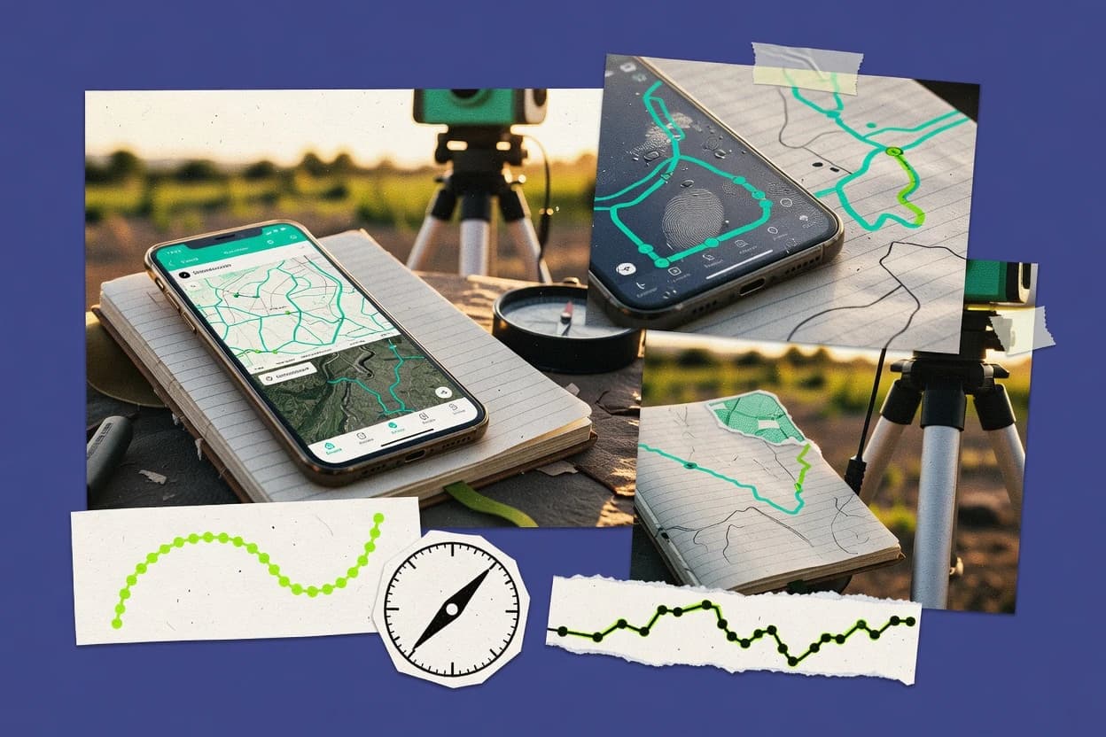
Science ResearchTop 9 Best Mobile Gis Software of 2026
Top 10 ranking of Mobile Gis Software for field data capture, offline mapping, and GIS workflows, with side-by-side tool comparisons.

How we ranked these tools
Core product claims cross-referenced against official documentation, changelogs, and independent technical reviews.
Analyzed video reviews and hundreds of written evaluations to capture real-world user experiences with each tool.
AI persona simulations modeled how different user types would experience each tool across common use cases and workflows.
Final rankings reviewed and approved by our editorial team with authority to override AI-generated scores based on domain expertise.
Score: Features 40% · Ease 30% · Value 30%
Gitnux may earn a commission through links on this page — this does not influence rankings. Editorial policy
Editor’s top 3 picks
Three quick recommendations before you dive into the full comparison below — each one leads on a different dimension.
Esri ArcGIS Survey123
Survey123 Connect publishes XLSForm-based surveys and pushes results to ArcGIS feature services with validation.
Built for fits when mid-size teams need GIS-first mobile forms with controlled schema and ArcGIS-based automation..
QField
Editor pickQGIS project support for offline layers, forms, and symbology as the mobile schema source.
Built for fits when field teams need QGIS-aligned offline capture with configuration control and low schema drift..
MapLibre Studio
Editor pickProject-driven style and layer configuration tied to an API for repeatable map builds.
Built for fits when mid-size teams need visual workflow automation without code..
Related reading
Comparison Table
The comparison table maps mobile GIS tools by integration depth with existing basemaps, data stores, and identity systems, including RBAC, audit log coverage, and admin controls. It also compares each tool’s data model, schema and provisioning approach, plus automation and API surface for repeatable workflows and external extensibility. The goal is to show concrete tradeoffs across configuration, throughput, and governance rather than list features.
Esri ArcGIS Survey123
survey-based GISSurvey123 delivers mobile survey forms for geospatial data collection with offline operation, repeatable sections, and automated validation tied to ArcGIS feature layers.
Survey123 Connect publishes XLSForm-based surveys and pushes results to ArcGIS feature services with validation.
This tool creates a schema-driven form that maps item types in XLSForm to fields in a feature layer, including repeats, attachments, and geopoint collection. It uses ArcGIS content items and feature services as the integration anchor, so governance can be aligned with portal roles, group permissions, and item sharing boundaries. Automation is driven by platform APIs and form publishing workflows, which reduces custom glue when the target is ArcGIS hosted data.
A key tradeoff is that the strongest interoperability is with the ArcGIS data model and feature services, which limits out-of-band schema control when the source of truth must live outside the ArcGIS stack. It fits best when field collection needs versioned form updates, consistent validation rules, and reliable ingestion into operational GIS layers for dashboards, analysis, and audit workflows.
- +XLSForm schema maps to feature layer fields with repeat and attachment support
- +ArcGIS feature service integration keeps geospatial submissions queryable for analytics
- +REST-based publishing and content management fits GIS-centric governance models
- +Rule-driven validation reduces bad data before it enters the feature layer
- –Deepest data integration depends on ArcGIS feature services and their schemas
- –Complex multi-system orchestration requires additional external workflow components
- –Fine-grained form-level RBAC is constrained by portal roles and item permissions
Field operations teams managing assets across multiple sites
Workers submit inspections and photo evidence for distributed equipment using offline-capable mobile forms.
Operations leadership gets clean inspection records available for dashboarding and work-order triage.
GIS administrators running ArcGIS Enterprise with governance requirements
Central teams need controlled survey deployment and data access aligned to RBAC and item sharing policies.
Admins can restrict who can publish, view, and edit survey data across business units.
Show 2 more scenarios
Software and integration teams building automated workflows around field events
New survey submissions must trigger downstream processing in ticketing, document generation, or data quality checks.
Systems automatically convert field submissions into validated work items with predictable field mappings.
ArcGIS integration provides an API-driven automation surface so submission records can be consumed by external services that enrich or route cases. Automation can be triggered by events related to survey result changes, with schema fields available for deterministic mapping.
Environmental and compliance teams managing sampling and chain-of-custody style records
Teams collect location-based measurements with required metadata, then store evidence in hosted GIS layers for review.
Compliance reviewers can trace each sampling record in the GIS layer with consistent structured fields.
The form schema can enforce required metadata fields, coded domains, and geospatial capture so records remain comparable across crews and dates. Attachments support supporting documents tied to each submission, which helps review workflows in ArcGIS-based reporting.
Best for: Fits when mid-size teams need GIS-first mobile forms with controlled schema and ArcGIS-based automation.
More related reading
QField
offline survey GISQField is an Android and iOS field app for GIS data collection that supports offline projects, map layers, attribute editing, and syncing to common GIS backends.
QGIS project support for offline layers, forms, and symbology as the mobile schema source.
Field deployments often fail when schema drift breaks collection workflows. QField mitigates this risk by using a QGIS project as the primary schema and rendering source, which keeps layer structure, symbology, and forms aligned across devices. Offline operation supports day-long capture, and synchronization can be configured around the project workflow rather than ad hoc per dataset handling.
A key tradeoff is that deeper automation depends on the upstream QGIS project setup, not on building custom server-side logic through a standalone in-app API. This makes QField a better fit when teams already maintain QGIS projects and can package configuration for each field program. It is also a better fit when audit and governance expectations can be satisfied through captured feature attributes, attachments, and export logs managed outside the mobile client.
- +QGIS project-driven data model keeps schema and forms consistent offline
- +Offline map and form workflows support field throughput without network dependency
- +Extensibility comes from QGIS layer definitions and project configuration
- +Sync relies on project workflow patterns that reduce per-project rework
- –Advanced automation requires QGIS project configuration rather than mobile-first scripting
- –Centralized RBAC and admin UI controls are limited compared to full server stacks
- –API surface is mainly indirect through the project workflow, not direct device control
- –Complex governance depends on external audit log and export handling
Environmental monitoring programs and conservation analysts
Repeat vegetation plot surveys across remote sites with consistent attribute forms
Consistent plot data across crews, with fewer schema mismatches during aggregation.
Utility asset management and network inspection teams
Field collection of defects and asset attributes from guided map layers
Lower rework from standardized defect capture and attribute completeness checks.
Show 2 more scenarios
Geospatial contractors running multi-project field campaigns
Deploy separate capture configurations for each client and campaign region
Faster onboarding of crews and fewer client-specific collection errors.
Campaign-specific QGIS projects act as configuration bundles that can be provisioned to devices for repeatable data collection. Device behavior stays consistent because schema, labels, and editing rules come from the packaged project.
Municipal GIS teams coordinating internal governance for field edits
Manage controlled field updates while keeping a traceable record outside the mobile client
Reviewable field edits with governance implemented through downstream audit and asset workflows.
Teams rely on structured feature attributes, attachments, and export artifacts derived from the mobile capture to support review workflows. Governance policies such as RBAC and audit log retention are typically handled through the surrounding data systems and processing pipelines.
Best for: Fits when field teams need QGIS-aligned offline capture with configuration control and low schema drift.
MapLibre Studio
mobile map stylingMapLibre Studio provides mobile-focused map styling and configuration so field applications can render custom vector styles offline or online through MapLibre SDKs.
Project-driven style and layer configuration tied to an API for repeatable map builds.
MapLibre Studio treats a map build as a structured artifact that ties style rules to sources and layer definitions. The workflow supports automation through an API surface designed for provisioning, configuration changes, and repeatable builds. The data model aligns with MapLibre style concepts, which helps teams migrate and maintain consistent rendering logic across devices and deployments. Integration depth is strongest when existing infrastructure can manage configuration as code and call the Studio API to update maps.
A key tradeoff is that higher automation comes from operating the platform with a schema and project lifecycle, not from ad hoc editing alone. Teams gain the most when they need controlled promotion of style and layer changes across staging and production. A usage situation that fits well is shared map definitions for a fleet or field program where multiple contributors update layers, and governance needs predictable change history.
- +API-first automation for provisioning and map configuration updates
- +Layer and source data model supports consistent rendering changes
- +Schema-based configuration enables versioned workflows and repeatability
- +Extensibility through configuration and API integrations for custom tooling
- –Project lifecycle overhead can slow quick one-off edits
- –Governance depends on external RBAC and audit-log integration
- –Automation requires teams to manage schema and environment promotion
GIS platform teams and mapping operations leads
Automate map style updates across staging and production for multiple operational apps
Fewer manual deployments and more predictable rendering changes across apps.
Enterprise field operations and asset management teams
Maintain a single map definition with role-specific layers for field workers and supervisors
Role-specific map views with controlled changes to layer visibility and styling.
Show 2 more scenarios
Software engineering teams building location-aware products
Integrate Studio configuration and generation into a CI pipeline for custom map products
Repeatable map artifacts with lower drift between development and release.
An API surface supports automated provisioning and configuration edits that fit CI-driven throughput. Schema-first configuration helps keep map outputs stable across builds.
Consulting and architecture studios managing client map portfolios
Standardize map templates across clients while isolating per-client source and layer settings
Faster onboarding for new client maps with consistent governance boundaries.
Studio projects can separate template logic from client-specific configuration, which reduces cross-client changes. Automation hooks support provisioning new client environments using the same data model.
Best for: Fits when mid-size teams need visual workflow automation without code.
GDAL Mobile
Geospatial processingGIS geoprocessing support on mobile through GDAL tooling and companion wrappers that enable common raster and vector workflows.
Direct access to GDAL drivers for consistent format handling on mobile.
GDAL Mobile packages GDAL tooling for mobile access to raster and vector processing tasks. It focuses on integration depth through the GDAL data model, including consistent drivers and schema-aware workflows.
Automation and API surface depend on how GDAL is exposed in the mobile app or wrapper, so provisioning and orchestration typically require external scripting. Admin and governance controls are limited because the mobile layer is mainly execution-focused rather than RBAC and audit-log driven.
- +Reuses GDAL drivers and data model across raster and vector workflows
- +Consistent schema and metadata handling via underlying GDAL capabilities
- +Extensibility through GDAL command coverage and plugin-driven driver ecosystem
- +Good fit for repeatable processing batches when wrapped by external automation
- –Mobile execution layer offers limited built-in provisioning and environment control
- –RBAC and audit logging are not emphasized for multi-user governance
- –API and automation surface can be thin without external orchestration glue
- –Throughput depends on device resources and transfer strategy for large datasets
Best for: Fits when field teams need GDAL-consistent processing without building new geospatial engines.
MapTiler GPS
Mobile map viewerMobile mapping workflow with GPS-driven geolocation overlays and integration with custom tile sources for field use.
GPS capture export wired into MapTiler map layer workflows via API-driven ingest.
MapTiler GPS is a mobile GIS app that lets field staff capture GPS tracks and points, then export them into MapTiler-hosted mapping workflows. The app integrates with the broader MapTiler stack through project configuration, offline-ready capture flows, and map layer usage for field review.
Automation and extensibility are anchored in MapTiler’s API surface for ingest and map services, which shifts governance from manual downloads to controlled provisioning. The data model centers on geospatial features tied to captured media and attributes, with schema choices driven by the target MapTiler layers.
- +Field capture of GPS tracks and points with attribute entry for later mapping
- +Offline-capable collection flows to reduce connectivity dependency during surveys
- +API-driven integration points for publishing captured data into map services
- +Project configuration supports repeatable layer structure across teams
- –Schema behavior depends on target layer setup outside the mobile app
- –RBAC and audit log controls are not managed within the mobile capture UI
- –Automation requires MapTiler stack knowledge to map fields correctly
- –Higher throughput ingestion favors server-side workflows over in-app operations
Best for: Fits when field teams need repeatable GPS capture that feeds API-published map layers.
TopoDroid
Terrain field GISMobile GIS data capture app for terrain-related field measurements with georeferenced recording and exports.
Offline field editing with project-driven layers and later sync for captured geometry and attributes.
TopoDroid targets mobile GIS workflows that need offline mapping, field capture, and repeatable projects for different crews. Its integration depth centers on importing and organizing geodata into a project-centric data model and syncing edits back after field work.
Automation and extensibility come from configuration-driven layer management and export workflows that fit repeatable operational throughput. Admin and governance controls are mostly practical for project permissions and shared datasets rather than enterprise RBAC with audit-grade reporting.
- +Project-based offline capture for field edits and later synchronization
- +Configurable layers and forms that map to a repeatable field data schema
- +Geodata import and export flows for mobile GIS handoffs
- +Lightweight automation through configuration instead of custom code
- –API surface is limited compared with platforms that expose full programmatic control
- –Governance controls focus on project access rather than granular RBAC
- –Automation depth depends on workflow configuration instead of event-based triggers
- –Schema evolution controls for long-running datasets are less explicit
Best for: Fits when field teams need offline editing with repeatable configuration and controlled project sharing.
Locus Map
Offline map fieldworkOffline-first mobile map app that supports GPX tracking, mapping, and field workflows using stored basemaps and overlays.
Offline map layer caching with route, track, and waypoint handling for field-first operation.
Locus Map focuses on mobile GIS workflows driven by local data handling and field-ready map layers rather than a heavy server-centric GIS stack. The tool’s integration story centers on importing geospatial data formats into a consistent on-device data model for map display, routing, and field annotations.
Automation and extensibility come primarily through file-based layer provisioning and integrations with external sources that can be rendered as map overlays. Governance depth depends on how teams standardize schemas, layer naming, and deployment artifacts across devices rather than centralized RBAC controls.
- +On-device map layers support offline field edits and navigation workflows.
- +Import pipelines for common GIS data formats reduce pre-processing steps.
- +Field annotation workflows map cleanly to track and waypoint datasets.
- +Layer provisioning via artifacts supports repeatable configuration across devices.
- +Extensibility works through external data overlays and reproducible layer sets.
- –Centralized RBAC and audit logs are not available as first-class admin controls.
- –API surface for automation is limited compared with server-first GIS products.
- –Schema governance across devices relies on documentation and conventions.
- –Automation throughput is constrained by manual or file-based provisioning patterns.
Best for: Fits when field teams need offline map layers and consistent artifacts without complex governance.
Avenza Maps
Georeferenced map viewerMobile mapping app that loads georeferenced maps for field navigation, measurement, and coordinate-based data capture.
Offline map package support for published maps and field-ready layer capture.
Avenza Maps centers on a mobile GIS workflow where offline map publishing and field data capture connect to a clear distribution model for map packages. Its data model revolves around map layers, feature capture, and reportable submissions through document-centric map products.
The automation surface is smaller than server GIS systems, but the tool still supports integration through map package management and developer-facing extensibility paths. Governance relies more on device and content control than on enterprise-grade RBAC and centralized audit logging.
- +Offline map packages support field work without carrier coverage
- +Map layer and feature capture enable structured field data collection
- +Document-centric map distribution reduces client setup complexity
- +Extensibility supports custom workflows through configuration and plugins
- –Limited evidence of enterprise RBAC and granular permissioning controls
- –Audit log and admin governance depth are not comparable to server platforms
- –API and automation surface is narrower than full mobile GIS stacks
- –Throughput management and background sync controls are less explicit
Best for: Fits when teams need offline map delivery and controlled field capture without deep enterprise GIS governance.
OruxMaps
Offline GPS mappingOffline mobile GPS mapping tool that supports GPX logging, map overlays, and route and waypoint workflows.
Offline map caching with GPX track and route playback for disconnected field navigation.
OruxMaps turns offline GPS navigation into a field-ready GIS viewer with route playback, GPX import, and map caching for disconnected use. The data model centers on track, route, and waypoint layers stored as common interchange formats like GPX.
Integration depth is limited since OruxMaps primarily consumes external map tiles and GPS files rather than offering a server-side API for multi-user workflows. Automation and governance controls are minimal because there are no documented provisioning, RBAC, or audit log surfaces for administrative governance.
- +Offline-first map caching supports route playback without cellular connectivity
- +GPX import and export covers tracks, routes, and waypoints interoperability
- +Configurable map layers and overlays support field review workflows
- –No documented automation or server API for orchestration and provisioning
- –Minimal admin and governance controls for shared teams and audit needs
- –Limited extensibility for custom data schemas beyond standard GIS file formats
Best for: Fits when field teams need offline GIS viewing and GPX interchange without server integration.
How to Choose the Right Mobile Gis Software
This buyer’s guide covers mobile GIS collection and field workflows across Esri ArcGIS Survey123, QField, MapLibre Studio, GDAL Mobile, MapTiler GPS, TopoDroid, Locus Map, Avenza Maps, and OruxMaps.
The guide focuses on integration depth, data model behavior, automation and API surface, and admin and governance controls so selection decisions map to real deployment constraints for field teams.
Mobile GIS tools for field data capture, offline editing, and map configuration with controlled sync
Mobile GIS software packages field capture, offline map interaction, and export or sync into a repeatable workflow that turns locations, attributes, and measurements into a usable geospatial dataset. Tools like Esri ArcGIS Survey123 bind an XLSForm schema to ArcGIS feature layer fields so submissions land directly in geospatial storage with validation.
QField and TopoDroid focus on offline project configuration and later synchronization so schema consistency and throughput depend on how offline projects are prepared and validated before sync. Teams use these tools for land surveys, asset inspections, terrain measurements, field inspections, and any workflow where connectivity and data quality rules must be handled on-device.
Evaluation criteria that map to integration depth, data model control, and governance
Integration depth determines whether captured records become queryable geospatial features in the target system or remain export artifacts that require extra transformation.
Data model design controls schema drift risk, while automation and API surface determine how repeatable provisioning and event-driven workflows can be. Admin and governance controls determine whether teams can manage permissions and audit expectations for shared datasets instead of relying on file sharing conventions.
Geospatial data model binding to a target layer schema
Survey123 maps an XLSForm schema to ArcGIS feature layer fields and stores results directly into ArcGIS hosted layers so field constraints and field types stay aligned. QField keeps schema consistency through QGIS project-driven offline layers and forms so offline edits remain consistent with the configured layer definitions.
Offline-first project workflows with repeatable provisioning artifacts
QField supports offline projects with map layers, attribute editing, and sync patterns designed around QGIS project configuration. Locus Map and OruxMaps provide offline-first basemap and overlay caching so field work can proceed without network dependency using local datasets and interchange formats.
Automation and event hooks that connect capture to downstream systems
Survey123 supports automation via webhooks and form event patterns so submissions can drive downstream processes after capture. MapTiler GPS anchors automation in MapTiler stack API-driven ingest so GPS capture exports can feed map layer workflows with less manual handoff.
API-first configuration and environment promotion for map styling
MapLibre Studio provides an API-first workflow for provisioning and map configuration updates, and it models sources, layers, and rendering settings as versionable configuration. This reduces repeat work for teams that need consistent vector styling across environments where teams want automation rather than one-off edits.
Admin and governance controls using RBAC-like boundaries and audit-grade expectations
Survey123 integrates with ArcGIS Online and ArcGIS Enterprise via REST endpoints for form deployment and content management, and it enforces governance through portal roles and item permissions. QField and Locus Map emphasize governance through project templates and standardized artifacts rather than centralized RBAC and audit-log surfaces inside the mobile app.
Execution-focused geoprocessing access for raster and vector workflows
GDAL Mobile reuses GDAL drivers and data model conventions for consistent raster and vector format handling so processing behavior stays predictable across workflows. Because GDAL Mobile emphasizes execution through drivers, orchestration for multi-user governance and provisioning typically requires external scripting.
Schema evolution and controlled synchronization behavior for long-running datasets
TopoDroid supports offline field editing with project-driven layers and later synchronization so crews can capture geometry and attributes consistently across sessions. MapTiler GPS and Avenza Maps rely on target map package or layer setup outside the mobile app, so schema evolution control depends on the configuration managed in the destination workflow.
Choose a mobile GIS workflow by matching data model control and automation to the target system
Selection should start with where the captured data must live, because Survey123 and MapTiler GPS push records into layer workflows with tight integration while OruxMaps and Locus Map emphasize interchange and local handling.
The next decision is how much control administration must provide for shared teams, since mobile-first apps often lack centralized RBAC and audit log surfaces compared with server-first GIS governance patterns.
Pick the destination system that must receive field submissions
If captured attributes must land in ArcGIS feature services with field constraints and geospatial storage, choose Esri ArcGIS Survey123 because submissions integrate directly with ArcGIS feature layers. If captured GPS data must feed MapTiler-hosted map workflows through ingest, choose MapTiler GPS so exports plug into MapTiler map layer processes via API-driven integration.
Lock the schema early using the tool’s native data model approach
If the goal is schema control via a defined model, choose Survey123 because its XLSForm schema maps to feature layer fields and supports repeat sections and attachments. If the goal is schema consistency through GIS project definitions, choose QField because it uses QGIS project workflow for offline layers, forms, and symbology as the mobile schema source.
Validate how offline workflows will be provisioned and synchronized
For teams that require offline capture with configuration control, choose QField because offline projects and sync behavior are driven by QGIS project configuration patterns. For teams focused on offline viewing and GPX interchange without a server workflow, choose Locus Map or OruxMaps because map layer caching and GPX track and route handling keep work moving disconnected.
Require automation by confirming the actual API and event surface
If capture events must trigger downstream automation, choose Survey123 because it supports webhooks and form event patterns connected to downstream systems. If map configuration changes must be repeatable across environments, choose MapLibre Studio because it is built around a documented API and project-driven configuration for provisioning and updates.
Set governance expectations by testing permission boundaries in the target stack
If governance must align to enterprise administration, choose Survey123 because governance ties into ArcGIS Online and ArcGIS Enterprise through portal roles and item permissions. If governance must be managed through project-level conventions instead of centralized RBAC and audit logging, choose QField, Locus Map, or Avenza Maps because their admin controls depend on project access and standardized deployment artifacts.
Add processing needs into the architecture instead of expecting the mobile layer to govern everything
If mobile work requires raster and vector processing using consistent GDAL behavior, choose GDAL Mobile and plan orchestration outside the mobile execution layer. If terrain measurements require offline capture and repeatable operational throughput, choose TopoDroid because it supports offline editing with project-driven layers and later sync for captured geometry and attributes.
Which teams benefit from specific Mobile GIS workflow patterns
Mobile GIS tool fit depends on whether the field workflow is schema-driven into a target GIS layer, project-driven through QGIS and offline configuration, or interchange-driven through GPX and map packages.
Admin and governance depth also drives which teams can adopt the tool without building extra governance infrastructure.
GIS-first teams publishing validated forms into ArcGIS layers
Esri ArcGIS Survey123 fits mid-size teams that need GIS-first mobile forms with controlled schema and ArcGIS-based automation. Survey123 is designed around XLSForm to ArcGIS feature layer field mapping with rule-driven validation before data lands in hosted layers.
Field operations aligning offline capture to QGIS project layers and forms
QField fits field teams that need QGIS-aligned offline capture with configuration control and low schema drift. QField’s QGIS project support provides offline layers, forms, and symbology as the mobile schema source so crews do not reinterpret attribute definitions on-device.
Teams automating map styling and rendering configuration across environments
MapLibre Studio fits mid-size teams needing visual workflow automation without code because it provides project-driven style and layer configuration tied to an API for repeatable map builds. This is a good match when map configuration updates must be versioned and promoted across environments with consistent sources and rendering settings.
Disconnected crews who need offline navigation and GPX-based interoperability
Locus Map fits field teams that need offline map layers and consistent artifacts without complex governance because it caches layers on-device for route, track, and waypoint handling. OruxMaps fits teams that prioritize offline GPS navigation using GPX import and export since it focuses on GPX tracks, routes, and waypoints stored as interchange formats.
Terrain measurement workflows with offline editing and later synchronization
TopoDroid fits teams that need offline editing with repeatable configuration and controlled project sharing for terrain-related measurements. Its project-centric data model supports configurable layers and forms so geometry and attributes sync back after field work.
Mobile GIS selection mistakes that create schema drift, weak governance, or fragile automation
Several pitfalls repeat across tools when teams assume the mobile app will provide the integration, schema enforcement, and governance controls that actually live in the destination stack.
Common failure modes also appear when automation is treated as an afterthought instead of evaluated through the presence of webhooks, documented APIs, or event-driven mechanisms.
Choosing a tool that does not bind the capture schema to the target layer
Avoid treating MapTiler GPS or Avenza Maps as schema-first systems when the schema behavior depends on target layer setup outside the mobile app. Prefer Esri ArcGIS Survey123 for XLSForm-to-feature-layer mapping and rule-driven validation, or choose QField to keep offline schema consistent with QGIS project layer definitions.
Assuming centralized RBAC and audit logs exist inside the mobile UI
Do not assume OruxMaps or Locus Map can deliver enterprise-style RBAC and audit log controls because governance surfaces depend on external standardization and artifacts. For permission-bound workflows tied to enterprise administration, use Survey123 with ArcGIS Online and ArcGIS Enterprise governance through portal roles and item permissions.
Underestimating how automation requires an explicit event or API surface
Do not plan on mobile-only scripting for multi-system orchestration when the tool’s automation is indirect through project configuration. Choose Survey123 if webhooks and form event patterns are needed, or choose MapLibre Studio if API-first provisioning and map configuration automation are required.
Overlooking orchestration and environment promotion when using execution-first processing tools
Do not select GDAL Mobile expecting mobile-layer provisioning and governance since admin controls are execution-focused and provisioning depends on external scripting. Place GDAL Mobile into a pipeline where external orchestration handles provisioning, environment promotion, and throughput strategy.
Confusing offline capture convenience with long-running schema evolution control
Do not assume offline project edits automatically manage schema evolution for long-running datasets because TopoDroid and other project-centric tools rely on configuration and workflow discipline. If schema governance must be explicit and enforced at ingestion, favor Survey123 where validation runs before data enters ArcGIS feature layers.
How We Selected and Ranked These Tools
We evaluated Esri ArcGIS Survey123, QField, MapLibre Studio, GDAL Mobile, MapTiler GPS, TopoDroid, Locus Map, Avenza Maps, and OruxMaps on features, ease of use, and value, and features carried the most weight because integration depth, data model control, and automation capabilities determine whether captured data actually becomes usable geospatial information. The overall rating uses a weighted average where features accounts for the largest share, while ease of use and value each contribute the same additional share. This scoring focuses on editorial criteria grounded in the provided tool capabilities and limitations and avoids claims of lab testing or private benchmarks.
Esri ArcGIS Survey123 stood apart because its XLSForm-based schema maps directly to ArcGIS feature layer fields and its submissions land in hosted layers with rule-driven validation, which raised the features score and supported high ease of use by keeping field constraints aligned with the destination data model.
Frequently Asked Questions About Mobile Gis Software
How do mobile GIS tools handle schema and form constraints for field capture?
Which tools integrate with an enterprise GIS backend through APIs for automated data flow?
What is the practical difference between offline workflows and later synchronization in mobile GIS apps?
How do admin controls and governance differ between enterprise-oriented and device/project-oriented tools?
What security and identity options exist for accessing mobile GIS workflows and data?
How does data migration work when teams replace one mobile GIS tool with another?
Which tools support extensibility through configurable automation rather than custom code embedded in the app?
How are common mobile GIS pain points handled when teams need repeatable throughput across crews?
Which tools are best suited for processing geospatial data with consistent raster and vector drivers on mobile devices?
How do file-centric tools compare with server-centric capture tools when building a disconnected field workflow?
Conclusion
After evaluating 9 science research, Esri ArcGIS Survey123 stands out as our overall top pick — it scored highest across our combined criteria of features, ease of use, and value, which is why it sits at #1 in the rankings above.
Use the comparison table and detailed reviews above to validate the fit against your own requirements before committing to a tool.
Tools reviewed
Primary sources checked during evaluation.
Referenced in the comparison table and product reviews above.
Keep exploring
Comparing two specific tools?
Software Alternatives
See head-to-head software comparisons with feature breakdowns, pricing, and our recommendation for each use case.
Explore software alternatives→In this category
Science Research alternatives
See side-by-side comparisons of science research tools and pick the right one for your stack.
Compare science research tools→FOR SOFTWARE VENDORS
Not on this list? Let’s fix that.
Our best-of pages are how many teams discover and compare tools in this space. If you think your product belongs in this lineup, we’d like to hear from you—we’ll walk you through fit and what an editorial entry looks like.
Apply for a ListingWHAT THIS INCLUDES
Where buyers compare
Readers come to these pages to shortlist software—your product shows up in that moment, not in a random sidebar.
Editorial write-up
We describe your product in our own words and check the facts before anything goes live.
On-page brand presence
You appear in the roundup the same way as other tools we cover: name, positioning, and a clear next step for readers who want to learn more.
Kept up to date
We refresh lists on a regular rhythm so the category page stays useful as products and pricing change.