GITNUXSOFTWARE ADVICE
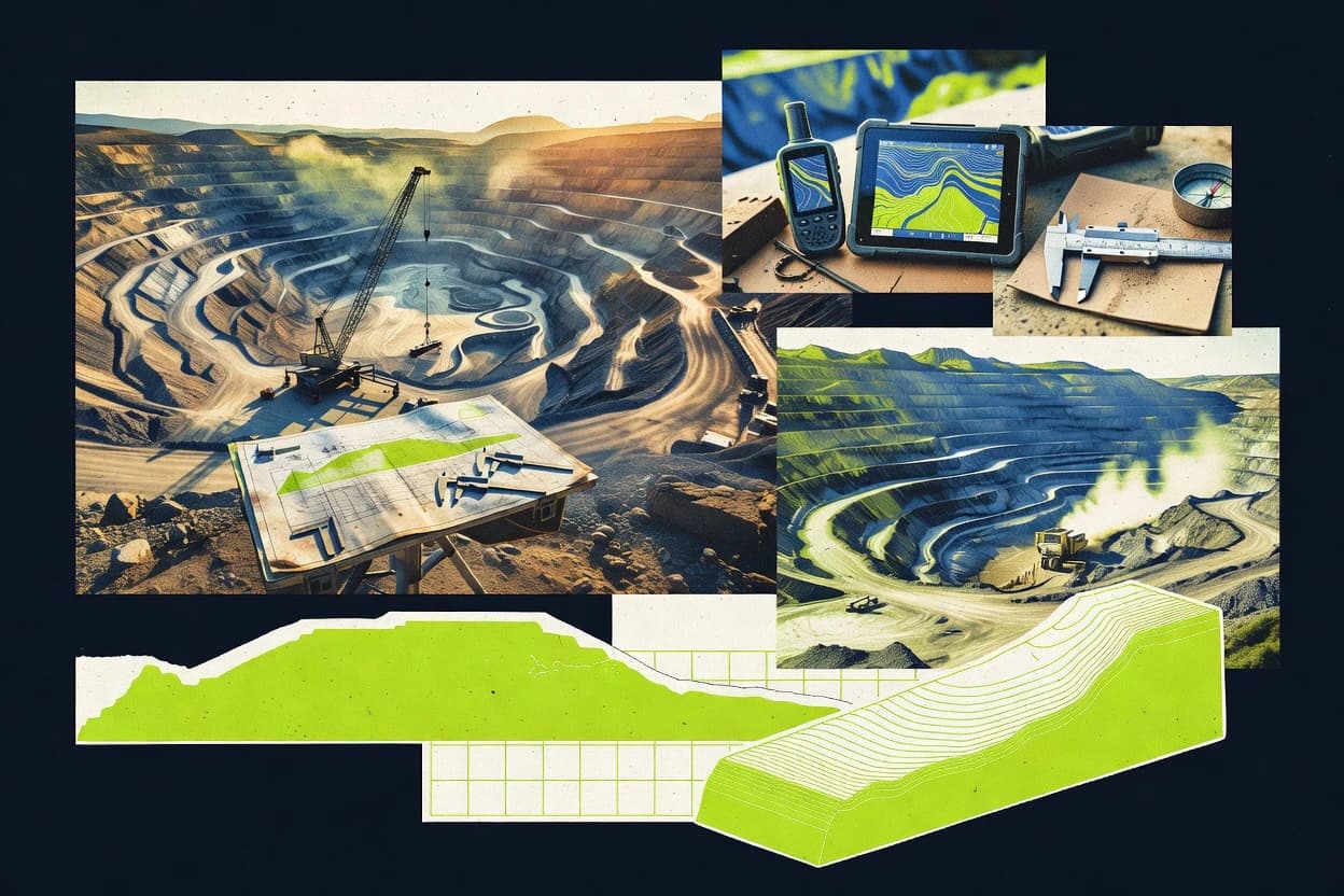
Mining Natural ResourcesTop 10 Best Mining Design Software of 2026
Top 10 Mining Design Software ranking with technical comparisons for mining engineers, featuring 12d Model, AutoCAD Civil 3D, and ArcGIS Pro.

How we ranked these tools
Core product claims cross-referenced against official documentation, changelogs, and independent technical reviews.
Analyzed video reviews and hundreds of written evaluations to capture real-world user experiences with each tool.
AI persona simulations modeled how different user types would experience each tool across common use cases and workflows.
Final rankings reviewed and approved by our editorial team with authority to override AI-generated scores based on domain expertise.
Score: Features 40% · Ease 30% · Value 30%
Gitnux may earn a commission through links on this page — this does not influence rankings. Editorial policy
Editor’s top 3 picks
Three quick recommendations before you dive into the full comparison below — each one leads on a different dimension.
12d Model
Project-based schema organization for managing survey, surface, and solids in one modeling environment.
Built for fits when mid-to-large mining teams need controlled, repeatable design updates with strong data model discipline..
AutoCAD Civil 3D
Editor pickCorridor Assemblies that generate surfaces from feature lines and targets with rule-based rebuilds.
Built for fits when mining teams need corridor-based terrain control with API-driven batch updates..
ArcGIS Pro
Editor pickArcPy geoprocessing toolbox automation for batch validation and mining constraint processing.
Built for fits when mid-size programs need schema-driven spatial design with governed automation and repeatable QA..
Related reading
Comparison Table
This comparison table benchmarks mining design workflows across integration depth, data model design, automation and API surface, and admin and governance controls. It highlights how tools handle schema and configuration, provisioning and RBAC, audit log coverage, and extensibility for geospatial and CAD pipelines. Use the table to map feature tradeoffs to throughput constraints and to assess how well each platform supports repeatable, governed automation.
12d Model
CAD civil modelingCAD and civil engineering design software used for mine layout, surface modeling, and grading with file workflows that integrate with mining surveys.
Project-based schema organization for managing survey, surface, and solids in one modeling environment.
The data model is built around 12d Model project components that hold survey and model entities, which reduces translation overhead when teams iterate on surfaces and solids. Integration depth comes from the ability to import and manage geospatial inputs and drive outputs that align with mining design deliverables, including volumes and plan artifacts used by downstream planning tools.
A tradeoff appears in workflow setup, since teams must align modeling standards with the project schema before automation can run consistently. 12d Model fits best when a single engineering group needs repeatable design updates across multiple sites or phases and requires controlled data governance for audits and review cycles.
- +Geologic model data stays consistent across surfaces, solids, and survey inputs
- +Design outputs map directly to mining deliverables like volumes and plan artifacts
- +Automation is driven by project configuration to reduce repeat modeling work
- +Project structure supports controlled access to model assets for governance
- –Automation depends on upfront schema alignment across modeling standards
- –Integration requires deliberate data preparation to keep imports consistent
- –Complex projects can require stricter change control to avoid drift
Mining engineering teams producing pit and design volumes
Updating resource and design volumes after survey changes and geology revisions
Faster design turnaround with consistent volume decisions tied to the latest inputs.
Geotechnical and geology groups managing multi-phase geologic models
Coordinating surface and solid revisions across exploration stages
Lower model mismatch risk between geology revisions and downstream design outputs.
Show 2 more scenarios
Mine planning administrators overseeing governance and audit trails
Running standardized design production with controlled changes across projects
Improved traceability for which model inputs produced which design outputs.
Administrators can enforce repeatability by managing project templates and configuration standards that determine how model entities are built and exported. Controlled access to model components helps limit unauthorized edits and supports internal audit processes.
Engineering integration teams connecting modeling to downstream planning pipelines
Automating export of modeling outputs into external planning workflows
Higher throughput from fewer manual exports and fewer format translation errors.
Integration work can focus on mapping model entities and export products to an external system workflow while keeping the project data model as the source of truth. This supports consistent data delivery across repeated design runs.
Best for: Fits when mid-to-large mining teams need controlled, repeatable design updates with strong data model discipline.
AutoCAD Civil 3D
Civil engineering CADInfrastructure design platform that supports mine earthworks modeling, corridor design, and survey-to-model workflows using geospatial and civil modeling toolsets.
Corridor Assemblies that generate surfaces from feature lines and targets with rule-based rebuilds.
Civil 3D centers on a structured data model that links alignments, profiles, surfaces, and corridors so edits propagate through dependent objects without rebuilding every artifact manually. Mining teams can use corridor assemblies to generate roads, haul routes, and grading objects from consistent rules, then update volumes using surface differences. The API and automation options enable programmatic creation and modification of these objects, which supports high-throughput model updates across phases and design variants. The integration depth is strongest when project governance relies on repeatable schemas and consistent object naming.
A tradeoff appears when the workflow demands frequent ad hoc geometry changes that do not map cleanly to corridor or feature-based constructs. In those cases, manual edits to downstream outputs can diverge from upstream design intent and increase cleanup work during rework cycles. Civil 3D fits best when designs are maintained through parameter changes, where corridor rebuilds, surface recalculation, and volume reporting can be rerun deterministically.
- +Corridor-driven surfaces keep grading logic connected to alignments and profiles
- +Earthwork volume workflows rely on surface differences and repeatable rebuilds
- +Extensible automation surface via .NET APIs for batch object generation
- +Civil data model preserves relationships across design iterations
- –Freeform geometry edits can break upstream design intent and increase rework
- –Automation requires strong familiarity with Civil 3D object models and schemas
- –Large project throughput depends on disciplined rebuild and dependency management
Mining engineering teams managing haul roads and pit access phases
Generate multiple haul route variants and update them through alignment and corridor parameters.
Faster design iteration with consistent earthwork deltas across phases.
Survey and field-to-design integration teams
Convert survey deliverables into design-ready surfaces and enforce consistent surface regeneration rules.
Reduced manual rework when survey revisions arrive mid-design cycle.
Show 2 more scenarios
Enterprise CAD administration groups using RBAC and change control processes
Provision civil design standards and enforce repeatable object naming and configuration across projects.
Lower governance risk from inconsistent civil objects across teams.
Administrators can standardize templates, styles, and configuration so created alignments, surfaces, and corridors follow a controlled schema. Automation scripts can validate object structure before publication and regenerate models deterministically for auditability.
Engineering automation teams building internal tooling for civil model throughput
Run batch corridor rebuilds and volume reporting for many pits, benches, and access alternatives.
Higher throughput for scenario generation with fewer human steps per variant.
The .NET API enables programmatic creation, modification, and rebuild triggers for civil objects. Tooling can read design parameters, generate variants, and export outputs with controlled configuration and dependency order.
Best for: Fits when mining teams need corridor-based terrain control with API-driven batch updates.
ArcGIS Pro
GIS desktopArcGIS Pro provides desktop GIS for mapping, spatial analysis, and geoprocessing workflows used in mine planning and site layout work.
ArcPy geoprocessing toolbox automation for batch validation and mining constraint processing.
For mining design tasks, ArcGIS Pro pairs a schema-driven geodatabase data model with project-based editing and visualization, which helps keep pit, haul, and infrastructure layers consistent across users. ArcPy and geoprocessing tools support automation for batch workflows like terrain preparation, constraints overlays, and spatial QA checks. The extensibility model supports custom toolboxes and add-ins, which lets teams encode repeatable design rules into the same environment that analysts use.
The main tradeoff is heavier operational overhead than lighter CAD or spreadsheet-based approaches, since consistent behavior depends on maintaining geodatabase schemas and publishing conventions across environments. ArcGIS Pro fits best when multiple teams need shared authoritative spatial data and repeatable geoprocessing for design iteration, not when workflows are mostly one-off sketches.
- +Geodatabase feature schemas support consistent mining design layer structure
- +ArcPy automation covers batch geoprocessing, validation, and data preparation
- +Project-based tooling supports repeatable constraints workflows across teams
- +Enterprise geodatabases enable RBAC and audit logs for dataset changes
- –Schema and publishing discipline is required to avoid layer drift
- –Automation breadth can increase maintenance for custom toolboxes and add-ins
Mining engineering teams working in multi-disciplinary design groups
Maintain a governed design workspace where pit shells, haul routes, and water management layers remain consistent across iterations.
Design review decisions rely on the same validated datasets across disciplines.
Geospatial data engineering teams that must automate spatial ETL and QA
Automate terrain and feature ingestion from field surveys into mining design layers with repeatable quality checks.
Throughput improves because manual cleanup and inconsistent QA steps reduce.
Show 2 more scenarios
Enterprise GIS administrators responsible for access control and change traceability
Enforce RBAC and track design data edits across multiple teams using enterprise geodatabase controls.
Governance improves because access and edits can be reviewed against audit records.
Permissions and roles restrict who can publish, edit, or view specific datasets, and audit log records support change traceability tied to GIS operations. Admin-managed connection and dataset ownership patterns help keep publishing consistent.
Software engineering teams building domain-specific mining tools inside a GIS workflow
Create custom analysis tools and UI components that run inside ArcGIS Pro for site-specific constraints modeling.
Teams reduce variation because domain rules are implemented as configurable tools rather than ad hoc scripts.
Custom toolboxes and Pro add-ins allow encoding mining design logic into the same environment used for visualization and validation. The automation surface stays close to the data model through geoprocessing APIs that operate on feature classes and tables.
Best for: Fits when mid-size programs need schema-driven spatial design with governed automation and repeatable QA.
QGIS
GIS desktopQGIS is an open-source desktop GIS used to build mining maps, perform spatial analysis, and manage geodata layers for design inputs.
Python scripting with QGIS Processing and Model Builder for repeatable, batch geoprocessing workflows.
QGIS provides deep integration with GIS data formats through a well-defined layer data model and extensible processing workflows. For mining design work, it supports vector and raster styling, editing, spatial analysis, and geoprocessing chains built on repeatable models.
Automation and integration rely on Python scripting and plugin architecture, which exposes an API surface for custom tools and batch processing. Governance is handled indirectly through project and plugin configuration controls, plus auditability gaps for changes to design assets compared with dedicated enterprise systems.
- +Python API enables batch geoprocessing and custom mining tools
- +Layer-based data model supports consistent styling across projects
- +Model Builder chains analyses into reproducible workflow steps
- +Extensible plugin system adds domain-specific processing capabilities
- +Strong support for raster and vector formats used in mining surveys
- –No built-in RBAC or project-level permission model
- –Project change audit logs are not first-class for design approvals
- –GUI-first workflows add friction for fully automated deployment
- –Plugin quality varies and can affect maintenance and throughput
- –Multi-user collaboration is limited compared with enterprise CAD-GIS tools
Best for: Fits when mining teams need scriptable GIS analysis and repeatable geoprocessing workflows.
Global Mapper
geospatial processingGlobal Mapper supports importing terrain and point cloud formats, generating surfaces, and preparing elevation data for mine design use cases.
TIN and point-cloud volume computations tied to survey surfaces with controlled export inputs.
Global Mapper turns imported terrain, CAD, and GIS datasets into a processing pipeline for mining design tasks like surface analysis and volume computations. It supports a wide geospatial data model, including raster, point clouds, triangulated surfaces, and vector layers, with consistent coordinate system handling across workflows.
Automation is driven by repeatable scripts, batch processing, and project-based configuration, with an extensibility path through its scripting and integration options for geospatial processing throughput. Governance control is handled through project organization and controlled workflow parameters, but it does not present enterprise RBAC and audit-log style administration in the core application workflow.
- +Wide geospatial data model for rasters, vectors, TINs, and point clouds
- +Consistent coordinate system handling across mixed mining datasets
- +Batch and scripted processing for repeatable survey and volume workflows
- +Surface analysis and volume measurement tools map directly to mine design needs
- +Project-based configuration supports repeatable pipelines without manual rework
- –Limited visibility into centralized RBAC and per-user permissions
- –Audit log and admin governance controls are not exposed as first-class features
- –API surface is oriented to geospatial processing rather than full platform integration
- –Cross-tool automation requires external scripting or orchestration for complex flows
Best for: Fits when mining teams need repeatable geospatial processing with scripting and project configuration control.
Trimble Tekla Structures
structural BIMTekla Structures supports structural modeling and detailing used for mine facilities such as buildings, tanks, and heavy industrial structures.
Tekla API scripting with parametric model objects for automated detailing and drawing generation.
Trimble Tekla Structures is a mining design toolset built around a parametric data model for steel and concrete detailing. It supports integration through Trimble workflows and interoperable file formats that carry geometry and model intent into downstream planning and fabrication.
Automation and extensibility rely on configurable model objects, rule-based drawing generation, and scripting via Tekla APIs. Governance and administration are driven by project standards, model templates, and role-based access patterns enforced in connected Trimble ecosystems.
- +Parametric data model keeps geometry, properties, and relationships aligned across outputs
- +Tekla APIs support automation of modeling, drawing creation, and batch operations
- +Rule-driven drawing generation reduces manual revisions for repeatable mine structures
- +Project templates and model standards support consistent schema-like modeling practices
- –API work often needs careful modeling conventions to avoid inconsistent results
- –Cross-tool integration depends on export/import fidelity for metadata and attributes
- –Automation throughput can slow when large assemblies drive heavy regeneration
- –Governance is strongest when connected Trimble services enforce RBAC and auditability
Best for: Fits when mining engineering teams need parametric detailing plus API-driven automation and controlled model standards.
SketchUp Pro
3D modelingSketchUp Pro is a modeling tool used to create conceptual and coordination models for mine site layouts and facility visualization.
Components plus tags structure repeatable mine layouts for consistent edits across large model sets.
SketchUp Pro centers on a geometry-first modeling workflow with a component and materials data model for repeatable mining site massing, pit shells, and equipment layouts. Integration depth is strongest through its extension system and file interoperability with CAD and GIS formats, while automation relies on scripting and API-adjacent extensibility rather than built-in server orchestration.
The component schema supports structured reuse, which helps when provisioning consistent model libraries across teams. Governance and admin controls are lighter than enterprise BIM and GIS stacks, with limited RBAC granularity and fewer audit-ready lifecycle hooks for automated approvals.
- +Component and material data model supports reusable mining layout libraries
- +Extension architecture enables added automation paths and custom tools
- +Large ecosystem of import and export formats supports cross-tool integration
- +Scripting options support repeatable modeling steps without manual redraw
- –Admin governance lacks granular RBAC and policy-driven approvals
- –Automation and API surface are weaker than dedicated engineering platforms
- –Change control relies more on file workflows than schema-aware validation
- –Server-side extensibility for high-throughput batch runs is limited
Best for: Fits when mining teams need fast, reusable 3D site layouts with controlled extension workflows.
AVEVA Engineering
engineering suiteEngineering design workflows for industrial assets with CAD interoperability, model-based engineering structure, and standards-based data management for multi-discipline projects.
API-driven integration for engineering data and workflows backed by a configurable schema.
AVEVA Engineering is built for engineering data integration in mining projects that need shared schemas across disciplines. It uses a configurable data model for assets, documents, and engineering structures, supporting consistent reuse across design stages.
The automation and extensibility story centers on API-first integration and workflow configuration that can connect design tasks to enterprise systems. Admin and governance rely on controlled access patterns, with auditability and structured configuration to reduce schema drift across teams.
- +Configurable engineering data model with consistent asset and document structures
- +API surface supports integration with enterprise systems and design tooling
- +Automation via configurable workflows reduces manual handoffs between disciplines
- +Governance controls help enforce schema and configuration consistency across projects
- –Extensibility requires design of schemas and integration contracts up front
- –Cross-project configuration management can add overhead for distributed teams
- –Workflow automation depends on disciplined data population to prevent rework
- –API-based integrations require careful throughput planning for large models
Best for: Fits when mining teams need schema-controlled engineering data, automation, and deep system integration.
MicroStation
CAD platformCAD-based design authoring for civil and industrial assets with large-model handling, geospatial data workflows, and interoperability for mine layout deliverables.
MicroStation’s reference model linking for coordinated mining design at scale.
MicroStation generates and edits mining design models with discipline-specific CAD and civil workflows. Its integration depth centers on a geometry-first data model that supports linkable references, exchange formats, and scriptable batch operations.
Automation and API surface rely on Bentley tooling and extensibility hooks that can drive repeatable production steps. Governance depends on workspace and project configuration patterns, with audit and RBAC depth tied to the broader Bentley ecosystem.
- +Reference-based design management for large mining project model sets
- +Scriptable batch workflows support repeatable drafting and geometry updates
- +Extensibility points enable custom tools for discipline-specific production steps
- +Exchange formats support model transfer into and out of CAD ecosystems
- –RBAC and audit-log granularity depends on external governance components
- –Automation throughput can require careful standards and template discipline
- –Automation surface is less unified than API-native modeling platforms
- –Cross-team configuration drift risk grows without strict provisioning controls
Best for: Fits when teams need governed CAD production workflows with extensibility and model exchange.
RockWorks
geology modelingSubsurface modeling and visualization for geology and drillhole interpolation with 3D block, fence, and stratigraphic modeling outputs.
RockWorks modeling and gridding tools that convert drillhole datasets into 3D surfaces for design outputs.
RockWorks is a mining design tool focused on geological modeling, surface and subsurface interpretation, and production-scale outputs for engineering workflows. Its data model supports layered geologic primitives, drillhole datasets, gridding, and 3D visualization, which reduces conversion steps between model stages.
Integration depth depends on how RockWorks exports and ingests formats across CAD, GIS, and spreadsheet workflows, because native API automation is limited. Automation and governance rely more on project configuration and controlled file outputs than on first-class RBAC, audit logging, or provisionable automation interfaces.
- +Layered geologic modeling workflow from drillhole data to 3D surfaces
- +Export-oriented approach supports handoff to CAD and GIS pipelines
- +Repeatable project configuration supports consistent multi-iteration studies
- +Visualization and section tools support rapid interpretation checks
- –Limited documented automation and API surface for external orchestration
- –Governance controls like RBAC and audit logs are not a central feature
- –Data schema interoperability depends heavily on export-import formats
- –Throughput for large batches relies on manual job setup patterns
Best for: Fits when teams need model-to-report workflows with controlled file-based handoffs.
How to Choose the Right Mining Design Software
This guide covers mining design software workflows across 12d Model, AutoCAD Civil 3D, ArcGIS Pro, QGIS, Global Mapper, Trimble Tekla Structures, SketchUp Pro, AVEVA Engineering, MicroStation, and RockWorks. It focuses on integration depth, the underlying data model, automation and API surface, and admin and governance controls that affect repeatability across revisions and teams.
The guide maps concrete capabilities like 12d Model project schema organization, AutoCAD Civil 3D corridor assemblies, and ArcGIS Pro ArcPy batch validation to selection criteria. It also calls out governance gaps like QGIS lacking first-class RBAC and audit logs, and RockWorks relying more on file-based handoffs than provisionable automation interfaces.
Evaluation criteria tied to integration, schema control, and automated throughput
Mining design programs succeed when the data model keeps relationships intact across surfaces, alignments, and geologic primitives. Automation and API surface matter because batch generation and validation reduce rebuild time and prevent manual drift across iterative studies. Admin and governance controls decide whether teams can enforce RBAC, preserve schema standards, and retain auditability for approvals in multi-user environments.
Each criterion below is grounded in specific tool mechanisms like 12d Model project-based schema organization and ArcGIS Pro enterprise geodatabase RBAC with audit logging.
Project-based schema organization across survey, surfaces, and solids
12d Model uses project-based schema organization to manage survey, surface, and solids in one modeling environment, which keeps design volumes and plan artifacts aligned with the same data structure. AutoCAD Civil 3D and ArcGIS Pro also preserve relationships through persistent civil data models and geodatabase schemas, but 12d Model emphasizes schema discipline inside the modeling environment itself.
Rule-based rebuild logic that preserves design intent
AutoCAD Civil 3D corridor assemblies generate surfaces from feature lines and targets and rebuild using corridor rules, which keeps grading logic tied to alignments and profiles. ArcGIS Pro supports repeatable constraints and validation workflows through ArcPy toolbox automation tied to feature schemas.
Documented automation and API surface for batch generation and geoprocessing
AutoCAD Civil 3D provides an automation surface via .NET APIs and accessible object models that can drive batch generation across projects. ArcGIS Pro delivers a documented ArcPy geoprocessing toolbox automation surface for batch validation and mining constraint processing.
Geodatabase governance with RBAC and audit logging tied to datasets
ArcGIS Pro governance uses enterprise geodatabases with RBAC and audit logging tied to GIS datasets and publishing events, which supports approval workflows across teams. QGIS and RockWorks lack first-class RBAC and audit-log style administration for design approvals, so governance must be handled outside the core tool.
Extensibility model that supports repeatable custom tooling
QGIS offers Python scripting with QGIS Processing and Model Builder chains, plus a plugin architecture for custom tools and batch workflows. Trimble Tekla Structures supports Tekla APIs for scripting and rule-driven drawing generation, which is suited for parametric detailing and repeatable production of drawings.
High-throughput surface and volume computation across mixed data formats
Global Mapper supports TIN and point-cloud volume computations tied to survey surfaces with controlled export inputs, which supports repeatable survey and volume pipelines. RockWorks focuses on layered geology model-to-report workflows by converting drillhole datasets into 3D surfaces via gridding and visualization tools.
Integration-first selection path for mining design toolchains
Start by mapping the integration depth required between survey ingestion, civil or GIS modeling, and downstream report generation. Then verify that the selected tool keeps relationships inside a persistent data model so rebuilds remain consistent across revisions. Finally, check whether governance must be enforced inside the tool through RBAC and audit logs, or outside the tool through project and file workflow discipline.
The steps below point to concrete selection checks using 12d Model, AutoCAD Civil 3D, ArcGIS Pro, and QGIS as anchor examples.
Confirm the required data model stays consistent across inputs
If survey, surfaces, and solids must remain consistent in a single geologic modeling environment, 12d Model fits because it links those inputs into a consistent geologic model with project-based schema organization. If terrain must be controlled by alignments and grading logic, AutoCAD Civil 3D fits because corridor-driven surfaces preserve relationships through corridor assemblies and rule-based rebuilds.
Match automation needs to the available API or scripting surface
For batch object generation across civil design projects, AutoCAD Civil 3D supports automation through .NET APIs and object models designed for batch generation. For repeatable QA, validation, and constraint processing based on geospatial datasets, ArcGIS Pro supports automation through ArcPy geoprocessing toolbox models.
Decide where governance must live: inside the tool or in external process controls
If RBAC and audit logging tied to datasets are required for design approvals, ArcGIS Pro provides enterprise geodatabase RBAC and audit log hooks tied to publishing events. If a tool lacks first-class RBAC, QGIS and Global Mapper require governance via project configuration and external process controls rather than built-in permission models.
Validate extensibility for the exact modeling objects the team generates
For parametric structure detailing and automated drawing generation, Trimble Tekla Structures provides Tekla APIs for scripting rule-driven drawing creation. For scriptable GIS analysis pipelines built around vector and raster styling plus repeatable models, QGIS supports Python scripting with QGIS Processing and Model Builder.
Stress-test throughput for surface, volume, and handoff patterns
If the workflow centers on surface analysis and volume measurement from rasters, TINs, and point clouds, Global Mapper supports those computations with batch and scripted processing and project configuration control. If the workflow centers on drillhole interpolation into layered geologic primitives and then gridding to 3D surfaces, RockWorks fits because it reduces conversion steps between model stages through its layered modeling workflow.
Which mining teams benefit from each software’s integration depth and governance model
Different mining programs prioritize different control points like schema discipline, corridor rebuild logic, or governed dataset approvals. The best fit depends on which stage needs automation through API surface and which stage needs enforceable governance controls.
The segments below map directly to each tool’s best_for fit and highlight where integration and governance depth align with actual work patterns.
Mid-to-large mining teams that need controlled, repeatable design updates with schema discipline
12d Model fits because it organizes projects using schema-driven structure for survey, surfaces, and solids in one modeling environment, which keeps design outputs mapped to mining deliverables. It also uses controlled project structure to enforce repeatable production runs and controlled access to model assets for governance.
Mining teams that need corridor-based terrain control driven by alignments and grading targets
AutoCAD Civil 3D fits because corridor assemblies generate surfaces from feature lines and targets with rule-based rebuilds. It also supports automation for batch updates via .NET APIs tied to persistent civil data model relationships.
Programs that require schema-driven spatial design with governed automation and repeatable QA
ArcGIS Pro fits because it uses geodatabase feature schemas for consistent design layers and ArcPy geoprocessing toolbox automation for batch validation. It additionally supports RBAC and audit logging in enterprise geodatabases tied to dataset changes and publishing events.
Teams that want scriptable GIS analysis pipelines and custom batch tooling
QGIS fits because it provides Python scripting with QGIS Processing and Model Builder for repeatable geoprocessing chains. It also supports a plugin architecture for custom mining tools while relying on project configuration rather than built-in RBAC and first-class audit logs.
Geology-first and drillhole interpolation workflows that end in model-to-report outputs
RockWorks fits because its layered geologic modeling converts drillhole datasets into 3D surfaces using gridding and visualization tools. Automation and governance in RockWorks rely more on project configuration and controlled file outputs than on first-class RBAC and provisionable automation interfaces.
Mining design pitfalls caused by weak schema control or misaligned governance
Many mining design failures come from breaking relationships that the tool expects to remain persistent, or from assuming automation exists without an API-backed surface. Governance mistakes usually show up as uncontrolled layer drift, missing permission controls, or audit gaps that make approvals hard to defend.
The pitfalls below map to concrete limitations and cons in 12d Model, AutoCAD Civil 3D, ArcGIS Pro, QGIS, and RockWorks.
Allowing schema drift during imports and publishes
12d Model requires deliberate schema alignment across modeling standards or automation setup can fail to map outputs correctly. ArcGIS Pro also needs schema and publishing discipline to avoid layer drift.
Using freeform edits that sever rebuild dependencies
AutoCAD Civil 3D freeform geometry edits can break upstream design intent and increase rework, which is avoidable by keeping corridors and rebuild logic consistent. Teams should treat rebuild dependencies as first-class objects rather than post-edit geometry.
Assuming a tool has governance controls it does not implement
QGIS lacks built-in RBAC and first-class project change audit logs for design approvals, so permission and audit workflows must be handled outside the authoring UI. RockWorks similarly does not center RBAC and audit logging, so approval governance must be enforced in the surrounding pipeline.
Building batch automation without validating the API or scripting surface fit
Global Mapper’s automation and API surface are oriented toward geospatial processing rather than full platform integration, so cross-tool orchestration can require external scripting. AVEVA Engineering provides API-first integration backed by a configurable schema, but extensibility still needs schema and integration contracts designed up front.
Overlooking throughput bottlenecks from large assemblies and regeneration cycles
Trimble Tekla Structures automation throughput can slow when large assemblies drive heavy regeneration, which needs careful modeling conventions. Teams that depend on high-frequency regeneration should validate model object size and drawing rule generation behavior early.
How We Selected and Ranked These Tools
We evaluated 12d Model, AutoCAD Civil 3D, ArcGIS Pro, QGIS, Global Mapper, Trimble Tekla Structures, SketchUp Pro, AVEVA Engineering, MicroStation, and RockWorks using three scored areas that map to real delivery needs: features, ease of use, and value. The overall rating is a weighted average where features carries the most weight, while ease of use and value each matter heavily enough to prevent high-capability tools from ranking too high when workflows become brittle.
This editorial scoring stays criteria-based and uses the provided review metrics, not private benchmark experiments or lab testing. 12d Model separated from lower-ranked tools because its project-based schema organization keeps survey, surface, and solids aligned inside one modeling environment, and that capability directly lifted the features score and supports repeatable production runs through controlled project structure and controlled access to model assets.
Frequently Asked Questions About Mining Design Software
Which mining design tool keeps a single data model across revisions for repeatable output?
What integration and API options best support automation for batch updates in corridor-based workflows?
Which toolchain is strongest for enterprise RBAC and audit logging tied to governed spatial datasets?
How do teams migrate existing CAD or GIS datasets into a mining design data model?
Which software supports scriptable geoprocessing workflows when custom mining constraints must be validated at scale?
What approach prevents geometry and reference breakage when coordinating large mining models across teams?
Which tool best supports parametric structural detailing automation for mine engineering deliverables?
What software supports geometry-first 3D massing workflows with repeatable site layout structure?
Which tool is better for mining volume computations from TIN and point-cloud inputs with controlled export inputs?
What is the main integration limitation teams hit when using geology modeling tools for downstream engineering automation?
Conclusion
After evaluating 10 mining natural resources, 12d Model stands out as our overall top pick — it scored highest across our combined criteria of features, ease of use, and value, which is why it sits at #1 in the rankings above.
Use the comparison table and detailed reviews above to validate the fit against your own requirements before committing to a tool.
Tools reviewed
Primary sources checked during evaluation.
Referenced in the comparison table and product reviews above.
Keep exploring
Comparing two specific tools?
Software Alternatives
See head-to-head software comparisons with feature breakdowns, pricing, and our recommendation for each use case.
Explore software alternatives→In this category
Mining Natural Resources alternatives
See side-by-side comparisons of mining natural resources tools and pick the right one for your stack.
Compare mining natural resources tools→FOR SOFTWARE VENDORS
Not on this list? Let’s fix that.
Our best-of pages are how many teams discover and compare tools in this space. If you think your product belongs in this lineup, we’d like to hear from you—we’ll walk you through fit and what an editorial entry looks like.
Apply for a ListingWHAT THIS INCLUDES
Where buyers compare
Readers come to these pages to shortlist software—your product shows up in that moment, not in a random sidebar.
Editorial write-up
We describe your product in our own words and check the facts before anything goes live.
On-page brand presence
You appear in the roundup the same way as other tools we cover: name, positioning, and a clear next step for readers who want to learn more.
Kept up to date
We refresh lists on a regular rhythm so the category page stays useful as products and pricing change.