GITNUXSOFTWARE ADVICE
Art DesignTop 10 Best Map Editing Software of 2026
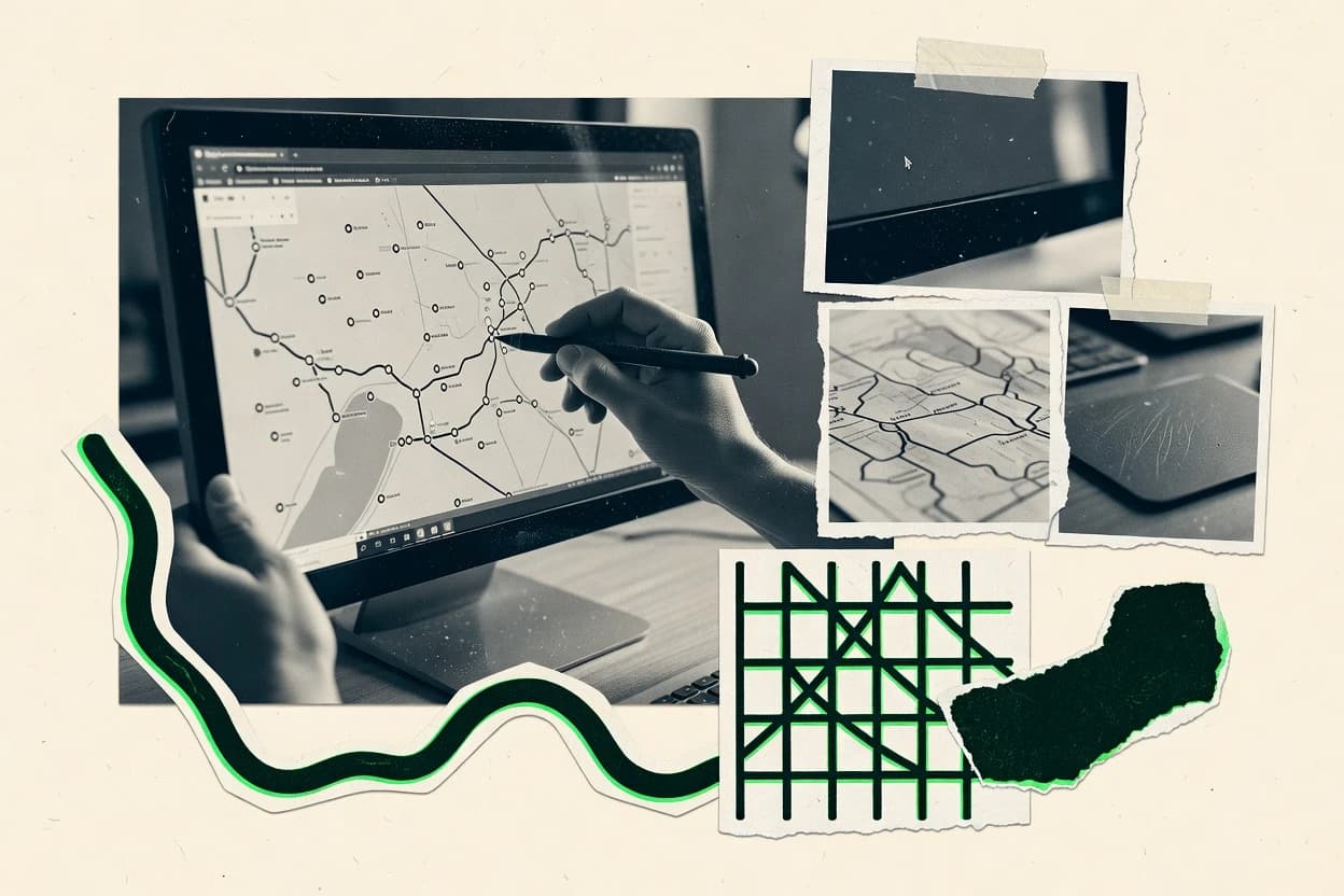
Top 10 Map Editing Software ranked by editing tools and GIS workflows, with comparisons for QGIS, ArcGIS Pro, and Autodesk Civil 3D users.

How we ranked these tools
Core product claims cross-referenced against official documentation, changelogs, and independent technical reviews.
Analyzed video reviews and hundreds of written evaluations to capture real-world user experiences with each tool.
AI persona simulations modeled how different user types would experience each tool across common use cases and workflows.
Final rankings reviewed and approved by our editorial team with authority to override AI-generated scores based on domain expertise.
Score: Features 40% · Ease 30% · Value 30%
Gitnux may earn a commission through links on this page — this does not influence rankings. Editorial policy
Editor’s top 3 picks
Three quick recommendations before you dive into the full comparison below — each one leads on a different dimension.
QGIS
Snapping and topology validation during digitizing for controlled geometry integrity.
Built for fits when teams need scriptable desktop map editing with strong geometry validation..
ArcGIS Pro
Editor pickPython-driven editing workflows paired with geodatabase validation using domains and subtypes.
Built for fits when teams need schema-governed map edits with automation and enterprise governance..
Autodesk Civil 3D
Editor pickCorridor modeling with controlled rebuild updates dependent geometry across design changes
Built for fits when engineering teams need repeatable, API-driven edits tied to surfaces and corridors..
Related reading
Comparison Table
The comparison table benchmarks map editing software across integration depth, data model compatibility, and the automation and API surface each platform exposes. Readers can compare extensibility, configuration and schema alignment, plus admin and governance controls like RBAC, audit log coverage, and provisioning workflows. The goal is to map tradeoffs that affect throughput, repeatability, and deployment in controlled environments.
QGIS
desktop GISOpen-source desktop GIS that supports map layout design, geodata editing, styling, and export for print and web workflows.
Snapping and topology validation during digitizing for controlled geometry integrity.
QGIS performs feature and geometry edits with vertex tools, trace digitizing, and snapping modes that control precision and alignment. It uses a clear data model for layers, attributes, and coordinate reference systems, which supports importing schemas and preserving field types. Integration depth comes from reading and writing widely used formats and data sources, plus a plugin system that adds editing behaviors and validators. Automation is driven by a Python API that can apply repeatable edits, run geometry operations, and generate outputs from consistent layer definitions.
A key tradeoff is that QGIS is primarily a local authoring client, so collaborative governance features are limited compared with multi-user server platforms. Map editing can still be standardized by sharing project files, enforcing naming and schema conventions, and using automation scripts to validate geometries before release. A good usage situation is a cartography or cadastral editing workflow where teams need deterministic geometry validation and scriptable batch updates on reference datasets.
- +Python API enables batch geometry edits and repeatable map production workflows
- +Snapping, trace digitizing, and topology checks reduce digitizing errors
- +Layer and CRS handling maintains schema and coordinate discipline during editing
- +Plugin architecture adds editing tools and validators without changing core GIS
- –Centralized RBAC and audit logs are not built into the editing workflow
- –Multi-user editing and conflict governance require external processes
- –Governance depends on project conventions and script discipline rather than server controls
Best for: Fits when teams need scriptable desktop map editing with strong geometry validation.
ArcGIS Pro
desktop GISArcGIS desktop GIS for creating and editing maps, managing geodatabases, styling layers, and exporting layouts for publishing.
Python-driven editing workflows paired with geodatabase validation using domains and subtypes.
ArcGIS Pro is a desktop authoring client for editing that works directly against enterprise geodatabases and hosted feature layers, which keeps edits consistent with the service schema. The editing framework supports topology-aware behavior in geodatabases and attribute validation using domains and subtypes, which reduces manual QA churn. Data changes can be validated with checks during workflows that rely on consistent schema rules and layer capabilities. Integration depth is strongest when map editing is coupled to the ArcGIS ecosystem for publishing, versioning, and downstream feature consumption.
A key tradeoff is that ArcGIS Pro is a heavy client compared with browser-based editors, which can slow onboarding for teams that need quick, ad hoc corrections. It fits well in structured production settings where edits must respect schema rules, auditability, and service-backed operational layers. Automation and throughput are stronger when editors use Python scripts, geoprocessing tools, and add-ins to apply repeatable edit patterns rather than manual edits alone.
- +Editing enforces geodatabase schema with domains, subtypes, and validation rules
- +Tight integration with ArcGIS feature services keeps edits aligned to layer capabilities
- +Python and add-ins support automation for QA, bulk edits, and repeatable workflows
- +Versioned enterprise workflows support controlled edits at scale
- +Admin controls via RBAC and audit log coverage for hosted item operations
- –Desktop client footprint increases setup and training compared with web editors
- –Browser-first collaboration workflows can require additional ArcGIS components
- –Some automation tasks still depend on ArcGIS server and geoprocessing configuration
Best for: Fits when teams need schema-governed map edits with automation and enterprise governance.
Autodesk Civil 3D
survey mappingCivil engineering GIS mapping workflow for editing survey data, creating surfaces, aligning coordinate systems, and generating map products.
Corridor modeling with controlled rebuild updates dependent geometry across design changes
Civil 3D represents map content as engineered objects like surfaces, feature lines, alignments, and parcels rather than only as editable geometry. This enables deterministic rebuild behavior through feature and corridor dependencies, which helps maintain data integrity during large edits. The automation surface is geared toward scripted and compiled extensions, using its .NET API and Civil 3D-specific object model so custom tooling can read, modify, and regenerate designs.
A key tradeoff appears when the editing workload is primarily GIS-style symbology or attribute maintenance, since Civil 3D focuses on design semantics rather than general-purpose editing. Civil 3D fits scenarios where throughput depends on repeatable rebuilds and where edits must propagate through corridors, grading, and parcel boundaries, such as site development and transportation corridors. Governance controls are strongest through host Autodesk account administration and project file management patterns, while fine-grained RBAC and audit logging for model objects depends on how vaulting and publishing are configured.
- +Discipline-native data model for surfaces, parcels, alignments, and corridors
- +Civil 3D .NET API supports custom commands, object edits, and regeneration
- +Deterministic rebuilds maintain relationships across corridor and grading dependencies
- +Feature-line and parcel operations support design-grade geometry edits
- –Not optimized for generic GIS attribute editing and styling workflows
- –Automation requires programming against Civil 3D-specific object types
- –RBAC and audit coverage for model objects depends on external Autodesk governance setup
Best for: Fits when engineering teams need repeatable, API-driven edits tied to surfaces and corridors.
FME
spatial ETLData integration software for transforming, cleaning, and publishing spatial data to map editing pipelines.
FME Server workflow management with publishing, execution control, RBAC, and audit logs for governed automation.
FME from safe.com is designed for map data transformation with a clear data model and a deep automation surface. Map editing workflows can be expressed as repeatable configurations that feed validation, enrichment, and format outputs.
Integration depth is driven by documented APIs and connectors that support provisioning-style deployments and batch throughput. Admin and governance controls center on role boundaries, auditability, and controlled execution of published workflows.
- +Configurable workflow graphs support repeatable map edits at scale
- +Broad connector coverage reduces custom ETL glue code
- +Automation and API surface support pipeline triggering and integration
- +Role-based access and audit trails support governance for shared workflows
- –Complex graph authoring can slow changes for small edit teams
- –Schema alignment effort is required across heterogeneous map sources
- –Debugging failed runs often needs platform logs and workflow replay
- –High customization can increase maintenance across versions
Best for: Fits when teams need controlled map editing automation with API integration and governance for shared assets.
Global Mapper
desktop GISDesktop GIS and data processing tool for editing geospatial datasets, managing projections, and producing map outputs.
Surface and terrain editing with tools that convert, clean, and reclassify elevation data.
Global Mapper edits and repairs geospatial datasets through a native 2D and 3D workflow with direct layer operations. It provides a GIS-style data model for rasters, vectors, and elevation surfaces, plus schema-aware import and export across many common formats.
Automation is handled through repeatable batch workflows and scripting-oriented extensibility that supports controlled processing runs. Governance depends on local workstation control for edits, with limited enterprise-grade RBAC and audit-log features compared with server-centric editors.
- +Direct vector and raster editing with map projection handling
- +Supports layered workflows across formats for consistent round-trips
- +Repeatable batch processing enables unattended geometry and surface updates
- +Configurable processing chains help standardize throughput for large datasets
- –Enterprise RBAC and permission scoping are not built for multi-tenant admin
- –Audit logging for edit actions is not designed for centralized governance
- –API surface for external automation is limited compared with server platforms
- –Collaboration features are primarily local and not workflow-managed by roles
Best for: Fits when teams need desktop map editing with repeatable batch processing for controlled outputs.
MapInfo Professional
desktop mappingDesktop mapping and spatial analysis environment for map editing and geospatial workflows via legacy MapInfo toolchains.
Map layer editing mapped to geodatabase schemas with consistent field-level attribute updates.
MapInfo Professional targets teams that need desktop map editing tied closely to GIS workflows in the Esri ecosystem. Its data model supports editing of map layers that originate from file-based sources and database-backed datasets, with schema changes reflected in the layer definitions.
Automation and integration are driven more by Esri-compatible workflows and scripting hooks than by a broad modern REST API surface inside the desktop editor. Admin and governance controls are strongest when edits flow through managed geodatabases and established RBAC, rather than through standalone desktop-only controls.
- +Strong editing behavior for tabular GIS layers tied to established schemas
- +Works well with Esri data paths via geodatabase-centric workflows
- +Extensible through scripting and configurable layer workflows
- +Predictable layer-based edits with explicit coordinate and projection handling
- –Desktop-centric integration reduces direct API-driven editing automation
- –Fine-grained RBAC and audit log visibility depends on backend governance
- –Schema and workflow changes can require manual layer configuration
- –Automation throughput is limited by client workstation dependency
Best for: Fits when mid-size GIS teams need controlled edits into geodatabase-backed layers.
GeoServer
OGC publishingServer for publishing edited and managed geospatial layers through standard OGC services like WMS, WFS, and WCS.
WFS-T transactional services provide insert, update, and delete operations for published layers.
GeoServer is a server-side geospatial publishing stack that supports map editing workflows through WMS and WFS transactional services. Its data model centers on PostGIS, shape stores, and GeoServer layers that map to styles, workspaces, and service endpoints.
Editing automation is expressed through WFS-T endpoints, REST administrative APIs, and consistent XML configuration that can be versioned. Governance relies on security integration with the deployment environment, with RBAC patterns handled via container or application security rather than a dedicated editor-native permission layer.
- +WFS-T enables feature inserts, updates, and deletes for editing workflows
- +Workspaces and layer configuration provide explicit organization of published data
- +REST API and XML configuration support automation and infrastructure-as-code setups
- +PostGIS integration keeps schemas and spatial indexes aligned with editing traffic
- +Custom services and extensions support provider-specific business rules
- –Editing depends on WFS-T support and client behavior for transactional semantics
- –No editor-native sandboxing for drafts exists inside GeoServer itself
- –RBAC and audit logging depend heavily on the surrounding security setup
- –Large transactional throughput can stress service configuration and database tuning
- –Complex style and layer configuration increases operational overhead
Best for: Fits when teams need governed, API-driven geospatial publishing and transactional editing.
PostGIS
spatial databaseSpatial database extension that supports storing, indexing, and editing geospatial features used by map editing pipelines.
ST_SnapToGrid and related spatial operations enable geometry normalization during edit-time triggers.
PostGIS adds a spatial data model inside PostgreSQL, so map editing workflows can persist geometry, attributes, and topology-friendly behavior in one database schema. It supports automation through SQL, stored procedures, and triggers that validate edits, enforce constraints, and generate derived layers.
Integration depth is high because editing systems can use the PostgreSQL and PostGIS API surface via standard drivers, while GIS services can read and write geometries using the same relational tables. Governance control comes from PostgreSQL roles, schema permissions, and auditing available through database logging and extension-compatible views.
- +Geometry types and spatial functions live in the database schema
- +SQL triggers enforce edit rules like validity, snapping, and deduplication
- +Relational constraints keep attributes consistent with spatial edits
- +Standard PostgreSQL drivers provide a predictable API surface
- +Supports custom behavior via extensions and SQL function extensibility
- –Map editor UI and digitizing tools are not included
- –Multi-user edit conflict handling needs external workflow logic
- –Topology editing features require additional schemas and conventions
- –Large edit bursts can strain database throughput without tuning
- –Audit logs require database logging setup and operational discipline
Best for: Fits when teams need database-centered map editing with SQL automation and strict data governance.
Mapbox Studio
vector stylingStyle authoring tool for designing map styles and customizing vector map appearance for web and mobile basemaps.
Studio-to-API publishing workflow for tilesets and styles with versioned asset updates.
Mapbox Studio provides a web-based workflow to create and edit Mapbox tilesets and styles, then publish changes through Mapbox’s APIs. The data model is centered on tileset sources and style layers, so edits map to specific layer and tileset revisions instead of free-form canvas artifacts.
Automation is exposed through Mapbox APIs for tilesets, styles, and related resources, which enables build pipelines that provision, update, and validate map assets. Governance depends on account-level permissions for Studio editing and the auditability of published resources rather than on a granular in-tool RBAC policy editor.
- +Edits tie directly to tilesets and style layers for traceable map revisions
- +API automation supports CI workflows for style and tileset updates
- +Configuration model keeps style changes scoped to named resources
- +Extensibility through API-driven provisioning of map assets
- –Governance controls are account scoped, not per-workspace or per-layer RBAC
- –Sandboxing edits before publish relies on external workflow design
- –Schema constraints are tied to Mapbox sources and styles, limiting custom models
Best for: Fits when teams need API-driven map asset updates with controlled tileset and style revisions.
Tangram Terrain Editor
3D map styling3D terrain style editor for converting terrain inputs into map-ready visualization styles.
Terrain-focused layer editing with schema-driven outputs for render pipeline consistency.
Tangram Terrain Editor targets map teams that need terrain-specific editing with a structured data model for map layers and assets. The tool’s integration depth depends on how map updates flow into Tangram’s rendering and deployment pipeline.
Automation and extensibility are centered on configuration driven workflows and an API surface that supports programmatic map data changes. Admin and governance controls are tied to account and workspace permissions rather than per-edit ownership for individual terrain changes.
- +Terrain editing focused on layer outputs and render-ready geometry changes
- +Structured map data model supports consistent schema-based updates
- +API and automation options fit scripted terrain imports and batch edits
- –Governance controls are coarse when multiple editors collaborate
- –Automation coverage is strongest for data changes, weaker for review workflows
- –Schema evolution requires careful coordination across editor and publishing steps
Best for: Fits when terrain editing needs scripted updates and controlled map data publishing.
How to Choose the Right Map Editing Software
This buyer's guide covers QGIS, ArcGIS Pro, Autodesk Civil 3D, FME, Global Mapper, MapInfo Professional, GeoServer, PostGIS, Mapbox Studio, and Tangram Terrain Editor.
It focuses on integration depth, data model fit, automation and API surface, and admin and governance controls across desktop editors, data pipelines, publishing servers, and terrain or style toolchains.
Map editing environments that change geometry, schema, and publishable outputs
Map editing software modifies spatial datasets and their associated attributes for publishing or downstream use. It solves problems like controlled digitizing, schema-governed feature edits, transactional updates via services, and automated conversion between data formats.
In practice, teams use QGIS for snapping and topology validation during local digitizing. Teams use GeoServer with WFS-T to perform insert, update, and delete operations on published layers.
Evaluation criteria for integration, governance, and automation at edit time
Integration depth determines whether edits stay aligned to a specific platform data model. ArcGIS Pro ties editing to geodatabases, while GeoServer ties editing to published layers and WFS-T semantics.
Automation and API surface determine whether map production can run as repeatable workflows. FME and ArcGIS Pro support automation surfaces for batch and QA workflows, while QGIS supports Python-driven editing tasks in a local desktop workflow.
Geometry validation in the digitizing tool
QGIS includes snapping and topology checks during digitizing to reduce digitizing errors. PostGIS complements this by enabling edit-time rules through SQL triggers and spatial normalization functions like ST_SnapToGrid.
Schema-governed editing with domains and subtypes
ArcGIS Pro enforces geodatabase schema using domains, subtypes, and validation rules inside editing workflows. MapInfo Professional also targets geodatabase-backed layers with explicit schema and consistent field-level attribute updates.
End-to-end automation via documented workflow graphs or code surfaces
FME expresses map editing as configurable workflow graphs and publishes execution through FME Server with execution control. ArcGIS Pro offers Python and add-ins for repeatable editing, while QGIS exposes a Python API for batch geometry edits and map production workflows.
Transactional editing and REST admin surfaces for published layers
GeoServer supports WFS-T for inserts, updates, and deletes on published layers. It also provides REST administrative APIs and XML configuration that can be versioned for automation and infrastructure-as-code setups.
Data model persistence that matches the editing domain
Autodesk Civil 3D uses a discipline-native data model for surfaces, parcels, alignments, and corridors to keep dependent relationships consistent. Tangram Terrain Editor uses a structured map data model for terrain-focused layer outputs that fit render-ready publishing steps.
Admin controls and auditability for shared editing pipelines
FME centers governance on RBAC and audit trails for governed workflow execution. ArcGIS Pro offers RBAC and audit log coverage for operations that touch hosted content, while PostGIS enables governance via PostgreSQL roles, schema permissions, and auditing available through database logging.
A decision path from edit-time validation to governed publishing
Start by matching edit-time validation to the failure modes of the target dataset. If geometry integrity errors are the bottleneck, QGIS snapping and topology validation changes the edit quality during digitizing.
Next, decide whether edits live in a desktop workflow or a governed server pipeline. FME and GeoServer move edits into controlled automation and transactional services, while ArcGIS Pro and Autodesk Civil 3D tie edits to their platform data models for schema validation and dependent rebuilds.
Confirm the edit-time data constraints that must hold
If coordinate discipline and geometry integrity require enforcement during digitizing, prioritize QGIS snapping and topology checks. If edits must obey database-level constraints and normalization, use PostGIS with SQL triggers and spatial operations like ST_SnapToGrid.
Select a data model that matches the domain and schema ownership
For geodatabase-centered feature models with domains and subtypes, ArcGIS Pro aligns edits to validation rules inside the editing workflow. For engineering survey and corridor dependencies, Autodesk Civil 3D provides deterministic rebuilds tied to corridor modeling and dependent geometry.
Map the automation surface to actual integration needs
For API-driven batch edits and repeatable workflow execution, use FME with FME Server publishing, execution control, and workflow management. For code-driven desktop automation, use QGIS Python or ArcGIS Pro Python and add-ins.
Choose the publishing and transactional editing mechanism
If edits must land directly in published layers via service transactions, use GeoServer with WFS-T insert, update, and delete. If edits are stored in PostGIS and exposed through services, combine PostgreSQL roles and database logging with a server stack that can write geometries to those tables.
Set governance expectations for shared workflows and change history
If multiple operators need governed workflow execution with auditability, use FME Server RBAC and audit trails. If hosted item operations need RBAC and audit log coverage, ArcGIS Pro fits because governance is enforced on hosted content operations.
Validate collaboration scope and sandboxing requirements
If drafts and multi-user conflict governance must be handled inside the editing workflow itself, QGIS requires external processes because it lacks centralized RBAC and audit logs in the editing workflow. If transactional semantics and service configuration drive the collaboration boundary, GeoServer depends on WFS-T behavior plus surrounding security for RBAC and audit logging.
Tool fit by workflow ownership: desktop edits, governed pipelines, and published layer transactions
Different map editing tools match different ownership boundaries for schema, execution, and auditability. Desktop-focused teams typically prioritize digitizing quality and local automation, while platform teams prioritize transactional services and governed workflow execution.
The right selection depends on where edits originate and where changes must be validated, tracked, and published.
Teams doing scriptable desktop digitizing with geometry integrity checks
QGIS fits when controlled geometry matters because snapping and topology validation run during digitizing. QGIS also supports Python API automation for batch geometry edits and repeatable map production workflows.
GIS teams editing schema-governed feature models inside enterprise workflows
ArcGIS Pro fits when geodatabase schema enforcement via domains and subtypes is required during edits. ArcGIS Pro also provides Python-driven editing workflows and RBAC plus audit log coverage for hosted content operations.
Engineering teams needing corridor and surface change propagation via API-driven rebuilds
Autodesk Civil 3D fits when deterministic rebuilds must keep corridor and grading dependencies consistent across design changes. Its .NET API entry points and object model support custom commands for repeatable edits tied to surfaces and corridors.
Data and GIS pipeline teams automating map edits across formats with governed execution
FME fits when map editing needs repeatable workflow graphs, broad connector coverage, and FME Server workflow management. It also supplies RBAC and audit trails for shared governed automation runs.
Platform teams performing transactional edits against published geospatial layers
GeoServer fits when clients must insert, update, and delete features via WFS-T transactional services. PostGIS fits when the governance model must be enforced through PostgreSQL roles and database triggers that validate edits.
Pitfalls that derail map editing governance and automation
Common failure modes come from mismatched governance expectations and automation scope. Several tools excel at edit-time validation, but governance and multi-user controls can rely on external security or service configuration.
The result is frequent rework when workflow automation, RBAC, or audit logging is expected inside the editor but only exists in a surrounding platform.
Treating desktop editors as governed multi-user platforms
QGIS depends on project conventions and external processes for conflict governance because centralized RBAC and audit logs are not built into the editing workflow. Global Mapper and Tangram Terrain Editor also center governance on workstation or account permissions rather than per-edit ownership with audit-ready change trails.
Assuming transactional edits work without confirming WFS-T semantics
GeoServer transactional editing depends on WFS-T support and client behavior for transactional semantics. If service configuration and database tuning are not aligned, large transactional throughput can stress service configuration and PostGIS indexes.
Skipping schema alignment when automating across heterogeneous sources
FME workflows require schema alignment across heterogeneous map sources, and graph authoring complexity can slow changes for small edit teams. MapInfo Professional and Global Mapper can also require manual layer configuration when schema or workflow changes occur.
Choosing a style or terrain editor when feature edits and schema validation are required
Mapbox Studio edits tie to tilesets and style layers through API-driven provisioning, which is not a replacement for feature schema-governed edits. Tangram Terrain Editor focuses on render-ready terrain layer outputs, so it does not provide general-purpose GIS attribute editing like ArcGIS Pro or QGIS.
How We Selected and Ranked These Tools
We evaluated QGIS, ArcGIS Pro, Autodesk Civil 3D, FME, Global Mapper, MapInfo Professional, GeoServer, PostGIS, Mapbox Studio, and Tangram Terrain Editor using the provided feature depth, ease-of-use, and value scores. We rated each tool on how well its editing workflow supports integration, how much automation and API surface exists for repeatable edits, and how much admin and governance control exists for shared or published assets.
Features carry the most weight at forty percent, while ease of use and value each account for thirty percent. QGIS set the top ranking because it combines snapping and topology validation during digitizing with a Python API for batch geometry edits and repeatable map production workflows, which directly improved integration of editing quality and automation throughput for local desktop pipelines.
Frequently Asked Questions About Map Editing Software
How do QGIS and ArcGIS Pro differ in schema governance during map editing?
Which tools offer API-driven automation for repeatable edit workflows instead of manual editing?
What is the most integration-oriented option when map edits must flow through governed batch pipelines?
How do server-side transactional editing approaches compare with client-side desktop editing?
When teams need strict geometry normalization during edits, which tool patterns work best?
Which tools handle access control and audit logging through different layers of the stack?
How do data migration and data-model mapping differ between database-centered tools and file-format desktop tools?
What should teams consider when exporting edited content to common formats from a desktop workflow?
Which tool best supports terrain-specific editing that must integrate with a rendering and deployment pipeline?
Conclusion
After evaluating 10 art design, QGIS stands out as our overall top pick — it scored highest across our combined criteria of features, ease of use, and value, which is why it sits at #1 in the rankings above.
Use the comparison table and detailed reviews above to validate the fit against your own requirements before committing to a tool.
Tools reviewed
Primary sources checked during evaluation.
Referenced in the comparison table and product reviews above.
Keep exploring
Comparing two specific tools?
Software Alternatives
See head-to-head software comparisons with feature breakdowns, pricing, and our recommendation for each use case.
Explore software alternatives→In this category
Art Design alternatives
See side-by-side comparisons of art design tools and pick the right one for your stack.
Compare art design tools→FOR SOFTWARE VENDORS
Not on this list? Let’s fix that.
Our best-of pages are how many teams discover and compare tools in this space. If you think your product belongs in this lineup, we’d like to hear from you—we’ll walk you through fit and what an editorial entry looks like.
Apply for a ListingWHAT THIS INCLUDES
Where buyers compare
Readers come to these pages to shortlist software—your product shows up in that moment, not in a random sidebar.
Editorial write-up
We describe your product in our own words and check the facts before anything goes live.
On-page brand presence
You appear in the roundup the same way as other tools we cover: name, positioning, and a clear next step for readers who want to learn more.
Kept up to date
We refresh lists on a regular rhythm so the category page stays useful as products and pricing change.