GITNUXSOFTWARE ADVICE
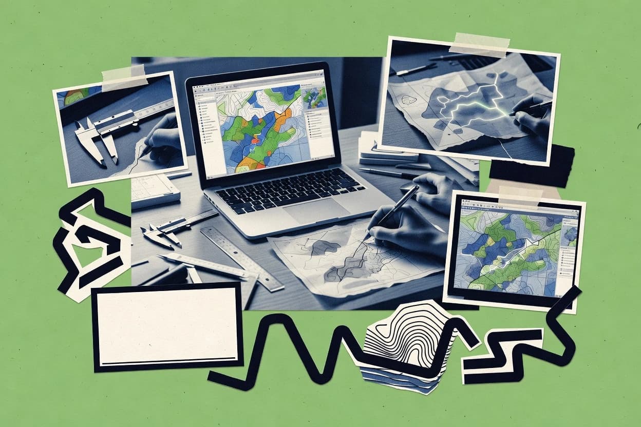
Art DesignTop 10 Best Map Designing Software of 2026
Top 10 Map Designing Software ranked by mapping features and workflows for GIS teams, with QGIS, ArcGIS Pro, and ArcGIS Online comparisons.

How we ranked these tools
Core product claims cross-referenced against official documentation, changelogs, and independent technical reviews.
Analyzed video reviews and hundreds of written evaluations to capture real-world user experiences with each tool.
AI persona simulations modeled how different user types would experience each tool across common use cases and workflows.
Final rankings reviewed and approved by our editorial team with authority to override AI-generated scores based on domain expertise.
Score: Features 40% · Ease 30% · Value 30%
Gitnux may earn a commission through links on this page — this does not influence rankings. Editorial policy
Editor’s top 3 picks
Three quick recommendations before you dive into the full comparison below — each one leads on a different dimension.
QGIS
Processing framework plus Python scripting for automated, batch geoprocessing and layout-driven exports.
Built for fits when teams need scripted map design automation with control over data schemas..
ArcGIS Pro
Editor pickPython-driven map series and layout export using the ArcPy mapping automation APIs.
Built for fits when teams need repeatable map production, schema control, and enterprise publishing governance..
ArcGIS Online
Editor pickHosted feature layers with REST-managed schemas and web map configuration.
Built for fits when mid-size teams need schema-consistent map publishing and API automation..
Related reading
Comparison Table
This comparison table contrasts map designing and geospatial tooling across integration depth, data model choices, and the automation and API surface for ingesting, styling, and publishing map outputs. It also covers admin and governance controls such as provisioning workflow, RBAC, and audit log coverage to show how each platform supports controlled collaboration and extensibility. Readers can use these dimensions to map tradeoffs between desktop authoring, hosted publishing, and programmable web delivery.
QGIS
desktop GISOpen-source desktop GIS for designing and styling maps from spatial data with layout tools, projections, and repeatable print workflows.
Processing framework plus Python scripting for automated, batch geoprocessing and layout-driven exports.
QGIS is used to design printable and publishable maps through layout tools that place labels, legends, scale bars, grids, and map frames tied to project layers. It maintains a project data model that includes layer definitions, renderers, and layout configuration, so the same styling rules can be reapplied across datasets. Python scripting and the Processing framework enable automation of geoprocessing chains and repeatable cartographic outputs, including batch runs for multiple inputs. Integration breadth includes reading and writing common GIS formats, plus interoperability with remote data sources through established client protocols and file-based exchange.
A concrete tradeoff appears in admin and governance controls, since QGIS primarily operates as a desktop client and does not provide built-in RBAC or centralized provisioning for map design assets. Teams typically mitigate this by versioning project files, layout templates, style libraries, and automation scripts in shared repositories. A common usage situation is a cartography team generating many variants of the same map layout from changing feature layers, where Python-driven exports and Processing workflows reduce manual steps while keeping cartographic rules consistent.
- +Python API enables custom geoprocessing and repeatable map export workflows
- +Data model tracks layer schema, symbology, and labeling rules inside a project
- +Layout templates support consistent cartographic production across many variants
- +Processing framework standardizes automation of spatial analysis chains
- +Extensible plugin architecture adds tools for new data types and workflows
- –Desktop-centric workflow limits RBAC and centralized provisioning for assets
- –Large projects can slow exports when many layers and complex renderers stack
- –Cross-team consistency depends on shared conventions for projects and styles
- –API access to styling and layouts can require custom scripting effort
- –Governance features like audit logs are not first-class within the desktop tool
Best for: Fits when teams need scripted map design automation with control over data schemas.
ArcGIS Pro
desktop GISDesktop GIS for creating cartographic maps with symbology, geoprocessing workflows, and high-fidelity layout exports for print and publishing.
Python-driven map series and layout export using the ArcPy mapping automation APIs.
ArcGIS Pro supports a project-centric authoring model that organizes maps, layouts, geoprocessing models, and tasks under one configuration boundary. It integrates tightly with ArcGIS Enterprise through publishing workflows that create map, feature, and scene service definitions from Pro projects. The data model supports feature layers, tables, domains, subtypes, and relationships, which helps keep symbology and behavior aligned with underlying schemas.
Automation is a key part of the experience. Pro exposes a Python automation surface for map series generation, layout export, and batch updates driven by parameterized logic. One tradeoff is that governance and reproducibility depend on disciplined environment design around workspaces, connection files, and shared item templates. Teams typically use it when many map variants must be generated from a consistent schema and then published with controlled permissions for downstream dashboards and web apps.
Admin and governance controls map to ArcGIS Enterprise administration patterns using roles and item-level permissions tied to published resources. Pro projects and publishing settings can be treated as configuration artifacts, which supports repeatable production if access and connection management are handled consistently. Extension points exist for deeper customization through add-ins and geoprocessing tools, which can integrate map behavior with custom workflow requirements.
- +Project-based authoring keeps maps, layouts, and configuration tightly scoped
- +Schema-aware mapping aligns symbology and behavior with feature layer definitions
- +Python automation supports batch exports and parameter-driven map series workflows
- +Publishing from Pro to ArcGIS Enterprise integrates authoring with service definitions
- –Automation often requires careful workspace and connection file management
- –Extension customization adds complexity compared with simpler layout editors
- –Governed publishing demands consistent role and item permission practices
Best for: Fits when teams need repeatable map production, schema control, and enterprise publishing governance.
ArcGIS Online
web GISCloud web GIS for building interactive maps, configuring basemaps and layers, and publishing styled map content to web audiences.
Hosted feature layers with REST-managed schemas and web map configuration.
ArcGIS Online’s integration depth comes from its hosted item system for maps, layers, and applications that share a consistent schema across web maps and feature layers. Map design leverages web map configuration, symbology, popups, and layer views that remain addressable via item IDs and REST endpoints. Extensibility is available through ArcGIS REST and web app configuration, which supports integration with external workflows via geoprocessing service calls and feature access patterns.
A key tradeoff is that the data model and layer types are tightly coupled to Esri’s schemas, so some non-Esri raster and custom data structures require conversion into supported item formats. This fits best when teams need repeatable map publishing and controlled access to map assets across departments, with automation that can provision items and validate state through API calls and item metadata.
- +Consistent item data model for maps, layers, and apps
- +REST API supports item publishing, lifecycle operations, and feature access
- +RBAC and organization-level settings support controlled sharing
- +Audit log records administrative and content actions
- –Layer schemas constrain custom geospatial or attribute models
- –Cross-system mapping of non-Esri formats can require preprocessing
Best for: Fits when mid-size teams need schema-consistent map publishing and API automation.
Mapbox Studio
vector stylingVector map styling and publishing tools for designing cartographic styles used by Mapbox vector tiles and web and mobile map SDKs.
Project-scoped style management that links editor changes to Mapbox deployable style configurations.
Mapbox Studio centers map design around a schema-driven workflow that connects visual editing to Mapbox styles, tiles, and API-backed deployment. It supports configuration and style iteration with project-based asset management, which helps keep changes reproducible across environments.
The integration depth comes from Mapbox API surfaces for styles, tiles, and related services, plus extensibility options for automating style generation. Governance controls are available through account-level permissions and project RBAC, with audit visibility tied to workspace activities.
- +Style editing mapped to Mapbox style objects and deployable configurations
- +Project-based asset organization supports repeatable promotion across environments
- +API integration for style and map configuration enables automation
- +RBAC controls restrict authoring, editing, and publishing by role
- +Extensibility through API and automation supports custom style pipelines
- –Complex style logic still requires careful coordination with the underlying schema
- –Large teams may need external process for review and approval workflows
- –Governance depends on workspace setup and consistent project permissioning
- –Automation throughput can bottleneck on style regeneration steps
Best for: Fits when teams need controlled map style production tied to Mapbox APIs and repeatable deployments.
kepler.gl
web cartographyWeb-based map design and exploration tool that renders deck.gl layers and supports interactive map composition with styles and layer configuration.
JSON-driven kepler.gl state model that persists layers, filters, and view configuration for reapplication.
kepler.gl renders geospatial scenes from external data in a MapLibre-compatible style pipeline and lets users design interactive dashboards inside the same visualization workspace. It uses a JSON-driven state model that captures layers, filters, view state, and interaction bindings, which makes configuration and repeatability feasible across environments.
Integration depth is strongest through published embedding and configuration patterns, plus extensibility via the underlying deck.gl layer architecture. Automation and governance depend on how the host app provisions kepler.gl state, because built-in RBAC and audit logging are not part of the visualization core.
- +JSON scene state captures layers, filters, and interactions for repeatable deployments
- +deck.gl layer model enables custom rendering and schema-specific layer extensions
- +Embedding patterns support integrating map design into existing web apps
- +High-throughput rendering path handles large point and polygon datasets
- –RBAC and admin governance controls are limited to host-application patterns
- –Audit logging for map changes is not native to the visualization runtime
- –Schema handling relies on layer-specific adapters and consistent field naming
- –Automation requires external tooling to generate and apply scene state JSON
Best for: Fits when teams need scripted geospatial map configurations inside an existing web app.
Figma
vector designVector design tool for map styling and layout creation using frames, components, and plugin-driven workflows for cartographic assets.
Figma REST API for node-level access and updates inside design files.
Figma supports map-like diagramming through vector frames, components, and auto-layout, which makes it practical for spatial planning workflows. Teams can standardize map symbols with libraries and then automate production using plugins and the public REST API for file, node, and comment operations.
The integration surface is centered on API-driven reading and writing of nodes inside files, plus extensibility via plugins that run against the design document context. For governance, Figma provides organization roles with RBAC-style access control and an audit log that supports traceability for admin oversight and operational reviews.
- +Vector-based map diagrams with reusable components and libraries
- +Public REST API supports programmatic reads and writes to files
- +Plugins enable custom tooling for map symbol generation and checks
- +Audit log and RBAC-style access controls for organization governance
- –No native geospatial model for coordinates, projections, or layers
- –API automation depends on design-file structure and node organization
- –Throughput can slow on large files with many nodes and variants
- –Change management requires discipline to keep symbol libraries consistent
Best for: Fits when teams need diagrammatic map design automation with API and plugin extensibility.
Adobe Illustrator
vector illustrationVector illustration software for manual map symbol design, map typography, and export of clean vector artwork for cartographic layouts.
Artboard and layer structure with symbol libraries supports consistent cartographic production exports.
Adobe Illustrator is a vector authoring tool with a mature integration path into Creative Cloud workflows for map production. It supports layered artwork, symbol libraries, and export pipelines through scripts and automation hooks that map well to production maps.
Illustrator’s data model stays document-centric rather than schema-first, so GIS attributes require manual structuring or external tooling. Automation and governance depend on Creative Cloud’s management controls plus custom scripting against the document model rather than a native map feature schema.
- +Layered symbol styling supports repeatable cartographic design across documents
- +Scripting via ExtendScript and UXP-style automation enables repeatable production steps
- +Creative Cloud integration fits teams already using Photoshop and InDesign pipelines
- +Vector exports cover print and web formats with controlled typography and outlines
- –No native map feature data model for geometry plus attribute schema
- –Automation targets artwork objects, so GIS attribute joins require external workflows
- –Governance relies on Creative Cloud admin tooling instead of map-specific RBAC
- –Audit logs and provisioning are not map-schema aware for traceable dataset changes
Best for: Fits when map output is design-driven and data enrichment happens outside Illustrator.
OpenLayers
web mapping SDKWeb mapping library for building custom interactive maps where styling and layer composition are controlled in JavaScript.
Vector layer styling and interaction events that drive application state through the OpenLayers API.
OpenLayers is a map rendering and visualization toolkit built around a documented JavaScript API and extensibility points for custom workflows. Its data model is centered on vector and raster layers plus a view system, so mapping logic stays close to application code and layer state.
Automation happens through code driven configuration, event hooks, and integration with external services via custom controls and network requests. Governance and administration are provided indirectly through the hosting application, since OpenLayers itself does not include RBAC or audit log features.
- +Layer and feature model maps cleanly to vector styles and interactions
- +Event and control APIs support custom automation and UI behaviors
- +Extensible rendering pipeline enables custom sources and overlays
- –No built-in admin, RBAC, or audit log for multi-user governance
- –Map authoring requires engineering work for schemas and workflows
- –Complex tooling for throughput depends on custom integration design
Best for: Fits when teams need code-driven map design with integration depth and control.
Leaflet
web mapping SDKWeb mapping library that supports custom vector overlays, basemap integration, and layer-driven cartographic styling for interactive maps.
GeoJSON layer support with per-feature styling and event handlers.
Leaflet renders interactive maps from developer-supplied layers, with tile handling driven by an explicit map configuration. The data model is a thin abstraction around GeoJSON, raster tile layers, and vector layers passed into the map API.
Integration depth depends on how well teams plug custom renderers, event handlers, and layer controls into their existing JavaScript stack. Automation and governance rely on external tooling because Leaflet provides an API and events but does not include admin roles, RBAC, or audit logging.
- +Layer API supports GeoJSON and custom vector renderers with direct control
- +Event system exposes user interactions for integration with application state
- +Plugin architecture adds controls, overlays, and draw tooling without core rewrites
- +Declarative configuration via JavaScript objects keeps map setup inspectable
- –No built-in schema or validation for geospatial data workflows
- –No admin, RBAC, or audit log for governance over map content
- –Automation for provisioning and CI must be built outside Leaflet
- –State and persistence are left to the host application and storage layer
Best for: Fits when teams need custom map rendering and event-driven integration using JavaScript APIs.
Google Maps Platform
managed web mapsManaged mapping platform with map styling controls and rendering for interactive map experiences in web and mobile applications.
Maps JavaScript API rendering plus Cloud-based IAM and audit logs for controlled map access.
Google Maps Platform fits organizations that already operate on GCP and need mapping design driven by a documented API surface. It supports a structured data model for places, routes, and geocoding workflows, with schema-backed responses that integrate into app and automation pipelines.
Automation comes from Maps APIs that can be called from build systems and backend services, while design control is expressed through request configuration and map styling layers rather than a visual editor-only workflow. Governance depends on Google Cloud IAM, quota controls, and audit log visibility for access and key usage patterns across projects and environments.
- +Extensive Maps APIs cover maps, routes, geocoding, and places workflows
- +Request configuration drives map behavior and rendering without client-side scripting
- +GCP IAM provides RBAC via roles for projects, services, and API access
- +Cloud audit logs record authorization events tied to service and user identities
- +Well-defined data responses integrate with existing schemas and pipelines
- –Map styling configuration and layers remain API and client-config driven
- –Throughput depends on quotas and rate limits per API and project
- –Complex multi-layer visual design requires more client implementation effort
- –Key and service auth setup adds operational overhead for multi-environment releases
Best for: Fits when teams need API-driven map design integrated with GCP IAM and automation pipelines.
How to Choose the Right Map Designing Software
This guide covers QGIS, ArcGIS Pro, ArcGIS Online, Mapbox Studio, kepler.gl, Figma, Adobe Illustrator, OpenLayers, Leaflet, and Google Maps Platform. It maps each tool to a specific integration, data model, automation and API surface, and admin and governance fit for map design workflows. It also calls out common failure points like missing schema governance in desktop and visualization editors.
Map design tooling that turns spatial or cartographic inputs into repeatable layouts, styles, and published outputs
Map designing software builds cartographic styling and map composition that can be exported for print, published to web, or embedded in applications. Some tools use a schema-aware GIS data model for layers and feature behavior, which ArcGIS Online and ArcGIS Pro apply through hosted feature layers and project authoring. Other tools focus on styling and state models that can be deployed via APIs, which Mapbox Studio and kepler.gl do through style configuration and JSON-driven scene state.
Integration breadth, data model governance, and automation depth for repeatable map production
Evaluation should start with integration depth because each tool pushes work into a different place in the pipeline. ArcGIS Online uses REST-managed schemas and web map configuration, while QGIS automates map composition through a Python-driven processing framework. Automation and API surface then determine whether map design changes can be generated, tested, and batch exported at throughput rather than by manual edits.
Schema-aware layer and attribute modeling
ArcGIS Online relies on hosted feature layers with REST-managed schemas, which constrains layer and attribute models to keep publishing consistent. ArcGIS Pro provides schema-aware mapping aligned to feature layer definitions inside a project so symbology and behavior follow the underlying definitions.
Automation surface for batch map composition and export
QGIS uses the Processing framework plus Python APIs for automated, batch geoprocessing and layout-driven exports, which supports repeatable production pipelines. ArcGIS Pro supports Python-driven map series and layout export through ArcPy mapping automation APIs for parameter-driven batch work.
API-first style and configuration management
Mapbox Studio ties editor changes to Mapbox style objects and deployable configurations and supports API integration for style and map configuration. kepler.gl uses a JSON-driven kepler.gl state model that persists layers, filters, view state, and interaction bindings so the same configuration can be reapplied across environments.
Admin controls, RBAC, and audit logging for map content changes
ArcGIS Online provides RBAC and organization-level settings tied to audit logging for administrative and content actions. Figma adds organization roles with RBAC-style access control and an audit log that records admin oversight and operational reviews.
Data model transparency inside the design project or file
QGIS keeps layer schema, symbology, labeling rules, and layout templates inside repeatable project artifacts so teams can align conventions across variants. Mapbox Studio uses project-scoped asset management that links style edits to deployable configurations for controlled promotion across environments.
Extensibility hooks for custom geoprocessing or rendering
QGIS exposes Python APIs for custom tools, geoprocessing, and batch workflows and also supports an extensible plugin architecture. OpenLayers exposes a documented JavaScript API with event and control APIs that drive application state through vector layer styling and interaction events.
A decision flow for selecting map design software by pipeline control and governance
Start by identifying where map design needs to live in the stack so the integration and data model match the workflow. If controlled publishing and schema-managed services are required, ArcGIS Pro plus ArcGIS Online fit because publishing connects Pro authoring to ArcGIS Enterprise service definitions and hosted feature layer schemas. If the requirement is code-driven map rendering and interaction state, OpenLayers and Leaflet provide rendering control but delegate RBAC and audit to the host application.
Map the pipeline to a first-class data model
For layer and attribute governance, pick ArcGIS Online or ArcGIS Pro because hosted feature layers and project-based authoring align symbology and behavior with schema definitions. For JSON or style-object workflows, pick kepler.gl for JSON-driven scene state or Mapbox Studio for Mapbox style objects and deployable configurations.
Define which system must own automation and exports
For batch geoprocessing and repeatable layout-driven exports, plan automation around QGIS because its Processing framework standardizes spatial analysis chains and Python scripting drives exports. For batch map series and layout export parameterization, plan around ArcGIS Pro because ArcPy mapping automation supports map series exports.
Verify API and integration points align with change management
For programmatic publishing and lifecycle operations, plan around ArcGIS Online REST APIs for item publishing and feature access and keep schemas consistent across maps and layers. For application embedding and state reapplication, plan around kepler.gl JSON scene configuration or OpenLayers vector layer styling and interaction events.
Lock down governance and audit requirements
If RBAC and audit logging for content actions must be native, plan around ArcGIS Online for audit log records tied to organizational settings and role-based access control. If the workflow is design-file centric, plan around Figma because it provides RBAC-style access controls and an audit log for design file changes.
Assess throughput hotspots in the rendering or styling loop
For high-throughput rendering of large point and polygon datasets, plan around kepler.gl because it uses a high-throughput rendering path through the deck.gl layer architecture. For complex layered cartography in desktop layouts, plan around QGIS but watch export performance when many layers and complex renderers stack.
Which teams get the most control from each map design approach
Audience fit comes from whether the tool controls the schema and publishing workflow or only provides styling and visualization state. Teams that need governed publishing and consistent layer schemas benefit from ArcGIS Pro and ArcGIS Online. Teams that need embed-ready configuration and scripted state can align around kepler.gl, OpenLayers, or Leaflet with governance implemented in the host application.
Cartography and GIS teams running automated production pipelines
QGIS fits teams that need scripted map design automation because its Processing framework plus Python APIs automate batch geoprocessing and layout-driven exports. ArcGIS Pro fits teams that need controlled batch map series and layout export through ArcPy mapping automation APIs.
Organizations publishing governed web GIS content at scale
ArcGIS Online fits mid-size teams that need schema-consistent map publishing and REST API automation because hosted feature layers have REST-managed schemas and web map configuration. ArcGIS Online also fits governance needs because RBAC and audit logging are tied to organizational settings for content actions.
Product teams building Mapbox-backed web or mobile map styling systems
Mapbox Studio fits teams that need controlled map style production tied to Mapbox APIs because it links style editing to Mapbox style objects and deployable configurations. It fits repeatable deployments because project-scoped asset management supports promotion across environments.
Web app teams embedding interactive geospatial dashboards
kepler.gl fits teams that need scripted geospatial map configurations inside an existing web app because its JSON-driven kepler.gl state model persists layers, filters, and interaction bindings. OpenLayers fits teams that need code-driven map design with vector layer styling and interaction event hooks because governance and RBAC must be implemented by the host.
Design teams producing symbol libraries and diagrammatic cartographic assets
Figma fits map symbol and layout workflows because it provides a public REST API for programmatic reads and writes of nodes inside design files plus RBAC-style access controls and an audit log. Adobe Illustrator fits design-driven map output when symbol libraries and vector exports are the primary deliverable and GIS attributes are handled outside Illustrator.
Pitfalls that break automation, governance, or schema consistency in map design workflows
Common mistakes come from assuming the tool provides governance or schema management when it actually delegates those responsibilities. Workflow failures often show up as brittle project conventions, missing audit trails, or automation that depends on manual file organization. These pitfalls are avoidable by aligning selection criteria to API surface, data model ownership, and admin controls.
Choosing a styling editor without a native schema or governance model
OpenLayers and Leaflet provide vector and event APIs but do not include RBAC or audit log features, so multi-user governance must be implemented in the host application. kepler.gl also lacks native audit logging and RBAC in the visualization core, so teams must plan external provisioning and review controls for map changes.
Treating desktop authoring as if it supports centralized provisioning and audit trails
QGIS is desktop-centric and governance features like audit logs are not first-class in the desktop tool, so centralized RBAC and audit-driven administration require external conventions. ArcGIS Pro provides governance through ArcGIS Enterprise concepts, so it fits governed publishing only when the enterprise roles and item permissions practices are consistently applied.
Building automation around manual export steps instead of a batch automation surface
QGIS supports Python-driven batch geoprocessing and layout export through the Processing framework, so automation should use its scripting hooks rather than relying on repeated manual layout recreation. ArcGIS Pro supports Python-driven map series and layout export through ArcPy mapping automation APIs, so batch work should be parameterized rather than scripted around GUI interactions.
Ignoring schema constraints that limit attribute and geospatial model flexibility
ArcGIS Online layer schemas constrain custom geospatial or attribute models, so teams with non-Esri formats may need preprocessing to align with hosted layer schemas. Mapbox Studio’s style logic still requires careful coordination with underlying schema objects, so style automation should be tested against the expected style and tile deployment targets.
How We Selected and Ranked These Tools
We evaluated QGIS, ArcGIS Pro, ArcGIS Online, Mapbox Studio, kepler.gl, Figma, Adobe Illustrator, OpenLayers, Leaflet, and Google Maps Platform using the provided feature scores, ease-of-use scores, and value scores, and we used overall rating as a weighted average where features carries the most weight at forty percent while ease of use and value each account for thirty percent. Feature emphasis reflects how often map design needs automation and API control rather than just manual styling.
We then treated integration depth, data model ownership, automation and API surface, and admin and governance controls as the practical reason tools land higher or lower because those mechanisms determine how reliably map outputs can be produced and managed. QGIS set itself apart in the ranking by combining a Processing framework with a Python API for automated, batch geoprocessing and layout-driven exports, and that capability lifted the feature side strongly because it directly supports repeatability and throughput through scripting rather than through GUI-only workflows.
Frequently Asked Questions About Map Designing Software
Which tools support schema-first map design with repeatable exports?
How do QGIS and ArcGIS Pro differ in automation depth for map composition?
What integration patterns work best when map publishing must be driven by APIs?
How do Mapbox Studio and ArcGIS Online handle style or schema iteration across environments?
Which tool is better suited for building interactive dashboards from external data in a JSON configuration model?
What is the tradeoff between code-centric mapping and visualization-first configuration?
How do teams implement admin controls and audit visibility for map authoring workflows?
What security boundary controls apply when using Google Maps Platform versus Mapbox Studio?
How do data migration workflows typically differ between QGIS and ArcGIS Online?
Which toolchain works best when the primary goal is diagrammatic map-like planning with API updates at the node level?
Conclusion
After evaluating 10 art design, QGIS stands out as our overall top pick — it scored highest across our combined criteria of features, ease of use, and value, which is why it sits at #1 in the rankings above.
Use the comparison table and detailed reviews above to validate the fit against your own requirements before committing to a tool.
Tools reviewed
Primary sources checked during evaluation.
Referenced in the comparison table and product reviews above.
Keep exploring
Comparing two specific tools?
Software Alternatives
See head-to-head software comparisons with feature breakdowns, pricing, and our recommendation for each use case.
Explore software alternatives→In this category
Art Design alternatives
See side-by-side comparisons of art design tools and pick the right one for your stack.
Compare art design tools→FOR SOFTWARE VENDORS
Not on this list? Let’s fix that.
Our best-of pages are how many teams discover and compare tools in this space. If you think your product belongs in this lineup, we’d like to hear from you—we’ll walk you through fit and what an editorial entry looks like.
Apply for a ListingWHAT THIS INCLUDES
Where buyers compare
Readers come to these pages to shortlist software—your product shows up in that moment, not in a random sidebar.
Editorial write-up
We describe your product in our own words and check the facts before anything goes live.
On-page brand presence
You appear in the roundup the same way as other tools we cover: name, positioning, and a clear next step for readers who want to learn more.
Kept up to date
We refresh lists on a regular rhythm so the category page stays useful as products and pricing change.