GITNUXSOFTWARE ADVICE
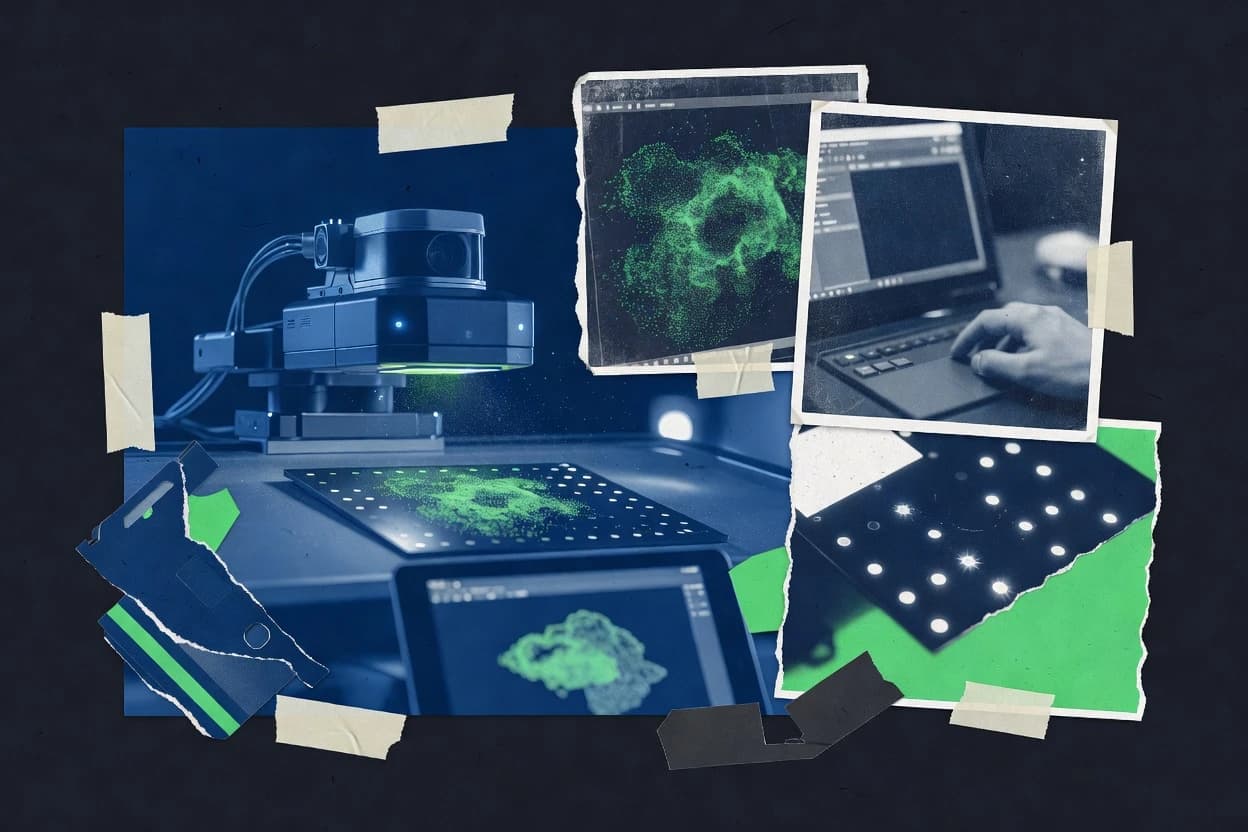
Data Science AnalyticsTop 10 Best Lidar Processing Software of 2026
Top 10 Lidar Processing Software tools ranked for point cloud workflows. Reviews cover CloudCompare, PDAL, LAStools, and alternatives.

How we ranked these tools
Core product claims cross-referenced against official documentation, changelogs, and independent technical reviews.
Analyzed video reviews and hundreds of written evaluations to capture real-world user experiences with each tool.
AI persona simulations modeled how different user types would experience each tool across common use cases and workflows.
Final rankings reviewed and approved by our editorial team with authority to override AI-generated scores based on domain expertise.
Score: Features 40% · Ease 30% · Value 30%
Gitnux may earn a commission through links on this page — this does not influence rankings. Editorial policy
Editor’s top 3 picks
Three quick recommendations before you dive into the full comparison below — each one leads on a different dimension.
CloudCompare
Command-line batch processing with sequenced filters and exports for repeatable LiDAR pipelines.
Built for fits when teams need deterministic CLI workflows for LiDAR preprocessing without a server control plane..
PDAL
Editor pickPipeline driven processing using a single JSON pipeline definition for readers, filters, and writers.
Built for fits when teams need versioned pipeline automation for LiDAR ETL without built-in admin governance..
LAStools
Editor pickLASground and related ground classification utilities provide parameterized classification from LAS inputs.
Built for fits when teams need deterministic, scriptable LiDAR processing around standard LAS/LAZ schemas..
Related reading
Comparison Table
This comparison table evaluates Lidar processing tools by integration depth, including how each system connects to existing pipelines, file formats, and data stores. It also compares the data model and schema handling, plus automation and API surface for repeatable runs, extensibility, and configuration. Admin and governance controls are included, with focus on RBAC, provisioning workflows, and audit log coverage.
CloudCompare
desktop processingDesktop software for point-cloud processing and inspection with workflows for filtering, registration, meshing, and quantitative analysis.
Command-line batch processing with sequenced filters and exports for repeatable LiDAR pipelines.
CloudCompare reads and writes common point cloud formats and applies operations such as noise removal, statistical outlier filtering, segmentation, normal estimation, and mesh generation for downstream analysis. Alignment workflows support coarse and fine registration, including iterative strategies that can be chained for multi-scan LiDAR scenes. The core integration depth comes from automation via command-line execution that can run the same sequence across datasets with controlled parameters. The data model exposes per-point scalar fields and per-point attributes, which filters consume and which exports preserve when the target format supports them.
A key tradeoff is that CloudCompare automation runs as external jobs rather than as an API-driven service with persistent projects, which limits direct integration with centralized orchestration and approvals. Another tradeoff is governance depth, since RBAC, audit logs, and provisioning controls are not part of the tool’s workflow layer. A strong usage situation is preprocessing LiDAR tiles at high throughput on shared compute, where a repeatable script performs denoise, crop, ground extraction, and export into a downstream system.
- +Command-line scripting enables repeatable point cloud processing batches
- +Attribute-driven filters operate on scalar fields and per-point metadata
- +Plugin architecture supports extensibility for custom processing steps
- +Interactive alignment workflows help validate registration before batch runs
- –No built-in REST API surface for direct system-to-system calls
- –Governance features like RBAC and audit logs are not available in-tool
- –Project state is not designed for multi-user server collaboration
Best for: Fits when teams need deterministic CLI workflows for LiDAR preprocessing without a server control plane.
More related reading
PDAL
open-source pipelinePoint Data Abstraction Library that runs on the command line and as a library for converting, transforming, and processing LiDAR point clouds.
Pipeline driven processing using a single JSON pipeline definition for readers, filters, and writers.
PDAL is a pipeline oriented LiDAR processing engine that turns input formats into a structured internal representation, then applies configured transforms before writing a chosen output format. A single pipeline definition captures reader selection, processing chain ordering, and output writing, which makes it easy to version configurations for repeatable throughput runs. Integration depth is strongest where workflows already fit around command execution or where teams generate pipeline JSON from upstream orchestration systems.
Automation comes from its pipeline configuration surface that can be generated and submitted programmatically, which limits the need for custom glue code when the processing chain stays within supported filters and writers. A key tradeoff is that governance controls like RBAC, audit logs, and role based provisioning are not part of PDAL itself, so enterprise admin requirements need to be implemented in surrounding orchestration. A common usage situation is batch normalization and analytics for LAS and LAZ datasets where the same pipeline must run across many tiles with consistent results.
- +Pipeline JSON captures reader, transforms, and writers in one versionable configuration
- +Plugin architecture enables custom processing steps beyond built in filters
- +CLI friendly execution supports automation and orchestration from external schedulers
- +Deterministic stage ordering improves repeatability across batch tile processing
- –No built in RBAC, audit logs, or admin governance controls for multi user deployments
- –Operational throughput depends on how pipelines are generated and executed externally
- –Complex pipelines require careful configuration to avoid mismatched schemas
Best for: Fits when teams need versioned pipeline automation for LiDAR ETL without built-in admin governance.
LAStools
LiDAR utilitiesTool suite for LiDAR point-cloud classification, ground filtering, tiling, and format conversion with command-line workflows.
LASground and related ground classification utilities provide parameterized classification from LAS inputs.
LAStools provides a granular utility set for common LiDAR steps like ground classification, noise filtering, point thinning, and reformatting between LAS and LAZ. Its data model stays anchored to LAS headers, point record layouts, and classification semantics, which helps when integrating with existing ingestion and QA tooling that expects standard LAS conventions. Configuration is typically expressed as explicit CLI parameters, which supports reproducible processing runs across batches and sites. Extensibility comes from composing utilities in scripts and maintaining deterministic arguments per dataset.
A key tradeoff is that most automation happens outside the tool via shell or workflow managers rather than through a managed API or long-lived service. This can add operational overhead when governance requires RBAC, centralized audit logs, or multi-tenant sandboxing around processing jobs. A good fit is batch reprocessing where throughput depends on predictable CLI throughput and where downstream systems consume file-based outputs with stable schemas.
For admin and governance controls, LAStools relies on external controls such as OS permissions, job schedulers, and workflow governance around command execution. When governance needs audit-grade traces of every parameter and intermediate artifact, the pipeline must capture command lines, logs, and produced filenames as part of the orchestration layer.
- +CLI utilities preserve LAS header and classification semantics for predictable pipelines.
- +Repeatable command parameters support deterministic batch reprocessing workflows.
- +Extensive conversion and filtering tools cover common pre-processing steps.
- +File-based outputs integrate well with existing ETL and point-cloud tooling.
- –Minimal managed orchestration features for RBAC, audit logs, and job governance.
- –Automation and API surface require external scripting and workflow tooling.
- –Interactive GUI-driven operations are not the primary workflow for most tasks.
Best for: Fits when teams need deterministic, scriptable LiDAR processing around standard LAS/LAZ schemas.
FME
data integrationETL and data-transformation platform that ingests LiDAR formats and runs reproducible workflows for cleaning, filtering, and exporting point-cloud data.
FME Workbench workspace graphs with parameterized conversion and custom transformer extensibility for point clouds.
FME focuses on repeatable Lidar processing by centering conversions, validations, and feature generation in a configurable workflow graph. Its data model and schema handling support multiple point cloud and spatial formats, with explicit per-step parameters that make automation auditable and reproducible.
Integration depth is strongest through FME Engines, REST-style automation endpoints, and extensible components that connect to storage, GIS, and custom transformation logic. Governance is addressed with administrative roles, project-level controls, and logging that supports troubleshooting across batch and streaming runs.
- +Workflow-based transformations with explicit, versionable parameterization per step
- +Strong format conversion coverage for point cloud and spatial inputs
- +Automation via engines and API surface for scheduled and on-demand runs
- +Extensibility through custom transformers and reusable workflow components
- +RBAC-style access controls for projects, workspaces, and execution
- –Schema mapping complexity can slow down first-time pipeline setup
- –High-volume throughput needs careful tuning of readers, writers, and chunking
- –Debugging large graphs requires disciplined logging and test datasets
- –Custom extensions add maintenance burden across environments
Best for: Fits when teams need automated Lidar ETL with controlled schemas and execution governance.
Terrasolid
survey processingLiDAR processing suite that supports classification, ground modeling, feature extraction, and generation of deliverables for surveying workflows.
Configurable processing chains that bind classification and surface steps to a consistent project data model.
Terrasolid processes LiDAR point clouds and manages geospatial workflows through a structured workspace and standardized data handling. The system supports repeatable processing chains for tasks like classification, filtering, surface generation, and GIS-ready outputs.
Integration depth is driven by project schemas, configurable processing steps, and interoperability across common geospatial formats. Automation and extensibility are centered on scripting and repeat execution, with a governance posture that relies on controlled projects and auditable workflow runs.
- +Project workspace keeps processing settings attached to outputs
- +Repeatable processing chains for classification and surface generation
- +Interoperable I/O for common LiDAR and geospatial formats
- +Scripting supports unattended batch throughput at scale
- +Clear data model separates raw points, derived products, and deliverables
- –Automation depends on users adopting the tool’s processing schema
- –Automation surface can feel indirect versus direct REST-style APIs
- –Cross-team governance needs disciplined project and permissions management
- –Large datasets require careful configuration for predictable runtime
Best for: Fits when survey and mapping teams need repeatable LiDAR processing with controlled project workflows.
Geomagic
scan processingPoint-cloud and scan-processing software used for aligning, cleaning, and generating CAD-like outputs from LiDAR and other 3D data.
Registration and meshing pipeline for converting aligned point clouds into inspection-ready geometry.
Geomagic fits teams that need an end-to-end pipeline from raw Lidar scan alignment to mesh and measurement outputs inside a shared processing environment. It focuses on geometric data handling, including scan registration workflows and conversion into surface meshes suitable for inspection and downstream CAD use.
Automation is typically driven through repeatable processing steps and scriptable tooling rather than a simple web UI only approach. Integration depth depends on how well the environment connects to existing file-based pipelines and whether the automation surface can be aligned with internal schema and governance requirements.
- +Strong scan registration workflow support for turning point data into consistent geometry
- +Mesh and measurement outputs align with inspection and CAD-adjacent review processes
- +Repeatable processing steps support batch throughput for recurring project types
- +Scriptable automation options reduce manual reruns across similar datasets
- –Integration relies heavily on file workflows and conversion points
- –API surface details for full provisioning and RBAC are limited in common documentation
- –Schema governance and audit log controls are not as explicit as enterprise ETL tools
- –Automation setup can require more engineering than GUI-only lidar viewers
Best for: Fits when geometry registration and mesh measurement are the main Lidar outcomes, not data cataloging.
Metashape
3D reconstructionPhotogrammetry and 3D reconstruction software that can process LiDAR-adjacent workflows to produce dense clouds and textured 3D models.
Batchable reconstruction pipeline within a single project workflow configuration.
Metashape targets photogrammetry and dense point workflows, so Lidar data usually needs pre-alignment and careful ingestion choices before feature extraction and meshing. It offers a project-based data model with explicit outputs like sparse and dense point clouds, meshes, and orthomosaics that can be stored and reprocessed consistently.
Automation is mostly workflow configuration through repeatable processing steps rather than a broad public API for external orchestration. Governance controls are limited to project access and operational permissions, with fewer enterprise-grade RBAC and audit log surfaces than many pipeline-focused systems.
- +Project workflow keeps outputs reproducible across reprocessing runs
- +Supports dense reconstruction outputs like meshes and orthomosaics from 3D inputs
- +Works well for mixed survey datasets when alignment and calibration are handled upstream
- –Lidar is not a native primary processing target in typical pipelines
- –Automation depth is limited compared with systems offering broad APIs
- –RBAC and audit logging controls are not positioned as enterprise pipeline governance
Best for: Fits when teams need photogrammetry style reconstruction and can manage Lidar preprocessing elsewhere.
MeshLab
open-source geometryOpen-source tool for filtering and processing meshes and point-based geometry exported from LiDAR pipelines.
Filter scripting and plugin extensibility for custom point-cloud processing stages.
MeshLab targets Lidar and point-cloud processing through a plugin-driven mesh and point-cloud workflow rather than a governed enterprise pipeline. Its core data model centers on in-memory point sets and surface-oriented operations like filtering, decimation, and mesh cleanup that apply through configurable filters.
Integration depth is mostly desktop-centric through extensibility via plugins and scripted filter stacks, with no native automation service or documented API surface for orchestration. Automation and governance controls are limited to local configuration and project-level workflows, with no documented RBAC, audit logs, or admin provisioning.
- +Plugin architecture enables custom filters for specialized point-cloud cleanup
- +Filter pipeline supports repeatable processing stacks across datasets
- +Mesh-focused tools handle decimation, smoothing, and cleaning workflows
- +Local project files capture processing settings for offline re-runs
- –No documented API for job orchestration across processing infrastructure
- –No RBAC, audit logs, or admin provisioning controls for shared environments
- –Automation is primarily batch via workflows rather than governed pipelines
- –Data handling is primarily file and in-memory oriented, not streaming
Best for: Fits when teams need customizable, desktop workflows for point-cloud processing without enterprise orchestration.
GDAL
geospatial conversionGeospatial data abstraction library that converts and transforms raster outputs derived from LiDAR such as elevation grids and intensity rasters.
Extensive format driver support for raster and vector I O with consistent geospatial metadata handling.
GDAL runs command-line and library-based workflows for converting, reprojecting, and resampling LiDAR-derived rasters and vectors. It provides a consistent geospatial data model via GDAL datasets, drivers, coordinate reference handling, and metadata propagation across processing stages.
Automation is driven through a stable C and Python API surface plus scripting around the CLI, which supports repeatable batch processing for high-throughput pipelines. Governance relies on the host environment and file-level permissions, since GDAL itself does not provide RBAC or audit logging.
- +Driver-based I O covers many raster and vector formats for LiDAR outputs
- +Consistent coordinate transforms and georeferencing handling via the GDAL dataset model
- +Python and C APIs support automation and integration into custom pipelines
- +Metadata and provenance fields pass through drivers for traceable outputs
- –No native LiDAR point cloud schema for returns, attributes, and classification
- –No built-in RBAC, audit logs, or sandboxed execution for multi-tenant governance
- –Throughput depends on external orchestration and parallelization configuration
- –Complex workflows require composing multiple tools and drivers outside GDAL
Best for: Fits when teams need scripted geospatial conversions for LiDAR rasters and derivatives.
OTB
raster analyticsOpen-source image processing toolkit that supports processing of raster products derived from LiDAR such as orthophotos and elevation maps.
Application-level filter pipeline chaining with parameterized processing graphs.
OTB targets lidar processing through a Geospatial-centric data model built around imagery and point cloud workflows. It provides extensive filters and pipeline composition for classification, feature extraction, and model-based operations, with configuration-driven execution.
The integration depth comes from its C++ core, command-line tooling, and support for scripting around batch processing. Automation and API surface rely on invoking compiled components with consistent parameter schemas and structured output artifacts.
- +C++ filter library covers many lidar workflows without custom code for common tasks
- +Pipeline composition supports repeatable batch processing via command-line interfaces
- +Consistent parameterization enables automation around schema-like configuration
- +Geospatial data model aligns outputs with standard GIS and raster workflows
- –Automation control is mostly process orchestration rather than workflow-level scheduling
- –RBAC, audit logs, and governance controls are not a first-class surface
- –Higher customization requires C++ integration and build tooling
- –Throughput tuning often depends on external parallelization rather than built-in services
Best for: Fits when teams need scripted lidar pipelines using filter chains and geospatial outputs.
How to Choose the Right Lidar Processing Software
This buyer’s guide covers CloudCompare, PDAL, LAStools, FME, Terrasolid, Geomagic, Metashape, MeshLab, GDAL, and OTB for LiDAR processing workflows that turn raw point clouds into cleaned, classified, aligned, or deliverable-ready outputs.
It focuses on integration depth, data model fit, automation and API surface, and admin and governance controls so teams can pick tools that match how processing runs are orchestrated and audited in real environments. It also maps common failure modes like missing RBAC and audit logs in tools such as CloudCompare and PDAL to concrete selection steps.
LiDAR processing software that cleans, classifies, converts, and turns points into deliverables
LiDAR processing software ingests LiDAR point clouds and applies configurable stages for filtering, registration, classification, meshing, or format conversion into outputs like LAS/LAZ derivatives, meshes, or geospatial rasters.
It solves problems like repeatable ETL of large tile sets, schema-safe attribute handling, and consistent transformation pipelines across batch runs. Tools like PDAL and LAStools anchor processing in pipeline or CLI workflows that stay close to LiDAR primitives, while FME wraps LiDAR transforms in governed workflow graphs with execution logging.
Evaluation criteria for LiDAR pipelines: integration, data model, automation, and governance
Choosing the right LiDAR processing tool depends on how well the processing configuration can be reused and executed by other systems. PDAL’s single JSON pipeline definition and LAStools’ parameterized CLI utilities show how versionable configuration can drive repeatability.
Governance and integration depth matter when multiple teams share datasets, run processing jobs, or need traceable execution. FME includes RBAC-style controls and logging surfaces, while CloudCompare and MeshLab rely on local execution and do not provide in-tool RBAC or audit logs.
Pipeline-as-configuration for repeatable ETL runs
PDAL uses a versionable JSON pipeline definition that captures readers, transforms, and writers in one object, which makes tile reprocessing deterministic. LAStools and CloudCompare also support repeatable sequences through command-line workflows and sequenced filters, but PDAL keeps the full stage graph in a single pipeline definition.
Automation and API surface for external orchestration
FME provides automation through engine execution and a REST-style API surface for scheduled and on-demand runs, which fits environments that need a processing control plane. CloudCompare and LAStools focus on CLI scripting with no built-in REST API surface for direct system-to-system calls, so orchestration stays external.
Attribute-aware data model and schema handling
CloudCompare centers on point sets with per-point attributes like color, normals, and scalar fields, so filters can operate on scalar fields and metadata. PDAL emphasizes schema-aligned options inside pipeline configuration, while FME uses explicit per-step parameters and schema handling across multiple point and spatial formats.
Extensibility via plugins or custom components
CloudCompare extends functionality through plugins, and PDAL extends pipeline stages through plugin-driven components. FME extends processing through custom transformers and reusable workflow components, which supports maintaining standardized transformation logic across teams.
Admin and governance controls for multi-user processing
FME includes administrative roles, project-level controls, and logging that supports troubleshooting across batch and streaming execution. CloudCompare lacks built-in RBAC and audit logs, and MeshLab also lacks documented RBAC, audit logs, or admin provisioning controls for shared environments.
Project schema binding for long-lived processing chains
Terrasolid binds classification and surface generation steps to a structured project workspace, which keeps processing settings attached to outputs for repeatable chains. Geomagic and Metashape also use project-like workflow structures that support reprocessing, but their governance posture and API surfaces are narrower than enterprise ETL tooling.
Decision framework for selecting LiDAR processing software that fits orchestration and control requirements
Start with the execution model needed for the processing lifecycle. If a versioned, stage-by-stage pipeline definition needs to be executed by external schedulers, PDAL and LAStools fit because they run through CLI or pipeline JSON without requiring an enterprise governance layer.
Next map governance and integration requirements to tool capabilities. If RBAC-style controls and execution logging are required across projects, FME fits because it provides admin roles and logging surfaces, while CloudCompare’s governance relies on the host environment rather than in-tool RBAC or audit logging.
Define the orchestration source: external scheduler versus built-in control plane
If processing must be triggered by an external workflow system, PDAL’s CLI-friendly execution and its single JSON pipeline definition support automation from outside tools. If teams need an automation surface with engine execution and REST-style endpoints, FME’s engines and API surface provide a direct integration path.
Lock the data model to your attribute and classification needs
For pipelines that depend on per-point scalar fields and metadata filters, CloudCompare’s in-memory point sets with attribute-driven filters are a strong fit. For workflows that must keep schema-related options consistent across readers, transforms, and writers, PDAL’s schema-aligned pipeline configuration reduces mismatched schema risks.
Choose the repeatability mechanism you can version
If the processing graph must be captured as a single artifact, PDAL’s pipeline JSON stores readers, transforms, and writers in one versionable configuration. If repeatability is achieved through stable CLI parameters, LAStools and CloudCompare support deterministic batch reprocessing through sequenced filters and exports.
Match governance requirements to actual in-tool control surfaces
If the environment requires RBAC-style access controls and audit-friendly logging, FME’s administrative roles and logging supports troubleshooting across batch and streaming runs. If governance relies on external host permissions and disciplined process handling, CloudCompare and PDAL can fit, since they do not provide built-in RBAC or audit logs in-tool.
Confirm whether the endpoint deliverable is point-cloud, geometry, or raster
For inspection-ready meshes and measurements, Geomagic provides a registration and meshing pipeline that converts aligned point clouds into inspection-ready geometry. For raster or geospatial derivatives derived from LiDAR outputs, GDAL supports conversions and consistent coordinate transforms using its dataset model, while OTB chains model-based raster operations using a C++ filter library.
Select extensibility paths that fit the team’s engineering capacity
Teams that can maintain custom processing components inside a governed workflow graph typically gain from FME custom transformers and reusable workflow components. Teams with an engineering workflow for plugin development can extend CloudCompare through plugins or extend PDAL through plugin-driven stages, while desktop-first options like MeshLab rely on plugin-driven filters without documented orchestration APIs.
Which teams should use which LiDAR processing tools
Different LiDAR processing tools align to different end goals and operational models. Some tools emphasize deterministic CLI processing around the LAS/LAZ data model, while others emphasize governed ETL graphs with admin controls.
The best match depends on whether the environment needs stage-level automation artifacts, documented API surfaces, and multi-user governance beyond local project files. The segments below map directly to the best-fit cases for CloudCompare, PDAL, LAStools, FME, Terrasolid, Geomagic, Metashape, MeshLab, GDAL, and OTB.
Teams building deterministic LiDAR preprocessing batches without a server control plane
CloudCompare and LAStools fit because both center on CLI workflows with sequenced filters and repeatable exports, and CloudCompare highlights command-line batch processing with sequenced filters. MeshLab also fits desktop processing needs with plugin-driven filter stacks, but it lacks a documented orchestration API for shared environments.
Teams running LiDAR ETL where pipeline definitions must be versioned and executed by external systems
PDAL fits because pipeline JSON captures readers, transforms, and writers in one versionable definition that stays deterministic across batch tile processing. This also suits teams that can manage governance outside the tool since PDAL does not provide built-in RBAC or audit logs.
Organizations needing admin controls and logging across multi-project processing executions
FME fits because it provides administrative roles, project-level controls, and logging surfaces that support troubleshooting across batch and streaming runs. It also supports integration depth through engine execution and a REST-style automation surface.
Survey and mapping teams that must keep classification and surface steps bound to project outputs
Terrasolid fits because it uses a project workspace that attaches processing settings to outputs and supports configurable processing chains for classification and surface generation. Geomagic also supports repeatable geometry pipelines, but it is more oriented to registration and mesh measurement outcomes than mapping deliverable governance.
Teams focused on derived deliverables like meshes or geospatial rasters rather than point-cloud ETL
Geomagic fits when the main outcome is scan registration plus meshing and measurement-ready geometry. GDAL and OTB fit when the deliverable is raster or geospatial derivatives because GDAL provides consistent dataset-based georeferencing handling and OTB provides C++ filter chaining for model-based raster processing.
Common selection pitfalls in LiDAR processing software procurement
Common failures come from mismatches between orchestration expectations and what the tool actually exposes. Tools like CloudCompare and PDAL support automation through CLI and configuration, but they do not provide in-tool RBAC or audit logging.
Another frequent issue is assuming LiDAR points and raster derivatives are interchangeable processing targets. GDAL and OTB process raster products derived from LiDAR outputs, while PDAL, LAStools, and CloudCompare focus on point-cloud operations and attribute-aware filtering.
Choosing a point-cloud tool and expecting enterprise RBAC and audit logs inside the product
CloudCompare and PDAL do not provide built-in RBAC or audit log surfaces for multi-user deployments, so governance must be handled outside the tool. FME is the safer match when RBAC-style access controls and logging are required for project execution.
Assuming the processing graph is versionable when only local project files exist
Terrasolid project workspaces and Metashape project workflows support repeatability, but pipeline versioning for external orchestration depends on the tool’s automation surfaces. PDAL’s single JSON pipeline definition gives a stronger versionable artifact for readers, transforms, and writers.
Building a job orchestration workflow around a missing REST API
CloudCompare and LAStools rely on command-line scripting and do not provide a built-in REST API surface for direct system-to-system calls. FME offers engine automation with a REST-style API surface, which supports integration with external job controllers.
Ignoring throughput constraints caused by external pipeline generation and execution
PDAL throughput depends on how pipelines are generated and executed externally, so tile size and pipeline construction rules must be consistent. GDAL and OTB also depend on external orchestration and parallelization tuning since they lack built-in scheduling services.
Confusing raster-derivative toolchains with point-cloud processing schema requirements
GDAL does not provide a native LiDAR point cloud schema for returns, attributes, and classification, so point-level classification workflows must use point-cloud tools like PDAL, LAStools, or CloudCompare. OTB processes imagery and raster products derived from LiDAR outputs, so it should be selected for raster stages rather than point-cloud ETL.
How We Selected and Ranked These Tools
We evaluated CloudCompare, PDAL, LAStools, FME, Terrasolid, Geomagic, Metashape, MeshLab, GDAL, and OTB using a criteria-based scoring approach that weighted features highest, then ease of use, then value. The overall rating was computed as a weighted average where features carries the most weight at 40 percent, while ease of use and value each account for 30 percent.
The criteria centered on concrete execution surfaces such as PDAL’s JSON pipeline definition, FME’s engine automation and REST-style API surface, and CloudCompare’s command-line batch processing with sequenced filters and exports. CloudCompare separates itself from lower-ranked tools by pairing high ease of use with a standout command-line batch workflow and attribute-driven filtering on scalar fields, which lifted the score primarily through feature fit for repeatable LiDAR preprocessing.
Frequently Asked Questions About Lidar Processing Software
Which tool fits a versioned, pipeline-first LiDAR ETL workflow?
How do APIs and automation surfaces differ across LiDAR processing tools?
Which tools provide stronger admin governance features like RBAC and audit logs?
What is the typical data migration approach when moving an existing LiDAR pipeline to another tool?
Which tool is best for controlled point-cloud schema handling and workflow reproducibility?
Which option suits high-throughput rasterization and resampling of LiDAR-derived rasters?
What tool choice matches deterministic batch alignment and preprocessing without a server control plane?
Which toolset fits scan alignment and mesh measurement outcomes instead of just classification and export?
How do extensibility options compare when custom processing stages are required?
Conclusion
After evaluating 10 data science analytics, CloudCompare stands out as our overall top pick — it scored highest across our combined criteria of features, ease of use, and value, which is why it sits at #1 in the rankings above.
Use the comparison table and detailed reviews above to validate the fit against your own requirements before committing to a tool.
Tools reviewed
Primary sources checked during evaluation.
Referenced in the comparison table and product reviews above.
Keep exploring
Comparing two specific tools?
Software Alternatives
See head-to-head software comparisons with feature breakdowns, pricing, and our recommendation for each use case.
Explore software alternatives→In this category
Data Science Analytics alternatives
See side-by-side comparisons of data science analytics tools and pick the right one for your stack.
Compare data science analytics tools→FOR SOFTWARE VENDORS
Not on this list? Let’s fix that.
Our best-of pages are how many teams discover and compare tools in this space. If you think your product belongs in this lineup, we’d like to hear from you—we’ll walk you through fit and what an editorial entry looks like.
Apply for a ListingWHAT THIS INCLUDES
Where buyers compare
Readers come to these pages to shortlist software—your product shows up in that moment, not in a random sidebar.
Editorial write-up
We describe your product in our own words and check the facts before anything goes live.
On-page brand presence
You appear in the roundup the same way as other tools we cover: name, positioning, and a clear next step for readers who want to learn more.
Kept up to date
We refresh lists on a regular rhythm so the category page stays useful as products and pricing change.