GITNUXSOFTWARE ADVICE
Construction InfrastructureTop 10 Best Landscape Measuring Software of 2026
Discover the top 10 best landscape measuring software to streamline your projects. Compare features & choose the best fit.

How we ranked these tools
Core product claims cross-referenced against official documentation, changelogs, and independent technical reviews.
Analyzed video reviews and hundreds of written evaluations to capture real-world user experiences with each tool.
AI persona simulations modeled how different user types would experience each tool across common use cases and workflows.
Final rankings reviewed and approved by our editorial team with authority to override AI-generated scores based on domain expertise.
Score: Features 40% · Ease 30% · Value 30%
Gitnux may earn a commission through links on this page — this does not influence rankings. Editorial policy
Editor picks
Three quick recommendations before you dive into the full comparison below — each one leads on a different dimension.
LandForms
Visual measurement markup that ties annotated plans directly to quantified takeoffs
Built for landscape contractors needing fast, visual measurement takeoffs with clear review trails.
AutoCAD
Runner UpDWG dimensioning and annotation tools with precise snapping for measured landscape plans
Built for landscape designers needing CAD-accurate measurement in professional plan sets.
SketchUp Pro
Also GreatPro’s dimension and annotation tools tied to scaled 3D geometry for measurement-ready drawings
Built for landscape designers modeling sites in 3D and extracting measurement-based visuals.
Related reading
- Construction InfrastructureTop 10 Best Construction Measuring Software of 2026
- Construction InfrastructureTop 10 Best Landscape Estimate Software of 2026
- Construction InfrastructureTop 10 Best Landscape Work Order Software of 2026
- Construction InfrastructureTop 10 Best Landscape Maintenance Estimating Software of 2026
Comparison Table
This comparison table evaluates landscape measuring software such as LandForms, AutoCAD, SketchUp Pro, Vectorworks Landmark, and Revit. You can compare core capabilities like measurement and scaling, terrain and site workflows, import and export options, and how each tool supports plan production for landscaping and site design.
LandForms
drone analyticsLandForms estimates landscapes by taking drone photos and producing measurable planting, area, and volume outputs for project planning.
Visual measurement markup that ties annotated plans directly to quantified takeoffs
LandForms stands out by turning landscape measuring into a guided workflow built around takeoff-ready outputs. It supports measurement capture, plan annotation, and estimation exports focused on landscape scopes like paving, planting, and grading.
The tool emphasizes visual review so field and design teams can align on quantities before approval. It also supports team collaboration patterns that keep measurements organized by project and revision.
- +Guided measurement workflow that produces takeoff-ready quantities quickly
- +Visual annotations make it easy to review and validate scope
- +Project-based organization keeps measurements linked to revisions
- –Advanced reporting options feel limited for highly custom estimating
- –Less suited for non-landscape measurement workflows and mixed scopes
- –Export formats may require cleanup for highly standardized accounting setups
Best for: Landscape contractors needing fast, visual measurement takeoffs with clear review trails
More related reading
AutoCAD
CAD designAutoCAD is a CAD platform used to create accurate landscaping plans, site layouts, and scaled measurements using vector drawings.
DWG dimensioning and annotation tools with precise snapping for measured landscape plans
AutoCAD stands out as a precise, CAD-first option for landscape measurement that supports drafting, dimensioning, and scalable plan production. It handles site geometry through layers, blocks, and measurement tools, letting you compute areas and distances from accurate drawings.
For landscape workflows, it integrates with AutoCAD’s annotation and plotting so you can produce construction-ready sheets with consistent scale. Its strength depends on users managing CAD setup, coordinate systems, and measurement standards rather than relying on purpose-built landscaping wizardry.
- +Dimensioning and annotation tools produce construction-ready landscape measurements
- +Layer and block workflows keep repeated site elements consistent across plans
- +DWG-based drawings preserve measurement accuracy for client and contractor handoff
- +Plotting and sheet layouts support standardized deliverables
- –Manual CAD setup is required for consistent landscape measurement conventions
- –Learning curve is steep for measurement workflows compared with specialized tools
- –Area and takeoff work often needs structured modeling and cleanup
- –Collaboration relies on external processes and file discipline
Best for: Landscape designers needing CAD-accurate measurement in professional plan sets
SketchUp Pro
3D modelingSketchUp Pro supports landscape modeling with scaled 3D geometry and measurement tools for estimating areas and material quantities.
Pro’s dimension and annotation tools tied to scaled 3D geometry for measurement-ready drawings
SketchUp Pro stands out for fast 3D modeling that turns site measurements into visual plans. It supports accurate scale modeling with dimensioning tools and workflows for importing CAD data and exporting layouts for review.
Landscape measuring tasks work best when you model terrain and hardscape elements in 3D and then capture measurements from the model for client-ready visuals. It is less suited to pure field measurement capture compared with dedicated surveying apps.
- +Fast 3D modeling for site concepts with measurement-ready scaled geometry
- +Strong dimensioning tools for lengths, areas, and annotated deliverables
- +CAD import and export supports coordination with landscape plan files
- +Large ecosystem of extensions and models for landscape workflows
- –Not a dedicated surveying or GNSS capture tool for field measurements
- –Terrain accuracy depends on model inputs and disciplined scaling
- –Advanced workflows can take time to learn for consistent documentation
- –Documenting quantities for estimating requires careful model organization
Best for: Landscape designers modeling sites in 3D and extracting measurement-based visuals
Vectorworks Landmark
landscape BIMVectorworks Landmark provides landscape-focused design and drafting tools for calculating quantities and producing site plans.
Landmark Site Modeling tools for grading and contour generation tied to landscape documentation
Vectorworks Landmark stands out for combining BIM-style modeling workflows with landscape-specific tools for grading, planting, and site documentation. It provides site model creation, contour and grading tools, and plant library management geared toward measurable site outcomes.
The software also supports annotation and output for plans and reports that directly support landscape measuring and takeoff-style tasks. Its depth is strongest for teams that already think in 2D plans and 3D site geometry.
- +Landscape-specific grading and site model tools support measurable takeoffs
- +Planting libraries streamline plant quantity and layout documentation
- +Rich 2D and 3D output links design geometry to plan deliverables
- +Annotation tools help generate consistent landscape drawings and schedules
- –Steeper learning curve than dedicated measuring-only tools
- –Advanced modeling workflows can slow smaller projects
- –Library setup and standards take time to align with client workflows
Best for: Landscape design teams needing detailed site modeling and measurement documentation
Revit
BIM takeoffRevit enables parametric landscape design and takeoff workflows using building information modeling for measurable site elements.
Schedules driven by parametric categories for automated landscape takeoff tables
Revit stands out for turning landscape measurement into a model-driven workflow built on parametric BIM objects. It supports precise area and volume takeoffs using built geometry, schedules, and measurement tools for site elements like terrain, paving, and planting placeholders.
You can coordinate measurements across disciplines in a shared model, which helps keep landscape quantities consistent with architectural and structural elements. Its strength is rigorous documentation, not rapid hand sketch measurement.
- +Parametric objects enable consistent landscape quantity takeoffs across the model
- +Schedules and measurement tools support detailed area, volume, and count reporting
- +Coordinate landscape elements with building BIM for cross-discipline quantity alignment
- +Strong documentation output for plans, legends, and scheduled takeoff tables
- –Steep learning curve for landscape measurement compared with point-and-click tools
- –Best results require disciplined modeling and correct categories and parameters
- –Heavy BIM workflows add time for quick concept-level measurements
Best for: BIM-focused landscape teams producing scheduled quantities and coordinated site documentation
Site Scan
drone measurementSite Scan turns drone imagery into 2D and 3D measurements for estimating areas and volumes during landscape and grading projects.
Image-to-measurement extraction for landscape quantities from captured site photos
Site Scan is distinct for turning captured site imagery into measurement-ready outputs for landscape and construction workflows. It focuses on quick project documentation with measurements derived from visual data rather than manual takeoff spreadsheets.
Core capabilities center on image capture, measurement extraction, and report-ready artifacts for estimating and client sharing. The platform is best aligned to teams that want a repeatable visual process for landscape quantities and progress documentation.
- +Visual measurement workflow ties documentation and quantification together
- +Produces measurement outputs directly from captured images
- +Supports project reporting for estimating and client updates
- –Setup and capture standards take training for consistent accuracy
- –Limited depth for complex takeoff structures versus full estimating suites
- –Value depends on how frequently the team measures and documents
Best for: Landscape crews needing image-based measurements and report-ready project documentation
Measure
mobile measurementMeasure creates street-level measurements from mobile imagery so teams can quantify features for planning and landscaping workflows.
Live annotated measurement views that make measurement review and collaboration fast
Measure stands out with a live visual workflow for landscape measuring that keeps field inputs and design measurements in one place. It supports drawing and measurement capture with sharing so teams can review measurements without exporting files.
The tool emphasizes collaboration and traceability for landscape projects like site plans, walkways, and outdoor layouts. It is best suited to teams that want measurement data to travel with annotated visuals.
- +Visual measuring workflow keeps annotations tied to measurements
- +Collaboration features support review and shared measurements
- +Project-friendly capture for outdoor layouts and site plan work
- –Advanced measurement workflows can feel rigid for complex sites
- –Import and export options are limited compared with CAD tools
- –Team setup and templates take time to standardize
Best for: Landscape teams collaborating on measured site plans and outdoor layout visuals
qTOC
takeoff softwareqTOC generates quantity takeoffs from digital plan data so landscaping contractors can estimate materials from measured quantities.
Landscape measurement takeoff templates that translate field measurements into quote-ready quantities
qTOC stands out with a laser-focused workflow for landscape measuring, including takeoff support that organizes measurements for quoting and project documentation. It provides tools to calculate areas and quantities from site measurements and to structure deliverables for clients and contractors.
The software emphasizes practical measurement capture and reporting over broad design or architectural modeling depth. It is best suited to teams that want faster measurement-to-quote documentation than manual spreadsheets.
- +Measurement-to-quote workflow keeps landscape takeoffs structured
- +Quantities and area calculations support faster quoting than spreadsheets
- +Project documentation output helps share consistent numbers with clients
- +Measurement organization reduces manual rework across revisions
- –Core strength centers on measuring, with limited advanced design features
- –Complex projects may require more manual setup than expected
- –Collaboration and review workflows are not as robust as specialist PM tools
- –Reporting flexibility can feel constrained for custom formats
Best for: Landscape contractors needing repeatable measuring, quantity takeoffs, and quote documentation
Global Mapper
GIS measurementGlobal Mapper is a GIS tool that measures terrain, areas, and distances from survey and map datasets used in landscaping design.
Terrain modeling with profile and cross-section measurement from loaded elevation data
Global Mapper stands out for combining fast geospatial data processing with measurement workflows in one desktop GIS tool. It supports terrain analysis, profile and cross-section creation, and area, distance, and volume calculations directly on loaded rasters and vector layers.
Its landscape measurement strength comes from handling common GIS data formats and providing strong editing and annotation tools for repeatable surveying-style outputs. Export and report-ready outputs fit teams that need consistent measurements across mixed elevation and imagery datasets.
- +Strong measurement toolset for distance, area, and volume on geospatial layers
- +Efficient processing of terrain data for profiles and cross-sections
- +Works with many raster and vector formats in the same workflow
- +Provides practical annotation and export outputs for landscape deliverables
- –Desktop GIS complexity can slow down first-time survey-style workflows
- –Specialized landscape-report automation requires manual setup and output handling
- –Licensing cost can be high for small teams doing occasional measurements
Best for: Teams measuring terrain and land features with desktop GIS workflows
Google Earth Pro
basic geo measurementGoogle Earth Pro supports distance and area measurements from geospatial imagery for quick landscape site quantification.
On-screen polygon area measuring using imagery and 3D terrain context
Google Earth Pro stands out with its tight integration to satellite and street imagery for quick landscape measurements over large areas. It supports measuring distances, areas, and elevations using built-in measurement tools and terrain visibility from 3D views.
You can also import and georeference KML and KMZ overlays to help map existing sites and compare changes. It lacks professional surveying workflows like coordinate system management and high-precision data collection needed for field-grade results.
- +Fast area and distance measuring directly on high-resolution imagery
- +3D terrain views make elevation and slope visualization straightforward
- +KML and KMZ import supports overlay-based landscape analysis
- –Precision is limited because measurements depend on imagery and model resolution
- –Advanced surveying controls like datum and coordinate transforms are weak
- –No built-in export format tailored to GIS or CAD quantities workflows
Best for: Quick visual landscape takeoffs and site area checks for non-survey use
Conclusion
After evaluating 10 construction infrastructure, LandForms stands out as our overall top pick — it scored highest across our combined criteria of features, ease of use, and value, which is why it sits at #1 in the rankings above.
Use the comparison table and detailed reviews above to validate the fit against your own requirements before committing to a tool.
How to Choose the Right Landscape Measuring Software
This buyer’s guide explains how to pick landscape measuring software for drone photos, mobile imagery, CAD drafting, BIM schedules, desktop GIS terrain analysis, and quick area checks in Google Earth Pro. It covers LandForms, AutoCAD, SketchUp Pro, Vectorworks Landmark, Revit, Site Scan, Measure, qTOC, Global Mapper, and Google Earth Pro. Use it to match the workflow that fits your measurement capture style and your deliverables like quantities, annotations, and construction-ready plan outputs.
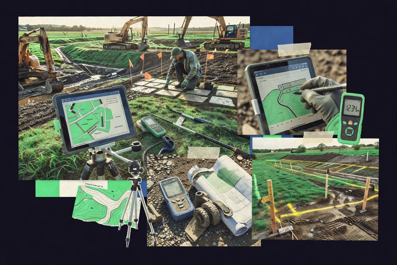
What Is Landscape Measuring Software?
Landscape measuring software helps teams calculate distances, areas, and volumes from site inputs like plan drawings, 3D models, drone imagery, and GIS layers. The best tools connect measurement capture to outputs like annotated drawings, quantity tables, and takeoff-ready estimates. Landscape contractors use tools like LandForms to generate measurable planting, area, and volume outputs with visual markup tied to quantities. Designers and BIM-focused teams use tools like Revit and Vectorworks Landmark to produce scheduled landscape quantities from model-driven geometry and documentation workflows.
Key Features to Look For
Choose features that align measurement capture to the exact deliverables your team must sign off on.
Visual markup tied directly to quantified takeoffs
LandForms anchors measurement review by using visual measurement markup that ties annotated plans directly to quantified takeoffs. Measure also keeps live annotated measurement views linked to measurements so teams can review field inputs without losing context. This connection reduces rework because quantities and the marked geometry they came from stay synchronized.
CAD-accurate dimensioning and annotation for measured landscape plans
AutoCAD supports DWG dimensioning and annotation tools with precise snapping for measured landscape plans. SketchUp Pro complements this for teams that prefer scaled 3D geometry by tying Pro’s dimension and annotation tools to measurement-ready drawings. This feature matters when your deliverable is a construction-ready plan set built on precise drawing conventions.
3D terrain and site geometry workflows for extracting measurements
SketchUp Pro helps teams model terrain and hardscape elements in scaled 3D and then capture measurements from the model. Vectorworks Landmark extends this into grading and contour workflows with landscape documentation outputs tied to measurable site outcomes. These tools fit landscape design workflows where measurements come from model geometry rather than from manual spreadsheet entry.
Landscape-specific modeling for grading, contours, and planting quantity documentation
Vectorworks Landmark provides Landmark Site Modeling tools for grading and contour generation tied to landscape documentation. It also includes plant library management to streamline plant quantity and layout documentation. Revit plays a different role by turning landscape elements into parametric objects that feed schedules for measurable site elements.
Parametric schedules and automated quantity tables from BIM objects
Revit is strongest when teams need scheduled output because it uses schedules driven by parametric categories for automated landscape takeoff tables. This structure supports detailed area, volume, and count reporting tied to the model’s documentation outputs. It is a match for teams that want quantity consistency across disciplines inside a shared model.
Image-to-measurement capture that produces estimate-ready outputs
Site Scan turns drone imagery into 2D and 3D measurements for estimating areas and volumes and produces report-ready artifacts for estimating and client sharing. LandForms also supports measurement capture from drone photos and produces takeoff-ready outputs for project planning. Measure focuses on live visual measurement workflows from mobile imagery so outdoor layouts stay annotated during capture.
How to Choose the Right Landscape Measuring Software
Pick the tool that matches your input source and your required output format for quantities, annotations, and construction deliverables.
Start with your primary input: drone, mobile, CAD drawings, BIM models, or GIS datasets
If you rely on drone photos for quantities, LandForms and Site Scan both convert image capture into measurable planting, area, and volume outputs. If you capture measurements in the field using mobile imagery, Measure keeps live annotated measurement views so your capture and review stay in the same place. If you start from engineered drawings, AutoCAD gives DWG dimensioning and annotation tools with precise snapping for measured landscape plans.
Match the workflow to your deliverable: annotated review, takeoff tables, or model-driven schedules
Choose LandForms when you need takeoff-ready quantities with visual measurement markup tied directly to what reviewers see on plans. Choose Revit when you need schedules driven by parametric categories to produce automated landscape takeoff tables. Choose Vectorworks Landmark when you need grading and contour generation tied to landscape documentation and plant library schedules.
Decide how you want measurements to be created: geometry-based modeling or image extraction
SketchUp Pro and Vectorworks Landmark generate measurements from scaled 3D geometry and landscape modeling tools like grading and contour generation. Global Mapper generates measurements from loaded elevation and geospatial layers using terrain modeling with profile and cross-section measurement for area, distance, and volume calculations. If you want the fastest measurement extraction from visuals, Site Scan and LandForms derive measurement outputs from captured images.
Evaluate collaboration and traceability for project revisions and client signoff
LandForms organizes measurements by project and revision so teams can align on quantities before approval. Measure emphasizes collaboration and traceability by letting teams review shared measurements without relying on external export-only processes. If your collaboration depends on CAD or BIM coordination, AutoCAD relies on DWG file discipline and Revit relies on coordinated BIM modeling conventions.
Confirm reporting depth fits your estimating style before you commit
If your estimating needs quick, structured quote-ready quantities, qTOC provides landscape measurement takeoff templates that translate field measurements into quote-ready quantities. If your project demands advanced terrain profiling and cross-sections, Global Mapper offers efficient processing for terrain data and consistent measurement workflows on geospatial rasters and vectors. If you must do highly customized reporting beyond core takeoff templates, LandForms can feel limited for highly custom estimating compared with tools that focus on custom report automation.
Who Needs Landscape Measuring Software?
Landscape measuring software fits teams that must turn site information into measurable quantities and reviewable deliverables.
Landscape contractors who want fast, visual takeoffs tied to reviewable plans
LandForms fits because it uses visual measurement markup that ties annotated plans directly to quantified takeoffs and organizes work by project and revision. qTOC is also a strong fit when you want measurement-to-quote workflow templates that translate field measurements into quote-ready quantities.
Landscape designers who produce construction-ready measured plan sets in CAD
AutoCAD is the match because DWG dimensioning and annotation tools with precise snapping support measured landscape plans. SketchUp Pro is a fit when designers prefer scaled 3D modeling so Pro’s dimension and annotation tools tie to measurement-ready drawings.
Landscape design teams that need grading, contours, and planting documentation
Vectorworks Landmark fits because Landmark Site Modeling tools generate grading and contours tied to landscape documentation and plant library management supports quantity and layout documentation. Revit fits for teams that treat landscapes as parametric BIM objects and require schedules for automated landscape takeoff tables.
Field teams and crews capturing site evidence for estimating and progress reporting
Site Scan fits crews that need image-based measurement extraction from drone imagery into report-ready measurement outputs. Measure fits crews that capture and review outdoor layouts using live annotated measurement views built on mobile imagery.
Common Mistakes to Avoid
Avoid tool choices that mismatch the source of measurement and the type of deliverable your team must produce.
Choosing a CAD tool without committing to CAD measurement discipline
AutoCAD requires manual CAD setup for consistent landscape measurement conventions, so inconsistent layers or dimension standards can break quantity reliability. If your process depends on visual takeoff review without CAD setup overhead, LandForms gives takeoff-ready outputs with visual markup tied to quantities.
Expecting field surveying workflows from a general imagery viewer
Google Earth Pro provides fast polygon area measuring using imagery and 3D terrain context, but it lacks professional surveying controls like datum and strong coordinate transforms. For measurement workflows that need terrain profiles and cross-sections from elevation data, Global Mapper provides terrain modeling and profile and cross-section measurement on loaded datasets.
Modeling for measurement without planning how quantities will be documented
SketchUp Pro supports scaled 3D geometry and measurement-ready dimensioning, but terrain accuracy depends on model inputs and disciplined scaling. Vectorworks Landmark needs library setup and standards alignment, so plant library setup and grading conventions must be planned to avoid manual rework.
Using an image workflow without standardizing capture standards
Site Scan needs setup and capture standards training for consistent accuracy because measurements are extracted from visual data. LandForms also relies on drone photo capture to estimate landscapes, so teams must standardize takeoff-ready capture and validation processes to keep revisions clean.
How We Selected and Ranked These Tools
We evaluated LandForms, AutoCAD, SketchUp Pro, Vectorworks Landmark, Revit, Site Scan, Measure, qTOC, Global Mapper, and Google Earth Pro using four rating dimensions: overall fit for landscape measurement, feature completeness for measurement capture and outputs, ease of use for completing measurement tasks, and value for the workflow it supports. We separated LandForms from lower-ranked tools by prioritizing an integrated visual measurement workflow that ties annotated plans directly to quantified takeoffs and keeps work organized by project and revision for faster alignment before approval. Tools like Revit scored strongly for documentation depth through schedules driven by parametric categories, while Global Mapper stood out for terrain modeling with profile and cross-section measurement from loaded elevation data. We kept the selection grounded in how each tool turns measurement inputs into reviewable quantities, from image-to-measurement extraction in Site Scan and LandForms to DWG-based measured plan annotation in AutoCAD.
Frequently Asked Questions About Landscape Measuring Software
Which tool is best when I need guided, reviewable landscape takeoffs instead of raw measurement capture?
How do AutoCAD and SketchUp Pro differ for landscape measurement work?
What should I use for landscape grading, contours, and planting documentation tied to measurable outputs?
When do Revit schedules beat drawing-based measurement for landscape quantities?
Which option is better for measuring from captured site imagery instead of manual takeoff spreadsheets?
How can I keep field inputs and design measurements in the same workspace for faster review?
If my main goal is quote-ready quantities, which tool structures measurements for quoting?
Which tool is best suited for terrain measurement using GIS datasets like rasters and vectors?
What are realistic limitations of using Google Earth Pro for landscape measurement accuracy?
Tools reviewed
Primary sources checked during evaluation.
Referenced in the comparison table and product reviews above.
Keep exploring
Comparing two specific tools?
Software Alternatives
See head-to-head software comparisons with feature breakdowns, pricing, and our recommendation for each use case.
Explore software alternatives→In this category
Construction Infrastructure alternatives
See side-by-side comparisons of construction infrastructure tools and pick the right one for your stack.
Compare construction infrastructure tools→FOR SOFTWARE VENDORS
Not on this list? Let’s fix that.
Our best-of pages are how many teams discover and compare tools in this space. If you think your product belongs in this lineup, we’d like to hear from you—we’ll walk you through fit and what an editorial entry looks like.
Apply for a ListingWHAT THIS INCLUDES
Where buyers compare
Readers come to these pages to shortlist software—your product shows up in that moment, not in a random sidebar.
Editorial write-up
We describe your product in our own words and check the facts before anything goes live.
On-page brand presence
You appear in the roundup the same way as other tools we cover: name, positioning, and a clear next step for readers who want to learn more.
Kept up to date
We refresh lists on a regular rhythm so the category page stays useful as products and pricing change.