GITNUXSOFTWARE ADVICE
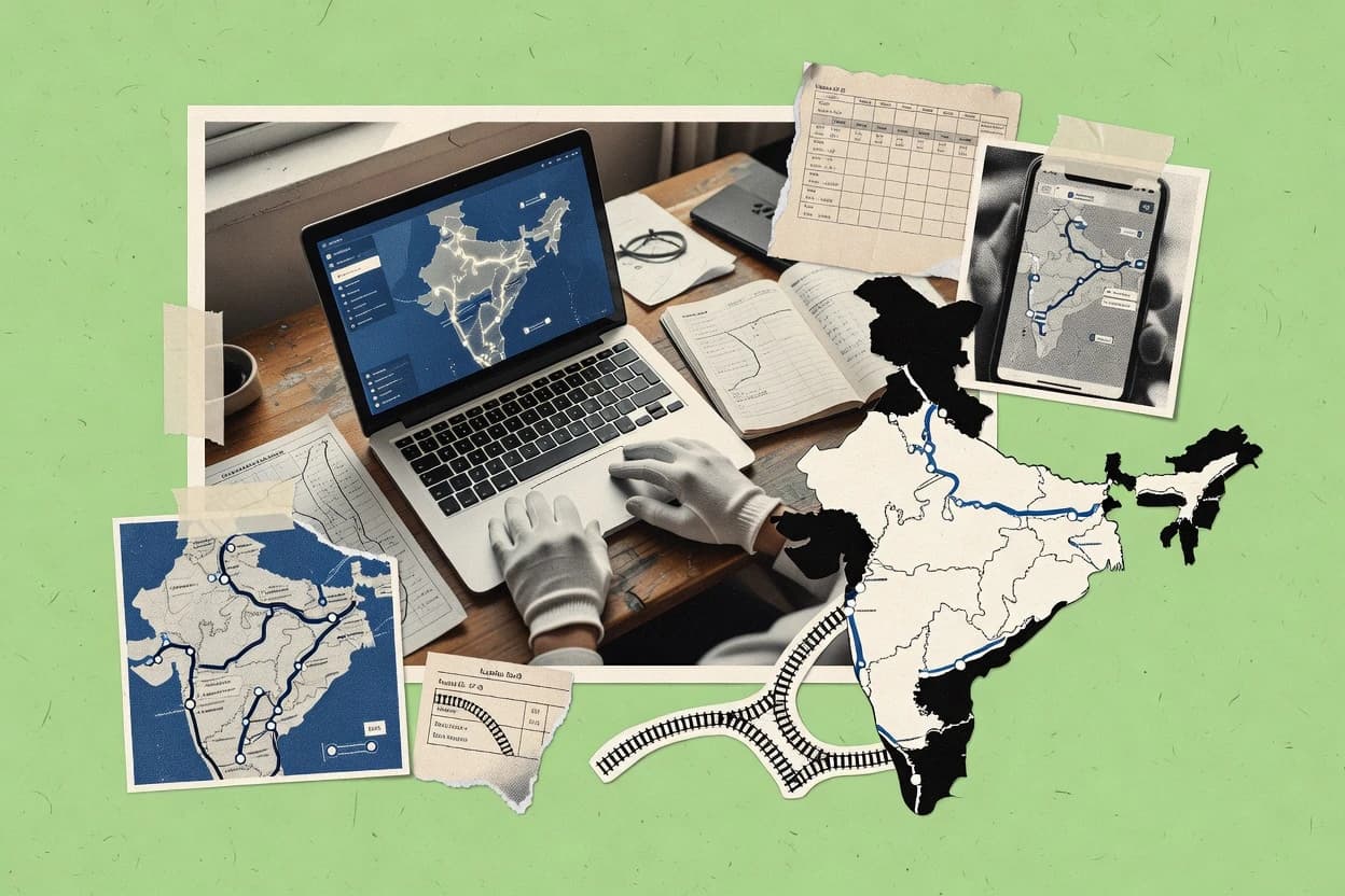
Transportation LogisticsTop 10 Best Indian Map Software of 2026
Compare the top 10 Indian Map Software tools. Rank mapping platforms with features and pricing. Explore the best picks today.

How we ranked these tools
Core product claims cross-referenced against official documentation, changelogs, and independent technical reviews.
Analyzed video reviews and hundreds of written evaluations to capture real-world user experiences with each tool.
AI persona simulations modeled how different user types would experience each tool across common use cases and workflows.
Final rankings reviewed and approved by our editorial team with authority to override AI-generated scores based on domain expertise.
Score: Features 40% · Ease 30% · Value 30%
Gitnux may earn a commission through links on this page — this does not influence rankings. Editorial policy
Editor’s top 3 picks
Three quick recommendations before you dive into the full comparison below — each one leads on a different dimension.
Mapbox
Vector tiles plus Studio style customization for brand-aligned, high-performance maps
Built for indian product teams building custom maps, routing, and location experiences.
Google Maps Platform
Editor pickRoutes API optimized for real-world multi-stop travel paths
Built for logistics, delivery, and consumer apps needing accurate Indian location services.
HERE Technologies
Editor pickTraffic-aware routing APIs for turn-by-turn guidance
Built for navigation, logistics, and location intelligence integrations in India.
Related reading
Comparison Table
This comparison table evaluates Indian-map software and global mapping platforms used for location-aware products in India. It compares core capabilities like basemaps, routing, geocoding, reverse geocoding, search, and map styling, along with deployment options and integration paths. Readers can use the side-by-side breakdown to match each provider’s features to common use cases such as navigation, logistics tracking, and location search.
Mapbox
API-first mappingProvides vector tiles, geocoding, and navigation-ready map rendering via map style APIs for Indian transportation logistics use cases.
Vector tiles plus Studio style customization for brand-aligned, high-performance maps
Mapbox stands out for developer-first mapping with highly customizable map styles and global data rendering pipelines. It supports vector tiles for crisp zooming and efficient client performance across interactive use cases. Mapbox tools cover geocoding, routing, and navigation building blocks that can power location features in Indian apps. The platform also enables map hosting and custom UI integration for products that need precise control over basemaps and overlays.
- +Vector tile rendering delivers sharp maps at multiple zoom levels
- +Geocoding supports address-to-coordinate workflows for location inputs
- +Routing APIs enable turn-by-turn travel paths for apps
- +Studio style controls support brand-specific map theming
- +High-performance map hosting supports interactive visualization
- –Developer tooling requires engineering effort for full implementation
- –Complex style customization can increase build and maintenance time
- –On-prem governance needs extra architecture for enterprise requirements
- –Limited end-user editing compared with non-developer map editors
Best for: Indian product teams building custom maps, routing, and location experiences
Google Maps Platform
routing and geocodingOffers routing, geocoding, places, and fleet-ready location workflows that support transportation and logistics operations in India.
Routes API optimized for real-world multi-stop travel paths
Google Maps Platform stands out in India for production-grade map rendering that matches local streets and POIs. It supports Places and Geocoding APIs to convert addresses and coordinates into structured results for Indian locations. Routes and Distance Matrix APIs enable distance and ETA calculations for delivery, dispatch, and logistics workflows across major Indian cities. For location-aware apps, it also provides Maps JavaScript and mobile SDKs to embed interactive maps with markers, directions, and overlays.
- +High-accuracy geocoding for Indian addresses and landmarks
- +Robust Places API for Indian POIs and venue search
- +Reliable Directions and Routes APIs for multi-stop routing
- +Distance Matrix supports batch ETA and distance calculations
- +Maps JavaScript and mobile SDKs enable fast map embedding
- +Strong support for overlays, markers, and interactive UX
- –Coverage quality can vary for remote Indian localities
- –Complex workflows require careful API quota and request planning
- –Customization options are limited versus fully bespoke map stacks
- –Timezone and localization fields need extra validation in some regions
Best for: Logistics, delivery, and consumer apps needing accurate Indian location services
HERE Technologies
location intelligenceDelivers mapping, routing, and location intelligence capabilities suitable for logistics routing, ETA estimation, and dispatch planning in India.
Traffic-aware routing APIs for turn-by-turn guidance
HERE Technologies stands out for India-focused mapping and road data depth designed for routing, logistics, and location analytics. The platform delivers high-accuracy geocoding, reverse geocoding, and address normalization across diverse Indian naming and numbering patterns. HERE also supports turn-by-turn navigation, traffic-aware routing, and APIs for location intelligence that integrate into mobility and enterprise workflows. Developers can combine map layers with spatial search, nearest-entity lookups, and custom geospatial services for operations that depend on consistent coordinates.
- +High-accuracy geocoding and reverse geocoding for Indian address inputs
- +Traffic-aware routing built for turn-by-turn navigation
- +Spatial search supports nearest-entity and location queries
- +Strong map data coverage for roads and road attributes
- –Integration requires careful handling of address and place normalization
- –Advanced routing tuning can add engineering complexity
- –Geospatial workflows may require extra data preparation
Best for: Navigation, logistics, and location intelligence integrations in India
AWS Location Service
cloud geospatialProvides geocoding, places, and route and map data capabilities delivered through AWS services for building logistics map features in India.
Geofencing with event notifications via location-based boundary monitoring
AWS Location Service stands out for managed geospatial APIs that integrate directly with AWS security and compute. It provides place indexes, geocoding and reverse geocoding, routing for driving, walking, and truck use cases, and geofencing with event notifications. These capabilities help Indian map software deployments handle address normalization, POI search, and location-aware workflows without building mapping infrastructure from scratch. IAM controls and AWS-native data flows support multi-region applications that need consistent geospatial outputs.
- +Managed geocoding and reverse geocoding APIs for address search
- +Routing APIs support common travel modes and turn-by-turn pathing
- +Geofencing events enable automatic triggers for location boundaries
- +Place index powers POI search with scalable queries
- +IAM integration fits AWS-based identity and access controls
- –Less flexible than self-hosted GIS for custom datasets
- –Indian address edge cases can require extra normalization logic
- –Geofence event payloads may need app-side enrichment
- –Routing accuracy depends on underlying map data coverage
Best for: AWS-first teams building India-aware geocoding, routing, and geofencing
Azure Maps
cloud geospatialSupplies geospatial services like routing, geocoding, and map rendering APIs for transportation logistics applications deployed with Azure.
Real-time geocoding and routing APIs designed for Azure event-driven architectures
Azure Maps stands out with deep Microsoft cloud integration for geospatial services in Indian deployments. It provides map rendering, geocoding, routing, and spatial analytics APIs for building location-aware applications. Data can be managed with Azure services like Event Grid and Functions for streaming telemetry and geofencing workflows. The platform also supports vector tiles and detailed map styling for consistent UI integration across web and mobile.
- +Offers geocoding and reverse geocoding APIs for Indian addresses
- +Routing and distance matrix support driving, walking, and optimized travel planning
- +Supports spatial analytics and route-based calculations for operational visibility
- +Integrates cleanly with Azure eventing and serverless data pipelines
- –Requires Azure-centric architecture patterns for best developer experience
- –Advanced customization can feel complex without strong mapping expertise
- –Some use cases need careful model tuning for accurate location matching
- –GIS workflows still need external tooling for deep data governance
Best for: Enterprise teams building Indian location intelligence on Azure
TomTom Maps
mapping and routingProvides mapping, routing, and location data for fleet and logistics use cases that require reliable road network behavior in India.
TomTom routing-ready map data for turn-by-turn navigation in India
TomTom Maps stands out with high-quality road geometry and map data designed for navigation and routing use cases across Indian cities and highways. Core capabilities include turn-by-turn routing inputs, traffic-ready map data feeds, and map layers that support accurate positioning for mobile and location-based services in India. It also provides developer-focused map APIs and data products for integrating map visualization and route computation into custom applications. The solution is particularly useful for businesses that need consistent map coverage in dense urban areas and reliable highway routing behavior.
- +Strong road network coverage for Indian urban and highway routes
- +Developer map APIs support route planning and map rendering integrations
- +Location intelligence features help improve driving experiences and ETA accuracy
- +Consistent map data helps reduce discrepancies across devices
- –Indian localization depth depends on the specific map data product
- –Integration effort is higher for teams without mapping or routing expertise
- –Map styling and UX require custom work for brand-specific experiences
- –Live traffic accuracy depends on feed availability for regions
Best for: Navigation and logistics teams building map and routing experiences for India
OpenRouteService
routing APIDelivers route computation APIs based on OpenStreetMap data that can support India logistics routing and custom travel planning.
Isochrone API for travel-time and distance based accessibility surfaces
OpenRouteService stands out with routing APIs and analysis tools built on OpenStreetMap data, aimed at developer and GIS workflows. The service provides route directions for cars, bikes, and pedestrians with turn-by-turn geometry output. It also supports spatial analytics like isochrones, route matrix calculations, and batch route generation for large datasets. Map outputs fit Indian location planning use cases by returning precise coordinates and distance summaries for cities and corridors.
- +Isochrone generation supports accessibility mapping for Indian urban and suburban planning
- +Route matrix calculations enable efficient multi-origin travel time studies
- +Turn-by-turn route steps include geometry for clean GIS visualization
- +API-first design fits custom dashboards and spatial pipelines
- –Geocoding and address handling are not the focus of the core toolset
- –Complex constraints require careful parameter tuning for reliable outcomes
- –Batch requests can be workflow heavy without rate-limit aware handling
Best for: GIS teams building custom routing and accessibility maps for Indian regions
OpenStreetMap
open map dataProvides open map data that transportation systems can use for India-focused mapping, routing research, and custom map layers.
Community editing with per-feature tags and automated validation tools
OpenStreetMap is distinct for its community-driven, editable geographic database that powers many Indian mapping use cases. The platform provides interactive web maps, a structured data model with tags, and APIs for querying and downloading map data. Contributors can add roads, POIs, and boundaries, and editors can improve data quality through validation and map styling. For India-focused workflows, it supports local feature coverage where mappers collaborate across cities and rural areas.
- +Editable global map data with granular tagging for India-specific features
- +Rich contributor workflow for roads, POIs, and administrative boundaries
- +Public API and data exports enable offline and custom Indian applications
- +Flexible map styling through renderers and community-built cartographic views
- –Data completeness varies widely across Indian regions and corridors
- –Tagging consistency can be uneven across contributors and map areas
- –Advanced routing and analytics require external tooling and setup
- –Editing at scale needs mapper training and QA processes
Best for: Indian teams building location features from community-sourced geodata
GraphHopper
routing optimizationOffers routing and turn-by-turn style route optimization APIs that can be integrated into logistics dispatch tools for India.
Map matching that snaps GPS traces to the road network
GraphHopper stands out for routing quality powered by advanced map matching and traffic-aware navigation options for road networks. It supports fast route computation via API for distance, travel time, and turn-by-turn directions that work well for India’s dense urban road geometry. Its geocoding and batch routing capabilities enable logistics workflows that plan multiple stops and optimize delivery sequences. GraphHopper also offers flexible constraints such as avoiding highways or tolls and choosing travel modes for driving, cycling, and walking use cases.
- +High accuracy road routing with turn-by-turn directions
- +API supports distance and time calculations for routing workflows
- +Map matching improves accuracy for GPS traces on roads
- +Configurable constraints for avoid areas and road types
- +Batch routing supports multiple destinations in one request
- –Tighter India-specific routing behavior may require parameter tuning
- –Complex multi-constraint setups need careful API design
- –Debugging route issues can require extra logging and test runs
- –Coverage gaps in remote areas can impact routing quality
Best for: Indian logistics and field navigation teams building routing into apps
Nominatim
geocoding serviceProvides open geocoding through a service built on OpenStreetMap data for resolving Indian addresses and coordinates in logistics workflows.
Detailed administrative breakdown from Nominatim place results
Nominatim stands out as a geocoding and reverse-geocoding service built on OpenStreetMap data for location lookups in India. It converts addresses, place names, and coordinates into structured results with administrative details and centroids for map-ready workflows. Reverse geocoding returns the most relevant place features for a latitude and longitude pair, which supports map popups and routing context. Search parameters and output formats enable integration into Indian map applications that need deterministic geospatial responses.
- +Supports geocoding and reverse geocoding with OpenStreetMap coverage in India
- +Returns structured place types and administrative hierarchy details
- +Accepts coordinate queries and address text queries in one API
- –Results depend on OpenStreetMap data completeness across Indian regions
- –High query volumes can trigger stricter usage limits from shared infrastructure
- –Fuzzy matching can yield ambiguous results for common Indian locality names
Best for: Indian mapping teams building address search and location lookups
How to Choose the Right Indian Map Software
This buyer's guide covers Indian map software tools including Mapbox, Google Maps Platform, HERE Technologies, AWS Location Service, Azure Maps, TomTom Maps, OpenRouteService, OpenStreetMap, GraphHopper, and Nominatim. It explains what these tools do for India-focused geocoding, routing, map rendering, and location intelligence workflows. It also maps practical tool capabilities to the exact teams that should choose them.
What Is Indian Map Software?
Indian map software is software that turns Indian addresses, coordinates, roads, and points of interest into usable map layers, route paths, and structured location results. It solves delivery dispatch and logistics problems by converting address-to-coordinate inputs with geocoding and then producing driving or navigation routes with turn-by-turn or multi-stop routing. It also supports fleet workflows through distance and ETA calculations and through event-based location triggers like geofencing. Tools like Google Maps Platform and HERE Technologies represent common production patterns that combine geocoding and routing APIs for Indian operational use cases.
Key Features to Look For
These features matter because Indian deployments depend on accurate India-specific addressing and road behavior plus predictable API outputs for routing, mapping, and search.
Vector tile map rendering and style control
Vector tile rendering provides sharp map zooming and efficient interactive performance. Mapbox supports vector tiles plus Studio style customization so brands can control basemap theming while keeping map overlays consistent.
Indian geocoding and reverse geocoding with address normalization
Address and place normalization is critical because Indian address formats vary across states, neighborhoods, and naming conventions. Google Maps Platform delivers high-accuracy geocoding and Places workflows for Indian POIs. HERE Technologies adds reverse geocoding and address normalization designed for diverse Indian naming and numbering patterns.
Multi-stop routing and distance or ETA calculations for logistics
Logistics routes require more than point-to-point paths because dispatch plans must evaluate multiple destinations and compute travel time. Google Maps Platform includes Directions and Routes APIs plus Distance Matrix for batch ETA and distance calculations for delivery workflows. Mapbox provides routing APIs that enable turn-by-turn travel paths for location features inside custom apps.
Traffic-aware turn-by-turn routing for navigation quality
Navigation-grade routing depends on traffic-aware guidance rather than static road geometry only. HERE Technologies focuses on traffic-aware routing APIs for turn-by-turn navigation. TomTom Maps and GraphHopper both support navigation-grade routing behavior, with GraphHopper emphasizing map matching for GPS traces and TomTom emphasizing consistent road network behavior.
Geofencing and event-driven location triggers
Geofencing moves boundary monitoring from manual checks to automated event workflows. AWS Location Service includes geofencing with event notifications that support boundary monitoring for location-based triggers. Azure Maps integrates with Azure eventing patterns so geocoding and routing can feed event-driven telemetry and geofencing workflows.
Search, spatial analytics, and accessibility outputs
Spatial analytics outputs like nearest-entity search and accessibility surfaces support operational decision-making beyond basic routing. HERE Technologies supports spatial search and nearest-entity lookups for location intelligence. OpenRouteService adds isochrone generation plus route matrix calculations for travel-time and distance based accessibility surfaces.
How to Choose the Right Indian Map Software
The choice becomes clear by matching geocoding depth, routing output type, and platform integration constraints to the target India workflow.
Define the exact location workflow: geocode, reverse geocode, or both
For address-to-coordinate lookups and Indian POI discovery, Google Maps Platform provides geocoding plus Places workflows with structured results for Indian locations. For reverse geocoding from latitude and longitude back to Indian place context, HERE Technologies supplies reverse geocoding and address normalization designed for diverse Indian naming and numbering patterns.
Match routing output to operations: multi-stop planning or navigation guidance
For dispatch and delivery planning that needs multi-stop routing and travel time calculations, Google Maps Platform combines Routes and Distance Matrix for batch ETA and distance calculations. For navigation-grade turn-by-turn guidance with traffic awareness, HERE Technologies and TomTom Maps focus on traffic-ready routing behavior and turn-by-turn pathing for India roads.
Decide where mapping UX customization must happen
If map UI needs tight brand control through styling and overlay management, Mapbox supports Studio style controls so basemaps can match product branding. If customization is secondary and the priority is production-grade Indian location results, Google Maps Platform and HERE Technologies focus on embedded map SDKs and routing and POI search outputs.
Pick the platform integration model based on your stack
For AWS-first deployments that need security controls and managed geospatial APIs, AWS Location Service fits with IAM integration plus managed place index, geocoding, routing, and geofencing events. For Azure-centric architectures that rely on eventing and serverless telemetry pipelines, Azure Maps fits with Azure Event Grid and Functions integration for geocoding and routing workflows.
Choose open or deterministic outputs when ownership of data and editing matters
For teams that need editable and community-sourced India geodata with per-feature tags and validation tools, OpenStreetMap supports contributor workflows plus APIs and data exports for custom map layers. For deterministic open geocoding and reverse geocoding on OpenStreetMap data, Nominatim provides structured administrative breakdown results for Indian place features.
Who Needs Indian Map Software?
Indian map software benefits teams that require India-specific geocoding accuracy, routing quality for Indian road behavior, and map outputs that integrate into operational systems.
Indian product teams building custom maps and routing experiences
Mapbox fits best because it delivers vector tiles for crisp zooming and Studio style controls for brand-aligned basemaps plus routing and geocoding building blocks for custom location experiences.
Logistics, delivery, and consumer apps needing accurate Indian location services
Google Maps Platform fits best because it provides high-accuracy geocoding for Indian addresses, a robust Places API for Indian POIs, and Routes and Distance Matrix APIs for multi-stop travel paths and batch ETA calculations.
Navigation and logistics integrations requiring traffic-aware turn-by-turn guidance
HERE Technologies fits best because it emphasizes traffic-aware routing APIs for turn-by-turn guidance plus high-accuracy geocoding and reverse geocoding with address normalization.
AWS-first enterprises building India-aware geocoding, routing, and geofencing
AWS Location Service fits best because it provides managed geocoding and reverse geocoding, routing for multiple travel modes, and geofencing event notifications with AWS-native IAM integration.
Azure enterprises building event-driven location intelligence
Azure Maps fits best because it supports real-time geocoding and routing APIs integrated into Azure eventing patterns with Event Grid and serverless functions for streaming telemetry and geofencing workflows.
Navigation and logistics teams that need consistent road network behavior in India
TomTom Maps fits best because it supplies routing-ready map data with strong road geometry for Indian urban and highway routes plus turn-by-turn routing inputs and consistent positioning support.
GIS teams building custom accessibility and spatial analytics maps
OpenRouteService fits best because it provides an isochrone API for travel-time and distance based accessibility surfaces plus route matrix calculations and turn-by-turn geometry outputs for GIS visualization.
Indian teams building location features from community-sourced geodata
OpenStreetMap fits best because it offers editable map data with granular tagging and contributor workflow for roads, POIs, and administrative boundaries plus public APIs and exports for offline custom applications.
Common Mistakes to Avoid
Several recurring pitfalls show up across Indian map tooling choices, mostly around addressing edge cases, routing assumptions, customization overhead, and mismatched tool focus.
Choosing a routing-first tool without addressing and normalization support
OpenRouteService and GraphHopper focus on routing and path computation, so address search and normalization often requires additional handling when Indian inputs are inconsistent. For workflows that start with Indian address text, combine or choose tools that include geocoding and reverse geocoding outputs like Google Maps Platform or HERE Technologies.
Over-customizing map styling without planning for engineering effort
Mapbox supports complex style customization through Studio controls, which can increase build and maintenance time for teams without mapping specialists. Google Maps Platform and HERE Technologies emphasize production-ready map and routing outputs with fewer map theming responsibilities compared with fully bespoke style pipelines.
Ignoring geofence event payload enrichment needs
AWS Location Service provides geofencing event notifications, but boundary event payloads may need app-side enrichment for operational context. Azure Maps similarly integrates geofencing into Azure event pipelines, so apps must be built to handle telemetry-to-action mapping reliably.
Assuming OpenStreetMap completeness without governance for Indian coverage gaps
OpenStreetMap data completeness varies by region and corridor, and tagging consistency can be uneven across contributors. Nominatim results depend on OpenStreetMap data completeness and can produce ambiguous outcomes for common locality names, so deterministic address resolution requires QA logic around Nominatim outputs.
How We Selected and Ranked These Tools
we evaluated every tool by scoring features, ease of use, and value as three sub-dimensions. features carry weight 0.4, ease of use carries weight 0.3, and value carries weight 0.3. the overall rating is computed as overall = 0.40 × features + 0.30 × ease of use + 0.30 × value. Mapbox separated itself from lower-ranked tools by combining vector tile rendering with Studio style customization, which directly improved feature strength for production map theming and interactive performance.
Frequently Asked Questions About Indian Map Software
Which tool is best for building a highly customized basemap and UI for Indian location apps?
Which maps and APIs handle address search and normalization for India’s varied street naming and numbering?
Which option is strongest for logistics routing across multiple Indian stops with distance and ETA?
What tool supports traffic-aware turn-by-turn navigation on Indian roads and highways?
Which platform is most suitable for enterprise teams that need geospatial APIs integrated with cloud identity and workflows?
Which solution fits GIS workflows that require isochrones and accessibility surfaces for Indian regions?
What is the best approach for handling reverse geocoding to power map popups and location context in India?
Which tool is better for snapping real-world GPS traces to the road network in Indian urban areas?
How do developers choose between using OpenStreetMap data directly versus using a managed OSM-based service for routing?
Conclusion
After evaluating 10 transportation logistics, Mapbox stands out as our overall top pick — it scored highest across our combined criteria of features, ease of use, and value, which is why it sits at #1 in the rankings above.
Use the comparison table and detailed reviews above to validate the fit against your own requirements before committing to a tool.
Tools reviewed
Primary sources checked during evaluation.
Referenced in the comparison table and product reviews above.
Keep exploring
Comparing two specific tools?
Software Alternatives
See head-to-head software comparisons with feature breakdowns, pricing, and our recommendation for each use case.
Explore software alternatives→In this category
Transportation Logistics alternatives
See side-by-side comparisons of transportation logistics tools and pick the right one for your stack.
Compare transportation logistics tools→FOR SOFTWARE VENDORS
Not on this list? Let’s fix that.
Our best-of pages are how many teams discover and compare tools in this space. If you think your product belongs in this lineup, we’d like to hear from you—we’ll walk you through fit and what an editorial entry looks like.
Apply for a ListingWHAT THIS INCLUDES
Where buyers compare
Readers come to these pages to shortlist software—your product shows up in that moment, not in a random sidebar.
Editorial write-up
We describe your product in our own words and check the facts before anything goes live.
On-page brand presence
You appear in the roundup the same way as other tools we cover: name, positioning, and a clear next step for readers who want to learn more.
Kept up to date
We refresh lists on a regular rhythm so the category page stays useful as products and pricing change.