GITNUXSOFTWARE ADVICE
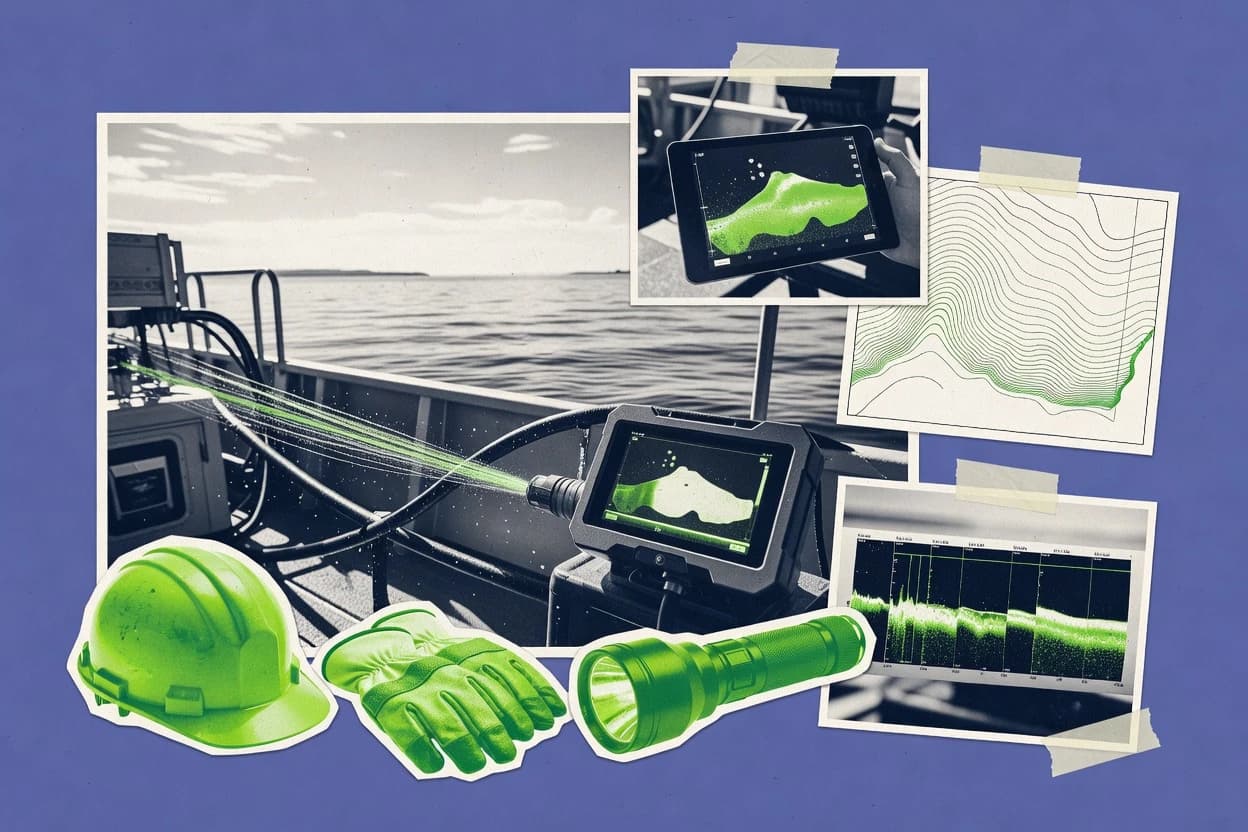
Science ResearchTop 10 Best Hydrographic Survey Software of 2026
Compare the top Hydrographic Survey Software tools with a ranked list and key features. Review best picks like CARIS HIPS and QPS Qimera.

How we ranked these tools
Core product claims cross-referenced against official documentation, changelogs, and independent technical reviews.
Analyzed video reviews and hundreds of written evaluations to capture real-world user experiences with each tool.
AI persona simulations modeled how different user types would experience each tool across common use cases and workflows.
Final rankings reviewed and approved by our editorial team with authority to override AI-generated scores based on domain expertise.
Score: Features 40% · Ease 30% · Value 30%
Gitnux may earn a commission through links on this page — this does not influence rankings. Editorial policy
Editor’s top 3 picks
Three quick recommendations before you dive into the full comparison below — each one leads on a different dimension.
CARIS HIPS and SIPS
HIPS motion compensation and calibration workflow integrated with SIPS surface production
Built for hydrographic teams producing chart-grade surfaces and backscatter products at scale.
QPS Qimera
Editor pickSurvey cleaning and QC-centric editing for multibeam bathymetry surface generation
Built for hydrographic survey teams needing repeatable bathymetry processing and QC workflows.
Teledyne CARIS Bathy Data Suite
Editor pickIntegrated CARIS processing suite for multibeam bathymetry editing, gridding, and quality review
Built for hydrographic teams producing bathymetric surfaces with rigorous quality control workflows.
Related reading
Comparison Table
This comparison table evaluates hydrographic survey software used for bathymetric data processing, quality control, and deliverable generation across tools such as CARIS HIPS and SIPS, QPS Qimera, Teledyne CARIS Bathy Data Suite, PDS2000, and HydroCAD. It highlights how each platform supports common workflows like importing survey data, running surface and feature extraction, managing uncertainty, and producing standardized outputs so teams can match software capabilities to survey requirements.
CARIS HIPS and SIPS
processing suitePerforms hydrographic data processing with complete workflows for multibeam, bathymetry, side scan, and surface generation.
HIPS motion compensation and calibration workflow integrated with SIPS surface production
CARIS HIPS and SIPS stand out for tight, end-to-end processing of hydrographic survey data from raw multibeam and side scan inputs to deliverable surfaces and products. HIPS focuses on beam footprint processing, calibration, and patch tests to reduce systematic error, while SIPS performs surface gridding and chart-ready extraction workflows.
The suite supports data QC with configurable review tools, plus repeatable processing histories for consistent reruns across survey lines. Specialized modules enable survey-specific tasks like motion compensation and water column handling to support deeper planning for coastal and offshore mapping deliverables.
- +Strong calibration and patch-test workflows for systematic multibeam error reduction
- +Integrated HIPS and SIPS pipeline for consistent processing from raw to deliverables
- +Robust QC and review tools for identifying bad pings and artifacts
- +Surface modeling and gridding designed for chart and mapping outputs
- +Repeatable project workflows support consistent reruns across survey areas
- –Complex configuration can slow setup for new survey processing teams
- –Specialized tooling favors hydrographic operators over general survey GIS users
- –High dataset sizes require careful hardware planning to maintain throughput
- –Automation setup depends on experienced rule and workflow design
Best for: Hydrographic teams producing chart-grade surfaces and backscatter products at scale
QPS Qimera
data processingProcesses multibeam and bathymetric survey data with automated routines for cleaning, classification, and surface creation.
Survey cleaning and QC-centric editing for multibeam bathymetry surface generation
QPS Qimera stands out with a hydrographic workflow focused on survey data processing, from raw acquisition through standardized deliverables. It supports comprehensive bathymetry processing for multibeam and singlebeam data with tools for sound velocity management, cleaning, and surface generation.
Editing, QC, and output handling enable consistent paper and digital production of charts and models. The software also integrates with QPS ecosystem components used by many hydrographic organizations for project-based processing.
- +End-to-end bathymetry workflow from raw data to deliverables
- +Strong multibeam processing with survey cleaning and surface creation
- +Built-in QC and editing tools for controlled hydrographic outputs
- –Workflow complexity can slow early onboarding for new teams
- –Requires careful project setup to maintain consistent processing standards
- –Less suited for non-hydrographic GIS-only users
Best for: Hydrographic survey teams needing repeatable bathymetry processing and QC workflows
Teledyne CARIS Bathy Data Suite
bathymetry productionProvides end-to-end bathymetric processing tools for multibeam datasets and deliverables used in hydrographic production.
Integrated CARIS processing suite for multibeam bathymetry editing, gridding, and quality review
Teledyne CARIS Bathy Data Suite stands out for its bathymetric processing workflow built around CARIS tools that translate raw multibeam and positioning data into deliverable products. The suite supports surface generation tasks such as editing, gridding, and soundings management so hydrographers can refine bathymetry for charts and models.
It also provides coverage and data quality control utilities that help identify gaps, artifacts, and inconsistent acquisition. The software integrates common marine geospatial outputs and supports survey review cycles from raw data through final surfaces.
- +Strong multibeam-to-surface processing workflow for bathymetry deliverables
- +Editing tools target soundings cleanup and artifact removal
- +Gridding and surface generation support chart-ready bathymetric products
- –Complex processing pipeline requires trained hydrographic operators
- –Workflow can be demanding for small teams with limited data volumes
- –Project setup and tuning take time across varied survey conditions
Best for: Hydrographic teams producing bathymetric surfaces with rigorous quality control workflows
PDS2000
survey workflowSupports hydrographic survey acquisition and processing workflows for marine positioning and bathymetric measurements.
Deliverable-focused hydrographic project workflow for multibeam processing and surface generation
PDS2000 stands out as Leica Geosystems' hydrographic production suite focused on structured survey data workflows. It supports end-to-end processing for multibeam bathymetry and geophysical inputs, including editing, filtering, and final surface generation. The software emphasizes repeatable survey routines and deliverable-focused project organization for teams producing charts and hydrographic products.
- +Structured multibeam processing workflow geared toward hydrographic production
- +Editing and quality-control tools for bathymetry and derived surfaces
- +Project organization tailored to deliverable generation and review
- –Specialized for hydrographic production, limiting general GIS use
- –Workflow complexity can slow down one-off investigations
- –Dataset management requires consistent survey setup and metadata discipline
Best for: Hydrographic survey teams producing multibeam deliverables at repeatable scale
HydroCAD
hydro modelingPerforms waterway cross-section and terrain modeling to support survey planning and engineering calculations.
Detention basin storage-indicator routing with outlet control settings
HydroCAD focuses on stormwater and drainage modeling using detailed culvert, pipe, and storage system components. It computes runoff and routes flows through structures like detention and retention basins with configurable control rules.
The software supports CAD-style cross-section and grading inputs for channel and storage geometry. HydroCAD outputs sizing recommendations using standard hydraulic and hydrologic calculation methods for planning and design review workflows.
- +Strong detention and retention basin sizing with detailed storage area modeling
- +Accurate routing through pipes, culverts, and outlet structures
- +Rich inlet and stormwater catchment modeling for runoff generation
- +Clear hydrograph and inflow-outflow reports for design review documentation
- –Primarily drainage-focused with limited broad hydrographic survey workflows
- –Less suited to raw survey data processing and georeferenced point-cloud ingestion
- –Heavy modeling setup can slow early concept iterations
- –Visualization is functional but not a dedicated GIS survey environment
Best for: Drainage and stormwater modelers needing basin routing and outlet sizing
Esri ArcGIS Pro
geospatial analysisEnables hydrographic dataset visualization, editing, and analysis with support for rasters, point clouds, and surfaces.
Geodatabase validation with domains and coded value rules for consistent survey feature integrity
Esri ArcGIS Pro stands out with a tightly integrated GIS geodatabase workflow built for spatial accuracy and repeatable analysis. It supports hydrographic deliverable production through feature-rich editing, inspection-ready mapping layouts, and geoprocessing tools for cleaning, validating, and transforming survey data.
The software also enables authoritative spatial management with domains, coded value controls, and spatial relationships that help maintain consistent survey schemas across projects. ArcGIS Pro can connect hydrographic datasets to visualization and analysis layers for workflows that span data ingestion, QC, and final map export.
- +Geodatabase editing supports controlled survey schemas with domains and coded values
- +Powerful geoprocessing tools streamline cleaning, transformation, and spatial analysis
- +Layout tools generate inspection-ready chart and map outputs from project data
- +Robust spatial QA workflows help validate features and maintain measurement consistency
- +3D scene support supports terrain and surface context for hydrographic review
- –Hydrographic-specific automation depends on external tools and custom workflows
- –Large survey datasets can require careful indexing and performance tuning
- –Faro-style acquisition-to-processing pipelines need additional integration work
Best for: Teams needing GIS-based hydrographic QC, schema control, and deliverable cartography
QGIS
open-source GISProvides open-source GIS tools for loading hydrographic products, inspecting surfaces, and producing map deliverables.
QGIS Processing Modeler for repeatable geoprocessing chains
QGIS stands out for delivering a full desktop GIS workflow for hydrographic survey processing with flexible, scriptable map automation. It supports importing common spatial data and overlaying raster and vector layers for plan production, QA checks, and survey comparisons.
QGIS also enables geoprocessing and symbology driven cartographic output using built-in tools and extensible processing plugins. For hydrography, it is strongest when hydrographic datasets already exist and the work focuses on analysis, visualization, and map exports.
- +Robust raster and vector layer handling for hydrographic survey visualization
- +Spatial analysis tools support surface workflows for depth and terrain QA
- +Extensible plugin ecosystem for specialized hydrography processing needs
- +High-quality cartographic exports with labeling and styling controls
- –No native end-to-end hydrographic survey capture and acquisition workflow
- –Advanced bathymetry processing often requires external tools or plugins
- –Large datasets can slow down without careful layer and tiling setup
- –Scripting workflows can be complex for teams without GIS fundamentals
Best for: Hydrographic teams needing desktop QA mapping and analysis without proprietary lock-in
Global Mapper
terrain processingImports survey point clouds and raster grids to generate terrain models, perform QA visual checks, and export surfaces.
Bathymetric surface modeling and contour generation from point and grid datasets
Global Mapper stands out for its fast handling of large geospatial datasets used in hydrographic workflows. It supports bathymetric surface creation and editing from point clouds and gridded inputs.
It can mosaic multiple raster charts and survey products while preserving georeferencing for downstream deliverables. It also provides robust GIS analysis tools for feature extraction, quality checks, and inspection of survey data coverage.
- +Creates and edits bathymetric grids from survey points
- +Handles large raster mosaics and georeferenced chart overlays
- +Tooling supports contouring and surface inspection workflows
- +Exports hydrographic-ready surfaces and derived products
- –Advanced scripting and automation require separate workflow setup
- –Dense projects can feel heavy without careful layer management
- –Some hydrographic QA steps still require external verification tools
Best for: Survey teams processing bathymetry and mosaicking charts for production deliverables
FME
data integrationAutomates hydrographic data transformation and ETL for converting formats like CSV, LAS, and raster grids into deliverable structures.
FME workspaces with configurable spatial ETL and format conversion using transformers
FME stands out with data integration and transformation workflows built to normalize heterogeneous survey datasets into consistent geospatial outputs. Its core capabilities include format conversion, geometry validation, attribute mapping, and automated ETL-style processing for spatial data.
Hydrographic teams can use FME workflows to ingest bathymetry and soundings, clean and reproject data, and generate chart-ready surfaces and deliverables. Strong auditability comes from reproducible workspace logic that supports repeatable processing across survey campaigns.
- +Automates multi-format hydrographic data conversion into consistent schemas
- +Powerful coordinate and datum transformations for geospatial normalization
- +Rule-based QA workflows for cleaning bad soundings and attributes
- +Workspace logic enables repeatable survey processing across projects
- –Requires workflow engineering skills for reliable, maintainable automation
- –Large datasets can demand careful performance tuning and hardware planning
- –Hydrographic surface creation is not as specialized as dedicated survey packages
Best for: Hydrographic teams automating ETL, validation, and deliverable preparation
AutoCAD Civil 3D
survey-to-designSupports survey-to-design workflows for creating terrain surfaces from survey points and generating engineering outputs.
Corridor and feature-line grading tied to survey surfaces with earthwork volume reporting
AutoCAD Civil 3D stands out for pairing civil design drafting with survey-to-delivery workflows built around surfaces, alignments, and profile views. It supports processing survey-derived point clouds through Autodesk ecosystem integration and converts survey measurements into TIN and corridor-ready surfaces.
The software then drives grading, earthworks, and volume calculations using alignments and feature lines to keep hydrographic modeling tied to design intent. It exports design geometry and derived surfaces into downstream GIS and CAD environments for mapping and documentation deliverables.
- +Surface modeling from survey data supports TIN and grid-based workflows
- +Alignments and profiles enable structured linear project hydrography modeling
- +Corridor tools generate repeatable geometry for channels and banks
- +Volume and earthwork reporting helps quantify dredge or regrading scopes
- +DWG-based deliverables integrate cleanly with established CAD production
- –Hydrographic workflows require extra setup beyond typical CAD drafting
- –Hydrography-specific validations for sounding cleaning are not its core strength
- –Large point-cloud datasets can strain performance without careful management
- –Data exchange with GIS hydro tools can require format conversions
- –Advanced automated feature extraction from bathymetry needs supplemental tools
Best for: Teams needing CAD-driven bathymetry surfaces and corridor-based hydro modifications
How to Choose the Right Hydrographic Survey Software
This buyer's guide covers hydrographic survey software workflows for multibeam bathymetry processing, surface production, and deliverable preparation using tools like CARIS HIPS and SIPS, QPS Qimera, and Teledyne CARIS Bathy Data Suite. It also covers GIS and integration tools such as Esri ArcGIS Pro, QGIS, Global Mapper, FME, and CAD-driven workflows in AutoCAD Civil 3D.
What Is Hydrographic Survey Software?
Hydrographic survey software turns raw marine acquisition data into chart-ready products such as gridded bathymetry surfaces, extracted soundings, and inspection views. It typically handles cleaning, quality control, surface generation, and repeatable production workflows across survey lines. Tools like CARIS HIPS and SIPS and QPS Qimera focus on end-to-end hydrographic processing from multibeam inputs through surface deliverables. GIS-focused platforms like Esri ArcGIS Pro and QGIS support hydrographic QC, visualization, and deliverable cartography when processing steps occur outside the GIS core.
Key Features to Look For
Hydrographic output quality depends on whether software can standardize processing, enforce QC, and produce surfaces that downstream charting or GIS steps can trust.
End-to-end multibeam to deliverable surface workflows
CARIS HIPS and SIPS provides a complete pipeline from multibeam and side scan processing through surface generation and chart-ready extraction using HIPS and SIPS. QPS Qimera provides end-to-end bathymetry workflows from raw acquisition through standardized deliverables using survey cleaning, QC, and surface creation tools.
Calibration, motion compensation, and systematic error reduction
CARIS HIPS and SIPS includes an integrated motion compensation and calibration workflow combined with SIPS surface production to reduce systematic multibeam error in the path to deliverables. This matters when survey accuracy is limited by motion and patch-test behavior across varying operational conditions.
Survey cleaning and QC-centric editing for bathymetry
QPS Qimera emphasizes survey cleaning and QC-centric editing for multibeam bathymetry surface generation. Teledyne CARIS Bathy Data Suite focuses on editing, gridding, and soundings management with coverage and data quality control utilities that identify gaps and artifacts.
Repeatable processing histories and consistent reruns
CARIS HIPS and SIPS supports repeatable project workflows and processing histories so consistent processing can be rerun across survey areas. PDS2000 also emphasizes deliverable-focused project organization with structured multibeam routines meant for repeatable hydrographic production.
Coverage, gap detection, and artifact identification utilities
Teledyne CARIS Bathy Data Suite includes coverage and data quality control utilities used to locate gaps and inconsistent acquisition patterns. Global Mapper supports bathymetric surface modeling and contour generation from point and grid datasets to support surface inspection and derived product review.
Automation and workflow integration across formats and ecosystems
FME provides workspace logic with configurable spatial ETL and transformers for format conversion, coordinate and datum transformations, and rule-based QA workflows. QGIS offers a repeatable automation approach through QGIS Processing Modeler, while Esri ArcGIS Pro adds geoprocessing and geodatabase validation for controlled survey schemas.
How to Choose the Right Hydrographic Survey Software
Selecting the right tool depends on whether the required workflow is hydrographic production inside a survey package or hydrographic QC and production in a GIS and integration stack.
Start with the deliverable chain that must be produced
If the required output is chart-grade bathymetry surfaces and surface-derived products from raw multibeam and side scan inputs, CARIS HIPS and SIPS fits because it performs HIPS calibration and motion compensation and then drives SIPS surface production. If the required output is repeatable bathymetry surfaces with strong cleaning and QC-centric editing, QPS Qimera fits because it builds a multibeam-to-surface workflow that culminates in deliverable generation.
Match QC depth to the accuracy risk in the survey
For teams that need systematic error reduction through calibrated motion compensation and patch-test-style behavior, CARIS HIPS and SIPS is built around that integrated calibration and calibration workflow plus QC and review tools. For teams that need editing targeted at soundings cleanup and artifact removal paired with gridding and quality review, Teledyne CARIS Bathy Data Suite matches because its workflow centers on soundings management and artifact-focused editing.
Choose the workflow model for how repeatability is enforced
If repeatability is enforced by repeatable processing histories and consistent reruns across lines, CARIS HIPS and SIPS supports repeatable project workflows with consistent pipelines. If repeatability is enforced through structured deliverable-focused project organization, PDS2000 supports repeatable multibeam processing routines aimed at chart and hydrographic product delivery.
Plan the role of GIS and visualization tools in QC and cartography
When hydrographic QC and inspection layers must be managed with controlled schemas, Esri ArcGIS Pro fits because it uses geodatabase validation with domains and coded value controls plus robust QA workflows. When the goal is desktop QA mapping and analysis without proprietary lock-in, QGIS fits because it supports hydrographic visualization, raster and vector QA workflows, and repeatable geoprocessing via QGIS Processing Modeler.
Integrate formats and automate ETL when data comes from multiple systems
When survey data formats vary across CSV, LAS, and raster grids and the goal is normalized deliverable preparation with reproducible processing logic, FME fits because it provides rule-based QA and coordinate and datum transformations via workspaces. When the workflow includes fast mosaicking and inspection-ready contouring from point and grid datasets, Global Mapper fits because it excels at creating and editing bathymetric grids and exporting hydrographic-ready surfaces and derived products.
Who Needs Hydrographic Survey Software?
Hydrographic survey software is most useful for teams that must convert multibeam and positioning data into validated bathymetry surfaces and deliverable products, and for teams that must inspect those products reliably in GIS and mapping environments.
Hydrographic teams producing chart-grade surfaces and backscatter products at scale
CARIS HIPS and SIPS is the best fit because it integrates HIPS motion compensation and calibration workflow with SIPS surface production and provides robust QC and review tools for bad pings and artifacts. This tool is designed for consistent processing reruns that support production throughput on large datasets.
Hydrographic survey teams needing repeatable bathymetry processing and QC workflows
QPS Qimera is the best fit because it provides survey cleaning and QC-centric editing for multibeam bathymetry surface generation and supports end-to-end bathymetry workflows from raw data to deliverables. It is optimized for controlled hydrographic output rather than general GIS-only usage.
Hydrographic teams focused on rigorous quality control for bathymetric surfaces
Teledyne CARIS Bathy Data Suite is a strong fit because it includes editing, gridding, soundings management, and coverage and data quality control utilities for gaps and artifacts. It supports survey review cycles from raw data through final surfaces for chart and model production.
Survey teams processing bathymetry and mosaicking charts for production deliverables
Global Mapper is the best fit for teams that need fast handling of large geospatial datasets and require bathymetric surface modeling and contour generation from point and grid datasets. It also supports mosaicking multiple raster charts while preserving georeferencing for downstream deliverables.
Common Mistakes to Avoid
Common failures happen when tool selection mismatches the required hydrographic production depth, or when workflows are built without the QC and repeatability mechanisms needed for validated surfaces.
Choosing GIS-only tooling for end-to-end multibeam surface production
Esri ArcGIS Pro and QGIS excel at visualization, geoprocessing, and inspection, but hydrographic-specific automation and end-to-end surface production depend on external hydro tools and custom workflows. For end-to-end processing, CARIS HIPS and SIPS or QPS Qimera is built for raw multibeam inputs through QC and surface deliverables.
Underestimating configuration complexity for calibrated production pipelines
CARIS HIPS and SIPS and Teledyne CARIS Bathy Data Suite can require trained hydrographic operators because calibration and processing pipelines are complex. Teams that lack workflow design experience can slow automation setup, so initial staffing and process design time must be planned before production.
Building ETL automation without enough workflow engineering skill
FME provides powerful workspace logic and rule-based QA, but reliable and maintainable automation depends on workflow engineering skills. When the goal is hydrographic surface modeling rather than format normalization and validation, dedicated survey tools like QPS Qimera or Teledyne CARIS Bathy Data Suite fit better.
Using CAD surfaces for hydrographic sounding validation tasks without supplemental hydro tools
AutoCAD Civil 3D supports TIN surfaces and corridor-based grading tied to survey surfaces, but sounding cleaning and hydrographic validations are not its core strength. For validated bathymetry surfaces and QC-centric editing, CARIS HIPS and SIPS or QPS Qimera must be part of the workflow.
How We Selected and Ranked These Tools
We evaluated every tool on three sub-dimensions with features weighted at 0.4, ease of use weighted at 0.3, and value weighted at 0.3. The overall rating is calculated as overall = 0.40 × features + 0.30 × ease of use + 0.30 × value using the tool scores shown in the product reviews. CARIS HIPS and SIPS separated itself from lower-ranked tools by combining integrated calibration and motion compensation in HIPS with SIPS surface production plus robust QC and repeatable processing histories, which strengthened the features dimension and reduced operational friction for production reruns. Tools like FME scored best when the workflow focus was ETL and normalization with configurable spatial workspaces, while tools like Global Mapper scored best when the workflow focus was bathymetric grid editing, mosaicking, and contour generation.
Frequently Asked Questions About Hydrographic Survey Software
Which hydrographic survey software is best for end-to-end processing from raw multibeam to chart-ready deliverables?
How do CARIS HIPS and SIPS and QPS Qimera differ in how they manage multibeam cleaning, QC, and surface production?
Which tool is better suited for rigorous bathymetric quality control and gap or artifact detection during surface creation?
Which software supports deliverable-focused project workflows for multibeam chart production at repeatable scale?
What software is most useful for integrating heterogeneous survey datasets into a single standardized deliverable workflow?
Which application should be used for bathymetry mosaicking and fast surface editing when large raster datasets are involved?
Which tool is best for GIS-based hydrographic quality checks that rely on schema control and repeatable validation rules?
When survey teams need desktop QA mapping and automation without proprietary lock-in, which option fits best?
Which software helps tie hydrographic survey-derived surfaces to grading, corridors, and earthwork calculations?
What is a practical workflow for getting from cleaned hydrographic point data into deliverable surfaces and chart exports using multiple tools?
Conclusion
After evaluating 10 science research, CARIS HIPS and SIPS stands out as our overall top pick — it scored highest across our combined criteria of features, ease of use, and value, which is why it sits at #1 in the rankings above.
Use the comparison table and detailed reviews above to validate the fit against your own requirements before committing to a tool.
Tools reviewed
Primary sources checked during evaluation.
Referenced in the comparison table and product reviews above.
Keep exploring
Comparing two specific tools?
Software Alternatives
See head-to-head software comparisons with feature breakdowns, pricing, and our recommendation for each use case.
Explore software alternatives→In this category
Science Research alternatives
See side-by-side comparisons of science research tools and pick the right one for your stack.
Compare science research tools→FOR SOFTWARE VENDORS
Not on this list? Let’s fix that.
Our best-of pages are how many teams discover and compare tools in this space. If you think your product belongs in this lineup, we’d like to hear from you—we’ll walk you through fit and what an editorial entry looks like.
Apply for a ListingWHAT THIS INCLUDES
Where buyers compare
Readers come to these pages to shortlist software—your product shows up in that moment, not in a random sidebar.
Editorial write-up
We describe your product in our own words and check the facts before anything goes live.
On-page brand presence
You appear in the roundup the same way as other tools we cover: name, positioning, and a clear next step for readers who want to learn more.
Kept up to date
We refresh lists on a regular rhythm so the category page stays useful as products and pricing change.