GITNUXSOFTWARE ADVICE
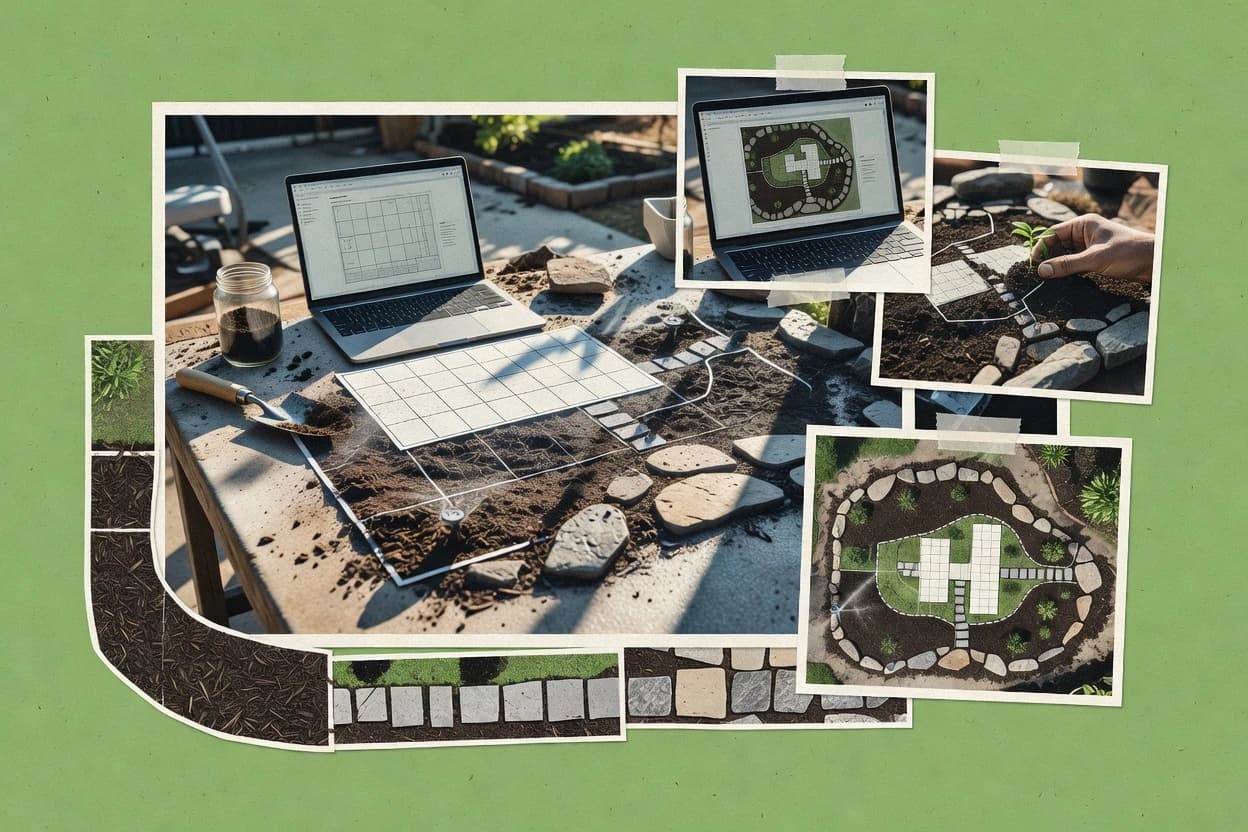
Art DesignTop 10 Best Home Landscaping Software of 2026
Compare the top 10 Home Landscaping Software picks for 2026. See rankings and get ready to design faster with SketchUp, Lumion, Twinmotion.

How we ranked these tools
Core product claims cross-referenced against official documentation, changelogs, and independent technical reviews.
Analyzed video reviews and hundreds of written evaluations to capture real-world user experiences with each tool.
AI persona simulations modeled how different user types would experience each tool across common use cases and workflows.
Final rankings reviewed and approved by our editorial team with authority to override AI-generated scores based on domain expertise.
Score: Features 40% · Ease 30% · Value 30%
Gitnux may earn a commission through links on this page — this does not influence rankings. Editorial policy
Editor’s top 3 picks
Three quick recommendations before you dive into the full comparison below — each one leads on a different dimension.
SketchUp
3D Warehouse library plus native component-based plant and fixture placement
Built for home designers needing quick 3D landscaping visuals and detailed spatial planning.
Lumion
Real-time rendering with instant material and lighting updates
Built for landscape designers needing rapid photoreal outdoor visualization and presentations..
Twinmotion
Real-time path-traced renders with weather and time-of-day controls
Built for landscaping designers needing photoreal visualizations and walkthroughs for client approvals.
Related reading
Comparison Table
This comparison table benchmarks home landscaping software used for design, visualization, modeling, and site planning. It maps how tools such as SketchUp, Lumion, Twinmotion, Revit, and ArcGIS Pro handle geometry workflows, landscape-specific outputs, asset libraries, and file handoff between design and presentation. Readers can use the table to match software capabilities to project needs, from 2D concept sketches to photoreal rendering and GIS-driven site analysis.
| # | Tool | Category | Overall | Features | Ease of Use | Value |
|---|---|---|---|---|---|---|
| 1 | SketchUp SketchUp provides a 3D modeling workflow for creating landscaping concepts, importing models, and generating presentation-ready views. | 3D design | 9.5/10 | 9.5/10 | 9.6/10 | 9.4/10 |
| 2 | Lumion Lumion enables real-time visualization and rendering of outdoor environments so landscaping designs can be reviewed with lighting and scene effects. | visualization | 9.2/10 | 9.2/10 | 9.5/10 | 9.0/10 |
| 3 | Twinmotion Twinmotion delivers fast landscape visualization with drag-and-drop assets and high-quality rendering for proposal visuals. | real-time viz | 8.9/10 | 9.0/10 | 8.8/10 | 8.9/10 |
| 4 | Revit Revit supports parametric 3D building and site modeling to coordinate landscaping elements within broader architectural projects. | BIM site modeling | 8.7/10 | 8.6/10 | 8.7/10 | 8.7/10 |
| 5 | ArcGIS Pro ArcGIS Pro supports geographic data workflows for mapping terrain, planning site impacts, and integrating spatial information into landscaping plans. | GIS planning | 8.4/10 | 8.5/10 | 8.3/10 | 8.3/10 |
| 6 | QGIS QGIS offers open source GIS tooling for importing geospatial datasets like terrain layers and measuring areas used for landscaping design decisions. | open-source GIS | 8.1/10 | 8.0/10 | 7.9/10 | 8.3/10 |
| 7 | Home Designer Pro Home Designer Pro provides home and property modeling tools that include outdoor landscaping and deck or patio layout capabilities. | home design | 7.8/10 | 7.8/10 | 7.5/10 | 8.0/10 |
| 8 | Chief Architect Chief Architect focuses on residential design drafting and visualization features that support landscape-related site planning and exterior detailing. | residential CAD | 7.5/10 | 7.4/10 | 7.6/10 | 7.5/10 |
| 9 | Garden Design Software SmartDraw supplies diagram and plan-building templates that can be adapted to landscaping site sketches and proposal diagrams. | templates | 7.2/10 | 7.0/10 | 7.4/10 | 7.1/10 |
| 10 | RoomSketcher RoomSketcher supports home exterior and garden visualization workflows for generating 2D and 3D presentations of landscaping ideas. | quick 3D | 6.9/10 | 7.0/10 | 6.7/10 | 6.9/10 |
SketchUp provides a 3D modeling workflow for creating landscaping concepts, importing models, and generating presentation-ready views.
Lumion enables real-time visualization and rendering of outdoor environments so landscaping designs can be reviewed with lighting and scene effects.
Twinmotion delivers fast landscape visualization with drag-and-drop assets and high-quality rendering for proposal visuals.
Revit supports parametric 3D building and site modeling to coordinate landscaping elements within broader architectural projects.
ArcGIS Pro supports geographic data workflows for mapping terrain, planning site impacts, and integrating spatial information into landscaping plans.
QGIS offers open source GIS tooling for importing geospatial datasets like terrain layers and measuring areas used for landscaping design decisions.
Home Designer Pro provides home and property modeling tools that include outdoor landscaping and deck or patio layout capabilities.
Chief Architect focuses on residential design drafting and visualization features that support landscape-related site planning and exterior detailing.
SmartDraw supplies diagram and plan-building templates that can be adapted to landscaping site sketches and proposal diagrams.
RoomSketcher supports home exterior and garden visualization workflows for generating 2D and 3D presentations of landscaping ideas.
SketchUp
3D designSketchUp provides a 3D modeling workflow for creating landscaping concepts, importing models, and generating presentation-ready views.
3D Warehouse library plus native component-based plant and fixture placement
SketchUp stands out with fast, intuitive 3D modeling for landscape concepts using a familiar drawing-to-model workflow. It supports precise terrain editing, curb and path layout, and vegetation placement through a large component ecosystem. Models can be styled with realistic materials and exported for visuals that help homeowners and contractors align on design intent. File exchange is strengthened by strong compatibility with common 3D formats and widespread community content.
Pros
- Rapid 3D modeling workflow for landscape shapes and layout
- Large 3D warehouse of plants, fixtures, and landscape components
- Accurate measurements using native dimensioning tools
- Flexible styling for materials, lighting, and presentation
- Exports support common 3D file workflows and handoff
Cons
- Terrain and drainage modeling requires extra modeling effort
- Advanced landscaping scheduling and estimating tools are limited
- Rendering realism depends heavily on plugins and setup
- Complex scenes can slow down on modest hardware
Best For
Home designers needing quick 3D landscaping visuals and detailed spatial planning
Lumion
visualizationLumion enables real-time visualization and rendering of outdoor environments so landscaping designs can be reviewed with lighting and scene effects.
Real-time rendering with instant material and lighting updates
Lumion stands out with real-time rendering that quickly turns landscaping concepts into photorealistic visuals. It supports modeling workflows for outdoor scenes, including vegetation placement, terrain shaping, and material-driven surfaces. The tool emphasizes fast iteration through drag-and-drop scene building and immediate viewport feedback for layout and lighting decisions. Export options include shareable image and animation outputs for client presentations and design reviews.
Pros
- Real-time viewport speeds up landscaping layout and lighting iterations.
- Vegetation and material libraries support believable outdoor scene staging.
- Animation and rendering tools help communicate grading and build phases.
- Scene control enables consistent camera and composition for client deliverables.
Cons
- Native landscaping modeling depth is weaker than dedicated CAD tools.
- Large scenes can strain performance on lower-spec hardware.
- Highly custom plant assets require extra preparation outside Lumion.
Best For
Landscape designers needing rapid photoreal outdoor visualization and presentations.
Twinmotion
real-time vizTwinmotion delivers fast landscape visualization with drag-and-drop assets and high-quality rendering for proposal visuals.
Real-time path-traced renders with weather and time-of-day controls
Twinmotion stands out for delivering near-real-time architectural and landscape visualization with interactive navigation and rapid iteration. Users can import terrain, plants, and design assets and then apply materials, lighting, and weather for plan-level presentation visuals. The software supports scene organization, vegetation placement, and high-quality stills and animations for client reviews. Its strongest fit is communicating landscaping concepts through photoreal renderings and guided walkthroughs built from a 3D scene.
Pros
- Real-time viewport updates for fast landscaping concept iteration and client feedback
- Physically based materials, sun, and sky settings for convincing outdoor lighting
- Vegetation and landscaping asset workflows for placing gardens and hardscape layouts
- High-quality render exports and animations for clear presentation deliverables
- VR and panorama outputs for immersive walkthrough experiences
Cons
- Large scenes can become difficult to manage without strict organization
- Vegetation realism depends heavily on asset selection and manual tuning
- Advanced modeling is limited compared to dedicated CAD toolchains
- Procedural control over plant layouts is less robust than specialized landscaping apps
Best For
Landscaping designers needing photoreal visualizations and walkthroughs for client approvals
Revit
BIM site modelingRevit supports parametric 3D building and site modeling to coordinate landscaping elements within broader architectural projects.
Parametric Families for reusable landscape elements with live schedules and quantity takeoffs
Revit delivers BIM-grade modeling for landscape projects with precise geometry, layered components, and coordinated drawings. The software supports parametric families for plants, hardscape elements, and site features, enabling consistent design variations across views. Revit links models to sheets, schedules, and sections so landscaping design documentation stays synchronized as changes occur. It also supports geolocation and survey points for site context and accurate placement.
Pros
- Parametric families enable consistent plants, paths, and wall components across projects
- BIM element data powers schedules for quantities and specifications
- Sheets, views, and sections stay coordinated during iterative landscaping edits
- Geolocation and survey points support accurate site placement and orientation
Cons
- High modeling complexity increases setup time for small residential landscapes
- Vegetation effects are limited compared with dedicated landscape visualization tools
- Workflow can feel engineering-focused rather than casual design drafting
- Large models require strong hardware to maintain interactive performance
Best For
BIM-ready landscape documentation for teams needing synchronized drawings and quantities
ArcGIS Pro
GIS planningArcGIS Pro supports geographic data workflows for mapping terrain, planning site impacts, and integrating spatial information into landscaping plans.
Spatial Analyst-style suitability modeling with raster and vector layers
ArcGIS Pro stands out for turning property-scale landscaping decisions into a GIS-backed, map-driven workflow. It supports importing parcel boundaries, terrain data, and imagery, then building thematic layers for soils, drainage, and planting zones. Advanced geoprocessing tools enable buffer, suitability modeling, and spatial analysis that translate into practical layout planning. Layout tools and attribute-rich maps help generate permit-ready views and consistent documentation for seasonal maintenance.
Pros
- Powerful geoprocessing for buffers, suitability, and terrain-based planning
- Layer-based mapping for soils, drainage, and planting zone visualization
- Attribute tables link plant varieties and maintenance notes to map features
- High-quality cartography layouts for presenting and printing design sets
Cons
- GIS complexity slows setup for simple yard sketching
- Data prep for imagery, parcels, and elevation can be time intensive
- Advanced analysis workflows require specialized familiarity to avoid errors
Best For
Homeowners and consultants needing GIS-grade landscaping plans and documentation
QGIS
open-source GISQGIS offers open source GIS tooling for importing geospatial datasets like terrain layers and measuring areas used for landscaping design decisions.
Georeferencer tool for aligning imagery and scanned plans to coordinates
QGIS stands out for turn-by-turn spatial editing and analysis using real GIS data formats. It supports importing aerial imagery, georeferencing maps, and digitizing landscape features like beds, fences, and property lines. Geoprocessing tools enable slope, aspect, watershed, and solar-shadow analysis that translate into practical landscaping decisions. Symbology, labeling, and map layouts produce printable design sheets for yard projects and contractor handoffs.
Pros
- Georeferencing aligns scanned maps and photos to real-world coordinates
- Digitize property lines and planting beds with precise editing tools
- Raster and vector analysis supports slope, viewshed, and watershed workflows
- Map layouts generate print-ready landscaping plans and legend-driven outputs
Cons
- UI and concepts like projections and layers demand GIS familiarity
- 3D walkthroughs are limited versus dedicated landscaping design apps
- Asset libraries and plant-specific automation require external datasets
- Data cleanup and styling can take time for polished client deliverables
Best For
Homeowners needing GIS-accurate yard mapping and spatial analysis
Home Designer Pro
home designHome Designer Pro provides home and property modeling tools that include outdoor landscaping and deck or patio layout capabilities.
Terrain-aware site planning tied to exterior plant and hardscape placement
Home Designer Pro stands out with a full suite for exterior design, combining landscaping layout planning and terrain-informed site work. Core tools support creating property plans, placing plants and hardscape elements, and producing visualizations from multiple camera angles. The software also enables measurement-driven drawing workflows so layouts can be refined before building decisions. Output options focus on presentation visuals and plan views for landscaping projects.
Pros
- Landscaping design tools for plants, paths, and exterior layout planning
- Property plan workflows support measurement-driven refinement of site layouts
- Rendering views help communicate landscaping concepts from multiple angles
Cons
- Exterior-focused features still require manual asset placement for complex scenes
- Visualization output can take iteration to achieve realistic landscaping detail
- Steeper learning curve than simpler sketching tools for beginners
Best For
Homeowners and designers creating detailed exterior concept plans with visuals
Chief Architect
residential CADChief Architect focuses on residential design drafting and visualization features that support landscape-related site planning and exterior detailing.
Integrated terrain modeling with grading inputs that drive consistent 3D landscape visuals
Chief Architect stands out for detailed 2D drawing plus photorealistic 3D rendering built for residential exterior planning. The software supports landscape design workflows with site plans, grading tools, and terrain modeling that feeds into realistic views. Library-based placement for plants, hardscape, lighting, and materials helps teams iterate layouts and communicate design intent through rendered presentations. Output options include high-quality documentation views for client review and build-ready plan sets.
Pros
- Terrain and grading modeling supports realistic sloped yard design
- 2D plan drafting stays consistent with 3D visualizations
- Extensive outdoor library placement speeds up landscape layout iterations
- Photorealistic 3D renders help sell design options to clients
- Plan documentation views support organized set exports
Cons
- Learning curved landscape workflows takes time for new users
- Large scenes can slow navigation on modest hardware
- Vegetation detail control needs careful management to avoid clutter
Best For
Residential landscape designers needing accurate 2D and photoreal 3D presentations
Garden Design Software
templatesSmartDraw supplies diagram and plan-building templates that can be adapted to landscaping site sketches and proposal diagrams.
Template-driven landscaping plan creation with reusable shapes and annotations
SmartDraw stands out with quick plan creation using built-in drawing templates and a diagram-first workflow. It supports landscaping-specific shapes like plants, hardscape elements, and layout components for conceptual home design. The software also enables clean labeling and measurement-style annotation for presenting ideas to homeowners and contractors. Exports and shareable outputs support sending designs without requiring recipients to recreate drawings from scratch.
Pros
- Built-in landscaping and layout templates speed up early concept drafting
- Large shape library covers plants, pathways, and hardscape elements
- Strong labeling tools improve readability for client presentations
- Export and sharing options make plans easy to distribute
Cons
- Less specialized than CAD-first tools for detailed grading and earthwork
- Planting logic requires manual placement rather than automated spacing rules
- Realistic rendering is limited compared with dedicated 3D design apps
Best For
Home designers needing fast, template-based landscaping layouts and shareable drawings
RoomSketcher
quick 3DRoomSketcher supports home exterior and garden visualization workflows for generating 2D and 3D presentations of landscaping ideas.
Instant 2D-to-3D conversion for sketching outdoor layouts into presentable scenes
RoomSketcher stands out with a quick 2D-to-3D workflow that helps map outdoor layouts into visual planning views. The software supports measuring, drawing walls and landscape elements, and viewing projects from multiple angles for client-ready presentations. Landscaping-specific tasks benefit from scene organization, object placement, and exportable views for walkthroughs and documentation. Collaboration is supported through shareable project links that keep stakeholders aligned on the same spatial design.
Pros
- Fast 2D-to-3D conversion for rapid landscape layout visualization
- Multi-angle 3D views help evaluate planting and hardscape placement
- Object placement workflow supports clear outdoor design documentation
- Export and share options streamline review cycles with clients
Cons
- Landscape detail depth is lighter than dedicated garden design tools
- Material and vegetation libraries are less specialized than CAD-heavy suites
- Precision landscaping grading and drainage modeling lacks advanced controls
- Complex site-scale projects can feel cumbersome to manage
Best For
Homeowners and small teams visualizing patios, paths, and planting concepts
How to Choose the Right Home Landscaping Software
This buyer's guide explains how to match landscaping design software capabilities to real project workflows using SketchUp, Lumion, Twinmotion, Revit, ArcGIS Pro, QGIS, Home Designer Pro, Chief Architect, Garden Design Software, and RoomSketcher. It covers the key features that matter, the decision steps to follow, and the most common mistakes that derail landscape plans and visual presentations.
What Is Home Landscaping Software?
Home landscaping software is a set of modeling, visualization, and planning tools used to design outdoor yards, beds, paths, grading, and vegetation placement. It solves problems like communicating spatial intent through rendered visuals, producing coordinated drawings, and translating site constraints like slope and geography into layout decisions. Tools like SketchUp focus on quick 3D landscaping concept modeling, while Revit focuses on parametric BIM-grade documentation for coordinated site elements.
Key Features to Look For
The right home landscaping tool depends on whether the workflow needs fast concept visuals, measurement-driven layouts, BIM-grade documentation, or GIS-grade spatial analysis.
Real-time outdoor visualization for fast client iteration
Real-time rendering helps designers iterate on lighting, composition, and scene layout without long render cycles. Lumion and Twinmotion deliver real-time viewport feedback for rapid outdoor visualization, and Twinmotion adds time-of-day and weather controls for consistent proposal views.
Instant 3D visualization from 2D-to-3D sketch workflows
2D-to-3D conversion reduces setup time when starting from a rough site layout. RoomSketcher provides instant conversion from drawn outdoor layouts into presentable 3D views, and it supports multi-angle viewing for planting and hardscape checks.
Component-based 3D landscaping modeling with large asset libraries
Landscape modeling becomes faster when plant and fixture placement relies on reusable components. SketchUp stands out with its 3D Warehouse library and native component-based plant and fixture placement, which speeds up detailed spatial planning.
Parametric families that keep site drawings synchronized
Parametric families enable consistent landscape element definitions across views and schedules. Revit supports reusable plant, hardscape, and site components with live schedules and quantity takeoffs, which keeps landscaping documentation synchronized during iterative edits.
Terrain-aware grading and landscaping visuals tied to sloped yards
Accurate grading support makes sloped-yard designs look correct in both plan and render outputs. Chief Architect integrates terrain and grading modeling that drives consistent 3D landscape visuals, and Home Designer Pro also ties terrain-aware site planning to exterior plant and hardscape placement.
GIS-grade mapping and spatial analysis for property-scale decisions
GIS workflows help translate parcel, elevation, soils, and suitability constraints into layout planning. ArcGIS Pro supports spatial analysis with raster and vector layers for buffers and suitability modeling, and QGIS adds georeferencing, digitizing, and slope or watershed analysis for GIS-accurate yard mapping.
How to Choose the Right Home Landscaping Software
Selecting the right tool requires aligning visualization speed, documentation depth, and spatial analysis needs with the way landscape work will be produced and reviewed.
Start with the deliverable type: visuals, drawings, maps, or all three
Choose Lumion or Twinmotion when the primary deliverable is photoreal outdoor visuals and presentation animations with fast iteration. Choose Revit when the primary deliverable is coordinated landscaping documentation with live schedules and quantity takeoffs, and choose ArcGIS Pro or QGIS when the primary deliverable is GIS-grade mapping that ties soils, drainage, and planting zones to real spatial layers.
Match modeling depth to the landscaping scope and complexity
Pick SketchUp when quick 3D modeling and component-based placement of plants and fixtures matter most for residential spatial planning. Pick Chief Architect or Home Designer Pro when integrated terrain and grading support must drive realistic sloped yard visuals across 2D plans and 3D views.
Use templates or diagram workflows for fast concept layout communication
Pick Garden Design Software when early concept layouts need reusable landscaping shapes, strong labeling, and shareable drawings for homeowners and contractors. Pick SmartDraw as the template-driven option that accelerates diagram-first plan creation using built-in landscaping shapes and measurement-style annotations.
Require accurate site context and measurement alignment when starting from imagery
Pick QGIS when starting from scanned maps or aerial imagery requires georeferencing and then digitizing property lines and planting beds in real-world coordinates. Pick ArcGIS Pro when property-scale decisions require buffers, suitability modeling, and cartography layouts that produce permit-ready views.
Confirm asset realism needs and performance expectations for large scenes
Pick Lumion or Twinmotion when fast scene iteration matters, and plan for performance limits on lower-spec hardware when scenes grow large. Pick SketchUp when high realism depends on styling and plugin setup, and plan extra effort for drainage and terrain modeling if those details are required.
Who Needs Home Landscaping Software?
Different users need different capabilities, so the best fit depends on whether the goal is visualization speed, documentation coordination, or GIS-grade spatial analysis.
Home designers who need quick 3D landscaping visuals and spatial planning
SketchUp fits this audience because its component-based 3D modeling workflow and large 3D Warehouse plant and fixture library accelerate detailed spatial planning for residential landscapes. RoomSketcher also fits when quick 2D-to-3D conversion supports fast patio, path, and planting concept visualization.
Landscape designers who need photoreal presentations and fast client approval iterations
Lumion fits because real-time rendering provides instant material and lighting updates for believable outdoor staging. Twinmotion fits because its path-traced renders include weather and time-of-day controls that help generate consistent proposal visuals and walkthrough experiences.
Teams that must produce coordinated landscaping drawings with schedules and quantities
Revit fits because parametric families support reusable landscape elements with live schedules, which powers quantity takeoffs tied to coordinated sheets, views, and sections. This matches the needs of teams maintaining synchronized landscaping documentation during iterative design changes.
Homeowners and consultants who need map-driven terrain and suitability planning
ArcGIS Pro fits because spatial Analyst-style suitability modeling uses raster and vector layers to build buffers, soils, drainage, and planting zone visuals. QGIS fits because its georeferencing and digitizing tools align scanned maps and imagery to coordinates for slope, watershed, and solar-shadow analysis used in landscaping decisions.
Common Mistakes to Avoid
Common failures come from picking the wrong depth of modeling, underestimating setup complexity for GIS and BIM workflows, and expecting realistic landscape grading without the right terrain controls.
Choosing photoreal visualization tools without planning for modeling depth
Lumion and Twinmotion excel at real-time rendering but have weaker native landscaping modeling depth than dedicated CAD toolchains, so advanced grading and terrain details can require extra work. SketchUp handles modeling well but requires extra effort for terrain and drainage modeling if those details are required for correctness.
Building GIS projects without allocating time for data preparation and setup
ArcGIS Pro supports powerful geoprocessing, but imagery, parcels, and elevation data prep can take significant time before analysis can start. QGIS provides georeferencing and spatial analysis tools, but projections and layer concepts demand GIS familiarity for accurate results.
Expecting automated planting logic from template or diagram tools
Garden Design Software and SmartDraw accelerate early layout creation with templates and labeling, but planting logic relies on manual placement rather than automated spacing rules. SketchUp also speeds placement with its component ecosystem, but advanced procedural control over plant layouts remains limited compared with specialized landscaping automation.
Ignoring scene organization and hardware limits during large projects
Twinmotion can struggle to manage large scenes without strict organization, which can complicate iterative changes late in the workflow. SketchUp can slow navigation with complex scenes on modest hardware, and Lumion can strain performance on lower-spec systems for large environments.
How We Selected and Ranked These Tools
we evaluated every tool on three sub-dimensions where features have a weight of 0.40, ease of use has a weight of 0.30, and value has a weight of 0.30. The overall rating is computed as overall = 0.40 × features + 0.30 × ease of use + 0.30 × value. SketchUp separated from lower-ranked tools because its 3D Warehouse library plus native component-based plant and fixture placement increased feature usefulness for landscape spatial planning while maintaining very high ease of use for quick concept iteration.
Frequently Asked Questions About Home Landscaping Software
Which home landscaping software is best for fast 3D concept visualization without complex modeling?
SketchUp fits quick 3D landscape concepting because it uses a drawing-to-model workflow with a large component ecosystem for plants, curbs, and paths. RoomSketcher can also move fast by converting 2D outdoor layouts into presentable 3D views for patios, paths, and planting sketches.
What tool produces photoreal outdoor renderings fastest for client presentations?
Lumion is designed for rapid iteration using real-time rendering and immediate viewport feedback as terrain, vegetation, and materials change. Twinmotion adds interactive navigation and near-real-time path-traced visuals with weather and time-of-day controls for walkthrough-style approvals.
Which software supports building GIS-backed planting and drainage plans from real property data?
ArcGIS Pro supports GIS workflows by importing parcel boundaries, terrain data, and imagery, then building attribute-rich thematic layers for soils, drainage, and planting zones. QGIS complements this by enabling georeferencing, digitizing features like beds and property lines, and running slope, aspect, watershed, and solar-shadow analyses.
What platform is best for teams that need coordinated landscape documentation and quantities?
Revit fits teams that require BIM-grade outputs because it supports parametric families for plants and hardscape with live schedules and quantity takeoffs. Revit also links models to sheets, schedules, and sections so updates remain synchronized across documentation sets.
Which option is strongest for interactive design walkthroughs that include weather and lighting changes?
Twinmotion is built for guided walkthroughs where materials, lighting, and weather can be applied to a 3D scene for client reviews. Lumion also supports fast lighting and material iteration through real-time rendering, but Twinmotion adds weather and time-of-day controls aimed at presentation navigation.
What software is best for accurate site plan drafting with 2D documentation plus realistic 3D views?
Chief Architect supports detailed 2D site plan work paired with photorealistic 3D rendering driven by integrated terrain and grading inputs. Garden Design Software is more focused on fast concept drafting using landscaping templates, while Chief Architect targets documentation views and build-ready plan sets.
How do designers handle terrain shaping and grading-driven landscape views?
SketchUp supports precise terrain editing and path and curb layout with vegetation placement for spatial alignment. Chief Architect and Home Designer Pro both emphasize terrain-informed site work, where grading and site planning feed into consistent 3D landscape visuals.
Which tools work best when the goal is to share designs with stakeholders who do not recreate drawings?
Garden Design Software supports shareable outputs by exporting clean, labeled landscaping plans built from templates and measurement-style annotations. RoomSketcher supports collaboration via shareable project links that keep stakeholders aligned on the same 2D-to-3D scene.
What is the most practical starting point for mapping an existing yard using aerial imagery and coordinates?
QGIS is a practical choice because it supports georeferencing, aligning scanned plans or aerial imagery to coordinates, and then digitizing landscape features like fences and beds. ArcGIS Pro is also strong for property-scale suitability modeling and buffer-based planning once the geodata is organized into layers.
Conclusion
After evaluating 10 art design, SketchUp stands out as our overall top pick — it scored highest across our combined criteria of features, ease of use, and value, which is why it sits at #1 in the rankings above.
Use the comparison table and detailed reviews above to validate the fit against your own requirements before committing to a tool.
Tools reviewed
Referenced in the comparison table and product reviews above.
Keep exploring
Comparing two specific tools?
Software Alternatives
See head-to-head software comparisons with feature breakdowns, pricing, and our recommendation for each use case.
Explore software alternatives→In this category
Art Design alternatives
See side-by-side comparisons of art design tools and pick the right one for your stack.
Compare art design tools→FOR SOFTWARE VENDORS
Not on this list? Let’s fix that.
Our best-of pages are how many teams discover and compare tools in this space. If you think your product belongs in this lineup, we’d like to hear from you—we’ll walk you through fit and what an editorial entry looks like.
Apply for a ListingWHAT THIS INCLUDES
Where buyers compare
Readers come to these pages to shortlist software—your product shows up in that moment, not in a random sidebar.
Editorial write-up
We describe your product in our own words and check the facts before anything goes live.
On-page brand presence
You appear in the roundup the same way as other tools we cover: name, positioning, and a clear next step for readers who want to learn more.
Kept up to date
We refresh lists on a regular rhythm so the category page stays useful as products and pricing change.