GITNUXSOFTWARE ADVICE
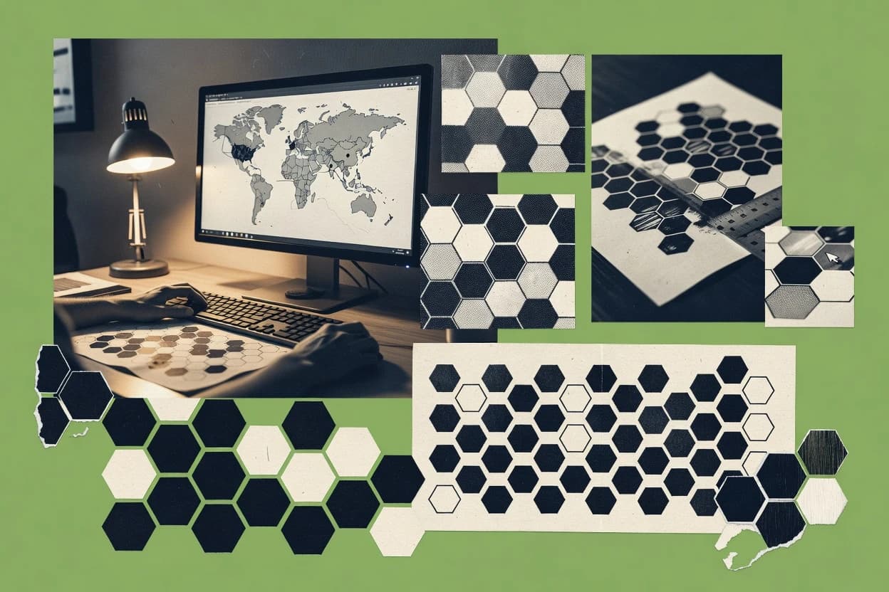
Data Science AnalyticsTop 10 Best Hex Map Software of 2026
Compare top Hex Map Software tools with a ranked list, featuring Kepler.gl, Deck.gl, and Mapbox. Explore the best picks.

How we ranked these tools
Core product claims cross-referenced against official documentation, changelogs, and independent technical reviews.
Analyzed video reviews and hundreds of written evaluations to capture real-world user experiences with each tool.
AI persona simulations modeled how different user types would experience each tool across common use cases and workflows.
Final rankings reviewed and approved by our editorial team with authority to override AI-generated scores based on domain expertise.
Score: Features 40% · Ease 30% · Value 30%
Gitnux may earn a commission through links on this page — this does not influence rankings. Editorial policy
Editor’s top 3 picks
Three quick recommendations before you dive into the full comparison below — each one leads on a different dimension.
Kepler.gl
Hexagon binning with interactive tooltips and filters for aggregated point density
Built for analysts visualizing spatial density with hex binning and interactive filtering.
Deck.gl
HexagonLayer supports aggregation metrics and interactive picking per hex cell
Built for teams building interactive hex map dashboards in web applications.
Mapbox
Mapbox Style Specification with expression-driven rendering for data-driven hex layers
Built for teams building interactive hexagon analytics maps in production apps.
Related reading
Comparison Table
This comparison table evaluates Hex Map Software tools used to build interactive geospatial visualizations in the browser and in notebooks. Readers can compare options such as Kepler.gl, deck.gl, Mapbox, CARTO, and Observable Plot across rendering approach, data and styling workflows, and integration paths. The goal is to help select a tool that matches the visualization requirements and the implementation stack.
| # | Tool | Category | Overall | Features | Ease of Use | Value |
|---|---|---|---|---|---|---|
| 1 | Kepler.gl Interactive WebGL geospatial visualization that renders hexagon aggregation layers for fast exploratory analytics in the browser. | WebGL mapping | 9.2/10 | 8.9/10 | 9.4/10 | 9.4/10 |
| 2 | Deck.gl WebGL visualization framework that supports HexagonLayer rendering for building custom hex-based spatial analytics. | Visualization SDK | 8.8/10 | 8.9/10 | 9.0/10 | 8.6/10 |
| 3 | Mapbox Location platform that supports hexagon-style aggregation using Mapbox rendering and geospatial tooling. | Mapping platform | 8.5/10 | 8.3/10 | 8.6/10 | 8.7/10 |
| 4 | CARTO Managed geospatial analytics with server-side map rendering that can generate and style hexagonal aggregations for analysis. | Geospatial analytics | 8.2/10 | 8.6/10 | 7.9/10 | 7.9/10 |
| 5 | Observable Plot Data visualization library in Observable that can generate hexbin and hex-grid style plots for exploratory analytics. | Data viz library | 7.8/10 | 7.9/10 | 8.0/10 | 7.6/10 |
| 6 | Python H3 Hexagonal geospatial indexing library for Python that converts coordinates into H3 hex cells for analytics and aggregation. | Hex indexing | 7.5/10 | 7.6/10 | 7.3/10 | 7.7/10 |
| 7 | GeoPandas Python geospatial library that supports geometry operations needed to build hex grids and aggregate spatial data for analytics. | Spatial data | 7.2/10 | 6.9/10 | 7.3/10 | 7.4/10 |
| 8 | QGIS Desktop GIS software that can generate hexagonal grids and run spatial joins to summarize data per hex cell. | GIS grid analysis | 6.8/10 | 6.8/10 | 6.6/10 | 7.1/10 |
| 9 | ArcGIS Online Web GIS mapping and analysis service that supports generating and symbolizing hexagonal aggregation layers for spatial insights. | Hosted GIS | 6.5/10 | 6.6/10 | 6.4/10 | 6.4/10 |
| 10 | Microsoft Power BI Analytics and reporting platform that can use map visuals and spatial preprocessing to render hex-style aggregations. | BI analytics | 6.2/10 | 6.1/10 | 6.2/10 | 6.2/10 |
Interactive WebGL geospatial visualization that renders hexagon aggregation layers for fast exploratory analytics in the browser.
WebGL visualization framework that supports HexagonLayer rendering for building custom hex-based spatial analytics.
Location platform that supports hexagon-style aggregation using Mapbox rendering and geospatial tooling.
Managed geospatial analytics with server-side map rendering that can generate and style hexagonal aggregations for analysis.
Data visualization library in Observable that can generate hexbin and hex-grid style plots for exploratory analytics.
Hexagonal geospatial indexing library for Python that converts coordinates into H3 hex cells for analytics and aggregation.
Python geospatial library that supports geometry operations needed to build hex grids and aggregate spatial data for analytics.
Desktop GIS software that can generate hexagonal grids and run spatial joins to summarize data per hex cell.
Web GIS mapping and analysis service that supports generating and symbolizing hexagonal aggregation layers for spatial insights.
Analytics and reporting platform that can use map visuals and spatial preprocessing to render hex-style aggregations.
Kepler.gl
WebGL mappingInteractive WebGL geospatial visualization that renders hexagon aggregation layers for fast exploratory analytics in the browser.
Hexagon binning with interactive tooltips and filters for aggregated point density
Kepler.gl stands out for its interactive, map-first workflow that renders large geospatial datasets with smooth pan and zoom. It supports hexagonal binning so point data can be aggregated into area-based densities for rapid spatial pattern discovery. Multiple map layers, filters, and tooltips enable iterative analysis without exporting to external BI tools. The app also provides programmable customization through a saved configuration and developer-friendly integrations.
Pros
- Built-in hexagon aggregation for fast density mapping of point datasets
- Drag-and-drop layer controls for quick iteration across multiple visual layers
- Powerful filtering and hover tooltips for interactive exploration
- Smooth GPU-rendering for large geospatial point and grid datasets
- Exportable configuration enables repeatable map builds
Cons
- Hex workflows require careful data preparation for correct aggregation
- Advanced styling can feel complex for teams without mapping experience
- Geocoding and secure data ingestion workflows are not its primary focus
- Handling very large multi-layer datasets can require performance tuning
Best For
Analysts visualizing spatial density with hex binning and interactive filtering
Deck.gl
Visualization SDKWebGL visualization framework that supports HexagonLayer rendering for building custom hex-based spatial analytics.
HexagonLayer supports aggregation metrics and interactive picking per hex cell
Deck.gl stands out for building interactive geospatial hexagon visualizations with GPU-accelerated WebGL rendering. It supports hexagon layers for aggregating points into cells using count, sum, or custom metrics, with smooth hover and click interactions. The toolkit also provides configurable views, map integration hooks, and reusable layer composition patterns for custom hex map dashboards. Rendering scales to large datasets while keeping style control for fills, outlines, and transitions across zoom levels.
Pros
- GPU-accelerated rendering keeps dense hex layers responsive
- HexagonLayer aggregates point data into grid cells
- Hover and click picking enables detailed cell tooltips
- Composed layers support custom styling and animation
- Works with GeoJSON and other spatial data pipelines
Cons
- WebGL knowledge is needed to tune performance
- Complex layer setups take more engineering time
- Browser-based rendering can strain low-end devices
- Offline export and static map workflows are limited
Best For
Teams building interactive hex map dashboards in web applications
Mapbox
Mapping platformLocation platform that supports hexagon-style aggregation using Mapbox rendering and geospatial tooling.
Mapbox Style Specification with expression-driven rendering for data-driven hex layers
Mapbox stands out for delivering production-grade map rendering via web and mobile SDKs plus flexible styling controls. The platform supports vector tiles and custom basemaps so hex map layers can be built with consistent theming and interactivity. Core capabilities include geocoding, routing, and map event handling that enables click, hover, and data-driven filtering. Mapbox also provides tooling for generating and serving custom map styles that integrate with hexagon grid workflows.
Pros
- Vector-tile rendering with fast, smooth pan and zoom
- Custom style specification for precise hex grid visual design
- Strong SDK support for web and mobile map interactions
- Geocoding and routing features for location-first experiences
- Efficient event handling for hover and click on hex layers
Cons
- Hex grid generation needs custom layer or tiling strategy
- Styling complexity can increase effort for advanced thematic maps
- Operational map performance depends on data and tile design
- Advanced cartography may require deeper Mapbox style expertise
Best For
Teams building interactive hexagon analytics maps in production apps
CARTO
Geospatial analyticsManaged geospatial analytics with server-side map rendering that can generate and style hexagonal aggregations for analysis.
Hexagon grid aggregation with map layer styling from dataset attributes
CARTO stands out for producing hexagon based choropleths and clustering views with fast, interactive map rendering. The platform supports data driven styling, layer management, and map expressions that update visuals from attribute data. CARTO also provides tools for geocoding, spatial joins, and exporting maps for sharing or embedding in external sites. Workflow features include dataset management and publishing that streamline repeatable map production for GIS and analytics teams.
Pros
- Hexagon choropleths with dynamic, attribute driven styling
- Fast interactive rendering for large point datasets
- Strong geospatial tooling for joins, aggregation, and visualization
- Web map publishing and embeddable outputs for dashboards
Cons
- More suited to data workflows than quick casual mapping
- Hex styling can require careful parameter tuning for clarity
- Advanced expressions may raise onboarding time for non GIS users
- Complex layer stacks can feel less streamlined than pure map editors
Best For
Teams building repeatable hex map analytics with interactive web publishing
Observable Plot
Data viz libraryData visualization library in Observable that can generate hexbin and hex-grid style plots for exploratory analytics.
Polygon mark support for hex-shaped cells rendered from custom coordinate transforms
Observable Plot focuses on JavaScript-driven, declarative chart specifications with direct integration to data workflows. It supports map rendering through geospatial pipelines that can transform hex grid coordinates into polygon marks for plotting. The library provides polygon, color, and legend controls that help produce choropleth-style hex maps and layered overlays. Interactivity is achieved through Observable notebooks and reactive updates rather than built-in map UI widgets.
Pros
- Declarative grammar builds hex polygon layers from transformed coordinates
- Strong styling control for fills, strokes, and color scales
- Legends and scales match the underlying data mappings
Cons
- No built-in hex grid generator or map projection toolkit
- Hex mapping requires custom data transformation into polygon shapes
- Interactivity depends on Observable reactivity, not map widgets
Best For
Developers creating code-first hex choropleths in Observable notebooks
Python H3
Hex indexingHexagonal geospatial indexing library for Python that converts coordinates into H3 hex cells for analytics and aggregation.
Resolution-based H3 indexing that drives fast neighbor and area rollups
Python H3 stands out for using H3 hex indexing to convert geographic data into consistent hex grid cells with Python workflows. It supports hex-to-geometry operations, area aggregation, and neighbor-aware spatial computations that fit analytical pipelines. It also integrates cleanly with geospatial tooling by treating each hex as a deterministic index for joins, filters, and summaries. Python H3 is well suited to hex-based visualization data preparation and spatial analysis tasks that need repeatable grid logic.
Pros
- Deterministic H3 indexing yields stable hex grids across datasets
- Efficient neighbor and ring queries enable local spatial context
- Hex cell aggregation supports fast rollups for analytics
- Python-first workflow fits data science pipelines directly
Cons
- Requires H3 knowledge to choose resolutions correctly
- Large datasets can be memory heavy during geometry conversions
- Geometry outputs may need post-processing for map rendering
- No built-in interactive map UI for end-user exploration
Best For
Analysts preparing hex-grid datasets for mapping and spatial aggregation
GeoPandas
Spatial dataPython geospatial library that supports geometry operations needed to build hex grids and aggregate spatial data for analytics.
Hex grid generation via GeoSeries or GeoDataFrame geometry operations
GeoPandas stands out by tightly integrating geospatial vector data handling with a Pythonic workflow built on pandas and Shapely. It supports hexagon grid creation, spatial joins, and attribute aggregation using standard geometry operations. The library also enables map-ready outputs through interoperability with plotting and GIS file formats. These capabilities fit Hex Map software workflows that need reproducible spatial binning and analysis in code.
Pros
- Creates hexagonal grids from bounds using spatial indexing support
- Performs spatial joins to map hex cells to point or polygon features
- Aggregates attributes per hex using groupby-friendly GeoDataFrame structure
Cons
- Hex map styling and interactive layers require extra plotting libraries
- Large datasets can be slow without careful indexing and geometry simplification
- Export formats are limited compared with full GIS authoring tools
Best For
Teams building code-driven hex binning and spatial aggregation pipelines
QGIS
GIS grid analysisDesktop GIS software that can generate hexagonal grids and run spatial joins to summarize data per hex cell.
Processing toolbox with batch-capable geoprocessing workflows and extensive algorithms
QGIS stands out for delivering a full desktop GIS workflow with open-source extensibility and deep format support. It enables map creation, geoprocessing, and spatial data editing through a plugin-based architecture and a mature processing toolbox. It supports common GIS file formats plus live layers from standards-based services like WMS and WFS. Layouts, symbology, and atlas-style exports support repeatable map production for projects and reporting.
Pros
- Powerful spatial analysis via the integrated Processing toolbox
- Plugin ecosystem expands workflows for specialized cartography and data tasks
- Strong layer and symbology controls for detailed thematic mapping
- Atlas and print layouts support repeatable map export outputs
- Works with many formats and coordinate systems for flexible integration
Cons
- Desktop-first interface can feel heavy for simple map viewing needs
- Advanced styling and layout tuning can require training
- Some workflows rely on external plugins and their maintenance
Best For
Teams needing desktop GIS mapping, analysis, and publication workflows
ArcGIS Online
Hosted GISWeb GIS mapping and analysis service that supports generating and symbolizing hexagonal aggregation layers for spatial insights.
Hexagon binning and visualization using ArcGIS Online web maps
ArcGIS Online stands out with a ready-to-use web mapping stack that supports interactive hex bin maps and thematic cartography without heavy GIS setup. The platform enables analysts to create hexagon visualization layers, style them with attribute-driven symbology, and share maps through web apps. Built-in geoprocessing and data tools help prepare spatial datasets for hex aggregation and support collaboration via groups and controlled sharing.
Pros
- Web-native hexagon binning with attribute-based styling
- Interactive map sharing through configurable web applications
- Integrated geoprocessing tools for spatial preparation workflows
- Collaborative organization via groups, roles, and controlled sharing
Cons
- Hex layer workflows can feel constrained for deep custom aggregation
- Performance can degrade with large feature counts and dense binning
- Some advanced cartographic and labeling controls require workarounds
Best For
Teams publishing interactive hex maps and sharing spatial insights as web apps
Microsoft Power BI
BI analyticsAnalytics and reporting platform that can use map visuals and spatial preprocessing to render hex-style aggregations.
Power BI Map visual with hexagon-like binning through density and filled region rendering
Microsoft Power BI stands out with tight integration between interactive hex-style mapping and enterprise data tooling. It supports geographic layouts using Map visuals, with hexagon density options that convert measure values into colored spatial cells. Report Builder and the Power BI service enable sharing dashboards, setting refresh schedules, and applying row-level security for location-based analysis. Advanced modeling with DAX helps build custom metrics that drive the map color scale and tooltips.
Pros
- Hex-style spatial density visuals supported via Map and filled data cell rendering
- DAX measures enable flexible metrics for hex color encoding and tooltips
- Row-level security supports governed analytics for map-linked datasets
- Power BI service publishing supports dashboard sharing and scheduled refresh
Cons
- Hex-map visuals can require careful model shaping for performant rendering
- Geospatial styling controls are less granular than dedicated GIS tools
- Cross-filter behavior across complex geographies can be tricky to validate
- Offline or disconnected use is limited versus local mapping software
Best For
Teams needing governed, interactive hex-style geospatial dashboards
How to Choose the Right Hex Map Software
This buyer’s guide helps map teams select the right Hex Map Software tool by matching hexagon binning and styling capabilities to real workflow needs across Kepler.gl, Deck.gl, Mapbox, CARTO, Observable Plot, Python H3, GeoPandas, QGIS, ArcGIS Online, and Microsoft Power BI. It covers key capabilities like interactive hex aggregation, expression-driven thematic styling, and code-first hex grid preparation. It also highlights common failure points such as incorrect aggregation setup and performance issues on dense multi-layer datasets.
What Is Hex Map Software?
Hex Map Software produces hexagon-based spatial views by aggregating point or polygon data into consistent hex cells. It solves the problem of visual clutter in dense datasets by rendering counts, sums, or attribute-driven metrics per hex cell. It also supports analysis workflows that require hover, click, filtering, and layer updates without losing spatial context. Tools like Kepler.gl and Deck.gl demonstrate a browser-first approach to interactive hex density mapping. Tools like Python H3 and GeoPandas show code-driven preparation of deterministic hex indexes and hex grids for downstream visualization.
Key Features to Look For
The fastest path to a successful hex map depends on capabilities that match how hex cells are generated, styled, and interacted with in the target workflow.
Hexagon binning that aggregates point data into density cells
Kepler.gl provides built-in hexagon aggregation that turns point datasets into area-based densities with smooth pan and zoom. Deck.gl’s HexagonLayer also aggregates points into grid cells with GPU-accelerated rendering for responsive density exploration.
Interactive picking and hover tooltips per hex cell
Kepler.gl includes hover tooltips and interactive filters so aggregated hex results can be inspected without exporting data. Deck.gl supports hover and click picking so each hex cell can expose cell-level details tied to aggregation metrics.
Expression-driven thematic styling and data-driven layer rendering
Mapbox offers a Style Specification with expression-driven rendering that enables precise hex grid visual design and data-driven styling. CARTO adds attribute-driven styling for hexagon choropleths so map visuals update directly from dataset attributes.
Configurable map composition and reusable layer controls
Kepler.gl supports drag-and-drop layer controls and lets maps be iterated across multiple visual layers with saved configuration for repeatable builds. Deck.gl supports composed layers and custom styling across zoom levels so hex layer dashboards can be built from reusable components.
Code-first hex grid and indexing utilities for reproducible analytics
Python H3 provides resolution-based H3 indexing that yields stable hex grids across datasets and supports neighbor-aware ring and local spatial computations. GeoPandas generates hexagonal grids from bounds and performs spatial joins so attributes can be aggregated per hex cell in a pandas-friendly workflow.
Hex visualization workflows that support publishing and enterprise sharing
ArcGIS Online enables interactive hexagon bin maps with attribute-based symbology and web app sharing for collaborative distribution. Microsoft Power BI supports governed interactive dashboards where hex-style density visuals use DAX measures for the map color scale and tooltip content.
How to Choose the Right Hex Map Software
A practical selection hinges on whether the workflow needs end-user map interactivity, production-grade web rendering, code-first hex preparation, or desktop GIS processing.
Match the tool to the intended user experience
If the goal is interactive exploration in a browser, Kepler.gl is built for hexagon aggregation with hover tooltips and filters that keep analysis inside the map. If the goal is custom hex dashboards in a web application, Deck.gl provides HexagonLayer aggregation plus hover and click picking per hex cell.
Decide how hex cells should be styled and driven by data
For expression-driven theming with precise design control, Mapbox uses expression-capable style specifications to render data-driven hex layers. For attribute-driven choropleth behavior that updates from dataset attributes, CARTO supports hexagon choropleths with dynamic styling and embeddable outputs.
Choose a hex grid generation approach that fits the data pipeline
When reproducible hex grid logic is required in a data science pipeline, Python H3 converts coordinates into deterministic H3 hex cells using resolution-based indexing. When spatial joins and hex-cell attribute aggregation must run in Python with geometry operations, GeoPandas can generate hex grids and aggregate attributes per hex using spatial joins.
Pick an ecosystem for publishing and operational workflows
If web publishing and collaborative sharing are central, ArcGIS Online supports interactive hex bin visualization and configurable web app sharing. If enterprise reporting and governed access are central, Microsoft Power BI connects hex-style density mapping to DAX modeling with row-level security and scheduled refresh.
Plan for complexity, performance, and data preparation constraints
If teams lack mapping expertise, Kepler.gl still requires careful data preparation so hex aggregation produces correct density results and complex styling may feel involved for non-mapping teams. If the browser must handle very dense multi-layer datasets, Deck.gl’s WebGL setup can require engineering time and performance tuning on low-end devices.
Who Needs Hex Map Software?
Hex Map Software is used across analysts, developers, GIS teams, and reporting teams based on how they need hexagon aggregation, interaction, and distribution.
Spatial analysts exploring point density with interactive filtering
Kepler.gl fits analysts who need fast hex density mapping because it provides built-in hexagon aggregation, hover tooltips, and interactive filters. Deck.gl also fits this need for teams that want GPU-accelerated hex layers with interactive picking per cell.
Web developers building custom interactive hex dashboards
Deck.gl is the right match for teams that want to compose custom hex map dashboards because HexagonLayer supports aggregation metrics and interactive hover and click. Mapbox supports production-grade web and mobile interactivity and uses its Style Specification to render data-driven hex layers with expression-driven styling.
Analytics teams publishing repeatable web hex choropleths and embedded outputs
CARTO fits teams that need repeatable hex map analytics because it generates hexagon-based choropleths with attribute-driven styling and supports web map publishing and embeddable outputs. ArcGIS Online fits teams that need web-native hex bin maps and collaborative sharing through web apps and controlled groups.
Data science teams preparing hex grids for downstream mapping and analysis
Python H3 fits analysts who require deterministic hex indexing and neighbor-aware ring queries for analytics workflows. GeoPandas fits teams who need Python-native hex grid generation plus spatial joins and attribute aggregation using GeoDataFrame geometry operations.
Desktop GIS practitioners creating mapping projects and batch geoprocessing outputs
QGIS fits teams that need a full desktop GIS workflow because it includes a plugin ecosystem and a Processing toolbox with batch-capable geoprocessing workflows for hex grids and spatial joins.
Enterprise reporting teams building governed interactive hex-style dashboards
Microsoft Power BI fits teams that need governed interactive dashboards because the Power BI service supports sharing and scheduled refresh with row-level security. Power BI also supports DAX measures that drive hex-style density visuals with filled region rendering and tooltip content.
Common Mistakes to Avoid
Hex map outcomes often fail because cell generation, styling logic, or performance assumptions do not match the selected tool’s strengths.
Building hex density views without validating aggregation inputs
Kepler.gl produces correct density results only when point data preparation supports the expected aggregation. Python H3 also requires correct resolution selection so hex indexing yields the intended spatial granularity.
Assuming hex interactivity is automatic in plotting libraries
Observable Plot focuses on declarative chart specifications and supports hex-like visuals through polygon mark rendering, not built-in map UI hex interactions. Kepler.gl and Deck.gl provide interactive hover and filtering behaviors that are designed into the mapping workflow.
Underestimating styling complexity for expression-driven thematic maps
Mapbox expression-driven styling can increase effort for advanced thematic maps because style logic must be specified precisely. CARTO also needs careful parameter tuning for hex clarity when dynamic styling and expressions update visuals.
Choosing a complex rendering stack for low-end environments
Deck.gl relies on WebGL and can strain low-end devices when dense hex layers and multiple layers are used. ArcGIS Online and Power BI can also face performance degradation with large feature counts and dense binning when hex layers become very dense.
How We Selected and Ranked These Tools
we evaluated every tool on three sub-dimensions. Features received a weight of 0.4. Ease of use received a weight of 0.3. Value received a weight of 0.3. The overall rating is the weighted average computed as overall = 0.40 × features + 0.30 × ease of use + 0.30 × value. Kepler.gl separated itself with its combination of built-in hexagon aggregation and interactive hover tooltips and filters that support exploratory analytics without extra engineering, which directly strengthened the features score while maintaining very high ease of use.
Frequently Asked Questions About Hex Map Software
Which tool is best for interactive hex density exploration without custom web development?
Kepler.gl is built for a map-first workflow with interactive tooltips and filtering over hex-aggregated point density. ArcGIS Online also supports hexagon binning and shareable web maps without requiring WebGL layer engineering.
What’s the fastest way to build a custom interactive hex dashboard in a web application?
Deck.gl is designed for WebGL rendering and provides HexagonLayer aggregation with hover and click picking per hex cell. Mapbox helps the same team anchor styles and interactions in production-grade map SDKs via vector tiles and event-driven filtering.
How do teams choose between H3-based workflows and GIS-style hex grid generation?
Python H3 uses resolution-based indexing to produce deterministic hex identifiers for fast joins and neighbor-aware rollups. GeoPandas generates hex grids via geometry operations on GeoSeries or GeoDataFrame, which is useful when the pipeline already relies on Shapely-style spatial joins.
Which option supports expression-driven styling for data-backed hex visuals?
Mapbox provides expression-driven rendering through its style system, which supports data-driven theming for hex layers. CARTO uses map expressions and attribute-driven layer styling to update hexagon choropleths based on dataset fields.
What’s the best fit for code-first hex choropleths in notebooks rather than point-and-click map UIs?
Observable Plot supports polygon marks that can render hex-shaped cells from custom coordinate transforms. Observable notebooks drive interactivity through reactive updates rather than built-in map UI widgets, which suits developers who want chart-spec control.
How can a team prepare reusable hex outputs for reports and publishing workflows?
QGIS enables desktop GIS processing with batch-capable geoprocessing tools and atlas-style exports for repeatable project reporting. CARTO adds dataset management and publishing so hex aggregation layers can be shared or embedded with consistent styling rules.
Which tools handle large datasets with smooth interaction during hex bin visualization?
Deck.gl scales hex rendering through GPU-accelerated WebGL and maintains smooth hover and click interactions across zoom levels. Kepler.gl also supports pan and zoom over large geospatial datasets with interactive layer controls for iterative density exploration.
How do integrations differ between analytics dashboards and pure geospatial toolchains?
Microsoft Power BI connects hex-like density mapping directly to enterprise reporting using Map visuals and DAX-driven metrics for tooltips and color scales. ArcGIS Online keeps the workflow inside a web mapping stack where analysts can prepare inputs with built-in geoprocessing and publish interactive web apps.
What common workflow problems appear when hex grids don’t match expectations across tools?
Resolution and indexing rules can cause mismatched cells when mixing Python H3 deterministic hex indexing with geometry-based grids from GeoPandas or QGIS. Mapbox and Deck.gl also require consistent coordinate transforms for HexagonLayer or hex cell polygons so hover events and fill regions align with the intended grid.
Conclusion
After evaluating 10 data science analytics, Kepler.gl stands out as our overall top pick — it scored highest across our combined criteria of features, ease of use, and value, which is why it sits at #1 in the rankings above.
Use the comparison table and detailed reviews above to validate the fit against your own requirements before committing to a tool.
Tools reviewed
Referenced in the comparison table and product reviews above.
Keep exploring
Comparing two specific tools?
Software Alternatives
See head-to-head software comparisons with feature breakdowns, pricing, and our recommendation for each use case.
Explore software alternatives→In this category
Data Science Analytics alternatives
See side-by-side comparisons of data science analytics tools and pick the right one for your stack.
Compare data science analytics tools→FOR SOFTWARE VENDORS
Not on this list? Let’s fix that.
Our best-of pages are how many teams discover and compare tools in this space. If you think your product belongs in this lineup, we’d like to hear from you—we’ll walk you through fit and what an editorial entry looks like.
Apply for a ListingWHAT THIS INCLUDES
Where buyers compare
Readers come to these pages to shortlist software—your product shows up in that moment, not in a random sidebar.
Editorial write-up
We describe your product in our own words and check the facts before anything goes live.
On-page brand presence
You appear in the roundup the same way as other tools we cover: name, positioning, and a clear next step for readers who want to learn more.
Kept up to date
We refresh lists on a regular rhythm so the category page stays useful as products and pricing change.