GITNUXSOFTWARE ADVICE
Science ResearchTop 10 Best Ground Penetrating Radar Software of 2026
Explore the top 10 ground penetrating radar software for accurate subsurface mapping. Compare tools, find the right fit, and boost project success. Check now.

How we ranked these tools
Core product claims cross-referenced against official documentation, changelogs, and independent technical reviews.
Analyzed video reviews and hundreds of written evaluations to capture real-world user experiences with each tool.
AI persona simulations modeled how different user types would experience each tool across common use cases and workflows.
Final rankings reviewed and approved by our editorial team with authority to override AI-generated scores based on domain expertise.
Score: Features 40% · Ease 30% · Value 30%
Gitnux may earn a commission through links on this page — this does not influence rankings. Editorial policy
Editor picks
Three quick recommendations before you dive into the full comparison below — each one leads on a different dimension.
Reflexw
Integrated full-waveform forward modeling and stochastic inversion for highly accurate velocity model building and anomaly characterization
Built for professional geophysicists, researchers, and engineering firms requiring top-tier GPR data processing and 3D subsurface modeling..
RADAN
Runner UpAdvanced 3D migration and time-slice volume rendering for hyper-accurate subsurface modeling
Built for experienced GPR professionals and engineering firms needing advanced subsurface analysis for complex surveys..
GPR-Slice
Also GreatAdvanced 3D tomography and interactive time-slicing for precise subsurface anomaly detection
Built for experienced geophysicists and professional surveyors tackling complex 3D GPR projects in utilities, archaeology, or forensics..
Related reading
Comparison Table
Explore a comparison of leading Ground Penetrating Radar (GPR) software tools, featuring Reflexw, RADAN, GPR-Slice, VisualIT 3D, EKKO_Project, and more. This table outlines key capabilities, usability, and practical applications to guide users in selecting the right software for subsurface imaging, infrastructure inspection, or other GPR tasks.
Reflexw
specializedAdvanced 2D/3D processing, filtering, migration, and interpretation software for GPR data.
Integrated full-waveform forward modeling and stochastic inversion for highly accurate velocity model building and anomaly characterization
Reflexw, developed by Sandmeier Geophysical Research, is a leading professional software package for the processing, visualization, and interpretation of Ground Penetrating Radar (GPR) data in 2D and 3D. It offers advanced tools for filtering, migration, velocity analysis, tomography, and full-waveform modeling, supporting a wide range of GPR systems and data formats. Widely used in geophysics, archaeology, and engineering, it enables high-quality subsurface imaging and anomaly detection with precise control over processing workflows.
- +Comprehensive suite of advanced processing tools including FK migration, diffraction tomography, and 3D visualization
- +Excellent support for multiple GPR systems and data import/export formats
- +Robust full-waveform modeling and inversion capabilities for accurate interpretation
- –Steep learning curve due to extensive feature set and non-intuitive interface
- –High upfront cost limits accessibility for small users or students
- –Primarily Windows-based with limited cross-platform support
Best for: Professional geophysicists, researchers, and engineering firms requiring top-tier GPR data processing and 3D subsurface modeling.
More related reading
RADAN
specializedProfessional post-processing and analysis tool optimized for GSSI SIR-series GPR systems.
Advanced 3D migration and time-slice volume rendering for hyper-accurate subsurface modeling
RADAN by GSSI is a professional-grade software suite designed specifically for processing, analyzing, and interpreting Ground Penetrating Radar (GPR) data collected from GSSI antennas and compatible systems. It offers advanced tools including signal gain control, filtering, migration, velocity analysis, and 3D time-slice volume rendering to produce detailed subsurface images. Widely used in utilities, concrete scanning, archaeology, and geotechnical applications, RADAN transforms raw radargrams into interpretable maps and reports for precise decision-making.
- +Comprehensive processing tools like migration, stacking, and 3D visualization
- +Seamless integration with GSSI SIR-series hardware and multi-vendor data import
- +Robust reporting and export options for professional deliverables
- –Steep learning curve requiring GPR expertise
- –Windows-only compatibility limiting accessibility
- –High upfront cost without free tier or trial
Best for: Experienced GPR professionals and engineering firms needing advanced subsurface analysis for complex surveys.
GPR-Slice
specialized3D migration, imaging, and volume rendering software for detailed GPR subsurface visualization.
Advanced 3D tomography and interactive time-slicing for precise subsurface anomaly detection
GPR-Slice is a professional-grade software suite from gpr-survey.com specializing in the processing, visualization, and interpretation of Ground Penetrating Radar (GPR) data. It excels in 2D and 3D data handling, offering tools for filtering, migration, hyperbola fitting, and time-slice analysis for applications like utility detection, archaeology, and forensics. The software supports multiple GPR systems and provides advanced modeling capabilities for accurate subsurface imaging.
- +Powerful 3D volume rendering and time-slice views
- +Broad compatibility with major GPR hardware formats
- +Robust migration and velocity analysis tools
- –Steep learning curve for non-experts
- –High upfront licensing costs
- –Primarily Windows-only with limited mobile support
Best for: Experienced geophysicists and professional surveyors tackling complex 3D GPR projects in utilities, archaeology, or forensics.
VisualIT 3D
specializedPowerful 3D visualization and interpretation platform for multi-offset GPR surveys.
Real-time 3D migration imaging from dense GPR grid surveys
VisualIT 3D from Sensors & Software is a specialized software for processing, visualizing, and interpreting Ground Penetrating Radar (GPR) data in three dimensions. It imports raw GPR profiles from compatible systems, applies migration, filtering, and gain corrections, and generates interactive 3D models of subsurface anomalies like utilities, voids, or geological layers. Primarily tailored for professional geophysical applications, it excels in multi-line survey data handling for accurate depth imaging.
- +Exceptional 3D volume rendering and slicing tools
- +Advanced processing for migration and velocity analysis
- +Strong compatibility with Sensors & Software GPR hardware
- –Steep learning curve for non-expert users
- –Limited interoperability with non-proprietary data formats
- –No public pricing transparency; sales quote required
Best for: Experienced GPR surveyors in geotechnical engineering, utility detection, and environmental assessments needing precise 3D subsurface modeling.
EKKO_Project
specializedComprehensive project management, processing, and modeling software for EKKO GPR instruments.
Optimized workflows for EKKO-series data with automatic hyperbola detection and real-time 3D volume rendering
EKKO_Project is a specialized software from Sensors & Software designed for processing, visualizing, and interpreting data from EKKO-series ground penetrating radar (GPR) systems. It provides tools for 2D/3D data handling, including gain adjustments, filtering, migration, and velocity analysis to reveal subsurface features like utilities, voids, and geological layers. Ideal for field-to-office workflows, it supports grid and multi-line surveys with export options for reports and modeling.
- +Seamless integration with EKKO GPR hardware and native data formats
- +Robust 2D/3D processing tools including migration and hyperbola fitting
- +Reliable for utility locating and archaeological surveys
- –Steep learning curve for non-experts due to technical interface
- –Limited compatibility with third-party GPR systems
- –Outdated UI compared to modern alternatives
Best for: GPR professionals using Sensors & Software EKKO systems who need hardware-specific processing power.
Leica DX Office
enterpriseOffice-based processing and reporting software for Leica DSX utility detection GPR data.
Integrated automatic target analysis that simplifies utility identification from complex GPR scans
Leica DX Office is a specialized post-processing software from Leica Geosystems designed for analyzing data from their ground penetrating radar (GPR) systems like the DSX and DS2000. It offers tools for importing raw radar scans, performing trace analysis, 3D visualization of underground utilities, and generating professional reports. The software excels in utility detection workflows, supporting features like automatic target recognition and CAD exports for integration into surveying projects.
- +Seamless integration with Leica GPR hardware for efficient data workflows
- +Powerful 3D modeling and automatic utility detection tools
- +Robust reporting and export options for professional use
- –Limited compatibility with non-Leica GPR systems
- –Steep learning curve requiring training
- –High cost, often bundled with expensive hardware
Best for: Professional surveyors and utility detection specialists using Leica GPR equipment in construction and infrastructure projects.
OPERA
enterpriseAdvanced processing suite for multi-channel IDS Stream GPR systems with 3D capabilities.
Multi-channel array data processing with automated migration and hyperbola fitting tailored for high-speed GPR surveys
OPERA, developed by IDS GeoRadar, is a specialized software platform for the acquisition, processing, analysis, and interpretation of Ground Penetrating Radar (GPR) data. It excels in handling multi-channel and multi-frequency datasets from IDS hardware, offering tools for filtering, migration, 3D visualization, and utility detection. Primarily targeted at civil engineering and geotechnical applications, it supports workflows from field data collection to detailed reporting.
- +Robust processing algorithms optimized for IDS multi-channel GPR systems
- +Advanced 3D visualization and interpretation tools for complex subsurface mapping
- +Seamless integration with IDS field acquisition hardware and software ecosystem
- –Steep learning curve due to specialized GPR-focused interface
- –Limited compatibility with non-IDS third-party GPR data formats
- –High cost for full feature set, less ideal for small-scale users
Best for: Professional GPR surveyors and geotechnical engineers using IDS GeoRadar hardware for large-scale utility detection and infrastructure monitoring projects.
GroundVision
specializedReal-time acquisition, visualization, and basic processing software for Guideline Geo GPR systems.
Advanced 3D volume rendering with interactive slicing for intuitive subsurface model exploration
GroundVision is a specialized software suite from Guideline Geo designed for processing, visualizing, and interpreting Ground Penetrating Radar (GPR) data acquired primarily from MALÅ systems. It provides advanced tools for 2D and 3D data handling, including filtering, migration, and attribute analysis to enhance subsurface imaging. Ideal for geophysical applications like utility detection, archaeology, and environmental surveys, it supports efficient workflows from raw data import to professional reporting.
- +Powerful processing algorithms for noise reduction and migration
- +High-quality 3D visualization and slicing capabilities
- +Seamless integration with MALÅ GPR hardware for real-time previews
- –Primarily optimized for Guideline Geo systems, limiting third-party data flexibility
- –Steep learning curve for non-expert users
- –Pricing can be high for standalone licenses without hardware bundle
Best for: Professional geophysicists and surveyors using MALÅ GPR systems who need robust post-processing and 3D interpretation tools.
GRED HD
specializedHigh-definition GPR data processing and 3D modeling software for geotechnical applications.
Advanced 3D migration and volume rendering for precise subsurface anomaly detection
GRED HD, developed by PASI, is a specialized software for processing and interpreting 2D and 3D Ground Penetrating Radar (GPR) data acquired from various antenna systems. It provides tools for filtering, migration, velocity analysis, and advanced visualization, supporting applications in utility location, geotechnical engineering, and archaeology. The software enables high-quality radargram rendering and 3D volume modeling for detailed subsurface analysis.
- +Robust 2D/3D processing with migration and filtering tools
- +Broad compatibility with major GPR hardware brands
- +High-quality 3D visualization and export capabilities
- –Steep learning curve for non-expert users
- –Interface appears somewhat dated and less intuitive
- –Requires significant hardware resources for large 3D datasets
Best for: Experienced geophysicists and engineering firms handling complex GPR surveys in geotechnical or archaeological projects.
gprMax
otherOpen-source FDTD simulator for accurate GPR wave propagation modeling and synthetic data generation.
Scriptable FDTD engine optimized for GPR, enabling simulation of arbitrary 3D subsurface geometries with realistic material properties
gprMax is a free, open-source electromagnetic simulation software designed specifically for Ground Penetrating Radar (GPR) applications using the Finite-Difference Time-Domain (FDTD) method. It models 2D and 3D wave propagation in complex subsurface environments, supporting custom antennas, dispersive soils, and realistic GPR scenarios. Users can generate input models via Python scripts and visualize results with integrated tools or external software.
- +Highly accurate FDTD simulations for complex 3D GPR models
- +Fully open-source with extensive customization via Python
- +Supports advanced features like dispersive media and custom sources
- –Command-line interface with steep learning curve and no native GUI
- –High computational demands for large 3D simulations
- –Limited pre-built analysis tools, requiring scripting for post-processing
Best for: Academic researchers and geophysicists needing precise, customizable GPR simulations without commercial costs.
Conclusion
After evaluating 10 science research, Reflexw stands out as our overall top pick — it scored highest across our combined criteria of features, ease of use, and value, which is why it sits at #1 in the rankings above.
Use the comparison table and detailed reviews above to validate the fit against your own requirements before committing to a tool.
How to Choose the Right Ground Penetrating Radar Software
This buyer’s guide helps teams select Ground Penetrating Radar software for subsurface mapping using tools like Reflexw, RADAN, GPR-Slice, VisualIT 3D, EKKO_Project, Leica DX Office, OPERA, GroundVision, GRED HD, and gprMax. It compares 2D and 3D processing workflows, migration and velocity analysis depth, and how each platform fits with specific GPR hardware ecosystems. It also lists the most common buying mistakes that stem from mismatched data formats, limited interoperability, and training overhead.
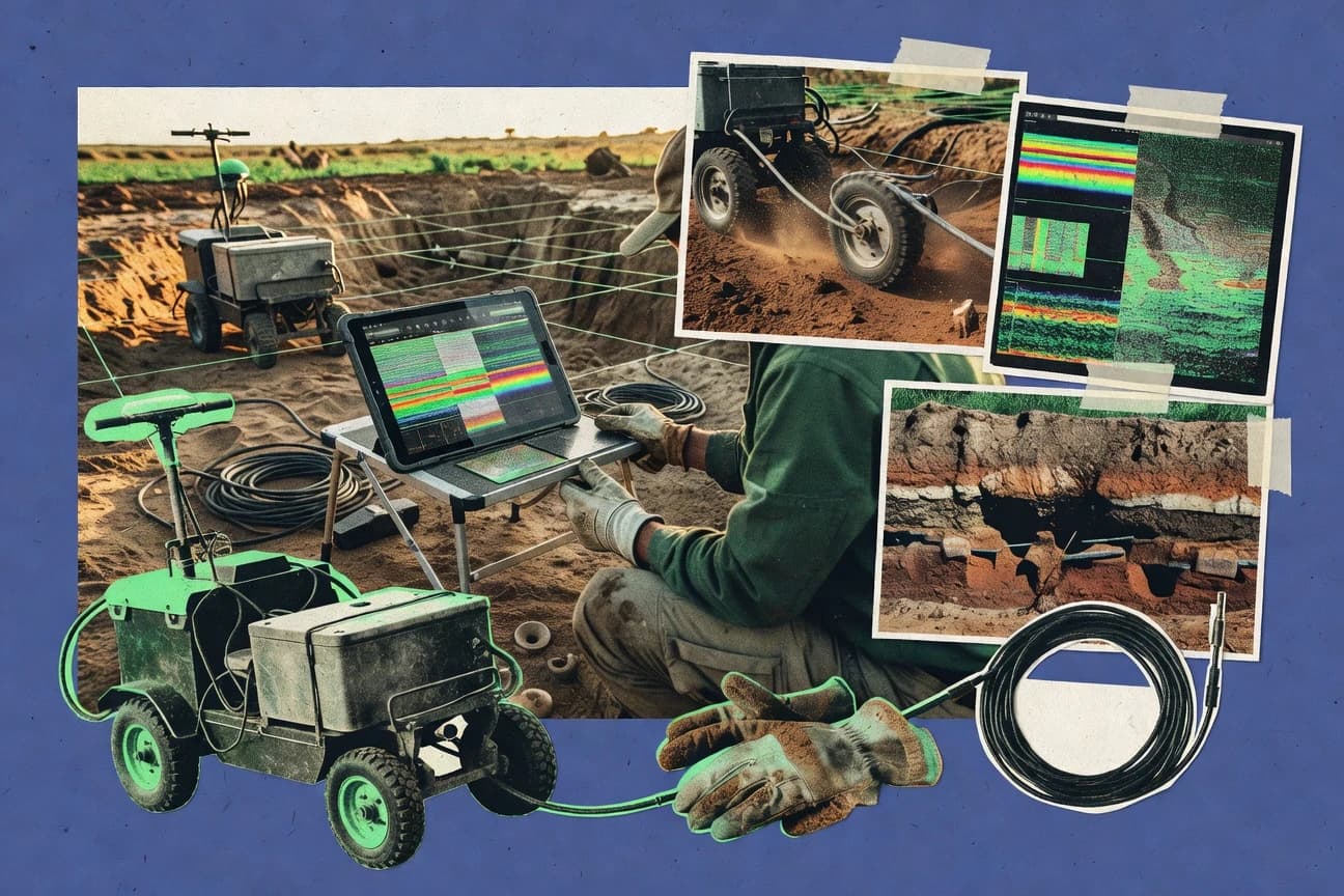
What Is Ground Penetrating Radar Software?
Ground Penetrating Radar software is processing, visualization, and interpretation software that converts raw GPR radargrams into depth-imaged subsurface results such as utilities, voids, and geological layers. It typically includes signal conditioning like gain and filtering, then depth-focused processing like migration and velocity analysis, then 2D or 3D rendering for decision-ready interpretation. Reflexw represents a full professional workflow that includes migration, tomography, and integrated full-waveform forward modeling and stochastic inversion for velocity model building. RADAN represents a GSSI-focused post-processing stack that emphasizes 3D time-slice volume rendering and migration for SIR-series workflows.
Key Features to Look For
These features determine whether a software tool can turn field radar data into accurate depth models with the visualization detail needed for your project deliverables.
Full-waveform modeling and stochastic inversion for velocity building
Reflexw supports integrated full-waveform forward modeling and stochastic inversion so velocity models can be built for more accurate anomaly characterization. This capability matters for complex targets where depth accuracy depends on velocity calibration, which is a central requirement in professional geophysics using Reflexw.
Advanced 3D migration plus time-slice or tomography visualization
RADAN provides advanced 3D migration and time-slice volume rendering for hyper-accurate subsurface modeling. GPR-Slice adds advanced 3D tomography and interactive time-slicing so anomaly detection can be refined across volumes instead of a single profile view.
Real-time 3D migration imaging for dense grid surveys
VisualIT 3D delivers real-time 3D migration imaging from dense GPR grid surveys, which supports rapid assessment during utility detection and site investigations. This matters when multi-line grids require timely interpretation rather than only offline batch processing.
Integrated automatic target analysis for utility identification
Leica DX Office includes integrated automatic target analysis that simplifies utility identification from complex GPR scans. This matters for construction and infrastructure workflows where consistent target recognition and report-ready outputs reduce manual interpretation time.
Hardware-native workflows with automatic hyperbola detection and 3D rendering
EKKO_Project is built for EKKO-series instruments and provides optimized workflows with automatic hyperbola detection and real-time 3D volume rendering. This matters when a team wants fewer steps between acquisition and interpretable 2D or 3D results within an EKKO-focused ecosystem.
Scriptable electromagnetic simulation for synthetic modeling
gprMax is an open-source FDTD simulator that enables scriptable 2D and 3D GPR wave propagation modeling and synthetic data generation. This matters when the goal includes validating survey design or interpreting ambiguous field returns through controlled simulations using Python-driven input models.
How to Choose the Right Ground Penetrating Radar Software
The decision framework starts with the GPR hardware ecosystem and then matches required 2D or 3D processing depth, migration needs, and visualization deliverables to the tool’s actual capabilities.
Match the software to the GPR hardware and data formats
RADAN is optimized for GSSI SIR-series workflows, and EKKO_Project is designed for Sensors & Software EKKO-series data, so hardware-native integration reduces friction when moving from field to interpretation. VisualIT 3D and EKKO_Project are strongest when multi-offset survey data comes from Sensors & Software hardware, while GroundVision is primarily optimized for MALÅ systems. If the survey uses IDS GeoRadar multi-channel arrays, OPERA is built around IDS workflows and automated migration plus hyperbola fitting.
Select the depth-imaging workflow that fits the target complexity
Teams needing rigorous velocity model calibration should prioritize Reflexw because it includes integrated full-waveform forward modeling and stochastic inversion for velocity model building. For projects where 3D subsurface geometry must be evaluated quickly, RADAN and GPR-Slice provide advanced 3D migration with time-slice visualization and tomography workflows. VisualIT 3D fits dense grid interpretation because it emphasizes real-time 3D migration imaging.
Verify 2D versus 3D analysis needs before committing
GPR-Slice, RADAN, and VisualIT 3D emphasize 3D time-slicing and volume rendering, which supports detailed subsurface anomaly detection beyond single profile interpretation. GRED HD also focuses on 2D and 3D processing with advanced 3D migration and volume rendering for precise anomaly detection, which suits geotechnical and archaeology projects. If the deliverable demands scripted validation rather than just interpretation, gprMax supports 2D and 3D synthetic modeling via Python.
Check whether automatic interpretation features reduce manual labor
Leica DX Office includes integrated automatic target analysis for utility identification, which is designed to simplify interpretation from complex scan data. EKKO_Project adds automatic hyperbola detection and real-time 3D volume rendering for EKKO-series workflows, which helps standardize interpretation outputs. For teams working with IDS multi-channel arrays, OPERA uses automated migration and hyperbola fitting tailored for high-speed GPR surveys.
Plan for learning curve and workflow design time
Reflexw, RADAN, and GPR-Slice offer advanced processing suites and can require training because the feature sets are deep and the interfaces are not simplified for non-experts. GPR-Slice and VisualIT 3D emphasize powerful 3D workflows, which increases setup and interpretation time if the team lacks prior migration experience. If command-line simulation workflow is acceptable, gprMax trades ease of use for a steep command-line interface and relies on scripting for post-processing.
Who Needs Ground Penetrating Radar Software?
Ground Penetrating Radar software fits organizations that must process radar data into accurate subsurface maps using 2D and 3D visualization, often for utilities, geotechnical engineering, and archaeology.
Professional geophysicists and engineering firms needing top-tier 3D velocity modeling
Reflexw is the best fit when full-waveform forward modeling and stochastic inversion are required to build velocity models and characterize anomalies. This suits research-grade interpretation and engineering projects where depth accuracy depends on velocity model refinement.
Experienced GPR professionals focused on GSSI SIR-series migration and deliverable-ready visualization
RADAN fits teams that need advanced 3D migration and time-slice volume rendering to create interpretable subsurface images from GSSI SIR-series data. This targets utility scanning, concrete scanning, archaeology, and geotechnical decision-making where reporting and export workflows matter.
Surveyors and geophysicists tackling complex 3D utility and forensic investigations
GPR-Slice supports advanced 3D tomography and interactive time-slicing for precise subsurface anomaly detection across volumes. VisualIT 3D fits dense grid surveys with real-time 3D migration imaging that helps teams interpret multi-line data efficiently.
Specialized hardware users building standardized field-to-office workflows
EKKO_Project supports EKKO-series data with automatic hyperbola detection and real-time 3D volume rendering, which suits teams that want hardware-native processing power. Leica DX Office targets Leica DSX and DS2000 utility detection with integrated automatic target analysis, while OPERA targets IDS Stream multi-channel array workflows for automated migration and hyperbola fitting.
Common Mistakes to Avoid
Purchases often fail when workflows are mismatched to hardware ecosystems, when teams underestimate training requirements for advanced migration, or when project deliverables demand 3D visualization that the chosen tool does not prioritize.
Buying for advanced processing without matching the target’s 3D interpretation needs
Teams that only need basic 2D visualization can overpay for full professional stacks, while teams that truly need 3D models may under-buy if the tool is not built around volume rendering. Use RADAN for 3D time-slice volume rendering and GPR-Slice for 3D tomography and interactive time-slicing when the deliverable demands volumetric anomaly detection.
Ignoring hardware ecosystem fit and data interoperability limits
Many tools are strongest inside their hardware ecosystems, and Leica DX Office is limited to Leica GPR workflows while EKKO_Project is optimized for EKKO-series data. OPERA is designed for IDS multi-channel array data and VisualIT 3D is tailored for Sensors & Software multi-offset grid surveys, so mismatch can block smooth processing.
Underestimating migration, velocity, and workflow training overhead
Reflexw, RADAN, and GPR-Slice provide deep migration and velocity analysis capabilities that come with a steep learning curve. GroundVision and GRED HD also present learning complexity for non-experts, so teams without migration experience may see delays unless training time is planned.
Choosing a simulator without planning for scripting and post-processing workflow
gprMax is open-source and highly accurate for FDTD modeling, but it uses a command-line workflow with a steep learning curve and requires scripting for post-processing. Teams seeking fast, point-and-click interpretation typically need commercial interpretation tools like VisualIT 3D, RADAN, or GPR-Slice instead.
How We Selected and Ranked These Tools
we evaluated every tool on three sub-dimensions: features with a weight of 0.4, ease of use with a weight of 0.3, and value with a weight of 0.3. The overall rating is calculated as overall = 0.40 × features + 0.30 × ease of use + 0.30 × value. Reflexw separated itself from lower-ranked options by combining very high feature depth with strong capability for full-waveform forward modeling and stochastic inversion, which directly supports velocity model building for accurate subsurface interpretation. Tools like RADAN and GPR-Slice were competitive on 3D migration and time-slice visualization, while gprMax scored exceptionally on value and features but lagged on ease of use due to its command-line workflow.
Frequently Asked Questions About Ground Penetrating Radar Software
Which tool is best for professional 2D and 3D GPR processing with advanced velocity modeling?
Which software is tailored to utility and concrete scanning workflows that require fast interpretation and reporting?
What option offers the most interactive 3D visualization for exploring anomalies using time-slice cuts?
Which tool is most suitable for multi-line or grid surveys that need real-time or near-real-time 3D migration imaging?
Which software best supports IDS GeoRadar multi-channel and multi-frequency datasets?
Which package is designed for geophysics-grade modeling and simulation when field processing is not enough?
How do tools differ when the primary challenge is velocity estimation and depth accuracy?
Which option is best when the project demands CAD-friendly outputs and automated target identification from complex radar scans?
What software is most appropriate for teams working across 2D profiles and 3D volumes while needing consistent field-to-office export workflows?
Tools reviewed
Primary sources checked during evaluation.
Referenced in the comparison table and product reviews above.
Keep exploring
Comparing two specific tools?
Software Alternatives
See head-to-head software comparisons with feature breakdowns, pricing, and our recommendation for each use case.
Explore software alternatives→In this category
Science Research alternatives
See side-by-side comparisons of science research tools and pick the right one for your stack.
Compare science research tools→FOR SOFTWARE VENDORS
Not on this list? Let’s fix that.
Our best-of pages are how many teams discover and compare tools in this space. If you think your product belongs in this lineup, we’d like to hear from you—we’ll walk you through fit and what an editorial entry looks like.
Apply for a ListingWHAT THIS INCLUDES
Where buyers compare
Readers come to these pages to shortlist software—your product shows up in that moment, not in a random sidebar.
Editorial write-up
We describe your product in our own words and check the facts before anything goes live.
On-page brand presence
You appear in the roundup the same way as other tools we cover: name, positioning, and a clear next step for readers who want to learn more.
Kept up to date
We refresh lists on a regular rhythm so the category page stays useful as products and pricing change.