GITNUXSOFTWARE ADVICE
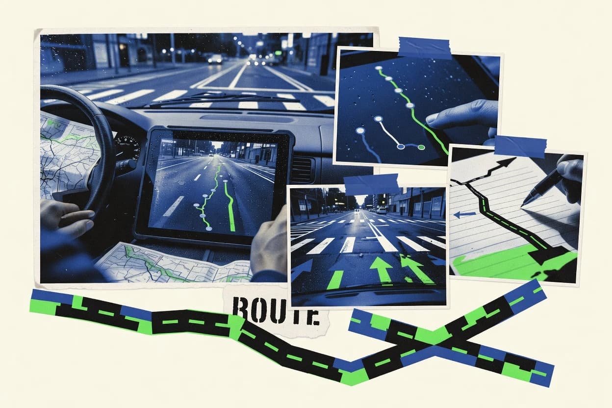
Transportation LogisticsTop 10 Best Gps Route Mapping Software of 2026
Compare Top 10 picks of Gps Route Mapping Software with Route4Me, Onfleet, and Geotab to rank the best route tools. Explore options

How we ranked these tools
Core product claims cross-referenced against official documentation, changelogs, and independent technical reviews.
Analyzed video reviews and hundreds of written evaluations to capture real-world user experiences with each tool.
AI persona simulations modeled how different user types would experience each tool across common use cases and workflows.
Final rankings reviewed and approved by our editorial team with authority to override AI-generated scores based on domain expertise.
Score: Features 40% · Ease 30% · Value 30%
Gitnux may earn a commission through links on this page — this does not influence rankings. Editorial policy
Editor’s top 3 picks
Three quick recommendations before you dive into the full comparison below — each one leads on a different dimension.
Route4Me
Route optimization with time windows and service times for multi-stop deliveries
Built for logistics teams optimizing many daily stops with schedule constraints.
Onfleet
Editor pickStop-level proof-of-delivery tied to live GPS tracking
Built for last-mile delivery teams needing stop-level tracking and optimized GPS routing.
Geotab
Editor pickGeofence-based alerts tied to live GPS location and telematics events
Built for organizations using telematics to map routes and manage fleet operations.
Related reading
Comparison Table
This comparison table evaluates GPS route mapping software such as Route4Me, Onfleet, Geotab, Samsara, and Locus across core dispatch and navigation workflows. It highlights how each platform handles route planning, live tracking, driver execution, and delivery or field-ops optimization so teams can match capabilities to operational requirements.
Route4Me
route optimizationRoute4Me plans optimized GPS routes with stop sequencing, time windows, and real-time address and travel-time updates for delivery and field service operations.
Route optimization with time windows and service times for multi-stop deliveries
Route4Me stands out with turn-by-turn route optimization that supports multi-stop delivery planning at scale. The platform builds optimized stops across distance, time windows, and service time constraints while presenting results on a map interface.
Dispatchers can generate routes, assign them to drivers, and export route plans for mobile navigation use. Route4Me also supports rerouting when schedules change and provides analytics for route performance tracking.
- +Multi-stop route optimization respects time windows and service times
- +Map-based planning enables quick route creation and driver assignment
- +Exports routes for mobile navigation and field execution workflows
- +Supports schedule changes with rerouting and updated stop sequences
- +Route performance analytics helps improve future planning decisions
- –Advanced optimization workflows can feel complex for new planners
- –Large route batches may require careful data preparation
- –Map viewing and editing can be slower with dense stop sets
- –Feature depth increases setup time for operations with strict constraints
- –Driver-specific details rely on consistent address and stop inputs
Best for: Logistics teams optimizing many daily stops with schedule constraints
Onfleet
dispatch and trackingOnfleet provides route planning and dispatch with driver app navigation, GPS tracking, and delivery status workflows.
Stop-level proof-of-delivery tied to live GPS tracking
Onfleet distinguishes itself with delivery-focused GPS route mapping that ties tracking events directly to each stop. Route planning supports optimized sequences for field teams and updates drivers as new locations come in.
Live dispatch visibility shows arrival progress, and mobile workflows let couriers capture status changes per stop. The system centers on last-mile execution rather than general map-only routing.
- +Route optimization assigns efficient stop sequences for daily delivery runs
- +Real-time driver tracking updates every stop status as movement occurs
- +Mobile stop workflow captures proof-of-delivery and delivery outcomes
- +Dispatch dashboard provides clear ETA and progress visibility per route
- –Best results depend on clean input addresses and accurate location data
- –Complex warehouse routing and staging workflows need more customization
- –Advanced constraints like time windows require careful route configuration
- –Reporting depth for non-delivery logistics stays limited compared to general TMS
Best for: Last-mile delivery teams needing stop-level tracking and optimized GPS routing
Geotab
fleet telematicsGeotab Fleet Management supports GPS tracking, route-related telematics data, and driver and vehicle visibility for logistics fleets.
Geofence-based alerts tied to live GPS location and telematics events
Geotab stands out with fleet hardware integration that produces route and activity data directly from vehicles. The platform supports GPS-based route mapping, live vehicle tracking, and route planning workflows using configurable rules and geofences.
It also centralizes driver and asset locations to power operational dashboards, compliance reporting, and exception-based alerts. Route optimization and map visualizations rely on the connected telematics data rather than manual uploads.
- +Live vehicle tracking synchronized to connected telematics devices
- +Route mapping with rich playback and event markers
- +Geofences enable location-based alerts and automated workflows
- +Works across fleets with centralized dashboards and permissions
- –Best route mapping depends on vehicle telematics hardware availability
- –Advanced route planning requires careful setup of rules and workflows
- –Complex reporting setup can take time for large operations
Best for: Organizations using telematics to map routes and manage fleet operations
Samsara
fleet telematicsSamsara Fleet Management delivers GPS vehicle tracking and operational intelligence with features used to support route planning and delivery operations.
Geofence alerts with location-based event timelines for vehicles and mobile assets
Samsara stands out with GPS route mapping tied directly to live fleet visibility and operations tracking. It supports route planning with geofencing and location history for mobile assets across roads and worksites.
The platform connects routing outcomes to driver activity and event data, enabling clearer context for delays and deviations. Map-based reporting helps teams review performance and optimize future route execution.
- +Live vehicle map shows route progress with real-time status events
- +Geofencing triggers location-based alerts for yards, sites, and zones
- +Route history supports investigation of stops, dwell time, and deviations
- –Route planning tools emphasize operations visibility over advanced optimization
- –Complex multi-stop routing requires careful setup to match workflows
- –Dashboards can feel data-dense without role-based views
Best for: Field operations teams needing live GPS mapping and route performance review
Locus
last-mile orchestrationLocus offers last-mile delivery orchestration with route optimization, live tracking, and driver execution workflows.
Offline-ready GPX route planning with waypoint-based track editing
Locus stands out for its tight focus on offline-ready GPS route planning and turn-by-turn navigation on mobile. Route creation supports track-based editing, waypoint management, and GPX import and export for field workflows.
Mapping layers integrate with offline map packages, which helps keep navigation usable in low-connectivity areas. Built-in elevation and track analysis tools support practical route refinement before rides and hikes.
- +Offline map support enables navigation without mobile data
- +GPX import export supports exchange with mapping and training tools
- +Track editing and waypoint tools improve route accuracy
- +Elevation and track stats aid planning and review
- +Turn-by-turn navigation guides along mapped routes
- –Interface complexity can slow first-time route creation
- –Advanced editing lacks desktop-grade precision workflows
- –Offline map storage needs planning for large regions
- –Multi-device collaboration features are limited
- –Power consumption increases during long GPS sessions
Best for: Solo and small groups mapping routes for hikes, rides, and field navigation
OptimoRoute
route optimizationOptimoRoute optimizes vehicle routes with constraints such as time windows and service times and supports route execution for logistics teams.
Multi-stop route optimization with map visualization for fast sequence validation
OptimoRoute focuses on turning address lists into efficient multi-stop routes with an emphasis on real-world constraints. It supports route optimization workflows for delivery and field operations, including stop ordering, distance-based planning, and assigning vehicles or drivers.
The tool also provides map-based visualization so teams can review sequences and exported schedules in a single view. Routing output can be shared or used for operational handoff across day-to-day planning tasks.
- +Optimizes multi-stop route order to reduce total travel distance
- +Map-driven route planning makes stop sequences easy to verify
- +Supports assigning stops across multiple routes for dispatch scenarios
- +Exports optimized schedules for practical operational use
- +Handles common constraints for route planning workflows
- –Best results depend on accurate addresses and consistent stop data
- –Complex constraint setups can require careful input formatting
- –Route scenarios can be harder to iterate with many frequent changes
- –Limited deep analytics compared with specialized logistics BI tools
Best for: Teams planning delivery or field routes with multi-stop optimization and dispatch handoff
Mapigo
route mappingMapigo helps create and optimize route maps with GPS tracking and scheduling features for sales and field logistics use cases.
Interactive GPX track visualization with route point editing
Mapigo focuses on turning GPS tracks into map-based route views that are easy to share and reuse. The workflow centers on uploading recorded GPX data, inspecting tracks on an interactive map, and creating route plans from those tracks.
It supports adding route points and organizing paths so trips can be reviewed visually instead of only through raw coordinates. The result fits fieldwork and trip review needs where spatial context matters more than offline navigation features.
- +GPX track upload with immediate interactive map visualization
- +Route points and path editing for refining recorded trips
- +Shareable map views for communicating route context
- –Route planning depends heavily on imported track data
- –Fewer advanced routing tools than dedicated navigation software
- –Limited evidence of offline turn-by-turn guidance features
Best for: Team trip review and route mapping from GPX track data
MyRouteOnline
route planningMyRouteOnline produces optimized driving routes with stop planning and mapping tools for route-based field operations.
Multi-stop route optimization with ordered stop mapping for driver execution
MyRouteOnline focuses on turning address lists and spreadsheet data into mapped driving routes with turn-by-turn readiness. The core workflow builds optimized multi-stop routes and supports dispatcher-style assignment of stops to specific vehicles or drivers.
Route maps include live route visualization and exportable route details for field execution. The tool also supports recurring route planning so frequent delivery patterns can be rebuilt without starting from scratch.
- +Optimizes multi-stop routes to reduce travel time across delivery sequences
- +Creates driver-ready route views with ordered stop visualization
- +Supports batch imports from common list formats for faster planning
- +Enables recurring route creation for repeat schedules
- –Route planning depends on accurate addresses for best results
- –Advanced workflow customization is limited compared with full dispatch suites
- –Map-based setup can be slower for very large stop counts
- –Field updates and edits require operational process coordination
Best for: Small logistics teams needing fast optimized routing and repeat schedule planning
Bringg
delivery managementBringg provides delivery management with route planning, dispatch, tracking, and operational workflows for logistics teams.
Real-time route tracking integrated with automated dispatch and SLA execution workflows
Bringg stands out with end-to-end delivery orchestration that couples dispatch logic with route visualization. The platform maps multi-stop routes on a GPS layer and supports real-time tracking of moving shipments.
It also provides operational workflows for scheduling, SLA management, and status updates across delivery teams and drivers. Route mapping is used as part of broader execution, not just map display.
- +Multi-stop route visualization tied to live shipment tracking
- +Automated dispatch and re-assignment logic during execution
- +Workflow-driven updates keep delivery statuses consistent
- +SLA-focused controls align operations with promised delivery windows
- –Route views depend on delivery orchestration configuration
- –Advanced planning requires setup of operational rules
- –GPS map output is strongest within Bringg execution workflows
Best for: Logistics teams needing orchestration plus live GPS route mapping
Trimble Transportation
fleet solutionsTrimble transportation solutions include GPS-based fleet visibility capabilities that support route awareness for logistics operations.
Route playback from captured vehicle GPS traces for trip-by-trip route verification
Trimble Transportation distinguishes itself with GPS route mapping that supports field-tested logistics workflows. It uses vehicle and trip location capture to visualize routes and segment travel history for planning and review. The system focuses on mapping, route playback, and operational reporting for transportation and service operations.
- +Route mapping tied to real vehicle movement and trip history
- +Route playback helps review how trips unfolded over time
- +Operational mapping supports dispatching and service planning decisions
- +Data-driven visualization improves auditability of travel activity
- –Less suited for simple personal navigation needs
- –Route mapping value depends on consistent telematics data capture
- –Setup effort can be higher than lightweight mapping-only tools
- –Advanced workflow outcomes require strong integration with operations
Best for: Transportation and service teams needing GPS route visualization and trip review
How to Choose the Right Gps Route Mapping Software
This buyer’s guide explains how to pick the right GPS route mapping software for delivery, fleet operations, field navigation, and route playback workflows. It covers Route4Me, Onfleet, Geotab, Samsara, Locus, OptimoRoute, Mapigo, MyRouteOnline, Bringg, and Trimble Transportation with concrete capability checkpoints. The guide focuses on stop sequencing, time-window logic, live tracking ties, GPX-based planning, geofence alerting, and route playback.
What Is Gps Route Mapping Software?
GPS route mapping software plans and visualizes routes on a map for vehicles, drivers, and mobile assets. It solves route sequencing problems for multi-stop stops, execution visibility problems for dispatch teams, and investigation problems for reviewing how trips unfolded. Route4Me turns address lists into optimized multi-stop routes using time windows and service times, then supports rerouting when schedules change. Onfleet pairs optimized route sequencing with stop-level proof-of-delivery tied to live GPS tracking.
Key Features to Look For
The best tools align route planning outputs with how work actually executes in the field, including constraints, offline needs, and proof-of-delivery events.
Multi-stop route optimization with time windows and service times
Route4Me optimizes stop sequencing around time windows and service times for delivery and field service operations. OptimoRoute also handles time windows and service times to produce efficient multi-stop routes from address lists.
Stop-level execution visibility tied to live GPS tracking
Onfleet ties route execution to each stop with live driver tracking updates and stop-level proof-of-delivery workflows. Bringg also maps multi-stop routes to real-time tracking so operational status and SLA controls stay connected to the route layer.
Geofence-based alerts tied to live vehicle location and events
Geotab uses geofences for location-based alerts tied to live GPS location and telematics events. Samsara delivers geofence alerts with location-based event timelines for vehicles and mobile assets so teams can review yard and site activity.
Offline-ready route planning and track editing with GPX
Locus supports offline-ready GPS route planning and turn-by-turn navigation with offline map packages. It also supports GPX import and export plus waypoint-based track editing for practical route refinement.
GPX-based route mapping and shareable track views
Mapigo centers on GPX track upload and interactive map visualization, then adds route points and path editing for refining recorded trips. This approach fits teams that need to communicate route context from recorded data rather than build advanced constraints.
Route playback for trip-by-trip verification and investigation
Trimble Transportation provides route playback from captured vehicle GPS traces for trip-by-trip route verification. Geotab also supports route-related telematics data playback with event markers to support compliance and exception-based workflows.
How to Choose the Right Gps Route Mapping Software
Pick the tool that matches the way routes are created, executed, and audited in the daily workflow.
Match routing complexity to constraint support
For delivery and field service schedules that require time windows and service-time constraints, Route4Me is built for optimized stop sequencing using those constraints. For teams that also need constraint-driven multi-stop optimization but prefer map-driven verification, OptimoRoute provides route optimization with map-based visualization and practical export handoff.
Decide whether proof-of-delivery must be tied to GPS
If stop-level execution records and proof-of-delivery must align to each GPS-tracked stop, Onfleet is designed around stop workflow capture tied to live tracking. For teams that run delivery orchestration with route visualization and automated dispatch logic, Bringg connects route mapping with real-time tracking and SLA-focused execution workflows.
Use telematics-first tools when routes come from vehicle hardware
When vehicle telematics devices already exist, Geotab maps routes using connected telematics data rather than manual uploads. Samsara also ties route mapping and operational intelligence to live fleet visibility and route history so teams can review delays and deviations with location-based event timelines.
Choose offline and GPX workflows for field navigation and recorded trips
For hikes, rides, and field navigation where mobile connectivity is limited, Locus supports offline map packages plus offline-ready turn-by-turn navigation and waypoint-based GPX track editing. For teams that primarily import recorded GPX tracks and need interactive visualization and route point refinement, Mapigo focuses on GPX track visualization and shareable map views.
Verify handoff, editing, and re-planning needs
If dispatchers must reroute when schedules change and also assign drivers, Route4Me supports rerouting with updated stop sequences and map-based planning with exports for mobile navigation. If recurring route planning and driver-ready ordered stop mapping are the priority for repeat schedules, MyRouteOnline supports recurring route creation and batch import workflows for faster repeat planning.
Who Needs Gps Route Mapping Software?
Different organizations need different outputs, from constraint-based route optimization to offline GPX planning to telematics-driven route playback.
Logistics teams optimizing many daily stops with schedule constraints
Route4Me fits this segment because it optimizes multi-stop routes with time windows and service times, then supports rerouting and updated stop sequences when schedules change. OptimoRoute also targets this need with multi-stop optimization and map visualization for sequence verification before dispatch handoff.
Last-mile delivery teams that need stop-level proof-of-delivery tied to GPS
Onfleet is built for last-mile execution where stop workflows capture delivery outcomes and tie them to live GPS tracking per stop. Bringg also supports real-time route tracking integrated with automated dispatch and SLA execution workflows for multi-team delivery operations.
Organizations that run fleet operations using telematics and want geofence alerts
Geotab is suited to teams that have vehicle telematics hardware and want geofences that trigger location-based alerts tied to telematics events. Samsara serves field operations teams that need live GPS mapping plus geofence alerts with location-based event timelines for assets across roads and worksites.
Field users building routes in low-connectivity areas or refining recorded tracks
Locus is best for solo users and small groups that need offline-ready GPS route planning with GPX import and export and waypoint-based track editing. Mapigo fits teams that want interactive GPX track visualization with route point editing and shareable map views for trip review.
Common Mistakes to Avoid
These mistakes repeatedly block successful route mapping projects by misaligning tool capabilities with real route execution and data requirements.
Picking a map-only workflow when dispatch needs constraints and rerouting
Route4Me supports time windows and service times plus rerouting with updated stop sequences, which is required for schedules that change mid-day. Samsara emphasizes route planning tied to operational visibility and geofence event timelines, so it fits investigation and monitoring better than pure constraint optimization.
Underestimating address quality requirements for optimized planning
Onfleet and OptimoRoute depend on clean input addresses and accurate location data because stop sequences and constraint handling produce best results when inputs are consistent. MyRouteOnline also relies on accurate addresses for optimal routing, and complex planning at very large stop counts can slow map-based setup.
Choosing telematics routing tools without available vehicle hardware
Geotab’s route mapping depends on vehicle telematics hardware availability since route and activity data comes from connected devices. Trimble Transportation’s route playback value depends on consistent vehicle GPS trace capture, so gaps in telematics collection reduce auditability.
Forgetting offline and GPX needs for field navigation or recorded trip review
Locus is built for offline-ready GPX route planning with offline map packages and turn-by-turn navigation, so it suits low-connectivity routing tasks. Mapigo focuses on GPX track upload and interactive map visualization, so it does not replace advanced constraint dispatch workflows like Route4Me or OptimoRoute.
How We Selected and Ranked These Tools
We evaluated each GPS route mapping tool on three sub-dimensions. Features carried a 0.40 weight, ease of use carried a 0.30 weight, and value carried a 0.30 weight. The overall score equals 0.40 × features plus 0.30 × ease of use plus 0.30 × value. Route4Me separated itself from lower-ranked tools by combining constraint-based multi-stop optimization for time windows and service times with dispatch-style outputs like rerouting and updated stop sequences tied to driver assignment workflows.
Frequently Asked Questions About Gps Route Mapping Software
Which GPS route mapping tools handle multi-stop delivery optimization with time windows and service times?
How do last-mile route mapping tools link GPS location to each delivery stop for proof of completion?
Which platforms create route mapping outputs directly from vehicle telematics instead of manual uploads?
What tools support offline-ready route planning and GPX workflows for areas with weak connectivity?
Which solution best supports geofence-triggered alerts tied to live GPS movement for operational exceptions?
Which GPS route mapping tools are best for address lists and spreadsheets that need dispatcher-style assignment to drivers or vehicles?
How do teams turn existing GPS traces into route maps for review and playback?
Which tools help dispatchers adjust plans when schedules change or when new location data arrives?
What technical workflow should teams expect when building routes for mobile field execution?
Conclusion
After evaluating 10 transportation logistics, Route4Me stands out as our overall top pick — it scored highest across our combined criteria of features, ease of use, and value, which is why it sits at #1 in the rankings above.
Use the comparison table and detailed reviews above to validate the fit against your own requirements before committing to a tool.
Tools reviewed
Primary sources checked during evaluation.
Referenced in the comparison table and product reviews above.
Keep exploring
Comparing two specific tools?
Software Alternatives
See head-to-head software comparisons with feature breakdowns, pricing, and our recommendation for each use case.
Explore software alternatives→In this category
Transportation Logistics alternatives
See side-by-side comparisons of transportation logistics tools and pick the right one for your stack.
Compare transportation logistics tools→FOR SOFTWARE VENDORS
Not on this list? Let’s fix that.
Our best-of pages are how many teams discover and compare tools in this space. If you think your product belongs in this lineup, we’d like to hear from you—we’ll walk you through fit and what an editorial entry looks like.
Apply for a ListingWHAT THIS INCLUDES
Where buyers compare
Readers come to these pages to shortlist software—your product shows up in that moment, not in a random sidebar.
Editorial write-up
We describe your product in our own words and check the facts before anything goes live.
On-page brand presence
You appear in the roundup the same way as other tools we cover: name, positioning, and a clear next step for readers who want to learn more.
Kept up to date
We refresh lists on a regular rhythm so the category page stays useful as products and pricing change.