GITNUXSOFTWARE ADVICE
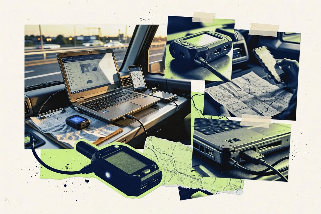
Transportation VehiclesTop 10 Best Gps Data Collection Software of 2026
Compare the top 10 Gps Data Collection Software options for fleet tracking. Review picks like Geotab, Samsara, and Verizon Connect.

How we ranked these tools
Core product claims cross-referenced against official documentation, changelogs, and independent technical reviews.
Analyzed video reviews and hundreds of written evaluations to capture real-world user experiences with each tool.
AI persona simulations modeled how different user types would experience each tool across common use cases and workflows.
Final rankings reviewed and approved by our editorial team with authority to override AI-generated scores based on domain expertise.
Score: Features 40% · Ease 30% · Value 30%
Gitnux may earn a commission through links on this page — this does not influence rankings. Editorial policy
Editor’s top 3 picks
Three quick recommendations before you dive into the full comparison below — each one leads on a different dimension.
Geotab
Event-driven Geofencing and rule-based alerts tied to telematics signals
Built for fleet teams needing reliable GPS capture, diagnostics, and event-driven alerts.
Samsara
Editor pickGeofencing with configurable alerts and automated incident workflows
Built for large fleets needing real-time GPS visibility plus automated geofence alerts.
Verizon Connect
Editor pickGeofencing alerts with automated notifications tied to vehicle location changes
Built for fleets needing reliable GPS capture, alerts, and operational dashboards.
Related reading
Comparison Table
This comparison table evaluates GPS data collection platforms such as Geotab, Samsara, Verizon Connect, Azuga, and Lytx across core deployment and data capture capabilities. It highlights how each tool handles real-time location tracking, routing and trip reporting, driver behavior or video features, and integrations with existing fleet and back-office systems. Readers can use the table to compare practical differences that affect daily fleet operations and reporting workflows.
Geotab
fleet telematicsFleet telematics collects GPS vehicle location and diagnostic data using Geotab devices and its fleet management software for reporting and analytics.
Event-driven Geofencing and rule-based alerts tied to telematics signals
Geotab stands out for fleet GPS data collection built around its plug-and-play telematics devices and open, rules-based integration model. The system captures location and diagnostic signals, then delivers data through a configurable dashboard and reporting tools.
It supports automated workflows using event rules like speeding and engine status changes, with data export options for downstream analytics. Administrators can manage devices, users, and access controls to keep collection consistent across large fleets.
- +Device-backed GPS and diagnostics capture fuel, engine, and driving events
- +Configurable reports and dashboards for trip and utilization visibility
- +Event rules automate alerts for speeding and idle behaviors
- +Open integration model supports custom data pipelines and systems
- –Setup can require specialized knowledge for telematics hardware installation
- –Advanced analytics often need external tools via exports or integrations
- –Usability depends on correct data mappings across vehicle manufacturers
- –Live tracking features can feel complex for small fleets
Best for: Fleet teams needing reliable GPS capture, diagnostics, and event-driven alerts
More related reading
Samsara
managed trackingVehicle tracking software gathers GPS location and driver behavior from Samsara devices and provides real-time fleet visibility and exports for downstream systems.
Geofencing with configurable alerts and automated incident workflows
Samsara stands out for GPS data collection built around enterprise-grade vehicle and asset tracking hardware plus a web dashboard. The platform collects location, engine, and driver behavior signals from connected devices and makes them searchable in near real time.
Route visibility, geofencing, and alert-driven incident workflows support dispatch and compliance teams. Multi-site fleet management features help standardize data capture and monitoring across large operations.
- +Real-time location tracking with device-based data collection
- +Geofencing triggers automated alerts for location-based events
- +Driver and vehicle behavior signals beyond simple GPS points
- +Map dashboards make fleet status easy to interpret
- –Setup depends on Samsara hardware provisioning and installation
- –More complex analytics require disciplined data tagging and configuration
- –Integrations can add effort when aligning with legacy systems
Best for: Large fleets needing real-time GPS visibility plus automated geofence alerts
Verizon Connect
enterprise telematicsFleet GPS tracking and telematics collect vehicle location data and configurable events, with reporting tools for operations and compliance workflows.
Geofencing alerts with automated notifications tied to vehicle location changes
Verizon Connect stands out for pairing GPS data collection with fleet-focused device management and analytics built for operations teams. The platform gathers location, speed, and activity signals from supported vehicle and mobile tracking hardware, then organizes records for reporting and compliance needs.
Real-time status views and geofencing rules help teams respond quickly to route and location changes. Admin workflows support managing devices and users across fleets without needing custom integrations.
- +Real-time vehicle visibility with live status and location history
- +Geofencing rules for alerts tied to defined areas
- +Fleet device management with organized user and vehicle administration
- +Dashboards for rapid reporting on speed and activity trends
- –Setup depends on supported tracking hardware and compatible device configurations
- –Some workflows require admin tuning to match operational processes
- –Reporting flexibility can be limited without deeper configuration
- –Data quality depends on consistent device connectivity in the field
Best for: Fleets needing reliable GPS capture, alerts, and operational dashboards
Azuga
fleet trackingFleet tracking platform collects GPS location and telematics signals from connected vehicles and exposes operational dashboards and data for fleet management.
Event and trip timelines that tie location changes to driver and vehicle activity
Azuga stands out for GPS data collection focused on driver and vehicle tracking at scale. The platform consolidates location updates, event history, and telematics signals into centralized reports and exports.
It supports live vehicle visibility and route and stop analysis to support day-to-day fleet operations. GPS collection can be configured through device integration workflows that feed data into dashboards and auditing views.
- +Live vehicle tracking with map-based visualization for operational awareness
- +Structured event history supports investigations using time and location context
- +Reports and exports streamline GPS data review and downstream analysis
- –Advanced analytics depend heavily on the quality of incoming device data
- –Setup varies by hardware integration and can require operational testing
- –Dashboard configuration can feel complex for teams needing only basic logging
Best for: Fleets needing reliable GPS collection, event history, and reporting workflows
Lytx
video telematicsVideo telematics and GPS tracking combine vehicle location history with driver and safety analytics in a fleet management console.
Event-based incident detection and map visualization from collected telematics data
Lytx stands out as a GPS data collection solution built around driver and fleet telematics analytics. The platform gathers vehicle location and driving behavior signals from Lytx connected devices and integrates that data into workflow-ready reporting.
It supports event-based tracking, map-based incident visualization, and operational dashboards designed for fleet oversight. Data collection centers on reliable capture of movement history and behavior metrics for risk reduction and compliance workflows.
- +Event-driven tracking turns raw location into actionable incidents
- +Map and dashboard views simplify fleet movement oversight
- +Integrates driving behavior signals alongside GPS location
- +Supports investigation workflows tied to recorded driving events
- –Setup depends on Lytx vehicle hardware and integrations
- –Advanced analytics can require fleet administrator training
- –Data workflows can feel telematics-centric rather than generic GPS logging
- –Export and reporting flexibility may lag specialized GPS loggers
Best for: Fleets needing GPS collection plus incident-focused telematics analytics
Omnitracs
logistics telematicsCommercial vehicle telematics collects GPS and shipment-related telemetry and supports fleet tracking workflows for large operators.
Exception-focused event history tied to vehicle GPS telemetry for operational review
Omnitracs stands out with fleet-grade GPS data collection built around telematics-style vehicle tracking and driver mobility workflows. The platform collects location, speed, and event history and supports routing and exception-driven insights for operations teams.
It connects collected vehicle telemetry to dispatch, compliance, and field execution processes rather than limiting output to raw maps. Data delivery is designed for ongoing fleet use with integration points for downstream reporting and systems.
- +Fleet-focused GPS telemetry capture for vehicles and mobile assets
- +Event history supports operational exception review
- +Routing and workflow features built around collected location data
- +Integration-friendly data flow for reporting and other systems
- +Designed for continuous fleet operations and monitoring
- –Primarily optimized for fleet operations rather than single-device logging
- –Setup and integrations typically require IT or telematics expertise
- –Dashboards can feel complex for users needing only simple map viewing
- –Depth of reporting depends on configured data sources and workflows
Best for: Fleet operations teams collecting vehicle telemetry for dispatch and compliance workflows
TrackoBit
GPS tracking platformGPS vehicle tracking platform records vehicle positions, trip history, and geofences and supports data export for fleet use cases.
Device event collection with export-ready location history suitable for downstream analytics
TrackoBit is distinct for turning GPS device signals into structured data feeds with shareable outputs. The core workflow centers on collecting location events, tracking assets on a map, and managing device-specific histories.
Data can be filtered by time and attributes to support reporting and investigation of trips, stops, and routes. Export-ready outputs help teams reuse collected telemetry in downstream tools.
- +Map-based tracking with device history timelines for quick event review
- +Time and attribute filtering for targeted route and stop analysis
- +Structured location event collection designed for exportable datasets
- –Limited visualization depth for custom analytics beyond basic tracking views
- –Requires manual configuration per device for consistent data normalization
- –Data output options feel oriented toward exports over deep dashboarding
Best for: Teams needing reliable GPS telemetry capture and export-focused reporting
Tracki
GPS trackingGPS tracking service collects vehicle location points and alerts with a web dashboard and history exports for fleet monitoring.
Trip and route history that converts GPS pings into structured journey timelines
Tracki focuses on GPS data collection with real-time location tracking built around device telemetry. The core workflow centers on tracking assets or field units, logging movement, and maintaining a historical location trail.
The platform supports route and trip analysis so collected GPS points can be reviewed as usable journeys. Tracki is positioned for operational monitoring where ongoing location updates feed dashboards and reports.
- +Real-time tracking for assets and field devices with continuously updating locations
- +Route and trip views turn raw GPS points into reviewable journeys
- +Historical location trail supports backtracking and operational investigations
- +Data collection centered on movement events for field workflow monitoring
- –Not designed for bulk GPS ingestion from multiple external systems at once
- –Reporting is focused on movement views and less on custom analytics
- –Limited evidence of advanced rules-based geofencing and alert orchestration
- –Device onboarding and data schema configuration can become complex at scale
Best for: Operations teams collecting and reviewing GPS movement for tracked assets
Geotab Marketplace
integration ecosystemGeotab’s marketplace provides GPS and telematics data integrations and add-ons that collect, analyze, and sync vehicle location data.
Marketplace add-ons that extend Geotab’s telematics data collection and integration layer
Geotab Marketplace stands out because it extends Geotab’s GPS data collection ecosystem with add-on integrations, device plugins, and data services. It supports collecting telematics data from compatible GPS hardware and delivering it through Geotab’s data layer for reporting, diagnostics, and operational workflows.
The marketplace model enables teams to standardize data capture while selectively enabling analytics, compliance features, and third-party integrations. This approach makes GPS data collection scalable across fleets by reusing proven connectors rather than building one-off integrations.
- +Marketplace app ecosystem expands data collection capabilities without custom engineering
- +Integrations leverage Geotab’s existing telematics data pipeline
- +Supports fleet-wide telemetry routing into reporting and operational workflows
- +Modular add-ons reduce disruption when adding new data sources
- +Compatible device integrations support multi-vehicle data capture
- –Feature availability depends on specific marketplace add-ons
- –Data output formats can vary across integrations and apps
- –Complex deployments require strong Geotab and fleet operations knowledge
- –Troubleshooting spans both Geotab and the selected marketplace component
- –Some niche requirements may still need custom development
Best for: Fleets needing extensible GPS data collection via proven marketplace integrations
Mapbox
geospatial platformGeospatial platform supports GPS data collection visualization workflows by rendering real-time vehicle locations on customizable maps.
Mapbox GL JS vector map rendering with data-driven styling and layer control
Mapbox stands out by turning GPS-aware data into custom, high-performance maps through its geospatial APIs and SDKs. It supports geocoding, routing, and map rendering, which enables capturing and visualizing location data alongside interactive map experiences.
Data collection workflows can be built using its location and mapping capabilities, then validated through visual inspection on rendered layers. Mapbox is strongest when raw GPS points need to become curated spatial layers and user-facing map interfaces.
- +Custom map rendering with vector tiles for fast, high-quality visualization
- +Geocoding and routing APIs translate GPS context into usable location intelligence
- +Flexible GL-based styling for building data-driven map layers
- +Scales from lightweight point displays to complex spatial layer systems
- –Not a dedicated field GPS data capture app for offline surveying
- –GPS collection requires custom workflow engineering outside Mapbox core
- –Advanced geospatial pipeline setup can increase implementation complexity
- –Requires strong frontend and geospatial design skills to get right
Best for: Teams turning GPS points into interactive maps and spatial layers
How to Choose the Right Gps Data Collection Software
This buyer’s guide explains how to choose GPS data collection software for fleet telematics, asset tracking, and custom mapping workflows using Geotab, Samsara, Verizon Connect, Azuga, Lytx, Omnitracs, TrackoBit, Tracki, Geotab Marketplace, and Mapbox. It focuses on concrete collection capabilities like event-driven geofencing, trip timelines, export-ready location history, and map rendering using GPS-aware layers. The guide also covers common deployment pitfalls like hardware dependency and inconsistent data mapping across vehicles.
What Is Gps Data Collection Software?
GPS data collection software records location events and turns them into searchable histories for operations teams, dispatch workflows, and downstream reporting. Many solutions also capture telematics signals like speed and driver or vehicle behavior so teams can build incident workflows and automated alerts. Fleet-focused platforms like Geotab and Samsara collect GPS and diagnostic signals through installed telematics devices and present event-driven dashboards. Mapbox serves a different pattern by rendering GPS-aware data into customizable map layers using vector tiles and map styling rather than operating as an offline field GPS logger.
Key Features to Look For
The right feature set determines whether GPS points become actionable incident alerts, audit-ready trip histories, or usable spatial layers.
Event-driven geofencing and rule-based alerts
Geotab excels with event-driven geofencing and rule-based alerts tied to telematics signals so alerts connect directly to speeding, idle, and engine status behaviors. Samsara and Verizon Connect also provide geofencing triggers that generate automated incident workflows tied to vehicle location changes.
Real-time visibility with operational dashboards
Samsara supports near real-time location searches with map dashboards that make fleet status easy to interpret. Verizon Connect pairs live status views and location history with dashboards designed for operational teams responding to speed and activity trends.
Diagnostics, driver behavior, and safety signals beyond GPS points
Geotab and Lytx both combine location capture with additional telematics signals so teams investigate behavior using event timelines and incidents on maps. Samsara also includes driver and vehicle behavior signals so collected data supports more than basic movement logging.
Trip, route, and stop timelines for investigation
Azuga provides event and trip timelines that tie location changes to driver and vehicle activity for day-to-day investigations. Tracki converts GPS pings into structured trip and route history so field movement becomes reviewable journeys.
Exception-focused event history for dispatch and compliance workflows
Omnitracs is built around exception-focused event history tied to vehicle GPS telemetry so teams can review operational exceptions in the context of dispatch and field execution. Geotab Marketplace extends Geotab’s telematics layer with add-ons that can deliver compliance and operational workflows through modular integrations.
Export-ready location history and structured datasets
TrackoBit focuses on structured device event collection with export-ready location history for reuse in downstream analytics. Geotab and Azuga also provide export options so GPS events and telematics signals can feed external reporting or custom pipelines.
How to Choose the Right Gps Data Collection Software
A decision framework based on the target workflow clarifies whether the tool should prioritize alerts, investigations, data exports, or map-layer visualization.
Choose the workflow output that must be reliable
If automated alerts must trigger from location and driving signals, select Geotab for rule-based geofencing tied to telematics events or select Samsara for geofencing with configurable alerts and incident workflows. If operational teams need dashboards built around live visibility and speed or activity trends, select Verizon Connect for live status views and geofencing alerts that notify on defined area changes.
Verify the data sources match the field reality
Fleet telematics platforms like Geotab, Samsara, Verizon Connect, and Lytx depend on supported tracking hardware and correct installation for consistent GPS and signal capture. If device configuration and normalization across many vehicles is a major risk, Geotab’s open, rules-based integration model helps reduce bespoke wiring but still requires correct data mappings.
Match timeline needs to how incidents are investigated
For investigations that must show how movement relates to driver or vehicle activity, Azuga’s event and trip timelines tie location changes to driver and vehicle activity. For incident-focused safety review, Lytx provides event-based incident detection with map visualization built from collected telematics signals.
Decide between export-first and dashboard-first usage
If downstream teams need structured datasets for analytics and integrations, TrackoBit is built around device event collection and export-ready location history. If the GPS history must be usable inside operational dashboards with map-based reviews, Tracki provides trip and route views that convert pings into journey timelines.
Pick a platform that fits custom mapping or integration strategy
If GPS data must become user-facing spatial layers and interactive maps, Mapbox is strongest because Mapbox GL JS enables vector map rendering with data-driven styling and layer control. If GPS collection must be extended via connectors, choose Geotab Marketplace to standardize data capture using marketplace add-ons that extend Geotab’s telematics data collection and integration layer.
Who Needs Gps Data Collection Software?
GPS data collection software benefits teams that need reliable location history, operational visibility, and actionable workflows tied to movement.
Fleet teams that need reliable GPS capture plus diagnostics and rule-based alerts
Geotab is the best fit because it captures GPS location and diagnostic signals and then automates alerts using event rules like speeding and engine status changes. This segment also benefits from Samsara when real-time fleet visibility and geofencing incident workflows are required.
Large fleets that prioritize near real-time visibility and automated geofence incidents
Samsara supports near real-time tracking search and configurable geofencing triggers that drive automated incident workflows. Verizon Connect also fits when operational dashboards and geofencing notifications tied to vehicle location changes are the primary goal.
Operations and compliance teams that review exceptions tied to vehicle telemetry
Omnitracs fits this segment because it centers on exception-focused event history tied to vehicle GPS telemetry for dispatch and compliance workflow review. Geotab Marketplace is a strong extension path when additional connectors must add compliance and operational features through Geotab’s integration layer.
Teams that need GPS movement histories for investigations and route or trip timelines
Azuga fits when event and trip timelines must tie location changes to driver and vehicle activity. Tracki fits when trip and route history must convert GPS pings into structured journey timelines for ongoing operational monitoring.
Common Mistakes to Avoid
Missteps usually come from selecting the wrong workflow pattern, underestimating hardware dependency, or assuming data can be analyzed without disciplined configuration.
Choosing a tool for maps while actually needing automated alerts
Mapbox is optimized for rendering and styling spatial layers rather than field GPS logging and incident automation, so geofencing and rule-based alerts must be handled outside its core map rendering workflow. Geotab, Samsara, and Verizon Connect are built to trigger automated alerts from location changes tied to telematics signals and defined areas.
Underestimating hardware and configuration dependency
Verizon Connect, Samsara, Geotab, and Lytx rely on supported tracking hardware and correct device configurations, so inconsistent connectivity can degrade data quality in practice. TrackoBit and Tracki also require device setup, and TrackoBit can need manual configuration per device for consistent data normalization.
Expecting advanced analytics without clean data tagging and consistent signals
Azuga and Lytx can require strong incoming device data quality for advanced analytics and investigation workflows to remain trustworthy. Samsara’s deeper analytics depend on disciplined data tagging and configuration so vehicle and driver behavior signals remain interpretable.
Forgetting that exporting GPS history is a separate requirement from dashboarding
TrackoBit and Geotab Marketplace emphasize structured outputs and extensible integrations, so teams that need a dashboard first may still require downstream configuration to replicate operational views. Tracki focuses on movement views and journey timelines, so teams that need bulk GPS ingestion into many external systems often find it less aligned with heavy multi-system ingestion needs.
How We Selected and Ranked These Tools
we evaluated every tool using three sub-dimensions. Features account for 0.40 of the overall rating. Ease of use accounts for 0.30 of the overall rating. Value accounts for 0.30 of the overall rating. Overall equals 0.40 × features plus 0.30 × ease of use plus 0.30 × value. Geotab separated from lower-ranked tools because its event-driven geofencing and rule-based alerts tied to telematics signals strengthen both the features dimension and the day-to-day operational usefulness of collected GPS and diagnostic data.
Frequently Asked Questions About Gps Data Collection Software
Which GPS data collection platform is best for event-driven geofencing alerts?
Which tools are strongest for combining GPS data with driver or incident analytics?
What solution works best for large multi-site fleets that need standardized workflows?
Which platforms provide the most export-ready structured location history for downstream analytics?
How do Geotab, Verizon Connect, and Samsara differ in operational workflows after GPS capture?
Which GPS data collection tool is best suited for dispatch and field execution using telemetry, not just maps?
Which solution fits teams that need extensible integrations through an ecosystem of connectors?
What is the best choice when GPS points must become interactive spatial layers for users?
Which platform helps teams pinpoint the cause of location anomalies using event timelines and map views?
Conclusion
After evaluating 10 transportation vehicles, Geotab stands out as our overall top pick — it scored highest across our combined criteria of features, ease of use, and value, which is why it sits at #1 in the rankings above.
Use the comparison table and detailed reviews above to validate the fit against your own requirements before committing to a tool.
Tools reviewed
Primary sources checked during evaluation.
Referenced in the comparison table and product reviews above.
Keep exploring
Comparing two specific tools?
Software Alternatives
See head-to-head software comparisons with feature breakdowns, pricing, and our recommendation for each use case.
Explore software alternatives→In this category
Transportation Vehicles alternatives
See side-by-side comparisons of transportation vehicles tools and pick the right one for your stack.
Compare transportation vehicles tools→FOR SOFTWARE VENDORS
Not on this list? Let’s fix that.
Our best-of pages are how many teams discover and compare tools in this space. If you think your product belongs in this lineup, we’d like to hear from you—we’ll walk you through fit and what an editorial entry looks like.
Apply for a ListingWHAT THIS INCLUDES
Where buyers compare
Readers come to these pages to shortlist software—your product shows up in that moment, not in a random sidebar.
Editorial write-up
We describe your product in our own words and check the facts before anything goes live.
On-page brand presence
You appear in the roundup the same way as other tools we cover: name, positioning, and a clear next step for readers who want to learn more.
Kept up to date
We refresh lists on a regular rhythm so the category page stays useful as products and pricing change.