GITNUXSOFTWARE ADVICE
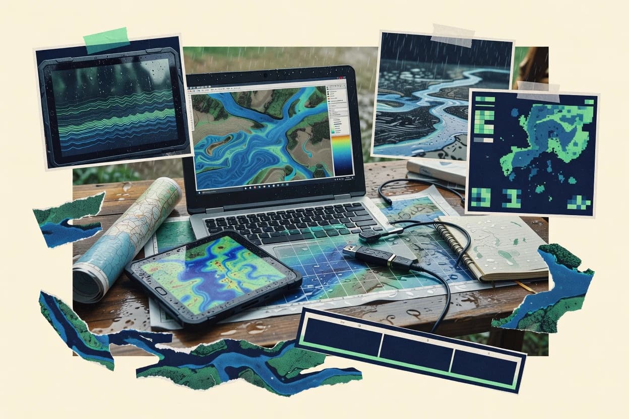
Emergency DisasterTop 10 Best Flood Simulation Software of 2026
Top 10 Flood Simulation Software picks ranked by flood modeling accuracy and speed. Compare options like FLO-2D, TUFLOW, Delft3D-FLOW.

How we ranked these tools
Core product claims cross-referenced against official documentation, changelogs, and independent technical reviews.
Analyzed video reviews and hundreds of written evaluations to capture real-world user experiences with each tool.
AI persona simulations modeled how different user types would experience each tool across common use cases and workflows.
Final rankings reviewed and approved by our editorial team with authority to override AI-generated scores based on domain expertise.
Score: Features 40% · Ease 30% · Value 30%
Gitnux may earn a commission through links on this page — this does not influence rankings. Editorial policy
Editor’s top 3 picks
Three quick recommendations before you dive into the full comparison below — each one leads on a different dimension.
FLO-2D
FLO-2D 2D shallow-water engine for grid-based flood routing and inundation mapping
Built for engineering teams needing physics-driven 2D flood inundation simulations.
TUFLOW
Editor pickCoupled 2D shallow water modeling producing time-stepped inundation hydraulics
Built for engineering teams building calibrated, GIS-based flood inundation simulations.
Delft3D-FLOW
Editor pickFully 2D and 3D unstructured-grid hydrodynamics for inundation and velocity simulation
Built for specialist teams modeling high-detail riverine and coastal flood hydrodynamics.
Related reading
Comparison Table
This comparison table evaluates flood simulation software used for hydraulic and hydrologic modeling across real-world study types, including dam breaks, overland flow, river flooding, and urban drainage. It summarizes key capabilities for FLO-2D, TUFLOW, Delft3D-FLOW, CityCAT, and the Stormwater Management Model, with focus on model scope, input requirements, output types, and typical use cases. Readers can quickly match tool strengths to modeling goals such as 1D-2D coupling, surface-groundwater considerations, and scenario analysis workflows.
FLO-2D
hydrodynamic modelingTwo-dimensional hydraulic flood modeling for overland flow and levee overtopping with GIS-based scenario setup and calibration tools.
FLO-2D 2D shallow-water engine for grid-based flood routing and inundation mapping
FLO-2D focuses on operational flood and debris flow modeling with a physics-based engine for overland flow and channelized hydraulics. The software supports detailed terrain inputs, hydraulic structures, and boundary conditions to produce spatially distributed flood depth, velocity, and inundation extents.
Preprocessing and postprocessing tools help convert GIS-derived topography into model-ready grids and visualize results for engineering and emergency planning workflows. Integration of hazard outputs supports scenario comparison for floods driven by rainfall, dam breaks, or levee and channel scenarios.
- +Physics-based 2D shallow-water modeling for realistic flood depth and velocity outputs
- +Strong support for terrain-based gridded simulations using GIS-derived elevation data
- +Modeling tools for hydraulic structures and boundary condition setup
- +Scenario testing workflow for comparing inundation impacts across different assumptions
- –Large, high-resolution grids can increase setup and runtime effort
- –Result interpretation can require hydraulic modeling expertise
- –More complex debris flow and structure setups add configuration burden
Best for: Engineering teams needing physics-driven 2D flood inundation simulations
More related reading
TUFLOW
2D flood engineHigh-performance 2D and 1D/2D flood modeling for surface-water dynamics with detailed raster and mesh-ready GIS inputs.
Coupled 2D shallow water modeling producing time-stepped inundation hydraulics
TUFLOW distinguishes itself with a strong depth-averaged hydrodynamic modeling focus for flood and stormwater scenarios. It supports integrated 2D surface flow and detailed boundary condition handling for realistic inundation mapping.
The workflow is built around preparing GIS-referenced inputs and running grid-based simulations to produce time-varying water levels, velocities, and extents. Outputs are tailored for flood risk analysis and engineering reporting with spatially consistent results across complex terrain.
- +Robust 2D depth-averaged flood modeling on irregular terrain grids
- +GIS-driven setup streamlines geometry, land surface, and boundary input
- +Time-varying outputs enable clear inundation extent and timing analysis
- +Strong support for storm surge and rainfall-driven flood simulations
- +Detailed hydraulic results support engineering design and risk studies
- –Model stability and calibration can require significant parameter tuning
- –Large domains increase computational load and runtime requirements
- –Complex workflows demand trained specialists for reliable setup
Best for: Engineering teams building calibrated, GIS-based flood inundation simulations
Delft3D-FLOW
hydrodynamic suiteOpen, process-based hydrodynamic modeling that simulates storm surge, waves, and flood behavior in coastal and river settings.
Fully 2D and 3D unstructured-grid hydrodynamics for inundation and velocity simulation
Delft3D-FLOW stands out with coupled 2D and 3D hydrodynamic modeling for coastal, riverine, and estuarine flood scenarios. It supports unstructured grids, complex geometries, and depth-averaged or layered flow formulations for detailed inundation studies.
The software includes robust boundary condition handling for tides, discharges, and water levels, which supports scenario-based flood simulation workflows. Integrated transport and water quality modules can extend flood modeling to sediment and contaminant behavior during extreme events.
- +Unstructured grid engine captures complex shorelines and urban embankments
- +2D and 3D depth layers support detailed flood depth and velocity outputs
- +Strong boundary condition support for tides, discharges, and stage time series
- +Hydrodynamics foundation integrates with sediment and transport simulations
- –Setup and calibration require strong numerical modeling expertise
- –Large domains can demand substantial compute and storage resources
- –Workflow complexity increases when coupling multiple physical processes
- –Visualization and reporting depend on external post-processing steps
Best for: Specialist teams modeling high-detail riverine and coastal flood hydrodynamics
CityCAT
urban flood modelingUrban flood modeling software that supports gridded terrain, drainage network inputs, and scenario-based flood extent outputs.
Flood inundation mapping workflow built around scenario comparisons and geospatial inputs
CityCAT stands out for focused flood-hazard modeling in built environments with an emphasis on practical study workflows. The tool supports hydraulic simulation setup for flood inundation mapping and scenario comparisons. CityCAT also integrates supporting geospatial inputs so results can be reviewed in a map-centric way.
- +Scenario-based flood inundation modeling for repeatable study comparisons
- +Map-centric geospatial workflow for result review and interpretation
- +Supports detailed hydraulic model setup for defensible flood assessments
- –Narrower scope than general-purpose hydrodynamic modeling suites
- –Requires strong GIS and modeling setup skills for reliable inputs
- –Less suited for fully automated multi-basin batch studies
Best for: Teams producing flood inundation maps with scenario-driven hydraulic modeling
Stormwater Management Model
runoff modelingWatershed-scale rainfall-runoff and flood response modeling that estimates flows and runoff for storm and drainage assessments.
Stormwater network routing with connected subcatchments, conduits, channels, and storage units
Stormwater Management Model is a hydrologic and hydraulic modeling tool from EPA for simulating stormwater runoff and open-channel flow. It supports design storm precipitation inputs and routes flow through drainage systems using event-based and continuous-style modeling approaches.
The model helps predict flood impacts through linked subcatchments, culverts, channels, and storage components. It also produces outputs suitable for stormwater planning and compliance-oriented analyses.
- +EPA-origin engine supports integrated rainfall-runoff and routing calculations
- +Subcatchment, conduit, and storage components map drainage networks effectively
- +Design-storm modeling supports engineering-focused flood scenario evaluation
- –Model setup and parameter calibration can be time-consuming
- –Complex networks require careful selection of routing and boundary conditions
- –Output interpretation demands hydraulic and hydrologic expertise
Best for: Teams modeling stormwater flooding using drainage-network simulations and scenario outputs
Floodlight
flood intelligenceWeb-based flood risk platform that overlays model outputs and real-time data to support emergency planning and response.
Scenario modeling with map outputs for depth and inundation extent
Floodlight distinguishes itself with flood and inundation modeling built around a user-driven workflow rather than a code-first pipeline. Core capabilities include defining flood scenarios, generating depth and extent outputs, and visualizing results on maps.
It supports working with external datasets for terrain, water levels, or hazard inputs to drive simulations for risk analysis and planning. Outputs are packaged for stakeholder review with shareable visual summaries of inundation impacts.
- +Interactive scenario setup for flood extents and inundation depth outputs
- +Map-based visualization for quickly validating model results
- +Scenario-driven outputs support planning and stakeholder communication
- –Limited evidence of advanced hydrodynamic configuration controls
- –Model accuracy depends heavily on input data quality and resolution
- –Workflow can be less flexible for highly customized simulation logic
Best for: Teams producing map-based flood impact scenarios for planning and communication
MIKE Flood
2D hydraulicsFlood simulation software for hydraulic and inundation modeling built around DHI’s MIKE ecosystem workflows.
Coupled 1D 2D hydrodynamic simulation for river-to-floodplain inundation behavior
MIKE Flood stands out as part of the MIKE Powered by DHI family built for operational flood modeling and scenario work. It supports 1D, 2D, and linked hydrodynamic simulations for river, coastal, and overland flooding workflows.
The tool manages complex terrain and boundary conditions to produce spatially resolved water levels, depths, and extents. MIKE Flood also enables result post-processing for map-based outputs that support planning and response decisions.
- +Integrated 1D and 2D modeling for realistic floodplain hydraulics
- +Strong support for varied boundary conditions and complex channel networks
- +Detailed water depth and inundation mapping for decision-ready outputs
- +Uses geospatial terrain inputs for physically consistent simulations
- –Model setup can be time-consuming for large study areas
- –Mesh and parameter tuning often require specialist hydraulic knowledge
- –Results configuration and export workflows can feel complex
Best for: Flood modeling teams needing linked hydrodynamics and mapped inundation results
Deltares Delft3D
multiphysicsNumerical modeling software for coastal and river hydrodynamics that can support storm surge and flood response simulations.
Integrated 2D and 3D flow modeling with advanced morphology and structure representations
Delft3D from Deltares combines hydrodynamics, water quality, and morphology in one integrated modeling suite for coastal, river, and delta flood studies. It supports flexible grids and boundary conditions across complex coastlines, channels, and floodplains using 2D and 3D formulations.
Flood simulations can include wind and wave forcing, sediment transport, and structures such as gates and weirs. Model workflows emphasize calibration and scenario analysis tied to measurable environmental inputs and outputs.
- +Strong 2D and 3D hydrodynamics for rivers, coasts, and deltas.
- +Built-in coupling options for waves, sediment transport, and water quality.
- +Handles complex boundaries with flexible grid generation and refinement.
- +Supports structures like weirs, culverts, and gates within simulations.
- –High setup and calibration effort for accurate floodplain representation.
- –Runs and workflows can require specialized domain expertise and hardware planning.
- –Complex projects can be difficult to validate across multiple gauges.
Best for: Hydrodynamics-focused flood modeling teams needing high-fidelity scenario simulations
InfoWorks ICM
catchment modelingIntegrated catchment and hydraulic modeling used to simulate rainfall-runoff processes and flood impacts for planning and response.
Seamless 1D and 2D coupling for realistic flood routing and inundation mapping
InfoWorks ICM stands out for coupling hydrodynamic flood modeling with GIS-driven catchment setup and fast scenario reruns. It supports 1D and 2D hydraulic modeling to simulate overland flow, channel conveyance, and inundation extents from rainfall or boundary conditions.
The workflow emphasizes building networks, defining structures and controls, and validating results using observed water levels or discharge points. It is well suited for flood hazard mapping and operational studies where consistent model governance and repeatable simulation runs matter.
- +Integrated 1D and 2D modeling for channels and floodplains
- +GIS-based model setup accelerates catchment geometry and parameter updates
- +Structure and control modeling supports culverts, weirs, and gates
- +Automated scenario runs support comparative flood assessments
- –Model building can be time-intensive for very large domains
- –Calibration accuracy depends on dense gauge data and careful parameterization
- –High-resolution 2D meshes increase compute time for many scenarios
- –Complex networks can require specialized configuration expertise
Best for: Flood modeling teams creating repeatable 1D-2D hazard scenarios with GIS workflows
FloodMap
GIS mappingGeospatial flood modeling and visualization solution that supports inundation mapping and emergency communications.
Interactive flood scenario mapping that visualizes modeled impacts for chosen locations
FloodMap stands out for turning flood risk into map-based simulations focused on real-world locations. The tool supports scenario setup and visual outputs that help users compare flood impacts across selected areas. Its core workflow centers on importing or selecting geography and running flood-related modeling results that can be explored interactively on the map.
- +Location-first workflow that ties simulations to real places on the map
- +Interactive map visualization for exploring modeled flood impacts
- +Scenario-based outputs that help compare results across areas
- –Fewer advanced modeling controls than engineering-grade flood tools
- –Limited evidence of deep customization for complex hydrodynamic workflows
- –Workflow can feel constrained for users needing extensive parameter tuning
Best for: Teams needing quick, map-driven flood scenario visualization for planning decisions
How to Choose the Right Flood Simulation Software
This buyer’s guide covers FLO-2D, TUFLOW, Delft3D-FLOW, CityCAT, Stormwater Management Model, Floodlight, MIKE Flood, Deltares Delft3D, InfoWorks ICM, and FloodMap. The guide maps these tools to the modeling work they do best, including 2D physics-based routing in FLO-2D, time-stepped GIS-driven flood hydraulics in TUFLOW, and fully coupled 1D to 2D river-to-floodplain workflows in MIKE Flood. It also highlights the tradeoffs that affect setup effort, calibration complexity, and runtime for large domains.
What Is Flood Simulation Software?
Flood simulation software models how water moves across landscapes and through drainage networks during rainfall, storm surge, river discharge, dam breaks, and levee overtopping scenarios. These tools produce spatial outputs such as flood depth, velocity, and inundation extent, often using terrain inputs derived from GIS data. Engineering and emergency planning teams use them to test scenarios, compare impacts, and produce map-ready hazard results for defensible flood assessments. Examples include FLO-2D for physics-driven 2D shallow-water inundation mapping and Floodlight for scenario-based depth and extent outputs in a map-centric workflow.
Key Features to Look For
The strongest flood simulation results depend on matching hydrodynamic depth and domain geometry handling to the scenario physics and the team’s calibration workflow needs.
2D shallow-water physics for grid-based flood routing
FLO-2D uses a 2D shallow-water engine to route water on grids and generate spatially distributed flood depth and velocity for inundation mapping. TUFLOW also focuses on depth-averaged hydrodynamics for irregular terrain grids, but FLO-2D’s physics-driven 2D routing is a stronger fit for teams focused on realistic grid-based inundation hydraulics.
Coupled time-stepped inundation hydraulics
TUFLOW produces time-stepped inundation hydraulics with water levels, velocities, and extents for timing-focused flood risk analysis. MIKE Flood similarly supports coupled 1D and 2D hydrodynamic simulation to produce mapped inundation behavior that evolves across river-to-floodplain transitions.
Unstructured-grid 2D and 3D hydrodynamics
Delft3D-FLOW supports fully 2D and 3D unstructured-grid hydrodynamics to resolve inundation and velocity over complex coastal and river geometries. Deltares Delft3D extends this approach with integrated morphology and the ability to include wind and wave forcing alongside flood simulations for higher-fidelity coastal and delta behavior.
GIS-based scenario setup and calibration workflows
FLO-2D emphasizes GIS-derived elevation inputs and includes preprocessing and postprocessing to convert terrain data into model-ready grids. TUFLOW is built around GIS-referenced preparation of geometry, land surface, and boundary inputs to support calibrated, GIS-driven flood inundation simulations.
Hydraulic structures and network controls
FLO-2D includes modeling tools for hydraulic structures and boundary conditions, and Stormwater Management Model maps drainage networks into subcatchments, conduits, channels, and storage components. MIKE Flood supports varied boundary conditions and complex channel networks, and InfoWorks ICM supports structure and control modeling for culverts, weirs, and gates.
Map-centric scenario comparison and stakeholder-ready outputs
CityCAT centers on scenario-based flood inundation mapping with map-centric geospatial workflows for repeatable comparisons. Floodlight and FloodMap both deliver interactive map outputs for depth and inundation extent, with Floodlight designed for user-driven scenario modeling and FloodMap centered on location-first exploration of modeled impacts.
How to Choose the Right Flood Simulation Software
Selecting flood simulation software should start with the scenario physics and the required output type, then match the tool to the calibration effort the team can execute.
Match the physics depth to the scenario type
For physics-driven 2D overland inundation mapping on terrain grids, FLO-2D is built around a 2D shallow-water engine that produces depth and velocity outputs for inundation extents. For depth-averaged flood and stormwater dynamics on irregular terrain grids, TUFLOW is designed around coupled 2D shallow water modeling that delivers time-stepped inundation hydraulics.
Choose the grid and dimensionality approach needed for your geography
Use Delft3D-FLOW when complex coastlines, shorelines, and urban embankments require unstructured-grid 2D and 3D hydrodynamics with layered depth formulations. Use Deltares Delft3D when coastal or delta flood studies require integrated wind and wave forcing plus optional sediment, transport, and morphology coupling.
Decide whether the workflow needs 1D-to-2D coupling
For river-to-floodplain behavior where channel conveyance and overland inundation must be linked, MIKE Flood provides coupled 1D and 2D hydrodynamic simulation. For repeatable GIS-governed hazard scenario runs that blend channels and floodplains, InfoWorks ICM also supports seamless 1D and 2D coupling with GIS-driven catchment setup.
Confirm the tool can represent your drainage network or hydraulic structures
If the flood problem depends on connected subcatchments and drainage network components, Stormwater Management Model supports routing through subcatchments, conduits, channels, and storage units. If structures like culverts, weirs, and gates are central to flood outcomes, InfoWorks ICM supports structure and control modeling, and FLO-2D includes hydraulic structure setup tools.
Pick based on output delivery and scenario comparison needs
If the work requires map-centric, scenario-driven flood extent outputs for defensible assessments, CityCAT provides a scenario comparison workflow tied to geospatial inputs. If the deliverable emphasizes interactive stakeholder exploration of depth and inundation extent, Floodlight and FloodMap focus on map-based scenario outputs rather than engineering-grade configuration depth.
Who Needs Flood Simulation Software?
Flood simulation software is selected by teams that need repeatable scenario testing, defensible inundation mapping, or high-fidelity hydrodynamic simulation for flood planning and emergency response.
Engineering teams needing physics-driven 2D flood inundation simulations
FLO-2D is the best match for engineering teams that require a 2D shallow-water engine producing spatially distributed flood depth, velocity, and inundation mapping. FLO-2D also supports terrain-based gridded simulations using GIS-derived elevation inputs, which aligns with operations that depend on accurate topography-to-grid translation.
Engineering teams building calibrated, GIS-based flood inundation simulations
TUFLOW suits teams that build calibrated GIS-driven flood inundation models because it supports robust 2D depth-averaged modeling on irregular terrain grids with GIS-referenced setup. TUFLOW’s time-varying outputs for water levels, velocities, and extents align with scenario comparisons driven by rainfall and storm surge.
Specialist teams modeling high-detail riverine and coastal flood hydrodynamics
Delft3D-FLOW is built for specialist work that needs fully 2D and 3D unstructured-grid hydrodynamics with strong boundary condition handling for tides and discharges. Deltares Delft3D fits when additional forcing such as wind and wave, plus morphology and structure representations, must be included within the same simulation workflow.
Teams producing map-based flood impact scenarios for planning and communication
Floodlight and FloodMap match planning and communication workflows by delivering interactive map visualizations of modeled depth and inundation extent tied to scenario selection. CityCAT fits map-centric hazard mapping teams that need scenario comparisons with geospatial inputs and repeatable inundation mapping outputs.
Common Mistakes to Avoid
Common failures come from mismatching scenario physics to dimensionality, underestimating calibration and parameter tuning effort, and overextending simplified workflows into highly customized hydrodynamics.
Underestimating runtime and setup burden from large high-resolution grids
FLO-2D and TUFLOW both increase setup and runtime effort when large, high-resolution domains are used, which can slow scenario iteration. MIKE Flood and InfoWorks ICM also add compute time when high-resolution 2D meshes are used across many scenarios.
Using a map-centric scenario tool for engineering-grade hydrodynamic customization
Floodlight and FloodMap prioritize user-driven scenario modeling and interactive map outputs, and Floodlight shows limited evidence of advanced hydrodynamic configuration controls. For engineering-grade physics and calibration depth, FLO-2D, TUFLOW, MIKE Flood, and Delft3D-FLOW provide the modeling controls required for complex hydraulics and boundary condition handling.
Skipping specialist calibration work for unstructured-grid 2D and 3D models
Delft3D-FLOW and Deltares Delft3D require strong numerical modeling expertise and substantial compute and storage planning for large domains. Running these models without dedicated calibration focus increases workflow complexity, especially when multiple physical processes are coupled.
Ignoring drainage network connectivity and structure controls in stormwater flooding problems
Stormwater Management Model is built to route flow through connected subcatchments, conduits, channels, and storage components, so skipping these network elements breaks routing fidelity. InfoWorks ICM and FLO-2D both include structure and control modeling capabilities, so replacing these controls with generic boundaries often produces misleading inundation behavior.
How We Selected and Ranked These Tools
we evaluated every tool on three sub-dimensions that directly reflect how flood simulation projects succeed: features, ease of use, and value. Features carry weight 0.40, ease of use carries weight 0.30, and value carries weight 0.30. The overall score is computed as overall = 0.40 × features + 0.30 × ease of use + 0.30 × value. FLO-2D separated from lower-ranked tools primarily through features strength in a 2D shallow-water engine that provides grid-based flood routing and inundation mapping with terrain-based GIS inputs.
Frequently Asked Questions About Flood Simulation Software
Which flood simulation tool is best for physics-driven 2D inundation mapping on structured grids?
When should a team choose TUFLOW over FLO-2D for calibrated, GIS-referenced flood simulations?
What tool is suited for coastal or estuarine flood studies that require coupled 2D and 3D modeling?
Which option covers flood modeling with morphology and structures like gates and weirs in a single suite?
Which software is best for built-environment flood-hazard mapping with scenario comparisons?
How do InfoWorks ICM and MIKE Flood differ for operational flood modeling workflows and repeatable scenario runs?
Which tool is tailored for stormwater drainage-network flood simulation using subcatchments and storage units?
What software supports stakeholder-friendly, map-based flood impact visualization from scenario inputs?
Which tool enables interactive flood scenario exploration tied to real-world locations without a heavy GIS workflow?
Which software choice reduces modeling friction when coupling channels with overland flooding in a single study?
Conclusion
After evaluating 10 emergency disaster, FLO-2D stands out as our overall top pick — it scored highest across our combined criteria of features, ease of use, and value, which is why it sits at #1 in the rankings above.
Use the comparison table and detailed reviews above to validate the fit against your own requirements before committing to a tool.
Tools reviewed
Primary sources checked during evaluation.
Referenced in the comparison table and product reviews above.
Keep exploring
Comparing two specific tools?
Software Alternatives
See head-to-head software comparisons with feature breakdowns, pricing, and our recommendation for each use case.
Explore software alternatives→In this category
Emergency Disaster alternatives
See side-by-side comparisons of emergency disaster tools and pick the right one for your stack.
Compare emergency disaster tools→FOR SOFTWARE VENDORS
Not on this list? Let’s fix that.
Our best-of pages are how many teams discover and compare tools in this space. If you think your product belongs in this lineup, we’d like to hear from you—we’ll walk you through fit and what an editorial entry looks like.
Apply for a ListingWHAT THIS INCLUDES
Where buyers compare
Readers come to these pages to shortlist software—your product shows up in that moment, not in a random sidebar.
Editorial write-up
We describe your product in our own words and check the facts before anything goes live.
On-page brand presence
You appear in the roundup the same way as other tools we cover: name, positioning, and a clear next step for readers who want to learn more.
Kept up to date
We refresh lists on a regular rhythm so the category page stays useful as products and pricing change.