GITNUXSOFTWARE ADVICE
Telecommunications ConnectivityTop 10 Best Fleet Mapping Software of 2026
Top 10 Fleet Mapping Software for 2026. Compare Fleet Complete, Samsara, and Verizon Connect to find the best fit for fleet teams.

How we ranked these tools
Core product claims cross-referenced against official documentation, changelogs, and independent technical reviews.
Analyzed video reviews and hundreds of written evaluations to capture real-world user experiences with each tool.
AI persona simulations modeled how different user types would experience each tool across common use cases and workflows.
Final rankings reviewed and approved by our editorial team with authority to override AI-generated scores based on domain expertise.
Score: Features 40% · Ease 30% · Value 30%
Gitnux may earn a commission through links on this page — this does not influence rankings. Editorial policy
Editor’s top 3 picks
Three quick recommendations before you dive into the full comparison below — each one leads on a different dimension.
Fleet Complete
Configurable geofences with automated alerts for route compliance and yard or site access
Built for operations teams needing live fleet visibility, alerts, and analytics.
Samsara
Editor pickSafety event detection with dashcam footage linked to tracked vehicle location
Built for mid-size fleets needing live mapping plus safety video event correlation.
Verizon Connect
Editor pickGeofencing and automated alerts linked to live fleet location tracking
Built for dispatch teams needing live maps, routing, and geofence alerts for fleets.
Related reading
Comparison Table
This comparison table evaluates fleet mapping software used to track vehicles, visualize locations, and support routing and dispatch workflows across common commercial fleets. It compares platforms such as Fleet Complete, Samsara, Verizon Connect, Geotab, and Omnitracs on core capabilities, deployment approach, and how each system handles map-based operations. Readers can use the side-by-side view to match tool features to operational needs like real-time tracking, driver workflows, and telematics integration.
Fleet Complete
integrated fleet platformProvides GPS fleet tracking with mapping, dispatch and routing, and driver and vehicle telemetry for telecom connectivity use cases.
Configurable geofences with automated alerts for route compliance and yard or site access
Fleet Complete stands out with a dedicated connected-fleet ecosystem built for real-time fleet tracking and driver-focused operations. It delivers map-based live vehicle visibility, configurable alerts, and driver behavior insights from telematics data.
Built-in workflows support dispatch-style monitoring and exception handling so operations teams can react quickly. Reporting and analytics convert movement and performance history into actionable fleet KPIs.
- +Real-time map tracking with status updates across large vehicle fleets
- +Configurable geofences with event alerts for location and route exceptions
- +Driver behavior insights from telematics signals for safer operations
- +Operational dashboards support dispatch-style monitoring and exception management
- +Historical reporting turns route and performance data into fleet KPIs
- –Setup requires careful data integration and rules configuration
- –Advanced workflows can feel complex without operational templates
- –User interface complexity increases with multi-department fleet management
- –Some insights depend on telematics device coverage and signal quality
Best for: Operations teams needing live fleet visibility, alerts, and analytics
Samsara
connected fleet SaaSDelivers real-time fleet tracking dashboards with mapping, geofencing, and connectivity management for vehicle and asset operations.
Safety event detection with dashcam footage linked to tracked vehicle location
Samsara stands out for pairing real-time fleet location intelligence with dashcam and safety event context in one system. Fleet mapping is backed by live vehicle tracking, geofencing, and route visibility that shows where assets travel and when exceptions occur.
Operations teams can manage compliance workflows and respond to incidents using recorded footage tied to telemetry events. The platform also supports multi-site deployments with centralized dashboards for day-to-day monitoring and performance review.
- +Live vehicle tracking with map-based route visibility for continuous situational awareness
- +Geofencing alerts help enforce service areas and automate exception handling
- +Dashcam and safety events link video evidence to location and telemetry
- +Centralized dashboards support multi-location fleet monitoring
- +Workflow tools help convert events into actionable operational tasks
- –Map views can feel dense without disciplined filter use
- –Advanced configuration can take time for large, complex fleets
- –Video event context depends on device coverage and installation quality
- –Some teams may need extra training to interpret telemetry signals
Best for: Mid-size fleets needing live mapping plus safety video event correlation
Verizon Connect
fleet managementOffers fleet management with live vehicle maps, route history, driver behavior insights, and connectivity options for telecom-linked deployments.
Geofencing and automated alerts linked to live fleet location tracking
Verizon Connect stands out for fleet-wide mapping tied to live vehicle visibility and location intelligence. The platform supports route planning, turn-by-turn navigation for drivers, and route optimization workflows for field operations. Fleet mapping is paired with alerts, geofencing, and progress tracking to reduce downtime and improve dispatch awareness.
- +Real-time vehicle locations across mapped fleet areas
- +Route planning and navigation support for day-to-day operations
- +Geofencing and automated alerts for location-based events
- +Dispatch-friendly progress tracking to monitor job movement
- –Workflow complexity can require setup across multiple modules
- –Mapping views may need tuning to match specific dispatch processes
- –Custom reporting can be limiting without deeper configuration
- –Data export workflows can feel indirect for quick analysis
Best for: Dispatch teams needing live maps, routing, and geofence alerts for fleets
Geotab
telematics and APIsProvides telematics and fleet tracking with map-based visibility, customizable dashboards, and an ecosystem for connectivity and device integration.
Geotab I/O uses a data exchange layer for integrating telematics with custom systems
Geotab stands out with its vehicle telematics powered by hardware integrations and a centralized fleet data platform. Fleet Mapping capabilities focus on visualizing fleet locations, managing routes and stops, and monitoring operational events across large vehicle populations.
The platform supports custom reporting and rules-based alerts using collected data such as engine diagnostics, driving behavior, and asset status. Its ecosystem approach enables integration with dispatch workflows and external systems for fleet-wide visibility and ongoing optimization.
- +Strong vehicle telematics using compatible hardware for rich location and diagnostics data
- +Fleet location mapping supports layered views for vehicles, assets, and events
- +Custom reports and rule-based alerts enable operational monitoring at scale
- +Integration options support connecting fleet data to other business systems
- –Hardware and installation requirements can slow time-to-deployment
- –Mapping setup and report building require admin discipline and data governance
- –Advanced workflows depend on configuration and rules quality
- –Usability varies across roles due to dashboard and permission complexity
Best for: Teams needing hardware-backed mapping, diagnostics, and rule-driven fleet monitoring
Omnitracs
logistics fleet platformDelivers fleet tracking and routing with logistics visibility on maps for commercial vehicle operations that rely on network connectivity.
Geofence and event monitoring layered over live route and stop tracking
Omnitracs stands out for trucking-focused fleet mapping with route intelligence tied to dispatch and driver execution workflows. Fleet users can visualize vehicle locations on maps and combine live tracking with operational context like stops and planned routes.
The platform supports performance visibility through data feeds that help teams monitor activity, adherence, and geography-based events. Geographic views are designed to support day-to-day fleet management rather than standalone map display.
- +Live vehicle location mapping built for transportation operations
- +Route and stop context improves situational awareness on maps
- +Geofence and event-driven visibility supports proactive operations
- +Workflow alignment with dispatch and driver execution data
- –Mapping features may be less flexible than general-purpose GIS tools
- –Advanced configuration can require specialized implementation support
- –Reporting workflows can feel constrained for highly custom analytics
- –Non-trucking use cases may not map cleanly to product assumptions
Best for: Trucking fleets needing map-based visibility tied to dispatch execution
Fleetio
fleet management suiteCombines fleet management workflows with mapping-style location visibility and integrations for telecom-connected vehicles.
Asset-level map views connected to maintenance history and scheduled work orders
Fleetio stands out with field-ready fleet maintenance and asset tracking tied directly to map views. It supports centralized vehicle and equipment management with location data, work orders, and service schedules that stay linked to each asset. Fleet mapping is used for visualizing where assets are and for organizing maintenance workflows around that operational context.
- +Map-based visibility for fleet location and asset context
- +Work order tracking tied to specific vehicles and equipment
- +Service schedules and maintenance history per tracked asset
- +Bulk asset and location management to keep data consistent
- –Geospatial capabilities focus on fleet assets, not deep GIS analysis
- –Advanced routing and turn-by-turn navigation are not the primary focus
Best for: Operations teams needing maintenance tracking tied to visual fleet location
TruckSpy
tracking and routingProvides fleet tracking with live maps, route tracking, and device connectivity options for asset and vehicle monitoring.
Geofence and speeding alerts integrated directly into live fleet visibility
TruckSpy stands out by focusing on fleet visibility through real-time GPS tracking and live route monitoring. The core dashboard shows driver locations, vehicle status, and trip history in a map-based interface for operational oversight.
It also supports alerts for events like geofence entries and speeding thresholds to help teams react quickly. The tool is designed for mapping workflows that need consistent track-and-trace reporting across multiple assets.
- +Live GPS tracking with map view for vehicles and drivers
- +Geofence and speeding alerts for faster operational response
- +Trip history supports reviewing movement patterns over time
- +Clear fleet dashboard improves daily dispatch visibility
- –Reporting depth can feel limited for complex analytics needs
- –Geofence management may require careful setup for best results
- –Customization options may not match highly bespoke fleet workflows
Best for: Dispatch and operations teams needing map-based fleet tracking and alerting
Track-POD
delivery trackingSupports delivery and fleet tracking with map-based visibility and connectivity-linked tracking for field operations.
Pod-level delivery tracking displayed directly on an interactive route map
Track-POD focuses on fleet mapping driven by real delivery and route visibility, with locations plotted on an interactive map. The core workflow supports pickup and drop tracking, plus driver and asset location updates that help reduce dispatch guesswork.
Route monitoring and status tracking support operational oversight for deliveries and field teams. The platform emphasizes geographic clarity over general asset management, making it a targeted mapping solution for delivery operations.
- +Live map view for pods, routes, and field activity
- +Pickup and drop status tracking tied to geographic locations
- +Dispatch-friendly visibility for driver and delivery progress
- +Operational oversight centered on route monitoring
- –Primary focus on mapping may limit broader fleet administration
- –Reporting depth can feel limited for organizations needing heavy analytics
- –Advanced workflows outside route tracking may require external tooling
Best for: Delivery and dispatch teams needing pod-level mapping and route visibility
Zonar
connected fleetOffers fleet management with GPS tracking, route views, and driver and vehicle monitoring over managed connectivity networks.
Geofencing alerts tied to telematics events across fleet vehicles
Zonar stands out for combining fleet location tracking with driver-facing and dispatch-ready vehicle insights. The system uses telematics data to show live vehicle positions, support geofencing, and surface trip and utilization views.
Fleet teams can coordinate workflows through alerts and operational reports tied to vehicle activity. The platform is designed to help routing and safety operations stay aligned on one mapping interface.
- +Live vehicle tracking with map views for real-time fleet awareness
- +Geofencing alerts to trigger actions at defined locations
- +Telematics-based trip and utilization reporting for operational visibility
- +Driver and vehicle event alerts to reduce response delays
- +Operational dashboards that connect activity to fleet decisions
- –Mapping and reporting depth can feel complex for small fleets
- –Setup requires disciplined device and data configuration to stay accurate
- –Workflow outcomes depend heavily on well-tuned alert rules
- –Integrations may require additional IT work for custom processes
Best for: Operations teams needing telematics mapping, geofencing, and event-driven dispatch support
Teletrac Navman
telematics platformDelivers fleet tracking on interactive maps, driver and vehicle insights, and connectivity support for commercial fleets.
Geofencing with event-based alerts tied to real-time vehicle location
Teletrac Navman stands out with fleet mapping built around real-time vehicle tracking and dependable route awareness for dispatch and operations. The solution supports live location updates, historical playback, and map-based visualization that helps teams monitor driver activity and operational performance.
It also provides geofencing controls and alerting so field events and access boundaries can trigger automated attention. Fleet managers can use the platform to review trips and optimize workflows using location history rather than manual logs.
- +Real-time vehicle tracking on map with timely location updates
- +Historical route playback supports investigations and performance reviews
- +Geofencing alerts help enforce service zones and asset movement rules
- –Advanced reporting depth can require setup across data sources
- –Map-driven workflows may feel complex for small fleets
- –Integrations and configuration depend on accurate vehicle data quality
Best for: Fleet operations teams needing real-time mapping, alerts, and trip playback
How to Choose the Right Fleet Mapping Software
This buyer's guide explains how to select Fleet Mapping Software for live vehicle visibility, geofencing alerts, and dispatch-ready route awareness. It covers tools including Fleet Complete, Samsara, Verizon Connect, Geotab, Omnitracs, Fleetio, TruckSpy, Track-POD, Zonar, and Teletrac Navman. The guide connects key buying requirements to the specific capabilities and constraints of these platforms.
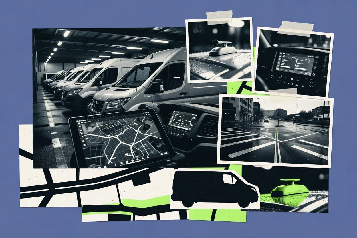
What Is Fleet Mapping Software?
Fleet Mapping Software displays live and historical vehicle or asset locations on interactive maps and turns movement into operational actions. It typically supports geofences, route and stop context, and event-driven alerts that help teams respond to location or behavior exceptions. Operations, dispatch, and fleet safety teams use it to reduce downtime, enforce service boundaries, and audit trip progress. Tools like Fleet Complete provide configurable geofences with automated alerts, while Samsara links safety event detection to dashcam footage tied to tracked vehicle location.
Key Features to Look For
The right fleet mapping tool depends on which operational outcomes matter most, such as compliant movement, safety evidence, or maintenance execution tied to where assets are.
Configurable geofences with automated event alerts
Fleet Complete provides configurable geofences with automated alerts for route compliance and yard or site access. Verizon Connect also uses geofencing and automated alerts linked to live fleet location tracking.
Safety event context tied to map telemetry
Samsara stands out by detecting safety events and linking dashcam footage to tracked vehicle location. Zonar also surfaces driver and vehicle event alerts on a telematics mapping interface for faster response.
Dispatch-ready live map visibility with route context
Verizon Connect supports real-time vehicle locations plus route planning, turn-by-turn navigation, and dispatch-friendly progress tracking. Omnitracs layers geofence and event monitoring over live route and stop tracking to match transportation workflows.
Hardware-backed telematics and diagnostics-driven mapping
Geotab focuses on vehicle telematics powered by compatible hardware integrations, which enables richer diagnostics and asset status mapping. Geotab also supports rule-based alerts using collected data such as engine diagnostics and driving behavior.
Asset-level mapping connected to maintenance execution
Fleetio connects asset-level map views to maintenance history and scheduled work orders so maintenance teams can act with location context. This tool also ties work order tracking directly to specific tracked vehicles and equipment.
Delivery and trip monitoring workflows mapped to geography
Track-POD emphasizes pod-level pickup and drop tracking displayed directly on an interactive route map. Teletrac Navman supports historical route playback plus geofencing with event-based alerts tied to real-time vehicle location.
How to Choose the Right Fleet Mapping Software
Selecting the right tool follows a simple sequence that starts with operational outcomes and ends with deployment constraints like configuration complexity and data integration needs.
Match the software to the operational job to be done
If the goal is live fleet visibility with automated compliance actions, Fleet Complete is built around map-based tracking, configurable geofences, and dispatch-style exception management. If the priority is safety investigations with video evidence tied to where events happened, Samsara links dashcam footage to tracked vehicle location and telemetry events.
Validate geofencing behavior for the boundaries that matter
For yard, site, and route compliance controls, Fleet Complete provides configurable geofences with automated alerts for route exceptions and site access. For dispatch-driven location enforcement, Verizon Connect also provides geofencing and automated alerts linked to live fleet location tracking.
Check whether the product aligns with how field teams plan and execute work
Verizon Connect supports route planning, turn-by-turn navigation, and progress tracking so dispatch teams can manage job movement on one live map view. Omnitracs is designed for trucking operations by combining live route and stop context with geofence and event monitoring.
Confirm the telematics and integration model fits current hardware and systems
Teams that rely on diagnostics and rule-driven monitoring benefit from Geotab, which uses hardware integrations and a data exchange layer via Geotab I/O for connecting telematics data to custom systems. If the operations stack needs mapping plus device connectivity and fleet insights, TruckSpy and Zonar both emphasize live GPS tracking and telematics event-driven alerts.
Align advanced workflows with the available setup discipline
Fleet Complete delivers strong operational dashboards and exception handling, but setup requires careful data integration and rules configuration for geofence automation. Geotab mapping setup and report building also require admin discipline and data governance, while Verizon Connect workflow complexity can require setup across multiple modules.
Who Needs Fleet Mapping Software?
Fleet mapping tools fit a range of operational roles from dispatch and safety to maintenance planning and delivery tracking.
Operations teams needing live fleet visibility, alerts, and analytics
Fleet Complete is the best fit when live map tracking, configurable geofences, and fleet KPI reporting drive daily dispatch actions. Verizon Connect also supports live maps, geofence alerts, and dispatch-friendly progress tracking for continuous operational awareness.
Mid-size fleets needing live mapping plus safety video event correlation
Samsara is built to pair real-time fleet location intelligence with dashcam and safety event context linked to tracked vehicle location. Zonar adds event-driven dispatch support by surfacing trip and utilization reporting tied to telematics alerts.
Dispatch teams needing live maps, routing, and geofence alerts
Verizon Connect aligns with dispatch workflows through route planning, turn-by-turn navigation, and dispatch-friendly progress tracking backed by geofencing alerts. TruckSpy also serves dispatch operations with live GPS tracking on maps plus geofence and speeding alerts integrated into day-to-day visibility.
Teams needing hardware-backed mapping, diagnostics, and rule-driven monitoring
Geotab fits organizations that want telematics diagnostics and rule-based alerts tied to fleet mapping at scale. Fleet Complete also works for rule-driven operations, but Geotab’s hardware integration model and Geotab I/O data exchange layer better support diagnostics-heavy monitoring.
Maintenance-focused operations needing asset location tied to work orders
Fleetio is designed around asset-level map views connected to maintenance history and scheduled work orders. This structure helps maintenance teams coordinate where assets are with what maintenance should happen next.
Delivery and dispatch teams needing pod-level route visibility
Track-POD targets delivery and dispatch with pod-level pickup and drop status tracking displayed directly on an interactive route map. Teletrac Navman adds historical playback plus geofencing with event-based alerts for investigation and enforcement in field operations.
Common Mistakes to Avoid
Several failure patterns appear across fleet mapping deployments when teams choose the tool without aligning configuration effort to operational rules and data sources.
Underestimating geofence and rule configuration effort
Fleet Complete provides automated geofence alerts for route compliance and site access, but setup requires careful data integration and rules configuration. Verizon Connect can also require disciplined setup across modules for geofence and workflow outcomes to operate consistently.
Expecting advanced reporting without strong data governance
Geotab delivers custom reporting and rule-based alerts, but mapping setup and report building require admin discipline and data governance. Verizon Connect custom reporting can feel limiting without deeper configuration, so complex analytics needs may need additional operational design.
Choosing a trucking-first tool for non-trucking workflows
Omnitracs is built around trucking-focused dispatch execution with live route and stop context and event monitoring. Non-trucking operations may not map cleanly to Omnitracs product assumptions, while Fleetio and Track-POD focus more directly on maintenance and delivery execution models.
Buying map visibility without verifying telematics event coverage
Samsara links video evidence to safety events tied to tracked vehicle location, and video context depends on dashcam installation quality and device coverage. Zonar and Teletrac Navman also depend on telematics data quality for alert accuracy, so weak device coverage can undermine location-based workflows.
How We Selected and Ranked These Tools
We evaluated each fleet mapping platform on three sub-dimensions. Features have a weight of 0.4 because they determine which operational outcomes like geofencing automation, dispatch visibility, safety context, and maintenance linkage are possible. Ease of use has a weight of 0.3 because multi-module setup and dashboard clarity directly impact daily adoption. Value has a weight of 0.3 because teams need mapping and alert workflows that translate into actionable operations rather than extra integration work. Fleet Complete separated itself through features that combine configurable geofences with automated alerts for route compliance and yard or site access while still supporting operational dashboards for dispatch-style exception management.
Frequently Asked Questions About Fleet Mapping Software
Which fleet mapping platforms combine live vehicle maps with geofencing alerts?
How do Fleet Complete and Samsara differ when safety incident evidence must be tied to location?
Which tool best supports dispatch workflows that require turn-by-turn routing and progress tracking?
What mapping and reporting capabilities help large fleets manage operational events beyond just locations?
Which platforms are strongest when vehicle tracking must integrate with external systems through a data layer or ecosystem?
Which options focus on asset or equipment management workflows connected to map views?
How do trucking-focused map views in Omnitracs compare with more general fleet mapping dashboards?
What tools support delivery-style pickup and drop monitoring with route or pod-level clarity on maps?
Which platforms help teams troubleshoot incidents using trip history and historical map playback?
What is a common starting workflow for teams evaluating geofence-driven operations using live maps?
Conclusion
After evaluating 10 telecommunications connectivity, Fleet Complete stands out as our overall top pick — it scored highest across our combined criteria of features, ease of use, and value, which is why it sits at #1 in the rankings above.
Use the comparison table and detailed reviews above to validate the fit against your own requirements before committing to a tool.
Tools reviewed
Primary sources checked during evaluation.
Referenced in the comparison table and product reviews above.
Keep exploring
Comparing two specific tools?
Software Alternatives
See head-to-head software comparisons with feature breakdowns, pricing, and our recommendation for each use case.
Explore software alternatives→In this category
Telecommunications Connectivity alternatives
See side-by-side comparisons of telecommunications connectivity tools and pick the right one for your stack.
Compare telecommunications connectivity tools→FOR SOFTWARE VENDORS
Not on this list? Let’s fix that.
Our best-of pages are how many teams discover and compare tools in this space. If you think your product belongs in this lineup, we’d like to hear from you—we’ll walk you through fit and what an editorial entry looks like.
Apply for a ListingWHAT THIS INCLUDES
Where buyers compare
Readers come to these pages to shortlist software—your product shows up in that moment, not in a random sidebar.
Editorial write-up
We describe your product in our own words and check the facts before anything goes live.
On-page brand presence
You appear in the roundup the same way as other tools we cover: name, positioning, and a clear next step for readers who want to learn more.
Kept up to date
We refresh lists on a regular rhythm so the category page stays useful as products and pricing change.