GITNUXSOFTWARE ADVICE
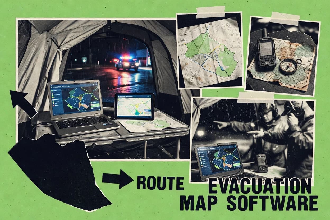
Emergency DisasterTop 10 Best Evacuation Map Software of 2026
Explore the Top 10 Evacuation Map Software options with a 2026 ranking comparison of OnSolve, Everbridge, and AlertMedia. Compare picks.

How we ranked these tools
Core product claims cross-referenced against official documentation, changelogs, and independent technical reviews.
Analyzed video reviews and hundreds of written evaluations to capture real-world user experiences with each tool.
AI persona simulations modeled how different user types would experience each tool across common use cases and workflows.
Final rankings reviewed and approved by our editorial team with authority to override AI-generated scores based on domain expertise.
Score: Features 40% · Ease 30% · Value 30%
Gitnux may earn a commission through links on this page — this does not influence rankings. Editorial policy
Editor’s top 3 picks
Three quick recommendations before you dive into the full comparison below — each one leads on a different dimension.
OnSolve
Location-based incident notifications that drive evacuation actions by map zone
Built for multi-site organizations needing map-driven evacuation guidance with coordinated alerting.
Everbridge
Geofenced, map-driven public alerting tied to incident response operations
Built for organizations running incident management workflows with geofenced evacuation communications.
AlertMedia
Trigger-based mass notifications with location targeting across SMS, voice, and digital channels
Built for safety teams needing fast evacuation notifications with strong delivery assurance.
Related reading
Comparison Table
This comparison table evaluates evacuation map software used for incident planning, live routing, and mass notification workflows across vendors such as OnSolve, Everbridge, AlertMedia, Blackboard Connect, and RapidSOS. Each row summarizes key capabilities, including map coverage and routing features, alert channel support, integration options, and operational requirements, so teams can match product behavior to deployment needs. Use the side-by-side view to compare how quickly locations and user groups can be updated during an evacuation event and how notifications are triggered at scale.
| # | Tool | Category | Overall | Features | Ease of Use | Value |
|---|---|---|---|---|---|---|
| 1 | OnSolve OnSolve provides emergency management and notification software that supports evacuation planning workflows and location-based alerts to employees and communities. | enterprise emergency | 9.3/10 | 9.2/10 | 9.6/10 | 9.1/10 |
| 2 | Everbridge Everbridge offers an emergency management platform with mass notification, incident coordination, and location-aware messaging for evacuation response scenarios. | enterprise incident | 9.0/10 | 9.1/10 | 9.0/10 | 8.8/10 |
| 3 | AlertMedia AlertMedia delivers critical communications and emergency alerting with contact management, escalation rules, and site-specific notification for evacuation actions. | mass notification | 8.6/10 | 8.7/10 | 8.5/10 | 8.7/10 |
| 4 | Blackboard Connect Blackboard Connect supports emergency notifications and communications for schools and public agencies with automated alerts and response workflows. | public alerting | 8.3/10 | 8.5/10 | 8.2/10 | 8.2/10 |
| 5 | RapidSOS RapidSOS aggregates data from connected devices and maps incident context to support faster emergency response that can inform evacuation decision-making. | data integration | 8.0/10 | 7.6/10 | 8.3/10 | 8.2/10 |
| 6 | Esri ArcGIS Esri ArcGIS provides configurable web maps and dashboards that enable publication of evacuation routes, shelters, and status indicators. | platform GIS | 7.7/10 | 7.8/10 | 7.6/10 | 7.6/10 |
| 7 | QGIS QGIS is an open-source desktop GIS tool used to design and publish evacuation map layers such as routes, hazard zones, and safe areas. | open-source GIS | 7.3/10 | 7.3/10 | 7.1/10 | 7.6/10 |
| 8 | OpenStreetMap OpenStreetMap supplies the underlying street and place data that evacuation map solutions use for route planning and shelter location mapping. | map data | 7.0/10 | 7.2/10 | 6.9/10 | 6.9/10 |
| 9 | Carto Carto enables geospatial visualization and hosted map layers for evacuation mapping use cases like shelter dashboards and route overlays. | location intelligence | 6.7/10 | 7.1/10 | 6.5/10 | 6.4/10 |
| 10 | Google Maps Platform Google Maps Platform supports routing and map rendering that evacuation map tools use to display evacuation routes and meeting points. | routing maps | 6.4/10 | 6.3/10 | 6.5/10 | 6.4/10 |
OnSolve provides emergency management and notification software that supports evacuation planning workflows and location-based alerts to employees and communities.
Everbridge offers an emergency management platform with mass notification, incident coordination, and location-aware messaging for evacuation response scenarios.
AlertMedia delivers critical communications and emergency alerting with contact management, escalation rules, and site-specific notification for evacuation actions.
Blackboard Connect supports emergency notifications and communications for schools and public agencies with automated alerts and response workflows.
RapidSOS aggregates data from connected devices and maps incident context to support faster emergency response that can inform evacuation decision-making.
Esri ArcGIS provides configurable web maps and dashboards that enable publication of evacuation routes, shelters, and status indicators.
QGIS is an open-source desktop GIS tool used to design and publish evacuation map layers such as routes, hazard zones, and safe areas.
OpenStreetMap supplies the underlying street and place data that evacuation map solutions use for route planning and shelter location mapping.
Carto enables geospatial visualization and hosted map layers for evacuation mapping use cases like shelter dashboards and route overlays.
Google Maps Platform supports routing and map rendering that evacuation map tools use to display evacuation routes and meeting points.
OnSolve
enterprise emergencyOnSolve provides emergency management and notification software that supports evacuation planning workflows and location-based alerts to employees and communities.
Location-based incident notifications that drive evacuation actions by map zone
OnSolve stands out for connecting evacuation planning to real-time alerting through its incident communications stack. It supports evacuation map creation and operational guidance that can be triggered during drills and emergencies. The workflow centers on coordinating notifications, responders, and locations so teams can follow predefined routes and instructions. Stronger use cases involve organizations managing multi-site facilities that need consistent, location-aware execution.
Pros
- Location-aware emergency messaging tied to evacuation zones
- Incident communication workflows align alerts with evacuation actions
- Supports drill and emergency operations from the same mapping structure
- Centralizes response coordination across multiple facilities
Cons
- Evacuation mapping setup can be complex for smaller sites
- Advanced routing logic depends on configuration and integrations
- Admin workflows require disciplined updates for changing layouts
- User experience for end navigators is less mapping-focused than some tools
Best For
Multi-site organizations needing map-driven evacuation guidance with coordinated alerting
Everbridge
enterprise incidentEverbridge offers an emergency management platform with mass notification, incident coordination, and location-aware messaging for evacuation response scenarios.
Geofenced, map-driven public alerting tied to incident response operations
Everbridge stands out for combining evacuation mapping with live public alerting and incident response workflows. The solution supports location-based messaging tied to map views so teams can coordinate actions by affected areas. It integrates alert distribution channels and operational dashboards to track response status during emergencies. Evacuation mapping capabilities focus on situational awareness for planners and operators coordinating under time pressure.
Pros
- Location-based alerts map to geofenced affected areas
- Operational dashboards support incident coordination and response tracking
- Multi-channel communications integrate with evacuation decision workflows
- Works with existing emergency operations planning processes
Cons
- Evacuation map configuration can require specialized operational setup
- Workflow tuning depends on disciplined incident data governance
- Map-centric workflows may feel heavy for small-scale events
Best For
Organizations running incident management workflows with geofenced evacuation communications
AlertMedia
mass notificationAlertMedia delivers critical communications and emergency alerting with contact management, escalation rules, and site-specific notification for evacuation actions.
Trigger-based mass notifications with location targeting across SMS, voice, and digital channels
AlertMedia stands out with rapid, automated mass notification workflows that connect directly to incident and safety communications. For evacuation map needs, it supports structured alert campaigns tied to location context and emergency events. It also integrates messaging delivery across SMS, voice, email, and mobile alerts for consistent instructions during evacuations. Admin workflows focus on triggering the right response quickly and auditing who received and engaged with alerts.
Pros
- Strong multi-channel emergency alert delivery for evacuation instructions
- Automation supports trigger-based messaging during active incidents
- Location-focused targeting helps deliver evacuation guidance to the right groups
- Usage and delivery reporting supports response auditing
Cons
- Evacuation map authoring is not the primary workflow focus
- Map creation and interactive wayfinding are limited versus dedicated GIS tools
- Complex building topology management can require external mapping processes
Best For
Safety teams needing fast evacuation notifications with strong delivery assurance
Blackboard Connect
public alertingBlackboard Connect supports emergency notifications and communications for schools and public agencies with automated alerts and response workflows.
Audience-targeted, automated emergency notification workflows across multiple communication channels
Blackboard Connect stands out by centering emergency notifications on automated outreach to large audiences. It supports message scheduling, audience targeting, and multi-channel delivery for time-critical alerts. Evacuation mapping is handled through integrating location and instructions into communications rather than providing interactive indoor maps inside the core product. Operational control is delivered through centralized admin workflows that coordinate updates during drills and incidents.
Pros
- Automated emergency messaging to targeted recipients
- Centralized administration for coordinated incident communications
- Multi-channel delivery for faster audience reach
- Scheduling supports planned drill and contingency alerts
Cons
- Evacuation mapping relies on message content more than interactive maps
- Limited evidence of advanced routing and real-time crowd guidance
- Field updates depend on operators preparing and sending alerts
- Geospatial views are not the primary product experience
Best For
Organizations needing reliable mass evacuation alerts and coordinated incident messaging
RapidSOS
data integrationRapidSOS aggregates data from connected devices and maps incident context to support faster emergency response that can inform evacuation decision-making.
Location verification and data enrichment from emergency calls and device sources
RapidSOS connects emergency calls and sensor feeds to responders through a RapidSOS incident platform built for faster, more complete context. The system supports location verification, device and data enrichment, and structured dispatch-ready information for incident coordination. For evacuation map use cases, it can help teams overlay verified incident location and impact details into operational workflows that support safer routing and timely evacuation decisions. The distinct value centers on data intake from multiple sources rather than purely map authoring.
Pros
- Verifies caller location using enriched data for dispatch-ready accuracy
- Ingests multi-source incident feeds to improve situational context
- Structures event information for operational routing and coordination
- Supports integration patterns used by emergency response workflows
Cons
- Evacuation map authoring tools are not its primary focus
- Map customization depends on downstream systems and integrations
- Operational outcomes depend on data availability and device reporting
- Less suited for organizations needing policy-based evacuation plan editing
Best For
Emergency response and operations teams needing enriched incident context for evacuation decisions
Esri ArcGIS
platform GISEsri ArcGIS provides configurable web maps and dashboards that enable publication of evacuation routes, shelters, and status indicators.
ArcGIS Web AppBuilder and ArcGIS Experience Builder for interactive evacuation mapping apps
Esri ArcGIS stands out for its mature GIS foundation and tight integration across web maps, dashboards, and data management. Evacuation mapping is supported through configurable web maps and apps that can visualize routes, hazard zones, and shelter locations from authoritative layers. ArcGIS also enables publishing and maintaining live scenario data with controlled edits, auditability, and role-based access across organizational teams. Analytics and visualization capabilities help turn spatial inputs into actionable views for operations planning and public communications.
Pros
- Strong GIS data model supports hazards, shelters, and route layers
- Web map and app framework enables interactive evacuation workflows
- Role-based access supports controlled sharing during incident operations
- Geoprocessing tools accelerate scenario building and spatial analysis
- Dashboards help monitor status across multiple locations
Cons
- Setup complexity rises with advanced workflows and enterprise deployment
- Public-facing app customization can require GIS and web development skills
- Real-time field updates need careful data design and publishing practices
- Organizations may need dedicated governance for authoritative layer management
Best For
Government and contractors building repeatable evacuation maps with strong GIS governance
QGIS
open-source GISQGIS is an open-source desktop GIS tool used to design and publish evacuation map layers such as routes, hazard zones, and safe areas.
Processing toolbox with network analysis and buffer tools for hazard impact and route coverage mapping
QGIS stands out for evacuation mapping that relies on local data control, from shapefiles to GeoPackage and CAD imports. It provides cartography tools for evacuation routes, shelter locations, and hazard overlays using symbology, labeling, and map layouts. Spatial analysis workflows support network routing, proximity checks, and buffer-based impact mapping to show which areas fall within hazard zones. Exports and map printing are built around publish-ready layouts and interoperable geospatial outputs suitable for field distribution and decision briefings.
Pros
- Powerful GIS data import with GeoPackage, shapefiles, and CAD formats
- Layout manager generates printable evacuation maps with legends and scale bars
- Network and geoprocessing tools support route planning and hazard buffers
- Rich symbology and labeling make routes and shelters easy to interpret
- Project files keep evacuation layers organized for repeatable updates
Cons
- No built-in real-time evacuation command center dashboard
- Advanced analyses require GIS skill and careful data preparation
- Editing complex routing geometries is slower than dedicated routing tools
- Out-of-the-box mobile delivery and offline routing are limited
- Custom automation often depends on Python scripting or plugins
Best For
Teams producing detailed evacuation maps from existing geospatial data
OpenStreetMap
map dataOpenStreetMap supplies the underlying street and place data that evacuation map solutions use for route planning and shelter location mapping.
Collaborative map editing with open data exports for evacuation routing and shelter updates
OpenStreetMap stands out for community-sourced, editable geospatial data that can be extended during emergencies. Its map renderer provides live navigation context for evacuation planning, including streets, public transport links, and place landmarks. Evacuation workflows are supported through custom map styles, offline-compatible basemaps via external tooling, and the ability to add hazards or shelters by editing or importing data layers. Coordination and decision support often rely on external GIS and publishing tools that turn OSM data into situation maps.
Pros
- Editable map data supports rapid updates to routes and shelter locations
- Strong coverage of road networks and landmarks aids evacuation route planning
- Reusable data exports enable custom evacuation layers in external GIS tools
- Custom map styling helps present routes, hazards, and facilities clearly
Cons
- Data quality varies by region and can lag after fast-moving incidents
- No built-in emergency routing workflow or dispatch controls are provided
- Change review and propagation depend on editing practices and tooling
- Real-time hazard overlays require additional data sources and integration
Best For
Teams creating evacuation basemaps and publishing incident maps using GIS tooling
Carto
location intelligenceCarto enables geospatial visualization and hosted map layers for evacuation mapping use cases like shelter dashboards and route overlays.
Custom thematic mapping with spatial analysis-driven layers for evacuation risk visualization
Carto stands out with a geospatial analytics platform that combines mapping, data modeling, and visual exploration in one workflow. Evacuation map use cases are supported through configurable thematic layers, interactive popups, and shared maps built from GIS-ready data. The platform also supports geocoding and spatial queries that help validate affected zones, route candidates, and resource locations against real boundaries. Carto’s visualization focus makes it suitable for publishing evacuation status maps and risk overlays without relying on custom GIS software.
Pros
- Interactive layers for evacuation zones, hazards, and shelters
- Spatial queries support validating impacted areas against boundaries
- Geocoding helps convert addresses into map-ready locations
- Reusable cartographic styling for consistent incident map visuals
Cons
- Evacuation routing is not a dedicated dispatch tool
- Live field updates require integrating external data feeds
- Complex workflows need GIS expertise for accurate modeling
- Offline map support for responders is limited
Best For
Teams publishing evacuation overlays and shelter maps from GIS data
Google Maps Platform
routing mapsGoogle Maps Platform supports routing and map rendering that evacuation map tools use to display evacuation routes and meeting points.
Cloud-based Maps JavaScript API with GeoJSON overlays for evacuation zone visualization
Google Maps Platform stands out for production-grade map rendering and global location coverage used by many evacuation and incident applications. It supports custom web experiences through JavaScript and mobile SDKs, including geocoding, routing, and map overlays. Facilities can visualize evacuation zones by adding GeoJSON layers and styling them for clear offline and real-time operational maps. Teams can integrate live location updates for responders and overlay authoritative points like shelters and assembly areas with consistent map controls.
Pros
- High-performance map rendering across geographies for evacuation route visualization
- Routing and directions support vehicle and transit evacuation route planning
- GeoJSON layer support enables custom evacuation zones and hazard footprints
- Geocoding and place lookups speed shelter and assembly area setup
- Flexible JavaScript APIs enable tailored incident map interfaces
- Autocomplete and Places data improve address entry for evacuation guidance
Cons
- Evacuation-specific workflows require custom development and operational logic
- Layer rendering complexity rises with frequent hazard updates and dense data
- Accuracy depends on data quality for coordinates, zones, and shelter locations
- Offline-first mapping needs additional architecture beyond core map rendering
- Advanced scenario controls like staged evacuations need manual implementation
Best For
Organizations building custom evacuation maps with routing, zones, and live responder overlays
How to Choose the Right Evacuation Map Software
This buyer's guide explains how to select evacuation map software by matching map creation, routing logic, and emergency communications to operational needs. It covers tools across both incident notification platforms like OnSolve and Everbridge and GIS mapping systems like Esri ArcGIS and QGIS. It also addresses lighter-weight map building options like Carto, OpenStreetMap, and Google Maps Platform.
What Is Evacuation Map Software?
Evacuation map software builds evacuation routes and hazard or shelter visuals so teams can guide people during incidents. Many tools also connect map zones to operational workflows so alerts and instructions align with the right affected areas. OnSolve and Everbridge focus on map-driven, location-aware messaging tied to incident response workflows, while Esri ArcGIS and QGIS focus on producing authoritative spatial layers like hazard zones, shelters, and routes.
Key Features to Look For
The right feature set determines whether evacuation guidance stays consistent across planners, operators, and live communications.
Location-based incident notifications tied to evacuation zones
OnSolve drives evacuation actions by map zone using location-based incident notifications. Everbridge provides geofenced, map-driven public alerting tied to incident response operations.
Geofenced messaging that maps directly to affected areas
Everbridge uses geofenced alerting tied to map views so operators can coordinate actions by impacted geography. OnSolve similarly links predefined evacuation actions to location-aware communications.
Trigger-based multi-channel evacuation instructions with delivery visibility
AlertMedia supports trigger-based mass notifications with location targeting across SMS, voice, email, and mobile alerts. It also includes usage and delivery reporting that supports auditing who received and engaged with evacuation instructions.
Audience-targeted automated emergency outreach for drill and incident cadence
Blackboard Connect centers automated emergency notifications with audience targeting and multi-channel delivery. Its scheduling supports planned drill and contingency alerts that keep evacuation messaging aligned with time-critical operations.
Incident context ingestion with location verification for safer routing decisions
RapidSOS verifies caller location using enriched data and ingests multi-source incident feeds. That capability improves the incident location and impact details that can inform evacuation map overlays and routing decisions in downstream workflows.
Interactive GIS publishing with role-based control for evacuation maps and apps
Esri ArcGIS enables interactive evacuation mapping through ArcGIS Web AppBuilder and ArcGIS Experience Builder. It also supports controlled data edits, auditability, and role-based access for multi-team governance of authoritative evacuation layers.
How to Choose the Right Evacuation Map Software
Selection should start from whether evacuation mapping must drive real-time notifications and operational actions or whether mapping production is the primary work.
Decide whether evacuation maps must directly power live alerts and actions
If evacuation zones must trigger real-time, location-aware communications, OnSolve and Everbridge fit the requirement because both tie map zones to incident messaging. If notifications must be delivered quickly across SMS, voice, and digital channels with trigger-based automation, AlertMedia adds location targeting plus delivery and engagement reporting.
Match your operational workflow to the tool’s core strengths
OnSolve and Everbridge focus on incident communications stacks and operational dashboards so response status can be coordinated across geographies. Blackboard Connect centers automated outreach and scheduling for drills and incidents, while RapidSOS focuses on data intake like location verification and multi-source enrichment for dispatch-ready context.
Choose the GIS depth level based on how maps are created and maintained
For repeatable, authoritative evacuation layers governed by roles and publishable apps, Esri ArcGIS provides a mature web map and dashboard framework. For detailed route and hazard layer production from existing datasets, QGIS offers a network and buffer toolset plus a layout manager for printable evacuation maps.
Plan how hazard zones, shelters, and routes stay accurate during changes
For interactive publishing and controlled editing of live scenario layers, Esri ArcGIS supports role-based access and careful publishing practices. For custom web experiences that overlay zones and shelters using GeoJSON, Google Maps Platform supports production-grade map rendering, but scenario controls and evacuation staging logic require implementation work.
Confirm mapping delivery needs for responders versus public-facing coordination
If responders need operational overlays and status maps, Carto provides custom thematic mapping with spatial queries and geocoding for publishing shelter and evacuation risk visuals. If the organization needs a collaborative basemap and exports for additional GIS processing, OpenStreetMap supports editable map data, but it does not provide a built-in emergency routing workflow or dispatch controls.
Who Needs Evacuation Map Software?
Evacuation map software benefits teams that must create evacuation guidance and keep it aligned with incident communications and operational decisions.
Multi-site organizations that need map-driven evacuation guidance with coordinated alerting
OnSolve is the best fit for multi-site organizations because it centralizes response coordination across multiple facilities and uses location-based incident notifications tied to map zones. Everbridge also supports location-based alerts map to geofenced areas and pairs map-driven messaging with operational dashboards for incident coordination.
Incident management teams running geofenced evacuation communications as part of response workflows
Everbridge is built for incident management workflows with geofenced, map-driven public alerting tied to operational response tasks. OnSolve also aligns evacuation actions with map zones through its incident communications workflow centered on coordination by location.
Safety teams that must send fast, reliable evacuation instructions across multiple channels
AlertMedia is best for safety teams because it automates mass notifications and supports location targeting across SMS, voice, email, and mobile alerts. It also provides delivery and engagement reporting that helps audit evacuation instruction reach.
GIS teams producing authoritative evacuation layers and printable route or hazard maps
QGIS is best for producing detailed evacuation maps from existing geospatial data because it supports network analysis, buffer-based hazard impact mapping, and layout-managed printable outputs. Esri ArcGIS fits organizations and contractors that need stronger governance and interactive evacuation map apps using ArcGIS Web AppBuilder and ArcGIS Experience Builder.
Common Mistakes to Avoid
Common failures come from choosing tools that do not match the required balance between evacuation map authoring, operational actions, and live field use.
Treating mass notification tools as interactive routing and wayfinding systems
Blackboard Connect and AlertMedia emphasize automated evacuation messaging rather than interactive map authoring and indoor routing. AlertMedia limits map creation and interactive wayfinding compared to dedicated GIS tools, so operational route guidance may require additional mapping processes.
Building evacuation staging logic without the right automation layer
Google Maps Platform can render GeoJSON zones and show routing and directions, but evacuation-specific workflows and staged evacuation controls require custom development and operational logic. OnSolve and Everbridge reduce that implementation work by aligning actions to incident communications workflows that are triggered by location zones.
Overestimating how quickly basemap edits translate into real incident accuracy
OpenStreetMap supports collaborative editing and quick updates to routes and shelter data, but its data quality varies by region and can lag after fast-moving incidents. Real-time hazard overlays also require additional data sources and integration beyond OSM alone.
Underestimating the governance effort for authoritative layers and live scenario edits
Esri ArcGIS supports controlled edits, auditability, and role-based access, but advanced workflows increase setup complexity and require governance for authoritative layer management. Without disciplined data design and publishing practices, real-time field updates can become unreliable even when the GIS platform is capable.
How We Selected and Ranked These Tools
we evaluated every tool across three sub-dimensions. Features were weighted at 0.4 because evacuation mapping success depends on capability depth like geofencing, interactive mapping, route and hazard layers, and operational dashboards. Ease of use was weighted at 0.3 because evacuation operations require fast authoring, disciplined admin workflows, and usable operational experiences. Value was weighted at 0.3 because teams must reach evacuation outcomes without excessive customization work. The overall rating was computed as the weighted average using overall = 0.40 × features + 0.30 × ease of use + 0.30 × value. OnSolve separated from lower-ranked tools by combining evacuation map zone logic with location-based incident notifications tied to evacuation actions, which raised the features dimension in a way that also supported operational usability.
Frequently Asked Questions About Evacuation Map Software
Which evacuation map software connects map zones to live alert delivery during an incident?
OnSolve connects evacuation planning to real-time alerting by coordinating notifications, responders, and locations through incident communications. Everbridge adds geofenced, map-driven public alerting tied to incident response workflows, so messaging follows affected areas.
What tool best supports fast, automated mass notifications with evacuation instructions across multiple channels?
AlertMedia is built for trigger-based mass notifications that deliver evacuation instructions via SMS, voice, email, and mobile alerts. Blackboard Connect also supports scheduled, audience-targeted multi-channel emergency messaging, but it relies on communications workflows rather than interactive indoor map authoring.
Which platform is strongest when enriched incident context is needed to drive safer evacuation routing?
RapidSOS focuses on connecting emergency calls and sensor feeds to responders with location verification and data enrichment. That enriched incident context can be overlaid into evacuation operational workflows for routing and decision support.
Which option is best for governments or contractors that need controlled edits, governance, and reusable evacuation map apps?
Esri ArcGIS supports evacuation mapping through configurable web maps and interactive apps built on a mature GIS foundation. ArcGIS also enables publishing and maintaining live scenario data with role-based access, auditability, and controlled edits.
Which tool fits teams that already have evacuation geometry in local GIS formats and need full control over cartography and analysis?
QGIS is a strong fit for processing local datasets like shapefiles and GeoPackage and then producing evacuation routes, shelter locations, and hazard overlays. Its network analysis and buffer tools help model route coverage and impact zones before exporting publish-ready layouts.
How do organizations use OpenStreetMap to create evacuation basemaps without building a full GIS stack from scratch?
OpenStreetMap provides an editable foundation of streets, transit links, and landmarks that can be styled into evacuation basemaps. Teams typically add hazards or shelters via layer edits or imports and then use external GIS tools to publish situation maps.
Which platform is best for publishing evacuation status overlays and risk layers without heavy custom app development?
Carto supports configurable thematic layers, interactive popups, and shared maps built from GIS-ready data. Its geocoding and spatial queries validate affected zones and route candidates, which makes it suitable for publishing evacuation overlays and risk views quickly.
Which mapping stack is designed for custom web or mobile evacuation experiences with reliable global basemaps and geospatial overlays?
Google Maps Platform provides production-grade rendering with JavaScript and mobile SDKs for routing, geocoding, and overlays. Teams can visualize evacuation zones by adding GeoJSON layers and overlay shelters or assembly points with consistent map controls.
What common workflow approach should teams use to keep evacuation maps consistent across multi-site facilities?
OnSolve is designed for multi-site organizations that need consistent, location-aware execution tied to alerting workflows. Everbridge also supports operational dashboards and geofenced messaging tied to map views, which helps standardize response actions across sites.
Conclusion
After evaluating 10 emergency disaster, OnSolve stands out as our overall top pick — it scored highest across our combined criteria of features, ease of use, and value, which is why it sits at #1 in the rankings above.
Use the comparison table and detailed reviews above to validate the fit against your own requirements before committing to a tool.
Tools reviewed
Referenced in the comparison table and product reviews above.
Keep exploring
Comparing two specific tools?
Software Alternatives
See head-to-head software comparisons with feature breakdowns, pricing, and our recommendation for each use case.
Explore software alternatives→In this category
Emergency Disaster alternatives
See side-by-side comparisons of emergency disaster tools and pick the right one for your stack.
Compare emergency disaster tools→FOR SOFTWARE VENDORS
Not on this list? Let’s fix that.
Our best-of pages are how many teams discover and compare tools in this space. If you think your product belongs in this lineup, we’d like to hear from you—we’ll walk you through fit and what an editorial entry looks like.
Apply for a ListingWHAT THIS INCLUDES
Where buyers compare
Readers come to these pages to shortlist software—your product shows up in that moment, not in a random sidebar.
Editorial write-up
We describe your product in our own words and check the facts before anything goes live.
On-page brand presence
You appear in the roundup the same way as other tools we cover: name, positioning, and a clear next step for readers who want to learn more.
Kept up to date
We refresh lists on a regular rhythm so the category page stays useful as products and pricing change.