GITNUXSOFTWARE ADVICE
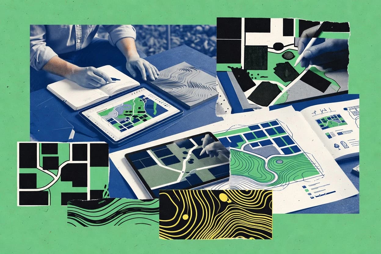
Art DesignTop 10 Best Digital Landscape Design Software of 2026
Compare and rank top Digital Landscape Design Software tools like SketchUp, Lumion, and Twinmotion. Explore the top 10 picks.

How we ranked these tools
Core product claims cross-referenced against official documentation, changelogs, and independent technical reviews.
Analyzed video reviews and hundreds of written evaluations to capture real-world user experiences with each tool.
AI persona simulations modeled how different user types would experience each tool across common use cases and workflows.
Final rankings reviewed and approved by our editorial team with authority to override AI-generated scores based on domain expertise.
Score: Features 40% · Ease 30% · Value 30%
Gitnux may earn a commission through links on this page — this does not influence rankings. Editorial policy
Editor’s top 3 picks
Three quick recommendations before you dive into the full comparison below — each one leads on a different dimension.
SketchUp
Component and dynamic component system for reusable landscape elements
Built for landscape designers needing quick 3D concept visualization and iterative client review.
Lumion
Real-time global illumination and weather effects for instant landscape mood changes
Built for landscape firms needing quick, high-quality visualizations for client presentations.
Twinmotion
Vegetation scatter and painting for rapid, naturalistic planting layouts
Built for landscape designers needing fast, photoreal outdoor visualization for stakeholder reviews.
Related reading
Comparison Table
This comparison table evaluates digital landscape design software across core workflows for terrain modeling, vegetation placement, lighting and rendering, and 2D-to-3D documentation. It covers tools such as SketchUp, Lumion, Twinmotion, Autodesk AutoCAD, ArcGIS Pro, and additional options to show how each platform handles real-time visualization, GIS data integration, and output formats. Readers can use the results to match tool capabilities to landscape design needs for concept development, detailed design, and presentation.
| # | Tool | Category | Overall | Features | Ease of Use | Value |
|---|---|---|---|---|---|---|
| 1 | SketchUp SketchUp provides 3D modeling tools for landscape concept design and presentations with plugins and direct-to-plan workflows. | 3D modeling | 8.5/10 | 9.0/10 | 8.6/10 | 7.8/10 |
| 2 | Lumion Lumion creates real-time visualization and animated walkthroughs for outdoor and landscape scenes using imported 3D geometry. | real-time visualization | 8.1/10 | 8.5/10 | 7.8/10 | 7.9/10 |
| 3 | Twinmotion Twinmotion delivers fast landscape rendering and animated scenes with vegetation tools, weather effects, and one-click media export. | rendering | 8.1/10 | 8.3/10 | 8.1/10 | 7.7/10 |
| 4 | Autodesk AutoCAD AutoCAD supports precision 2D drafting and layout workflows for site plans, grading plans, and technical landscape drawings. | 2D CAD | 8.0/10 | 8.2/10 | 7.7/10 | 8.1/10 |
| 5 | ArcGIS Pro ArcGIS Pro supports geospatial terrain modeling and mapping workflows that underpin landscape planning and digital site analysis. | GIS mapping | 7.5/10 | 8.3/10 | 6.7/10 | 7.2/10 |
| 6 | QGIS QGIS provides GIS drafting and analysis tools for building digital terrain layers and producing landscape planning maps. | open-source GIS | 8.1/10 | 8.6/10 | 7.6/10 | 8.0/10 |
| 7 | Blender Blender delivers modeling, shading, and rendering tools for custom landscape assets and high-quality visual outputs. | open-source 3D | 7.9/10 | 8.2/10 | 7.2/10 | 8.1/10 |
| 8 | V-Ray V-Ray adds photorealistic rendering and material systems for landscape visualization when paired with a modeling tool. | photoreal rendering | 8.0/10 | 8.7/10 | 7.6/10 | 7.4/10 |
| 9 | Photoshop Photoshop supports concept art finishes, matte compositing, and texture work for landscape design boards. | digital art | 7.6/10 | 8.3/10 | 7.2/10 | 7.1/10 |
| 10 | Gaea Gaea generates procedural terrain and erosion maps used to build realistic landscapes for visualization and 3D scenes. | procedural terrain | 7.4/10 | 8.1/10 | 6.9/10 | 6.8/10 |
SketchUp provides 3D modeling tools for landscape concept design and presentations with plugins and direct-to-plan workflows.
Lumion creates real-time visualization and animated walkthroughs for outdoor and landscape scenes using imported 3D geometry.
Twinmotion delivers fast landscape rendering and animated scenes with vegetation tools, weather effects, and one-click media export.
AutoCAD supports precision 2D drafting and layout workflows for site plans, grading plans, and technical landscape drawings.
ArcGIS Pro supports geospatial terrain modeling and mapping workflows that underpin landscape planning and digital site analysis.
QGIS provides GIS drafting and analysis tools for building digital terrain layers and producing landscape planning maps.
Blender delivers modeling, shading, and rendering tools for custom landscape assets and high-quality visual outputs.
V-Ray adds photorealistic rendering and material systems for landscape visualization when paired with a modeling tool.
Photoshop supports concept art finishes, matte compositing, and texture work for landscape design boards.
Gaea generates procedural terrain and erosion maps used to build realistic landscapes for visualization and 3D scenes.
SketchUp
3D modelingSketchUp provides 3D modeling tools for landscape concept design and presentations with plugins and direct-to-plan workflows.
Component and dynamic component system for reusable landscape elements
SketchUp stands out for fast, intuitive 3D modeling that supports landscape concepts from massing to walkable scenes. It delivers core modeling tools for terrain, grading, vegetation placement, and 3D object detailing using flexible components and layers. The workflow integrates with plugins and exports to common presentation formats so designs can be reviewed with clients and collaborators. It also supports visualization via built-in rendering and third-party toolchains for more realistic landscape outputs.
Pros
- Rapid 3D concepting with simple push-pull modeling
- Large ecosystem of landscape-focused plugins and extensions
- Component-based modeling improves reuse for plants and hardscape
Cons
- Native terrain tools are limited versus dedicated grading software
- Photoreal rendering often relies on external renderers or plugins
- Coordinate system and geospatial accuracy require extra setup
Best For
Landscape designers needing quick 3D concept visualization and iterative client review
More related reading
Lumion
real-time visualizationLumion creates real-time visualization and animated walkthroughs for outdoor and landscape scenes using imported 3D geometry.
Real-time global illumination and weather effects for instant landscape mood changes
Lumion stands out for fast visual iteration of landscape concepts using a large real-time rendering workflow. It supports modeling via imported CAD and terrain inputs, then adds weather, vegetation, lighting, and camera tools to reach presentation-ready renders. The software emphasizes scene building and rendering speed over deep BIM or simulation depth, which fits many landscape design communication workflows. Export outputs support client-ready stills and animation sequences for site plan storytelling.
Pros
- Real-time rendering accelerates landscape iteration for early design reviews
- Extensive vegetation, terrain, and material library speeds scene assembly
- Weather and lighting presets improve atmosphere without complex setup
Cons
- Landscape-accurate modeling depends on external CAD or GIS inputs
- Advanced procedural landscape logic is limited compared with modeling suites
- Large scenes can stress hardware during high-fidelity rendering
Best For
Landscape firms needing quick, high-quality visualizations for client presentations
Twinmotion
renderingTwinmotion delivers fast landscape rendering and animated scenes with vegetation tools, weather effects, and one-click media export.
Vegetation scatter and painting for rapid, naturalistic planting layouts
Twinmotion stands out for producing photorealistic outdoor scenes quickly using a real-time visualization workflow tied to Unreal Engine. It supports landscape-focused modeling via terrain tools, scatter tools for vegetation, and rapid asset placement for plants, buildings, and site elements. Core capabilities include dynamic lighting, physically based materials, weather and time-of-day controls, and high-resolution rendering outputs for design reviews. It also enables iterative collaboration by importing models and syncing design changes into updated visualizations.
Pros
- Real-time photorealistic rendering for landscape concept iterations
- Strong vegetation scatter tools for dense planting layouts
- Weather and time-of-day controls for outdoor mood studies
- Fast asset library workflow for site elements and materials
- Direct scene updates after model imports reduce rework
Cons
- Terrain editing is limited versus dedicated CAD or GIS tools
- Vegetation realism depends on external asset quality and setup
- Large projects can become performance constrained on modest GPUs
Best For
Landscape designers needing fast, photoreal outdoor visualization for stakeholder reviews
More related reading
Autodesk AutoCAD
2D CADAutoCAD supports precision 2D drafting and layout workflows for site plans, grading plans, and technical landscape drawings.
Dynamic Blocks for parametrically reusable landscape details and scalable plan symbols
AutoCAD stands out for translating 2D CAD precision into landscape plans using layers, blocks, and robust editing tools. It supports topographic mapping workflows through DWG-native referencing, object snapping, and annotation controls that help standardize site deliverables. For landscape design, it is strongest when workflows rely on detailed plan drafting, grading layouts, and CAD-based plan sets rather than prebuilt planting or irrigation libraries. Integration with Civil 3D improves earthwork and surface-centric site modeling for projects that need more than schematic landscaping.
Pros
- DWG-native precision tools for detailed grading and hardscape plan drafting
- Blocks and dynamic blocks streamline reusable landscape symbols and details
- Strong annotation, layers, and plotting controls support consistent landscape plan sets
- DWG external reference workflows fit multi-discipline landscape deliverables
Cons
- Limited landscape-specific intelligence compared with dedicated design platforms
- Surface modeling and earthwork workflows often require Civil 3D add-ons
- Advanced detailing can demand CAD expertise and disciplined templates
Best For
CAD-first landscape firms needing precise plan sets and symbol management
ArcGIS Pro
GIS mappingArcGIS Pro supports geospatial terrain modeling and mapping workflows that underpin landscape planning and digital site analysis.
Geoprocessing ModelBuilder for repeatable suitability and landscape analysis workflows
ArcGIS Pro stands out for its tight integration of GIS analysis, mapping, and geoprocessing inside one desktop environment. It supports detailed cartography workflows with vector, raster, and terrain data, plus automated modeling for repeatable landscape planning tasks. Digital landscape work benefits from tools for spatial analysis, network and suitability modeling, and 3D visualization for terrain and built features. The steep learning curve around geoprocessing, symbology, and project structure can slow production for teams focused only on design mockups.
Pros
- Strong spatial analysis tools for site suitability and constraints mapping
- Integrated 3D scene visualization for terrain, massing, and feature placement
- Reusable geoprocessing models for consistent landscape planning workflows
- High-fidelity cartography with detailed labeling and layer symbology control
- Handles multi-source geodata including rasters, vectors, and imagery layers
Cons
- Geoprocessing setup and data modeling require substantial GIS expertise
- Design iteration is less streamlined than dedicated CAD or design tools
- 3D cartographic output can be harder to tune than targeted visualization software
- Project organization and layer management can feel complex for new users
Best For
GIS-led landscape planning teams needing analysis-driven mapping and 3D context
QGIS
open-source GISQGIS provides GIS drafting and analysis tools for building digital terrain layers and producing landscape planning maps.
Processing Toolbox with model builder enables repeatable geoprocessing workflows
QGIS stands out by combining advanced GIS analysis with direct map-based drafting workflows for landscape planning. It supports geospatial data ingestion, editing, and spatial operations like buffering, overlay, and network analysis to model landscape features. Styling, labeling, and layout tools help produce publication-ready landscape maps and plan sheets from the same project.
Pros
- Powerful geospatial editing and analysis tools for landscape planning workflows
- Flexible symbology, labeling, and print composer for clear landscape plan outputs
- Strong plugin ecosystem for specialized landscape and terrain analysis tasks
Cons
- Complex GIS concepts can slow down early landscape drafting projects
- Managing large datasets can require careful hardware and layer organization
- Land-use and design-specific automation needs plugins or custom workflows
Best For
Landscape teams producing map-driven designs using GIS data and analysis
More related reading
Blender
open-source 3DBlender delivers modeling, shading, and rendering tools for custom landscape assets and high-quality visual outputs.
Procedural geometry with modifiers and node-based materials for terrain and vegetation
Blender stands out by combining full 3D modeling, procedural shading, and animation in a single open-source tool. For digital landscape design work, it supports terrain workflows with sculpting, modifier stacks, and displacement-ready materials. It also enables vegetation and layout visualization through particle systems, instancing, and robust lighting for realistic site renders. Strong export options help deliver design outputs to common planning and visualization pipelines.
Pros
- Nonlinear modifiers and procedural materials support repeatable site variations
- Terrain sculpting and displacement workflow fit landscape massing and grading
- Particle and instancing tools help generate vegetation distributions
- High-quality Cycles and Eevee rendering supports day and night visualization
- Scriptable automation via Python supports batch scene generation
Cons
- Landscape-specific UI and tools are limited compared with dedicated design suites
- Steep learning curve slows early layout and asset workflows
- Vegetation realism often needs manual tuning of materials and scatter parameters
- Large scenes can become heavy without careful scene optimization
Best For
Studios needing high-end 3D landscape visualization with procedural control
V-Ray
photoreal renderingV-Ray adds photorealistic rendering and material systems for landscape visualization when paired with a modeling tool.
V-Ray Global Illumination with advanced render settings for photoreal outdoor lighting in complex scenes
V-Ray stands out for its production-grade rendering engine that supports photoreal landscaping outputs from common 3D authoring workflows. It delivers physically based materials, advanced global illumination, and strong lighting controls that help visualize terrain, vegetation, and hardscape with consistent realism. The toolset is most effective when landscape design work is driven from 3D scene assembly in host applications, because V-Ray focuses on rendering rather than dedicated landscape toolchains. For digital landscape design, the clearest value comes from high-fidelity look development and render iterations that reflect design intent quickly.
Pros
- Physically based global illumination for consistent outdoor lighting and shadow fidelity
- Rich material system supports realistic foliage, stone, and soil look development
- Strong render controls for vegetation lighting, contrast tuning, and weather-like atmospherics
- Works inside popular DCC workflows used to build landscape scenes
Cons
- Not a dedicated landscape modeling suite for terrain and plant placement automation
- Scene setup and render configuration can become complex for vegetation-heavy projects
- Geospatial or procedural landscape toolchains require external tools and custom setup
Best For
Landscape visualization teams needing photoreal rendering inside existing 3D pipelines
More related reading
Photoshop
digital artPhotoshop supports concept art finishes, matte compositing, and texture work for landscape design boards.
Content-Aware Fill and Generative Fill for rapid landscaping element removal and addition
Photoshop stands out for its pixel-level control across raster workflows and its tight integration with the Adobe creative toolset. It supports landscape design visualization through precise composition, photo-editing, masking, and layered layout that can be used for concept boards and elevation-style mockups. Strong selection tools, non-destructive adjustments, and wide brush and effects libraries speed up iterative landscaping visuals. It does not provide purpose-built landscape planning objects like terrain modeling or planting database management.
Pros
- Layered compositing enables fast iterations for garden concept boards
- Powerful masking and selection tools isolate plants, paths, and hardscape elements
- Non-destructive adjustment layers support repeatable lighting and color grading
- Extensive brush and effects libraries help create stylized landscape overlays
- PSD files preserve editable structure for client review workflows
Cons
- No terrain modeling or grading tools for true landscape geometry
- Manual scaling and perspective management increase redesign rework
- Vector and symbol libraries require extra organization for planting catalogs
- Collaboration and versioning depend on external review workflows
- Advanced controls have a steep learning curve for typical landscape tasks
Best For
Designers producing detailed landscape visual mockups from images and layers
Gaea
procedural terrainGaea generates procedural terrain and erosion maps used to build realistic landscapes for visualization and 3D scenes.
Physically inspired erosion simulation with controllable parameters
Gaea stands out with a node-based procedural terrain workflow that focuses on fast, iterative landscape generation. It includes built-in erosion, masks, and advanced devices for shaping heightfields into believable terrains. Outputs are designed for seamless round-tripping to common real-time workflows, including detailed meshes and maps for texturing and materials. Its depth favors artists who want control over terrain logic rather than manual sculpting alone.
Pros
- Node-based erosion and shaping produce realistic terrain features quickly
- Mask workflows support precise control for biomes and material placement
- Export outputs include terrain meshes and texture maps for downstream use
- Device library covers common landscape tasks without custom scripting
Cons
- Procedural graph management can feel heavy for simple one-off terrains
- Achieving stylized looks often requires more iteration and tuning
- Large-world setups need extra planning for scale and consistency
Best For
Teams building procedural landscapes for games, visualization, or simulation
How to Choose the Right Digital Landscape Design Software
This buyer’s guide explains how to choose Digital Landscape Design Software using concrete workflow capabilities from SketchUp, Lumion, Twinmotion, Autodesk AutoCAD, ArcGIS Pro, QGIS, Blender, V-Ray, Photoshop, and Gaea. It maps tool strengths to specific landscape deliverables like concept massing, photoreal walkthroughs, GIS suitability mapping, CAD plan sets, and procedural terrain generation. It also highlights the most common failure points seen across these tools so selection stays focused on real production needs.
What Is Digital Landscape Design Software?
Digital Landscape Design Software is used to create, refine, and communicate outdoor site designs with digital terrain, planting layouts, and presentation-ready visuals. These tools solve problems in landscape planning such as turning site constraints into usable plan sets, generating repeatable terrain or erosion logic, and producing stakeholder visuals with fast iteration. Many teams split workflows across authoring and visualization tools, such as CAD-first plan production in Autodesk AutoCAD or real-time scene rendering in Lumion and Twinmotion. Other teams rely on GIS-driven planning using ArcGIS Pro or QGIS to connect spatial analysis to map outputs and 3D context.
Key Features to Look For
The right feature set determines whether the software speeds iteration for the deliverable at hand or forces a rework-heavy pipeline.
Real-time outdoor visualization and animated walkthrough exports
Real-time rendering reduces design iteration time when changing vegetation, lighting mood, and weather conditions for client walkthroughs. Lumion is built around real-time visualization with weather and lighting presets, while Twinmotion provides real-time photoreal rendering tied to Unreal Engine with one-click media export.
Component-based 3D modeling for reusable landscape elements
Reusable components reduce repeated work for plants, hardscape details, and repeated layout variations. SketchUp’s component and dynamic component system supports reusable landscape elements and iterative client review scenes.
Geospatial terrain modeling and repeatable landscape analysis workflows
GIS-first tools connect terrain context, constraints, and suitability logic to consistent planning outputs. ArcGIS Pro includes geoprocessing model building for repeatable suitability and landscape analysis workflows, and QGIS offers a Processing Toolbox model builder workflow for repeatable geoprocessing.
CAD-native precision for grading plans and symbol management
Plan-set accuracy depends on CAD-native drafting controls, layer discipline, and reusable symbols. Autodesk AutoCAD supports DWG-native precision tools with blocks and dynamic blocks, making it strong for detailed plan drafting and plotting in landscape deliverables.
Procedural terrain generation with erosion logic and texture-ready outputs
Procedural terrain workflows speed creation of believable terrains while keeping control over erosion and masks. Gaea delivers node-based procedural terrain generation with built-in erosion and mask workflows, and it exports terrain meshes and texture maps for downstream 3D scene use.
Physically based rendering and global illumination for photoreal look development
High-fidelity lighting and material response improves the realism of vegetation, stone, and soil in final visuals. V-Ray provides physically based global illumination and advanced render controls that support consistent outdoor lighting realism inside existing 3D pipelines.
How to Choose the Right Digital Landscape Design Software
Selection works best by matching the tool’s strongest workflow to the first deliverable stage needed in production.
Start with the primary deliverable stage
Choose SketchUp when the first need is fast 3D concept massing that can evolve into walkable scenes with reusable landscape components. Choose Lumion or Twinmotion when the first need is client-ready stills and animated walkthroughs using real-time outdoor rendering with weather and lighting mood controls.
Decide whether planning is CAD, GIS, or analysis-driven
Choose Autodesk AutoCAD for DWG-native precision drafting of site plans, grading layouts, and detailed landscape plan sets with robust layers and blocks. Choose ArcGIS Pro or QGIS when designs must be driven by spatial analysis, such as suitability and constraints mapping supported by reusable geoprocessing workflows.
Match terrain creation to your required control level
Choose Gaea when realistic terrain formation needs physically inspired erosion with controllable parameters and mask-driven biomes. Choose Blender when custom terrain shaping must be controlled through sculpting, displacement-ready materials, and procedural modifier stacks for repeatable variations.
Match planting realism to your asset workflow
Choose Twinmotion when vegetation scatter and painting must produce dense planting layouts quickly for outdoor mood studies. Choose Lumion when the workflow requires fast scene assembly using built-in vegetation and terrain libraries, then iterating lighting and weather for client presentations.
Pick a rendering path that matches the scene source tool
Choose V-Ray when high-end photoreal look development is required inside existing 3D authoring pipelines built in host modeling tools. Choose Photoshop when the output target is pixel-level compositing and matte-style mockups, using layered adjustments and generative or content-aware edits to refine landscape visuals based on imagery.
Who Needs Digital Landscape Design Software?
Digital Landscape Design Software serves teams that need either design communication visuals, technical plan sets, GIS-driven planning outputs, or procedural terrain generation for later 3D scene assembly.
Landscape designers focused on fast 3D concept visualization and iterative client review
SketchUp supports rapid 3D concepting with push-pull modeling and component-based reusable landscape elements, making it effective for quick design iterations. Twinmotion is also a strong fit when photoreal outdoor scenes and vegetation scatter must be ready for stakeholder reviews with fast changes after model imports.
Landscape firms that prioritize presentation speed using real-time visualization
Lumion is built for real-time scene building and rendering speed using imported geometry plus weather, lighting, and vegetation libraries for instant mood changes. Twinmotion complements this need with one-click media export and vegetation painting designed for naturalistic planting layouts.
CAD-first landscape teams producing precise plan sets and reusable symbol libraries
Autodesk AutoCAD is a strong choice for DWG-native precision workflows that rely on layers, blocks, and dynamic blocks for consistent landscape plan symbols and grading drawing standards. AutoCAD also fits teams that extend surface modeling workflows with Civil 3D-style add-ons when earthwork modeling is required.
GIS-led landscape planning teams translating constraints into map-driven decisions
ArcGIS Pro supports integrated GIS analysis, cartography, and geoprocessing model building that connects terrain context to repeatable planning tasks. QGIS supports similar map-driven workflows with a Processing Toolbox model builder approach for repeatable geoprocessing and publication-ready layout exports.
Common Mistakes to Avoid
Misalignment between tool strengths and deliverable requirements causes rework, data translation issues, and performance bottlenecks across the landscape design workflow.
Buying a visualization tool for planning-grade terrain editing
Lumion and Twinmotion excel at real-time presentation visuals but terrain editing is limited compared with dedicated CAD or GIS terrain toolchains. SketchUp’s terrain and grading tools are also limited compared with grading-focused software, which can break workflows that require precise earthwork modeling.
Forgetting that photoreal rendering and modeling are separate capabilities
V-Ray is a rendering engine that improves photoreal look development when landscape scenes are assembled in host applications, so it does not replace dedicated terrain and planting automation. SketchUp can model quickly but photoreal output may require external renderers or plugins for the desired realism.
Overbuilding a GIS project for purely visual concept stages
ArcGIS Pro and QGIS provide powerful spatial analysis and map composition but geoprocessing setup and project organization can slow teams that only need design mockups. Blender and SketchUp deliver faster concept iteration because they prioritize 3D layout and modeling workflows over GIS project structures.
Using image editors as substitutes for geometry and planting logic
Photoshop supports layered compositing and edits like Content-Aware Fill and Generative Fill, but it has no terrain modeling or planting database management. This causes manual scaling and perspective management overhead compared with terrain and scene assembly workflows in SketchUp, Lumion, or Twinmotion.
How We Selected and Ranked These Tools
We evaluated every tool on three sub-dimensions: features with weight 0.4, ease of use with weight 0.3, and value with weight 0.3. The overall rating is the weighted average computed as overall = 0.40 × features + 0.30 × ease of use + 0.30 × value. SketchUp separated itself from lower-ranked tools with its component and dynamic component system that directly improves iteration speed for reusable landscape elements, which contributes to the features sub-dimension and reduces rework in concept pipelines.
Frequently Asked Questions About Digital Landscape Design Software
Which tool best supports fast 3D concept modeling for landscape massing and walkable scenes?
SketchUp is the fastest option when landscape concepts must move quickly from rough massing to walkable scenes using terrain, grading, vegetation placement, and 3D object detailing. Its component system supports reusable landscape elements, which speeds up iteration during client reviews.
What’s the quickest path from imported CAD and terrain data to presentation-ready landscape visuals?
Lumion is designed for rapid visual iteration after CAD and terrain inputs are brought in. It adds weather, vegetation, lighting, and camera tools to generate stills and animation sequences for client-ready storytelling.
Which software produces photoreal outdoor renders with strong vegetation scattering and time-of-day controls?
Twinmotion targets photoreal outdoor visualization using a real-time Unreal Engine workflow. It provides vegetation scatter and painting for naturalistic planting layouts plus weather and time-of-day controls that update scenes during design review.
Which option is best when landscape deliverables must be precise 2D plan sets with standardized symbols?
Autodesk AutoCAD is the correct choice when the workflow relies on layered drafting, blocks, object snapping, and annotation controls for consistent site plan deliverables. It also becomes more earthwork-capable for surface-centric modeling when Civil 3D is used alongside it.
What’s the best fit for landscape planning that depends on GIS analysis, suitability modeling, and map-driven outputs?
ArcGIS Pro fits teams that need GIS analysis tied directly to mapping and geoprocessing for repeatable landscape planning tasks. QGIS supports similar GIS editing and operations like buffering, overlay, and network analysis while also producing publication-ready map layouts from the same project.
Which tool works best for integrating procedural terrain logic and believable erosion into landscape assets?
Gaea is built for node-based procedural terrain generation with built-in erosion and controllable parameters. Blender can then take the resulting heightfield workflow into sculpting and displacement-ready materials using modifier stacks for deeper control.
Which software is most effective for high-end rendering when landscape design work is already assembled in a 3D authoring tool?
V-Ray is the strongest rendering choice when a landscape scene is assembled in a host 3D application and the goal is photoreal look development. It focuses on physically based materials, global illumination, and lighting controls rather than dedicated landscape toolchains.
Which tool is best for concept board style landscaping mockups from images and layered comps?
Photoshop excels when landscaping visuals start from images and must be refined through precise composition, masking, and layered layouts. It enables rapid element edits with non-destructive adjustments and supports concept boards or elevation-style mockups without providing terrain or planting database objects.
A team needs both analysis-driven mapping and repeatable terrain-related workflows. How do ArcGIS Pro and QGIS differ for production?
ArcGIS Pro supports repeatable analysis workflows through geoprocessing and ModelBuilder with tighter integration across data types like vector, raster, and terrain for 3D context. QGIS provides a similar repeatability path with Processing Toolbox and model builder, plus strong map-based drafting from GIS data for plan-sheet style outputs.
Which setup prevents common visualization bottlenecks when stakeholders request frequent iteration during landscape reviews?
Lumion and Twinmotion prevent iteration bottlenecks by prioritizing real-time scene updates with vegetation, lighting, and camera controls that translate quickly into stakeholder visuals. For deeper vegetation realism and procedural control, Blender combined with V-Ray can shift iterations from layout changes to material and lighting refinement.
Conclusion
After evaluating 10 art design, SketchUp stands out as our overall top pick — it scored highest across our combined criteria of features, ease of use, and value, which is why it sits at #1 in the rankings above.
Use the comparison table and detailed reviews above to validate the fit against your own requirements before committing to a tool.
Tools reviewed
Referenced in the comparison table and product reviews above.
Keep exploring
Comparing two specific tools?
Software Alternatives
See head-to-head software comparisons with feature breakdowns, pricing, and our recommendation for each use case.
Explore software alternatives→In this category
Art Design alternatives
See side-by-side comparisons of art design tools and pick the right one for your stack.
Compare art design tools→FOR SOFTWARE VENDORS
Not on this list? Let’s fix that.
Our best-of pages are how many teams discover and compare tools in this space. If you think your product belongs in this lineup, we’d like to hear from you—we’ll walk you through fit and what an editorial entry looks like.
Apply for a ListingWHAT THIS INCLUDES
Where buyers compare
Readers come to these pages to shortlist software—your product shows up in that moment, not in a random sidebar.
Editorial write-up
We describe your product in our own words and check the facts before anything goes live.
On-page brand presence
You appear in the roundup the same way as other tools we cover: name, positioning, and a clear next step for readers who want to learn more.
Kept up to date
We refresh lists on a regular rhythm so the category page stays useful as products and pricing change.