GITNUXSOFTWARE ADVICE
Business FinanceTop 10 Best Dem Software of 2026
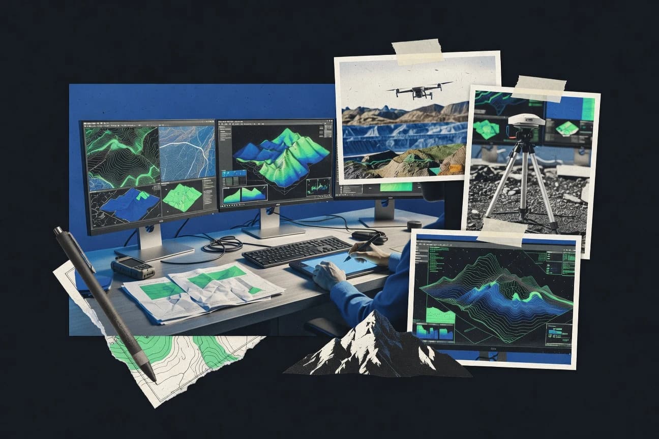
Explore top 10 dem software tools.

How we ranked these tools
Core product claims cross-referenced against official documentation, changelogs, and independent technical reviews.
Analyzed video reviews and hundreds of written evaluations to capture real-world user experiences with each tool.
AI persona simulations modeled how different user types would experience each tool across common use cases and workflows.
Final rankings reviewed and approved by our editorial team with authority to override AI-generated scores based on domain expertise.
Score: Features 40% · Ease 30% · Value 30%
Gitnux may earn a commission through links on this page — this does not influence rankings. Editorial policy
Editor picks
Three quick recommendations before you dive into the full comparison below — each one leads on a different dimension.
ArcGIS Pro
Advanced 3D Scene viewer with photorealistic terrain rendering and integrated lidar-to-DEM workflows
Built for professional GIS analysts, environmental scientists, and large organizations requiring enterprise-level DEM analysis and 3D terrain modeling..
QGIS
Runner UpSeamless integration of multiple processing engines (GDAL/OGR, GRASS, SAGA) for versatile, one-stop DEM terrain analysis
Built for gIS professionals, researchers, and educators seeking a powerful, no-cost solution for DEM visualization, analysis, and terrain modeling..
Global Mapper
Also GreatIntegrated LiDAR Module for automated ground classification, noise removal, and feature extraction from massive point clouds
Built for gIS analysts, surveyors, and engineers handling large-scale DEM and lidar datasets for terrain analysis and mapping projects..
Related reading
Comparison Table
This comparison table examines leading tools for digital elevation model (DEM) processing, featuring ArcGIS Pro, QGIS, Global Mapper, GRASS GIS, SAGA GIS, and more. Readers will learn about core capabilities, usability, and ideal use cases to identify the right software for their needs.
ArcGIS Pro
enterpriseProfessional GIS software for advanced DEM analysis, 3D visualization, hydrological modeling, and terrain processing.
Advanced 3D Scene viewer with photorealistic terrain rendering and integrated lidar-to-DEM workflows
ArcGIS Pro, developed by Esri, is a premier GIS platform renowned for its robust handling of Digital Elevation Models (DEMs), enabling advanced terrain analysis, 3D visualization, and raster processing. It supports comprehensive workflows from lidar data import and DEM generation to hydrological modeling, slope analysis, and volumetric calculations. With seamless integration across the ArcGIS ecosystem, it empowers users to create immersive 3D scenes and perform complex geospatial simulations critical for environmental, urban planning, and engineering applications.
- +Unparalleled suite of DEM tools including hydrology, raster analysis, and lidar processing
- +Superior 3D visualization with dynamic scene views and real-time rendering
- +Extensive integration with ArcGIS Online, extensions like Spatial Analyst, and enterprise data management
- –Steep learning curve for beginners due to its professional-grade complexity
- –High subscription costs that may deter small teams or individuals
- –Resource-intensive, requiring powerful hardware for large datasets
Best for: Professional GIS analysts, environmental scientists, and large organizations requiring enterprise-level DEM analysis and 3D terrain modeling.
More related reading
QGIS
specializedOpen-source GIS platform for viewing, editing, analyzing, and generating DEMs with extensive raster tools.
Seamless integration of multiple processing engines (GDAL/OGR, GRASS, SAGA) for versatile, one-stop DEM terrain analysis
QGIS is a free, open-source Geographic Information System (GIS) software renowned for its robust handling of Digital Elevation Models (DEMs) and raster data. It provides comprehensive terrain analysis tools including slope, aspect, hillshade, contour generation, and hydrological modeling through integrated processing engines like GRASS, SAGA, and GDAL. Ideal for geospatial professionals, it supports visualization, manipulation, and advanced analysis of elevation data across Windows, macOS, and Linux platforms.
- +Completely free and open-source with no licensing costs
- +Extensive raster processing toolbox and plugin ecosystem for DEM analysis
- +Cross-platform compatibility and strong community support
- –Steep learning curve for beginners due to complex interface
- –Can struggle with performance on very large DEM datasets without optimization
- –Requires additional plugins for some advanced DEM-specific workflows
Best for: GIS professionals, researchers, and educators seeking a powerful, no-cost solution for DEM visualization, analysis, and terrain modeling.
Global Mapper
specializedVersatile GIS application specialized in LiDAR and DEM processing, 3D rendering, and terrain extraction.
Integrated LiDAR Module for automated ground classification, noise removal, and feature extraction from massive point clouds
Global Mapper is a powerful GIS software suite from Blue Marble Geographics, specializing in the processing, analysis, and visualization of digital elevation models (DEMs) and lidar point clouds. It offers comprehensive tools for terrain modeling, including contour generation, hillshade rendering, viewshed analysis, volume calculations, and cut/fill operations. With support for hundreds of spatial data formats, it serves as an all-in-one solution for elevation data workflows, from import to 3D export.
- +Exceptional support for DEM and LiDAR formats with seamless import/export
- +Robust terrain analysis tools like path profiling, watershed delineation, and volumetric calculations
- +High-quality 3D visualization and rendering capabilities
- –Additional modules (e.g., LiDAR) require extra purchase
- –Interface can feel dated and has a moderate learning curve for advanced functions
- –Primarily optimized for Windows, with limited cross-platform support
Best for: GIS analysts, surveyors, and engineers handling large-scale DEM and lidar datasets for terrain analysis and mapping projects.
GRASS GIS
specializedPowerful open-source geospatial toolkit for raster-based DEM analysis, hydrology, and topographic modeling.
Unmatched suite of raster modules like r.watershed and r.viewshed for advanced hydrological and visibility analysis on massive DEMs
GRASS GIS is a robust, open-source Geographic Information System (GIS) specialized in raster and vector geospatial data processing, with exceptional capabilities for Digital Elevation Model (DEM) handling and analysis. It provides hundreds of modules for DEM tasks such as interpolation, hydrological modeling, slope/aspect derivation, visibility analysis, and 3D visualization. Designed for large-scale data processing, it supports parallel computing and integrates seamlessly with tools like QGIS and Python for advanced workflows.
- +Extensive library of 350+ specialized DEM modules for terrain analysis and hydrology
- +Handles massive datasets with parallel processing and high-performance computing support
- +Fully free, open-source, and highly scriptable for automation
- –Steep learning curve dominated by command-line interface
- –GUI is functional but less polished and intuitive than commercial alternatives
- –Documentation can be overwhelming for beginners
Best for: Experienced geospatial analysts, researchers, and scientists requiring powerful, no-cost DEM processing for complex terrain modeling.
SAGA GIS
specializedFree GIS toolbox focused on terrain analysis, geomorphometry, and DEM manipulation with modular algorithms.
Comprehensive Terrain Analysis library with 100+ specialized modules for multi-scale topographic parameters like TPI, MRVBF, and convergence indexing.
SAGA GIS (System for Automated Geoscientific Analyses) is a free, open-source GIS software platform renowned for its extensive terrain analysis capabilities, particularly for processing Digital Elevation Models (DEMs). It offers over 700 modular tools for raster and vector data manipulation, hydrology simulations, geomorphometry, and landscape analysis. Ideal for environmental and geoscientific applications, it supports scripting in Python, R, and its own language for automated workflows.
- +Vast library of specialized DEM tools for hydrology, slope analysis, and terrain metrics
- +Handles large datasets efficiently with parallel processing support
- +Fully customizable via scripting and open-source extensibility
- –Clunky, modular GUI with a steep learning curve for non-experts
- –Documentation is technical and sometimes incomplete
- –Limited native support for 3D visualization and modern vector editing
Best for: Geoscientists and researchers needing advanced, no-cost DEM analysis for hydrological modeling and terrain morphometry.
Surfer
specializedSurface mapping software for gridding, contouring, and 3D visualization of elevation data from DEMs.
Scientifically validated gridding algorithms like kriging for accurate DEM surface creation from sparse data
Surfer by Golden Software is a specialized contouring and 3D surface mapping tool tailored for creating high-quality terrain models from XYZ point data, making it a solid choice for DEM workflows. It supports advanced gridding algorithms like kriging, inverse distance, and minimum curvature to interpolate surfaces accurately. Users can generate contours, heat maps, profiles, and volumetric calculations, with robust export options to GIS formats like GeoTIFF and SHP for further DEM analysis.
- +Extensive gridding methods optimized for DEM interpolation
- +Professional-grade 2D/3D visualizations and customization
- +Strong import/export support for common geospatial formats
- –Windows-only, limiting cross-platform use
- –Steep learning curve for advanced features
- –No built-in geospatial analysis beyond mapping
Best for: Earth scientists and surveyors who need precise contouring and surface generation from scattered elevation data without full GIS overhead.
WhiteboxTools
specializedOpen-source GIS library and GUI for high-performance DEM processing, hydrological tools, and geospatial analysis.
Unmatched breadth of over 450 geospatial tools, with dozens specifically optimized for DEM geomorphometry and hydrological simulations
WhiteboxTools is a free, open-source geospatial analysis platform developed by Dr. John Lindsay, offering over 450 command-line tools for raster and vector data processing, with extensive capabilities for Digital Elevation Model (DEM) analysis including hydrological modeling, geomorphometry, and terrain preprocessing.
It excels in tasks like pit filling, flow accumulation, stream network delineation, slope/aspect calculation, and advanced surface metrics. The toolkit supports Python integration for scripting and includes an optional graphical user interface (Whitebox GAT) for easier access.
- +Comprehensive suite of over 450 specialized tools for DEM processing and analysis
- +High performance due to Rust implementation and efficient algorithms
- +Fully open-source with Python bindings for automation and extensibility
- –Primarily command-line interface requires scripting knowledge for full use
- –GUI (Whitebox GAT) is functional but less polished than commercial alternatives
- –Learning curve for optimal use and documentation can be dense for newcomers
Best for: Advanced geospatial researchers, hydrologists, and academics needing powerful, cost-free DEM analysis tools for terrain modeling and hydrology.
ENVI
enterpriseRemote sensing software with DEM generation, orthorectification, and terrain analysis from satellite imagery.
Automated DEM extraction and orthorectification from diverse stereo satellite imagery
ENVI is a comprehensive remote sensing software suite from L3Harris Geospatial, renowned for processing satellite and aerial imagery, including specialized tools for Digital Elevation Model (DEM) generation, orthorectification, and terrain analysis. It supports DEM extraction from stereo pairs, slope/aspect calculations, and integration with multispectral/hyperspectral data for topographic corrections. Widely used in geospatial analysis, ENVI excels in handling complex elevation datasets from various sensors.
- +Powerful DEM generation from stereo imagery and RPC orthorectification
- +Extensive terrain analysis tools like hillshading and hydrological modeling
- +Seamless integration with IDL for custom DEM processing scripts
- –Steep learning curve due to complex interface
- –High cost limits accessibility for small teams
- –Resource-heavy, requiring high-end hardware for large DEMs
Best for: Experienced remote sensing professionals needing integrated DEM tools with advanced spectral analysis.
ERDAS IMAGINE
enterpriseGeospatial processing suite for DEM production, photogrammetry, and advanced terrain modeling.
Leica Photogrammetry Suite (LPS) for fully automated, production-grade DEM/DSM extraction from stereo imagery
ERDAS IMAGINE, developed by Hexagon Geospatial, is a comprehensive geospatial software suite renowned for its advanced photogrammetry and image analysis capabilities, particularly in generating accurate Digital Elevation Models (DEMs) from stereo aerial and satellite imagery. It offers robust tools for orthoimage production, terrain modeling, and 3D feature extraction, supporting a wide array of sensors and data formats. The software integrates seamlessly with other Hexagon products for end-to-end geospatial workflows.
- +Powerful photogrammetric tools like LPS for automatic, high-precision DEM generation from stereo imagery
- +Handles massive datasets with advanced processing for orthorectification and mosaicking
- +Extensive terrain analysis features including hydrology, visibility, and 3D visualization
- –Steep learning curve due to complex interface and workflow customization
- –High cost with expensive licensing and module add-ons
- –Resource-intensive, requiring high-end hardware for optimal performance
Best for: Enterprise geospatial professionals and photogrammetrists handling large-scale, high-accuracy DEM production for government or commercial mapping projects.
CloudCompare
specialized3D point cloud and mesh processing tool for generating, editing, and analyzing DEMs from LiDAR data.
Cloth Simulation Filter (CSF) for superior ground point extraction and noise removal in DEM generation
CloudCompare is a free, open-source 3D point cloud and mesh processing software renowned for handling massive datasets from LiDAR, photogrammetry, and other sources. In DEM applications, it excels at generating Digital Elevation Models through tools like rasterization, ground segmentation, and interpolation, enabling precise terrain modeling and analysis. Its plugin ecosystem extends capabilities for volume calculations, curvature analysis, and multi-scale registration critical for geoscientific workflows.
- +Exceptional performance with billions of points, ideal for large-scale DEM projects
- +Comprehensive free tools for point cloud filtering, segmentation, and rasterization to DEM
- +Active community and plugin support for extended DEM functionalities
- –Steep learning curve due to dense interface and advanced options
- –Limited native GIS integration and automation compared to dedicated DEM suites
- –Occasional stability issues with very complex meshes or plugins
Best for: Geoscientists, surveyors, and researchers processing raw LiDAR data into high-fidelity DEMs on a budget.
Conclusion
After evaluating 10 business finance, ArcGIS Pro stands out as our overall top pick — it scored highest across our combined criteria of features, ease of use, and value, which is why it sits at #1 in the rankings above.
Use the comparison table and detailed reviews above to validate the fit against your own requirements before committing to a tool.
How to Choose the Right Dem Software
This buyer’s guide covers ArcGIS Pro, QGIS, Global Mapper, GRASS GIS, SAGA GIS, Surfer, WhiteboxTools, ENVI, ERDAS IMAGINE, and CloudCompare for Digital Elevation Model workflows. It maps tool capabilities like hydrological modeling, terrain analysis, LiDAR-to-DEM processing, and 3D visualization to concrete buying decisions. It also highlights common selection mistakes based on each tool’s usability, workflow fit, and data handling strengths.
What Is Dem Software?
DEM software processes and analyzes elevation data to produce outputs like slope, aspect, hillshade, contours, flow networks, and volumetric cut and fill surfaces. It is used to generate terrain models from raster elevation grids or from LiDAR and stereo imagery workflows. ArcGIS Pro fits advanced GIS terrain processing and 3D scene rendering, while QGIS provides a no-cost GIS foundation with raster engines such as GRASS, SAGA, and GDAL for DEM analysis. WhiteboxTools and GRASS GIS represent research-focused toolkits that emphasize hydrology and geomorphometry through large command libraries and automation-friendly designs.
Key Features to Look For
The right DEM tool depends on whether the workflow is raster-based analysis, point-cloud or stereo-based DEM production, or production-grade mapping outputs.
Hydrological modeling and flow-based terrain analysis
Hydrology workflows require tools that can derive flow accumulation, watersheds, and drainage structures from elevation grids. GRASS GIS includes raster hydrology modules like r.watershed and r.viewshed for advanced watershed delineation and visibility analysis. WhiteboxTools provides dozens of DEM hydrology tools built for efficient geomorphometry and flow modeling.
LiDAR-to-DEM ground extraction and point-cloud filtering
LiDAR projects need automated ground classification and noise removal before rasterization to a DEM. Global Mapper includes an integrated LiDAR Module for ground classification, noise removal, and feature extraction from massive point clouds. CloudCompare adds the Cloth Simulation Filter (CSF) for superior ground point extraction, then supports rasterization and mesh-to-DEM generation.
Multi-engine raster analysis for flexible DEM processing
Flexible DEM processing benefits from one interface that can run multiple terrain engines and geospatial libraries. QGIS is designed to integrate processing engines including GDAL/OGR, GRASS, and SAGA so slope, hillshade, and hydrology workflows can be assembled in one environment. GRASS GIS and SAGA GIS also support automation and scripting for repeatable terrain analysis pipelines.
Large-scale performance for massive elevation datasets
Large DEMs require toolchains that can handle big rasters without breaking workflows. GRASS GIS emphasizes handling massive datasets using parallel computing and high-performance processing. WhiteboxTools is implemented in Rust for high-performance DEM processing, and CloudCompare is built to handle billions of points efficiently.
Specialized gridding and scientifically validated surface creation
Surveying and Earth-science workflows that start from scattered elevations need interpolation methods that create reliable DEM surfaces. Surfer focuses on gridding and surface generation and includes scientifically validated algorithms like kriging along with inverse distance and minimum curvature. Surfer also supports exporting gridded outputs to GIS formats like GeoTIFF and SHP for follow-on terrain workflows.
Enterprise photogrammetry and production-grade stereo DEM extraction
Stereo imagery DEM production needs photogrammetry pipelines that automate DEM and DSM extraction at production scale. ERDAS IMAGINE includes Leica Photogrammetry Suite (LPS) for fully automated, production-grade DEM and DSM extraction from stereo imagery. ENVI supports DEM extraction from stereo pairs plus RPC orthorectification and terrain analysis, making it suited for remote sensing elevation generation from multiple sensor types.
How to Choose the Right Dem Software
Selection should start with the input source and the required outputs, then match those needs to workflow fit, processing depth, and analysis automation.
Start with the elevation input you actually have
If the workflow begins with LiDAR point clouds, Global Mapper and CloudCompare match the expected inputs because they provide LiDAR ground classification and point filtering before rasterization to DEM. If the workflow begins with scattered elevation samples, Surfer is built around gridding, contour generation, and 3D surface modeling from XYZ data. If the workflow begins with raster DEMs already in hand, QGIS, GRASS GIS, and SAGA GIS provide extensive raster terrain processing for slope, aspect, hillshade, and hydrology.
Match the required outputs to tool-specific terrain analytics
Watershed and visibility outputs are a strong fit for GRASS GIS because modules like r.watershed and r.viewshed are designed for those tasks. Multi-scale terrain metrics such as TPI, MRVBF, and convergence indexing align with SAGA GIS because its terrain analysis library includes 100+ specialized geomorphometry modules. For generating flow and surface derivatives across many DEM preprocessing scenarios, WhiteboxTools offers a large set of DEM geomorphometry and hydrology tools.
Decide how much GIS and 3D visualization is required
If advanced GIS integration and 3D scene work are required, ArcGIS Pro delivers a professional-grade environment with an advanced 3D Scene viewer and integrated lidar-to-DEM workflows. If 3D visualization is needed but the priority is terrain modeling and analysis rather than enterprise GIS administration, Global Mapper provides high-quality 3D rendering alongside DEM and LiDAR processing. If 3D output is mainly a byproduct of surface mapping from gridded interpolation, Surfer emphasizes 2D and 3D surface visualization tied to gridding.
Plan for automation and repeatable processing
Automation-heavy workflows fit WhiteboxTools because it includes Python integration and a large set of command-line tools for reproducible DEM processing. GRASS GIS and SAGA GIS also support scripting and batch processing approaches due to their modular command structure and open ecosystems. If the workflow depends on repeatable GIS operations across projects, QGIS benefits from engine integration so the same GRASS, SAGA, and GDAL-based steps can be chained for consistent terrain outputs.
Choose by ecosystem and workflow context
Teams already standardized on Esri workflows should favor ArcGIS Pro because it integrates into the ArcGIS ecosystem and uses extensions such as Spatial Analyst for advanced raster analysis. Remote sensing pipelines that rely on stereo extraction and terrain corrections align with ENVI and ERDAS IMAGINE because they focus on DEM generation from imagery and orthorectification. Research workflows that prioritize open, broad tool coverage align with GRASS GIS, SAGA GIS, and WhiteboxTools for deep DEM geomorphometry and hydrology libraries.
Who Needs Dem Software?
DEM tools serve different user roles based on whether the work is GIS analysis, mapping production, or point-cloud and stereo-based elevation generation.
Professional GIS analysts and large organizations that need enterprise terrain workflows
ArcGIS Pro fits because it targets professional-grade DEM analysis, raster processing, and advanced hydrology and terrain processing with enterprise data management. Teams that need photorealistic terrain in 3D should prioritize ArcGIS Pro due to its advanced 3D Scene viewer and integrated lidar-to-DEM workflows.
GIS researchers and educators who want a no-cost raster analysis toolbox
QGIS fits because it is free and open-source while integrating GDAL/OGR, GRASS, and SAGA engines for a one-stop DEM analysis workflow. GRASS GIS and SAGA GIS also fit research use because they provide deep hydrological modeling and multi-scale terrain metrics through large module libraries.
Surveyors and engineers working with LiDAR and large-scale terrain extraction
Global Mapper fits because it specializes in LiDAR and DEM processing with an integrated LiDAR Module for ground classification and automated noise removal. For budget-conscious LiDAR preprocessing into DEMs, CloudCompare fits because it runs on open toolchains and includes Cloth Simulation Filter (CSF) for ground extraction and noise reduction.
Earth scientists and survey workflows focused on surface gridding and contour outputs
Surfer fits because it is specialized in gridding, contouring, and 3D visualization from XYZ point data. Its scientifically validated kriging algorithm helps when elevation samples are sparse and the goal is an accurate interpolated surface that can be exported to GIS formats.
Common Mistakes to Avoid
These mistakes cause avoidable delays by mismatching workflow inputs, overestimating built-in capability, or underestimating learning curve and interface fit.
Choosing a raster DEM tool for raw LiDAR input without a ground extraction workflow
LiDAR projects often fail when ground extraction and noise removal steps are missing, so CloudCompare with CSF or Global Mapper with its integrated LiDAR Module should be selected for point-cloud-to-DEM workflows. QGIS can analyze rasters well but does not replace LiDAR ground classification when the input is raw points.
Assuming a mapping-focused tool covers advanced hydrology and geomorphometry
Surfer is strong for gridding, contours, and 2D and 3D surface visualization, but it does not act as a full GIS hydrology engine. GRASS GIS and WhiteboxTools are better choices when watersheds, flow networks, or geomorphometry metrics are core requirements.
Underestimating the usability cost of command-line-first GIS toolkits
GRASS GIS and WhiteboxTools offer deep DEM module coverage but rely heavily on command-line usage, which can slow down teams that need rapid interactive workflows. QGIS provides an easier GUI entry point while still integrating raster engines, which can reduce time-to-first-results.
Overlooking photogrammetry automation needs for stereo-derived DEM production
Stereo imagery DEM production needs dedicated photogrammetry pipelines, so ENVI and ERDAS IMAGINE should be prioritized when orthorectification and automated DEM extraction from stereo pairs are required. ERDAS IMAGINE is especially suited when fully automated production-grade DEM and DSM extraction is needed through Leica Photogrammetry Suite (LPS).
How We Selected and Ranked These Tools
We evaluated ArcGIS Pro, QGIS, Global Mapper, GRASS GIS, SAGA GIS, Surfer, WhiteboxTools, ENVI, ERDAS IMAGINE, and CloudCompare on three sub-dimensions. Features carried a weight of 0.40, ease of use carried a weight of 0.30, and value carried a weight of 0.30. Each overall rating used the weighted average formula overall = 0.40 × features + 0.30 × ease of use + 0.30 × value. ArcGIS Pro separated from lower-ranked options primarily on features because its advanced 3D Scene viewer with photorealistic terrain rendering and integrated lidar-to-DEM workflows supports end-to-end GIS terrain analysis rather than only isolated DEM operations.
Frequently Asked Questions About Dem Software
Which DEM software works best for large-scale 3D terrain visualization and lidar-to-DEM workflows?
What tool is the best choice for free, open-source DEM analysis across multiple operating systems?
Which software is designed for automated cut-and-fill, volume calculations, and viewshed analysis from elevation datasets?
How do open-source DEM toolkits compare for hydrological modeling and terrain preprocessing?
Which DEM software is best for generating high-quality surfaces from scattered XYZ elevation points?
Which tools matter most for extracting DEMs from imagery in remote sensing workflows?
What DEM workflow uses photogrammetry-grade automation for production DEM extraction from stereo imagery?
Which software is best for turning raw LiDAR into DEM-ready rasters with strong ground classification controls?
Which toolchain supports scripting and advanced automated DEM analysis at scale?
What common DEM problems should be addressed during preprocessing and why do some tools handle them better?
Tools reviewed
Primary sources checked during evaluation.
Referenced in the comparison table and product reviews above.
Keep exploring
Comparing two specific tools?
Software Alternatives
See head-to-head software comparisons with feature breakdowns, pricing, and our recommendation for each use case.
Explore software alternatives→In this category
Business Finance alternatives
See side-by-side comparisons of business finance tools and pick the right one for your stack.
Compare business finance tools→FOR SOFTWARE VENDORS
Not on this list? Let’s fix that.
Our best-of pages are how many teams discover and compare tools in this space. If you think your product belongs in this lineup, we’d like to hear from you—we’ll walk you through fit and what an editorial entry looks like.
Apply for a ListingWHAT THIS INCLUDES
Where buyers compare
Readers come to these pages to shortlist software—your product shows up in that moment, not in a random sidebar.
Editorial write-up
We describe your product in our own words and check the facts before anything goes live.
On-page brand presence
You appear in the roundup the same way as other tools we cover: name, positioning, and a clear next step for readers who want to learn more.
Kept up to date
We refresh lists on a regular rhythm so the category page stays useful as products and pricing change.