GITNUXSOFTWARE ADVICE
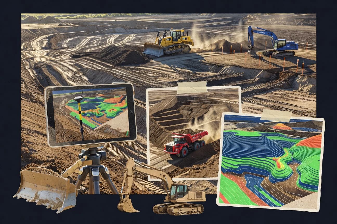
Construction InfrastructureTop 10 Best Cut And Fill Software of 2026
Find the top 10 cut and fill software options. Compare features, choose the best fit, and start your project.

How we ranked these tools
Core product claims cross-referenced against official documentation, changelogs, and independent technical reviews.
Analyzed video reviews and hundreds of written evaluations to capture real-world user experiences with each tool.
AI persona simulations modeled how different user types would experience each tool across common use cases and workflows.
Final rankings reviewed and approved by our editorial team with authority to override AI-generated scores based on domain expertise.
Score: Features 40% · Ease 30% · Value 30%
Gitnux may earn a commission through links on this page — this does not influence rankings. Editorial policy
Editor picks
Three quick recommendations before you dive into the full comparison below — each one leads on a different dimension.
Bentley OpenGround
Terrain-based cut-and-fill quantity computation driven by surface model comparisons
Built for civil survey and earthworks teams needing dependable volume calculations across revisions.
Trimble Earthworks
Runner UpEarthwork volume calculations that directly compare measured surfaces to design targets
Built for civil contractors using Trimble positioning for production earthworks control.
Autodesk Civil 3D
Also GreatCorridor Earthworks volume reporting between design and comparison surfaces
Built for civil teams needing corridor-based earthwork quantities with model-linked surfaces.
Related reading
Comparison Table
This comparison table evaluates cut and fill software used for earthworks planning, volume calculations, and site grading across Bentley OpenGround, Trimble Earthworks, Autodesk Civil 3D, BricsCAD Earthwork, MicroStation, and other common workflows. Readers can compare modeling and survey data handling, alignment and grading automation, quantity reporting outputs, and typical exchange formats so tool selection matches project deliverables.
Bentley OpenGround
earthworksProvides earthwork and cut-and-fill workflows for surveying and site models using Bentley's infrastructure data and surface tools.
Terrain-based cut-and-fill quantity computation driven by surface model comparisons
Bentley OpenGround stands out by targeting survey-to-earthwork workflows with a tight connection between terrain models, design surfaces, and construction volumes. It supports cut and fill computations by comparing ground models and handling typical earthmoving analysis outputs for planning and reporting. The tool emphasizes spatial data alignment and repeatable calculations across project surfaces and revisions rather than standalone spreadsheet volume estimates.
- +Strong terrain-to-volume workflow with reliable cut and fill comparisons
- +Produces actionable earthwork quantities aligned to design and existing surfaces
- +Supports revision-driven volume recalculation for iterative planning
- –Workflow setup and data preparation demand stronger surveying discipline
- –Earthwork configurations can feel complex for simple single-surface tasks
- –Visualization and reporting options require extra steps for tailored deliverables
Best for: Civil survey and earthworks teams needing dependable volume calculations across revisions
More related reading
Trimble Earthworks
construction volumesSupports earthmoving calculations and reporting from design and field data to quantify cut, fill, and haul volumes.
Earthwork volume calculations that directly compare measured surfaces to design targets
Trimble Earthworks focuses on automating earthmoving workflows by turning survey and design inputs into cut and fill control-ready outputs. It supports integration with Trimble positioning hardware and workflows used for grading, stockpiling, and production control.
Core capabilities include volumetric calculations, plan and profile comparisons, and alignment between field surfaces and design targets. The system is most effective when deployed as part of a broader Trimble jobsite toolchain rather than as a standalone estimating package.
- +Strong cut and fill volume workflows tied to field surface data
- +Good design-to-field comparison for grading and earthwork verification
- +Trimble integration supports consistent positioning control during production
- –Best results depend on Trimble hardware and established field processes
- –Setup and data preparation can be heavy for complex projects
- –Less ideal as a generic, standalone tool for non-Trimble workflows
Best for: Civil contractors using Trimble positioning for production earthworks control
Autodesk Civil 3D
CAD earthworksCalculates cut-and-fill quantities from corridor and surface models and exports earthwork volume reports for infrastructure sites.
Corridor Earthworks volume reporting between design and comparison surfaces
Autodesk Civil 3D stands out for its tight workflow between terrain modeling and engineering surface-driven volumes for cut and fill. It supports creating corridor-driven earthwork using alignments, profiles, and assemblies, then computing volume reports from defined comparison surfaces.
The software also integrates grading and surface editing tools for iterating design intent while preserving survey and alignment context. Civil 3D fits earthwork projects where the most value comes from maintaining a model-based data chain rather than one-off volume calculations.
- +Corridor earthwork volumes stay linked to alignment, profile, and assembly geometry.
- +Volume reports compute cut and fill between multiple surface definitions and regions.
- +Survey and surface tools support iterative grading without losing design context.
- +Earthwork quantities can be driven from feature lines for controlled grading layouts.
- –Setup of styles, regions, and volume targets can be time-consuming.
- –Model complexity increases performance demands on large corridor projects.
- –Some grading and quantity tasks need careful surface management to avoid mismatches.
- –Workflow learning curve is steep for teams unfamiliar with Civil 3D concepts.
Best for: Civil teams needing corridor-based earthwork quantities with model-linked surfaces
BricsCAD Earthwork
CAD earthworksCreates terrain surfaces and computes cut-and-fill quantities with earthwork tools for civil site projects.
Volume computation between triangulated surfaces with earthwork quantity output
BricsCAD Earthwork stands out by bringing earthwork quantity and cut fill calculation workflows into the BricsCAD CAD environment. It supports triangulated surface workflows for computing volumes between an existing and proposed surface.
It also includes grading and alignment-driven earthwork tools that fit projects already modeled in BricsCAD. The solution focuses on quantity extraction rather than standalone civil design automation.
- +Earthwork volumes compute directly from triangulated surfaces
- +Runs inside BricsCAD, keeping CAD layers and drafting consistent
- +Supports grading and alignment-driven earthwork workflows
- –Earthwork logic depends on clean surface models and inputs
- –Less specialized than dedicated civil earthwork platforms
- –Complex jobs require careful setup of boundaries and volume options
Best for: Civil drafters using BricsCAD who need cut and fill quantities
MicroStation
CAD earthworksGenerates and compares terrain models to derive cut-and-fill volumes for transportation and civil construction deliverables.
Advanced surface modeling and editing for precise terrain change calculations
MicroStation stands out for its strong CAD-grade geometry handling and visualization workflow for civil surfaces. It supports point cloud integration and survey-style data processing that can feed terrain models used for cut and fill calculations.
The platform also benefits from established interoperability with common civil file formats, which helps when comparing volumes across project baselines. Its core value is managing complex spatial datasets more than delivering a dedicated, automated earthworks workflow out of the box.
- +Robust surface and terrain editing for complex cut and fill geometry
- +Point cloud handling supports modeling from scanned survey data
- +Strong interoperability for bringing in and exporting civil geometry
- –Cut and fill workflows require configuration rather than guided automation
- –Earthworks volume reporting can feel indirect versus specialized tools
- –Learning curve is steep for teams focused only on earthworks
Best for: Civil teams needing CAD-level terrain control and mixed-format geodata workflows
Tekla Structures
BIM integrationCoordinates model-based construction information that can be used to support earthworks quantification workflows for infrastructure projects.
Rule-based quantity takeoff from model geometry with revision-linked consistency
Tekla Structures stands out for tying cut and fill workflows to a BIM authoring model used for structural detailing, clash checking, and construction documentation. It can generate earthwork volumes from model geometry and support quantity takeoffs through model-based calculations that stay consistent with revisions.
Its primary strength is engineering coordination across disciplines rather than specialized standalone grading and earthwork simulation. For cut and fill, it fits best when earthwork quantities depend on an integrated design model that already drives the structural and site constraints.
- +Model-based quantities stay linked to structural and site geometry changes
- +Powerful BIM coordination supports clash detection and construction-ready documentation
- +Automation via templates and parametric objects reduces manual rework
- +Strong audit trail with model revision history and repeatable calculations
- –Cut and fill workflows are not as specialized as dedicated earthwork tools
- –Setup effort is higher when earthwork needs exceed standard modeling practices
- –Learning curve is steep for teams without Tekla modeling experience
Best for: Engineering teams needing BIM-linked earthwork volumes with structural coordination
Global Mapper
GIS earthworksCompares raster or terrain surfaces to support volume and earthwork analysis tasks including cut and fill calculations.
Cut-and-fill volume computation between two surfaces with extensive terrain editing controls
Global Mapper stands out for cut and fill workflows that stay anchored in GIS-grade terrain data handling and cross-format import. It supports volume calculations using gridded surfaces and TINs, with configurable breaklines, interpolation controls, and earthwork statistics output. Its value is strongest when projects require repeated terrain edits, alignment checks, and map-based QA across large spatial datasets.
- +Handles diverse terrain inputs including DEMs and TINs for earthwork calculations
- +Provides detailed cut and fill volume reporting with configurable comparison surfaces
- +Supports breaklines and interpolation settings to improve surface creation accuracy
- –Earthwork setup can feel complex compared with dedicated surveying cut-fill tools
- –Precision control depends on correct surface generation and datum alignment by users
- –Visualization for haul logistics is limited beyond volume and surface QA outputs
Best for: GIS-focused earthwork teams needing accurate cut-fill volumes from varied terrain data
QGIS
open-source GISEnables terrain surface comparison and volume estimation using spatial analysis plugins for cut-and-fill style workflows.
Raster calculator plus terrain surface differencing from DEMs for cut and fill mapping
QGIS stands out for turning raw elevation data into analysis-ready terrain layers using an open GIS workflow. For cut and fill tasks, it supports raster differencing, volume estimation via surface comparison, and visualization through 2D maps and profiles. It can be extended for geoprocessing using processing tools and plugins, which fits projects that need repeatable spatial analytics rather than a single-purpose mass-haul interface.
- +Raster calculator and surface differencing workflows support cut and fill volumes.
- +Strong visualization with contours, hillshade, and 2D layouts for validation.
- +Extensible processing toolbox lets teams automate geospatial steps.
- –Cut and fill output quality depends on careful preprocessing and CRS alignment.
- –Volumetrics require combining tools rather than a dedicated mass-haul wizard.
- –Large rasters can be slow without tuned settings and compute resources.
Best for: Surveying teams needing GIS-driven cut and fill analysis with customizable workflows
Land Development Desktop
civil CADBuilds and analyzes civil alignments and surfaces to support earthwork volume computations for site grading projects.
Alignment and grading surface modeling that drives cut-and-fill volume calculations
Land Development Desktop stands out for deep Autodesk CAD lineage and integration with civil workflows that already use DWG data. It supports cut and fill analysis through surface modeling, volume calculations, and alignment-based earthwork quantities tied to survey and design geometry. It also fits into repeatable production processes where grading surfaces, parcels, and alignments are managed as engineering objects rather than standalone meshes.
- +Uses DWG-native workflows for grade surfaces, alignments, and earthwork models
- +Supports volume and cut-and-fill calculations tied to engineering geometry
- +Integrates with broader Autodesk civil toolchains for data continuity
- +Object-based civil modeling supports repeatable earthwork production
- –Earthwork workflows feel CAD-centric and less guided than dedicated tools
- –Surface and quantity setups require careful template and settings management
- –Large models can become slower when many design objects are updated
- –Modern 3D quantity and reporting experiences are not as streamlined
Best for: Autodesk-centric civil teams producing repeatable DWG-based earthwork quantities
Civil Site Design
site gradingProvides site grading and earthworks quantity calculations for cut-and-fill planning on construction sites.
Section and earthworks volume outputs tied to existing and proposed surface comparisons
Civil Site Design centers cut and fill planning around a civil-focused workflow for grading, earthworks, and mass haul style evaluation. The tool supports importing and managing terrain and surface data so volumes can be computed against proposed grading surfaces.
It emphasizes plan and section outputs for design review and construction communication, which aligns with site grading use cases. Coordination relies on accurate surface inputs and a structured modeling process rather than advanced parametric automation.
- +Built for cut and fill workflows with grading and earthworks volume computation.
- +Surface-based approach supports clear comparisons between existing and proposed grades.
- +Section and plan outputs help validate earthwork design decisions.
- –Advanced optimization and design automation are limited versus broader Earthworks suites.
- –Workflow depends heavily on clean surface data and controlled modeling steps.
- –Collaboration and model interoperability features are less comprehensive than top-tier tools.
Best for: Civil teams preparing grading volumes and plan-ready cut-and-fill documentation
Conclusion
After evaluating 10 construction infrastructure, Bentley OpenGround stands out as our overall top pick — it scored highest across our combined criteria of features, ease of use, and value, which is why it sits at #1 in the rankings above.
Use the comparison table and detailed reviews above to validate the fit against your own requirements before committing to a tool.
How to Choose the Right Cut And Fill Software
This buyer’s guide explains how to choose Cut And Fill Software that computes earthwork quantities from real terrain models and design geometry. It covers workflows and fit areas for Bentley OpenGround, Trimble Earthworks, Autodesk Civil 3D, BricsCAD Earthwork, MicroStation, Tekla Structures, Global Mapper, QGIS, Land Development Desktop, and Civil Site Design. Each section ties tool capabilities to concrete project needs like corridor volume reporting, raster differencing, and revision-linked quantity recalculation.
What Is Cut And Fill Software?
Cut And Fill Software calculates excavation and embankment quantities by comparing an existing ground surface against a proposed or target surface. It turns terrain models, design surfaces, and survey data into cut and fill outputs used for planning, reporting, and construction coordination. Tools like Autodesk Civil 3D compute corridor earthwork volumes between design and comparison surfaces using alignments, profiles, and assemblies. Tools like Global Mapper compute cut and fill volume statistics between two gridded surfaces or TINs while supporting extensive terrain editing controls.
Key Features to Look For
The right features determine whether results stay model-linked, repeatable, and QA-able across revisions and data formats.
Terrain-to-surface volume comparisons
Bentley OpenGround drives cut and fill quantity computation through surface model comparisons so volumes stay aligned to design and existing terrain. Global Mapper provides cut-and-fill volume computation between two surfaces while exposing detailed terrain editing controls that improve surface QA before reporting.
Corridor and assembly-driven earthwork reporting
Autodesk Civil 3D keeps corridor earthwork quantities linked to alignment, profile, and assembly geometry so volume reports remain tied to engineering intent. Land Development Desktop also supports alignment and grading surface modeling that drives cut-and-fill volume calculations inside Autodesk DWG-based workflows.
Direct measured-to-design cut and fill workflows
Trimble Earthworks focuses on earthwork volume calculations that compare measured surfaces to design targets to produce outputs suitable for grading and production control. Civil Site Design similarly emphasizes comparisons between existing and proposed grades using plan and section outputs for construction communication.
TIN surface and triangulated volume computation
BricsCAD Earthwork computes volume between triangulated surfaces and outputs earthwork quantities derived directly from clean existing and proposed surfaces. MicroStation supports CAD-grade terrain modeling and precise terrain change calculations using robust surface editing for cut and fill geometry.
Raster differencing and DEM workflows
QGIS enables cut and fill style workflows by supporting raster differencing and volume estimation via surface comparison, with visualization through contours, hillshade, and 2D layouts. QGIS also extends repeatable geoprocessing with an extensible processing toolbox when projects require repeated spatial analytics.
Revision-linked, model-based quantity takeoff
Tekla Structures ties earthwork quantification to a BIM authoring model so quantity outputs stay consistent with structural and site model revisions. Bentley OpenGround also emphasizes revision-driven volume recalculation for iterative planning so changes to terrain comparisons update earthwork quantities rather than starting over.
How to Choose the Right Cut And Fill Software
The selection process should map required inputs and deliverables to the tool’s strongest volume-computation workflow and data model alignment.
Start with the surface types that drive quantities
If existing and proposed surfaces come from survey-grade terrain models and must remain aligned across revisions, Bentley OpenGround is built around terrain-based cut-and-fill quantity computation driven by surface model comparisons. If terrain data arrives as DEMs, TINs, or gridded layers that must be edited and QA-ed before computing volumes, Global Mapper supports cut-and-fill volume computation between two surfaces with configurable breaklines and interpolation controls. If the project team works primarily with DEM rasters, QGIS supports raster differencing and volume estimation using a raster differencing workflow.
Match the reporting structure to corridor or site grading deliverables
For infrastructure sites where quantities must stay linked to corridor alignments, profiles, and assemblies, Autodesk Civil 3D is designed for corridor earthworks volume reporting between design and comparison surfaces. If the project is DWG-centric and uses Autodesk grading surfaces and alignments as engineering objects, Land Development Desktop supports alignment and grading surface modeling that drives cut-and-fill calculations. If site teams need plan and section outputs tied to existing and proposed surface comparisons for design review and construction communication, Civil Site Design centers cut-and-fill planning around grading and earthworks volume computation.
Choose the workflow that fits the data custody model
When production control depends on integrating measured surfaces and design targets with Trimble field processes, Trimble Earthworks provides earthwork volume workflows that compare measured surfaces to design targets. When teams need CAD-level terrain control with strong geometry handling and point cloud integration to model from scanned survey data, MicroStation supports point cloud integration feeding terrain models for cut and fill calculations. When teams draft and manage surfaces directly in a CAD environment and want quantity extraction between triangulated surfaces, BricsCAD Earthwork runs earthwork tools inside BricsCAD while keeping CAD layers and drafting consistent.
Confirm that the tool can handle your revision and audit expectations
If iterative planning requires recalculating volumes after terrain model changes, Bentley OpenGround emphasizes revision-driven volume recalculation for iterative planning and consistent comparisons across project surfaces. If the quantity source of truth must remain the BIM model and audit trail must follow model revision history, Tekla Structures supports rule-based quantity takeoff from model geometry with revision-linked consistency. If the environment is built around engineering objects and engineering context must remain preserved, Autodesk Civil 3D and Land Development Desktop keep quantities tied to corridor or alignment-driven design surfaces.
Validate expected setup effort and performance constraints with a pilot model
Civil 3D corridor workflows can require time for styles, regions, and volume targets, so a pilot corridor with the intended surface definitions helps confirm surface management effort on large projects. Global Mapper and QGIS require correct surface generation, datum alignment, and raster preprocessing, so a pilot surface build validates precision control before mass volume reporting. MicroStation and BricsCAD Earthwork depend on clean surface models and accurate boundaries, so a pilot triangulation and boundary setup prevents mismatches that degrade volume outputs.
Who Needs Cut And Fill Software?
Cut And Fill Software fits teams that must convert terrain and design models into excavation and embankment quantities with repeatable logic.
Civil survey and earthworks teams managing revisions
Bentley OpenGround matches civil survey and earthworks needs because it computes cut and fill quantities from terrain model comparisons and emphasizes revision-driven recalculation across project surfaces. Global Mapper also fits teams that repeatedly edit terrain and need GIS-grade cut and fill computations with extensive terrain editing controls.
Civil contractors using Trimble positioning for grading production control
Trimble Earthworks is built for civil contractors who use Trimble positioning workflows, because it compares measured surfaces to design targets to produce earthwork volume outputs for control. This measured-to-design comparison workflow supports earthwork verification tied to field surface data rather than standalone estimating.
Infrastructure teams needing corridor-based, model-linked earthwork quantities
Autodesk Civil 3D is the fit for corridor-based earthwork quantities because it performs corridor earthworks volume reporting between design and comparison surfaces using alignment, profile, and assembly geometry. Land Development Desktop also supports alignment and grading surface modeling for DWG-based repeatable earthwork production in Autodesk civil toolchains.
GIS and surveying teams doing raster-based terrain analytics
QGIS supports raster differencing and surface comparison so teams can map cut and fill outcomes with 2D contours and hillshade validation. Global Mapper supports gridded surfaces and TIN-based cut and fill volume computation when terrain arrives in multiple formats that require breaklines and interpolation controls.
Common Mistakes to Avoid
Volume results degrade quickly when surface definitions, boundaries, or comparison targets do not match the computation workflow the tool expects.
Using mismatched surface definitions for comparison regions
Autodesk Civil 3D volume reporting depends on defined comparison surfaces and regions, so mismatches between design targets and comparison extents create incorrect cut and fill results. Global Mapper and QGIS similarly require correct datum alignment and careful surface generation, so inconsistent datums or preprocessing break precision control and volume accuracy.
Underestimating the setup burden for complex models
Civil 3D can require time for styles, regions, and volume targets, and MicroStation can require configuration rather than guided automation for cut and fill workflows. BricsCAD Earthwork also requires careful setup of boundaries and volume options for complex jobs, so teams should pilot setup before committing to production datasets.
Treating earthworks tools as generic volume calculators instead of workflow systems
Trimble Earthworks delivers best results when deployed as part of the Trimble jobsite toolchain with established field processes. Bentley OpenGround emphasizes terrain-to-volume workflows driven by surface comparisons rather than one-off spreadsheet style volume estimates, so teams that skip data preparation typically get less reliable results.
Expecting haul logistics optimization from tools that focus on volumes and surface QA
Global Mapper prioritizes volume and surface QA outputs, so visualization for haul logistics remains limited relative to volume-centric analysis. Civil Site Design provides plan and section outputs for grading decisions, but advanced optimization and design automation remain limited versus broader earthworks optimization suites.
How We Selected and Ranked These Tools
We evaluated each cut and fill software tool on three sub-dimensions. Features received a weight of 0.4, ease of use received a weight of 0.3, and value received a weight of 0.3. The overall rating is computed as overall = 0.40 × features + 0.30 × ease of use + 0.30 × value. Bentley OpenGround stood out through strong terrain-to-volume workflow strength in the features dimension because its standout terrain-based cut-and-fill quantity computation runs directly from surface model comparisons and supports revision-driven recalculation for iterative planning.
Frequently Asked Questions About Cut And Fill Software
How do Bentley OpenGround and Autodesk Civil 3D handle cut and fill calculations across design revisions?
Which tool best supports production earthworks control tied to field measurement and machine workflows?
What is the most practical choice for corridor-based cut and fill quantity reporting?
Which software fits teams that already model terrain in CAD and need cut and fill quantities from triangulated surfaces?
When point clouds and mixed geodata formats are part of the input pipeline, which tool is strongest?
Which option is best when earthwork volumes must stay consistent with a BIM model used for coordination and documentation?
Which tools are better suited for large-area GIS terrain edits and repeatable QA based on map-grade datasets?
What toolset is most appropriate for converting DEM or raster elevation data into cut and fill mappings?
How do Global Mapper and QGIS differ in how they compute volumes between two surfaces?
What is the fastest starting workflow for teams producing DWG-based grading quantities and alignment-tied volumes?
Tools reviewed
Primary sources checked during evaluation.
Referenced in the comparison table and product reviews above.
Keep exploring
Comparing two specific tools?
Software Alternatives
See head-to-head software comparisons with feature breakdowns, pricing, and our recommendation for each use case.
Explore software alternatives→In this category
Construction Infrastructure alternatives
See side-by-side comparisons of construction infrastructure tools and pick the right one for your stack.
Compare construction infrastructure tools→FOR SOFTWARE VENDORS
Not on this list? Let’s fix that.
Our best-of pages are how many teams discover and compare tools in this space. If you think your product belongs in this lineup, we’d like to hear from you—we’ll walk you through fit and what an editorial entry looks like.
Apply for a ListingWHAT THIS INCLUDES
Where buyers compare
Readers come to these pages to shortlist software—your product shows up in that moment, not in a random sidebar.
Editorial write-up
We describe your product in our own words and check the facts before anything goes live.
On-page brand presence
You appear in the roundup the same way as other tools we cover: name, positioning, and a clear next step for readers who want to learn more.
Kept up to date
We refresh lists on a regular rhythm so the category page stays useful as products and pricing change.