GITNUXSOFTWARE ADVICE
Public Safety CrimeTop 10 Best Crime Scene Reconstruction Software of 2026
Explore the top 10 crime scene reconstruction software tools to boost investigations. Find the best fit for your needs.
How we ranked these tools
Core product claims cross-referenced against official documentation, changelogs, and independent technical reviews.
Analyzed video reviews and hundreds of written evaluations to capture real-world user experiences with each tool.
AI persona simulations modeled how different user types would experience each tool across common use cases and workflows.
Final rankings reviewed and approved by our editorial team with authority to override AI-generated scores based on domain expertise.
Score: Features 40% · Ease 30% · Value 30%
Gitnux may earn a commission through links on this page — this does not influence rankings. Editorial policy
Editor’s top 3 picks
Three quick recommendations before you dive into the full comparison below — each one leads on a different dimension.
ReconstructMe
Measurement-to-3D scene conversion that produces walkthrough-ready reconstructions
Built for crime scene teams needing measurement-driven 3D reconstructions for review and court.
CyberLink PowerDirector
Editor pickMotion Tracking for stabilizing overlays and callouts on moving video elements
Built for teams creating clear visual reconstruction videos from video and stills.
SketchUp
Editor pickPush-pull 3D modeling with components for rapid, scaled scene reconstruction
Built for reconstruction teams needing fast visual modeling for exhibits and presentations.
Related reading
Comparison Table
This comparison table benchmarks major crime scene reconstruction tools alongside general 3D and geospatial platforms, including ReconstructMe, CyberLink PowerDirector, SketchUp, Blender, and QGIS. It summarizes each option’s core workflow strengths, such as scene modeling, video and photo handling, mapping and measurements, and output use cases for evidentiary presentation.
ReconstructMe
photogrammetryCreates photogrammetry and 3D reconstructions from images to support crime scene documentation and analysis workflows.
Measurement-to-3D scene conversion that produces walkthrough-ready reconstructions
ReconstructMe focuses on turning crime-scene measurements into navigable 3D reconstructions with clear scene context. Core capabilities center on importing or capturing geometry, placing assets, and generating walkthrough-ready models for analysis and courtroom communication.
The workflow emphasizes visual evidence organization and repeatable scene building rather than general-purpose CAD modeling. Collaboration supports exporting outputs that can be reviewed by investigators and stakeholders.
- +Measurement-to-3D reconstruction workflow supports evidence-grade scene visualization
- +3D scene exports aid investigator review and courtroom presentation workflows
- +Scene organization features reduce confusion across multiple reconstructions
- –Best results require disciplined capture of measurements and scene constraints
- –Complex layouts can demand more setup time than lighter reconstruction tools
- –Advanced customization is less straightforward than fully featured modeling suites
Best for: Crime scene teams needing measurement-driven 3D reconstructions for review and court
More related reading
CyberLink PowerDirector
timeline visualizationProvides video editing and mapping-style annotation capabilities that can be used to reconstruct and present crime scene timelines.
Motion Tracking for stabilizing overlays and callouts on moving video elements
CyberLink PowerDirector stands out for combining video editing with timeline-based media workflows that can support reconstruction-style storytelling. It provides multi-track editing, keyframing, and motion effects that help produce annotated scene walkthrough videos from stills, photos, and recorded footage.
It also includes motion tracking and object overlay tools that can visually align labels or callouts to moving elements. The tool is stronger at producing polished visual narratives than at providing forensic-specific measurement, evidence chain, or CAD-like scene geometry.
- +Multi-track timeline supports layered scene walkthroughs and overlays
- +Keyframing and motion effects help create controlled camera movement sequences
- +Motion tracking enables callouts that follow moving subjects in video
- +Export profiles support sharing reconstructed visuals in common video formats
- –Lacks forensic measurement tools like scale bars and precise spatial calibration
- –Provides limited scene geometry and CAD-style floorplan alignment
- –Evidence labeling and audit trails are not designed for courtroom-grade workflows
Best for: Teams creating clear visual reconstruction videos from video and stills
SketchUp
3D modelingBuilds 3D models of crime scenes to support scale diagrams, walkthroughs, and visual evidence presentation.
Push-pull 3D modeling with components for rapid, scaled scene reconstruction
SketchUp stands out for its rapid 3D modeling workflow using push-pull editing and a large component library. For crime scene reconstruction, it supports accurate scale modeling, orthographic views, and exports to common formats for documentation and court presentation.
It also benefits from extensive plugins and community workflows for adding realism such as lighting and scene assets. The tool’s main limitation is that it lacks purpose-built forensic analysis tools for measurements, trajectory solving, and evidence-to-world calibration.
- +Fast push-pull modeling for quick scene layout and spatial hypotheses
- +Strong scale handling with dimension tools for courtroom-friendly diagrams
- +Large plugin ecosystem for extensions like rendering and modeling automation
- –No dedicated forensic evidence workflows like trajectory and bullet path solvers
- –Calibration and measurement accuracy depend on manual user setup
- –Scene realism relies on external assets and rendering workflows
Best for: Reconstruction teams needing fast visual modeling for exhibits and presentations
Blender
open-source 3DCreates high-detail 3D reconstructions and visualizations using a modeling and rendering toolchain for forensic presentation.
Python scripting API for automating scene building, importing, and custom reconstruction tools
Blender stands out for using a full 3D open-source pipeline for modeling, physics-based scene setup, and photoreal rendering in one workspace. Crime scene reconstruction workflows can leverage mesh modeling, animation, and camera tooling to place objects and evidence in a spatial timeline.
Its node-based materials and lighting support helps recreate surfaces, shadows, and material response from reference imagery. The lack of dedicated forensics and measurement automation means workflows still depend on careful manual scaling and external calibration.
- +Full 3D pipeline covers modeling, lighting, animation, and rendering in one tool
- +Node-based materials enable realistic surface appearance for evidence visualization
- +Python scripting supports repeatable scene setups and custom import pipelines
- –No built-in crime-scene specific measurement, calibration, or uncertainty tools
- –Manual scaling and coordinate discipline are required for accurate reconstructions
- –Steep learning curve for advanced workflows like camera solving and procedural scenes
Best for: Forensic teams needing bespoke 3D reconstructions and scripted visualization workflows
QGIS
GIS mappingPerforms geospatial analysis and mapping that supports crime scene location visualization and spatial relationships.
Georeferencer tool for aligning scanned sketches and photos to real-world coordinates
QGIS stands out for its strong geospatial workflow capabilities built around layers, projections, and spatial analysis tools. It supports crime scene reconstruction tasks through georeferencing, digitizing evidence features, measuring distances and areas, and producing map layouts for timelines and diagrams.
Its data model and export options let teams move between aerial imagery, scanned sketches, and GIS-ready outputs for reporting. The open ecosystem of plugins expands capabilities for specialized visualization and analysis, but reconstruction workflows can require careful dataset preparation.
- +Layer-based digitizing supports evidence mapping over imagery and basemaps
- +Georeferencing and measurement tools enable repeatable scene scale workflows
- +Map layout exporter produces publication-ready diagrams and evidence figures
- +Plugin ecosystem adds specialized visualization and analysis options
- +GIS data imports and exports fit common forensic and reporting pipelines
- –No purpose-built reconstruction wizard for object placement and uncertainty
- –Coordinate system mistakes can silently break scale and alignment
- –Advanced tasks often require GIS skill and scripting familiarity
- –Timeline-driven reconstructions need manual workflow design
- –Standardized forensic reporting templates are limited
Best for: GIS-capable teams creating evidence maps, measurements, and georeferenced reconstructions
ArcGIS
enterprise GISAnalyzes and visualizes spatial data for crime scene mapping, buffering, and contextual investigations.
ArcGIS Web Map and Scene layers for sharing reconstructed evidence with spatial context
ArcGIS stands out for mapping-first crime scene workflows that connect field capture, geospatial analysis, and evidence visualization in one environment. Crime scene reconstruction support comes through tightly integrated GIS layers, measurement tools, and the ability to build interactive maps for timelines and spatial relationships.
Teams can combine photogrammetry or other 3D outputs with GIS basemaps to contextualize trajectories, locations, and scene changes over time. Collaboration relies on shared web maps, dashboards, and controlled access across work products.
- +Strong geospatial modeling for trajectories, zones, and evidence locations
- +Interactive web maps support stakeholder review of reconstructed scenes
- +3D and image-based workflows can be layered over accurate basemaps
- –Reconstruction-specific tools require configuration rather than turnkey physics solvers
- –Advanced GIS setup and data cleaning slow down small investigations
- –Complex projects can become heavy for field teams without GIS experience
Best for: Geospatially mature teams needing interactive, map-driven reconstruction workflows
AutoCAD
CAD draftingProduces accurate 2D and 3D CAD drawings to document evidence layouts, measurements, and court-ready diagrams.
Dimensioning with annotation scales and layers for evidence-accurate scene drawings
AutoCAD stands out for its mature 2D drafting core combined with precise measurement control needed for court-ready sketches. It supports layered drawings, dimensioning, and scalable layout workflows that map well to scene plans and evidence locations.
Crime scene reconstruction use is strengthened by importing reference imagery and exporting DWG and PDF for reporting and handoff. Its fit depends on manual modeling effort because specialized reconstruction tooling is not native to the core CAD environment.
- +DWG-based precision supports accurate measurements for scene diagrams
- +Layered drawing, blocks, and dimension tools streamline evidence documentation
- +Imports and exports enable clean handoff to reporting and collaboration
- –Reconstruction workflows require custom modeling and manual assumptions
- –Learning CAD commands and standards takes time for scene teams
- –No built-in forensic reconstruction simulation modules in the core product
Best for: Forensic teams needing accurate CAD scene plans and evidence mapping
Civil 3D
survey-grade CADModels terrain and survey-based geometry for crime scenes that require earthwork and spatial grading context.
Surface and corridor modeling driven by survey data
Civil 3D distinguishes itself with strong civil engineering modeling around surfaces, alignments, and corridors that can be repurposed for crime scene spatial planning. It supports precision geometry workflows, including survey-style data import and annotation for measurements and relationships.
Reconstruction work benefits from importing point clouds and generating controlled plan and profile views, then exporting layouts for documentation. The tool is less specialized for evidentiary workflows than dedicated forensic platforms, so investigators often rely on export pipelines and manual conventions.
- +Survey-grade surfaces, alignments, and corridors support disciplined spatial documentation.
- +Point cloud and GIS-ready import workflows help establish real-world geometry quickly.
- +DWG-centric drafting enables consistent plans, sections, and exportable reporting figures.
- –Forensic evidence management and chain-of-custody workflows are not purpose-built.
- –Crime reconstruction tools like trajectory analysis require external tools or manual methods.
- –Interface complexity slows non-engineering users during iterative scene reconstruction.
Best for: Civilly oriented teams creating precise scene geometry, not forensic analysis automation
E3D
virtual reconstructionDelivers virtual evidence reconstructions using 3D scene capture and viewing tools for investigative review.
Scene reconstruction from imported point clouds with measurement-ready 3D navigation
E3D stands out for crime-scene reconstruction workflows that combine 3D capture, scene building, and evidence-focused visualization in one environment. The tool supports importing point clouds and mesh data, then aligning views to create a navigable 3D scene for analysis and presentation. It emphasizes measurement and annotation so investigators can link spatial context to observations across reconstruction iterations.
- +Supports point cloud and mesh ingestion for detailed spatial scene reconstruction
- +Measurement tools help quantify distances, angles, and layouts within the 3D scene
- +Annotation and scene navigation support evidence communication during reviews
- –Workflow requires more setup discipline than guided reconstruction tools
- –Collaboration and review controls are weaker than document-centric case platforms
- –Rendering performance can limit interactivity on large scans
Best for: Investigative teams needing 3D scan-based reconstruction with measurement and annotated walkthroughs
Faro Scene
laser scanningProcesses terrestrial laser scan data into navigable 3D scenes for measurement-grade crime scene reconstructions.
Multi-station registration workflow for aligning terrestrial laser scans into one scene
Faro Scene centers on point cloud and scan-to-model workflows for capturing crime scene geometry with terrestrial laser scanning. It provides tools to register scans, clean and classify point data, and export results for downstream visualization and measurement. Its criminalistics fit comes from repeatable scene documentation that supports evidence-grade spatial review across multiple scan positions.
- +Robust scan registration and alignment workflow for large point sets
- +Strong point cloud processing tools for filtering and cleaning
- +Consistent exports for measurement and downstream reconstruction work
- –Scene setup and cleanup steps can be time intensive for new teams
- –Workflow depends on scanning discipline to avoid registration problems
- –Collaboration and evidence presentation features are limited compared to some suites
Best for: Investigator units using laser scanning to produce measured, reviewable 3D evidence
Conclusion
After evaluating 10 public safety crime, ReconstructMe stands out as our overall top pick — it scored highest across our combined criteria of features, ease of use, and value, which is why it sits at #1 in the rankings above.
Use the comparison table and detailed reviews above to validate the fit against your own requirements before committing to a tool.
How to Choose the Right Crime Scene Reconstruction Software
This buyer's guide explains how to choose crime scene reconstruction software for evidence-grade visualization, measurement workflows, and courtroom-ready outputs. Tools covered include ReconstructMe, Faro Scene, E3D, ArcGIS, QGIS, AutoCAD, Civil 3D, Blender, SketchUp, and CyberLink PowerDirector. The guidance maps common investigation workflows to the specific capabilities and limitations of each tool.
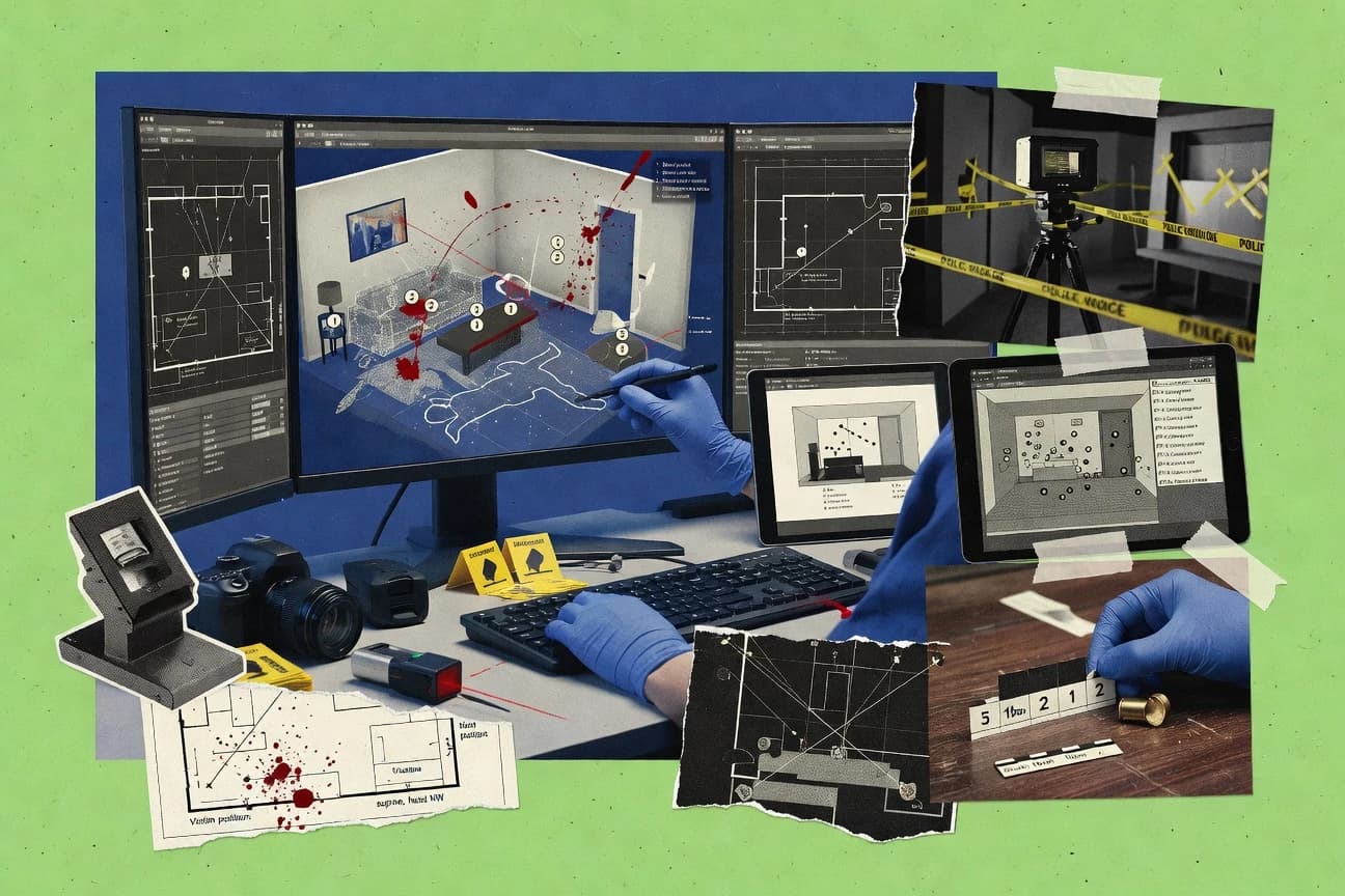
What Is Crime Scene Reconstruction Software?
Crime scene reconstruction software turns field observations, measurements, imagery, and scan data into visual scene models for investigation and presentation. It is used to document spatial relationships, support walkthroughs, and generate diagrams that map evidence to real-world coordinates. For example, ReconstructMe focuses on measurement-to-3D scene conversion from capture inputs. Faro Scene focuses on aligning terrestrial laser scans into a navigable 3D scene for measured review.
Key Features to Look For
The right features determine whether a reconstruction stays measurement-ready and repeatable or becomes presentation-only.
Measurement-to-3D scene conversion for walkthrough-ready models
ReconstructMe is built around converting measurements and scene context into navigable 3D reconstructions for evidence-grade visualization. E3D similarly supports measurement-ready 3D navigation after importing point clouds and mesh data.
Terrestrial laser scan registration and scan cleanup for measured geometry
Faro Scene provides multi-station registration workflow and point cloud processing tools for filtering and cleaning large scan sets. E3D also supports point cloud and mesh ingestion for scan-based scene reconstruction, but Faro Scene is centered on multi-station alignment discipline.
Point cloud and mesh ingestion with measurement-ready navigation
E3D accepts point clouds and mesh data and supports measurement tools for distances and angles inside a navigable 3D scene. Faro Scene delivers a scan-to-model pipeline that exports consistent results for downstream measurement and reconstruction work.
Evidence-accurate CAD dimensioning and layered drawing exports
AutoCAD emphasizes dimensioning with annotation scales and layered drawing workflows for evidence-accurate scene plans. It supports importing reference imagery and exporting DWG and PDF for courtroom and reporting handoffs.
Survey-grade surfaces and corridors driven by real-world data
Civil 3D distinguishes itself with surface and corridor modeling driven by survey data and point cloud import workflows. It supports controlled plan and profile views and DWG-centric exportable layouts for documentation when earthwork context matters.
Georeferencing and coordinate-stable mapping for evidence locations
QGIS provides a Georeferencer tool for aligning scanned sketches and photos to real-world coordinates and supports digitizing evidence features over imagery. ArcGIS extends this mapping-first workflow with ArcGIS Web Map and Scene layers to share reconstructed evidence with spatial context.
How to Choose the Right Crime Scene Reconstruction Software
A reliable selection starts by matching the reconstruction input type and the required output format to the tool's native workflow.
Match the input type to the tool’s reconstruction pipeline
For measurement-driven scene reconstruction from capture inputs, ReconstructMe is designed to convert measurements into walkthrough-ready 3D reconstructions. For terrestrial laser scanning workflows that require multi-station alignment, Faro Scene provides scan registration and point cloud filtering and cleaning tools. For scan-based reconstruction with navigation and measurement inside the 3D space, E3D imports point clouds and mesh data and supports measurement tools for distances and angles.
Decide whether the deliverable is a model, a map, or a presentation video
For interactive scene sharing with geospatial context, ArcGIS supports ArcGIS Web Map and Scene layers over accurate basemaps. For evidence maps, measuring distances, and producing map layouts from georeferenced layers, QGIS provides layer-based digitizing and map layout exporters. For annotated reconstruction video outputs using timeline workflows, CyberLink PowerDirector focuses on motion tracking and overlay callouts rather than forensic measurement or calibration.
Use CAD tools when strict evidence diagrams and scale control are the priority
For court-ready 2D and 3D CAD plans with precise measurement control, AutoCAD offers dimensioning with annotation scales and layered evidence layouts. For crime scene geometry that includes terrain grading and corridor context from survey-style data, Civil 3D supports survey-grade surfaces and alignment-driven corridors with plan and profile outputs.
Pick modeling and rendering tools only when purpose-built forensics is not required
SketchUp enables fast push-pull 3D modeling for scaled scene hypotheses and exports commonly used formats for exhibits and presentations. Blender provides a full 3D pipeline with Python scripting for repeatable custom scene building and photoreal rendering, but it does not provide built-in crime-scene measurement and calibration automation. These tools work best when manual scaling and coordinate discipline are feasible and when the workflow prioritizes visualization over forensic trajectory solving.
Validate workflow discipline for accuracy and collaboration needs
ReconstructMe produces best results when teams apply disciplined measurement capture and scene constraints, since complex layouts can require more setup time. Faro Scene depends on scanning discipline to avoid registration problems during multi-station alignment and cleanup. E3D supports measurement and annotations but collaboration and review controls are weaker than document-centric case platforms, so teams that need strong case controls often rely on mapping layers in ArcGIS or document-friendly exports from AutoCAD.
Who Needs Crime Scene Reconstruction Software?
Different investigation roles need different reconstruction workflows, from measurement-to-3D to georeferenced maps and CAD evidence diagrams.
Crime scene teams needing measurement-driven 3D reconstructions for review and court
ReconstructMe is the direct fit for measurement-to-3D scene conversion that creates walkthrough-ready reconstructions. E3D also fits teams that need scan-based reconstruction with measurement-ready 3D navigation and annotated walkthrough communication.
Investigator units using laser scanning to produce measured, reviewable 3D evidence
Faro Scene is built around multi-station registration and point cloud filtering and cleaning for measured geometry across scan positions. E3D supports point cloud and mesh ingestion with measurement tools, but Faro Scene focuses more on scan registration workflow consistency.
GIS-capable teams creating evidence maps, measurements, and georeferenced reconstructions
QGIS is the best match for georeferencing scanned sketches and photos, measuring distances and areas, and exporting publication-ready map layouts. ArcGIS is a strong choice for geospatially mature teams that need interactive web map and scene layers for stakeholder review.
Forensic teams needing accurate CAD scene plans and evidence mapping
AutoCAD is designed for layered drawing workflows with dimensioning and annotation scales for evidence-accurate scene diagrams. Civil 3D is the fit when the scene needs survey-grade terrain surfaces and corridor modeling with point cloud and alignment workflows.
Common Mistakes to Avoid
Common failure modes show up when teams pick a tool that cannot enforce measurement discipline or when they treat mapping or video tools as substitutes for forensic reconstruction.
Choosing a video timeline tool for measurement-grade reconstruction
CyberLink PowerDirector provides motion tracking for stabilizing overlays and callouts, but it lacks forensic measurement tools like scale bars and precise spatial calibration. ReconstructMe, E3D, and Faro Scene provide measurement-focused 3D reconstruction workflows and measurement-ready navigation instead of video-first overlay composition.
Assuming CAD or general 3D modeling automatically preserves calibration accuracy
SketchUp and Blender can produce scaled and photoreal visuals, but both rely on manual scaling and coordinate discipline because they do not provide built-in forensic measurement and calibration automation. AutoCAD supports strict dimensioning and annotation scales, while ReconstructMe and E3D emphasize measurement-to-3D conversion and measurement-ready navigation.
Using geospatial mapping as a replacement for scene object placement and forensic workflow
QGIS and ArcGIS excel at georeferencing and spatial context, but neither provides a turnkey forensic reconstruction wizard for object placement and uncertainty. ReconstructMe, E3D, and Faro Scene are designed around scene building and measurement-ready 3D reconstruction workflows.
Ignoring scan registration and cleanup discipline for point cloud alignment
Faro Scene depends on scanning discipline to avoid registration problems, and multi-station alignment needs consistent capture and cleanup. E3D supports measurement after point cloud and mesh ingestion, but large scan interactivity can drop without careful performance planning on big datasets.
How We Selected and Ranked These Tools
we score every tool on three sub-dimensions. Features carry a weight of 0.4. Ease of use carries a weight of 0.3. Value carries a weight of 0.3. The overall rating equals 0.40 × features + 0.30 × ease of use + 0.30 × value. ReconstructMe separated itself from lower-ranked tools by combining strong measurement-to-3D reconstruction workflow capabilities with an evidence-focused organization approach that reduces confusion across multiple reconstructions, which boosted the features dimension more than general-purpose modeling or mapping tools.
Frequently Asked Questions About Crime Scene Reconstruction Software
Which tool best converts field measurements into a walkthrough-ready 3D reconstruction?
What’s the main difference between ReconstructMe and Blender for building a reconstruction?
Which software is better for creating annotated reconstruction videos for stakeholders?
Which tool handles georeferencing and evidence maps more directly in one workflow?
When should a team choose ArcGIS instead of QGIS for reconstruction deliverables?
Which option is best for court-ready 2D plans with precise dimensioning?
What’s a practical workflow difference between E3D and Faro Scene for scan-based reconstruction?
Which tool supports rapid scaled 3D exhibit modeling when forensic automation is not the priority?
What common technical issue affects reconstruction results across multiple tools?
Tools reviewed
Primary sources checked during evaluation.
Referenced in the comparison table and product reviews above.
Keep exploring
Comparing two specific tools?
Software Alternatives
See head-to-head software comparisons with feature breakdowns, pricing, and our recommendation for each use case.
Explore software alternatives→In this category
Public Safety Crime alternatives
See side-by-side comparisons of public safety crime tools and pick the right one for your stack.
Compare public safety crime tools→FOR SOFTWARE VENDORS
Not on this list? Let’s fix that.
Our best-of pages are how many teams discover and compare tools in this space. If you think your product belongs in this lineup, we’d like to hear from you—we’ll walk you through fit and what an editorial entry looks like.
Apply for a ListingWHAT THIS INCLUDES
Where buyers compare
Readers come to these pages to shortlist software—your product shows up in that moment, not in a random sidebar.
Editorial write-up
We describe your product in our own words and check the facts before anything goes live.
On-page brand presence
You appear in the roundup the same way as other tools we cover: name, positioning, and a clear next step for readers who want to learn more.
Kept up to date
We refresh lists on a regular rhythm so the category page stays useful as products and pricing change.