GITNUXSOFTWARE ADVICE
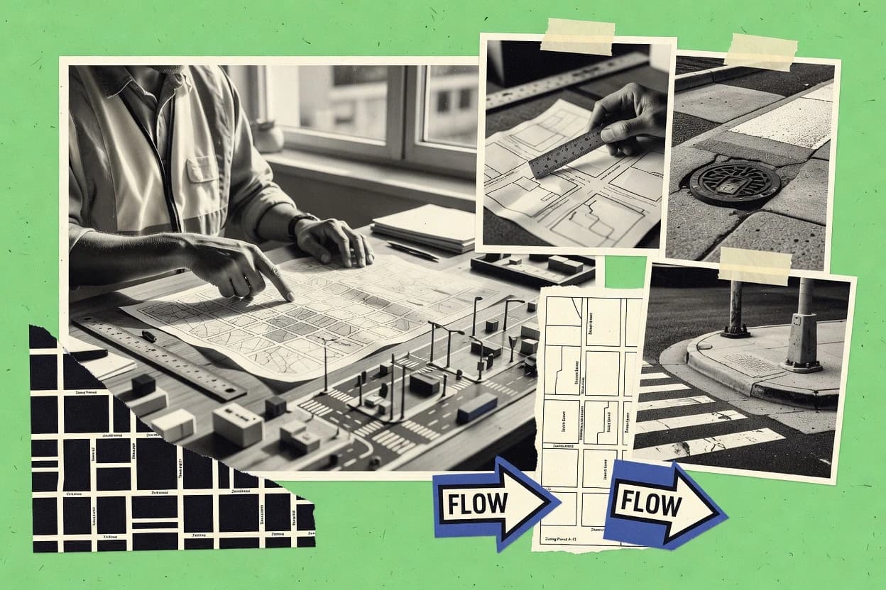
Construction InfrastructureTop 10 Best City Planner Software of 2026
Top 10 City Planner Software picks with a ranking for GIS workflows. Includes ArcGIS Urban, CityEngine, and FME for planning teams.

How we ranked these tools
Core product claims cross-referenced against official documentation, changelogs, and independent technical reviews.
Analyzed video reviews and hundreds of written evaluations to capture real-world user experiences with each tool.
AI persona simulations modeled how different user types would experience each tool across common use cases and workflows.
Final rankings reviewed and approved by our editorial team with authority to override AI-generated scores based on domain expertise.
Score: Features 40% · Ease 30% · Value 30%
Gitnux may earn a commission through links on this page — this does not influence rankings. Editorial policy
Editor’s top 3 picks
Three quick recommendations before you dive into the full comparison below — each one leads on a different dimension.
ArcGIS Urban
Urban planning scenario modeling with development controls and web-ready comparative visualization
Built for city planning teams needing GIS-driven scenario workflows with stakeholder-ready visualization.
CityEngine
Editor pickRule-based procedural city modeling with CGA-style syntax for semantic growth
Built for planning teams needing procedural 3D city generation from GIS layers.
FME
Editor pickFME Workbench visual workflow building with advanced spatial transformers
Built for planning teams needing automated, repeatable GIS data transformation workflows.
Related reading
Comparison Table
The comparison table groups city planner and GIS tools by integration depth, including how each system connects to existing geospatial data, ETL pipelines, and CAD workflows. It also contrasts the data model and schema approach, plus automation and API surface for provisioning, configuration management, and extensibility. Admin and governance controls are evaluated through RBAC, audit log coverage, and operational controls that affect deployment throughput and change tracking.
ArcGIS Urban
geospatial planningArcGIS Urban supports land-use planning workflows with configurable development scenarios, zoning concepts, and stakeholder-ready map outputs.
Urban planning scenario modeling with development controls and web-ready comparative visualization
ArcGIS Urban builds city planning workflows on top of geospatial sources, so planners can connect parcels, layers, and planning controls to scenario outputs. Configurable planning templates support land use planning and development control tasks while maintaining traceability from the visualization back to underlying GIS features. Scenario dashboards support feasibility-style analysis workflows that planners can review during iterative development discussions.
A tradeoff is that results depend on data readiness and configuration quality because the workflow ties visual outputs to parcel and layer inputs. It fits best for cities or planners that already maintain parcel layers and need repeatable scenario comparisons for stakeholder review and decision-making.
- +Scenario planning ties land use controls to spatial, model-backed outcomes
- +Interactive web visualization helps stakeholders compare planning alternatives quickly
- +Geospatial data lineage supports auditable updates from parcels to scenarios
- –Advanced configurations require strong ArcGIS admin and data modeling skills
- –Performance can degrade on large city extents with highly detailed datasets
- –Custom planning logic often needs specialist setup beyond standard templates
Planning analysts and GIS specialists
Configure templates for zoning and controls
Repeatable planning scenarios
City planners and development teams
Compare scenarios for feasibility assessments
Faster feasibility iteration
Show 1 more scenario
Urban design reviewers and stakeholders
Review interactive plans with traceable sources
Clearer review decisions
They inspect visual changes while tracing results back to geospatial layers and planning inputs.
Best for: City planning teams needing GIS-driven scenario workflows with stakeholder-ready visualization
More related reading
CityEngine
3D urban modelingCityEngine generates rule-based urban design models and massing for city planning studies using GIS-integrated workflows.
Rule-based procedural city modeling with CGA-style syntax for semantic growth
CityEngine stands out for turning GIS data into 3D urban models using rule-based procedural modeling. It supports city planning workflows with semantic modeling, facade and massing generation, and scenario-ready exports into common visualization pipelines.
Built-in integration with Esri geospatial data makes it practical for planners who already maintain authoritative feature layers. The same procedural approach can rapidly regenerate updated geometry, but deeper customization often requires rule logic authoring.
- +Procedural modeling converts GIS parcels and streets into detailed 3D city blocks
- +Semantic rules control building massing, facades, and style variations consistently
- +Regenerate models quickly after GIS edits to support rapid scenario iterations
- +Strong Esri GIS integration aligns with planning data layers and symbology
- –Rule authoring takes time to learn and maintain for complex design systems
- –High-detail outcomes can increase processing time for large urban extents
- –Best results depend on clean, consistent input layers like parcels and zoning
Urban planners with GIS feature layers
Generate rule-based 3D city massing
Faster concept iteration
Transportation and mobility analysts
Visualize corridor impacts in 3D
Clearer corridor stakeholder views
Show 2 more scenarios
Architecture and facade design teams
Apply procedural facade generation rules
Consistent design alternatives
Creates facade variants from semantic attributes so design options map to specific parcel features.
Planning communications and visualization staff
Export scenario-ready 3D assets
Reusable visualization deliverables
Produces repeatable 3D outputs for visualization pipelines used in public presentations and reviews.
Best for: Planning teams needing procedural 3D city generation from GIS layers
FME
data integrationFME automates GIS data conversion, enrichment, and publication so city planning datasets can be prepared consistently for planning and visualization.
FME Workbench visual workflow building with advanced spatial transformers
FME stands out for turning messy city data into consistent, usable layers through highly configurable automation workflows. It supports GIS-style transformations, spatial joins, and format handling across CAD, GIS, imagery, and tabular sources.
Automated translation and validation workflows reduce repetitive GIS prep and help standardize deliverables across planning teams. Strong workflow control and testing support ongoing updates to street, parcel, and utilities datasets.
- +Strong data translation across GIS, CAD, imagery, and spreadsheets
- +Visual workflow automation for repeatable planning dataset production
- +Robust spatial operations like joins, overlays, and geometry fixes
- +Field mapping and validation rules support consistent deliverables
- +Scales from single workflow runs to scheduled batch processing
- –Workflow authoring takes time and benefits from technical GIS experience
- –Complex logic can become difficult to maintain without strong standards
- –UI-centric tuning may slow rapid iteration compared to code-first tooling
Planning data analysts
Standardize mixed CAD and parcel datasets
Clean layers ready for planning
GIS workflow managers
Validate street and utilities updates
Fewer errors in published layers
Show 2 more scenarios
Municipal integration coordinators
Ingest imagery and tabular attributes
Unified datasets across departments
Transforms imagery footprints and tabular fields into harmonized formats for cross-department deliverables.
Development review teams
Automate permit boundary enrichment
Faster enriched permit packets
Performs spatial joins to attach zoning and parcel attributes to applicant submission boundaries.
Best for: Planning teams needing automated, repeatable GIS data transformation workflows
More related reading
QGIS
desktop GISQGIS provides desktop GIS editing and analysis tools for preparing land-use, parcel, and infrastructure layers for planning models and reports.
Processing Toolbox with Model Builder for repeatable geoprocessing workflows
QGIS stands out as a desktop GIS system that supports extensive data formats and spatial analysis workflows for planning teams. It delivers core capabilities for mapping, geoprocessing, geocoding, and network and raster analysis using a modular plugin ecosystem.
QGIS also supports standard geospatial standards through OGC services, styling via layers and symbology rules, and repeatable model workflows. For city planning, it is strongest when the workflow needs customized spatial analysis rather than a turnkey planning dashboard.
- +Strong spatial analysis and geoprocessing with native tools
- +Large plugin ecosystem for planning-specific workflows and formats
- +Works with many OGC services for live layer access
- –Advanced styling and processing workflows require GIS expertise
- –Project organization and performance can degrade with complex datasets
- –Collaboration and approval workflows require external tooling
Best for: Planning teams performing spatial analysis and mapping with GIS expertise
AutoCAD Civil 3D
civil designCivil 3D supports civil infrastructure design and planning with alignment, grading, profiles, and earthwork workflows tied to CAD drawings.
Clash Detective with rule-based clash tests across federated models
Navisworks by Autodesk stands out for turning large 3D design and construction datasets into a single coordinated model for review and simulation. It supports clash detection across disciplines, schedule-driven model walkthroughs, and issue management workflows for coordinating changes.
For city planning use cases, it is strongest when city-scale assemblies are prepared in CAD or BIM first, then reviewed for spatial conflicts and sequencing impacts. Its reliance on external model preparation limits how directly it supports early-stage planning and data creation from GIS sources.
- +Robust clash detection for discipline coordination across large federated models
- +TimeLiner supports schedule-aware walkthroughs tied to external planning schedules
- +Review and markup tools streamline issue capture and model-based feedback
- –GIS-native planning workflows are limited compared with dedicated city planning tools
- –Model federation and performance tuning require technical preparation of inputs
- –Early-stage scenario planning needs extra tools for analysis and reporting
Best for: Teams coordinating multi-discipline urban projects through model review and clash checks
MicroStation
engineering CADMicroStation enables infrastructure planning and modeling through CAD-based drafting and shared data workflows used in large engineering projects.
Immersive 3D planning review built around Bentley model context
OpenCities Planner centers planning workflows on Bentley’s 3D geospatial ecosystem and focuses on immersive site understanding for urban projects. It supports task-based planning that connects spatial context to review and coordination processes across stakeholders. The tool is strongest for planners who already rely on Bentley models and need structured visualization and decision support tied to the built environment.
- +Tight integration with Bentley geospatial and model data for planning workflows
- +Immersive 3D visualization for communicating constraints, massing, and context
- +Structured collaboration support for review and coordination around shared spatial views
- –Workflow depends heavily on Bentley data readiness and model conventions
- –Planning-specific analysis depth lags tools focused on specialized GIS planning
- –Large models can feel cumbersome without strong data management discipline
Best for: Teams using Bentley models for 3D planning review and stakeholder coordination
More related reading
OpenCities Planner
master planningOpenCities Planner helps manage city and master planning concepts with GIS-integrated models and collaborative planning tasks.
Immersive 3D planning review built around Bentley model context
OpenCities Planner centers planning workflows on Bentley’s 3D geospatial ecosystem and focuses on immersive site understanding for urban projects. It supports task-based planning that connects spatial context to review and coordination processes across stakeholders. The tool is strongest for planners who already rely on Bentley models and need structured visualization and decision support tied to the built environment.
- +Tight integration with Bentley geospatial and model data for planning workflows
- +Immersive 3D visualization for communicating constraints, massing, and context
- +Structured collaboration support for review and coordination around shared spatial views
- –Workflow depends heavily on Bentley data readiness and model conventions
- –Planning-specific analysis depth lags tools focused on specialized GIS planning
- –Large models can feel cumbersome without strong data management discipline
Best for: Teams using Bentley models for 3D planning review and stakeholder coordination
InfraWorks
infrastructure visualizationInfraWorks accelerates infrastructure planning and visualization using scenario models, terrain context, and network-based design exploration.
Clash Detective with rule-based clash tests across federated models
Navisworks by Autodesk stands out for turning large 3D design and construction datasets into a single coordinated model for review and simulation. It supports clash detection across disciplines, schedule-driven model walkthroughs, and issue management workflows for coordinating changes.
For city planning use cases, it is strongest when city-scale assemblies are prepared in CAD or BIM first, then reviewed for spatial conflicts and sequencing impacts. Its reliance on external model preparation limits how directly it supports early-stage planning and data creation from GIS sources.
- +Robust clash detection for discipline coordination across large federated models
- +TimeLiner supports schedule-aware walkthroughs tied to external planning schedules
- +Review and markup tools streamline issue capture and model-based feedback
- –GIS-native planning workflows are limited compared with dedicated city planning tools
- –Model federation and performance tuning require technical preparation of inputs
- –Early-stage scenario planning needs extra tools for analysis and reporting
Best for: Teams coordinating multi-discipline urban projects through model review and clash checks
More related reading
Navisworks
coordinationNavisworks supports construction infrastructure planning through clash detection, scheduling views, and coordination across model federations.
Clash Detective with rule-based clash tests across federated models
Navisworks by Autodesk stands out for turning large 3D design and construction datasets into a single coordinated model for review and simulation. It supports clash detection across disciplines, schedule-driven model walkthroughs, and issue management workflows for coordinating changes.
For city planning use cases, it is strongest when city-scale assemblies are prepared in CAD or BIM first, then reviewed for spatial conflicts and sequencing impacts. Its reliance on external model preparation limits how directly it supports early-stage planning and data creation from GIS sources.
- +Robust clash detection for discipline coordination across large federated models
- +TimeLiner supports schedule-aware walkthroughs tied to external planning schedules
- +Review and markup tools streamline issue capture and model-based feedback
- –GIS-native planning workflows are limited compared with dedicated city planning tools
- –Model federation and performance tuning require technical preparation of inputs
- –Early-stage scenario planning needs extra tools for analysis and reporting
Best for: Teams coordinating multi-discipline urban projects through model review and clash checks
Civil 3D-like alternatives in BricsCAD
CAD alternativeBricsCAD offers CAD workflows for civil drafting and grading tasks that can support infrastructure planning deliverables.
DWG-native parametric civil objects with alignment and profile-style design updates
BricsCAD is a CAD-centric workflow for city planning that feels familiar to Civil 3D users through DWG-native drafting and feature modeling. It supports alignment and profile style modeling, plus corridor-style surface work using its Civil tools add-on ecosystem.
Parcel mapping and survey-style drawing automation are handled through parametric objects and scripts that reuse DWG data across disciplines. For city planning deliverables, it exports and publishes to common GIS and document workflows while keeping the project anchored in CAD standards.
- +DWG-first foundation keeps city planning datasets consistent across teams
- +Alignment and profile workflows support typical road and utility layout planning
- +Parametric civil objects speed updates when design geometry changes
- +Open CAD workflows integrate with drafting and documentation pipelines
- –Civil-specific automation is less expansive than Civil 3D for complex corridors
- –Advanced surveying and GIS analytics require extra workflow management
- –Tooling depth varies by civil add-on modules rather than one unified stack
Best for: City planning teams needing DWG-based civil drafting with familiar workflows
Conclusion
After evaluating 10 construction infrastructure, ArcGIS Urban stands out as our overall top pick — it scored highest across our combined criteria of features, ease of use, and value, which is why it sits at #1 in the rankings above.
Use the comparison table and detailed reviews above to validate the fit against your own requirements before committing to a tool.
How to Choose the Right City Planner Software
This buyer's guide covers ArcGIS Urban, CityEngine, FME, QGIS, AutoCAD Civil 3D, MicroStation, OpenCities Planner, InfraWorks, Navisworks, and BricsCAD-like civil workflows for city planning execution.
It focuses on integration depth, data model fit, automation and API surface expectations, and admin and governance controls that impact repeatability across teams. It also connects GIS-to-scenario workflows, procedural modeling, and model review pipelines to concrete mechanisms like scenario dashboards, rule-based generation, and visual workflow automation.
Software that turns planning inputs into governed spatial outputs and review-ready models
City planner software combines a geospatial data model with planning logic so parcel, zoning, and infrastructure inputs produce scenario outputs, reports, and stakeholder-ready views. ArcGIS Urban drives land-use scenario modeling with configurable development controls and web-ready comparative visualization tied back to underlying GIS feature inputs.
CityEngine produces rule-based procedural 3D city models from GIS layers using semantic growth rules. FME complements these planning tools by automating GIS data conversion, spatial operations, and repeatable publication workflows that keep planning datasets consistent across updates.
Evaluation criteria for planning data integration, scenario logic, and controlled automation
Integration depth determines whether parcel layers, zoning concepts, and network models flow into planning outputs without manual relabeling each time the GIS changes. ArcGIS Urban connects planning templates and scenario dashboards back to parcel and layer inputs, while FME builds repeatable spatial transformation pipelines across CAD, GIS, imagery, and spreadsheets.
Automation and API surface expectations affect how governance can enforce repeatability at throughput. QGIS can standardize geoprocessing through its Processing Toolbox and Model Builder, while CityEngine relies on rule authoring to regenerate updated geometry consistently from the same GIS inputs.
Scenario logic tied to parcel and layer inputs with traceability
ArcGIS Urban connects land-use development controls to spatial inputs and produces scenario outputs with geospatial lineage that supports auditable updates from parcels to scenarios. This traceability matters when planners need iterative feasibility-style discussions backed by the underlying GIS features.
Rule-based procedural 3D generation from GIS semantics
CityEngine turns GIS parcels and streets into 3D urban models using semantic rules that control building massing and facade variations. This approach matters when the planning workflow must regenerate geometry after GIS edits without re-modeling manually.
Visual GIS automation pipelines for repeatable translation and validation
FME Workbench supports visual workflow automation with advanced spatial transformers, spatial joins, overlays, geometry fixes, and field mapping and validation rules. This matters for city planning datasets that require consistent deliverables across street, parcel, and utilities updates.
Repeatable geoprocessing workflows built from models and standard tools
QGIS uses its Processing Toolbox and Model Builder to assemble repeatable geoprocessing workflows for mapping, geocoding, and network and raster analysis. This matters when analysis-heavy planning steps must run consistently for new datasets and produce standardized outputs.
Coordinated infrastructure model review with rule-based clash tests
AutoCAD Civil 3D, InfraWorks, and Navisworks include clash detection with rule-based clash tests across federated models, plus walkthrough and markup workflows driven by external schedules in the case of Civil 3D. This matters when planning execution depends on detecting spatial conflicts and sequencing impacts across disciplines.
Governed model context review tied to Bentley geospatial conventions
MicroStation and OpenCities Planner center immersive 3D planning review around Bentley model context for communicating constraints and coordinating stakeholder review around shared spatial views. This matters when data readiness and model conventions in the Bentley ecosystem drive planning task outcomes.
DWG-native parametric civil objects for aligned infrastructure planning deliverables
BricsCAD-like civil workflows provide a DWG-first foundation with parametric alignment, profile-style surface work, and corridor-style surface tooling through its civil add-on ecosystem. This matters when planning deliverables must stay anchored in CAD standards while still exporting into common GIS and document workflows.
A decision framework for selecting city planning software by integration, automation, and governance fit
First map planning artifacts to data sources and decide which tool owns scenario outputs versus which tool owns data preparation. ArcGIS Urban fits teams that already maintain authoritative parcel layers and need repeatable scenario comparisons with web-ready visualization and traceability back to GIS inputs.
Next identify the automation boundary and governance needs. FME handles translation, enrichment, spatial operations, and validation as repeatable pipelines, while QGIS and its Processing Toolbox and Model Builder standardize analysis steps, and Navisworks-style tools handle rule-based clash tests for federated model coordination.
Assign ownership of scenarios versus data preparation
Use ArcGIS Urban for scenario outputs that connect configurable land-use development controls to parcel and layer inputs. Use FME when the dataset conversion and validation workload is the bottleneck because it supports visual workflow automation, spatial joins, overlays, and geometry fixes across CAD, GIS, imagery, and tabular sources.
Match the data model to the generation method
Select CityEngine when planning requires rule-based procedural 3D city generation from GIS semantics like parcels and streets using CGA-style rules for massing and facade variations. Select QGIS when the planning pipeline is analysis-led and needs modular geoprocessing and plugin-based capabilities over a wide range of data formats.
Define where regeneration must be automatic
Prioritize procedural regeneration with CityEngine so updated GIS layers produce refreshed geometry through the same semantic rule sets. Prioritize repeatable analysis and export with QGIS Processing Toolbox and Model Builder when standard processing chains must run consistently for new inputs.
Plan governance around workflow throughput and auditability
Choose ArcGIS Urban when scenario traceability from visualization back to parcel and layer inputs supports auditable updates across iterative planning. Choose FME when validation rules and field mapping enforce dataset consistency in scheduled batch processing workflows.
Decide the coordination layer for multi-discipline execution
If planning execution requires cross-discipline conflict detection, use AutoCAD Civil 3D, InfraWorks, or Navisworks with rule-based clash tests across federated models and review and markup workflows for issue capture. If the planning workflow is centered on Bentley model context and stakeholder coordination, use MicroStation or OpenCities Planner for immersive 3D review tied to Bentley geospatial conventions.
Lock the CAD foundation if the workflow is DWG anchored
Select BricsCAD-like civil workflows when the planning pipeline must remain DWG-native with alignment and profile-style design updates using parametric civil objects. This choice matters when deliverables must match CAD standards and still publish to common GIS and document pipelines.
Which city planning teams benefit from each tool category by workflow ownership
City planner software fits teams that must convert parcel, zoning, and infrastructure inputs into controlled scenario outputs or into governed review models that stakeholders can verify. The right fit depends on whether GIS-driven scenario logic, procedural 3D generation, data automation, or federated clash coordination is the critical path.
The following segments map to the specific best_for statements for ArcGIS Urban, CityEngine, FME, QGIS, AutoCAD Civil 3D, MicroStation, OpenCities Planner, InfraWorks, Navisworks, and BricsCAD-like civil workflows.
GIS-driven scenario planning with stakeholder-ready comparative visualization
ArcGIS Urban fits city planning teams that need GIS-driven scenario workflows because it supports configurable development scenarios with scenario dashboards and web-ready comparative visualization tied to parcel and layer inputs.
Procedural 3D urban design studies from GIS parcels and streets
CityEngine fits planning teams that need procedural 3D city generation because it uses semantic rules to control building massing and facade variations and supports regenerating models after GIS edits.
Automated GIS preparation, enrichment, and repeatable dataset publication
FME fits planning teams that need automated, repeatable GIS data transformation workflows because it handles translation across CAD, GIS, imagery, and spreadsheets with spatial transformers and validation rules in visual workflow automation.
Analysis-heavy planning with custom spatial geoprocessing and modelled outputs
QGIS fits planning teams performing spatial analysis and mapping with GIS expertise because it provides strong native geoprocessing, OGC service access patterns, and repeatable workflows through Processing Toolbox and Model Builder.
Multi-discipline coordination through clash detection and schedule-aware review
AutoCAD Civil 3D, InfraWorks, and Navisworks fit teams coordinating multi-discipline urban projects through model review and clash checks because they provide clash detection with rule-based tests across federated models plus walkthrough and markup workflows tied to external schedules in Civil 3D.
Common failure modes when City Planner Software is selected without integration and governance mapping
Selection failures show up when scenario workflows depend on data readiness that is not established in the chosen toolchain. MicroStation and OpenCities Planner depend heavily on Bentley model conventions and data readiness, and planning outcomes degrade when those conventions are inconsistent.
Other failures occur when teams underestimate automation and workflow authoring effort. FME workflows require standards to keep complex logic maintainable, and CityEngine rule authoring takes time to learn for complex design systems.
Choosing a scenario dashboard tool without controlling GIS input quality
ArcGIS Urban outputs depend on data readiness and configuration quality because scenario outputs tie back to parcel and layer inputs. Building a governed data prep pipeline with FME before scenario configuration prevents repeated manual cleanup for street, parcel, and utilities updates.
Treating procedural 3D rules as a one-time authoring task
CityEngine requires rule authoring time for complex design systems and maintenance as rules evolve. Using stable, validated GIS inputs through FME helps keep regeneration consistent when semantic rules rely on clean parcels and zoning layers.
Using GIS analysis tools without a repeatable workflow container
QGIS can degrade in organization and performance with complex datasets if projects and processing chains are not structured. Packaging analysis steps in Processing Toolbox and Model Builder reduces repeatability gaps when new planning datasets arrive.
Relying on federated model review without rule-based clash coverage
AutoCAD Civil 3D, InfraWorks, and Navisworks provide rule-based clash tests across federated models, so leaving clash rule coverage undefined creates blind spots. Aligning discipline models into the federated setup before review avoids performance tuning problems caused by poorly prepared inputs.
Anchoring planning delivery in DWG without planning the export workflow boundary
BricsCAD-like civil workflows stay DWG-native through parametric objects, but advanced surveying and GIS analytics require extra workflow management. Defining what gets exported into GIS and documents before design iteration prevents late-stage rework when GIS analytics need different data structures.
How We Selected and Ranked These Tools
We evaluated ArcGIS Urban, CityEngine, FME, QGIS, AutoCAD Civil 3D, MicroStation, OpenCities Planner, InfraWorks, Navisworks, and BricsCAD-like civil workflows using editorial criteria that prioritize features first, then ease of use, then value. Each tool receives an overall rating using a weighted average where features carries the most weight at 40% while ease of use and value each account for 30%. This ranking is grounded in the provided capability descriptions and the numeric ratings for features, ease of use, and value rather than any private benchmark experiments.
ArcGIS Urban apart from lower-ranked tools is the combination of urban planning scenario modeling with development controls plus scenario dashboards that support web-ready comparative visualization, and it ties scenario outputs back to parcel and layer inputs for geospatial data lineage. This capability lifted ArcGIS Urban primarily through the features factor and secondarily through ease-of-use fit for scenario comparison workflows that stakeholders can review quickly.
Frequently Asked Questions About City Planner Software
Which city planning tool fits teams that already maintain parcel layers and need repeatable scenario comparisons?
What tool is best for automating GIS data cleanup and format translation before planning dashboards or models run?
Which option supports rule-based procedural 3D city generation from GIS features without manually modeling each facade?
Which tools handle immersive site review tied to a specific 3D geospatial model ecosystem?
How do Navisworks-style tools differ from GIS planning tools for clash detection and issue management?
Which tool supports OGC services and modular geoprocessing for customized spatial analysis workflows?
What are the main integration and API considerations when combining scenario workflows with GIS hosting layers?
How should admin controls and audit visibility be handled when multiple planners edit scenario configurations?
What is the safest approach to migrate existing city data models into a new planning workflow?
Which tool is better for getting started when the primary data format is DWG from civil drafting workflows?
Tools reviewed
Primary sources checked during evaluation.
Referenced in the comparison table and product reviews above.
Keep exploring
Comparing two specific tools?
Software Alternatives
See head-to-head software comparisons with feature breakdowns, pricing, and our recommendation for each use case.
Explore software alternatives→In this category
Construction Infrastructure alternatives
See side-by-side comparisons of construction infrastructure tools and pick the right one for your stack.
Compare construction infrastructure tools→FOR SOFTWARE VENDORS
Not on this list? Let’s fix that.
Our best-of pages are how many teams discover and compare tools in this space. If you think your product belongs in this lineup, we’d like to hear from you—we’ll walk you through fit and what an editorial entry looks like.
Apply for a ListingWHAT THIS INCLUDES
Where buyers compare
Readers come to these pages to shortlist software—your product shows up in that moment, not in a random sidebar.
Editorial write-up
We describe your product in our own words and check the facts before anything goes live.
On-page brand presence
You appear in the roundup the same way as other tools we cover: name, positioning, and a clear next step for readers who want to learn more.
Kept up to date
We refresh lists on a regular rhythm so the category page stays useful as products and pricing change.