GITNUXSOFTWARE ADVICE
Data Science AnalyticsTop 10 Best Camera Mapping Software of 2026
Compare the top Camera Mapping Software picks with a ranking of the best tools like Pix4Dmapper, Metashape, and RealityCapture. Explore options.

How we ranked these tools
Core product claims cross-referenced against official documentation, changelogs, and independent technical reviews.
Analyzed video reviews and hundreds of written evaluations to capture real-world user experiences with each tool.
AI persona simulations modeled how different user types would experience each tool across common use cases and workflows.
Final rankings reviewed and approved by our editorial team with authority to override AI-generated scores based on domain expertise.
Score: Features 40% · Ease 30% · Value 30%
Gitnux may earn a commission through links on this page — this does not influence rankings. Editorial policy
Editor’s top 3 picks
Three quick recommendations before you dive into the full comparison below — each one leads on a different dimension.
Pix4Dmapper
GCP- and GNSS-based georeferencing with reprojection error QA for metric accuracy
Built for survey and construction teams producing accurate orthos, DSM, and DTM from drone imagery.
Agisoft Metashape
Editor pickDense point cloud generation with configurable depth maps and multi-view reconstruction
Built for engineering teams needing accurate photogrammetry outputs with detailed parameter control.
RealityCapture
Editor pickLiDAR-like dense point cloud generation from imagery with robust reconstruction pipeline
Built for teams producing accurate photogrammetry models from medium to large photo captures.
Related reading
Comparison Table
This comparison table evaluates camera mapping software used to generate 3D reconstructions from overlapping photos or video, including Pix4Dmapper, Agisoft Metashape, RealityCapture, KOLMAP, and OpenMVG. It breaks down key differences that affect production outcomes such as reconstruction quality, processing workflow, hardware and GPU requirements, licensing model, and compatibility with common data formats. The goal is to help teams match tool capabilities to their capture method, dataset size, and accuracy or speed targets.
Pix4Dmapper
photogrammetryProcesses drone images into camera-calibrated georeferenced outputs by performing photogrammetric alignment and mapping workflows.
GCP- and GNSS-based georeferencing with reprojection error QA for metric accuracy
Pix4Dmapper stands out with a full photogrammetry workflow that turns overlapping drone or camera images into metrically scaled 3D outputs. It supports point clouds, dense reconstructions, orthomosaics, DSM and DTM generation, and textured models from common camera map datasets.
The software provides QA tools like reprojection error checks and flexible georeferencing using GCPs and GNSS data. Output management integrates exports for GIS and measurement workflows used in survey, mapping, and construction documentation.
- +End-to-end photogrammetry pipeline from images to orthomosaics and terrain models
- +Strong georeferencing using GCPs, GNSS, and coordinate system controls
- +Built-in quality reports with reprojection error metrics for dataset validation
- –High hardware demands increase time and processing complexity for large projects
- –GEO workflow tuning can be challenging for mixed or poorly calibrated image sets
- –Dense output generation can feel less streamlined than simpler mapping tools
Best for: Survey and construction teams producing accurate orthos, DSM, and DTM from drone imagery
More related reading
Agisoft Metashape
photogrammetryGenerates camera models, dense point clouds, and georeferenced 3D reconstructions from overlapping images.
Dense point cloud generation with configurable depth maps and multi-view reconstruction
Agisoft Metashape stands out for producing dense 3D reconstructions from photogrammetry workflows with tight control over alignment, dense cloud generation, and mesh texturing. The software supports camera calibration and alignment, sparse-to-dense processing, and export to common 3D and surveying formats for downstream GIS and inspection use cases.
Metashape also includes tools for tiled processing and model refinement that help manage large, high-detail capture projects. Rendering and texturing options are built around preserving visual fidelity while generating metric geometry.
- +Strong photogrammetry pipeline with configurable alignment and dense reconstruction steps
- +Dense point clouds, meshes, and orthomosaics with integrated texturing controls
- +Scales to large datasets using tiled processing workflows for detailed outputs
- +Supports survey-oriented outputs with georeferencing and calibration features
- –Workflow complexity is high for first-time users managing parameters and quality settings
- –Processing time increases sharply with dense settings and large image counts
- –Result stability can require careful capture settings and dataset QA checks
- –Advanced editing and automation feel less streamlined than some competitors
Best for: Engineering teams needing accurate photogrammetry outputs with detailed parameter control
RealityCapture
photogrammetryPerforms image alignment to estimate camera poses and builds detailed 3D models and orthomosaics from photogrammetry datasets.
LiDAR-like dense point cloud generation from imagery with robust reconstruction pipeline
RealityCapture distinguishes itself with fast, high-accuracy photogrammetry for producing dense reconstructions and textured 3D models from large photo sets. Core capabilities include feature matching, camera alignment, dense point cloud generation, mesh reconstruction, and texture baking with export-ready outputs.
The tool supports both terrestrial and aerial capture workflows, including GCP and scale constraints for tighter georeferencing control. RealityCapture also provides automated reconstruction pipelines aimed at reducing manual babysitting during large batch jobs.
- +Very fast alignment and dense reconstruction on large image datasets
- +Strong control for georeferencing with GCP and distance constraints
- +High-quality textured meshes with consistent export outputs
- –Advanced settings can be complex for repeatable production workflows
- –Accuracy tuning often requires careful dataset-specific parameter choices
- –Memory and GPU demands can limit throughput on smaller workstations
Best for: Teams producing accurate photogrammetry models from medium to large photo captures
More related reading
KOLMAP
open-source SFMReconstructs scenes from images by estimating camera intrinsics and extrinsics using structure-from-motion and multi-view stereo.
Integrated project workflow that visualizes camera poses and sparse points during reconstruction
KOLMAP provides a streamlined graphical workflow around COLMAP for camera and sparse point reconstruction. It supports feature extraction, feature matching, sparse reconstruction, and dense reconstruction via COLMAP components. The tool emphasizes repeatable project setup and progress-friendly visualization of camera poses and reconstructed points.
- +Direct COLMAP pipeline access with clear stages for reconstruction work
- +Pose and point cloud visualization helps validate camera alignment quickly
- +Project-based workflow improves repeatability across datasets
- –Dense reconstruction tuning is less guided than specialized GUIs
- –Large datasets can feel slow during iterative parameter changes
- –Advanced settings can require familiarity with COLMAP concepts
Best for: Researchers and technical teams running COLMAP-like reconstruction on new image sets
OpenMVG
open-source SfMEstimates camera poses and sparse reconstructions from image collections using incremental SfM pipelines.
SfM pose estimation with bundle adjustment for estimating camera trajectories from image sets
OpenMVG stands out for producing camera motion and sparse or semi-dense reconstructions from images using an open-source photogrammetry pipeline. It includes Structure-from-Motion components, including pose estimation and bundle adjustment, plus downstream dense reconstruction hooks when paired with compatible tools. It is especially strong when image sets contain sufficient overlap and when workflows can tolerate command-line execution and data preparation steps.
- +Modular SfM pipeline with camera pose estimation and bundle adjustment support
- +Accurate output models suitable for further reconstruction and analysis
- +Works well for reproducible research workflows using documented commands and configs
- –Command-line setup and intermediate files add workflow friction
- –Dense results depend on additional tooling and careful parameter tuning
- –Scene success can be sensitive to image quality, overlap, and calibration inputs
Best for: Technical teams running SfM pipelines and integrating outputs into larger reconstruction workflows
OpenCV
vision toolkitProvides computer vision primitives for camera calibration, feature matching, and pose estimation used in custom camera-mapping pipelines.
Camera calibration with distortion estimation using cv::calibrateCamera
OpenCV stands apart because it provides a large, optimized computer-vision library with camera calibration primitives and direct access to pixel-level processing. Camera mapping workflows are supported through functions for camera calibration, pose estimation, feature detection, and geometric transformations needed for multi-view alignment.
The library can drive mapping pipelines from raw frames to rectified images, tracked correspondences, and reconstruction-ready outputs using standard vision building blocks. Complex mapping systems require significant integration work across calibration, feature matching, and downstream reconstruction stages.
- +Built-in camera calibration and distortion models for accurate intrinsic setup
- +Rich feature detection and matching for robust multi-view correspondence building
- +Well-tested geometric routines for pose estimation and image rectification
- –No complete camera-mapping application or guided end-to-end workflow
- –Common mapping pipelines require substantial custom glue code
- –Real-time performance tuning often needs careful profiling and parameterization
Best for: Teams building custom camera mapping pipelines with OpenCV-based vision components
More related reading
MicMac
photogrammetry toolkitPerforms photogrammetric processing to estimate camera geometry and create dense reconstructions from images.
Automated camera pose estimation from image sets using MicMac’s photogrammetric orientation pipeline
MicMac distinguishes itself with photogrammetry-oriented camera calibration and dense matching workflows built around open processing steps. It supports geometric calibration from image sets and can generate dense point clouds and derived products from standard camera data. The software’s core capabilities focus on extracting camera geometry, estimating 3D structure, and running reconstruction tasks via repeatable command-based processing.
- +Strong photogrammetric camera calibration and orientation estimation workflow
- +Produces dense reconstructions from image sets using established processing steps
- +Supports complex scenes with configurable parameters for advanced users
- –Command-line driven workflow slows down first-time adoption
- –Parameter tuning is required for stable results across varied image quality
- –Less guidance for end-to-end mapping workflows than GUI-based tools
Best for: Teams performing photogrammetry with command-line control for accurate camera mapping
RealityScan
mobile photogrammetryBuilds 3D captures from mobile photos by aligning camera positions and generating textured models.
Dense reconstruction from aligned images to generate high-detail 3D meshes
RealityScan is distinct for producing photogrammetry outputs focused on accurate 3D reconstructions from real-world imagery. It supports camera calibration and dense 3D reconstruction workflows using Structure-from-Motion and depth-map generation.
The tool is especially strong when capturing consistent photos or scans around an object or scene with good overlap and controlled lighting. It integrates well with RealityCapture-style workflows for teams that already manage photogrammetry processing pipelines.
- +Strong photogrammetry reconstruction pipeline for detailed 3D models from photos
- +Camera calibration and SfM alignment support accurate scene geometry recovery
- +Dense reconstruction generates usable meshes suitable for downstream visualization
- –Results depend heavily on capture quality, overlap, and exposure consistency
- –Advanced control over processing parameters adds learning overhead for new users
- –Workflow complexity can slow iteration compared with guided mapping apps
Best for: Teams creating accurate photogrammetry assets needing dense 3D reconstruction from photos
More related reading
Meshroom
node-based SfMUses a node-based pipeline to run feature matching, camera alignment, and sparse-to-dense reconstruction for image mapping.
AliceVision node graph workflow for configurable sparse-to-dense reconstruction
Meshroom builds 3D reconstructions from overlapping photos using a node-based AliceVision pipeline. It performs feature detection, sparse reconstruction, dense depth estimation, and mesh generation with outputs suitable for camera mapping workflows.
The software shines for repeatable photogrammetry runs, including optional depth-map fusion and texturing based on the reconstructed geometry. Processing is GPU-accelerated where available but remains sensitive to capture quality, alignment stability, and dataset scale.
- +Node-based photogrammetry pipeline makes each reconstruction stage reproducible
- +End-to-end workflow covers sparse reconstruction, dense depth, mesh, and texturing
- +Integrates AliceVision components for detailed control over camera mapping steps
- –Node graph setup and tuning can feel complex for nontechnical users
- –Dense reconstruction quality drops sharply with weak overlap or motion blur
- –Large datasets can require substantial GPU memory and long compute times
Best for: Visual effects and technical teams running photo-based reconstruction pipelines
ODM
open-source mappingBuilds camera poses and georeferenced reconstructions from drone imagery using OpenDroneMap photogrammetry pipelines.
Dense point cloud and textured mesh generation from drone imagery via configurable pipeline
ODM stands out for turning drone imagery into mapping products through an open, self-hosted photogrammetry pipeline. It supports dense point clouds, textured meshes, and georeferenced outputs suitable for surveying and site planning. The software emphasizes raw processing control through command-line execution and export of standard geospatial artifacts.
- +Generates dense point clouds, textured meshes, and georeferenced outputs
- +Open processing workflow with configurable photogrammetry parameters
- +Runs self-hosted for offline use and tight environment control
- –Command-line oriented workflow requires technical setup
- –Processing can be slow without tuned hardware and parameters
- –Less UI guidance than dedicated mapping suites
Best for: Teams needing customizable photogrammetry outputs with self-hosted processing
How to Choose the Right Camera Mapping Software
This buyer’s guide covers camera mapping software workflows across Pix4Dmapper, Agisoft Metashape, RealityCapture, KOLMAP, OpenMVG, OpenCV, MicMac, RealityScan, Meshroom, and ODM. It translates tool-specific capabilities like GCP and GNSS georeferencing QA in Pix4Dmapper and dense reconstruction pipelines in RealityCapture and RealityScan into purchase decisions. It also flags the operational tradeoffs that repeatedly appear across command-line tools like ODM and MicMac and node-based setups like Meshroom.
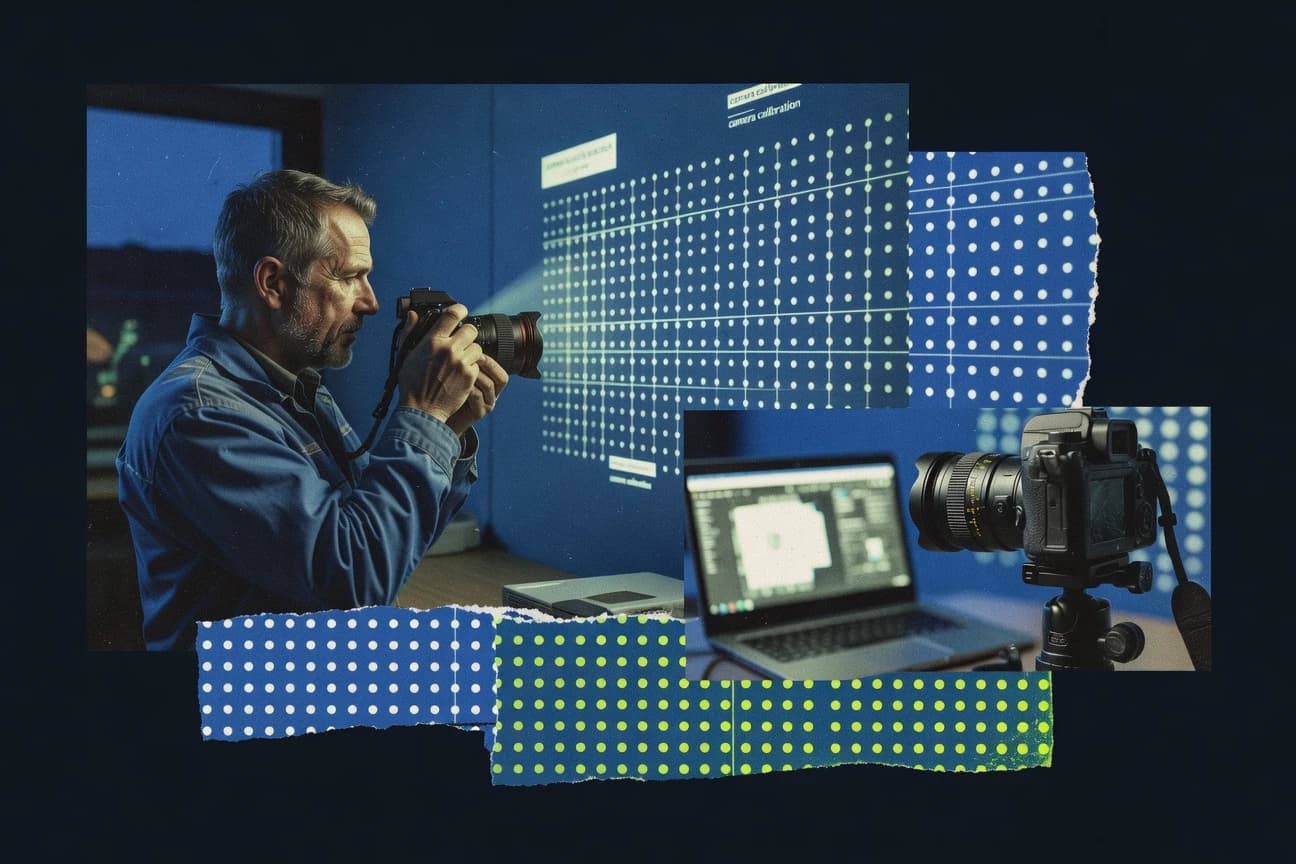
What Is Camera Mapping Software?
Camera mapping software estimates camera geometry and reconstructs real-world structure from overlapping photos, then exports usable outputs like dense point clouds, meshes, and orthomosaics. These tools handle image alignment, feature matching, camera pose estimation, dense depth reconstruction, and optional georeferencing with GCPs and GNSS inputs. Pix4Dmapper shows what an end-to-end photogrammetry mapping suite looks like because it builds orthomosaics plus DSM and DTM and includes reprojection error QA for metric accuracy. KOLMAP and OpenMVG illustrate the more technical side because they focus on pose estimation and sparse reconstruction stages that feed downstream dense reconstruction tools.
Key Features to Look For
Key features should map to the exact outputs and controls needed for each project, since the top tools differentiate on georeferencing accuracy, dense reconstruction quality, and workflow friction.
GCP and GNSS georeferencing with reprojection error QA
Pix4Dmapper excels because it supports GCP- and GNSS-based georeferencing with reprojection error checks for dataset validation. RealityCapture also supports GCP and distance constraints for tighter georeferencing control when repeatability matters.
Dense reconstruction from imagery with configurable reconstruction stages
RealityCapture provides very fast alignment and dense reconstruction on large photo datasets and outputs textured 3D models. Agisoft Metashape and RealityScan both target dense outputs with dense depth and mesh generation workflows suitable for downstream use.
Terrain model outputs like DSM and DTM for survey and construction
Pix4Dmapper is built for survey and construction output needs because it generates orthomosaics plus DSM and DTM from drone imagery. ODM also targets georeferenced reconstructions with dense point clouds and textured meshes that fit site planning workflows.
Tiled or batch processing support for large capture sets
Agisoft Metashape scales to large datasets using tiled processing workflows that support high-detail reconstructions. Pix4Dmapper and RealityCapture both emphasize production pipelines that handle medium to large image sets without requiring manual rework for each step.
Repeatable project workflows with pose and alignment visualization
KOLMAP offers an integrated project workflow that visualizes camera poses and sparse points so alignment quality can be validated quickly. Meshroom supports repeatable photogrammetry runs through a node-based pipeline that makes each reconstruction stage reproducible.
Open, modular pipeline options for advanced integration
OpenMVG provides SfM pose estimation with bundle adjustment for estimating camera trajectories and supports reproducible command-based workflows. OpenCV supplies camera calibration and feature matching primitives like cv::calibrateCamera that teams can integrate into custom camera-mapping pipelines.
How to Choose the Right Camera Mapping Software
The decision should start with the exact output types, then match georeferencing controls and workflow style to team skills and dataset size.
Match outputs to the deliverables used downstream
If orthomosaics plus DSM and DTM are required for survey and construction documentation, Pix4Dmapper fits because it generates metrically scaled outputs with built-in QA reporting. If dense textured 3D meshes for visualization and asset creation are the priority, RealityCapture and RealityScan focus on dense reconstruction and textured model outputs from large or mobile photo sets.
Choose the georeferencing control level needed for accuracy
For projects that depend on metric accuracy, Pix4Dmapper provides GCP- and GNSS-based georeferencing plus reprojection error metrics to validate dataset quality. For tighter control without heavy manual tuning, RealityCapture supports GCP and distance constraints to improve georeferencing reliability in medium to large photo captures.
Select a workflow style that fits the team’s operational capacity
Teams that want a guided mapping workflow with end-to-end processing typically align with Pix4Dmapper and RealityCapture rather than command-line centered tools. If the team is comfortable with command-based processing and tuning, ODM and MicMac offer open processing control while trading away UI guidance.
Plan for dataset scale and compute limits before committing
High-detail dense outputs increase hardware demands, so Pix4Dmapper notes that large projects raise processing complexity and time. Meshroom can run GPU-accelerated dense steps but still depends on capture quality and dataset scale for stable results and memory usage.
Ensure the pipeline can be validated and iterated quickly
If fast alignment validation is required, KOLMAP’s visualization of camera poses and sparse points supports quick diagnosis before dense reconstruction. If stage reproducibility matters for technical pipelines, Meshroom’s AliceVision node graph workflow and Agisoft Metashape’s configurable alignment and dense depth stages help keep runs consistent.
Who Needs Camera Mapping Software?
Camera mapping software fits teams that convert overlapping images into calibrated 3D geometry, then export georeferenced or measurement-ready artifacts.
Survey and construction teams needing metric orthos plus terrain surfaces
Pix4Dmapper is the best match because it produces orthomosaics plus DSM and DTM and uses GCP- and GNSS-based georeferencing with reprojection error QA. ODM also supports georeferenced dense outputs for site planning when self-hosted control is required.
Engineering teams that need dense reconstruction control and parameter tuning
Agisoft Metashape fits engineering requirements because it provides configurable alignment and dense reconstruction steps plus dense point clouds, meshes, and orthomosaics. RealityCapture also works well for accurate outputs from medium to large photo captures when automated pipelines reduce manual babysitting.
Production teams targeting fast dense models from large photo sets
RealityCapture is optimized for very fast alignment and dense reconstruction on large image datasets with export-ready textured meshes. RealityScan fits teams creating dense 3D meshes from mobile photos when capture overlap and exposure consistency are well managed.
Technical researchers and pipeline builders who prioritize modular SfM and integration
KOLMAP suits technical teams running COLMAP-like reconstructions because it visualizes camera poses and sparse points in a project workflow. OpenMVG provides SfM pose estimation with bundle adjustment for camera trajectories, and OpenCV supplies calibration and pose-building primitives like cv::calibrateCamera for custom mapping pipelines.
Common Mistakes to Avoid
Common failures come from mismatched workflow expectations, weak georeferencing planning, and underestimating compute and capture sensitivity across dense reconstruction pipelines.
Selecting a tool for dense outputs without planning for compute and QA
Pix4Dmapper and RealityCapture can generate dense reconstructions from large datasets, but both increase processing time and compute demands as dense settings expand. Agisoft Metashape also increases processing time with dense settings, so dataset QA and parameter discipline are required for stability.
Ignoring georeferencing validation when metric accuracy is required
Pix4Dmapper directly addresses this with reprojection error QA tied to GCP and GNSS georeferencing. RealityCapture can use GCP and distance constraints, but accuracy tuning still requires careful dataset-specific parameter choices.
Assuming command-line or node-based workflows will match guided mapping speed
ODM and MicMac emphasize command-line control and tuning, which slows first-time adoption when teams expect GUI-driven guidance. Meshroom’s node graph setup can feel complex for nontechnical users and dense quality can drop sharply with weak overlap or motion blur.
Underestimating how capture quality and overlap impact dense reconstruction
RealityScan and Meshroom both depend heavily on capture quality, overlap, and exposure consistency for dense mesh quality. KOLMAP, OpenMVG, and MicMac also depend on sufficient overlap and good calibration inputs for successful alignment and stable reconstruction.
How We Selected and Ranked These Tools
We score every tool on three sub-dimensions: features with a weight of 0.4, ease of use with a weight of 0.3, and value with a weight of 0.3. The overall rating is computed as overall = 0.40 × features + 0.30 × ease of use + 0.30 × value. Pix4Dmapper separated from lower-ranked options through its georeferencing depth plus QA because it combines GCP and GNSS workflows with reprojection error metrics for dataset validation, which strongly boosts the features dimension while staying usable enough for mapping deliverables like orthomosaics and DSM and DTM. KOLMAP and OpenMVG score differently because they focus more on pose estimation and staged reconstruction workflows that require additional dense reconstruction decisions outside the core GUI or pipeline.
Frequently Asked Questions About Camera Mapping Software
Which camera mapping software produces the most metrically accurate orthomosaics and terrain products?
Which tool is best for high-detail dense reconstructions from large photo sets?
What’s the difference between SfM-focused tools and full mapping pipelines that output geospatial products?
Which software best supports GCPs and georeferencing constraints for tighter alignment control?
Which option is most suitable for building a custom camera mapping pipeline with code-level control?
Which tools are better choices for command-line, repeatable processing on servers or pipelines?
What camera overlap and capture consistency issues commonly break reconstruction, and which tools tend to cope better?
Which software outputs camera trajectories or pose visualization for debugging calibration and alignment?
Which option is best when security requirements demand self-hosted processing on customer infrastructure?
Which tool is most suitable for generating assets quickly for visualization rather than strict GIS deliverables?
Conclusion
After evaluating 10 data science analytics, Pix4Dmapper stands out as our overall top pick — it scored highest across our combined criteria of features, ease of use, and value, which is why it sits at #1 in the rankings above.
Use the comparison table and detailed reviews above to validate the fit against your own requirements before committing to a tool.
Tools reviewed
Primary sources checked during evaluation.
Referenced in the comparison table and product reviews above.
Keep exploring
Comparing two specific tools?
Software Alternatives
See head-to-head software comparisons with feature breakdowns, pricing, and our recommendation for each use case.
Explore software alternatives→In this category
Data Science Analytics alternatives
See side-by-side comparisons of data science analytics tools and pick the right one for your stack.
Compare data science analytics tools→FOR SOFTWARE VENDORS
Not on this list? Let’s fix that.
Our best-of pages are how many teams discover and compare tools in this space. If you think your product belongs in this lineup, we’d like to hear from you—we’ll walk you through fit and what an editorial entry looks like.
Apply for a ListingWHAT THIS INCLUDES
Where buyers compare
Readers come to these pages to shortlist software—your product shows up in that moment, not in a random sidebar.
Editorial write-up
We describe your product in our own words and check the facts before anything goes live.
On-page brand presence
You appear in the roundup the same way as other tools we cover: name, positioning, and a clear next step for readers who want to learn more.
Kept up to date
We refresh lists on a regular rhythm so the category page stays useful as products and pricing change.