GITNUXSOFTWARE ADVICE
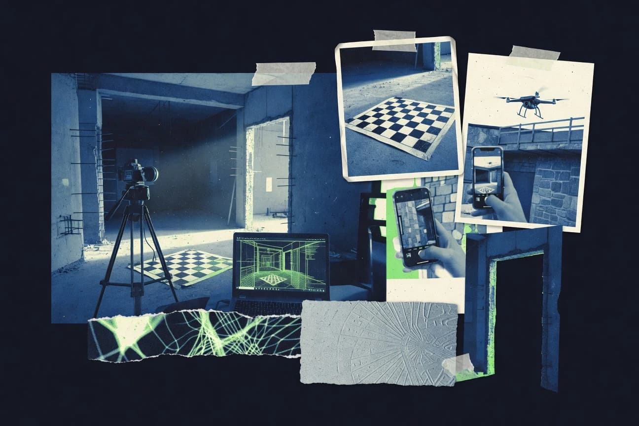
Construction InfrastructureTop 9 Best Architectural Photogrammetry Software of 2026
Top 10 Architectural Photogrammetry Software picks ranked for accuracy and speed, with comparison of RealityCapture, Metashape, Pix4Dmapper. Explore options

How we ranked these tools
Core product claims cross-referenced against official documentation, changelogs, and independent technical reviews.
Analyzed video reviews and hundreds of written evaluations to capture real-world user experiences with each tool.
AI persona simulations modeled how different user types would experience each tool across common use cases and workflows.
Final rankings reviewed and approved by our editorial team with authority to override AI-generated scores based on domain expertise.
Score: Features 40% · Ease 30% · Value 30%
Gitnux may earn a commission through links on this page — this does not influence rankings. Editorial policy
Editor’s top 3 picks
Three quick recommendations before you dive into the full comparison below — each one leads on a different dimension.
RealityCapture
Fast, high-detail dense reconstruction from large image collections
Built for architectural teams needing high-detail textured meshes from photo sets.
Metashape
Editor pickGeoreferencing and orthomosaic generation from aligned photo imagery
Built for architectural teams producing measurement-grade models and orthomosaics from photo sets.
Pix4Dmapper
Editor pickAutomated dense point cloud and texturized mesh generation from overlapping images
Built for architectural teams needing survey outputs, orthomosaics, and 3D models from photos.
Related reading
Comparison Table
This comparison table evaluates leading architectural photogrammetry tools, including RealityCapture, Metashape, Pix4Dmapper, ContextCapture, and RealityScan, side by side. It highlights practical differences that affect project outcomes such as image alignment, reconstruction quality, texturing workflows, compute and GPU requirements, and export options for common architecture deliverables.
RealityCapture
photogrammetry desktopRealityCapture creates 3D models and photogrammetry reconstructions from large image sets and supports survey-grade outputs for architectural documentation.
Fast, high-detail dense reconstruction from large image collections
RealityCapture specializes in fast, accurate photogrammetry reconstruction from large photo sets, which suits architectural capture workflows. It supports dense point cloud generation, textured mesh reconstruction, and export to common CAD and rendering formats for design review. The software’s component-based processing and alignment controls help maintain stable results across indoor and exterior scenes. Practical results depend on careful photo overlap, camera calibration handling, and consistent geometry scale.
- +High-speed dense reconstruction from large image sets
- +Strong alignment and component workflow for complex buildings
- +Crisp textured meshes suitable for architectural visualization
- –Image quality and overlap strongly affect outcomes
- –Workflow complexity can slow first-time architectural projects
- –Advanced control requires learning more than basic capture tools
Best for: Architectural teams needing high-detail textured meshes from photo sets
More related reading
Metashape
photogrammetry desktopAgisoft Metashape processes photographs into dense point clouds, textured meshes, and orthomosaics for architectural photogrammetry deliverables.
Georeferencing and orthomosaic generation from aligned photo imagery
Metashape stands out for dense 3D reconstruction pipelines tuned for repeatable survey outcomes from overlapping photos. For architectural photogrammetry, it builds cameras alignment, generates dense point clouds, and produces textured meshes suitable for measurements and visualization. The software supports georeferencing and can output orthomosaics and scaled models for façade and interior documentation workflows. Metashape also offers automation via batch processing so large photo sets for multiple rooms can be handled consistently.
- +Strong alignment-to-dense-cloud workflow for detailed architectural reconstructions
- +Textured mesh and orthomosaic outputs support documentation and visualization
- +Georeferencing and scaling tools help deliver measurement-ready models
- +Batch processing enables consistent runs across multiple project photo sets
- –Workflow setup and parameter tuning can be complex on challenging interiors
- –Large datasets can strain hardware during depth and meshing stages
- –Many advanced capabilities require operator judgment for best results
Best for: Architectural teams producing measurement-grade models and orthomosaics from photo sets
Pix4Dmapper
mapper platformPix4Dmapper generates georeferenced 3D models, point clouds, and orthomosaics from aerial or terrestrial imagery for construction and infrastructure survey workflows.
Automated dense point cloud and texturized mesh generation from overlapping images
Pix4Dmapper stands out for producing dense point clouds and photorealistic orthomosaics from overlapping images with a workflow tailored to surveying deliverables. It supports architectural use cases like facade modeling, site documentation, and progress measurement through orthomosaic and mesh generation. The software includes georeferencing options with GNSS and camera calibration handling, plus change-detection style outputs when projects are organized consistently.
- +Dense point clouds and texturized 3D meshes for architectural documentation
- +Georeferencing workflows support GNSS and camera parameters for survey-grade alignment
- +Orthomosaic outputs help generate facade and site plan views quickly
- +Quality controls and automatic processing reduce manual cleanup needs
- +Export formats support GIS, BIM coordination, and downstream analysis
- –Image planning and coverage gaps can cause noisy meshes in narrow corridors
- –Large architectural datasets can require substantial compute time and storage
- –BIM-centric workflows still depend on external tools for true parametric updates
Best for: Architectural teams needing survey outputs, orthomosaics, and 3D models from photos
More related reading
ContextCapture
enterprise reconstructionHexagon ContextCapture turns imagery into large-scale 3D reconstructions with automated processing and engineering-ready outputs for infrastructure documentation.
Automated dense reconstruction pipeline optimized for large-scale photogrammetry datasets
ContextCapture is a photogrammetry workflow focused on automated image-to-3D processing for large architectural and site datasets. The software builds dense 3D models and orthographic outputs from photos with robust scaling from control points and survey imports. It also supports repeatable reconstruction pipelines, which helps teams standardize model production across buildings and infrastructure scenes. Dense results can be used for measurement and visualization, with outputs aligned to common GIS and CAD handoff patterns.
- +Automates alignment and reconstruction for large, detailed architectural photo sets
- +Dense outputs and orthophotos support measurement and documentation workflows
- +Control point and survey integration improves scale accuracy for building models
- –Dense reconstruction tuning can be heavy for small teams and small projects
- –Workflow setup and QA checks take practice to avoid usable-data gaps
- –Collaboration and review tooling can require external viewers and handoffs
Best for: Architectural survey teams needing automated dense reconstructions and orthos
RealityScan
mobile photogrammetryRealityScan captures photos on mobile devices and produces 3D reconstructions suitable for architectural and infrastructure visualization workflows.
On-device mobile photogrammetry workflow that turns photos into 3D reconstructions
RealityScan stands out by focusing on mobile photogrammetry capture with an end-to-end workflow from images to a reconstructed 3D model. It supports typical architectural photogrammetry steps like aligning photos, generating dense geometry, and exporting usable meshes for inspection and visualization. The tool is strongest for fast acquisition on-site and for projects where rapid iteration matters more than highly controlled studio setups. It can deliver detailed results for structured building documentation when capture geometry and lighting remain consistent.
- +Mobile-first capture streamlines on-site architectural documentation workflows
- +Automated photo alignment reduces manual setup compared to desktop-only tools
- +Exports reconstructed meshes suitable for review, coordination, and visualization
- –Fewer advanced modeling controls than desktop photogrammetry suites
- –Complex scenes often require careful capture planning for stable alignment
- –Large architectural projects can be slower to process end-to-end
Best for: Architects and survey teams needing fast on-site 3D capture for documentation
More related reading
RealityCapture Cloud
cloud processingRealityCapture Cloud processes photogrammetry inputs in a cloud workflow to generate 3D reconstructions and textured outputs for project teams.
RealityCapture Cloud’s cloud execution for alignment-to-texture reconstruction using RealityCapture projects
RealityCapture Cloud is distinct for pushing high-volume photogrammetry processing into a cloud workflow while keeping the photogrammetry pipeline familiar to RealityCapture users. It supports full photogrammetry tasks for architectural assets, including image alignment, dense reconstruction, mesh generation, and textured outputs suitable for visualization and measurement. The service focuses on accuracy-driven reconstruction from photos and integrates with RealityCapture project assets for repeatable processing across sessions. Cloud execution suits staged capture workflows for buildings where compute availability and turnaround time matter.
- +Cloud processing accelerates heavy reconstruction without local GPU bottlenecks
- +Strong dense reconstruction and texturing support architectural visualization workflows
- +Project-based workflow enables repeatable alignment and reconstruction passes
- –Upload and storage friction can slow iterative capture-to-results cycles
- –Less guided architectural surveying tooling compared with dedicated BIM-focused tools
- –Workflow complexity rises when managing large photo sets and reconstruction settings
Best for: Architecture teams needing reliable photogrammetry outputs with cloud compute
CloudCompare
point-cloud processingCloudCompare is an open-source point-cloud processing tool that supports cleaning, alignment, and export of photogrammetry-derived point clouds.
CloudCompare’s iterative closest point registration and distance-based alignment workflows
CloudCompare focuses on point cloud analysis and mesh processing, which fits architectural photogrammetry workflows after reconstruction. It imports dense point clouds and meshes, supports registration, and enables cleanup with tools like outlier removal and segmentation. It also provides measurement utilities for distances, angles, and volumes, which supports quantity estimation tasks on architectural scans. The software is distinct for fast visual inspection and iterative refinement across large datasets.
- +Robust point cloud cleaning tools for noise removal and refinement
- +Strong registration workflows using distance, ICP, and manual alignment
- +Accurate measurement tools for distances, angles, and volumetric estimates
- +Flexible mesh and point cloud export for downstream CAD or GIS use
- –No integrated photogrammetry pipeline for alignment, matching, and camera calibration
- –Dense dataset performance depends heavily on system memory and GPU usage
- –User interface and tool discovery can feel unintuitive for new users
- –Limited support for photogrammetry-specific outputs like orthomosaics
Best for: Architectural teams needing point-cloud QC, registration, and measurement without full photogrammetry
More related reading
MeshLab
mesh processingMeshLab provides open-source tools for repairing and processing photogrammetry meshes and textured models for architectural visualization.
Large collection of mesh processing filters with extensible plugins for dense photogrammetry cleanup
MeshLab stands out for its open, plugin-driven mesh processing toolkit used to clean and enhance photogrammetry outputs. It supports common reconstruction file formats and includes dense mesh editing, decimation, smoothing, and automated cleaning filters. For architectural photogrammetry, it excels at preparing surfaces for downstream meshing, texturing workflows, and model optimization. It is weaker as a dedicated end-to-end capture and alignment tool, so it fits best after reconstruction.
- +Advanced mesh cleaning filters for removing noise and isolated components
- +Plugin system enables specialized processing workflows for dense photogrammetry meshes
- +Powerful decimation and smoothing tools help control polygon budgets
- +Batchable processing supports repeating the same edits across many models
- –Workflow lacks camera alignment and reconstruction features for architecture projects
- –Dense-mesh operations can require careful parameter tuning to avoid artifacts
- –UI and filter selection are less guided than reconstruction-focused tools
- –Texture handling and quality control are limited compared with texturing specialists
Best for: Teams refining dense architectural reconstructions into clean, optimized meshes
Intel Open Image Denoise
preprocessingIntel Open Image Denoise helps improve image quality prior to photogrammetry processing by reducing noise that can degrade feature matching.
Edge-preserving CPU denoising tuned for realistic image reconstruction
Intel Open Image Denoise provides CPU-based denoising aimed at accelerating photorealistic rendering pipelines used for photogrammetry visualization and export. It supports classic workflows with Intel-optimized rendering integration through Open Image Denoise and compatible renderers. The tool can remove noise from rendered images while preserving edges and fine texture details, which helps architectural datasets look cleaner for documentation and presentations.
- +Edge-preserving denoising improves architectural texture clarity in final renders
- +Strong performance on CPU with Intel optimization for throughput in batch workflows
- +Integrates with common rendering pipelines used to generate photogrammetry visuals
- –Requires a renderer or image pipeline that produces noisy inputs for best results
- –Less direct than full photogrammetry tools for survey-grade reconstruction tasks
- –Tuning quality and artifact control can take iteration for mixed lighting datasets
Best for: Architectural teams cleaning photogrammetry render outputs and previews
How to Choose the Right Architectural Photogrammetry Software
This buyer's guide explains how to choose architectural photogrammetry software by mapping real deliverable needs to specific tools like RealityCapture, Metashape, Pix4Dmapper, ContextCapture, RealityScan, RealityCapture Cloud, CloudCompare, MeshLab, and Intel Open Image Denoise. It covers key capabilities such as dense reconstruction speed, orthomosaic and georeferencing outputs, automation for large datasets, and post-processing for mesh cleanup. It also outlines common workflow mistakes tied to image overlap, hardware limits, and missing photogrammetry pipelines in point-cloud and mesh-only tools.
What Is Architectural Photogrammetry Software?
Architectural photogrammetry software turns overlapping photos into 3D geometry such as dense point clouds, textured meshes, and orthomosaics for documentation. It solves the need to convert site or interior imagery into measurement-ready outputs that can support facade studies, room documentation, and engineering review. Tools like RealityCapture focus on fast dense reconstruction and crisp textured meshes for architectural visualization. Tools like Metashape focus on georeferencing and orthomosaic generation from aligned imagery for measurement-grade deliverables.
Key Features to Look For
These capabilities determine whether a tool produces usable building models quickly or forces major rework during alignment, depth computation, meshing, and export.
Fast dense reconstruction from large photo sets
RealityCapture is built for fast, high-detail dense reconstruction from large image collections, which helps teams keep architectural capture schedules moving. Pix4Dmapper and ContextCapture also deliver automated dense point cloud and texturized mesh generation when images have adequate overlap and coverage.
Orthomosaics and georeferencing for documentation
Metashape excels at georeferencing and orthomosaic generation from aligned photo imagery, which supports façade and site plan documentation workflows. Pix4Dmapper delivers georeferencing options that work with GNSS and camera parameters for survey-grade alignment.
Stable alignment and component-style workflows for complex buildings
RealityCapture supports alignment controls and a component workflow that helps maintain stable results across indoor and exterior scenes. ContextCapture provides automated image-to-3D processing that teams can standardize across buildings when control points and survey inputs are available.
Survey-grade scaling with control points and survey integration
ContextCapture emphasizes robust scaling from control points and survey imports, which supports scale accuracy for building models. Metashape includes tools for georeferencing and scaling so outputs can be measurement-ready for documentation tasks.
Automated processing pipelines that reduce manual cleanup
Pix4Dmapper includes quality controls and automatic processing designed to reduce manual cleanup needs after dense reconstruction. ContextCapture focuses on automated alignment and reconstruction pipelines optimized for large-scale photogrammetry datasets.
Post-reconstruction mesh and point-cloud refinement tools
CloudCompare provides point cloud cleaning, distance and angle measurement, and ICP and manual alignment for registration and quantity estimation. MeshLab provides dense mesh cleaning, decimation, smoothing, and plugin-driven processing that helps refine photogrammetry meshes after reconstruction.
How to Choose the Right Architectural Photogrammetry Software
The right choice matches the required deliverables and operating constraints to the tool’s actual reconstruction, georeferencing, and post-processing capabilities.
Start with the deliverable type: textured model, orthomosaic, or measurement-ready point cloud
For crisp architectural visualization, RealityCapture stands out with fast, high-detail dense reconstruction and textured mesh output that works well for design review. For orthomosaic and measurement-grade deliverables, Metashape is tuned for georeferencing and orthomosaic generation from aligned photo imagery. For survey-style outputs that include orthomosaic and dense point clouds, Pix4Dmapper targets facade modeling, site documentation, and progress measurement.
Match georeferencing and scaling requirements to survey inputs
If scale accuracy depends on control points and survey imports, ContextCapture supports robust scaling and control point integration for building models. If the workflow needs georeferencing built around aligned imagery, Metashape includes georeferencing and scaling tools that produce orthomosaics and scaled models. If GNSS inputs and camera calibration handling matter, Pix4Dmapper supports GNSS and camera parameter workflows for survey-grade alignment.
Select the right workflow automation level for the dataset size
For large image sets where speed and dense reconstruction throughput matter, RealityCapture is optimized for fast dense reconstruction from large collections. For engineering-oriented automated production across large architectural or site datasets, ContextCapture provides automated alignment and reconstruction pipelines. For architectural teams organizing large projects that still need repeatable dense outputs, RealityCapture Cloud offloads heavy reconstruction into cloud execution using RealityCapture projects.
Plan for capture reality: use mobile capture tools when iteration speed beats strict controls
For fast on-site acquisition and rapid iteration, RealityScan provides an end-to-end mobile photogrammetry workflow that aligns photos and produces 3D reconstructions. For teams that need a desktop-level pipeline with more advanced controls, RealityCapture and Metashape remain better fits because they support deeper reconstruction tuning beyond mobile-first capture. For complex scenes where stable alignment depends on capture consistency, RealityScan requires careful capture planning to avoid unstable reconstruction.
Add dedicated QC and cleanup tools when needed after reconstruction
When the deliverable depends on registration, noise removal, and measurement on reconstructed point clouds, CloudCompare provides distance and angle measurement plus ICP and manual alignment workflows. When the deliverable depends on repairing and optimizing dense meshes for visualization, MeshLab provides decimation, smoothing, dense mesh editing, and automated cleaning filters. For cleaning render outputs and improving texture clarity in generated previews, Intel Open Image Denoise can denoise noisy images using edge-preserving CPU denoising.
Who Needs Architectural Photogrammetry Software?
Different architectural teams need different reconstruction outputs such as textured meshes, orthomosaics, survey-grade scaling, or post-processing for QC and measurement.
Architectural teams needing high-detail textured meshes from photo sets
RealityCapture fits this need because it specializes in fast, high-detail dense reconstruction that produces crisp textured meshes for architectural visualization. RealityScan can also support teams that prioritize quick on-site capture and fast iteration when capture geometry and lighting remain consistent.
Architectural teams producing measurement-grade models and orthomosaics
Metashape is the best match because it generates orthomosaics and supports georeferencing and scaling from aligned photo imagery. Pix4Dmapper is also suitable when deliverables require georeferencing workflows supported by GNSS and camera calibration handling.
Architectural survey teams that need automated dense reconstructions and orthos
ContextCapture fits this segment because it delivers automated image-to-3D processing with dense outputs and orthographic results aligned with measurement and documentation workflows. Pix4Dmapper also targets survey deliverables with dense point clouds, texturized meshes, and orthomosaic outputs.
Teams focused on QC, registration, and measurement without building a full photogrammetry pipeline
CloudCompare fits when the workflow starts after reconstruction and focuses on point cloud cleaning, registration using distance, ICP, and manual alignment, and measurement tools for distances, angles, and volumes. MeshLab fits when dense meshes need repair, decimation, smoothing, and plugin-driven cleanup after photogrammetry finishes.
Common Mistakes to Avoid
Common failures come from capture inputs and workflow mismatches that harm alignment, dense reconstruction stability, or downstream usability.
Insufficient image overlap and inconsistent capture geometry
RealityCapture and RealityScan both depend strongly on capture geometry and overlap for stable alignment and dense reconstruction. Pix4Dmapper can produce noisy meshes when coverage gaps appear in narrow corridors, so corridor capture coverage planning prevents weak dense outputs.
Expecting a point-cloud or mesh-only tool to perform full photogrammetry reconstruction
CloudCompare does not provide integrated photogrammetry alignment, matching, and camera calibration, so it cannot replace RealityCapture or Metashape for photo-to-3D reconstruction. MeshLab lacks camera alignment and reconstruction features, so it works best as a post-processing stage for meshes produced by RealityCapture, Metashape, or Pix4Dmapper.
Ignoring hardware and compute constraints during depth and meshing
Metashape can strain hardware during depth and meshing stages on large datasets, which forces longer processing or reduced reconstruction complexity. RealityCapture Cloud helps reduce local GPU bottlenecks by running dense reconstruction and texturing in the cloud, which supports compute-heavy architectural datasets.
Skipping QA checks and scale validation in large automated pipelines
ContextCapture automates dense reconstruction but dense reconstruction tuning and QA checks take practice to avoid usable-data gaps. Metashape requires correct parameter tuning in challenging interiors, so failing to tune alignment and reconstruction settings can harm measurement-grade outputs.
How We Selected and Ranked These Tools
we score every tool on three sub-dimensions. features have weight 0.4. ease of use has weight 0.3. value has weight 0.3. the overall rating is the weighted average using overall = 0.40 × features + 0.30 × ease of use + 0.30 × value. RealityCapture separated itself from lower-ranked tools on the features dimension with fast, high-detail dense reconstruction from large image collections that repeatedly supports architectural textured mesh output.
Frequently Asked Questions About Architectural Photogrammetry Software
Which tool produces the most detailed textured meshes from large architectural photo sets?
Which option is best for measurement-grade models and orthomosaics in architectural workflows?
How do RealityCapture Cloud and ContextCapture differ for multi-building or multi-room production pipelines?
What software fits faster on-site capture when architectural capture schedules are tight?
Which tool is most useful after photogrammetry reconstruction for cleaning, decimation, and preparing meshes?
Which option handles point cloud QC, registration, and measurements without running a full photogrammetry pipeline?
Which software best supports georeferencing and scaled outputs for architectural documentation?
What are common causes of unstable or inconsistent reconstructions across indoor and exterior shots?
How do denoising workflows improve photogrammetry visualization outputs for architectural presentations?
Conclusion
After evaluating 9 construction infrastructure, RealityCapture stands out as our overall top pick — it scored highest across our combined criteria of features, ease of use, and value, which is why it sits at #1 in the rankings above.
Use the comparison table and detailed reviews above to validate the fit against your own requirements before committing to a tool.
Tools reviewed
Primary sources checked during evaluation.
Referenced in the comparison table and product reviews above.
Keep exploring
Comparing two specific tools?
Software Alternatives
See head-to-head software comparisons with feature breakdowns, pricing, and our recommendation for each use case.
Explore software alternatives→In this category
Construction Infrastructure alternatives
See side-by-side comparisons of construction infrastructure tools and pick the right one for your stack.
Compare construction infrastructure tools→FOR SOFTWARE VENDORS
Not on this list? Let’s fix that.
Our best-of pages are how many teams discover and compare tools in this space. If you think your product belongs in this lineup, we’d like to hear from you—we’ll walk you through fit and what an editorial entry looks like.
Apply for a ListingWHAT THIS INCLUDES
Where buyers compare
Readers come to these pages to shortlist software—your product shows up in that moment, not in a random sidebar.
Editorial write-up
We describe your product in our own words and check the facts before anything goes live.
On-page brand presence
You appear in the roundup the same way as other tools we cover: name, positioning, and a clear next step for readers who want to learn more.
Kept up to date
We refresh lists on a regular rhythm so the category page stays useful as products and pricing change.