GITNUXSOFTWARE ADVICE
Agriculture FarmingTop 10 Best Ag Mapping Software of 2026
Top 10 Ag Mapping Software picks ranked for accuracy and field workflows. Compare ArcGIS Field Maps, ArcGIS Enterprise, QGIS.

How we ranked these tools
Core product claims cross-referenced against official documentation, changelogs, and independent technical reviews.
Analyzed video reviews and hundreds of written evaluations to capture real-world user experiences with each tool.
AI persona simulations modeled how different user types would experience each tool across common use cases and workflows.
Final rankings reviewed and approved by our editorial team with authority to override AI-generated scores based on domain expertise.
Score: Features 40% · Ease 30% · Value 30%
Gitnux may earn a commission through links on this page — this does not influence rankings. Editorial policy
Editor’s top 3 picks
Three quick recommendations before you dive into the full comparison below — each one leads on a different dimension.
ArcGIS Field Maps
Offline map areas with field-ready feature editing and automatic sync
Built for agronomy teams needing offline-ready GIS data collection and field validation.
ArcGIS Enterprise
Editor pickArcGIS GeoAnalytics Server for large-scale spatiotemporal processing of agricultural datasets
Built for agricultural organizations needing governed mapping, imagery analysis, and scalable web services.
QGIS
Editor pickProcessing toolbox with Model Builder for automated raster and vector analysis chains
Built for gIS-focused agronomy teams needing repeatable mapping and spatial analysis.
Related reading
Comparison Table
This comparison table evaluates leading ag mapping software options used for field data capture, geospatial analysis, and map production. It contrasts tools such as ArcGIS Field Maps, ArcGIS Enterprise, QGIS, Global Mapper, ENVI, and related platforms across core capabilities, deployment models, and typical workflows so readers can match features to land and operations needs.
ArcGIS Field Maps
field data captureProvides mobile map capture and field data collection that supports agriculture mapping workflows with feature layers and attachments.
Offline map areas with field-ready feature editing and automatic sync
ArcGIS Field Maps stands out for turning GIS maps into mobile field workflows built around real map context and offline data capture. It supports collecting and validating agricultural field observations with configurable forms, geotagged assets, and feature edits that sync back to ArcGIS Online or ArcGIS Enterprise.
Strong integration with ArcGIS web maps and layers enables consistent symbology, measurement, and attribution across planning, field collection, and reporting. Automated survey logic and repeatable templates help teams standardize data quality for common agronomic tasks like scouting and crop inspections.
- +Offline map and data editing for field work with intermittent connectivity
- +Configurable forms with validation to enforce consistent agronomic data capture
- +Seamless edits to hosted layers with sync workflows for rapid updates
- +Built-in GPS positioning and geolocation for accurate field measurements
- +Layer-driven maps reuse existing symbology and boundaries for scouting
- –Deep setup depends on ArcGIS content design and layer configuration
- –Advanced survey logic can feel heavy compared with lightweight survey tools
- –Offline performance depends on feature density and map packaging choices
Best for: Agronomy teams needing offline-ready GIS data collection and field validation
More related reading
ArcGIS Enterprise
enterprise GISHosts authoritative web maps and feature services for farm-scale GIS mapping with configurable roles, editors, and publishing tools.
ArcGIS GeoAnalytics Server for large-scale spatiotemporal processing of agricultural datasets
ArcGIS Enterprise stands out for delivering an on-prem and cloud-capable geospatial platform that supports full GIS operations for agriculture workflows. It provides map, feature, and geoprocessing capabilities through configurable services, including imagery, terrain-ready analysis, and standardized data management.
ArcGIS Enterprise also supports operational deployments for field teams via web maps, dashboards, and secure service layers. Integrated administration, security, and extensibility make it suitable for organizations that need governed mapping at scale.
- +End-to-end GIS with hosted web maps, feature services, and analysis services
- +Supports raster and vector workflows for field imagery, boundaries, and attributes
- +Strong governance via roles, permissions, and enterprise-grade security controls
- +Scales to many users with configurable servers and service-based deployments
- +Integrates automation using geoprocessing tools and workflow-driven applications
- –Setup and tuning across components can be complex for new deployments
- –Custom app development and administration can require specialized GIS expertise
- –Performance depends heavily on sizing, caching, and server configuration choices
- –Simple “turnkey” mapping experiences still require significant configuration effort
Best for: Agricultural organizations needing governed mapping, imagery analysis, and scalable web services
QGIS
open-source GISOpen-source desktop GIS software for creating and editing agricultural maps using vector and raster datasets.
Processing toolbox with Model Builder for automated raster and vector analysis chains
QGIS stands out for its open, plugin-driven geospatial toolkit and deep GIS interoperability for agricultural mapping. It supports raster and vector layers, georeferencing, digitizing, spatial analysis, and map composition for field, soil, and crop workflows.
Strong data exchange exists through standard formats and styling, with processing tools that cover buffers, overlays, rasters, and statistics. The same project can power repeatable map production and analysis through saved models and batch processing.
- +Extensive geospatial analysis tools for rasters, vectors, and terrain workflows
- +Layer styling, map layouts, and print-ready cartography for field reporting
- +Processing models enable repeatable spatial workflows across seasons
- +Broad import and export support for common GIS data formats
- –Workflow depth can slow adoption for teams focused on simple Ag maps
- –No built-in farm asset management or crop analytics dashboards out of the box
- –Geospatial setup often requires careful coordinate systems and data QA
Best for: GIS-focused agronomy teams needing repeatable mapping and spatial analysis
More related reading
Global Mapper
desktop GISDelivers fast desktop GIS and surveying data import, georeferencing, and map production for agriculture boundary and terrain mapping.
Powerful raster and DEM editing plus analysis with real-time visualization
Global Mapper from Blue Marble stands out with fast, interactive processing of large geospatial datasets and strong raster-to-vector and GIS editing workflows. It supports common agriculture mapping needs like field boundary digitizing, orthomosaic and imagery handling, elevation analysis with DEMs, and map production for farm planning.
The tool also works well for integrating CAD and GIS data while performing coordinate system transformations and spatial overlays. Its strength is end-to-end geospatial data preparation and visualization rather than specialized agronomic modeling.
- +Excellent support for raster and vector geospatial workflows in one environment
- +Strong coordinate system management for integrating datasets from multiple sources
- +Efficient DEM visualization and terrain analysis for agricultural context mapping
- +Practical CAD and GIS import and export for field and infrastructure mapping
- –Specialized agronomy tools are limited compared with purpose-built ag platforms
- –Advanced workflows require training and careful parameter setup
- –Large projects can feel heavy without good data organization
- –Limited built-in collaboration and reporting compared with GIS ecosystems
Best for: Teams preparing field maps, overlays, and terrain context from mixed datasets
ENVI
remote sensingPerforms satellite and imagery processing and classification used for farm mapping tasks such as vegetation assessment.
Advanced supervised classification and change detection built for high-precision land and crop analysis
ENVI stands out for its deep remote sensing toolset that supports full geospatial workflows around crop and field analysis. Core capabilities include raster processing, atmospheric and radiometric corrections, classification and change detection, and map-ready outputs for GIS.
The software supports automation through scripting and repeatable processing chains, which benefits large survey programs. ENVI also integrates with broader geospatial ecosystems for visualization and spatial analysis.
- +Comprehensive raster science tools for classification, change detection, and indices
- +Automation via scripting enables repeatable multi-scene agronomic workflows
- +Strong geospatial output quality for downstream GIS mapping and reporting
- –Interface and processing depth require training for consistent agronomic results
- –Workflow setup can be time-consuming for teams needing quick field maps
- –Common mapping tasks still rely on mastering multiple processing steps
Best for: Remote sensing teams producing analytical agronomic maps with repeatable pipelines
Google Earth Engine
geospatial analyticsSupports scalable geospatial analysis by processing satellite imagery to derive agriculture mapping layers.
Code Editor geospatial scripting for pixel-wise processing and large-scale exports
Google Earth Engine stands out for its cloud-based geospatial processing on massive satellite archives and its JavaScript and Python scripting workflows. It supports land cover classification, change detection, vegetation index time series, and custom analyses using Earth Observation data layers. For ag mapping, it enables repeatable field-scale workflows that combine AOI management, sensor harmonization, and export-ready rasters and statistics.
- +Massive satellite archive processing enables scalable ag time-series analysis
- +Scriptable workflows with reusable functions support consistent field mapping
- +Flexible exports deliver rasters and zonal stats for downstream reporting
- –JavaScript and geospatial concepts raise the learning curve for mapping teams
- –Less turnkey than dedicated farm mapping tools for non-technical users
- –Debugging workflows can be time-consuming without software engineering practices
Best for: Teams building custom ag mapping workflows from satellite and index analytics
More related reading
Satellite imagery services in Microsoft Azure Maps
maps platformProvides mapping and geospatial services for building custom agriculture maps with basemaps, geocoding, and spatial data visualization.
Azure Maps Web SDK and spatial operations for interactive satellite basemap rendering
Azure Maps provides satellite basemap consumption, geocoding, and spatial analytics building blocks that integrate with Azure data and workflows. It supports raster-friendly map rendering and map interactions through standard web map controls, which helps visualize field boundaries and locations alongside satellite imagery.
It also fits into agricultural mapping pipelines that need consistent basemaps, overlays, and downstream GIS processing via Azure services. Satellite imagery capabilities center on display and integration rather than turning raw imagery into finished crop insights within the platform.
- +Azure Maps SDK simplifies adding satellite basemaps to custom GIS web apps
- +Strong integration with Azure data services supports unified geospatial pipelines
- +Good tools for overlays, markers, and interactive map visualization in field workflows
- –Satellite imagery processing and analytics require external GIS tooling
- –Imagery sourcing and licensing are not a full end-to-end crop intelligence solution
- –Advanced agronomy outputs like classifications need additional services
Best for: Teams building agronomy workflows that need Azure-native map visualization and basemaps
Mapbox
developer mappingEnables custom interactive mapping for farm data visualization by serving styled basemaps and rendering geospatial layers.
Vector tiles with flexible style specification for highly controlled cartography
Mapbox stands out for building custom map experiences with granular styling and low-level control over basemaps, tiles, and geospatial rendering. It supports vector and raster map delivery, map styling via a JSON-based specification, and integration with web and mobile applications through SDKs.
For ag mapping workflows, it works well as the visualization layer for field boundaries, routes, and sensor overlays when the underlying data is prepared for web mapping. Its strength is custom cartography and performant map delivery, while full agronomic analytics and field-specific tools are typically handled outside Mapbox.
- +Highly customizable map styling using a JSON style specification
- +Fast vector tile rendering supports large geographic extents smoothly
- +Strong SDK ecosystem for web and mobile map integrations
- –Requires engineering work for data pipelines and map layer management
- –Not an out-of-the-box agronomy analytics platform for field decisions
- –Complexity rises when supporting multi-source overlays and time-series data
Best for: Teams building custom ag map viewers for boundaries, routes, and overlays
More related reading
OpenLayers
open-source web mappingJavaScript mapping library for rendering custom agriculture map layers and interactive vector or raster data in web apps.
Layer-based rendering with custom styling and interaction handling for vector features
OpenLayers stands out with a highly flexible JavaScript map-rendering library that powers custom GIS web experiences. It supports tiled basemaps, vector layers, and styling needed for field boundary visualization and crop-area overlays.
Core capabilities include feature interaction, layer management, and geospatial projections, which suit Ag mapping use cases that require bespoke map workflows. It does not provide out-of-the-box agronomic analytics or farm data models, so implementations rely on integration with external services.
- +Flexible layer and style system for custom field maps
- +Broad basemap and tile support for field context
- +Robust vector editing and interactions for geometry workflows
- –Requires custom development for agronomy-specific workflows
- –No built-in farm data model or analysis tooling
- –Complex projection and configuration details can slow setup
Best for: Teams building custom web mapping for field boundaries and overlays
Leaflet
web mappingLightweight web mapping library for building agriculture map viewers that overlay field boundaries and collected sensor data.
GeoJSON layer integration with per-feature styling and interactive events
Leaflet stands out for its lightweight, code-first mapping approach using web technologies. It provides interactive map rendering, custom layers, and geospatial overlays driven by GeoJSON and tile sources. For agricultural mapping, it supports workflows that combine boundaries, field parcels, and thematic layers through custom styling and event handling.
- +Fast client-side map rendering with tile layers and dynamic overlays
- +Native GeoJSON support for field boundaries, sampling points, and zone maps
- +Flexible layer styling using marker, path, and feature-specific options
- +Event handling for click and hover interactions on agricultural features
- –No built-in agronomy-specific analysis tools for crops, soils, or prescriptions
- –Requires engineering to build data pipelines, editing, and persistence
- –Limited native geospatial operations beyond what external libraries provide
- –Scales as an app framework only with careful performance tuning
Best for: Teams building custom ag maps with GeoJSON layers and interactive web viewers
How to Choose the Right Ag Mapping Software
This buyer's guide covers Ag Mapping Software solutions ranging from offline field capture with ArcGIS Field Maps to satellite time-series analysis with Google Earth Engine and remote sensing pipelines with ENVI. It also covers governance and enterprise publishing with ArcGIS Enterprise, spatial data preparation with Global Mapper, and custom web map viewers with Mapbox, OpenLayers, and Leaflet. The guide helps teams match tool capabilities to field workflows, imagery analysis needs, and custom visualization requirements across the full set of listed tools.
What Is Ag Mapping Software?
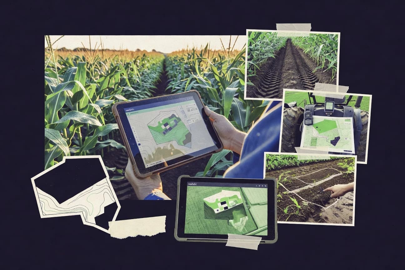
Ag Mapping Software turns field locations, parcels, imagery, and sensor observations into map layers and field-ready outputs for agronomy decisions. These tools support tasks like collecting geotagged observations, managing authoritative boundaries, producing map-ready rasters, and visualizing overlays on basemaps. For mobile capture and consistent data entry, ArcGIS Field Maps converts GIS web maps into offline-ready field workflows with configurable forms, validation, and sync. For custom analysis and exports from large satellite archives, Google Earth Engine uses a code editor to derive vegetation index and change layers for downstream mapping.
Key Features to Look For
The right Ag Mapping Software depends on matching workflow stages, from data capture and validation to analysis and map delivery.
Offline map areas with field-ready editing and automatic sync
Offline-ready field capture is the foundation for agronomy teams working with intermittent connectivity. ArcGIS Field Maps provides offline map areas with feature editing for field observations and automatic sync back to hosted layers.
Configurable forms with validation for consistent agronomic data entry
Validated forms prevent inconsistent scouting notes and incomplete attribute sets. ArcGIS Field Maps supports configurable forms with validation so field teams collect observations in a standardized agronomic structure.
Layer-driven mapping that reuses existing boundaries and symbology
Ag mapping becomes faster when maps reuse authoritative field boundaries and consistent styling rules. ArcGIS Field Maps builds scouting maps from hosted layers so symbology and boundaries stay consistent across planning, field collection, and reporting.
Geospatial governance with secure publishing of web maps and feature services
Organizations needing governed mapping and controlled access should look for enterprise publishing and permissions. ArcGIS Enterprise supports web maps, feature services, and analysis services with configurable roles, permissions, and enterprise-grade security controls.
Large-scale spatiotemporal analytics for agricultural datasets
When field and imagery datasets need big-data processing, spatiotemporal analytics becomes a deciding capability. ArcGIS GeoAnalytics Server inside ArcGIS Enterprise supports large-scale spatiotemporal processing for agricultural datasets.
Repeatable raster and vector analysis pipelines
Repeatable pipelines matter for year-over-year mapping and consistent output generation. QGIS provides a processing toolbox with Model Builder for automated raster and vector analysis chains, and Google Earth Engine provides scriptable workflows to standardize exports across areas of interest.
How to Choose the Right Ag Mapping Software
A practical selection matches the tool to the main workflow stage that carries the most risk for data quality, timing, and outputs.
Start with the workflow stage that must succeed in the field
If field teams must capture observations with intermittent connectivity, ArcGIS Field Maps fits because it supports offline map areas plus field-ready feature editing and automatic sync. If the field workflow is primarily boundary visualization and interactive overlays, Leaflet and OpenLayers work as web mapping frameworks because they render GeoJSON and support interactive events for feature inspection.
Choose the delivery model for where your data should live and be controlled
If farm mapping must be governed with roles, permissions, and secure service publishing, ArcGIS Enterprise provides web maps, feature services, and analysis services with enterprise-grade security controls. If the main goal is a custom viewer that consumes prebuilt layers and emphasizes cartography, Mapbox and OpenLayers focus on vector tile delivery and custom styling rather than agronomy-specific farm data models.
Match your imagery and analytics depth to your outputs
If the goal is analytical crop and land mapping from imagery with classification and change detection, ENVI delivers deep raster science including supervised classification and change detection. If the goal is scalable time-series mapping from massive satellite archives using export-ready rasters and statistics, Google Earth Engine uses a code editor for pixel-wise processing and large-scale exports.
Pick a data preparation tool when inputs come from mixed sources
If boundaries, orthomosaics, CAD layers, and DEMs arrive in mixed formats and require georeferencing and map production, Global Mapper supports end-to-end raster and DEM visualization plus coordinate system transformations. QGIS can also handle raster and vector composition and map layouts, but it requires careful coordinate system setup for reliable GIS outputs.
Confirm integration and complexity tolerance for the team that will run it
ArcGIS Field Maps depends on ArcGIS content and layer configuration, so teams must be ready to design hosted feature layers and forms. ArcGIS Enterprise similarly requires server sizing, caching, and component tuning, while Google Earth Engine and ENVI require technical processing setup for consistent analytical results.
Who Needs Ag Mapping Software?
Different teams need different Ag Mapping Software capabilities, so the best choice depends on whether the core job is field capture, governed mapping, satellite analytics, or custom visualization.
Agronomy teams needing offline-ready GIS data collection and field validation
ArcGIS Field Maps matches this need because it provides offline map areas, configurable forms with validation, and geotagged asset capture that syncs back to ArcGIS web maps and layers. QGIS can support repeatable mapping and spatial analysis, but it lacks the purpose-built offline field editing workflow that ArcGIS Field Maps delivers.
Agricultural organizations needing governed mapping, imagery analysis, and scalable web services
ArcGIS Enterprise is designed for end-to-end GIS operations with roles, permissions, and secure service publishing. ArcGIS Enterprise also adds ArcGIS GeoAnalytics Server for large-scale spatiotemporal processing when agriculture datasets must be processed at scale.
GIS-focused agronomy teams needing repeatable mapping and spatial analysis
QGIS fits teams that want repeatable map production and analysis through saved models and batch processing. Its processing toolbox with Model Builder supports automated raster and vector analysis chains for field reporting and cartography.
Remote sensing teams producing analytical agronomic maps with repeatable pipelines
ENVI is built for remote sensing depth with raster processing, atmospheric and radiometric corrections, supervised classification, and change detection. Google Earth Engine fits remote sensing and analytics teams that want scalable satellite archive processing plus code-based workflows that export ready rasters and zonal statistics.
Teams building custom agronomy map visualization with Azure-native basemaps
Satellite imagery services in Microsoft Azure Maps fit teams that need Azure-native basemap consumption and interactive map visualization for field boundaries and locations. It focuses on display and integration via Azure services, so analytical classifications and agronomy outputs require external GIS tooling.
Teams building custom ag map viewers for boundaries, routes, and overlays
Mapbox fits teams needing highly controlled cartography because it serves styled basemaps and renders geospatial layers with a JSON style specification and performant vector tile rendering. OpenLayers and Leaflet fit teams that prefer code-first web mapping where geometry interactions and GeoJSON-driven overlays are implemented by the application.
Common Mistakes to Avoid
Common failure points come from mismatching tools to workflow depth, connectivity constraints, and required governance or development effort.
Choosing a visualization library and expecting agronomy workflows out of the box
Mapbox, OpenLayers, and Leaflet provide interactive map rendering and styling but do not deliver agronomy-specific analysis tooling for crops, soils, or prescriptions. ArcGIS Field Maps and ArcGIS Enterprise deliver field-ready workflows and managed services instead of requiring custom agronomy logic for every step.
Underestimating offline and data validation requirements for field teams
A purely online web viewer can fail in intermittent connectivity conditions, which is why ArcGIS Field Maps focuses on offline map areas with field-ready feature editing and automatic sync. Leaflet and OpenLayers can support interaction, but they require custom engineering to replicate offline-ready editing and validated agronomic data capture.
Treating enterprise GIS as turnkey without planning for configuration and performance tuning
ArcGIS Enterprise requires setup and tuning across components, and it relies on sizing, caching, and server configuration for performance. Global Mapper and QGIS can be faster for individual map preparation tasks, but they do not provide enterprise-governed publishing and secure service workflows.
Picking satellite analytics tools without the technical processing capacity to produce consistent results
ENVI requires training to use its processing depth for consistent agronomic outcomes across scenes and dates. Google Earth Engine uses a code editor scripting model that raises the learning curve for teams that expect a turnkey, non-technical workflow.
How We Selected and Ranked These Tools
we evaluated every tool on three sub-dimensions using fixed weights of features at 0.40, ease of use at 0.30, and value at 0.30. The overall rating is the weighted average of those three sub-dimensions computed as overall = 0.40 × features + 0.30 × ease of use + 0.30 × value. ArcGIS Field Maps stood apart because its features directly cover offline map areas, configurable forms with validation, and automatic sync workflows for field editing, which aligns strongly with the practical needs of agronomy field data collection while keeping usability high for that targeted workflow.
Frequently Asked Questions About Ag Mapping Software
Which tool best supports offline field data capture for agronomy scouting and crop inspections?
What differentiates ArcGIS Enterprise from ArcGIS Field Maps for agricultural mapping at scale?
Which option is strongest for repeatable geospatial analysis workflows without locking into a single vendor ecosystem?
Which software is best for preparing farm planning maps from mixed raster, DEM, and CAD inputs?
When should agronomic teams choose ENVI over general GIS tools?
How does Google Earth Engine fit into an ag mapping workflow that needs time series vegetation analytics?
Which tool works best as a satellite basemap and mapping integration layer inside Microsoft Azure workflows?
Which platform is suited for building a custom agronomy map viewer with precise cartographic control?
What should teams use if they need full control over web map rendering and vector feature interactions?
Which approach suits lightweight web mapping for field parcels using GeoJSON overlays?
Conclusion
After evaluating 10 agriculture farming, ArcGIS Field Maps stands out as our overall top pick — it scored highest across our combined criteria of features, ease of use, and value, which is why it sits at #1 in the rankings above.
Use the comparison table and detailed reviews above to validate the fit against your own requirements before committing to a tool.
Tools reviewed
Primary sources checked during evaluation.
Referenced in the comparison table and product reviews above.
Keep exploring
Comparing two specific tools?
Software Alternatives
See head-to-head software comparisons with feature breakdowns, pricing, and our recommendation for each use case.
Explore software alternatives→In this category
Agriculture Farming alternatives
See side-by-side comparisons of agriculture farming tools and pick the right one for your stack.
Compare agriculture farming tools→FOR SOFTWARE VENDORS
Not on this list? Let’s fix that.
Our best-of pages are how many teams discover and compare tools in this space. If you think your product belongs in this lineup, we’d like to hear from you—we’ll walk you through fit and what an editorial entry looks like.
Apply for a ListingWHAT THIS INCLUDES
Where buyers compare
Readers come to these pages to shortlist software—your product shows up in that moment, not in a random sidebar.
Editorial write-up
We describe your product in our own words and check the facts before anything goes live.
On-page brand presence
You appear in the roundup the same way as other tools we cover: name, positioning, and a clear next step for readers who want to learn more.
Kept up to date
We refresh lists on a regular rhythm so the category page stays useful as products and pricing change.