GITNUXSOFTWARE ADVICE
Construction InfrastructureTop 10 Best Aerial Roof Measurement Software of 2026
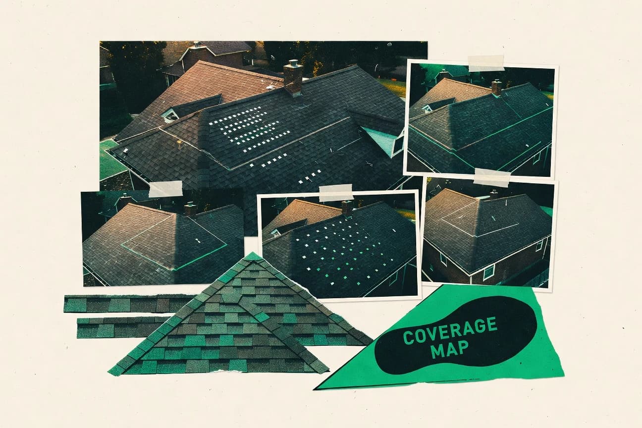
Top 10 Aerial Roof Measurement Software ranked for fast roof surveys, with comparisons of DroneDeploy, Pix4D, and Propeller Aero options.

How we ranked these tools
Core product claims cross-referenced against official documentation, changelogs, and independent technical reviews.
Analyzed video reviews and hundreds of written evaluations to capture real-world user experiences with each tool.
AI persona simulations modeled how different user types would experience each tool across common use cases and workflows.
Final rankings reviewed and approved by our editorial team with authority to override AI-generated scores based on domain expertise.
Score: Features 40% · Ease 30% · Value 30%
Gitnux may earn a commission through links on this page — this does not influence rankings. Editorial policy
Editor’s top 3 picks
Three quick recommendations before you dive into the full comparison below — each one leads on a different dimension.
DroneDeploy
Roof measurement workflow that generates orthomosaics and surface models from mapped drone flights
Built for roofing teams needing fast aerial measurements and consistent deliverable exports.
Pix4D
Editor pickPhotogrammetric processing to generate dense point clouds and orthomosaics for measurement-ready roofs
Built for survey teams producing repeatable roof measurements from drone or camera imagery.
Propeller Aero
Editor pickAutomated roof area measurement derived from captured aerial imagery
Built for roofing and solar teams needing fast aerial measurements for estimates.
Related reading
Comparison Table
This comparison table groups aerial roof measurement tools such as DroneDeploy, Pix4D, and Propeller Aero by integration depth, data model, and automation plus API surface. It also captures admin and governance controls including RBAC, provisioning workflows, and audit log coverage, so teams can map each platform to their deployment requirements and extensibility needs.
DroneDeploy
cloud mappingCloud platform for mapping workflows that supports aerial capture and roof measurement outputs for construction and insurance use cases.
Roof measurement workflow that generates orthomosaics and surface models from mapped drone flights
DroneDeploy turns drone flights into roof-specific measurements with automated orthomosaics, surface models, and progress-ready reports. The workflow supports capturing consistent roof imagery, generating measurements like area and pitch-relevant views, and sharing results for field and estimating teams.
It also integrates collaboration around marked imagery and exported deliverables that support downstream estimating and documentation. Strong capture-to-report automation differentiates it for aerial roof measurement use cases.
- +Automates roof imagery processing into measurable outputs and shareable deliverables
- +Structured capture workflows support repeatable roof surveys across sites
- +Exportable models and orthomosaics support estimating and documentation handoffs
- –Processing quality depends heavily on consistent flight coverage and camera settings
- –Advanced roof takeoff workflows may require training for optimal results
- –Big projects can feel workflow-heavy due to review and export steps
Residential roofing contractors estimating multiple jobs per week
Capture standardized drone roof imagery at each site and generate orthomosaic roof maps with measurement-ready outputs for estimating
Faster estimate preparation with measurement-backed roof area inputs across a pipeline of active jobs.
Commercial roofing estimators and project managers supporting larger scope takeoffs
Create surface models and roof views that help validate complex roof configurations and support internal review before field work
More reliable takeoff inputs and fewer scope surprises during later field verification.
Show 2 more scenarios
Insurance adjusters and mitigation teams documenting storm or damage events
Record roof condition imagery and generate a measurement-aligned documentation set for damage assessment and review
Consistent roof documentation that improves turnaround for review and claims-related assessment.
DroneDeploy converts roof flights into visuals and measurements that fit documentation needs for damage evaluation. Shared deliverables help stakeholders align on the same roof reference set.
Enterprise field operations teams coordinating inspections and reporting across multiple assets
Standardize capture and reporting for repeatable roof measurements across a portfolio and share results with estimating stakeholders
A repeatable measurement workflow that supports portfolio-level documentation and downstream estimating.
The capture-to-report pipeline reduces variation between sites by using automated processing tied to roof imagery. Exported deliverables and collaboration features support coordinated handoffs between field and desk teams.
Best for: Roofing teams needing fast aerial measurements and consistent deliverable exports
More related reading
Pix4D
photogrammetryPhotogrammetry software that turns drone images into 3D models and measurements suitable for roof area takeoffs and surface analysis.
Photogrammetric processing to generate dense point clouds and orthomosaics for measurement-ready roofs
Pix4D stands out for producing survey-grade photogrammetry outputs that support measurable roof workflows beyond basic visualization. Its core toolset covers aerial image processing, dense point cloud and orthomosaic generation, and automated measurement exports used for roof inspections.
The platform also supports structured photogrammetry project handling for repeatable data capture across sites. For roof measurement teams, it connects processed 3D deliverables to downstream tasks like quantification and reporting.
- +Survey-grade photogrammetry outputs for measurable roof geometry
- +Dense point clouds and orthomosaics support accurate roof feature checks
- +Workflow structures projects for consistent repeatable roof processing
- –Processing setup and output tuning can require specialist attention
- –Hardware demands grow quickly with higher-resolution roof datasets
- –Automation for roof-specific reporting can be limited versus dedicated add-ons
Roof inspection contractors running repeatable aerial surveys across multiple properties
Standardizing photogrammetry project templates to produce consistent roof orthomosaics and measurement-ready outputs for each site
A uniform set of roof measurements and visual references across properties that speeds up review cycles for multi-site reports.
Solar installers assessing roof suitability and usable panel layout areas from aerial imagery
Deriving roof surface area and overlay references from processed orthomosaics and point clouds to plan installation boundaries
Faster pre-installation planning with measurement-backed usable roof surface estimates to reduce field rework.
Show 2 more scenarios
Commercial property managers coordinating roof condition documentation and asset reporting
Consolidating aerial 3D measurements into inspection packages for recurring portfolio audits
Clear measurement-based inspection records that improve comparability across audits and support maintenance decisions.
The platform produces survey-grade photogrammetry outputs that connect roof deliverables to downstream tasks like quantification and reporting. Reprocessing structured projects supports consistent documentation across inspection intervals.
Engineering and surveying teams validating roof geometry for planning and scope definition
Using dense point clouds and orthomosaics as measurement inputs to estimate roof dimensions and features for engineering takeoffs
More efficient roof geometry inputs for planning and estimating with reduced on-site measurement effort.
Pix4D processes aerial images into dense 3D products that support measurable roof workflows beyond basic visualization. Teams can base scope calculations on 3D geometry captured from the roof without repeated manual tape measures.
Best for: Survey teams producing repeatable roof measurements from drone or camera imagery
Propeller Aero
roof analyticsAerial measurement workflow that produces roof measurements by combining drone capture with automated processing for construction and solar planning.
Automated roof area measurement derived from captured aerial imagery
Propeller Aero stands out with aerial roof measurement workflows that translate flight imagery into usable roof area and geometry outputs for construction and insurance use cases. The product focuses on automated measurement from captured images rather than general project management.
It supports structured capture and downstream estimating inputs, which helps standardize results across sites and roof types. The overall workflow is tuned for repeatability, with less emphasis on highly customizable CAD or full design toolchains.
- +Automated roof measurement from aerial imagery reduces manual takeoff effort
- +Consistent capture-to-output workflow supports repeatable measurements across jobs
- +Exports are geared toward estimating and underwriting style inputs
- +Designed for roof-focused workflows instead of broad GIS complexity
- –Limited evidence of deep CAD editing and structural modeling capabilities
- –Complex roofs can still require QA because measurement automation is not perfect
- –Less suited for teams needing full end-to-end design and documentation
Roofing contractors producing per-roof measurement packages
Capturing an existing roof in structured flights and converting the imagery into measured roof area and geometry outputs for material takeoffs and change-order documentation
More consistent roof area and geometry inputs for quoting and purchasing material quantities with fewer manual takeoffs.
Insurance and claims teams handling property damage documentation
Generating standardized roof measurement outputs from aerial capture to support estimate scoping after storms or partial roof damage
Faster creation of consistent roof scope inputs that align across adjusters and reviewers.
Show 2 more scenarios
Solar installers and EPC partners planning rooftop PV layouts
Using aerial roof measurements to size system coverage area and provide geometry inputs for initial design constraints before deeper engineering work
Reduced time spent collecting baseline roof dimensions needed to start layout planning and feasibility assessments.
The tool focuses on producing roof-area and roof-shape measurement outputs that can feed early planning and feasibility checks for PV placement.
Construction and facility management teams managing multi-site roofing programs
Running repeatable aerial capture across many sites and exporting standardized measurement inputs for estimating and work planning
More uniform inputs for program-level estimating, scheduling, and cross-site reporting of roof scope.
The measurement-first workflow helps standardize the captured-to-measurements pipeline so different crews and locations produce comparable roof data.
Best for: Roofing and solar teams needing fast aerial measurements for estimates
More related reading
Roofr
roof measurementRoof measurement software that uses aerial capture and image-based workflows to estimate roof area and generate customer-ready documentation.
Annotated roof measurement outputs for client and internal review
Roofr stands out by turning aerial roof imagery into a measurement-driven workflow for residential roofing projects. The platform supports roof measurements, annotations, and proposal-ready outputs tied to customer-facing deliverables. Roofr also streamlines review and revision steps so field capture and estimations stay aligned across stakeholders.
- +Converts aerial roof imagery into measurement views for takeoff workflows
- +Annotation and shareable deliverables reduce back-and-forth during review
- +Supports project organization that keeps roof-specific assets together
- –Outcome quality depends heavily on capture consistency and image coverage
- –Measurement output flexibility can lag behind highly custom estimating workflows
- –Review and approvals require user training to avoid misreads
Best for: Roofing contractors needing consistent aerial measurement deliverables for proposals
Dronelink
capture orchestrationDrone flight planning and capture tool that supports aerial data collection feeding roof measurement and mapping workflows.
Mobile mission workflow designed for aerial roof capture and measurement documentation
Dronelink stands out with a flight-to-measurement workflow built around capturing roof context in the field. It supports mobile mission control with mapping capture, then turns imagery into roof measurements used for estimating and documentation. The tool is most effective when crews want a consistent process from takeoff planning through deliverable-ready outputs.
- +Guided mission workflows reduce inconsistent roof data capture across crews
- +Mobile controls support repeatable flight paths and scheduled capture sessions
- +Roof-focused measurement outputs support estimating and project documentation needs
- –Setup and workflow configuration take time before consistent results
- –Measurement accuracy depends heavily on capture overlap and flight execution
- –Export and integration options can feel limited for nonstandard estimating stacks
Best for: Roof measurement teams needing consistent drone capture to estimation-ready documentation
OpenDroneMap
open-source photogrammetryOpen-source photogrammetry toolkit that generates 3D reconstructions and measurable outputs from aerial imagery for roof area computations.
End-to-end photogrammetry pipeline producing measurement-ready orthophotos and meshes
OpenDroneMap turns drone image collections into georeferenced outputs such as orthophotos, textured meshes, and point clouds, which supports aerial roof measurement workflows. It performs photogrammetry locally and then can export products suitable for roof-area estimation and visual documentation.
The tool focuses on data processing and output generation rather than providing a dedicated roof-measurement interface with built-in measurements. That design makes it flexible for asset owners and survey teams who already manage measurement steps elsewhere.
- +Generates orthophotos, meshes, and point clouds from typical drone image sets
- +Local processing supports controlled workflows for field teams and data governance
- +Exportable georeferenced outputs integrate with external measurement tools
- –No dedicated roof measurement UI for direct area and dimension extraction
- –Processing quality depends heavily on image overlap, exposure, and operator setup
- –Toolchain complexity increases for non-technical users managing dependencies
Best for: Survey teams needing geospatial roof outputs from drone photogrammetry
More related reading
Metashape
desktop photogrammetryPhotogrammetry application that reconstructs 3D geometry from aerial images so roof surfaces can be measured and quantified.
Georeferenced photogrammetry with dense cloud and mesh generation for metric roof measurements
Metashape stands out for turning overlapping aerial photos into metric 3D models that work well for roof measurement workflows. It supports dense point cloud generation, textured mesh creation, and camera alignment from drone imagery using photogrammetry.
Accuracy depends heavily on image coverage quality and ground control usage, which can slow projects on complex roof geometries. Roof deliverables are typically derived by measuring within the reconstructed 3D scene rather than through a purpose-built roof automation wizard.
- +Metric photogrammetry pipeline converts aerial images into measurable 3D roof geometry
- +Dense cloud and textured mesh generation supports detailed visual and measurement outputs
- +Coordinate-system and georeferencing tools enable consistent results across mapping projects
- –Roof-specific automation is limited, so measurement setup can be manual
- –Processing and alignment often require careful image capture and parameter tuning
- –Large datasets can demand substantial compute and memory to finish reconstruction
Best for: Survey teams producing accurate roof models from drone imagery for metrology deliverables
RealityCapture
reality captureReality capture software that builds detailed 3D models from drone photos for roof measurement and volume or area calculations.
High-precision reconstruction from aerial photos with dense point clouds and mesh generation
RealityCapture stands out for producing highly accurate photogrammetry reconstructions from aerial imagery for roof measurement workflows. It supports dense point clouds, mesh generation, and orthographic outputs that map well to inspections, as-built documentation, and surface area takeoffs.
The workflow can handle large datasets with advanced reconstruction controls and delivers measurement-ready geometry for downstream CAD or GIS use. Automation and consistency depend on careful capture settings and dataset organization rather than fully hands-off processing.
- +Dense reconstruction and clean mesh output support detailed roof surface measurement.
- +Batch-friendly workflows handle large aerial image sets efficiently.
- +Orthographic views and measurement-ready geometry reduce manual rework.
- –Quality depends heavily on image overlap, alignment, and consistent capture geometry.
- –Advanced settings require training to avoid scale and alignment mistakes.
- –Export formats and downstream cleanup can add extra steps for roof-specific deliverables.
Best for: Teams needing accurate aerial roof models with photogrammetry control and measurement outputs
More related reading
CloudCompare
point cloud measurementPoint cloud processing tool that enables measurement on aerial 3D data extracted from photogrammetry pipelines.
Interactive distance and cloud-to-mesh comparison tools for roof surface deviation analysis
CloudCompare stands out for direct point-cloud processing and measurement workflows on local datasets. It supports classification, filtering, cropping, and surface reconstruction for roof geometry from aerial scans or LiDAR.
Measurement tools like distance, angles, and volume make it feasible to quantify roof features after alignment and cleanup. The workflow requires exporting results into other tools for reporting, since it focuses on analysis rather than end-to-end roof analytics.
- +Rich point-cloud toolset for filtering, classification, and denoising
- +Accurate measurements via distances, angles, and volume computations
- +Flexible alignment and resampling for preparing aerial roof scans
- +Supports mesh and surface reconstruction to derive roof geometry
- –Requires manual workflow steps for roof-specific extraction and reporting
- –User interface can feel technical for non-geomatics operators
- –Automated roof segmentation is limited compared with specialized platforms
- –Output formats may need post-processing for stakeholder-ready deliverables
Best for: Geomatics teams measuring roof geometry from point clouds without full roof-analytics automation
Bentley iTwin Capture
construction dataAerial capture and workflow tooling for creating data suitable for measuring construction surfaces and reconciling roof geometry.
iTwin Capture to iTwin integration for georeferenced roof measurement context
Bentley iTwin Capture distinguishes itself by turning captured aerial imagery into iTwin-ready 3D visual and measurement outputs. The workflow supports georeferenced roof data capture, enabling measurement tasks tied to digital models and coordinates.
It focuses on visual capture for project documentation and measurement, rather than being a pure standalone roof quantification calculator. For aerial roof measurement, it fits teams that want captured evidence connected to an iTwin data environment.
- +Georeferenced capture helps keep roof measurements aligned to real-world coordinates
- +Integrated iTwin data flow supports linking imagery and measurements to digital models
- +Visual capture accelerates roof documentation for inspection and reporting
- –Setup and data alignment can be complex without strong surveying workflows
- –Roof-specific measurement automation is less direct than specialized roof analytics tools
- –Results depend on capture quality and consistent flight or imagery parameters
Best for: Teams needing iTwin-linked aerial roof measurement from georeferenced capture
Conclusion
After evaluating 10 construction infrastructure, DroneDeploy stands out as our overall top pick — it scored highest across our combined criteria of features, ease of use, and value, which is why it sits at #1 in the rankings above.
Use the comparison table and detailed reviews above to validate the fit against your own requirements before committing to a tool.
How to Choose the Right Aerial Roof Measurement Software
This buyer’s guide compares DroneDeploy, Pix4D, Propeller Aero, Roofr, Dronelink, OpenDroneMap, Metashape, RealityCapture, CloudCompare, and Bentley iTwin Capture for aerial roof measurement workflows. It focuses on integration depth, data model fit, automation and API surface, and admin and governance controls.
The guide also maps concrete workflow mechanisms like capture-to-orthomosaic processing, dense point cloud generation, and annotated measurement outputs to real team use cases across roofing, solar, and geomatics.
Software that turns aerial roof imagery into measurable geometry, orthomosaics, and takeoff-ready outputs
Aerial roof measurement software converts drone photos into orthomosaics, dense point clouds, and measurement-ready geometry so roof area and surface attributes can be quantified. Many tools also generate structured deliverables like annotated roof outputs or progress-ready reports that reduce manual takeoff steps.
Teams use these systems to align roof measurements with downstream estimating, documentation, and digital model workflows. DroneDeploy and Pix4D represent the capture-to-processed-geometry pattern where orthomosaics and surface models become the basis for roof measurements.
Evaluation checkpoints for integration, data model control, and automation depth
Roof measurement outcomes depend on how reliably the tool produces measurement-ready assets from captured imagery. Integration depth and data model alignment determine whether those assets drop cleanly into estimating, review, and digital model workflows.
Automation and API surface matter because capture-to-report or capture-to-output steps often need to run consistently across crews and sites. Admin and governance controls matter because teams usually manage shared datasets, review states, and access to deliverables and georeferenced outputs.
Capture-to-measurement workflow automation
DroneDeploy automates roof imagery processing into measurable outputs by generating orthomosaics and surface models from mapped drone flights. Propeller Aero and Dronelink also emphasize automated roof area measurement and repeatable mobile mission workflows tied to estimation-ready deliverables.
Photogrammetry output depth for roof geometry
Pix4D produces dense point clouds and orthomosaics designed for measurement-ready roof workflows. RealityCapture also focuses on high-precision dense reconstruction with mesh and orthographic outputs that support detailed roof surface measurement.
Georeferencing and coordinate alignment for governed data
Bentley iTwin Capture ties georeferenced roof data capture to an iTwin data flow so measurements stay aligned to real-world coordinates. OpenDroneMap and Metashape also support georeferenced outputs like orthophotos, textured meshes, and dense point clouds that integrate with external measurement steps when governance is needed.
Deliverable schema for estimating and stakeholder review
Roofr turns roof imagery into measurement-driven workflows with annotations and proposal-ready outputs tied to customer-facing documentation. DroneDeploy and Propeller Aero export roof models and orthomosaics geared toward estimating and documentation handoffs.
Automation surface and extensibility via API or workflow hooks
Tools that provide a documented automation and API surface enable repeatable capture-to-export runs across sites and reduce manual export steps that can slow large projects like DroneDeploy’s review and export workflow. Platforms that focus on analysis and processing steps like CloudCompare typically require more external orchestration for reporting and stakeholder deliverables.
Admin controls for multi-user access to datasets and approvals
Platforms that support structured review and revision steps like Roofr help keep roof-specific assets aligned across stakeholders. Teams using capture-to-model tools like Bentley iTwin Capture benefit from governance patterns that connect imagery and measurements to digital models under controlled access.
Decision framework for selecting a roof measurement platform that fits capture, processing, and governance needs
Start by matching the tool’s core output to the measurement workflow used by the team. DroneDeploy and Propeller Aero drive fast roof measurements from mapped flights with orthomosaics and roof area outputs aimed at estimating and underwriting inputs.
Then verify that the tool’s data model and delivery format fit downstream systems. Pix4D, Metashape, RealityCapture, and OpenDroneMap produce dense geometry artifacts like point clouds and meshes that require either in-tool measurement steps or external downstream processing and mapping integrations.
Choose the primary artifact the team will standardize on
If the standardized deliverable must be orthomosaics and surface models for roof measurements, use DroneDeploy or Pix4D. If the workflow must prioritize fast roof area outputs for estimating and solar planning, prioritize Propeller Aero or Dronelink.
Confirm the geometry pipeline matches roof complexity tolerance
For measurement teams that need dense point clouds and mesh-ready geometry, use Pix4D or RealityCapture because they produce dense reconstruction and measurement-ready outputs. For teams that require more post-capture extraction and analysis, use CloudCompare after photogrammetry or scanning because it focuses on filtering, classification, and interactive distance and volume computations.
Align georeferencing and coordinate handling to the governance model
If roof measurement must stay connected to a digital model environment, use Bentley iTwin Capture because it links georeferenced roof capture to iTwin integration. If the workflow requires local processing and exportable georeferenced outputs under stricter data handling, use OpenDroneMap or Metashape for orthophotos and meshes that feed external measurement tools.
Select the tool that minimizes manual review and re-export steps for stakeholders
If customer-ready documentation with annotations and review alignment is the main pain point, use Roofr because it provides annotated measurement outputs and structures review and revision steps. If internal estimating teams need repeatable exports of orthomosaics and roof models, use DroneDeploy or Propeller Aero because their deliverables are geared toward downstream estimating and documentation handoffs.
Plan for training and dataset capture discipline based on processing sensitivity
If capture settings and flight coverage must be consistent, select a workflow that matches crew operational reality because processing quality depends heavily on overlap and coverage in tools like DroneDeploy, Pix4D, RealityCapture, and Metashape. If the team cannot provide consistent capture geometry, treat manual QA as a required step and budget review time, especially for complex roofs where measurement automation is not perfect in tools like Propeller Aero.
Which teams should evaluate each roof measurement platform based on workflow fit
Aerial roof measurement tools vary by how much of the pipeline runs automatically versus how much requires technical capture and parameter tuning. The best fit depends on whether the priority is fast estimating deliverables, survey-grade geometry, or georeferenced integration into a digital model environment.
The audience segments below map directly to each tool’s best-fit use case.
Roofing teams needing fast aerial measurements with structured deliverable exports
DroneDeploy fits this workflow because it automates roof imagery processing into orthomosaics and surface models that support estimating and documentation handoffs. Roofr also fits this audience because annotated roof measurement outputs support proposal-ready documentation and review.
Survey teams producing repeatable metric measurements from drone imagery
Pix4D fits repeatable roof processing because it generates dense point clouds and orthomosaics suitable for measurement-ready roofs. Metashape and RealityCapture also fit when dense reconstruction and georeferenced outputs must support metric roof models, even when measurement setup can be manual.
Roofing and solar teams that need aerial roof area inputs for estimates quickly
Propeller Aero fits fast estimation workflows because it produces automated roof area measurement derived from captured aerial imagery. Dronelink fits when crews need guided mission planning and consistent mobile capture that feeds measurement documentation.
Geomatics and analytics teams measuring from point clouds and meshes rather than driving end-to-end roof analytics
CloudCompare fits teams that already have point clouds from photogrammetry or LiDAR because it provides classification, filtering, and distance and angle computations for roof feature deviation analysis. OpenDroneMap fits teams that want a local photogrammetry pipeline for orthophotos and meshes that can be exported to external measurement workflows.
Teams tied to iTwin or digital model environments that require georeferenced measurement context
Bentley iTwin Capture fits teams that need georeferenced roof data capture connected to iTwin integration so roof measurement context remains aligned to digital models. It is less direct as a standalone roof measurement automation tool than specialized roof analytics platforms.
Common buyer pitfalls that break aerial roof measurement workflows
Most failures come from mismatched expectations about capture discipline, output format readiness, and downstream reporting integration. These issues show up across both all-in-one roof measurement platforms and photogrammetry or point cloud analysis tools.
The fixes below reference specific platforms that either intensify the failure mode or avoid it with clearer workflow structure.
Assuming roof measurements will be accurate without consistent flight coverage and capture geometry
DroneDeploy, Pix4D, RealityCapture, and Metashape depend on image overlap and consistent capture geometry for quality results. Propeller Aero also can require QA on complex roofs because automation is not perfect when coverage or geometry is inconsistent.
Buying a photogrammetry processor and expecting turnkey roof takeoff reporting
CloudCompare focuses on point-cloud analysis and measurement tools like distance, angles, and volume, which means roof-specific segmentation and reporting require external steps. OpenDroneMap and Metashape produce orthophotos, meshes, and point clouds that can be measurement-ready but do not provide a purpose-built roof measurement interface.
Forgetting that review and stakeholder alignment needs structured deliverables and annotation workflows
Roofr provides annotated roof measurement outputs and structures review and revision steps to keep field capture aligned with proposals. DroneDeploy can create workflow-heavy review and export steps on large projects, so planning for review states and export throughput avoids delays.
Overlooking scale, compute, and dataset handling realities for dense reconstruction
Pix4D, Metashape, and RealityCapture can demand specialist tuning and higher compute as dataset resolution grows. RealityCapture supports batch-friendly workflows for large image sets, while Metashape can require careful parameter tuning and memory for large reconstructions.
Choosing an iTwin-connected capture tool without a clear iTwin data workflow
Bentley iTwin Capture provides georeferenced capture to iTwin integration, but it can be complex without strong surveying workflow alignment. Teams that only need standalone roof geometry extraction typically get a more direct roof-focused measurement experience from DroneDeploy, Roofr, or Propeller Aero.
How We Selected and Ranked These Tools
We evaluated DroneDeploy, Pix4D, Propeller Aero, Roofr, Dronelink, OpenDroneMap, Metashape, RealityCapture, CloudCompare, and Bentley iTwin Capture on three criteria using the provided feature descriptions and score summaries. Features carries the most weight in the overall rating at the center of the decision, with ease of use and value each accounting for the remaining share. Each tool’s placement reflects how well its named roof measurement outputs, deliverable structure, and workflow automation align with aerial roof measurement needs.
DroneDeploy separated from lower-ranked tools because its roof measurement workflow generates orthomosaics and surface models from mapped drone flights, which directly increases measurable output consistency for fast roof surveys. That capability pulled it up on both feature fit for roof measurement deliverables and ease-of-use outcomes tied to capture-to-report automation.
Frequently Asked Questions About Aerial Roof Measurement Software
How do DroneDeploy and Pix4D differ for roof measurements from aerial capture?
Which tool fits faster roof area and geometry outputs for construction or insurance estimates?
What workflow differences matter between Roofr and Dronelink for residential proposals?
When is OpenDroneMap a better choice than a dedicated roof measurement interface?
How do RealityCapture and Metashape handle accuracy for roof metrology from aerial photos?
What technical inputs most affect results for dense point cloud and mesh outputs in photogrammetry tools?
How does CloudCompare fit roof measurement workflows compared to full aerial capture-to-report tools?
What integration and API needs drive teams to choose DroneDeploy versus Bentley iTwin Capture?
How do admin controls and security planning differ across these platforms for multi-user teams?
Tools reviewed
Primary sources checked during evaluation.
Referenced in the comparison table and product reviews above.
Keep exploring
Comparing two specific tools?
Software Alternatives
See head-to-head software comparisons with feature breakdowns, pricing, and our recommendation for each use case.
Explore software alternatives→In this category
Construction Infrastructure alternatives
See side-by-side comparisons of construction infrastructure tools and pick the right one for your stack.
Compare construction infrastructure tools→FOR SOFTWARE VENDORS
Not on this list? Let’s fix that.
Our best-of pages are how many teams discover and compare tools in this space. If you think your product belongs in this lineup, we’d like to hear from you—we’ll walk you through fit and what an editorial entry looks like.
Apply for a ListingWHAT THIS INCLUDES
Where buyers compare
Readers come to these pages to shortlist software—your product shows up in that moment, not in a random sidebar.
Editorial write-up
We describe your product in our own words and check the facts before anything goes live.
On-page brand presence
You appear in the roundup the same way as other tools we cover: name, positioning, and a clear next step for readers who want to learn more.
Kept up to date
We refresh lists on a regular rhythm so the category page stays useful as products and pricing change.