GITNUXSOFTWARE ADVICE
Art DesignTop 10 Best 3D Landscaping Software of 2026
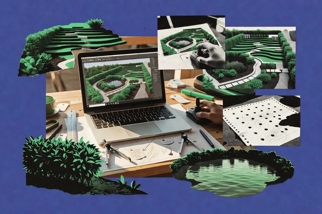
Top 10 3D Landscaping Software picks for 3D planning and rendering, with rankings comparing Lumion, Twinmotion, and SketchUp.

How we ranked these tools
Core product claims cross-referenced against official documentation, changelogs, and independent technical reviews.
Analyzed video reviews and hundreds of written evaluations to capture real-world user experiences with each tool.
AI persona simulations modeled how different user types would experience each tool across common use cases and workflows.
Final rankings reviewed and approved by our editorial team with authority to override AI-generated scores based on domain expertise.
Score: Features 40% · Ease 30% · Value 30%
Gitnux may earn a commission through links on this page — this does not influence rankings. Editorial policy
Editor’s top 3 picks
Three quick recommendations before you dive into the full comparison below — each one leads on a different dimension.
Lumion
Weather and lighting controls that affect imported outdoor scenes during image and video rendering.
Built for fits when landscape teams need quick visual review exports without external automation or governance requirements..
Twinmotion
Editor pickDatasmith import and Unreal Engine asset integration preserve material and hierarchy fidelity.
Built for fits when design teams need rapid landscaping visualization tied to Unreal pipelines..
SketchUp
Editor pickRuby-based plugin scripting that automates component placement and batch scene generation.
Built for fits when mid-size landscaping teams need visualization iteration with automation via scripts and extensions..
Related reading
Comparison Table
This comparison table covers Lumion, Twinmotion, and SketchUp alongside other 3D landscaping tools, focusing on integration depth, the underlying data model, and how automation and API access map to scene and asset workflows. Readers can compare provisioning and extensibility options, plus admin and governance controls like RBAC and audit log coverage, to gauge fit for team throughput and configuration management.
Lumion
real-time renderingReal-time 3D visualization software for fast architectural and landscape rendering, including materials, lighting, and scene animation.
Weather and lighting controls that affect imported outdoor scenes during image and video rendering.
Lumion is used to turn landscape models into photoreal images and animation sequences with adjustable sun, sky, weather effects, and camera paths for consistent review outputs. The data model is file-based at the project level, with scene elements tied to imported meshes and asset parameters rather than a queryable schema. Integration depth is driven by external modeling tools through mesh and texture imports, plus the reuse of vegetation and material assets inside the project.
A concrete tradeoff is that Lumion focuses on interactive visualization and export, while it lacks a documented automation surface for provisioning, RBAC, or API-led scene updates. This pattern fits teams that run a mostly manual design-to-visual pipeline and need high iteration throughput from consistent project scenes. It is less suited for organizations that require audit log driven governance, external system orchestration, or programmatic environment configuration across many concurrent projects.
- +Fast landscape scene iteration using imported terrain and vegetation assets
- +Consistent media output from controlled lighting, camera paths, and weather effects
- +Rich material and vegetation controls for presentation-grade visuals
- +Clear project workflow for repeatable image and video exports
- –Limited extensibility because scene automation is not exposed through a public API
- –No published RBAC or audit log controls for multi-admin governance workflows
- –Data model is project-centric, which reduces external system synchronization
- –Throughput for large multi-model updates depends on manual import and editing
Best for: Fits when landscape teams need quick visual review exports without external automation or governance requirements.
More related reading
Twinmotion
real-time visualizationReal-time 3D scene creation and rendering for design visualization with vegetation, weather, and camera animation tools.
Datasmith import and Unreal Engine asset integration preserve material and hierarchy fidelity.
Twinmotion targets rapid landscaping scene composition using drag-and-drop placement, material tweaking, and vegetation placement for vegetation-heavy projects. The workflow is built around a scene graph and imported geometry, with Datasmith as the primary bridge to Unreal Engine for preserving hierarchies and materials. Render output supports common review formats like image sequences, still images, and videos for stakeholder walkthroughs. Asset handling is practical for landscape teams, but it is not designed as a plant-first data schema for automated plant schedules or compliance checks.
The main tradeoff is automation and governance depth. Twinmotion offers a relatively narrow automation surface compared with tools that expose full project schemas, provisioning, and API-driven updates across large portfolios. It fits teams that iterate on design intent quickly and rely on an external pipeline for asset versioning and permissioning. It is also a good fit for one-off or small-batch visualization tasks where scene authors own the structure and updates remain manual.
- +Datasmith imports preserve hierarchy and materials from CAD and Unreal pipelines
- +Real-time viewport feedback speeds landscaping iteration and layout review
- +High-fidelity vegetation and terrain workflows support design intent visualization
- +Exports images and video sequences for stakeholder presentations
- –Scene-centric data model limits horticulture-specific automation and validation
- –Automation and API surface are limited for schema-driven batch updates
- –Built-in RBAC and audit logging controls are minimal for enterprise governance
- –Automation throughput depends on external tooling rather than native configuration
Best for: Fits when design teams need rapid landscaping visualization tied to Unreal pipelines.
SketchUp
3D modeling3D modeling tool used for landscape design workflows with extensive extensions for terrain, vegetation, and visualization.
Ruby-based plugin scripting that automates component placement and batch scene generation.
SketchUp uses a persistent 3D model that supports imported geometry, edited meshes, and construction tools for terrain-like shaping and layout massing. Landscaping work is typically driven by imported CAD or GIS context, then refined with components for repeated elements like trees, shrubs, and hardscape blocks. The platform’s extensibility comes from Ruby scripting and third-party extensions that add tools for assets, rendering, and documentation exports.
A concrete tradeoff is that the core data model is not a typed schema for landscaping domains, so automation usually targets geometry and metadata stored as component definitions, tags, and custom attributes. That increases setup time for teams that want strict data governance across multiple authors. SketchUp fits when a design-to-visualization workflow needs high throughput for iterative massing, while automation focuses on recurring component placement and view generation.
- +Ruby scripting and extension API for repeatable landscaping workflows
- +Tag and component structure supports consistent scene and asset reuse
- +Large extension catalog adds plants, terrains, and documentation add-ons
- +File-based interoperability with common CAD and 3D formats
- –Domain data lacks a typed landscaping schema for governance
- –Cross-tool automation often depends on conventions in tags and attributes
- –Complex scenes can strain performance without model discipline
Best for: Fits when mid-size landscaping teams need visualization iteration with automation via scripts and extensions.
More related reading
Autodesk 3ds Max
pro modelingProfessional 3D modeling and rendering suite used to build detailed landscape assets and generate high-quality landscape visuals.
MaxScript automation for procedural terrain-adjacent vegetation layouts and asset material rules.
Autodesk 3ds Max is a scene-authoring engine for landscaping visualization where assets, materials, and lighting are created or imported into a consistent 3D data model. Integration depth is strongest through its plugin ecosystem and Autodesk ecosystem handoffs, including interchange through common geometry formats and pipeline-friendly file structures.
Automation relies on MaxScript and the extensibility hooks used by plugins, which can generate or transform vegetation layouts and terrain-linked proxy objects at scale. Admin and governance controls are mostly project-level via file-based workflows rather than centralized RBAC or tenant-wide audit logs.
- +MaxScript supports repeatable vegetation placement and material assignment across scenes
- +Plugin extensibility enables custom landscaping tools and procedural asset behavior
- +Interchange through common formats supports terrain and plant asset pipeline integration
- +Scene graph data model keeps transforms, instances, and materials trackable
- –Governance lacks centralized RBAC and audit logs for collaborative deployments
- –Automation is largely workstation-centric rather than scheduler-based throughput
- –Asset management depends on external pipeline tooling rather than built-in schemas
- –Cross-user consistency needs strict file and reference management practices
Best for: Fits when landscaping teams need custom automation in a DCC scene workflow.
Blender
open-source 3DOpen-source 3D creation suite used to model terrains, place vegetation, and render landscape scenes with Cycles.
Python scripting drives Blender operators and data blocks for automated placement, materials, and rendering.
Blender provides end-to-end 3D scene authoring for landscaping assets, from modeling and scattering to physically based rendering and animation. Its integration depth comes from file-based pipelines and scripting via Python, with extensibility through add-ons that operate on a shared scene data model.
Automation relies on Python operators, background rendering, and repeatable scene states that can be versioned and regenerated. Governance controls are limited compared with business software, since project roles and audit logging are not built into the core application workflow.
- +Python API enables deterministic scene generation and batch asset rendering
- +Add-on extensibility lets teams codify landscaping tools and UI workflows
- +Scene data model supports reusable collections, materials, and node graphs
- –No built-in RBAC or per-user permission model for projects
- –Limited native audit logs for changes, requiring external versioning
- –Automation depends on Python scripting maintenance for every pipeline variant
Best for: Fits when landscaping visualization teams need scripted, repeatable 3D scene production.
Cinema 4D
DCC rendering3D modeling and rendering application that supports landscape asset creation and production-grade lighting and effects.
MoGraph provides procedural instancing for repeating landscaping elements like trees, grass, and shrubs.
Cinema 4D is a 3D authoring tool that can serve landscaping visualization pipelines when automation and asset governance are required. Its scene data model is built around a hierarchical object graph with modifiers and materials, which supports repeatable landscaping layouts and controlled variations.
Integration depth is strongest through maxon’s ecosystem tooling and common interchange formats used to move geometry and materials between steps. API and automation depend on extensibility paths like scripting and plugin development, with governance centered on project structure and versioned asset libraries rather than enterprise RBAC and audit logging.
- +Hierarchical scene graph supports structured landscaping layout variations.
- +Materials and node-based workflows improve repeatable vegetation and material assignments.
- +Extensibility via scripting and plugins enables pipeline automation.
- +Interchange workflows support moving assets across DCC and render tools.
- –No explicit enterprise RBAC or admin audit logging is built into core Cinema 4D.
- –Automation coverage depends on scripting depth rather than a documented external API surface.
- –Large-scale scene throughput can bottleneck without render farm orchestration.
- –Governance relies heavily on external asset management discipline and conventions.
Best for: Fits when landscape teams need governed 3D scene authoring with automation through scripting and pipeline tooling.
More related reading
Revit
BIM-centricBuilding information modeling software used to coordinate landscape-related design data and produce consistent 3D views.
Revit API with managed add-ins for automated placement, parameters, and view/document updates.
Revit is distinct for its tightly governed building information data model and deep Autodesk interoperability across design, coordination, and documentation workflows. Its BIM-centric schema drives planting and grading workflows through parametric families, schedules, and documented geometry rules that carry into downstream coordination.
Automation and extensibility rely on the Revit API, including managed code add-ins and Dynamo for node-based scripting that can modify models and generate outputs. Integration depth is strongest inside the Autodesk ecosystem, where file exchange and model coordination support traceable revisions and repeatable documentation sets.
- +Parametric families and schedules keep landscaping elements tied to a consistent data model
- +Revit API supports model automation via add-ins for creation, edits, and view generation
- +Dynamo enables repeatable geometry and data transformations with shareable graphs
- +Works with Autodesk coordination workflows for consistent revisions across teams
- –Landscape-specific tool depth depends on third-party add-ins and family libraries
- –Performance can degrade in large sites with many planted assets and linked geometry
- –Custom automation often requires strong API familiarity and careful transaction handling
- –Cross-platform automation outside Autodesk tooling is limited by format and data fidelity
Best for: Fits when teams need governed BIM data and automation tied to documented landscaping objects.
ArcGIS Pro
GIS 3DGIS visualization tool used to create and style geospatial 3D scenes that support terrain-informed landscape design.
ArcPy geoprocessing and ArcGIS Pro SDK extensibility for repeatable 3D scene generation and tooling.
ArcGIS Pro couples a GIS-native 3D mapping workflow with deep integration into ArcGIS Online and ArcGIS Enterprise for vegetation, terrain, and scene authoring. Its data model ties 2D and 3D datasets through geodatabases, feature classes, and raster types that support consistent symbology and analysis across projects.
Automation and extensibility come through ArcPy geoprocessing, Python toolchains, and custom add-ins using the ArcGIS Pro SDK. Governance controls are anchored in Enterprise RBAC, workspace permissions, and item access rules that can be audited through enterprise admin logging.
- +Tight ArcGIS Enterprise and Online integration for shared 3D scene publishing
- +Geodatabase data model links terrain, features, and raster layers consistently
- +ArcPy automation supports reproducible geoprocessing and schema-driven workflows
- +ArcGIS Pro SDK enables custom UI tools and workflow extensions for scene editing
- +Enterprise RBAC controls access to projects, services, and underlying datasets
- +Publishing pipeline supports hosted and server-based layers for managed throughput
- –Automation depends heavily on ArcPy patterns and geoprocessing toolbox design
- –3D landscaping styling often requires manual tuning of symbology and render settings
- –Custom add-ins need separate engineering effort to maintain compatibility releases
- –Large scenes can hit performance bottlenecks without careful LOD and tiling strategy
- –Cross-platform collaboration still requires ArcGIS ecosystem components for editing parity
Best for: Fits when teams need ArcGIS-integrated 3D landscaping with governance and Python automation.
More related reading
Civil 3D
terrain designCivil engineering design software used for terrain modeling, grading, and alignment workflows that feed landscape visualization.
Corridor-based grading with rebuildable feature definitions tied to alignment and profile geometry.
Civil 3D generates and manages Civil 3D corridor and grading surfaces for land development workflows, including alignment, profile, and alignment-based feature modeling. It ties that geometry to a structured civil data model and uses Autodesk schema-driven feature definitions for repeatable earthwork production.
Integration depth is reinforced through Autodesk platform connectivity, including interoperability with Revit and AutoCAD formats plus automation hooks for batch processing and custom workflows. Automation and governance are centered on extensibility via .NET APIs and automation tooling, with administrators relying on role-based access and audit-oriented file and project controls.
- +Alignment, profile, and corridor modeling links design intent to grading output
- +Structured civil data model supports consistent rebuilds and earthwork recalculation
- +Extensible .NET API enables custom labels, rules, and reporting workflows
- +Automation supports batch processing of surfaces, quantities, and plan sheets
- –Automation requires .NET development and disciplined data model conventions
- –Complex projects can slow design rebuilds when dependencies proliferate
- –Standards and naming governance often need custom scripts and templates
- –Cross-software handoffs can require data cleanup to preserve constraints
Best for: Fits when engineering teams need controlled civil data production with custom automation.
Lumion LiveSync
live syncLive synchronization workflow that lets designers view Twinmotion-like immediate updates to 3D scenes as models change in compatible authoring tools.
LiveSync maintains a live authoring-to-Lumion link for continuous geometry and material updates.
Lumion LiveSync targets teams that already model in external 3D tools and need continuous scene updates inside Lumion. It focuses on integration depth between a source application and Lumion by maintaining a live link that updates geometry, transforms, and materials without full scene rebuilds.
LiveSync can reduce iteration cycle time by pushing changes as they occur, which helps keep landscaping layout reviews aligned with authoring-side edits. Automation and governance depend on how the connected authoring workflow is provisioned and controlled outside Lumion, since the integration is driven through the live connection rather than a first-class admin surface.
- +Live link supports iterative updates from connected 3D authoring workflows.
- +Scene edits sync as a unit, reducing manual import-replace cycles.
- +Material and transform changes can propagate without recreating assets.
- –Governance controls like RBAC and audit logs are not exposed through the integration.
- –Automation surface is centered on a live connection, not a programmable API.
- –Data model mapping depends on the connected authoring workflow schema.
Best for: Fits when landscaping teams need frequent scene iteration synced from an external modeling tool.
Conclusion
After evaluating 10 art design, Lumion stands out as our overall top pick — it scored highest across our combined criteria of features, ease of use, and value, which is why it sits at #1 in the rankings above.
Use the comparison table and detailed reviews above to validate the fit against your own requirements before committing to a tool.
How to Choose the Right 3D Landscaping Software
This buyer’s guide covers 10 widely used 3D landscaping and site visualization tools including Lumion, Twinmotion, SketchUp, and Blender. It explains what to look for in landscape rendering, terrain shaping, plant and vegetation workflows, and coordinated documentation across BIM and civil pipelines. It also maps common pitfalls to specific tools so teams can choose the fastest path to client-ready visuals and accurate site outputs.
What Is 3D Landscaping Software?
3D landscaping software creates and renders outdoor site scenes using terrain geometry, vegetation placement, hardscape elements, and lighting for visualization and communication. It solves the core design problem of turning imported site or building models into clear landscape concepts using camera views, animations, and presentation-ready outputs. Tools like Lumion and Twinmotion focus on real-time rendering workflows that update landscapes quickly during iteration. Tools like Revit and Civil 3D focus on coordinated design data for grading, site components, and civil earthworks that can feed visualization pipelines.
Key Features to Look For
Feature fit determines whether a tool produces client-ready landscape visuals quickly or supports engineering-grade grading and documentation workflows.
Real-time global illumination or real-time weather and lighting presets
Real-time lighting features speed up design iteration during landscaping concept reviews. Lumion delivers real-time Global Illumination with weather and time-of-day controls, and Twinmotion uses real-time weather and lighting presets that update landscapes instantly during iteration.
Drag-and-drop scene building with landscape-first asset libraries
Landscape-first libraries reduce setup time for vegetation, materials, and environmental effects. Lumion emphasizes vegetation, terrain, and lighting controls in a rapid scene-building workflow, and Twinmotion provides large vegetation and material libraries for quick site concept building.
Sandbox-style terrain shaping for site layout formation
Terrain controls that are easy to sculpt and reshape help designers explore layouts without heavy engineering overhead. SketchUp includes sandbox-style terrain tools for forming site shapes and shaping landscaping layouts, and Blender offers terrain sculpting and mesh modeling tools for detailed site modeling.
Procedural or modifier-driven asset reuse
Procedural workflows help teams produce consistent vegetation and hardscape geometry across multiple iterations. Autodesk 3ds Max supports a Modifier Stack and procedural workflows for building reusable landscape geometry, and Cinema 4D provides MoGraph instancing and distribution for patterned vegetation setups.
Photoreal rendering paths for stills and walkthroughs
High-quality rendering output matters when landscape visuals must convince stakeholders. Blender combines Cycles ray tracing with node-based material and lighting workflows for photoreal stills, and Autodesk 3ds Max provides high-quality rendering options for client-ready stills and walkthrough animations.
Pipeline alignment for coordination and data-driven site work
Coordination features prevent rework when landscapes must match project documentation and geospatial context. Revit supports parametric site components that link landscaping elements to documentation via named views and sheets, ArcGIS Pro builds 3D scenes from geospatial terrain with time-enabled scene layers, and Civil 3D delivers corridor-driven grading from alignments and profiles with automatic earthwork quantities.
How to Choose the Right 3D Landscaping Software
Selection should start with the required workflow type: fast client visualization, modeling depth and control, or engineering and GIS coordination.
Match the tool to the visualization workflow speed needed
If client updates require rapid visual iteration, choose Lumion or Twinmotion because both emphasize real-time daylight, weather, and global illumination style feedback during landscaping work. Lumion is built for real-time Global Illumination with weather and time-of-day controls, and Twinmotion provides real-time weather and lighting presets that update landscapes instantly during iteration.
Pick terrain control depth based on how precise the site shaping must be
For fast layout exploration and shaping, SketchUp provides sandbox-style terrain tools for forming site shapes and shaping landscaping layouts. For detailed terrain sculpting and custom production control, Blender offers sculpting and mesh modeling plus Cycles and Eevee rendering paths.
Choose a vegetation workflow that fits the asset realism target
For quick vegetation distribution with less manual placement, Cinema 4D excels with MoGraph instancing and distribution across landscaping layouts. For advanced control via reusable geometry logic, Autodesk 3ds Max uses a Modifier Stack and procedural workflows, while Blender uses Python scripting and add-ons for vegetation scattering and custom pipelines.
Decide whether landscaping is a standalone visualization task or a coordinated design deliverable
If landscaping must stay inside BIM documentation, Revit supports site components and parametric families that connect landscaping objects to project documentation views and sheets. If grading and earthworks are the primary responsibility feeding a landscape output, Civil 3D supports corridor-based grading from alignments and profiles with earthwork volume and quantity extraction.
Ensure the pipeline supports your model update and rework tolerance
When changes to design models must flow into visualization with minimal friction, Lumion LiveSync provides LiveSync real-time synchronization of connected 3D model updates into Lumion. If real-world context and georeferenced terrain matter for landscape impact reviews, ArcGIS Pro builds 3D scenes with a geospatial coordinate system using time-enabled scene layers.
Who Needs 3D Landscaping Software?
Different users need different strengths like real-time visualization, landscape-first asset libraries, procedural instancing, or engineering and GIS coordination.
Landscape designers needing rapid client visuals from imported 3D models
Lumion is built for landscape-first visualization with fast scene building from imported models and real-time Global Illumination with weather and time-of-day controls. Twinmotion is also tailored for rapid stakeholder communication using real-time rendering, large vegetation libraries, and one-click presentation walkthrough outputs.
Landscape design teams focused on rapid client-ready visualization and walkthroughs
Twinmotion is optimized for camera paths and presentation exports that support walkthroughs during landscaping iteration. Lumion supports similar design review outputs with stills and animations designed for client-ready visuals.
Landscape designers who need quick concepting and flexible site massing before deeper production
SketchUp supports rapid landscape massing using push-pull modeling and intuitive camera controls with extensive extensions and asset libraries. Its standout sandbox-style terrain tools help shape landscaping layouts without requiring specialized grading and drainage calculations.
3D visualizers and studios producing photoreal landscaping renders and animations
Autodesk 3ds Max supports professional polygon modeling with modifier stack procedural workflows plus high-quality rendering for stills and walkthrough animations. Blender suits studios that want full control through sculpting, Cycles ray tracing, node-based materials, and Python-driven vegetation scattering.
Professional visualizers who want procedural instancing for repeatable vegetation patterns
Cinema 4D provides MoGraph instancing and distribution for vegetation setups across landscaping layouts. Its modeling and shading stack supports camera-ready exterior scenes while dense planting may still require manual scene optimization.
Architect-led projects that require coordinated landscape documentation inside BIM
Revit supports parametric site components that link landscaping elements to named views and sheets. It is best for teams coordinating landscape geometry with building design instead of replacing photoreal landscape rendering tools.
Teams using GIS terrain data for landscape impact visualization and analysis
ArcGIS Pro excels when landscapes must be grounded in real geospatial terrain with a georeferenced 3D scene viewer. Its time-enabled and measurement tools support phased scenario reviews and spatial context for planting boundary analysis outputs.
Civil-focused teams needing accurate terrain grading and earthworks for downstream landscape visualization
Civil 3D provides strong surface modeling with survey-to-terrain workflows and corridor-driven grading from alignments and profiles. It also extracts earthwork volumes and quantities from design data to keep terrain inputs consistent for landscape presentations.
Landscape visualization teams syncing design changes into fast marketing render cycles
Lumion LiveSync is designed for LiveSync real-time synchronization of connected 3D model updates into Lumion. It reduces manual re-imports so visuals can refresh quickly as landscapes evolve.
Common Mistakes to Avoid
Common failures come from choosing a tool whose strengths do not match required output realism, terrain precision, procedural vegetation needs, or coordination responsibilities.
Using a visualization-first tool for exact grading and drainage engineering
Lumion and Twinmotion emphasize client-ready visuals and scene iteration rather than fully replacing specialized GIS or civil pipelines. SketchUp also focuses on terrain shaping and object placement rather than automated grading and drainage calculations.
Overbuilding vegetation detail without planning scene performance
Large vegetation scenes can stress performance in Lumion and Twinmotion and require careful optimization and LOD management. Blender, Cinema 4D, and Autodesk 3ds Max can also slow down with dense planting unless scene optimization is handled deliberately.
Assuming procedural and procedural instancing are available without setup
Autodesk 3ds Max provides modifier stack procedural workflows, but vegetation workflows still need more manual setup than landscape-focused tools. Cinema 4D provides MoGraph instancing and distribution, but realistic vegetation variation often requires extra procedural or asset work.
Mixing responsibilities between BIM, GIS, and civil grading without a pipeline plan
Revit supports parametric site components for coordinated documentation, but photoreal landscape visualization still relies on external rendering pipelines. ArcGIS Pro and Civil 3D provide strong geospatial and grading foundations, but plant-centric workflows and photoreal plant assets typically need external 3D modeling and additional render steps.
How We Selected and Ranked These Tools
we evaluated each tool on three sub-dimensions. Features score uses a weight of 0.4, ease of use uses a weight of 0.3, and value uses a weight of 0.3. The overall rating is computed as overall = 0.40 × features + 0.30 × ease of use + 0.30 × value. Lumion separated itself from lower-ranked tools primarily through its strong features score driven by real-time Global Illumination with weather and time-of-day controls that support faster landscape iteration for client-ready outputs.
Frequently Asked Questions About 3D Landscaping Software
Which tool best matches an iterative landscaping rendering workflow for client-ready stills and videos?
How do Lumion LiveSync and Datasmith differ for keeping landscaping scenes synchronized with external modeling tools?
Which option supports deeper automation via a programmable API or scripting surface?
Which tools provide the strongest governance controls for multi-user administration and auditability?
What data migration paths work best when moving landscaping content between ecosystems like BIM, GIS, and 3D scene tools?
Which tool is best when landscaping teams need a horticulture-aware data model instead of scene-only geometry?
How should teams choose between procedural instancing workflows in Cinema 4D and script-driven placement in Blender or 3ds Max?
What causes broken plant placement or inconsistent terrain interaction when importing into different tools?
Which tool supports controlled earthwork and grading workflows where rebuildable surfaces depend on corridor geometry?
Tools reviewed
Primary sources checked during evaluation.
Referenced in the comparison table and product reviews above.
Keep exploring
Comparing two specific tools?
Software Alternatives
See head-to-head software comparisons with feature breakdowns, pricing, and our recommendation for each use case.
Explore software alternatives→In this category
Art Design alternatives
See side-by-side comparisons of art design tools and pick the right one for your stack.
Compare art design tools→FOR SOFTWARE VENDORS
Not on this list? Let’s fix that.
Our best-of pages are how many teams discover and compare tools in this space. If you think your product belongs in this lineup, we’d like to hear from you—we’ll walk you through fit and what an editorial entry looks like.
Apply for a ListingWHAT THIS INCLUDES
Where buyers compare
Readers come to these pages to shortlist software—your product shows up in that moment, not in a random sidebar.
Editorial write-up
We describe your product in our own words and check the facts before anything goes live.
On-page brand presence
You appear in the roundup the same way as other tools we cover: name, positioning, and a clear next step for readers who want to learn more.
Kept up to date
We refresh lists on a regular rhythm so the category page stays useful as products and pricing change.