GITNUXSOFTWARE ADVICE
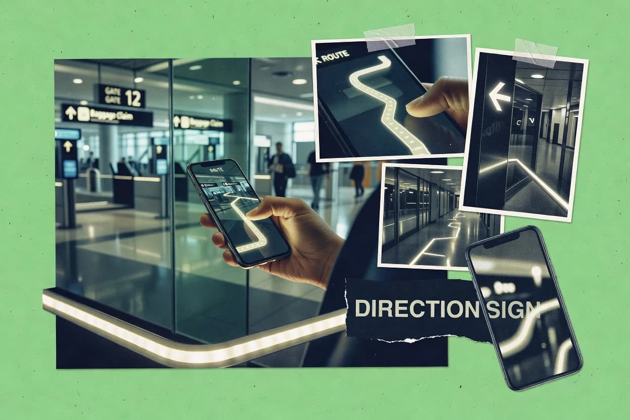
Tourism HospitalityTop 10 Best Interactive Wayfinding Software of 2026
Top 10 interactive wayfinding software ranked by indoor and outdoor routing, including Google Maps Platform, HERE, and Mapbox comparisons.

How we ranked these tools
An editor sets the topic, the inclusion criteria, and the evaluation framework before research starts.
AI search agents find sources, extract figures with provenance, and aggregate written reviews. They also transcribe video reviews and podcasts.
Framework: Features 40% · Ease 30% · Value 30%
Gitnux may earn a commission through links on this page — this does not influence rankings. Editorial policy
Concept3D is the strongest choice if facilities and visitor services need controlled, campus-wide interactive 3D wayfinding updates, whereas Steerpath is the better fit for teams that want an API-first route and directory foundation to plug into custom applications.
Editor’s top 3 picks
Three quick recommendations before you dive into the full comparison below — each one leads on a different dimension.
Concept3D
Wayfinding route behavior is configured against spatial layers derived from uploaded floor assets, not only flat POI lists.
Best for: Fits when facilities and visitor services need controlled campus-wide interactive wayfinding updates.
MazeMap
Editor pickTurn-by-turn routing that stays aligned to live directory content and floor context rather than static signage text.
Best for: Fits when campus operators need floor-aware directory navigation with ongoing content updates.
Steerpath
Editor pickCentralized content management ties destination metadata to routing so directory changes propagate without rebuilding screens.
Best for: Fits when campuses need synchronized directory updates and routing across floors and buildings.
Comparison Table
Concept3D
enterpriseInteractive 3D maps and wayfinding for campuses, hospitals, and convention centers.
Wayfinding route behavior is configured against spatial layers derived from uploaded floor assets, not only flat POI lists.
Concept3D focuses on directory mapping and turn-by-turn guidance driven by configured wayfinding logic on top of uploaded floor plans and spatial layers. It supports centralized content management for locations, signage messaging, and wayfinding assets, which reduces the friction of keeping kiosks and digital directories aligned. Kiosk deployments benefit from a mobile-responsive rendering path for the same content set and from touchscreen-oriented interaction flows for step-by-step guidance.
A key tradeoff is that route quality depends on careful zoning, path definition, and landmark segmentation during setup, especially across multi-floor buildings. Concept3D fits best when a campus team needs consistent guidance for visitors and staff while maintaining controlled updates for map geometry and directory changes.
- +CAD-to-navigation pipeline reduces manual remapping for indoor floors
- +Centralized content management keeps kiosks and directories synchronized
- +REST API integration supports external directory and destination control
- +Multi-floor configuration supports consistent routes across stacked layouts
- –Route accuracy depends on path zoning and landmark segmentation setup
- –Governed rollout requires defined ownership for map updates and releases
- –Advanced directory behaviors take more configuration than basic kiosk menus
Campus visitor services teams
Kiosk navigation across multi-building sites
Fewer questions at help desks
Facilities operations teams
Frequent directory and map revisions
Lower administrative update effort
Show 2 more scenarios
Real estate IT teams
External systems drive destinations
Faster integration with existing tools
Use the REST API to integrate destination inputs and directory updates from internal applications.
Accessibility program owners
Path accessibility overlays for routes
More reliable accessible navigation
Configure accessibility-focused routing logic to guide pedestrians toward compliant paths and entrances.
Best for: Fits when facilities and visitor services need controlled campus-wide interactive wayfinding updates.
MazeMap
enterpriseCampus and building wayfinding platform with indoor navigation, search, and route optimization.
Turn-by-turn routing that stays aligned to live directory content and floor context rather than static signage text.
MazeMap is best evaluated on how its map layer and directory layer stay consistent, because venue naming and location data change more often than building geometry. The product is commonly used to render interactive maps for wayfinding surfaces such as kiosks and mobile browsers, then route users to entrances, offices, and amenities using floor context. MazeMap also supports multilingual directory entries, which matters when signage and staff help do not cover every visitor language.
A key tradeoff is that quality of routing depends on the accuracy of imported floor plan geometry and the completeness of location labeling before launch. MazeMap works well when a facilities or campus operations team can maintain centralized content and coordinate updates during renovations, tenant churn, or seasonal re-labeling. It is less ideal for organizations that cannot establish a repeatable workflow for location data changes.
- +Floor-aware navigation tied to directory updates, reducing stale wayfinding labels
- +Interactive kiosk-ready map rendering for high-traffic help desks
- +Multilingual directory support for campus-wide visitor use cases
- +Centralized content workflow supports CMS-driven map changes
- –Routing accuracy is constrained by the quality of imported floor plans and labeling
- –Deeper governance requires disciplined location data management
- –Advanced integrations can require engineering time beyond basic map publishing
- –Complex building layouts may need careful zoning and segmentation before routes feel natural
Campus operations teams
Multi-building visitor navigation with updates
Fewer wayfinding questions at help desks
Property and facilities teams
Directory updates for tenant churn
Reduced manual signage rework
Show 1 more scenario
Large venue customer experience
Interactive touchscreen kiosks for guests
Faster self-serve navigation
Guests search destinations and receive guidance between landmarks across multi-floor sections using consistent labels.
Best for: Fits when campus operators need floor-aware directory navigation with ongoing content updates.
Steerpath
API-firstIndoor positioning and wayfinding SDK for integrating navigation into custom applications.
Centralized content management ties destination metadata to routing so directory changes propagate without rebuilding screens.
Steerpath is geared toward campus-wide wayfinding networks where destinations span buildings, floors, and common gathering zones. Map updates can be managed via centralized content workflows, which reduces the operational load of pushing changes across an interactive touchscreen interface. Routing configuration supports pedestrian pathing with path accessibility routing considerations for constrained segments.
A key tradeoff is that meaningful outcomes depend on disciplined map and directory governance so floor naming, landmarks, and routing links remain consistent. Steerpath is a strong fit when frequent wayfinding updates are needed during construction cycles and when digital directory integration must stay aligned with the on-site naming scheme.
- +CMS-driven content workflows keep destination labels and maps coordinated
- +Routing configuration supports multi-floor navigation across a campus footprint
- +Interactive touchscreen directory experiences reduce dependence on printed signage
- +Integration surface supports external systems for navigation triggers and updates
- –Campus data hygiene is required to avoid broken destination and floor mappings
- –Advanced routing setup takes time compared with simpler directory-only deployments
Campus operations teams
Wayfinding updates during construction
Fewer incorrect directions
Facilities and planning teams
Multi-building, multi-floor navigation
More successful arrivals
Show 2 more scenarios
Digital experience teams
Interactive directory integration
Reduced label mismatch
Align map labels with the campus digital directory for consistent naming.
Integration teams
External system-driven routing
Automated updates
Use defined endpoints to drive destination selection and refresh content from other tools.
Best for: Fits when campuses need synchronized directory updates and routing across floors and buildings.
GoodMaps
vertical specialistCloud-based indoor mapping and accessible wayfinding using LiDAR-derived digital twins.
Path accessibility routing that applies overlay layer rules during route selection, not only during display of directions.
GoodMaps delivers interactive wayfinding for campuses and venues using web-rendered maps designed for touchscreen kiosk deployment. The system supports directory mapping, multi-floor routing, and path accessibility routing with layered map content for zones and landmarks.
- +CMS-driven updates reduce manual rework for floor plan and directory changes
- +Multi-floor routing supports consistent navigation across connected facilities
- +REST API integration supports external directory and content synchronization
- +Path accessibility routing works with route logic and overlay layers
- –Indoor positioning integration depends on the selected indoor positioning system
- –Complex kiosk hardware and enclosure layouts can require extra implementation work
Best for: Fits when facilities teams need CMS-led content updates plus indoor routing with accessibility-aware paths.
Pointr
enterpriseDeep indoor positioning, mapping, and wayfinding platform for complex buildings.
CMS-driven map updates tied to directory content, so floor edits propagate to kiosk experiences without rebuilding the entire navigation flow.
Pointr provides interactive wayfinding for touchscreen kiosk deployments by combining directory-style content with on-map navigation flows. The system supports CMS-driven map updates and mobile-responsive map rendering for consistent results across kiosk and web handoff.
- +REST API integration supports directory and routing data synchronization
- +Indoor CAD import and floor plan geocoding speed up indoor onboarding
- +Mobile-responsive map rendering keeps kiosk and web experiences aligned
- +CMS-driven map updates reduce time between floor changes and releases
- –Multi-floor routing setup requires careful floor segmentation and naming discipline
- –Advanced routing customization depends on integration work with map layers
Best for: Fits when campus teams need centrally managed directory mapping with kiosk-ready interactive navigation flows.
Intuiface
SMBNo-code interactive experience platform used to build wayfinding kiosks and digital directories.
Scene-based authoring with reusable UI components for consistent interactive wayfinding across many kiosk deployments.
Intuiface fits teams that need interactive touchscreen wayfinding without building custom apps from scratch. It supports authoring of kiosk experiences with a reusable component approach and device deploy targets for signage and interactive surfaces.
- +Interactive map and UI authoring for kiosk directory mapping workflows
- +REST API integration supports dynamic content feeds and event-driven screens
- +Centralized content updates across device deployments reduce per-kiosk rework
- +Component-based scenes help standardize multilingual directory experiences
- –Deeper indoor positioning logic requires extra integration work
- –Complex multi-floor routing behaviors take careful configuration and testing
Best for: Fits when organizations need touchscreen directory experiences with API-driven content and controlled deployments.
Jibestream
API-firstIndoor mapping platform with an API for embedding interactive wayfinding into applications.
Admin configuration of live directory interactions lets teams change wayfinding flows and UI behavior without redeploying kiosk applications.
Jibestream focuses on interactive wayfinding networks where operators control content, layouts, and routing flows across many locations. It supports touchscreen kiosk experiences and mobile-responsive directory browsing for step-by-step pedestrian guidance.
- +REST API enables programmatic content and map updates
- +Interactive kiosk and mobile rendering support consistent directory flows
- +Centralized configuration supports multi-location rollout patterns
- +Routing behavior can be tuned without rebuilding the kiosk UI
- –Indoor positioning and calibration workflows require careful site preparation
- –Complex accessibility overlays can take iterative design cycles
Best for: Fits when a facilities team needs centralized wayfinding updates across many floors and kiosk endpoints.
Visix
enterpriseDigital signage software with interactive wayfinding and directory kiosk modules.
Centralized content workflow for synchronized directory and map updates across a campus-wide kiosk network.
Visix delivers interactive wayfinding for campuses and large facilities with touchscreen kiosk experiences and mobile-friendly map flows. Map data can be kept in sync through a centralized content workflow that pushes updated directory and map layers to live locations.
- +Centralized content management keeps directory and map layers consistent across kiosks
- +CAD file import supports production of floor plan map assets for facility mapping
- +Kiosk and mobile rendering are designed around interactive, directory-first wayfinding
- +QR code wayfinding handoff links signage destinations to digital flows
- –Multi-floor routing setup requires careful floor plan geocoding and landmark alignment
- –Integration depth depends on custom REST API work for enterprise systems
Best for: Fits when facilities need touchscreen kiosk wayfinding with controlled content updates and directory-driven navigation.
Point Inside
vertical specialistIndoor mapping and wayfinding platform for retail, airports, and large venues.
QR code handoff from kiosk flows links wayfinding prompts to mobile directory journeys without rebuilding the route logic.
Point Inside delivers interactive touchscreen directory and wayfinding flows for campuses, floors, and buildings using digitized maps and guided routing. It supports kiosk-style navigation experiences with multilingual content, interactive overlays, and QR code handoff into mobile-friendly directory journeys.
- +Interactive kiosk directory and wayfinding flows with multilingual content
- +Centralized content and map configuration that reduces per-device manual work
- +QR code handoff supports smooth mobile continuity from kiosk prompts
- +REST API integration supports external system updates and directory data syncing
- –Indoor positioning accuracy depends on the configured indoor positioning system
- –Complex multi-floor accessibility routing needs careful map segmentation
- –CMS-driven map update workflows can require governance to prevent stale layers
- –CAD file import and floor plan geocoding effort can dominate setup timelines
Best for: Fits when a campus network needs kiosk-first directory mapping with API-driven content updates across multiple floors.
Proximi.io
API-firstIndoor wayfinding and IoT platform with open SDKs.
Kiosk-ready interactive wayfinding screens with route guidance tied to centrally managed directory and location content.
Proximi.io focuses on interactive wayfinding content, from directory search to map-guided routes on deployed signage. It supports multi-floor routing using provided floor plans and location data inputs, with kiosk and web renderers for different screen formats.
- +Centralized content management for directory screens and map overlays
- +Multi-floor routing driven by floor plan geocoding and location definitions
- +Admin audit logging for map and content changes
- +REST API integration for directory sync and waypoint provisioning
- –Route accuracy depends on clean indoor positioning inputs and calibrated landmarks
- –CMS-driven updates can lag when publish workflows are not aligned
Best for: Fits when campus operators need centralized directory updates and multi-floor routing across kiosk and web screens.
Conclusion
After evaluating 10 interactive wayfinding software, Concept3D stands out as our overall top pick — it scored highest across our combined criteria of features, ease of use, and value, which is why it sits at #1 in the rankings above.
Use the comparison table and detailed reviews above to validate the fit against your own requirements before committing to a tool.
How to Choose the Right Interactive Wayfinding Software
This buyer's guide compares Concept3D, MazeMap, Steerpath, GoodMaps, Pointr, Intuiface, Jibestream, Visix, Point Inside, and Proximi.io as interactive wayfinding software built for kiosk and mobile directory journeys.
The evaluation emphasis follows how each tool handles integration depth, automation and API surface, and governance controls for campus-wide wayfinding networks where maps and directory content must stay synchronized across floors.
Interactive Wayfinding Software for kiosk and mobile route guidance across multi-floor spaces
Interactive wayfinding software provides touch-first kiosk flows and mobile-responsive map experiences that connect destination directories to turn-by-turn navigation and multi-floor routing.
Tools like Concept3D and MazeMap build navigation behavior around how floor assets and directory content are structured, so route selection can reflect spatial layers and floor context instead of only displaying signage text.
Many deployments rely on centralized content workflows that keep destination labels and map overlays aligned across multiple screens, including kiosk deployments and digital directory integrations.
For indoor accuracy and accessibility routing, these systems either integrate with an indoor positioning system or depend on calibrated floor segmentation so routing stays consistent when visitors move between connected spaces.
Core evaluation criteria for Interactive Wayfinding Software
Interactive wayfinding software has to keep route guidance, destination labels, and floor context aligned across kiosk and mobile screens, especially when the directory changes after deployment. The criteria below focus on integration depth, automation through API and content workflows, and governance controls that prevent stale maps and broken floor mappings.
Spatial-layer routing driven by uploaded floor assets
Concept3D configures route behavior against spatial layers derived from uploaded floor assets, so route selection can use spatial structure instead of only POI lists. GoodMaps also supports multi-floor routing, but Concept3D ties behavior to spatial layers for more controlled indoor guidance.
Directory synchronization that preserves live floor context
MazeMap ties turn-by-turn routing to live directory content and floor context to reduce stale wayfinding labels. Steerpath propagates destination and routing updates through centralized content management so directory changes do not require rebuilding screens.
Automation surface with REST API integration for content and map data
Pointr provides REST API integration that supports directory and routing data synchronization alongside indoor CAD import and floor plan geocoding. Jibestream also exposes a REST API for programmatic content and map updates so kiosk and directory experiences can change without redeploying kiosk applications.
Centralized content workflow across kiosk networks
Visix uses centralized content management to keep directory and map layers consistent across a campus-wide kiosk network. Intuiface centralizes authoring with scene-based UI components so the same interactive wayfinding patterns repeat across kiosk deployments.
Multi-floor configuration discipline for floor segmentation and naming
GoodMaps builds multi-floor routing that depends on indoor positioning system selection and careful implementation for connected facilities. Proximi.io drives multi-floor routing from floor plan geocoding and location definitions, and its route accuracy depends on clean indoor positioning inputs and calibrated landmarks.
Accessibility overlays applied during route selection
GoodMaps applies overlay layer rules during route selection rather than only during display, which changes which paths are chosen. Jibestream can handle complex accessibility overlays but requires iterative design cycles for correct behavior.
How to choose Interactive Wayfinding Software for synchronized kiosk and mobile routing
Selection should start with how the software ties routing behavior to your spatial inputs, because some tools configure behavior from floor assets while others rely more heavily on imported floor data quality. Then the decision should branch on how content changes are governed, because directory updates can break floor mappings if the workflow is not paired with automation and ownership.
Choose a routing foundation: spatial-layer behavior versus label-driven navigation
If route behavior must be configured from uploaded floor assets into spatial layers, Concept3D is built around that pipeline. If routing needs to stay aligned to live directory content and floor context, MazeMap is designed to keep guidance aligned as directory data changes.
Decide whether directory updates propagate through routing metadata or screen rebuilding
If the requirement is centralized content management where destination metadata changes propagate through routing configuration, Steerpath aligns routing and destination updates without rebuilding screens. If the requirement is kiosk-ready map updates tied to directory content through a CMS-driven mapping flow, Pointr ties floor edits to kiosk experiences without rebuilding the full navigation flow.
Select based on your integration path: REST API versus authoring workflows
If the environment expects REST API integration for programmatic synchronization with external systems, Pointr and Jibestream provide API surfaces that support automated updates. If the requirement centers on consistent interactive kiosk UI patterns delivered through reusable authoring, Intuiface uses scene-based authoring with reusable UI components and API-driven content feeds.
Model governance around which team owns floor segmentation quality
If governance can be assigned to teams that manage floor segmentation and naming discipline, tools like Proximi.io can deliver multi-floor routing driven by floor plan geocoding and location definitions. If governance must include additional work for floor input quality and labeling, MazeMap and GoodMaps constrain routing accuracy by imported floor plan quality and indoor positioning integration.
Plan accessibility logic where it matters: route selection versus route display
If accessibility routing must affect which paths are selected, GoodMaps applies overlay layer rules during route selection. If accessibility overlays are required but the rollout can tolerate iterative design cycles, Jibestream can handle complex accessibility overlays with careful testing.
Match kiosk rollout shape to the control model for live directory interactions
If the rollout needs admin configuration of live directory interactions so teams can change flows and UI behavior without redeploying kiosk applications, Jibestream fits that operational control pattern. If the rollout needs synchronized updates across kiosk networks with a centralized workflow, Visix keeps directory and map layers consistent across the network.
Who should buy Interactive Wayfinding Software
Facilities and campus operations teams should buy interactive wayfinding software when visitor routes must stay accurate as floor content, destinations, and kiosk directory screens change. Kiosk and digital directory operators should also buy when the deployment needs synchronized behavior across multiple floors and connected locations, including accessibility-aware routing.
Campus operations teams managing kiosk fleets
Jibestream supports admin configuration of live directory interactions across many kiosk endpoints without redeploying kiosk applications. Visix keeps directory and map layers synchronized across a campus-wide kiosk network through centralized content workflow.
Facilities teams that need controlled indoor routing behavior from floor assets
Concept3D configures route behavior against spatial layers derived from uploaded floor assets, which supports controlled indoor behavior. GoodMaps supports multi-floor routing with accessibility-aware overlay rules, but route behavior depends on indoor positioning integration selection.
Directory owners who require live updates that preserve wayfinding context
MazeMap keeps turn-by-turn routing aligned to live directory content and floor context rather than static signage text. Steerpath ties centralized content management to routing so directory changes propagate across floors and buildings.
IT teams integrating wayfinding into enterprise systems
Pointr provides REST API integration for directory and routing data synchronization and supports indoor CAD import and floor plan geocoding for indoor onboarding. Jibestream also uses REST API for programmatic content and map updates across kiosk and mobile rendering.
Accessibility-focused deployments that require route-level overlay logic
GoodMaps applies overlay layer rules during route selection so accessibility constraints affect the chosen path. Jibestream can implement complex accessibility overlays, but correct behavior needs careful iterative design cycles.
Common implementation mistakes in Interactive Wayfinding Software deployments
Implementation teams often underestimate how much route accuracy depends on floor asset quality, naming discipline, and indoor positioning integration decisions. Teams also commonly treat directory updates as separate from routing configuration, which creates mismatches between kiosk screens and the actual guidance behavior.
Treating floor plan labeling quality as a display-only problem
MazeMap constrains routing accuracy by the quality of imported floor plans and labeling, so bad inputs create guidance errors. GoodMaps also depends on indoor positioning integration, so floor input issues compound when positioning support is selected late.
Publishing directory changes without aligning routing metadata and floor mappings
CMS-driven updates can lag when publish workflows are not aligned in Proximi.io, which causes kiosks to show outdated guidance relative to directory content. Steerpath ties destination metadata to routing so directory changes propagate without rebuilding screens, which reduces mismatch risk when workflows are connected.
Delaying indoor positioning setup until after multi-floor routing configuration
GoodMaps and Proximi.io both depend on indoor positioning inputs for accurate behavior, so late calibration creates rework. Jibestream also requires careful site preparation for indoor positioning and calibration workflows, which can extend implementation timelines.
Assuming accessibility overlays change only what the user sees
GoodMaps applies overlay layer rules during route selection, so accessibility constraints must be validated against the path selection engine. Jibestream requires iterative design cycles for complex accessibility overlays, so accessibility testing cannot be limited to visual verification.
Skipping governance definitions for map ownership and release control
Concept3D requires defined ownership for map updates and releases, so unmanaged ownership leads to route behavior drift. Jibestream lets teams change flows without redeploying kiosk apps, so governance must still define who can administer live directory interactions and content updates.
How We Selected and Ranked These Tools
We evaluated Concept3D, MazeMap, Steerpath, GoodMaps, Pointr, Intuiface, Jibestream, Visix, Point Inside, and Proximi.io on features, ease of setup, and overall value using integration depth and automation and API surface as the primary technical lenses. Features accounted for 40% of the scoring, while ease accounted for 30% and value accounted for 30%.
Concept3D earned the highest ranking because it configures wayfinding route behavior against spatial layers derived from uploaded floor assets, and it pairs that with centralized content management so kiosks and directory experiences stay synchronized across floors. Concept3D also combines a CAD-to-navigation pipeline with governance-oriented update ownership, which supports controlled rollout of interactive touchscreen wayfinding behavior.
Frequently Asked Questions About Interactive Wayfinding Software
How do Concept3D and Steerpath structure indoor map updates when floor plans change often?
Which tools support REST API integration for driving destinations and refreshing directory content from external systems?
When does MazeMap’s approach to turn-by-turn routing align better with live directory content than static signage text?
What tradeoff appears when Jibestream centralizes route and UI behavior changes without redeploying kiosk applications?
How do GoodMaps and Proximi.io handle path accessibility routing differently in multi-floor guidance?
Which platform is better aligned for campus-wide synchronization of directory and map layers using a centralized content workflow?
What breaks if Point Inside kiosk flows rely on multilingual content without a consistent digitized map configuration?
How do QR handoff workflows differ between Point Inside and Visix?
Which tools provide admin controls with auditing suitable for controlled campus change management?
Tools reviewed
Primary sources checked during evaluation.
Referenced in the comparison table and product reviews above.
- Transportation LogisticsTop 10 Best Wayfinding Software of 2026
- Technology Digital MediaTop 10 Best Interactive Maps Software of 2026
- Travel TourismTop 10 Best Travel Mapping Software of 2026
- Tourism HospitalityTop 10 Best Virtual Tour Services of 2026
- Communication MediaTop 10 Best Interactive Video Services of 2026
Keep exploring
Comparing two specific tools?
Software Alternatives
See head-to-head software comparisons with feature breakdowns, pricing, and our recommendation for each use case.
Explore software alternatives→In this category
Tourism Hospitality alternatives
See side-by-side comparisons of tourism hospitality tools and pick the right one for your stack.
Compare tourism hospitality tools→