
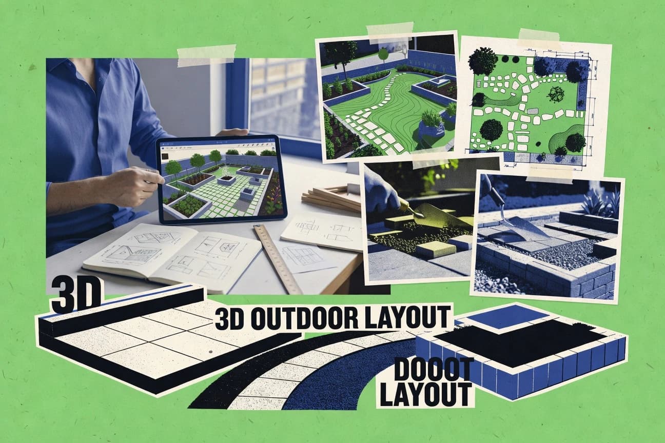
GITNUXSOFTWARE ADVICE
Construction InfrastructureTop 10 Best 3D Outdoor Design Software of 2026
Top 10 3d outdoor design software ranked for landscaping, modeling, and civil work, with tool comparisons covering Blender, Rhino, Cedreo, and more.

How we ranked these tools
Core product claims cross-referenced against official documentation, changelogs, and independent technical reviews.
Analyzed video reviews and hundreds of written evaluations to capture real-world user experiences with each tool.
AI persona simulations modeled how different user types would experience each tool across common use cases and workflows.
Final rankings reviewed and approved by our editorial team with authority to override AI-generated scores based on domain expertise.
Score: Features 40% · Ease 30% · Value 30%
Gitnux may earn a commission through links on this page — this does not influence rankings. Editorial policy
Blender is the best fit when teams need custom 3D outdoor visualization automation beyond basic CAD drafting, whereas Rhino is the tighter choice if you need precision NURBS geometry and flexible CAD exchange for terrain and landscape design workflows.
Editor’s top 3 picks
Three quick recommendations before you dive into the full comparison below — each one leads on a different dimension.
Blender
Python scripting plus add-ons for automating scene assembly and batch rendering from repeatable rules.
Built for fits when teams need custom 3D outdoor visualization automation beyond CAD drafting..
Rhino
Editor pickRhino NURBS core and extensive geometry toolset make it strong for bespoke terrain and hardscape modeling.
Built for fits when teams need precision NURBS geometry and flexible CAD exchange for outdoor design visualization..
Cedreo
Editor pickOne workspace that converts placed outdoor elements into linked 2D plan views and client walkthrough renders.
Built for fits when design firms need fast outdoor concept visuals and linked 2D plan sheets for client approval..
Comparison Table
Blender
SMBOpen-source 3D creation suite adaptable for outdoor landscape visualization.
Python scripting plus add-ons for automating scene assembly and batch rendering from repeatable rules.
Blender supports full 3D site model building with polygon modeling, sculpting, and modifier stacks for non-destructive edits. Materials, node-based shaders, and render engines enable photorealistic rendering for outdoor room design and walkthrough rendering. CAD import and export via common vector and mesh formats helps move geometry into and out of a site workflow.
Tradeoff: Blender requires more manual setup than CAD and BIM tools for strict grading and drainage deliverables, since it does not provide a dedicated civil modeling engine. Usage fit: Blender works well when a team needs high-control 3D visualization and custom automation for scene assembly, like batch-generating angles, seasons, and daylight conditions.
- +Modifier stack enables non-destructive terrain and hardscape iteration
- +Node-based materials support consistent outdoor material look-dev
- +Python scripting automates asset placement and batch render setups
- +Multiple cameras and lighting workflows support walkthrough render sequences
- –No built-in civil grading and drainage modeling constraints
- –Georeferencing and real-world scale setup takes manual discipline
- –Plan sheet production needs extra layout and annotation workflow
Landscape design studios
Iterate planting and hardscape scenes
Faster visual approvals
Architecture visualization teams
Produce photoreal walkthroughs
More consistent renders
Show 2 more scenarios
GIS and CAD workflow integrators
Transform imported site geometry
Reusable visualization pipeline
Teams convert external terrain and meshes into Blender for decoration and scene integration.
Automation-minded technical artists
Batch-generate variant layouts
Higher throughput concepting
Python scripts place assets, randomize parameters, and render controlled scene sets for review.
Best for: Fits when teams need custom 3D outdoor visualization automation beyond CAD drafting.
Rhino
enterprise3D modeling software used for landscape and terrain design workflows.
Rhino NURBS core and extensive geometry toolset make it strong for bespoke terrain and hardscape modeling.
Rhino supports 2D plan view work and 3D site model creation from survey and CAD references through DWG and DXF import and export workflows. It handles terrain modeling with manual grading approaches and geometry operations that map well to conceptual hardscape and planting layout iteration. The add-on ecosystem extends Rhino into planting plan creation, material library workflows, and photorealistic rendering pipelines used for walkthrough rendering.
A key tradeoff is that Rhino does not provide a built-in end-to-end civil design data model for grading and drainage comparable to dedicated civil authoring tools. It fits teams that already manage design data in CAD or spreadsheets and need a precise 3D geometry workflow for outdoor design studies, hardscape layout coordination, and visual QA.
- +NURBS modeling gives tight control over grading shapes and hardscape edges
- +DWG and DXF exchange supports CAD-driven site model workflows
- +Add-ons expand into rendering, planting, and landscape presentation tasks
- +Viewport and section workflows enable fast elevation and 2D-to-3D checking
- –Grading and drainage require more manual modeling than civil authoring tools
- –Add-on dependencies increase workflow setup complexity for multi-discipline teams
- –True BIM coordination relies on external conversion and discipline-specific tooling
Landscape architects and designers
Outdoor room design studies in 3D
Faster design iteration cycles
Site designers using CAD references
Topographic survey import and grading edits
Cleaner grading concept models
Show 2 more scenarios
Visualization specialists
Walkthrough rendering of outdoor scenes
More persuasive design reviews
Rhino workflows pair with rendering add-ons to produce presentation-ready walkthrough views.
Architectural BIM coordinators
IFC coordination through geometry exchange
Reduced manual rework
IFC interoperability depends on conversion paths that translate Rhino geometry into coordination-ready formats.
Best for: Fits when teams need precision NURBS geometry and flexible CAD exchange for outdoor design visualization.
Cedreo
SMBWeb-based home design software for creating floor plans, exterior environments, landscaping, and 3D presentations.
One workspace that converts placed outdoor elements into linked 2D plan views and client walkthrough renders.
Cedreo’s core strength is moving from a site sketch to a coordinated 3D outdoor model without bouncing between desktop tools. The workflow typically includes placing landscape and exterior components, producing 2D plan and elevation outputs, and packaging walkthrough rendering for stakeholder review. The model-to-render loop helps teams validate sightlines, outdoor room layouts, and material selections before drafting final plan sheets.
A practical tradeoff is that Cedreo’s automation and parametrization are workflow-driven rather than schema-driven, so highly customized grading logic and advanced drainage modeling are more limited than specialist civil tools. Cedreo fits best when design intent, client communication, and quick iteration matter more than engineering-grade outputs. A common usage situation is remodeling a property with an existing floor plan, then producing client-ready visuals and plan deliverables in the same project.
- +Browser-based workflow keeps 3D outdoors modeling accessible to client teams
- +2D plan and elevation outputs stay linked to the same 3D workspace
- +Walkthrough rendering supports structured client review without extra scene setup
- +Reusable design elements speed repetitive patio and landscaping layouts
- –Depth of grading and drainage calculations lags dedicated civil design tools
- –Advanced BIM coordination workflows can require export to external systems
- –CAD import support may need manual cleanup for complex DWG geometry
Landscape design studios
Client-ready outdoor room concepts
Faster approvals and fewer revisions
Exterior remodeling contractors
Remodel visuals on existing site plans
Clear scope alignment with homeowners
Show 1 more scenario
Real estate design coordinators
Marketing visuals for property listings
Consistent brand and messaging
Create consistent outdoor elevations and walkthrough rendering for staged exterior scenarios.
Best for: Fits when design firms need fast outdoor concept visuals and linked 2D plan sheets for client approval.
VIP3D
vertical specialist3D landscape design software for pools, outdoor living areas, planting, terrain, and construction proposals.
Contour-driven terrain modeling that keeps grading decisions aligned with the 3D site model during iteration.
VIP3D delivers 3D outdoor design workflows focused on site planning, landscape design, and hardscape layout through an interactive 3D workspace. It supports importing topographic survey geometry and working from contour-driven terrain so grading and drainage decisions stay tied to the model.
Output includes photorealistic walkthrough rendering and plan sheet exports that help teams review design intent in both 2D and 3D views. CAD interoperability for everyday formats like DWG and DXF helps connect site work with broader design deliverables.
- +Interactive 3D site modeling tied to terrain from survey or contour inputs
- +Built-in walkthrough rendering for client-facing outdoor visualizations
- +Plan sheet outputs support quick review in both 2D and 3D
- +DWG and DXF import and export support practical CAD handoffs
- –Limited evidence of deep BIM coordination workflows compared with CAD-centric suites
- –Material and plant library customization takes time to standardize across projects
- –Advanced automation and API access is not a primary documented strength
- –Geospatial imagery overlay tools are not as prominent as model-core features
Best for: Fits when landscape and outdoor hardscape teams need fast 3D visualization from site contours and plan sheets.
Punch! Landscape Design
SMBConsumer 3D landscape and outdoor space design application.
One-model workflow that keeps plantings, surfaces, and outdoor layout synchronized for quick walk-through presentation renders.
Punch! Landscape Design turns topographic base data into a walkable 3D landscape model with design-specific objects like plants, hardscape elements, and terrain features. Its core workflow focuses on creating a site plan and 3D outdoor rooms from measured ground surfaces, then generating presentation visuals from the same model.
The tool includes libraries for plants and materials and supports exporting drawings for coordination. It also emphasizes rapid layout iteration rather than deep civil analysis workflows.
- +Direct 3D modeling workflow for outdoor rooms, decks, and hardscape layouts
- +Plant and material libraries support consistent design intent across revisions
- +Presentation views derive from the same 3D site model used for planning
- +Drawing exports help share plan sheets with other project participants
- –Civil-grade grading and drainage tooling is limited versus dedicated civil CAD
- –Geospatial and survey import depth is not as comprehensive as GIS-driven workflows
- –BIM interoperability and IFC coordination are weaker than BIM-first authoring tools
- –Extensibility and API-based automation surface is not prominent for governed pipelines
Best for: Fits when landscape designers need fast 3D outdoor design iteration with drawing exports and library-driven assets.
Planner 5D
SMBBrowser and mobile design software for creating homes, gardens, patios, yards, and rendered 3D scenes.
One-click layout iteration using a curated plant and material library inside interactive 3D scenes.
Planner 5D is a browser-first 3D design tool used for outdoor room concepts like patios, decks, and garden layouts. It focuses on fast visual modeling with an accessible plant and material library, plus walkthrough-style presentation views.
Terrain handling is lighter than CAD or BIM workflows, so the tool suits layout and ideation more than survey-grade grading and drainage. Output generation supports 2D plan-style exports alongside 3D previews for client-facing reviews.
- +Browser-based 3D modeling workflow reduces setup friction
- +Plant and material libraries speed up outdoor concept creation
- +Walkthrough and render views support client review meetings
- +Mixed 2D plan and 3D scene export covers common handoff needs
- –Terrain modeling depth is limited versus CAD site workflows
- –Survey import and geospatial overlay are not geared for precision grading
- –CAD exchange and BIM coordination support is limited for complex projects
- –Automation and API access are not built for workflow provisioning at scale
Best for: Fits when small teams need quick 3D outdoor concepts and client-ready visuals without heavy CAD or BIM workflows.
PRO Landscape
vertical specialistLandscape design software with CAD drawing, photo imaging, estimating, and 3D visualization tools.
Plant-centric library workflow links planting plan choices into the same 3D site model for faster iteration.
PRO Landscape focuses on end-to-end 3D landscape design workflows, including site modeling and presentation outputs for outdoor rooms. It supports terrain and grading work for site planning and hardscape layouts, then carries those models into 3D visualization.
The workflow is oriented around a plant library and material library so planting plans and surface details stay consistent across views. The tool’s value is strongest when the design process needs repeatable creation of a 3D site model plus deliverables like walkthrough renders and plan sheets.
- +Terrain modeling and grading tools map directly to landscape design steps
- +Plant library and material library help keep planting and surfaces consistent
- +3D views support walkthrough rendering for client-facing presentations
- +CAD import and export supports DWG and DXF round-tripping for edits
- –More time is needed to set up recurring project styles and libraries
- –Advanced BIM coordination workflows like IFC-driven coordination are limited
- –Automation for large libraries is weaker than API-driven competitors
- –Browser-based deployment options are not the default workflow
Best for: Fits when landscape-focused studios need repeatable 3D outdoor models and presentation deliverables for client reviews.
iScape
SMBMobile landscape design software for visualizing planting, hardscape, and outdoor improvements from property photos.
Library-driven outdoor scene assembly that keeps plant and material assignments consistent across 3D and presentation outputs.
iScape focuses on creating and visualizing 3D outdoor design models for site planning workflows, with an emphasis on interactive scene building and presentation. It supports a practical loop from terrain and layout work to outdoor room design outputs like walkthrough rendering and plan-style views.
The tool is oriented around a managed plant and material library workflow so scenes stay consistent across iterations. Export-ready deliverables are built for sharing with stakeholders who need both 2D plan view references and 3D context.
- +Interactive 3D scene workflow reduces back-and-forth between modeling and review
- +Plant and material libraries support repeatable outdoor room design iterations
- +Walkthrough rendering helps stakeholders validate scale and sightlines
- +Scene outputs maintain a consistent look across plan-like and 3D views
- –Limited automation depth for large-scale projects and bulk edits
- –CAD import and export coverage may not match heavy DWG-centric pipelines
- –Geospatial imagery overlay and advanced sun and shadow analysis feel basic
- –External coordination formats require extra checks before publication
Best for: Fits when landscape teams need fast 3D outdoor design iterations and client-ready walkthroughs.
Floorplanner
SMBBrowser-based space planning software with 2D layouts and 3D views for homes, gardens, patios, and site concepts.
Drag-and-place outdoor scene building with immediate 3D feedback for patio and deck spatial layout reviews.
Floorplanner converts measured room and outdoor-area inputs into navigable 3D scenes for patio, deck, and landscape-style layouts. It emphasizes browser-based placement workflows, with a built-in content library that supports quick material and object swaps inside the model.
Export targets focus on presentation outputs rather than full-engine GIS or civil-survey pipelines, which limits survey-to-grading traceability. For outdoor visualization teams, Floorplanner is strongest when the work is about spatial arrangement and walkthrough clarity rather than engineering-grade site construction outputs.
- +Browser-based modeling workflow keeps design sessions simple for distributed teams
- +Object and material library speeds up outdoor room and patio layout iterations
- +Walkthrough-style 3D viewing supports fast client review cycles
- +Intuitive 3D placement tools reduce time spent on coordinate and alignment steps
- –Limited civil workflow depth for grading, drainage, and contour fidelity
- –CAD and BIM interchange support is not positioned for IFC or DWG round-tripping
- –Automation and API surface for model changes is not available in a governance-friendly way
- –Quantity takeoff and construction-spec outputs are not a first-class workflow
Best for: Fits when teams need quick 3D outdoor layout visualization without engineering-grade site engineering deliverables.
AutoCAD
enterpriseCAD software used by landscape professionals for 2D and 3D site plans.
DWG-first extensibility through AutoLISP and .NET add-ins for automating site drawing standards.
AutoCAD is a DWG-first 2D and 3D CAD tool used for site planning deliverables when DWG control matters more than BIM-centric workflows. It supports 3D solids and surface-based modeling for patio and deck modeling, grading layouts, and retaining wall design workflows.
Built-in automation comes from AutoLISP, .NET add-ins, and a broad set of scripting hooks for repeatable drafting standards. For outdoor design packages, it integrates best when the workflow already revolves around CAD exchange files like DWG and DXF and when downstream visualization or coordination happens outside AutoCAD.
- +Strong DWG-centered workflow for hardscape layout and CAD-heavy handoffs
- +Scripting via AutoLISP and .NET add-ins supports repeatable site drafting rules
- +Native 3D modeling tools for solids and construction geometry
- +DWG and DXF support supports frequent exchange with other design tools
- –Limited outdoor-specific modeling features compared with Civil 3D workflows
- –3D terrain modeling and grading tools are less specialized than vertical products
- –Plant library, material presets, and quantity takeoff require manual setup or add-ons
- –Geospatial imagery overlays and sun and shadow analysis depend on external or indirect workflows
Best for: Fits when CAD teams need DWG-controlled outdoor layouts and automation for repeated hardscape drafting.
Conclusion
After evaluating 10 construction infrastructure, Blender stands out as our overall top pick — it scored highest across our combined criteria of features, ease of use, and value, which is why it sits at #1 in the rankings above.
Use the comparison table and detailed reviews above to validate the fit against your own requirements before committing to a tool.
How to Choose the Right 3d outdoor design software
This buyer's guide evaluates 3D outdoor design software for landscape design, hardscape layout, and client-facing walkthroughs, with coverage that spans Blender, Rhino, Cedreo, and VIP3D. It also compares Punch! Landscape Design, Planner 5D, PRO Landscape, iScape, Floorplanner, and AutoCAD, including how each tool handles terrain iteration, plan outputs, and outdoor scene construction.
Blender is positioned around Python-driven scene automation, while Rhino and VIP3D emphasize geometry and contour-aligned terrain modeling. Cedreo, Punch! Landscape Design, and the browser-based tools focus on linked 3D and 2D plan views for fast approval workflows.
3D Outdoor Design Software for Terrain Modeling, Outdoor Layouts, and Presentation Deliverables
3D outdoor design software creates a 3D site model used for outdoor room design, patio and deck modeling, and planting plan visualization. Blender supports automation via Python scripting and repeatable scene assembly from rules, which fits teams that need batch rendering across outdoor variations. Rhino centers on NURBS geometry for tight control of grading shapes and hardscape edges, while VIP3D anchors iteration around contour-driven terrain modeling that stays aligned with the 3D site model.
Cedreo and Punch! Landscape Design keep 3D elements connected to 2D plan outputs and walkthrough rendering so design intent can be approved from linked views. AutoCAD is included as DWG-first tooling where AutoLISP and .NET add-ins automate repeated site drawing standards, even though its outdoor-specific modeling depth is less specialized than vertical civil design workflows.
Evaluation criteria for 3D outdoor design software across site and presentation workflows
Outdoor design work depends on whether terrain and outdoor layout stay synchronized across iteration, drawing outputs, and client walkthroughs. Blender, Rhino, Cedreo, and VIP3D handle that loop with different mechanics that change how fast a team can converge on a usable outdoor design model.
Terrain iteration control and constraint depth
VIP3D aligns grading decisions with contour-driven terrain modeling that stays tied to the 3D site model during iteration. Rhino offers NURBS precision for bespoke terrain and hardscape edges, while grading and drainage require more manual modeling than civil authoring tools.
Scene-to-plan linkage for approvals
Cedreo converts placed outdoor elements into linked 2D plan views and walkthrough renders inside one workspace. Punch! Landscape Design and VIP3D also support client-facing presentations, but Cedreo’s explicit linked 2D plan outputs are a distinct workflow anchor.
Automation surface for outdoor variations
Blender stands out with Python scripting plus add-ons for automating scene assembly and batch rendering from repeatable rules. AutoCAD supports automation through AutoLISP and .NET add-ins for DWG-first site drawing standards, but it lacks specialized outdoor-specific modeling depth compared with tools built for outdoor scenes.
Outdoor layout fidelity for patio and deck geometry
VIP3D includes built-in walkthrough rendering tied to contour-driven terrain modeling that helps teams validate outdoor space placement. Floorplanner supports drag-and-place outdoor scene building with immediate 3D feedback for patio and deck spatial layout reviews, while it limits civil workflow depth for grading and drainage.
Library-driven consistency for plants and materials
Punch! Landscape Design provides plant and material libraries that keep outdoor rooms, decks, and hardscape layouts consistent across revisions. iScape also uses plant and material libraries for repeatable outdoor room design iterations, but its automation depth is limited for large-scale projects and bulk edits.
CAD exchange suitability for DWG and DXF pipelines
Rhino supports DWG and DXF exchange that fits CAD-driven site model workflows with flexible geometry authoring. AutoCAD is DWG-centered with strong scripting hooks, while several browser-first tools trade CAD round-tripping depth for linked client outputs.
Decision framework for selecting 3D outdoor design software by workflow mechanics
The first fork is whether the team needs geometry-authoring control or a linked outdoor design workspace that drives approvals. Blender and Rhino favor model authoring control for grading shapes, while Cedreo, Punch! Landscape Design, and VIP3D emphasize connected 3D and review outputs that keep client communication aligned to the same outdoor model.
Pick the core iteration loop: constraint-aligned terrain vs geometry-first modeling
Choose VIP3D when contour-driven terrain modeling needs to stay aligned with grading decisions during iteration and when built-in walkthrough rendering is part of the loop. Choose Rhino when NURBS geometry control for bespoke terrain and hardscape edges matters more than civil-grade grading and drainage constraints.
Choose the review mechanism: linked 2D plan views tied to the same 3D workspace
Choose Cedreo when placed outdoor elements must generate linked 2D plan views and client walkthrough renders from the same workspace. Choose Punch! Landscape Design when the workflow needs plant and material library-driven outdoor room design that stays synchronized with surfaces and layout for quick walkthrough presentation renders.
Choose automation philosophy: rule-based batch rendering vs interactive library assembly
Choose Blender when repeatable scene assembly and batch rendering from Python-driven rules is the main productivity lever. Choose Planner 5D when one-click layout iteration with curated plant and material libraries inside interactive 3D scenes matters more than automation for large variations.
Validate integration expectations: DWG or DXF round-tripping needs vs scene-focused interchange
Choose Rhino when DWG and DXF exchange supports CAD-driven site model workflows and geometry editing. Choose AutoCAD when the requirement is DWG-first drafting with automation through AutoLISP and .NET add-ins, then accept that specialized terrain and grading tools are less dedicated than vertical products like civil suites.
Select by library governance needs across multi-project production
Choose PRO Landscape when plant-centric library workflows must link planting plan choices into the same 3D site model for repeatable outdoor models. Choose iScape when interactive scene workflows must keep plant and material assignments consistent across 3D and presentation outputs, while bulk edits and large-scale automation depth are secondary.
Confirm the ceiling for civil depth and survey import expectations
Choose Rhino or VIP3D when grading and drainage fidelity needs to be actively engineered with more manual work or contour-aligned modeling mechanics. Choose Floorplanner, Planner 5D, or Cedreo when the priority is outdoor layout visualization or linked plan sheets, since civil-grade grading and drainage calculations or contour fidelity are limited relative to dedicated civil design tools.
Which teams fit each 3D outdoor design software workflow
Outdoor design tools separate into two practical groups based on whether work is authoring-heavy geometry production or a linked design-and-review workflow for client-facing approvals. Blender and Rhino suit production teams that need control over terrain and hardscape geometry, while Cedreo and Punch! Landscape Design suit design firms that need fast linked 2D plan sheets and walkthrough presentation renders.
Landscape visualization teams building repeated outdoor design variations
Blender fits teams that need Python scripting and add-on workflows for repeatable scene assembly and batch rendering across outdoor variations. Rhino fits teams that need NURBS geometry control when grading shapes and hardscape edges must stay precise across design iterations.
Design firms that run client approvals off linked 2D and 3D deliverables
Cedreo fits firms that want linked 2D plan views and client walkthrough renders generated from the same workspace. Punch! Landscape Design fits teams that need one-model synchronization across plantings, surfaces, and outdoor layout to produce presentation walkthroughs quickly.
Contouring-first landscape and hardscape teams that iterate from survey or contour inputs
VIP3D fits when contour-driven terrain modeling must keep grading decisions aligned with the 3D site model during iteration. VIP3D also supports built-in walkthrough rendering for client-facing visualization without leaving the iteration loop.
Small teams seeking interactive browser-based outdoor concepts with library-driven assets
Planner 5D fits teams that want one-click layout iteration inside interactive 3D scenes using curated plant and material libraries. Floorplanner fits teams that need drag-and-place outdoor scene building for patio and deck spatial layout reviews without engineering-grade site deliverables.
CAD-centric studios with DWG standards and automation built around CAD workflows
AutoCAD fits studios that require DWG-controlled outdoor layouts and automation via AutoLISP and .NET add-ins for repeated site drafting rules. Rhino fits CAD-centric studios that also require DWG and DXF exchange for more geometry-flexible site modeling.
Common buying pitfalls for 3D outdoor design software
Most project failures come from assuming a tool that is fast for visualization can also meet civil-grade grading and drainage needs without additional engineering effort. Another failure mode comes from selecting a library-driven or browser-based tool while expecting deep CAD or BIM coordination workflows.
Choosing a visualization-first tool and expecting constraint-driven grading and drainage modeling
VIP3D and Rhino require different levels of manual modeling effort for grading and drainage, while Blender and browser-based tools do not include built-in civil grading and drainage constraint depth. Match the tool to civil fidelity needs early to avoid rework after design review.
Assuming linked plan outputs equal deep BIM coordination
Cedreo provides linked 2D plan views tied to the same 3D workspace, but advanced BIM coordination workflows can require export to external systems. PRO Landscape and Punch! Landscape Design also focus on consistent planting and surface workflows rather than IFC-driven coordination depth.
Underestimating setup time for repeatable libraries and project styles
PRO Landscape requires more time to set up recurring project styles and libraries to get repeatable results across projects. iScape supports consistent plant and material assignments, but it limits automation depth for large-scale projects and bulk edits.
Overbuying for CAD interchange when the workflow is mainly scene-centric review
Rhino and AutoCAD emphasize DWG and DXF exchange or DWG-first drafting with scripting, which adds overhead if the team primarily needs client walkthrough renders and linked plan outputs. Cedreo and Punch! Landscape Design reduce that overhead by keeping outputs connected inside a single outdoor design workspace.
Ignoring terrain fidelity ceilings for contour and survey workflows
Floorplanner and Planner 5D provide browser-based outdoor layout visualization but limit civil workflow depth for grading, drainage, and contour fidelity. VIP3D and Rhino better match contour-driven or NURBS-precision terrain needs, even though their workflows differ in how much manual modeling is required.
How We Selected and Ranked These Tools
We evaluated each tool on features that directly affect outdoor design iteration, including contour-aligned or NURBS terrain control, linked 2D outputs tied to the same 3D workspace, and walkthrough visualization within the workflow. We weighted features at 40% based on how consistently planting, materials, surfaces, and outdoor layout stay synchronized across revisions in Blender, Rhino, Cedreo, and VIP3D. We weighted ease of use at 30% and value at 30% based on the practical setup friction for repeatable rules in Blender, CAD exchange friction in Rhino and AutoCAD, and browser workflow friction in Cedreo, Punch!
Landscape Design, Planner 5D, and iScape. Blender ranked highest because Python scripting plus add-ons support repeatable scene assembly and batch rendering from rules, while its modifier stack and node-based materials keep terrain and outdoor material look development non-destructive.
Frequently Asked Questions About 3d outdoor design software
Which tool is best for DWG and DXF CAD exchange for outdoor design deliverables?
How should a workflow handle topographic survey import and contour-driven grading decisions?
When is a browser-first workflow preferable for outdoor room design concepts?
What breaks if a team needs deep civil analysis workflows instead of 3D visualization?
Which tool fits a linked 2D plan sheet and 3D visualization workflow from one workspace?
How do extensibility options differ when automation is required for repeatable outdoor scene setup?
Which tool is better for library-driven planting and material consistency across views?
What tradeoff exists between NURBS precision workflows and drag-and-place outdoor layout building?
How do security and user access controls typically show up in these outdoor design tools?
Tools reviewed
Primary sources checked during evaluation.
Referenced in the comparison table and product reviews above.
- Top 10 Best Truss Design Software of 2026
- Top 10 Best Architectural Engineering Software of 2026
- Top 10 Best Pipeline Estimating Software of 2026
- Top 10 Best Building Estimation Software of 2026
- Top 10 Best Electricians Job Management Software of 2026
- Top 10 Best Online Architecture Design Software of 2026
- Top 10 Best Construction Survey Software of 2026
- Top 10 Best Structural Steel Takeoff Software of 2026
- Top 10 Best Construction Drafting Software of 2026
- Top 10 Best Building Pricing Software of 2026
- Top 10 Best Electrical Plan Drawing Software of 2026
- Top 10 Best Architect Management Software of 2026
- Top 10 Best Building Interior Design Software of 2026
- Top 10 Best Bathroom Estimating Software of 2026
- Top 10 Best Resume Building Software of 2026
- Top 10 Best Building Survey Software of 2026
- Top 10 Best Storefront Estimating Software of 2026
- Top 10 Best Snagging Software of 2026
- Top 10 Best Sheet Metal Quoting Software of 2026
- Top 10 Best Painting Bid Software of 2026
Keep exploring
Comparing two specific tools?
Software Alternatives
See head-to-head software comparisons with feature breakdowns, pricing, and our recommendation for each use case.
Explore software alternatives→In this category
Construction Infrastructure alternatives
See side-by-side comparisons of construction infrastructure tools and pick the right one for your stack.
Compare construction infrastructure tools→